Morgantown, Oktibbeha County, Mississippi
| Morgantown, Mississippi | |
|---|---|
| Unincorporated community | |
| Morgantown | |
 Morgantown, Mississippi  Morgantown, Mississippi | |
| Coordinates: 33°18′20″N 88°59′49″W / 33.30556°N 88.99694°WCoordinates: 33°18′20″N 88°59′49″W / 33.30556°N 88.99694°W | |
| Country | United States |
| State | Mississippi |
| County | Oktibbeha |
| Elevation | 308 ft (94 m) |
| Time zone | UTC-6 (Central (CST)) |
| • Summer (DST) | UTC-5 (CDT) |
| ZIP code | 39769 |
| Area code(s) | 662 |
| GNIS feature ID | 694037 |
Morgantown, Mississippi is a small unincorporated community in Oktibbeha County, Mississippi, located between the Noxubee River and Sand Creek at latitude 33.306 and longitude -88.997.[1][2]
History
Although the area had been previously settled in 1818 by the Lenoir family of South Carolina, Morgantown was founded near the end of the American Civil War by George Decatur Morgan.[3] In 1864, Macedonia school was founded in Morgantown. The name of the town officially became Morgantown on February 27, 1915 after previously being known as The Village of Claude.
Demographics
Morgantown has a population of 1,412 as of 2010. Morgantown lost almost 20% of its population between 2006 and 2010. The population is 37% white and 59% black. The median age is 39.4 years. Over 42% have attended college.[4]
References
- ↑ "Archived copy". Archived from the original on 2014-09-02. Retrieved 2013-11-07.
- ↑ "Feature Detail Report for: Morgantown". US Geographic Names Information System. U.S. Department of the Interior / U.S. Geological Survey. Retrieved 3 June 2014.
- ↑ "The History of Morgantown, Oktibbeha County, MS". Sturgisms.homestead.com. Retrieved 18 December 2017.
- ↑ "Morgantown, MS - USA.com™". Usa.com. Retrieved 18 December 2017.
Municipalities and communities of Oktibbeha County, Mississippi, United States | ||
|---|---|---|
| City | 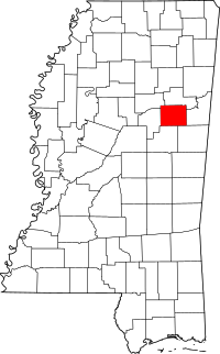 | |
| Towns | ||
| CDP | ||
| Unincorporated communities | ||
| Ghost town | ||
| Footnotes | ‡This populated place also has portions in an adjacent county or counties | |