Carroll County, Mississippi
| Carroll County, Mississippi | |
|---|---|
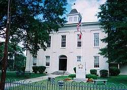 Carroll County Courthouse | |
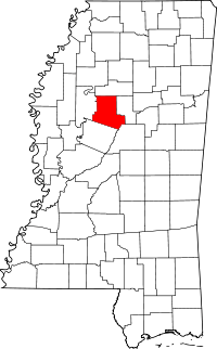 Location in the U.S. state of Mississippi | |
 Mississippi's location in the U.S. | |
| Founded | 1833 |
| Named for | Charles Carroll of Carrollton |
| Seat |
Carrollton (Northern District) Vaiden (Southern District) |
| Largest town | Vaiden |
| Area | |
| • Total | 635 sq mi (1,645 km2) |
| • Land | 628 sq mi (1,627 km2) |
| • Water | 6.3 sq mi (16 km2), 1.0% |
| Population | |
| • (2010) | 10,597 |
| • Density | 17/sq mi (7/km2) |
| Congressional district | 2nd |
| Time zone | Central: UTC−6/−5 |
Carroll County is a county located in the U.S. state of Mississippi. As of the 2010 census, the population was 10,597.[1] Its county seats are Carollton and Vaiden.[2] The county is named for Charles Carroll of Carrollton,[3] the last surviving signatory of the U.S. Declaration of Independence.
Carroll County is part of the Greenwood, Micropolitan Statistical Area. Bordered by the Yazoo River on the west and the Big Black River to the east, it is considered within the Mississippi Delta region. Most of its land is in the hill country.
The Porter Wagoner song "The Carroll County Accident" was set here. The county is referred to in the third verse of Bobbie Gentry's 1967 hit song, "Ode to Billie Joe".
History
This area was developed by European Americans for cotton plantations near the rivers. These were dependent on the labor of large gangs of enslaved African Americans. After the American Civil War, many freedmen worked as sharecroppers or tenant farmers on the plantations. Other areas were harvested for timber.
Whites used violence and intimidation to suppress voting and enforce white supremacy. In 1890 the state legislature disenfranchised most blacks, who were a majority in the state, by creating barriers to voter registration; it also passed Jim Crow laws, treating freedmen and their descendants as second-class citizens.
In the period from 1877 to 1950, Carrollton County had 29 documented lynchings of African Americans, the second-highest number in the state after a total of 48 in nearby LeFlore County.[4] Twenty-five of these killings were committed in little more than a one-month period in Carrollton, the county seat, in the late winter of 1886.[5] One local man was lynched in February, taken from jail where he was serving a sentence. Twenty-four deaths are associated with what has been known as the "Carrollton Courthouse Massacre", called a "riot" at the time and blamed on African Americans by the grand jury. But 60 armed, masked men entered the courthouse, fatally shooting the black plaintiffs in an assault case against a white man, and 18 other blacks who died that day. Another three black men died of their wounds soon after. The father of the two Brown brothers was also fatally shot.[5]
Geography
According to the U.S. Census Bureau, the county has a total area of 635 square miles (1,640 km2), of which 628 square miles (1,630 km2) is land and 6.3 square miles (16 km2) (1.0%) is water.[6]
Major highways
Adjacent counties
- Grenada County (north)
- Montgomery County (east)
- Attala County (southeast)
- Holmes County (south)
- Leflore County (west)
Demographics
| Historical population | |||
|---|---|---|---|
| Census | Pop. | %± | |
| 1840 | 10,481 | — | |
| 1850 | 18,491 | 76.4% | |
| 1860 | 22,035 | 19.2% | |
| 1870 | 21,047 | −4.5% | |
| 1880 | 17,795 | −15.5% | |
| 1890 | 18,773 | 5.5% | |
| 1900 | 22,116 | 17.8% | |
| 1910 | 23,139 | 4.6% | |
| 1920 | 20,324 | −12.2% | |
| 1930 | 19,765 | −2.8% | |
| 1940 | 20,651 | 4.5% | |
| 1950 | 15,499 | −24.9% | |
| 1960 | 11,177 | −27.9% | |
| 1970 | 9,397 | −15.9% | |
| 1980 | 9,776 | 4.0% | |
| 1990 | 9,237 | −5.5% | |
| 2000 | 10,769 | 16.6% | |
| 2010 | 10,597 | −1.6% | |
| Est. 2016 | 10,255 | [7] | −3.2% |
| U.S. Decennial Census[8] 1790-1960[9] 1900-1990[10] 1990-2000[11] 2010-2013[1] | |||
From 1940 to 1970, the county population declined markedly, as many African Americans left in the Great Migration to West Coast cities that had a growing defense industry. Others went North to Chicago and other industrial cities. Rural whites also moved to cities to find work.
As of the census[12] of 2000, there were 10,769 people, 4,071 households, and 3,069 families residing in the county. The population density was 17 people per square mile (7/km²). There were 4,888 housing units at an average density of 8 per square mile (3/km²). The racial makeup of the county was 62.67% White, 36.61% Black or African American, 0.07% Native American, 0.16% Asian, 0.01% Pacific Islander, 0.13% from other races, and 0.36% from two or more races. 0.73% of the population were Hispanic or Latino of any race.
There were 4,071 households out of which 32.10% had children under the age of 18 living with them, 56.20% were married couples living together, 15.20% had a female householder with no husband present, and 24.60% were non-families. 22.40% of all households were made up of individuals and 10.80% had someone living alone who was 65 years of age or older. The average household size was 2.57 and the average family size was 3.01.
According to the census[12] of 2000, the largest ancestry groups in Carroll County were English 51%, African 38.6%, and Scots-Irish 12.1%
In the county, the population was spread out with 24.50% under the age of 18, 9.60% from 18 to 24, 26.70% from 25 to 44, 25.70% from 45 to 64, and 13.60% who were 65 years of age or older. The median age was 38 years. For every 100 females, there were 99.20 males. For every 100 females age 18 and over, there were 97.00 males.
The median income for a household in the county was $28,878, and the median income for a family was $35,711. Males had a median income of $28,459 versus $19,695 for females. The per capita income for the county was $15,744. About 13.70% of families and 16.00% of the population were below the poverty line, including 17.30% of those under age 18 and 23.50% of those age 65 or over.
Education
Carroll County School District is the area public school district.
Carroll Academy is an area private school that is financially supported by the Council of Conservative Citizens, a white supremacist group.[13]
Pillow Academy in unincorporated Leflore County, near Greenwood, enrolls some students from Carroll County.[14] It originally was a segregation academy.[15]
Communities
Towns
- Carrollton (county seat)
- North Carrollton
- Vaiden (county seat)
Unincorporated places
Notable people
- Henry Pinckney McCain - born in Carroll County, 1861
- John S. McCain, Sr. - born in Carroll County, 1894; became admiral in US Navy, served during World War II
- Mississippi John Hurt - born in Carroll County, ca. 1893, blues musician
Politics
| Year | Republican | Democratic | Third parties |
|---|---|---|---|
| 2016 | 68.7% 3,799 | 30.4% 1,680 | 0.9% 49 |
| 2012 | 66.1% 3,960 | 33.5% 2,007 | 0.4% 25 |
| 2008 | 65.4% 3,902 | 34.2% 2,037 | 0.4% 26 |
| 2004 | 65.5% 3,664 | 34.0% 1,900 | 0.5% 28 |
| 2000 | 64.3% 3,165 | 35.1% 1,726 | 0.7% 33 |
| 1996 | 53.3% 2,629 | 41.4% 2,041 | 5.4% 264 |
| 1992 | 55.0% 1,695 | 38.3% 1,182 | 6.7% 207 |
| 1988 | 62.5% 2,628 | 37.1% 1,560 | 0.4% 16 |
| 1984 | 65.7% 2,823 | 34.0% 1,462 | 0.3% 12 |
| 1980 | 50.9% 2,153 | 48.2% 2,037 | 0.9% 38 |
| 1976 | 49.3% 1,561 | 49.5% 1,566 | 1.3% 40 |
| 1972 | 73.3% 1,777 | 23.9% 580 | 2.8% 67 |
| 1968 | 4.3% 138 | 29.0% 925 | 66.7% 2,131 |
| 1964 | 95.4% 2,043 | 4.6% 98 | |
| 1960 | 14.1% 207 | 28.9% 425 | 57.1% 840 |
| 1956 | 15.1% 234 | 69.6% 1,080 | 15.3% 237 |
| 1952 | 31.4% 535 | 68.6% 1,168 | |
| 1948 | 1.1% 14 | 6.0% 74 | 92.8% 1,138 |
| 1944 | 4.5% 68 | 95.5% 1,438 | |
| 1940 | 2.6% 38 | 97.4% 1,408 | |
| 1936 | 1.8% 19 | 98.1% 1,030 | 0.1% 1 |
| 1932 | 0.8% 9 | 99.2% 1,189 | 0.1% 1 |
| 1928 | 4.3% 49 | 95.7% 1,102 | |
| 1924 | 7.3% 70 | 92.8% 895 | |
| 1920 | 21.3% 184 | 77.4% 669 | 1.3% 11 |
| 1916 | 3.4% 34 | 95.0% 943 | 1.6% 16 |
| 1912 | 2.1% 16 | 85.4% 653 | 12.6% 96 |
See also
References
- 1 2 "State & County QuickFacts". United States Census Bureau. Retrieved September 3, 2013.
- ↑ "Find a County". National Association of Counties. Archived from the original on 2011-05-31. Retrieved 2011-06-07.
- ↑ Gannett, Henry (1905). The Origin of Certain Place Names in the United States. Govt. Print. Off. p. 70.
- ↑ Lynching in America, 3rd edition, Supplement by County, p. 6
- 1 2 Susie James, "Carrollton Courthouse 'Riot' of 1886", Commonwealth (Greenwood, Mississippi), 12 March 1996; accessed 31 March 2018
- ↑ "2010 Census Gazetteer Files". United States Census Bureau. August 22, 2012. Archived from the original on September 28, 2013. Retrieved November 3, 2014.
- ↑ "Population and Housing Unit Estimates". Retrieved June 9, 2017.
- ↑ "U.S. Decennial Census". United States Census Bureau. Archived from the original on May 12, 2015. Retrieved November 3, 2014.
- ↑ "Historical Census Browser". University of Virginia Library. Retrieved November 3, 2014.
- ↑ "Population of Counties by Decennial Census: 1900 to 1990". United States Census Bureau. Retrieved November 3, 2014.
- ↑ "Census 2000 PHC-T-4. Ranking Tables for Counties: 1990 and 2000" (PDF). United States Census Bureau. Retrieved November 3, 2014.
- 1 2 "American FactFinder". United States Census Bureau. Archived from the original on 2013-09-11. Retrieved 2008-01-31.
- ↑ Beirich, Heidi (28 October 2010). "White Supremacist Group Backs Private Academies in Mississippi". Southern Poverty Law Center. Retrieved 3 December 2014.
- ↑ "Profile of Pillow Academy 2010-2011 Archived 2001-12-01 at the Library of Congress Web Archives." Pillow Academy. Retrieved on March 25, 2012.
- ↑ Lynch, Adam (18 November 2009). "Ceara's Season". Jackson Free Press. Retrieved 19 August 2011.
- ↑ Leip, David. "Dave Leip's Atlas of U.S. Presidential Elections". uselectionatlas.org. Retrieved 2018-03-04.
Places adjacent to Carroll County, Mississippi | ||||||||||
|---|---|---|---|---|---|---|---|---|---|---|
| ||||||||||
Municipalities and communities of Carroll County, Mississippi, United States | ||
|---|---|---|
| Towns | | |
| Unincorporated communities | ||
.svg.png)