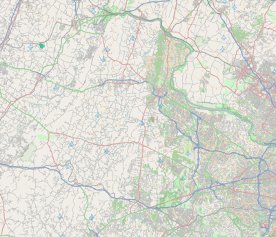
Loudoun County, Virginia
| Loudoun County, Virginia | |||
|---|---|---|---|
| County | |||
| Loudoun County | |||
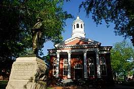 Loudoun County Courthouse and Confederate monument at Leesburg, 2010 | |||
| |||
| Motto: "I Byde My Time"[1] | |||
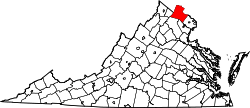 Location in the U.S. state of Virginia | |||
 Virginia's location in the U.S. | |||
| Founded | 1757 | ||
| Named for | John Campbell, 4th Earl of Loudoun[2] | ||
| Seat | Leesburg | ||
| Largest town | Leesburg | ||
| Area | |||
| • Total | 521 sq mi (1,349 km2) | ||
| • Land | 516 sq mi (1,336 km2) | ||
| • Water | 6 sq mi (16 km2), 1.1% | ||
| Population (est.) | |||
| • (2017) | 398,080 | ||
| • Density | 772/sq mi (298/km2) | ||
| Congressional district | 10th | ||
| Time zone | Eastern: UTC−5/−4 | ||
| Website |
www | ||
Loudoun County (/ˈlaʊdən/) is a county in the Commonwealth of Virginia in the United States. In 2015, the population was estimated at 375,629,[3] making it Virginia's third-most populous county. Loudoun County's seat is Leesburg.[4] Loudoun County is part of the Washington–Arlington–Alexandria, DC–VA–MD–WV Metropolitan Statistical Area.
As of 2012, Loudoun County had a median household income of $117,876. Since 2008, the county has been ranked first in the U.S. in median household income among jurisdictions with a population of 65,000 or more.[5]
History
Loudoun County was established in 1757 from Fairfax County. The county is named for John Campbell, Fourth Earl of Loudoun and Governor General of Virginia from 1756–59.[2] Western settlement began in the 1720s and 1730s with Quakers, Scots-Irish, Germans and others moving south from Pennsylvania and Maryland and by English and African slaves moving upriver from Tidewater.
By the time of the American Revolution, it was Virginia's most populous county. It was also rich in agriculture, and the county's contributions of grain to George Washington's Continental Army, earned it the nickname "Breadbasket of the Revolution."[6]
During the War of 1812, important Federal documents and government archives were evacuated from Washington and stored at Leesburg. Local tradition holds that these documents were stored at Rokeby House, making Leesburg briefly the capital of the United States.
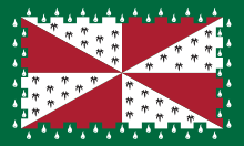
U.S. President James Monroe treated Oak Hill Plantation as a primary residence from 1823 until his death on July 4, 1831.[7] The Loudoun County coat of arms and flag, granted by the English College of Arms, memorialize the special relationship between Britain and the United States that developed through his Monroe Doctrine.
Early in the American Civil War, the Battle of Balls Bluff took place near Leesburg on October 21, 1861. Future jurist Oliver Wendell Holmes, Jr. was critically wounded in that battle along the Potomac River. During the Gettysburg Campaign in June 1863, Confederate Major General J.E.B. Stuart and Union cavalry clashed in the battles of Aldie, Middleburg, and Upperville. Confederate partisan John S. Mosby based his operations in Loudoun and adjoining Fauquier County (for a more in-depth account of the history of Loudoun County during the Civil War, see Loudoun County in the American Civil War).
In 1962, Washington Dulles International Airport was built in southeastern Loudoun County in Sterling. Since then, Loudoun County has experienced a high-tech boom and rapid growth. Accordingly, many have moved to eastern Loudoun and become residents of planned communities such as Sterling Park, Sugarland Run, Cascades, and Ashburn Farm, making that section a veritable part of the Washington suburbs. Others have moved to the county seat or to the small towns and rural communities of the Loudoun Valley.[6]
Government and politics

The county's official motto, I Byde My Time, is borrowed from the coat of arms of the Earl of Loudoun.[1][8]
In the late 20th century, as northerners gradually migrated to Southern suburbs, Loudoun County increasingly shifted to the Republican Party in supporting presidential candidates, and more local ones. But that may be changing with changing demographics. Before the 2008 election of Barack Obama, county voters had not supported a Democrat for President since Lyndon B. Johnson in 1964.
In recent years, the county's rapid growth in its eastern portion, settled by educated professionals working in or near Washington, D.C., has changed the demographics, and the Democratic Party has become increasingly competitive in the county. After giving Senator Barack Obama nearly 54% of its presidential vote in 2008, the county supported Republican Bob McDonnell in 2009, who received 61% of the gubernatorial vote. Voters also replaced two incumbent Democratic delegates, making Loudoun's state House delegation all-Republican. In 2012 county voters again supported Obama, who took 51.5% of the vote, with Republican challenger Mitt Romney garnering 47%.[9]
Democrats carried the county again in the 2016 presidential election, when Loudoun swung heavily towards Hillary Clinton, giving her 55.1% to Trump's 38.2%.[10]
| Year | Republican | Democratic | Third parties |
|---|---|---|---|
| 2016 | 38.2% 69,949 | 55.1% 100,795 | 6.7% 12,296 |
| 2012 | 47.0% 75,292 | 51.5% 82,479 | 1.4% 2,289 |
| 2008 | 45.4% 63,336 | 53.7% 74,845 | 0.9% 1,278 |
| 2004 | 55.7% 60,382 | 43.6% 47,271 | 0.7% 777 |
| 2000 | 56.1% 42,453 | 40.9% 30,938 | 3.0% 2,262 |
| 1996 | 52.1% 25,715 | 40.4% 19,942 | 7.4% 3,673 |
| 1992 | 46.4% 19,290 | 34.8% 14,462 | 18.8% 7,822 |
| 1988 | 66.3% 20,448 | 32.7% 10,101 | 1.0% 313 |
| 1984 | 68.0% 17,765 | 31.5% 8,227 | 0.5% 136 |
| 1980 | 58.9% 12,076 | 32.7% 6,694 | 8.4% 1,722 |
| 1976 | 51.8% 9,192 | 45.0% 7,995 | 3.2% 561 |
| 1972 | 69.5% 9,417 | 29.1% 3,941 | 1.5% 199 |
| 1968 | 45.9% 4,577 | 32.7% 3,262 | 21.3% 2,131 |
| 1964 | 37.7% 2,594 | 62.2% 4,278 | 0.1% 5 |
| 1960 | 51.0% 2,526 | 48.4% 2,399 | 0.6% 29 |
County Board of Supervisors
Like many counties in Virginia, Loudoun is locally governed by a board of supervisors, the Loudoun County Board of Supervisors. The Chairman of the Board is elected by county voters at-large while the remaining supervisors are elected from eight single-member districts roughly equal in population. All nine members serve concurrent terms of four years. The board handles policy issues and sets the budget; it appoints a County Administrator to handle the county government's day-to-day operations.[12] As of the 2015 elections, the Chairman of the Board and two district supervisors are Democrats; the remaining six supervisors are Republican.[13]
The 2003 board, and other officials in Loudoun, was the subject of a federal investigation of possible corruption relating to a land deal involving the Royal Saudi Academy.[14]
In November 2007, voters removed four incumbent, fiscally conservative Republicans from the Board of Supervisors in a backlash over rapid development in the county's eastern portion. The Board's make-up after the election was five Democrats, two Republicans, and two Independents.[15]
In November 2011, Republicans were elected to all nine seats on the Board.[16] In 2015 three were replaced by Democrats.
On September 6, 2015, Broad Run Supervisor Shawn M. Williams resigned after his arrest for assault.[17]
In November 2017, voters replaced three of the four Republican state Delegates with Democrats, leaving only a sole Republican Delegate representing the county in Richmond.
| Name | Party | First Election | District | |
|---|---|---|---|---|
| Phyllis J. Randall, Chairman | Democrat | 2015 | At-Large | |
| Suzanne M. Volpe | Republican | 2011 | Algonkian | |
| Ralph M. Buona | Republican | 2011 | Ashburn | |
| Tony R. Buffington, Jr. | Republican | 2015 | Blue Ridge | |
| Ron A. Meyer, Jr. | Republican | 2015 | Broad Run | |
| Geary M. Higgins | Republican | 2011 | Catoctin | |
| Matthew F. Letourneau | Republican | 2011 | Dulles | |
| Kristen C. Umstattd | Democrat | 2015 | Leesburg | |
| Koran T. Saines | Democrat | 2015 | Sterling | |
| Position | Name | Party | First Election | |
|---|---|---|---|---|
| Sheriff | Mike Chapman | Republican | 2011 | |
| Commonwealth's Attorney | James E. Plowman | Republican | 2003 | |
| Clerk of Circuit Court | Gary Clemens | Republican | 1999 | |
| Name | Party | First Election | District | |
|---|---|---|---|---|
| Wendy Gooditis | Democratic | 2017 | 10 | |
| David A. Reid | Democratic | 2017 | 32 | |
| Dave A. LaRock | Republican | 2013 | 33 | |
| Kathleen Murphy | Democrat | 2015 | 34 | |
| Karrie Delaney | Democratic | 2017 | 67 | |
| Jennifer B. Boysko | Democrat | 2015 | 86 | |
| John J. Bell | Democrat | 2015 | 87 | |
| Name | Party | First Election | District | |
|---|---|---|---|---|
| Richard A. Black | Republican | 2011 | 13 | |
| Jill Holtzman Vogel | Republican | 2007 | 27 | |
| Barbara A. Favola | Democrat | 2011 | 31 | |
| Jennifer T. Wexton | Democrat | 2014 | 33 | |
Geography
According to the U.S. Census Bureau, Loudoun County has a total area of 521 square miles (1,350 km2), of which 516 square miles (1,340 km2) is land and 6 square miles (16 km2) (1.1%) is water.[18] It is bounded on the north by the Potomac River; across the river are Frederick, Washington and Montgomery counties in Maryland; it is bounded on the south by Prince William and Fauquier counties, on the west by watershed of the Blue Ridge Mountain across which are Jefferson County, West Virginia and Clarke County, and on the east by Fairfax County. The Bull Run Mountains and Catoctin Mountain bisect the county. To the west of the range is the Loudoun Valley. Bisecting the Loudoun Valley from Hillsboro to the Potomac River is Short Hill Mountain.
Street addresses
Block numbers in the unincorporated areas of Loudoun County, with the exception of older Sterling Park and the community of CountrySide, are assigned in the following manner: on north-south streets, block numbers increase from north to south and range from 10000 to 27000; on east-west streets, block numbers increase from west to east and range from 30000 to 48000.[19]
Adjacent counties
|
|
National protected area
Economy
Traditionally a rural county, Loudoun's population has grown dramatically since the 1980s. Having undergone heavy suburbanization since 1990, Loudoun has a full-fledged service economy. It is home to world headquarters for several Internet-related and high tech companies, including Verizon Business, Telos Corporation, Orbital Sciences Corporation, and Paxfire. Like Fairfax County's Dulles Corridor, Loudoun County has economically benefited from the existence of Washington Dulles International Airport, the majority of which is in the county along its border with Fairfax.[20][21]
Loudoun County retains a strong rural economy. The equine industry has an estimated revenue of $78 million. It is home to the Morven Park International Equestrian Center which hosts national horse trials. In addition, a growing wine industry has produced several internationally recognized wines. Loudoun now has 40 wineries[22] and over 25 active farms. Loudoun has rich soil and was in the mid-19th century a top wheat-producing county in the fourth largest wheat-producing state.[23]
MCI, Inc. (formerly WorldCom), a subsidiary of Verizon Communications, is headquartered in Ashburn, Loudoun County. It announced it would move its headquarters to Ashburn in 2003.[24][25] AOL had its headquarters at 22000 AOL Way in Dulles in unincorporated Loudoun County.[26] In 2007 AOL announced it would move its headquarters from Loudoun County to New York City; it would continue to operate its Virginia offices.[27] Orbital Sciences Corporation has its headquarters in Dulles.[28]
Before its dissolution, Independence Air (originally Atlantic Coast Airlines) was headquartered in Dulles.[29][30] At one time Atlantic Coast Airlines had its headquarters in Sterling.[31] Before its dissolution, MAXjet Airways was headquartered on the grounds of Washington-Dulles International Airport.[32]
Top employers
According to the County's 2011 Comprehensive Annual Financial Report,[33] the top employers in the county are:
| # | Employer | # of employees |
|---|---|---|
| 1 | Loudoun County Public Schools | 10,098 |
| 2 | County of Loudoun | 3,303 |
| 3 | M.C. Dean, Inc. | 1,000–5,000 |
| 4 | Verizon Business | 1,000–5,000 |
| 5 | U.S. Department of Homeland Security | 1,000–5,000 |
| 6 | Orbital ATK | 1,000–5,000 |
| 7 | United Airlines | 1,000–5,000 |
| 8 | AOL | 1,000–5,000 |
| 9 | INOVA Loudoun Hospital | 1,000–5,000 |
| 10 | United States Postal Service | 1,000–5,000 |
Demographics
From 1890 to 1940, the county had a decline in population as people moved to cities for more opportunities. The decline was likely highest among African Americans, who had worked in an agricultural economy that was becoming increasingly mechanized. During the first half of the 20th century, African Americans moved out of rural areas to cities in the Great Migration. In the early 21st century, they are a small minority within the county.
| Historical population | |||
|---|---|---|---|
| Census | Pop. | %± | |
| 1790 | 18,962 | — | |
| 1800 | 20,523 | 8.2% | |
| 1810 | 21,338 | 4.0% | |
| 1820 | 22,702 | 6.4% | |
| 1830 | 21,939 | −3.4% | |
| 1840 | 20,431 | −6.9% | |
| 1850 | 22,079 | 8.1% | |
| 1860 | 21,774 | −1.4% | |
| 1870 | 20,929 | −3.9% | |
| 1880 | 23,634 | 12.9% | |
| 1890 | 23,274 | −1.5% | |
| 1900 | 21,948 | −5.7% | |
| 1910 | 21,167 | −3.6% | |
| 1920 | 20,577 | −2.8% | |
| 1930 | 19,852 | −3.5% | |
| 1940 | 20,291 | 2.2% | |
| 1950 | 21,147 | 4.2% | |
| 1960 | 24,549 | 16.1% | |
| 1970 | 37,150 | 51.3% | |
| 1980 | 57,427 | 54.6% | |
| 1990 | 86,129 | 50.0% | |
| 2000 | 169,599 | 96.9% | |
| 2010 | 312,311 | 84.1% | |
| Est. 2017 | 398,080 | [34] | 27.5% |
| U.S. Decennial Census[35] 1790-1960[36] 1900-1990[37] 1990-2000[38] | |||
As of the census of 2010,[39] there were 312,311 people, 104,583 households, and 80,494 families residing in the county. The population density was 606 people per square mile (234/km²). There were 109,442 housing units at an average density of 212 per square mile (82/km²). The racial makeup of the county was:
- 68.7% White
- 7.3% African American
- 14.7% Asian
- 0.3% Native American
- 0.1% Pacific Islander
- 4.9% of some other race
- 4.0% of two or more races
- 12.4% of the population were Hispanic or Latino of any race (3.4% Salvadorian, 1.8% Mexican, 1.3% Peruvian, 0.9% Puerto Rican, 0.6% Honduran, 0.6% Bolivian, 0.5% Guatemalan, 0.5% Colombian)
According to the 2010 census, 10.5% of residents reported being of German ancestry, while 9.1% reported Irish, 7.7% English, 5.4% Italian and 5.2% American ancestry.
As of 2000 there were 59,900 households out of which 43.10% had children under the age of 18 living with them, 64.30% were married couples living together, 7.80% had a female householder with no husband present, and 24.80% were non-families. 18.40% of all households were made up of individuals and 3.70% had someone living alone who was 65 years of age or older. The average household size was 2.82 and the average family size was 3.24.
In the county, the population was spread out with 29.80% under the age of 18, 5.70% from 18 to 24, 38.90% from 25 to 44, 20.00% from 45 to 64, and 5.60% who were 65 years of age or older. The median age was 34 years. For every 100 females, there were 97.80 males. For every 100 females age 18 and over, there were 95.50 males.
In 2011, Census survey data concluded that Loudoun County had the highest median income in the country at $119,134.[5]
From 1980 to 2014, deaths from cancer in Loudoun County decreased by 46 percent, the largest such decrease of any county in the United States.[40]
From 2017 to 2018, Loudoun County saw an increase of 18.5% of households experiencing homelessness, a 21% increase for single adults, and a 36% increase for families. Homelessness for veterans in the county decreased by 16% from 2017 to 2018.[41]
Government and infrastructure
The National Transportation Safety Board operates the Ashburn Aviation Field Office in Ashburn, an unincorporated area of Loudoun County.[42]
Emergency services are provided by the Loudoun County Fire and Rescue Department with the Office of Emergency Management. LCFR is a combination system that utilizes some 1,500 volunteers and 500 firefighters, EMT/paramedics, and support staff. LCFR is one of the largest fire and rescue systems in Virginia.[43]
Law enforcement in Loudoun County is served by the Loudoun County Sheriff's Office, as well as three town police departments: Leesburg Police, Purcellville Police, and Middleburg Police.
The Loudoun County Public Library System has eleven[44] branches in the county. The library's Outreach Department of the Loudoun County Public Library is a resource for those who cannot easily access branch services. The public library system has won many awards, and came in 10th place for libraries serving a comparably sized population in 2006 Hennen's American Public Library Ratings (HAPLR).
Transportation
Airports
Loudoun County has two airports: the Washington Dulles International and Leesburg Executive.
Bus
Loudoun County operates its own bus public transit system, known as Loudoun County Commuter Bus.
Rail
The Silver Line of the Washington Metro, will extend into Loudoun County. The planned extension will include stations at the Dulles International Airport, and two stations in Ashburn, Virginia.
Major highways
|
Education
The county is served by Loudoun County Public Schools (LCPS). LCPS serves over 70,000 students from Kindergarten through 12th grade and is Virginia's fifth largest school system.[45][46] While there is a trend toward home schooling in the county, the vast majority of school age children attend LCPS schools. Loudoun County schools recently ranked 11th in the United States in terms of educational achievement versus funds spent.[47] Loudoun County also sends students to its Loudoun Academy of Science, housed within Dominion High School,[48] and is eligible to send students to Thomas Jefferson High School for Science and Technology, a STEM magnet school in Alexandria, Virginia.[49]
Loudoun County is home to nine private schools: Loudoun Country Day School, a Pre-K–8 independent school in Leesburg; Notre Dame Academy, an independent non-denominational day high school in Middleburg; the Foxcroft School, a boarding school for girls located in Middleburg; Dominion Academy, a Non-denominational Christian school, K–8 in Leesburg; Leesburg Christian School, a K–12 school in Leesburg; St. Theresa School, a K–8 Roman Catholic school in Ashburn; Village Montessori School at Bluemont, an accredited Pre-K through Elementary Montessori school in Bluemont; Christian Faith & Fellowship School, a PreK–12 non-denominational Christian school and Loudoun County's only private school accredited by the Association of Christian Schools International; and Ideal Schools High School, an independent non-denominational school in Ashburn.
In terms of post-secondary education, Loudoun County is home to a variety of colleges and universities, including: Patrick Henry College; a branch of Northern Virginia Community College in Sterling; George Washington University (satellite campus); George Mason University (satellite campus); Marymount University (satellite campus); Shenandoah University (satellite campus); and Strayer University (satellite campus).[50] Loudoun is also home to a satellite campus of the Virginia–Maryland College of Veterinary Medicine and the Janelia Farm Research Campus of the Howard Hughes Medical Institute.
Communities
Towns
- Hamilton
- Hillsboro
- Leesburg (county seat)
- Lovettsville
- Middleburg
- Purcellville
- Round Hill
Census-designated places
Other unincorporated communities
- Airmont
- Aldie
- Bloomfield
- Bluemont
- Britain
- Conklin
- Dover
- Dulles
- Elvan
- Eubanks
- Georges Mill
- Gilberts Corner
- Gleedsville
- Howardsville
- Leithtown
- Lenah
- Lincoln
- Loudoun Heights
- Lucketts
- Morrisonville
- Mount Gilead
- Neersville
- Oatlands
- Paeonian Springs
- Paxson
- Philomont
- Potomac Falls
- Potomac Green
- Randolph Corner
- River Creek
- Ryan
- Saint Louis
- Scattersville
- Silcott Spring
- Sterling Park
- Stewartown
- Stumptown
- Sycolin
- Taylorstown
- Telegraph Spring
- Trapp
- Unison
- Virts Corner
- Waterford
- Watson
- Waxpool
- Wheatland
- Willard
- Willisville
- Woodburn
Notable people
James Monroe constructed and resided at Oak Hill near Aldie after his presidency. American Civil War Brigadier General Robert H. Chilton (Chief of Staff under Robert E. Lee) was a native of Loudoun County. World War II general George C. Marshall resided at Dodona Manor in Leesburg. Essayist and journalist Russell Baker grew up in Morrisonville, Virginia and his book Growing Up highlights his childhood in rural Virginia. Entertainer Arthur Godfrey lived near historic Waterford, Virginia. Loudoun County is also the birthplace of Julia Neale Jackson, mother of Stonewall Jackson,[51] and Susan Catherine Koerner, mother of the Wright Brothers.[52]
- John Champe – Revolutionary War soldier and double agent.
- James Monroe (1758–1831) – 5th President of the United States
- Isaiah L. Potts (1784?-after 1843) – tavern keeper of the notorious Potts Tavern who, allegedly, ran a gang of highwaymen and murderers on the Illinois frontier
- Charles F. Mercer (1788–1858) – Founded village of Aldie; U.S. Congressman from Virginia
- John L. Dagg (1794–1884) – Baptist theologian, pastor, educator, and president of Mercer University, GA (1844–54)[53][54]
- William Wilson (1794–1857) – Chief Justice of the Illinois Supreme Court[55]
- John Janney (1798–1872) – Member of the Virginia General Assembly and officer of the Virginia Secession Convention of 1861
- Stevens T. Mason (1811–1843) – First governor of Michigan (Democrat, 1837–40)[56]
- Joshua White (1812–1890) – businessman and Illinois state legislator
- Richard Henry Dulany (1820–1906) – Colonel of the 7th Virginia Cavalry during the Civil War
- Roger Preston Chew, (1843-1921) Horse artillery commander in the Confederate Army of Northern Virginia, prominent West Virginia businessman, railroad executive and West Virginia legislator[57]
- Lucien Whiting Powell (1846–1930) – Renowned landscape artist
- Westmoreland Davis (1859–1942) – Governor of Virginia
- William H. Ash (1859–1908) – Former slave who was one of the first African-American politician to be elected to the Virginia House of Delegates
- Wilton Lackaye (1862-1932) – American stage and film actor, the original Broadway stage Svengali, 1895
- Billy Mitchell (1879–1936) – Controversial Army officer and military aviation pioneer
- George Marshall (1880–1959) – General of the Army (5-star), U.S. Secretary of State and author of the "Marshall Plan"
- Arthur Godfrey (1903–1983) – Popular national radio and television personality
- Pamela Harriman (1920–1997) – Daughter-in-law of Sir Winston Churchill and U.S. Ambassador to France
- Lyndon LaRouche (1921–) – Controversial American politician, activist, and founder of the LaRouche movement
- Russell Baker (1925–) – Pulitzer Prize-winning author of Growing Up (1983, Autobiography)[58]
- Barbara Holland (1933–2010) – author
- Madeleine Albright (1937–) – U.S. Secretary of State in Clinton Administration
- Joe Gibbs (1940–) – Lived just west of Leesburg while coaching the Washington Redskins
- Wilson Pickett (1941–2006) – R&B and soul singer and songwriter
- Henry S. Taylor (1942–) – Pulitzer Prize–winning poet
- Fred Hetzel (1942–) – Former professional basketball player
- Oliver North (1943–) – Former USMC Officer and figure in the Iran–Contra scandal; commentator and host on the Fox network
- Sheila Johnson (1949–) – Entertainment and sports entrepreneur and philanthropist.
- Michael Farris (born 1951) – Founder of Home School Legal Defense Association and Patrick Henry College in Purcellville; unsuccessful Republican nominee for Lieutenant Governor of Virginia in 1993
- Sandra Lerner (c. 1953–) – Entrepreneur and philanthropist
- Paul Pastorek (1954–) – former Louisiana state superintendent of education; now general counsel to Airbus Group, Inc.
- Geraldine Brooks (writer) (1955–) – Pulitzer Prize–winning author
- Mark Levin (1957–) – New York Times best-selling author and conservative talk radio host
- Tony Horwitz (1958–) – Pulitzer Prize–winning author
- Rachel Renee Russell (1959–) – #1 New York Times best-selling author of the children's book series, Dork Diaries
- Darrell Green (1960–) – Former Washington Redskin and inductee to the NFL Pro Football Hall of Fame
- Patton Oswalt (1969–) – American stand-up comedian, writer and actor
- Annia Hatch (1978-) - Cuban American 2x Olympic silver medalist in gymnastics, currently lives in Ashburn
- Gina Haspel (1956-) - Director of the CIA, first female ever appointed to the position
See also
References
- 1 2 Rosalind S. Helderman, Proud Past, Bright Future Rub Elbows in Today's Loudoun, Washington Post (April 21, 2005), page LZ03.
- 1 2 "About Loudoun - History". Loudoun County. Retrieved January 3, 2013.
- ↑ "County Totals Dataset: Population, Population Change and Estimated Components of Population Change: April 1, 2010 to July 1, 2015". Archived from the original on July 8, 2016. Retrieved July 2, 2016.
- ↑ "Find a County". National Association of Counties. Archived from the original on 2011-05-31. Retrieved 2011-06-07.
- 1 2 "LOUDOUN COUNTY INCOME HIGHLIGHTS, AMERICAN COMMUNITY SURVEY, 2011 ACS UPDATE". Loudoun County Department of Planning. Retrieved March 26, 2014.
- 1 2 "Loudoun History". Loudoun_Museum. Archived from the original on 24 March 2014. Retrieved 22 March 2014.
- ↑ An Account of James Monroe's Land Holdings, by Christopher Fennell. Chapter V. Oak Hill Plantation, Loudoun County. Accessed 18 Nov 2016.
- ↑ Coat of Arms, Loudoun County.
- ↑ "Wayback Machine". 11 November 2012. Archived from the original on 11 November 2012. Retrieved 7 August 2018.
- ↑ "Wayback Machine". 11 November 2012. Archived from the original on 11 November 2012. Retrieved 7 August 2018.
- ↑ Leip, David. "Dave Leip's Atlas of U.S. Presidential Elections". Uselectionatlas.org. Retrieved 7 August 2018.
- ↑ "Loudoun County Board of Supervisors Operations Manual". Loudoun.gov. Archived from the original on 2016-07-13. Retrieved 7 August 2018.
- ↑ "UPDATED: Unofficial Loudoun 2015 election results, voter turnout". Loudountimes.com. Retrieved 7 August 2018.
- ↑ Laris, Michael; Somashekhar, Sandhya (February 7, 2007). "Loudoun Land Deals Subject of U.S. Probe". The Washington Post.
- ↑ Somashekhar, Sandhya (November 7, 2007). "Slow-Growth Board Candidates Win". The Washington Post.
- ↑ Smith, Dusty (November 9, 2011). "Loudoun Goes Red, Big Time". Ashburn Patch.
- ↑ "Loudoun County Supervisor Charged with Assault After Dispute". Washington Post. September 6, 2015.
- ↑ "US Gazetteer files: 2010, 2000, and 1990". United States Census Bureau. 2011-02-12. Retrieved 2011-04-23.
- ↑ Loudoun County Code Chapter 1026: Addressing of Premises
- ↑ "Loudoun Domestic Tourism Worth Nearly $1.7 Billion - Loudoun County Economic Development, VA". Loudoun County Economic Development, VA. 2017-09-13. Retrieved 2018-06-04.
- ↑ "Another Record Year at Dulles International Airport - Loudoun County Economic Development, VA". Loudoun County Economic Development, VA. 2018-02-26. Retrieved 2018-06-04.
- ↑ "Loudon Is DC's Wine Country". Loudoun Convention and Visitors Association (Visit Loudoun). Archived from the original on 2013-05-29.
- ↑ "Early 19th-Century Milling and Wheat Farming". The History of Loudoun County, Virginia.
Since its settlement in the mid-1700s, Loudoun County has been acclaimed for its fertile soil. In the 1850s and 1860s, Virginia was the fourth largest wheat producing state, and Loudoun was one of the state's top-producing counties.
- ↑ MCI Inc (March 14, 2003). "Schedule 13D. Amendment to General Statement of Beneficial Ownership". Securities and Exchange Commission. Retrieved September 25, 2009.
- ↑ Reuters news agency (April 14, 2003). "WorldCom to emerge from collapse". CNN (international ed.). Retrieved September 25, 2009.
- ↑ "Company Overview". AOL. February 8, 2008. Archived from the original on February 18, 2009. Retrieved May 7, 2009.
- ↑ Goldfarb, Zachary; Diaz, Sam (September 18, 2007). "AOL Moving Executives, Headquarters to New York". The Washington Post. p. A01. Retrieved May 7, 2009.
- ↑ "Contact Information". Orbital Sciences Corporation. Retrieved September 25, 2009.
- ↑ "Company Information". Atlantic Coast Airlines. August 11, 2001. Archived from the original on August 11, 2001. Retrieved September 25, 2009.
- ↑ "Independence Air, Inc". Bloomberg Businessweek. Retrieved September 25, 2009.
- ↑ "SKEEN, K. B.", Standard & Poor's Register of Corporations, Directors and Executives, Standard & Poor's Corp., 2: 1012, 1998, retrieved January 31, 2011,
Atlantic Coast Airlines Inc., One Export Dr., Sterling, VA 20164
- ↑ "Contact Us". MAXjet Airways. February 18, 2007. Archived from the original on July 18, 2006. Retrieved September 25, 2009.
- ↑ "Comprehensive Annual Fiscal Report" (PDF). County of Loudoun, Virginia. 22 December 2011. Archived from the original (PDF) on 29 April 2014.
- ↑ "Population and Housing Unit Estimates". Retrieved March 30, 2018.
- ↑ "U.S. Decennial Census". United States Census Bureau. Archived from the original on May 12, 2015. Retrieved January 2, 2014.
- ↑ "Historical Census Browser". University of Virginia Library. Retrieved January 2, 2014.
- ↑ "Population of Counties by Decennial Census: 1900 to 1990". United States Census Bureau. Retrieved January 2, 2014.
- ↑ "Census 2000 PHC-T-4. Ranking Tables for Counties: 1990 and 2000" (PDF). United States Census Bureau. Retrieved January 2, 2014.
- ↑ "American FactFinder". United States Census Bureau. Archived from the original on 2013-09-11. Retrieved 2011-05-14.
- ↑ Barry-Jester, Anna Maria. "How Americans Die May Depend On Where They Live". FiveThirtyEight. December 13, 2016.
- ↑ Baratko, Trevor (2018-05-25). "On the brink: Homelessness on the rise in Loudoun County". LoudounTimes.com. Retrieved 2018-05-25.
- ↑ "Regional Offices: Aviation." National Transportation Safety Board. Retrieved on May 15, 2010.
- ↑ "Loudoun County Fire and Rescue Department". Wikipedia. 2018-05-10.
- ↑ Library, Loudoun County Public. "Locations and Hours". Library.loudoun.gov. Retrieved 2018-06-04.
- ↑ About Loudoun County Public Schools Archived 2012-02-09 at the Wayback Machine., Loudoun County Public Schools
- ↑ 2005 Triennial school census Archived 2010-01-11 at the Wayback Machine., Virginia Department of Education
- ↑ Settimi, Christina (2007-07-05). "Best And Worst School Districts For The Buck". Forbes. Retrieved 2008-07-17.
- ↑ "Loudoun County Academy of Science". Loudoun County Public Schools. Loudoun County Public Schools. Retrieved 17 August 2015.
- ↑ "TJHSST Eligibility Requirements". Fairfax County Public Schools. Retrieved April 19, 2017.
- ↑ "Loudoun Guide 2006: Higher Education at Your Fingertips". The Washington Post. 2006.
- ↑ "Stonewall Jackson Ancestors". VMI Archives. Virginia Military Institute.
She was born 28 February 1798 near Aldie, Loudoun Co., VA.
- ↑ "Happy Mother's Day, Mrs. Wright". AOPA ONLINE. Aircraft Owners and Pilots Association.
Susan Catherine Koerner was born in tiny Hillsboro, Va.
- ↑ "Biographical Sketch of John L. Dagg". founders.org. Archived from the original on 1996-11-04.
- ↑ "John Leadley Dagg 1844-1854 Mercer University Presidents" Archived 2011-03-22 at the Wayback Machine.
- ↑ "William Wilson - Previous Illinois Supreme Court Justice". Illinoiscourts.gov.
- ↑ "Stevens Thomson Mason Biography - Biography.com". Archive.is. 30 September 2007. Archived from the original on 30 September 2007. Retrieved 7 August 2018.
- ↑ Hermitage NRIS at p. 13, available at http://www.wvculture.org/shpo/nr/pdf/jefferson/93001444.pdf
- ↑ "The Pulitzer Prizes". pulitzer.org.
External links
| Wikimedia Commons has media related to Loudoun County, Virginia. |
| Wikivoyage has a travel guide for Loudoun County. |
- Official website
- Loudoun County Chamber of Commerce
- Travel Information: Loudoun Convention & Visitors Association
- History and Comprehensive Description of Loudoun County, Virginia, by James W. Head, 1908 at Project Gutenberg
- Loudoun County at the Wayback Machine (archived October 26, 2001)
Places adjacent to Loudoun County, Virginia | |
|---|---|
| Administration |  | ||
|---|---|---|---|
| Landmarks | |||
| Transportation | |||
| Culture |
| ||
| Education | |||

| Principal cities |
|   | ||||||
|---|---|---|---|---|---|---|---|---|
| Counties and county equivalents* |
| |||||||
The District of Columbia itself, and Virginia's incorporated cities, are county equivalents. Virginia's incorporated cities are listed under their surrounding county. The incorporated cities bordering more than one county (Alexandria, Falls Church and Fredericksburg) are listed under the county they were part of before incorporation as a city. | ||||||||