Essex County, Virginia
| Essex County, Virginia | ||
|---|---|---|
 Essex County Courthouse in Tappahannock | ||
| ||
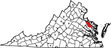 Location in the U.S. state of Virginia | ||
 Virginia's location in the U.S. | ||
| Founded | 1692 | |
| Seat | Tappahannock | |
| Largest town | Tappahannock | |
| Area | ||
| • Total | 286 sq mi (741 km2) | |
| • Land | 257 sq mi (666 km2) | |
| • Water | 29 sq mi (75 km2), 10.1% | |
| Population (est.) | ||
| • (2015) | 11,130 | |
| • Density | 40/sq mi (15/km2) | |
| Congressional district | 1st | |
| Time zone | Eastern: UTC−5/−4 | |
| Website |
www | |

Essex County is a county located in the Middle Peninsula in the U.S. state of Virginia; the peninsula is bordered by the Rappahannock River on the north and the Dragon swamp on the south. As of the 2010 census, the population was 11,151.[1] Its county seat is Tappahannock.[2]
History
Essex County was established in 1692 from the old Rappahannock County, Virginia (not to be confused with the present-day Rappahannock County, Virginia). The county is named for either the shire or county in England, or for the Earl of Essex.
Geography
According to the U.S. Census Bureau, the county has a total area of 286 square miles (740 km2), of which 257 square miles (670 km2) is land and 29 square miles (75 km2) (10.1%) is water.[3] Its main town, Tappahanock, is focused at the Rappahanock River.
Adjacent counties
- Westmoreland County – north
- Richmond County – northeast
- Middlesex County – southeast
- King and Queen County – south
- Caroline County – west
- King George County – northwest
Major highways
National protected area
- Rappahannock River Valley National Wildlife Refuge (part) Hutchinson unit, Thomas unit
Demographics
| Historical population | |||
|---|---|---|---|
| Census | Pop. | %± | |
| 1790 | 9,122 | — | |
| 1800 | 9,508 | 4.2% | |
| 1810 | 9,376 | −1.4% | |
| 1820 | 9,909 | 5.7% | |
| 1830 | 10,521 | 6.2% | |
| 1840 | 11,309 | 7.5% | |
| 1850 | 10,206 | −9.8% | |
| 1860 | 10,469 | 2.6% | |
| 1870 | 9,927 | −5.2% | |
| 1880 | 11,032 | 11.1% | |
| 1890 | 10,047 | −8.9% | |
| 1900 | 9,701 | −3.4% | |
| 1910 | 9,105 | −6.1% | |
| 1920 | 8,542 | −6.2% | |
| 1930 | 6,976 | −18.3% | |
| 1940 | 7,006 | 0.4% | |
| 1950 | 6,530 | −6.8% | |
| 1960 | 6,690 | 2.5% | |
| 1970 | 7,099 | 6.1% | |
| 1980 | 8,864 | 24.9% | |
| 1990 | 8,689 | −2.0% | |
| 2000 | 9,989 | 15.0% | |
| 2010 | 11,151 | 11.6% | |
| Est. 2016 | 11,123 | [4] | −0.3% |
| U.S. Decennial Census[5] 1790-1960[6] 1900-1990[7] 1990-2000[8] 2010-2013[1] | |||
As of the census[9] of 2000, there were 9,989 people, 3,995 households, and 2,740 families residing in the county. The population density was 39 people per square mile (15/km²). There were 4,926 housing units at an average density of 19 per square mile (7/km²). The racial makeup of the county was 57.96% White, 39.04% Black or African American, 0.55% Native American, 0.81% Asian, 0.03% Pacific Islander, 0.32% from other races, and 1.28% from two or more races. 0.72% of the population were Hispanic or Latino of any race.
There were 3,995 households out of which 28.00% had children under the age of 18 living with them, 50.70% were married couples living together, 14.00% had a female householder with no husband present, and 31.40% were non-families. 26.10% of all households were made up of individuals and 11.30% had someone living alone who was 65 years of age or older. The average household size was 2.46 and the average family size was 2.95.
In the county, the population was spread out with 22.90% under the age of 18, 7.00% from 18 to 24, 27.00% from 25 to 44, 25.70% from 45 to 64, and 17.30% who were 65 years of age or older. The median age was 40 years. For every 100 females there were 89.90 males. For every 100 females age 18 and over, there were 88.20 males.
The median income for a household in the county was $37,395, and the median income for a family was $43,588. Males had a median income of $29,736 versus $22,253 for females. The per capita income for the county was $17,994. About 7.70% of families and 11.20% of the population were below the poverty line, including 16.80% of those under age 18 and 11.80% of those age 65 or over.
Government
Board of supervisors
- Central District: John Magruder (I)
- Greater Tappahannock District: Robert Akers (I)
- North District: Sidney N. Johnson (I)
- South District: Margaret H. "Prue" Davis (I)
- At-Large: Edwin E. "Bud" Smith Jr. (I)
Constitutional officers
- Clerk of the Circuit Court: Gayle J. Ashworth (I)
- Commissioner of the Revenue: Thomas M. Blackwell (I)
- Commonwealth's Attorney: Vince S. Donoghue (R)
- Sheriff: Stanley S. Clarke (I)
- Treasurer: B. A. "Penny" Davis (I)
Essex is represented by Republican Ryan T. McDougle in the Virginia Senate, Republican M. Keith Hodges in the Virginia House of Delegates, and Republican Robert J. "Rob" Wittman in the U.S. House of Representatives.
| Year | Republican | Democratic | Third parties |
|---|---|---|---|
| 2016 | 49.5% 2,657 | 47.3% 2,542 | 3.2% 173 |
| 2012 | 45.9% 2,602 | 53.2% 3,016 | 1.0% 57 |
| 2008 | 44.4% 2,379 | 54.7% 2,934 | 1.0% 51 |
| 2004 | 53.0% 2,304 | 46.2% 2,007 | 0.8% 33 |
| 2000 | 52.1% 1,995 | 45.7% 1,750 | 2.2% 86 |
| 1996 | 46.1% 1,627 | 47.2% 1,668 | 6.7% 238 |
| 1992 | 48.6% 1,897 | 40.6% 1,583 | 10.9% 424 |
| 1988 | 60.6% 2,038 | 38.5% 1,294 | 1.0% 33 |
| 1984 | 61.6% 2,120 | 37.8% 1,300 | 0.6% 20 |
| 1980 | 52.9% 1,581 | 42.9% 1,280 | 4.2% 126 |
| 1976 | 50.6% 1,380 | 47.8% 1,306 | 1.6% 44 |
| 1972 | 62.6% 1,482 | 34.1% 808 | 3.3% 78 |
| 1968 | 36.6% 791 | 41.5% 897 | 22.0% 476 |
| 1964 | 50.9% 789 | 49.0% 760 | 0.1% 1 |
| 1960 | 54.3% 606 | 45.6% 509 | 0.2% 2 |
| 1956 | 55.5% 597 | 30.5% 328 | 14.0% 151 |
| 1952 | 52.5% 610 | 46.9% 545 | 0.7% 8 |
| 1948 | 34.0% 221 | 50.5% 329 | 15.5% 101 |
| 1944 | 26.0% 179 | 73.7% 508 | 0.3% 2 |
| 1940 | 20.9% 145 | 78.9% 547 | 0.1% 1 |
| 1936 | 18.0% 116 | 81.7% 527 | 0.3% 2 |
| 1932 | 19.3% 101 | 80.2% 420 | 0.6% 3 |
| 1928 | 37.8% 195 | 62.2% 321 | |
| 1924 | 15.6% 60 | 82.0% 315 | 2.3% 9 |
| 1920 | 24.1% 101 | 76.0% 319 | |
| 1916 | 20.3% 77 | 79.7% 302 | |
| 1912 | 19.9% 72 | 77.0% 278 | 3.1% 11 |
Education
Essex County Public Schools (ECPS) is the public schools system for Essex County, Virginia, United States.[11] The following schools make up the Essex County Public Schools system:
Tappahannock Elementary School (Grades PK - 4th)[12]
Essex Intermediate School (Grades 5th - 8th)[13]
Essex High School (Grades 9th - 12th)[14]
Other schools located in Essex County include:
St Margaret's School (Grades 8th - 12th, girls only)[15]
Tappahannock Junior Academy (Grades K - 10th)[16]
Aylett Country Day School (Grades PK - 8th) [17]
Communities
Town
Unincorporated communities
|
|
|
Notable residents
- David George (Baptist)- African American ex-slave founder of Silver Bluff Baptist Church
- Former NBA player Xavier McDaniel once lived in this county.
- U.S. Senator Paul S. Trible, Jr. was Commonwealth's Attorney of Essex County.
- Robert Mercer Taliaferro Hunter, 1809-1887. Speaker of the United States House of Representatives and Confederate States Secretary of State.
- Grammy Award-nominated R&B singer Chris Brown was born and raised in this county.
- Richard B. Garnett- Confederate States of America general who was killed while leading his brigade during Pickett's Charge.
See also
References
- 1 2 "State & County QuickFacts". United States Census Bureau. Archived from the original on July 10, 2011. Retrieved January 2, 2014.
- ↑ "Find a County". National Association of Counties. Archived from the original on 2011-05-31. Retrieved 2011-06-07.
- ↑ "US Gazetteer files: 2010, 2000, and 1990". United States Census Bureau. 2011-02-12. Retrieved 2011-04-23.
- ↑ "Population and Housing Unit Estimates". Retrieved June 9, 2017.
- ↑ "U.S. Decennial Census". United States Census Bureau. Archived from the original on May 12, 2015. Retrieved January 2, 2014.
- ↑ "Historical Census Browser". University of Virginia Library. Retrieved January 2, 2014.
- ↑ "Population of Counties by Decennial Census: 1900 to 1990". United States Census Bureau. Retrieved January 2, 2014.
- ↑ "Census 2000 PHC-T-4. Ranking Tables for Counties: 1990 and 2000" (PDF). United States Census Bureau. Retrieved January 2, 2014.
- ↑ "American FactFinder". United States Census Bureau. Archived from the original on 2013-09-11. Retrieved 2011-05-14.
- ↑ Leip, David. "Dave Leip's Atlas of U.S. Presidential Elections". uselectionatlas.org.
- ↑ http://www.essex.k12.va.us Essex
- ↑ "Home - Tappahannock Elementary School". essextes.sharpschool.net.
- ↑ "Home - Essex Intermediate School". eis.essex.k12.va.us.
- ↑ "Home - Essex High School". essexehs.sharpschool.net.
- ↑ "St. Margaret's - Girls Boarding School Near Fredericksburg & Richmond, VA". www.sms.org.
- ↑ "Home : Tappahannock Junior Academy Tappahannock VA". tappahannock22.adventistschoolconnect.org.
- ↑ "Aylett Country Day School~Home of the Patriots". www.acdspatriots.net.
External links
Places adjacent to Essex County, Virginia | ||||||||||
|---|---|---|---|---|---|---|---|---|---|---|
| ||||||||||
Municipalities and communities of Essex County, Virginia, United States | ||
|---|---|---|
| Town | | |
| Unincorporated communities | ||
| Footnotes | ‡This populated place also has portions in an adjacent county or counties | |
