Louisa County, Virginia
| Louisa County, Virginia | |
|---|---|
%2C_Louisa_(Louisa_County%2C_Virginia).jpg) Louisa County Courthouse | |
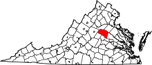 Location in the U.S. state of Virginia | |
 Virginia's location in the U.S. | |
| Founded | 1742 |
| Named for | Louise of Great Britain |
| Seat | Louisa |
| Largest town | Louisa |
| Area | |
| • Total | 511 sq mi (1,323 km2) |
| • Land | 496 sq mi (1,285 km2) |
| • Water | 15 sq mi (39 km2), 2.9% |
| Population (est.) | |
| • (2015) | 34,602 |
| • Density | 68/sq mi (26/km2) |
| Congressional district | 7th |
| Time zone | Eastern: UTC−5/−4 |
| Website |
www |
Louisa County is a county located in the Commonwealth of Virginia. As of the 2010 census, the population was 33,153.[1] The county seat is Louisa.[2]
History
Prior to colonial settlement, the area comprising Louisa County was occupied by several indigenous peoples including the Tutelo, the Monacan, and the Manahoac peoples, who eventually fled to join the Cayuga Iroquois (Haudenosaunee) people in New York state under pressure from English settlers. Louisa County was established in 1742 from Hanover County. The county is named for Princess Louise of Great Britain, youngest daughter of King George II, and wife of King Frederick V of Denmark.[3] Patrick Henry lived for some time in Louisa County on Roundabout Creek in 1764. Henry was being mentored at that time by the Louisa County magnate Thomas Johnson the representative of Louisa County in the House of Burgesses. In 1765, Patrick Henry won his first election to represent Louisa County in the House of Burgesses. At the end of the eighteenth century and in the early nineteenth century, numerous free mixed-race families migrated together from here to Kentucky, where neighbors began to identify them as Melungeon.
The Virginia Central Railroad was completed through Louisa County in 1838–1840. During the Civil War, it was an important supply line for the Confederate armies. As a result, several significant cavalry actions took place in the county, particularly one fought at Trevilians in 1864.
20th century to present

The Twin Oaks Community is one of the country's oldest secular communes, established by its first eight members in 1967. This was part of a national movement among numerous young people to "get back to the land" and live in more simple ways based in community. Louisa is also home to the Acorn Community, a rural, cooperative, income sharing community on about 80 acres, founded in 1993 by one of the founding members of Twin Oaks, Kat Kincade. Another newly forming community as of 2011 is the Living Energy Farm, a 'neo-Amish' farm, where no fossil fuels will be used but new technologies such as solar will be embraced. Louisa is becoming a hub of cooperative rural communities.
Lake Anna, a 13,000-acre (53 km2) artificial lake, and the associated North Anna Nuclear Generating Station were built by Virginia Power in the 1970s. In recent years the predominantly rural county has grown because of retirees' settling near Lake Anna, and because of its convenient location for commuters. It is an hour's drive or less from Richmond, Fredericksburg and Charlottesville.[4]
For a discussion and additional information on Louisa County history, see: Louisa County Historical Notes.[5]
2011 earthquake
The U.S. Geological Survey reported that a magnitude 5.8 earthquake hit Virginia on Tuesday, August 23, 2011 at 1:51 PM EST. The quake occurred at an approximate depth of 3.7 miles and was centered in Louisa County (location at 37.944°N, 77.942°W), 5 miles SSW of Mineral and 38 miles NW of Richmond.[6] According to Associated Press, "Shaking was felt at the White House and all over the East Coast, as far south as Charleston, S.C. Parts of the Pentagon, White House and Capitol were evacuated."[7] It was also felt in parts of Canada.[8]
Damage totals in Louisa County totaled over $70 million:[9]
- $57.5 million in damages to public school structures
- $11.5 million in damages to residential structures
- $400,000 in damages to religious structures
- $400,000 in damages to commercial structures
- $500,000 in damages to government structures
Geography
According to the U.S. Census Bureau, the county has a total area of 511 square miles (1,320 km2), of which 496 square miles (1,280 km2) is land and 15 square miles (39 km2) (2.9%) is water.[10]
Adjacent counties
- Orange County – north
- Spotsylvania County – northeast
- Hanover County – east
- Goochland County – south
- Fluvanna County – southwest
- Albemarle County – west
Major highways
Demographics
| Historical population | |||
|---|---|---|---|
| Census | Pop. | %± | |
| 1790 | 8,467 | — | |
| 1800 | 11,892 | 40.5% | |
| 1810 | 11,900 | 0.1% | |
| 1820 | 13,746 | 15.5% | |
| 1830 | 16,151 | 17.5% | |
| 1840 | 15,433 | −4.4% | |
| 1850 | 16,691 | 8.2% | |
| 1860 | 16,701 | 0.1% | |
| 1870 | 16,332 | −2.2% | |
| 1880 | 18,942 | 16.0% | |
| 1890 | 16,997 | −10.3% | |
| 1900 | 16,517 | −2.8% | |
| 1910 | 16,578 | 0.4% | |
| 1920 | 17,089 | 3.1% | |
| 1930 | 14,309 | −16.3% | |
| 1940 | 13,665 | −4.5% | |
| 1950 | 12,826 | −6.1% | |
| 1960 | 12,959 | 1.0% | |
| 1970 | 14,004 | 8.1% | |
| 1980 | 17,825 | 27.3% | |
| 1990 | 20,325 | 14.0% | |
| 2000 | 25,627 | 26.1% | |
| 2010 | 33,153 | 29.4% | |
| Est. 2016 | 35,236 | [11] | 6.3% |
| U.S. Decennial Census[12] 1790–1960[13] 1900–1990[14] 1990–2000[15] 2010–2013[1] | |||
As of the census[16] of 2000, there were 25,627 people, 9,945 households, and 7,259 families residing in the county. The population density was 52 people per square mile (20/km²). There were 11,855 housing units at an average density of 24 per square mile (9/km²). The racial makeup of the county was 50.96% White, 46.58% Black or African American, 0.42% Native American, 0.25% Asian, 0.01% Pacific Islander, 0.18% from other races, and 1.01% from two or more races. 0.71% of the population were Hispanic or Latino of any race.
There were 9,945 households out of which 31.20% had children under the age of 18 living with them, 57.30% were married couples living together, 10.80% had a female householder with no husband present, and 27.00% were non-families. 22.10% of all households were made up of individuals and 9.00% had someone living alone who was 65 years of age or older. The average household size was 2.56 and the average family size was 2.97.
In the county, the population was spread out with 24.40% under the age of 18, 6.60% from 18 to 24, 29.90% from 25 to 44, 26.20% from 45 to 64, and 12.90% who were 65 years of age or older. The median age was 39 years. For every 100 females, there were 96.90 males. For every 100 females age 18 and over, there were 94.90 males.
The median income for a household in the county was $39,402, and the median income for a family was $44,722. Males had a median income of $31,764 versus $24,826 for females. The per capita income for the county was $19,479. About 7.10% of families and 10.20% of the population were below the poverty line, including 13.00% of those under age 18 and 12.50% of those age 65 or over.
Although the county's 2008 population is only 31,000, it is one of the fastest-growing in Virginia, as people have moved near Lake Anna. At least 15 new housing developments have sprouted in five years.[4]
Communities
Towns
Census-designated place
Other unincorporated communities
- Apple Grove
- Bumpass
- Cuckoo
- Ferncliff
- Gum Spring
- Holly Grove
- Orchid
- Trevilians
- Zion Crossroads
Historical places and points of interest
- Green Springs Historic District
- Jerdone Castle
- Lake Anna
- Twin Oaks Community, arguably America's most successful secular commune, is located in Louisa County.
- Acorn Community another income sharing community in the county, which runs the successful Southern Exposure Seed Exchange business as its principal source of income.
Notable people
- Henry "Box" Brown (c.1816–after 1889) a slave who escaped to freedom by having himself mailed in a wooden crate to Pennsylvanian abolitionists.
- Patrick Henry, (1736–1799), at Roundabout Plantation, eight miles southwest of Louisa Court House, Patrick Henry lived in Louisa County from 1765 to 1768, when he sat for Louisa County in the House of Burgesses. This was the beginning of his political career.[17]
- James Waddel Alexander, (1804–1859), born in Louisa County, noted Presbyterian minister and professor at Princeton Theological Seminary [18]
- Arthur P. Bagby, (1794–1858), born in Louisa County, was the tenth Governor of Alabama from 1837 to 1841.
- Paxus Calta, (1957–?) anti-nuclear activist, blogger and member of Twin Oaks Community and Acorn Community
- Dabney Carr, (October 26, 1743 – May 16, 1773), celebrated Louisa County patriot.
- Charles Henry Langston (1817–1892), born free, one of two men tried and convicted after Oberlin-Wellington Rescue, abolitionist and political activist in Ohio and Kansas.
- John Mercer Langston (1829–1899), abolitionist, activist, educator and politician – in 1855 first black person in Ohio elected to public office, first dean of Howard University law school, first president of Virginia State University, in 1888 first black person to be elected to the United States Congress from Virginia.
- Flora Molton (1908–1990), singer
- John Overton, (1766–1833), born in Louisa County, notable political leader who was an adviser to Andrew Jackson and co-founder of Memphis, Tennessee.
- James Waddel (1739–1805), celebrated Presbyterian preacher
Politics
| Year | Republican | Democratic | Third parties |
|---|---|---|---|
| 2016 | 59.8% 10,528 | 35.3% 6,212 | 5.0% 872 |
| 2012 | 56.0% 9,215 | 42.3% 6,953 | 1.7% 284 |
| 2008 | 53.3% 8,182 | 45.5% 6,978 | 1.3% 193 |
| 2004 | 58.9% 7,083 | 40.3% 4,844 | 0.9% 108 |
| 2000 | 54.1% 5,461 | 42.7% 4,309 | 3.2% 326 |
| 1996 | 45.3% 3,768 | 45.2% 3,761 | 9.5% 794 |
| 1992 | 41.7% 3,461 | 40.9% 3,399 | 17.4% 1,447 |
| 1988 | 57.2% 3,831 | 41.6% 2,789 | 1.2% 82 |
| 1984 | 57.9% 3,789 | 41.3% 2,703 | 0.8% 51 |
| 1980 | 46.1% 2,633 | 49.2% 2,809 | 4.6% 264 |
| 1976 | 41.9% 2,151 | 55.6% 2,857 | 2.5% 127 |
| 1972 | 63.6% 2,545 | 33.4% 1,338 | 3.1% 122 |
| 1968 | 38.1% 1,510 | 32.5% 1,290 | 29.4% 1,164 |
| 1964 | 44.1% 1,369 | 55.8% 1,731 | 0.1% 3 |
| 1960 | 47.6% 1,170 | 50.6% 1,244 | 1.8% 44 |
| 1956 | 47.4% 1,152 | 32.7% 795 | 19.8% 482 |
| 1952 | 52.3% 1,135 | 47.2% 1,025 | 0.6% 12 |
| 1948 | 41.5% 701 | 46.2% 782 | 12.3% 208 |
| 1944 | 40.3% 634 | 59.2% 930 | 0.5% 8 |
| 1940 | 38.7% 573 | 60.5% 896 | 0.9% 13 |
| 1936 | 30.4% 486 | 68.8% 1,100 | 0.8% 12 |
| 1932 | 28.6% 366 | 68.6% 879 | 2.8% 36 |
| 1928 | 51.3% 772 | 48.7% 734 | |
| 1924 | 27.0% 282 | 67.6% 707 | 5.5% 57 |
| 1920 | 31.1% 312 | 68.2% 684 | 0.7% 7 |
| 1916 | 26.7% 263 | 72.1% 710 | 1.2% 12 |
| 1912 | 11.1% 91 | 70.5% 578 | 18.4% 151 |
See also
References
- 1 2 "State & County QuickFacts". United States Census Bureau. Archived from the original on July 14, 2011. Retrieved January 3, 2014.
- ↑ "Find a County". National Association of Counties. Retrieved 2011-06-07.
- ↑ Gannett, Henry (1905). The Origin of Certain Place Names in the United States. U.S. Government Printing Office. p. 191.
- 1 2 Merida, Kevin (June 7, 2008). "The 'Obama Before Obama'". The Washington Post. p. A01.
- ↑ Pattie Cooke, "Louisa County Historical Notes" Archived 2008-05-11 at the Wayback Machine., Excerpt from Louisa & Louisa County, Dover, New Hampshire: Arcadia Publishing, 1997
- ↑ Archived August 24, 2011, at the Wayback Machine.
- ↑ "Quake rocks Washington area, felt on East Coast". Associated Press (AP). August 23, 2011. Archived from the original on August 23, 2011.
- ↑ "Strong earthquake hits Canada, U.S. East Coast". The Vancouver Sun. August 23, 2011.
- ↑ "Louisa Updates Earthquake Damage Estimates". Gray Television, Inc. Retrieved 31 August 2011.
- ↑ "US Gazetteer files: 2010, 2000, and 1990". United States Census Bureau. 2011-02-12. Retrieved 2011-04-23.
- ↑ "Population and Housing Unit Estimates". Retrieved June 9, 2017.
- ↑ "U.S. Decennial Census". United States Census Bureau. Retrieved January 3, 2014.
- ↑ "Historical Census Browser". University of Virginia Library. Retrieved January 3, 2014.
- ↑ "Population of Counties by Decennial Census: 1900 to 1990". United States Census Bureau. Retrieved January 3, 2014.
- ↑ "Census 2000 PHC-T-4. Ranking Tables for Counties: 1990 and 2000" (PDF). United States Census Bureau. Retrieved January 3, 2014.
- ↑ "American FactFinder". United States Census Bureau. Retrieved 2011-05-14.
- ↑ Virginia Historical Markers Archived 2012-06-09 at the Wayback Machine., Virginia Historical Marker W-211: Patrick Henry's Home
- ↑ Who Was Who in America, Historical Volume, 1607–1896. Chicago: Marquis Who's Who. 1963.
- ↑ Leip, David. "Dave Leip's Atlas of U.S. Presidential Elections". uselectionatlas.org. Retrieved 2018-08-21.
External links
| Wikimedia Commons has media related to Louisa County, Virginia. |
- Official Louisa County Website
- The Healthy Living Directory
- Louisa County VAGenWeb Genealogy Project
- 2014 Fresh Air piece (audio here) and Atlantic article on a sexting scandal in Louisa County
Places adjacent to Louisa County, Virginia | ||||||||||
|---|---|---|---|---|---|---|---|---|---|---|
| ||||||||||
Municipalities and communities of Louisa County, Virginia, United States | ||
|---|---|---|
| Towns | | |
| CDP | ||
| Unincorporated communities |
| |
| Footnotes | ‡This populated place also has portions in an adjacent county or counties | |
