Mathews County, Virginia
| Mathews County, Virginia | ||
|---|---|---|
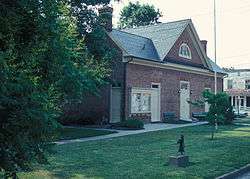 Mathews County Courthouse Square | ||
| ||
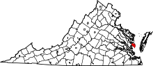 Location in the U.S. state of Virginia | ||
 Virginia's location in the U.S. | ||
| Founded | 1791 | |
| Seat | Mathews | |
| Area | ||
| • Total | 252 sq mi (653 km2) | |
| • Land | 86 sq mi (223 km2) | |
| • Water | 166 sq mi (430 km2), 65.9% | |
| Population (est.) | ||
| • (2015) | 8,862 | |
| • Density | 110/sq mi (41/km2) | |
| Congressional district | 1st | |
| Time zone | Eastern: UTC−5/−4 | |
| Website |
www | |


Mathews County is a county located in the U.S. state of Virginia. As of the 2010 census, the population was 8,978.[1] Its county seat is Mathews.[2]
Located on the Middle Peninsula, Mathews County is included in the Virginia Beach-Norfolk-Newport News, VA-NC Metropolitan Statistical Area.
History
At the time of European colonization, the Chiskiake tribe, one of the Algonquian-speaking tribes who were part of the Powhatan Confederacy, inhabited this peninsula at the entrance to Chesapeake Bay. After the death of his father (and tribal head), a young "boy king", and his "protector", with a name sounding like "Pindavako" to English ears, supposedly signed over the northern areas of the county to the English settlers.
During Virginia's colonial era, the area that later became Mathews County was part of Gloucester County. In 1691, the Virginia General Assembly had directed that each county designate an official port-of-entry. Established around 1700, the community of Westville was located along Put-in Creek, a tidal tributary of Virginia's East River feeding into Mobjack Bay, which was a tributary of the Chesapeake Bay.[3]
In 1776 during the American Revolutionary War, Virginia's last Royal Governor, Lord Dunmore, left Virginia after pushed to the southeast to Gwynn's Island by General Andrew Lewis and the Continental Army. General Lewis' forces bombarded Gwynn's Island from Fort Cricket Hill.
In 1791, after Virginia gained its independence from Great Britain, the Virginia General Assembly split Gloucester county and created Mathews County. The county was named for Brigadier General Thomas Mathews, then speaker of the Virginia House of Delegates. Westville was designated at the county seat (later it became known variously as Mathews Court House or simply Mathews).[4]
Seaborne commerce, fishing and oyster farming had always been important in the area and Old Point Comfort Lighthouse was built in 1802 to guide vessels into the Hampton Roads seaport (along with the older lighthouse at Cape Henry). Two additional lighthouses were built slightly later: New Point Comfort Light and Smith Point Light. During the War of 1812, British vessels anchored in Hampton Roads and raided adjacent areas.
Farming using enslaved labor was important to the 19th century economy, and early in the century Edmund Ruffin introduced the use of limestone marl as fertilizer on fields worn out from tobacco crops.[5] Two Mathews County men implicated in Gabriel's Rebellion in 1802 were sentenced to transportation out of the Commonwealth. In a lawsuit begun in 1806, Jackey Wright of Mathews County was granted her freedom from prominent landowner Holder Hudgins due to her grandmother's Native American ancestry in one of the last cases decided by Judge George Wythe, with a Virginia Supreme Court opinion by St. George Tucker.[6]
During the American Civil War, many white men from Mathews County enlisted in the Confederate Army. Some Union sympathizers petitioned President Abraham Lincoln for help, alleging that Confederate sympathizers had harassed them.[7] Union forces by 1862 controlled the Hampton Roads area and in July 1862 a detachment of Pennsylvania cavalry arrived at Gloucester Court House, then went to Mathews to arrest Carter B. Hudgins, but were unsuccessful. Several other Union raids occurred beginning in September 1863, initially designed to disrupt Confederate salt works. However, in the October 1863 raid, Union General Wistar later reported some of his troops behaved very badly, and Sands Smith was executed after he shot a Union soldier attempting to confiscate his cow.[8] His son and grandson would become prominent Mathews County officials by century's end. Also, Miss Sally Louisa Tompkins, of a prominent Mathews family, went to Richmond, Virginia and established a private hospital for Confederate wounded, which achieved significant success, such that she was granted an officer's commission on September 9, 1861 by Confederate President Jefferson Davis and continued to nurse the wounded until 1865.[9][10]
In 1882-1886, complaints about out-of-state watermen dredging local oyster beds (and destroying young oysters) produced an "oyster war" during the administration of Virginia Governor William E. Cameron. Several offending boats were captured, but all but one of their watermen were from Virginia's Eastern shore (across Chesapeake Bay)rather than from outside the Commonwealth.[11]
During World War I, Mathews County greatly exceeded its quota of volunteers. In addition to fatalities, several men were disabled by gas attacks at the battlefront, and later relayed their stories. Many Mathews county seamen also served in the Merchant Marine. The war also changed economic relations within the county, for farm laborers could get better paying jobs in Hampton Roads or nearby cities.
As the Great Depression began, voters elected Emma Lee Smith White, wife of local physician Dr. Carl Clifford White, to represent them in the Virginia General Assembly. As a local insurance agent, among other jobs, she had other priorities after a hurricane and 100-year level flooding devastated Mathews County in August 1933. No woman again sat in the Virginia General Assembly for 21 years.[12]
In October 2012, Hurricane Sandy also devastated Mathews County, and while rebuilding, officials decided to petition to have the town center declared a historic district. It received nomination from the Virginia Department of Historic Resources in 2016.[13][14] The Mathews County Courthouse Square has been recognized as a National Historic District since 1977, and the Sibley's and James Store Historic District (consisting of two 19th century general stores) has been recognized as a National Historic District since 2011.
Geography
According to the U.S. Census Bureau, the county has a total area of 252 square miles (650 km2), of which 86 square miles (220 km2) is land and 166 square miles (430 km2) (65.9%) is water.[15] It is the second-smallest county in Virginia by land area.
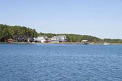
Mathews County is perhaps best known for its miles of waterfront sites, as well as its prominent location on the Chesapeake Bay. Surrounded almost completely by water, it is bordered by Middlesex County to the north, separated by the Piankatank River and Gloucester County to the west. The southern side of the county borders Mobjack Bay.
Adjacent counties
- Middlesex County - north
- Gloucester County - south & west
- York County - south
Demographics
| Historical population | |||
|---|---|---|---|
| Census | Pop. | %± | |
| 1800 | 5,806 | — | |
| 1810 | 4,227 | −27.2% | |
| 1820 | 6,920 | 63.7% | |
| 1830 | 7,664 | 10.8% | |
| 1840 | 7,442 | −2.9% | |
| 1850 | 6,714 | −9.8% | |
| 1860 | 7,091 | 5.6% | |
| 1870 | 6,200 | −12.6% | |
| 1880 | 7,501 | 21.0% | |
| 1890 | 7,584 | 1.1% | |
| 1900 | 8,239 | 8.6% | |
| 1910 | 8,922 | 8.3% | |
| 1920 | 8,447 | −5.3% | |
| 1930 | 7,884 | −6.7% | |
| 1940 | 7,149 | −9.3% | |
| 1950 | 7,148 | 0.0% | |
| 1960 | 7,121 | −0.4% | |
| 1970 | 7,168 | 0.7% | |
| 1980 | 7,995 | 11.5% | |
| 1990 | 8,348 | 4.4% | |
| 2000 | 9,207 | 10.3% | |
| 2010 | 8,978 | −2.5% | |
| Est. 2016 | 8,782 | [16] | −2.2% |
| U.S. Decennial Census[17] 1790-1960[18] 1900-1990[19] 1990-2000[20] 2010-2013[1] | |||
As of the census[21] of 2010, there were 8,978 people, 3,932 households, and 2,823 families residing in the county. The population density was 108 people per square mile (41/km²). There were 5,333 housing units at an average density of 62 per square mile (24/km²). The racial makeup of the county was 88.0% White, 9.2% Black or African American, 0.2% Native American, 0.3% Asian, 0.3% from other races, and 1.9% from two or more races. 1.2% of the population were Hispanic or Latino of any race.
There were 3,932 households out of which 24.20% had children under the age of 18 living with them, 61.20% were married couples living together, 7.90% had a female householder with no husband present, and 28.20% were non-families. 24.90% of all households were made up of individuals and 13.50% had someone living alone who was 65 years of age or older. The average household size was 2.32 and the average family size was 2.75.
In the county, the population was spread out with 19.90% under the age of 18, 5.20% from 18 to 24, 23.10% from 25 to 44, 30.10% from 45 to 64, and 21.60% who were 65 years of age or older. The median age was 46 years. For every 100 females there were 93.20 males. For every 100 females age 18 and over, there were 91.70 males.
The median income for a household in the county was $43,222, and the median income for a family was $50,653. Males had a median income of $36,294 versus $23,434 for females. The per capita income for the county was $23,610. 6.00% of the population and 4.30% of families were below the poverty line. Out of the total people living in poverty, 7.50% are under the age of 18 and 4.80% are 65 or older.
Tourism, leisure, and fishing industries are the major sources of employment. Mathews County is one of the few counties in Virginia without a traffic signal. (Charlotte County & Bath County are others.) Along State Route 223 at Gwynn's Island, there is a small drawbridge which is manned 24 hours daily.[22]
Ethnicity
As of 2016 the largest self-identified ancestries/ethnicities in Mathews county are:
- English - 32.3%
- Irish - 14.0%
- German - 12.8%
- American - 10.5%
Communities
Census-designated places
Other unincorporated communities
Prominent among Mathews County tourism and leisure locations is Gwynn's Island, a popular spot for recreational boating and sailing. It is located where the Piankatank River feeds into the Chesapeake Bay.[24] Nearby is the off-shore location of the historic New Point Comfort Light.
Sports, events
Mathews County hosts the annual Tour De Chesapeake (due to its lack of hills except for the north section of the county near the Mathews-Gloucester border). The bicycling event is a benefit for the Chesapeake Bay Foundation.[25] The community also sponsors Mathews Market Days, featuring local artists such as P. Buckley Moss.
Susan, Virginia- which is in Mathews County- is where the DIY Blog Cabin 2011 is located. This event has drawn more attention to the county.
Despite lackluster football and basketball teams, Mathews High School is known for success in several sports including Boy's and Girl's Crew Teams, Boys and Girls Cross Country, Volleyball, Wrestling, Softball, and Track and Field. The wrestling team won the 1990 and 1991 state championships, boys track won the 1969 and 1986 state championships, baseball won the state title in 2004, and the volleyball team won two consecutive state titles in 2011 and 2012.The Crew Team has also won many championships for Mathews including the Stotesbury Cup.[26]
Notable residents
Captain Sally Tompkins was a Mathews County native. Gwynn's Island resident William B. Livermon, Sr. appeared throughout the 1970s on television in religion segments as "The Circuit Rider".[27] Mathews is also home to former NFL football player Stuart Anderson (football) of the Washington Redskins and baseball player Keith Atherton of the Minnesota Twins.
Former Beatle John Lennon and his wife Yoko Ono once owned two historic waterfront estates in Mathews.
Politics
| Year | Republican | Democratic | Third parties |
|---|---|---|---|
| 2016 | 66.2% 3,517 | 29.4% 1,563 | 4.4% 231 |
| 2012 | 64.9% 3,488 | 33.6% 1,807 | 1.5% 79 |
| 2008 | 63.5% 3,456 | 35.6% 1,934 | 0.9% 50 |
| 2004 | 68.2% 3,497 | 31.0% 1,589 | 0.8% 43 |
| 2000 | 64.0% 2,951 | 32.5% 1,499 | 3.5% 159 |
| 1996 | 51.8% 2,206 | 37.6% 1,602 | 10.6% 452 |
| 1992 | 48.2% 2,179 | 31.0% 1,402 | 20.9% 944 |
| 1988 | 67.5% 2,752 | 30.3% 1,235 | 2.2% 89 |
| 1984 | 71.6% 2,868 | 27.6% 1,106 | 0.8% 31 |
| 1980 | 59.3% 2,204 | 35.0% 1,300 | 5.7% 212 |
| 1976 | 57.8% 1,908 | 39.6% 1,309 | 2.6% 86 |
| 1972 | 72.5% 2,164 | 24.4% 730 | 3.1% 93 |
| 1968 | 47.1% 1,309 | 24.9% 691 | 28.0% 777 |
| 1964 | 50.3% 1,149 | 49.7% 1,137 | |
| 1960 | 61.0% 1,069 | 38.9% 682 | 0.2% 3 |
| 1956 | 65.4% 1,018 | 26.1% 406 | 8.5% 132 |
| 1952 | 63.9% 951 | 35.8% 533 | 0.3% 5 |
| 1948 | 47.5% 490 | 44.4% 458 | 8.1% 83 |
| 1944 | 44.4% 491 | 55.6% 615 | 0.1% 1 |
| 1940 | 36.9% 349 | 62.5% 592 | 0.6% 6 |
| 1936 | 41.9% 452 | 57.7% 622 | 0.5% 5 |
| 1932 | 42.3% 488 | 56.5% 652 | 1.2% 14 |
| 1928 | 66.5% 855 | 33.5% 431 | |
| 1924 | 22.1% 195 | 76.8% 678 | 1.1% 10 |
| 1920 | 25.2% 216 | 72.9% 624 | 1.9% 16 |
| 1916 | 13.8% 90 | 83.9% 549 | 2.3% 15 |
| 1912 | 7.5% 45 | 86.9% 523 | 5.7% 34 |
See also
References
- 1 2 "State & County QuickFacts". United States Census Bureau. Archived from the original on July 14, 2011. Retrieved January 3, 2014.
- ↑ "Find a County". National Association of Counties. Retrieved 2011-06-07.
- ↑ "Mathews eyes transforming Put-in Creek - tribunedigital-dailypress". Dailypress.com. 2010-10-02. Retrieved 2015-08-11.
- ↑ "VAGenWeb Mathews County, VA Genealogy". Rootsweb.ancestry.com. 2007-11-08. Retrieved 2015-08-11.
- ↑ McCartney pp. 266--268
- ↑ McCartney pp. 223-226
- ↑ McCartney pp. 337-339
- ↑ Mathews County Historical Society, History and Progress, Mathews County, Virginia (reprints from 1949 and 1979 special editions of the Gloucester Mathews Gazette-Journal pp. 15-16
- ↑ 1979 history pp. 44-47
- ↑ McCartney pp. 332-333 relates that of 1,333 men receiving care, only 73 died
- ↑ McCartney pp. 429-430
- ↑ Cynthia A. Kierner and Sandra Goia Treadway, Virginia Women: Their Lives and Times, Vol. 2 (Athens, Georgia: University of Georgia Press 2016) p. 336
- ↑ http://dhr.virginia.gov/registers/Counties/Mathews/057-5415_Mathews_Downtown_HD_2016_PIF.pdf
- ↑ http://dhr.virginia.gov/registers/Counties/Mathews/057-5415_Mathews_Downtown_HD_photographs.htm
- ↑ "US Gazetteer files: 2010, 2000, and 1990". United States Census Bureau. 2011-02-12. Retrieved 2011-04-23.
- ↑ "Population and Housing Unit Estimates". Retrieved June 9, 2017.
- ↑ "U.S. Decennial Census". United States Census Bureau. Retrieved January 3, 2014.
- ↑ "Historical Census Browser". University of Virginia Library. Retrieved January 3, 2014.
- ↑ "Population of Counties by Decennial Census: 1900 to 1990". United States Census Bureau. Retrieved January 3, 2014.
- ↑ "Census 2000 PHC-T-4. Ranking Tables for Counties: 1990 and 2000" (PDF). United States Census Bureau. Retrieved January 3, 2014.
- ↑ "American FactFinder". United States Census Bureau. Retrieved 2011-05-14.
- ↑ "Watching The World Go By". tribunedigital-dailypress. Retrieved 3 August 2015.
- ↑ https://factfinder.census.gov/bkmk/table/1.0/en/ACS/16_5YR/DP02/0500000US51115
- ↑ "Welcome". Gwynnsislandmuseum.org. Retrieved 3 August 2015.
- ↑ Archived August 1, 2015, at the Wayback Machine.
- ↑ Archived August 13, 2014, at the Wayback Machine.
- ↑ Callis, Rita A. (1992). "William B. Livermon, Sr., 1916-1992". Memoirs from the 1992 Journal of the Virginia Annual Conference. Virginia Conference of the United Methodist Church. Archived from the original on 2008-09-08. Retrieved 2009-04-21.
- ↑ Leip, David. "Dave Leip's Atlas of U.S. Presidential Elections". uselectionatlas.org. Retrieved 2018-08-21.
External links
Places adjacent to Mathews County, Virginia | ||||||||||
|---|---|---|---|---|---|---|---|---|---|---|
| ||||||||||
Municipalities and communities of Mathews County, Virginia, United States | ||
|---|---|---|
| CDPs | | |
| Unincorporated communities |
| |
