| [3] |
Name on the Register[4] |
Image |
Date listed[5] |
Location |
City or town |
Description |
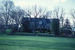
|---|
| 1 |
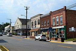
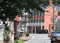
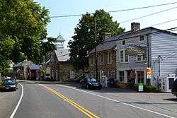
Aldie Mill Historic District |
|
September 15, 1970
(#70000806) |
Both sides of U.S. Route 50 from east of Tail Race Rd. to west of Meetinghouse Ln.
38°58′31″N 77°38′28″W / 38.975278°N 77.641111°W / 38.975278; -77.641111 (Aldie Mill Historic District) |
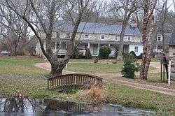
Aldie |
|
| 2 |
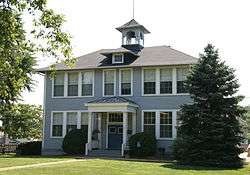
Arcola Elementary School |
|
June 5, 2013
(#13000363) |
24244 Gum Spring Rd.
38°56′52″N 77°32′14″W / 38.947778°N 77.537222°W / 38.947778; -77.537222 (Arcola Elementary School) |
Arcola |
|
| 3 |
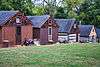
Arcola Slave Quarters |
|
November 26, 2008
(#08001113) |
24837 Evergreen Mills Rd.
38°56′49″N 77°31′43″W / 38.946833°N 77.528611°W / 38.946833; -77.528611 (Arcola Slave Quarters) |
Arcola |
|
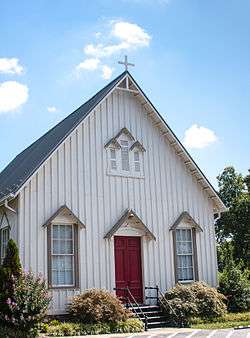
| 4 |
Ashburn Presbyterian Church |
|
August 5, 1999
(#99000962) |
20962 Ashburn Rd.
39°02′19″N 77°29′08″W / 39.038611°N 77.485556°W / 39.038611; -77.485556 (Ashburn Presbyterian Church) |
Leesburg |
|
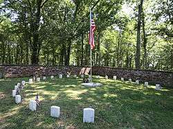
| 5 |
Ball's Bluff Battlefield Historic District and National Cemetery |
|
April 27, 1984
(#84003880) |
Ball's Bluff
39°07′55″N 77°31′39″W / 39.131944°N 77.527500°W / 39.131944; -77.527500 (Ball's Bluff Battlefield Historic District and National Cemetery) |
Leesburg |
|
| 6 |
Bear's Den Rural Historic District |
|
May 14, 2009
(#08001112) |
Generally runs along both sides of the ridge along parts of Raven Rocks and Blue Ridge Mountain Rds.
39°06′32″N 77°50′54″W / 39.108889°N 77.848333°W / 39.108889; -77.848333 (Bear's Den Rural Historic District) |
Bluemont |
|
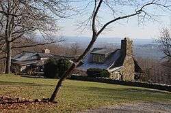
| 7 |
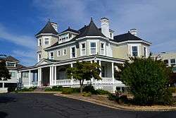
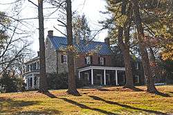
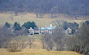
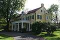
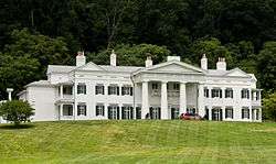
Belmont |
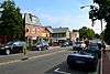
|
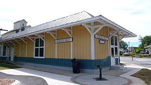
February 8, 1980
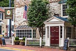
(#80004198) |
1.8 miles (2.9 km) north of Ashburn
39°04′10″N 77°29′29″W / 39.069444°N 77.491389°W / 39.069444; -77.491389 (Belmont) |
Ashburn |
|
| 8 |
Benton |
|
June 14, 1984
(#84003545) |
Snake Hill Rd.
39°00′11″N 77°45′58″W / 39.003056°N 77.766111°W / 39.003056; -77.766111 (Benton) |
Middleburg |
|
| 9 |
Bluemont Historic District |
|
February 23, 1984
(#84003546) |
Snickersville Turnpike and Clayton Hall Rd.
39°06′40″N 77°50′04″W / 39.111111°N 77.834444°W / 39.111111; -77.834444 (Bluemont Historic District) |
Bluemont |
|
| 10 |
Broad Run Bridge and Tollhouse |
|
April 17, 1970
(#70000808) |
Junction of State Routes 7 and State Route 28 with Broad Run
39°02′49″N 77°25′59″W / 39.046944°N 77.433194°W / 39.046944; -77.433194 (Broad Run Bridge and Tollhouse) |
Sterling |
|
| 11 |
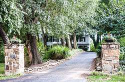
Brown-Koerner House |
|
August 15, 2016
(#16000531) |
38340 Winsome Trail Ln.
39°10′23″N 77°40′28″W / 39.173056°N 77.674444°W / 39.173056; -77.674444 (Brown-Koerner House) |
Purcellville |
|
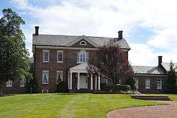
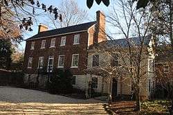
| 12 |
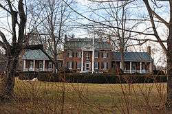
Carlheim |
|
December 28, 1979
(#79003050) |
North of Leesburg on U.S. Route 15
39°07′22″N 77°33′16″W / 39.122778°N 77.554444°W / 39.122778; -77.554444 (Carlheim) |
Leesburg |
|
| 13 |
Catoctin Creek Bridge |
|
June 25, 1974
(#74002136) |
Featherbed Ln., north of Waterford
39°13′56″N 77°35′29″W / 39.232222°N 77.591389°W / 39.232222; -77.591389 (Catoctin Creek Bridge) |
Waterford |
|
| 14 |
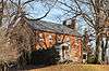
Clapham's Ferry |
|
September 4, 1997
(#97001076) |
44344 E. Spinks Ferry Rd.
39°13′21″N 77°27′52″W / 39.222500°N 77.464444°W / 39.222500; -77.464444 (Clapham's Ferry) |
Leesburg |
|
| 15 |
Cleremont Farm |
|
January 25, 1997
(#96001627) |
Eastern side of Trappe Rd., 0.6 miles (0.97 km) northeast of Millville Rd.
39°02′53″N 77°51′49″W / 39.048056°N 77.863611°W / 39.048056; -77.863611 (Cleremont Farm) |
Upperville |
|
| 16 |
Crednal |
|
February 22, 2011
(#11000034) |
34500 Welbourne Rd.
39°00′22″N 77°48′41″W / 39.006111°N 77.811389°W / 39.006111; -77.811389 (Crednal) |
Unison |
|
| 17 |
Douglass High School |
|
September 24, 1992
(#92001274) |
408 E. Market St.
39°06′35″N 77°33′17″W / 39.109722°N 77.554722°W / 39.109722; -77.554722 (Douglass High School) |
Leesburg |
|
| 18 |
Ebenezer Baptist Churches |
|
June 3, 1994
(#94000548) |
Northwestern corner of the junction of Airmont and Ebenezer Church Rds.
39°03′30″N 77°48′42″W / 39.058333°N 77.811667°W / 39.058333; -77.811667 (Ebenezer Baptist Churches) |
Bloomfield |
|
| 19 |
Ellwood |
|
February 11, 2004
(#04000054) |
17360 Count Turf Place
39°08′09″N 77°35′15″W / 39.135833°N 77.587500°W / 39.135833; -77.587500 (Ellwood) |
Leesburg |
|
| 20 |
Fair Oaks |
|
February 6, 2014
(#13001171) |
23718 New Mountain Rd.
38°57′45″N 77°38′00″W / 38.962500°N 77.633333°W / 38.962500; -77.633333 (Fair Oaks) |
Aldie |
|
| 21 |
Farmer's Delight |
|
June 2, 1973
(#73002033) |
About 3 miles (4.8 km) north of Middleburg off Mountville Rd.
39°01′11″N 77°45′12″W / 39.019722°N 77.753333°W / 39.019722; -77.753333 (Farmer's Delight) |
Leithtown |
|
| 22 |
Fleetwood Farm |
|
February 1, 1991
(#90002172) |
Evergreen Mills Rd. south of the junction with Red Hill Rd.
38°59′20″N 77°33′44″W / 38.988889°N 77.562222°W / 38.988889; -77.562222 (Fleetwood Farm) |
Arcola |
|
| 23 |
Francis-Gulick Mill |
|
February 1, 2006
(#05001582) |
Northern side of Goose Creek[6]
39°01′39″N 77°33′27″W / 39.027500°N 77.557500°W / 39.027500; -77.557500 (Francis-Gulick Mill) |
Leesburg |
|
| 24 |
Furr Farm |
|
August 17, 2012
(#12000541) |
40590 Snickersville Turnpike
38°59′30″N 77°39′45″W / 38.991667°N 77.662500°W / 38.991667; -77.662500 (Furr Farm) |
Aldie |
|
| 25 |
Glebe of Shelburne Parish |
|
April 1, 1975
(#75002023) |
3.5 miles (5.6 km) south of Lincoln off Shelburne Glebe Rd.
39°04′13″N 77°40′32″W / 39.070278°N 77.675556°W / 39.070278; -77.675556 (Glebe of Shelburne Parish) |
Lincoln |
|
| 26 |
Amos Goodin House |
|
June 12, 2017
(#100001081) |
37738 Wright Farm Dr.
39°09′01″N 77°41′54″W / 39.150278°N 77.698333°W / 39.150278; -77.698333 (Amos Goodin House) |
Purcellville |
|
| 27 |
Goose Creek Historic District |
|
November 14, 1982
(#82001822) |
Roughly bounded by the town of Purcellville and Greggsville, Harmony Church, Mount Gilead, North Fork, Sands, and Telegraph Springs Rds.
39°06′51″N 77°41′50″W / 39.114167°N 77.697222°W / 39.114167; -77.697222 (Goose Creek Historic District) |
Lincoln |
|
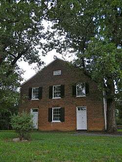
| 28 |
Goose Creek Meetinghouse Complex |
|
July 24, 1974
(#74002135) |
South of State Route 7
39°06′49″N 77°41′41″W / 39.113611°N 77.694722°W / 39.113611; -77.694722 (Goose Creek Meetinghouse Complex) |
Lincoln |
|
| 29 |
Goose Creek Stone Bridge |
|
October 9, 1974
(#74002134) |
Northwest of Atoka off U.S. Route 50
38°58′54″N 77°49′08″W / 38.981667°N 77.818889°W / 38.981667; -77.818889 (Goose Creek Stone Bridge) |
Atoka |
|
| 30 |
Green Garden |
|
July 24, 2007
(#07000769) |
22439 Green Garden Rd.
38°59′57″N 77°51′43″W / 38.999167°N 77.861944°W / 38.999167; -77.861944 (Green Garden) |
Upperville |
|
| 31 |
Hamilton Masonic Lodge |
|
December 9, 1999
(#99001505) |
43 S. Rogers St.
39°08′02″N 77°39′53″W / 39.133889°N 77.664861°W / 39.133889; -77.664861 (Hamilton Masonic Lodge) |
Hamilton |
|
| 32 |
Harpers Ferry National Historical Park |
|
October 15, 1966
(#66000041) |
At the confluence of the Potomac and Shenandoah rivers
39°19′00″N 77°41′40″W / 39.316667°N 77.694444°W / 39.316667; -77.694444 (Harpers Ferry National Historical Park) |
Harpers Ferry |
|
| 33 |
Hibbs Bridge |
|
March 1, 2011
(#11000067) |
Snickersville Turnpike, 6 miles (9.7 km) northwest of Aldie between Hibbs Bridge Rd. to the south and Watermill Rd. to the north
39°02′15″N 77°43′22″W / 39.0375°N 77.722778°W / 39.0375; -77.722778 (Hibbs Bridge) |
Mountville |
|
| 34 |
Hillsboro Historic District |
|
May 7, 1979
(#79003049) |
State Route 9; also Charles Town Pike, between Hillsboro Rd. and Stony Point Rd.
39°11′56″N 77°43′28″W / 39.198889°N 77.724444°W / 39.198889; -77.724444 (Hillsboro Historic District) |
Hillsboro |
Charles Town Pike represents a boundary increase of March 23, 2012 |
| 35 |
Home Farm |
|
August 10, 2007
(#07000828) |
40332 Mount Gilead Rd.
39°04′36″N 77°36′32″W / 39.076667°N 77.608750°W / 39.076667; -77.608750 (Home Farm) |
Leesburg |
|
| 36 |
Huntland |
|
December 24, 2013
(#13000990) |
35955 Huntland Farm Rd.
39°00′44″N 77°45′45″W / 39.012222°N 77.762500°W / 39.012222; -77.762500 (Huntland) |
Middleburg |
|
| 37 |
Janelia |
|
March 20, 1987
(#86003596) |
North side of State Route 7, 6 miles (9.7 km) east of Leesburg
39°04′10″N 77°27′57″W / 39.069583°N 77.465972°W / 39.069583; -77.465972 (Janelia) |
Ashburn |
|
| 38 |
Janney House |
|
November 27, 2004
(#04001269) |
15 W. Colonial Highway
39°08′05″N 77°39′55″W / 39.134861°N 77.665278°W / 39.134861; -77.665278 (Janney House) |
Hamilton |
|
| 39 |
Ketoctin Baptist Church |
|
May 22, 2003
(#03000452) |
Approximately 2 miles (3.2 km) north of State Route 7 at the junction of Allder School Rd. and Ketoctin Church Rd.
39°09′27″N 77°44′56″W / 39.157500°N 77.748889°W / 39.157500; -77.748889 (Ketoctin Baptist Church) |
Round Hill |
|
| 40 |
Leesburg Historic District |
|
February 26, 1970
(#70000807) |
Area of the original town centered at the junction of U.S. Route 15 and State Route 7; also roughly bounded by North and Union Sts., Morven Park Rd., and Harrison St.
39°06′54″N 77°33′54″W / 39.115000°N 77.565000°W / 39.115000; -77.565000 (Leesburg Historic District) |
Leesburg |
Second set of boundaries represents a boundary increase of May 22, 2001 |
| 41 |
Little River Turnpike Bridge |
|
April 11, 2014
(#14000148) |
U.S. Route 50 over the Little River
38°58′31″N 77°38′22″W / 38.975278°N 77.639444°W / 38.975278; -77.639444 (Little River Turnpike Bridge) |
Aldie |
|
| 42 |
Llangollen |
|
August 21, 2017
(#100001497) |
21515 Trappe Rd.
39°01′51″N 77°53′31″W / 39.030889°N 77.891944°W / 39.030889; -77.891944 (Llangollen) |
Upperville |
|
| 43 |
Locust Grove |
|
February 21, 2007
(#07000083) |
200 Locust Grove Dr.
39°07′41″N 77°42′57″W / 39.128056°N 77.715833°W / 39.128056; -77.715833 (Locust Grove) |
Purcellville |
|
| 44 |
Loudoun Agricultural and Mechanical Institute |
|
July 8, 1982
(#82004568) |
Oatlands Rd.
39°00′28″N 77°39′36″W / 39.007778°N 77.660000°W / 39.007778; -77.660000 (Loudoun Agricultural and Mechanical Institute) |
Aldie |
Now called Institute Farm |
| 45 |
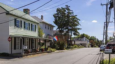
Lovettsville Historic District |
|
August 10, 2012
(#12000518) |
Roughly N. and S. Berlin Pike, E. Broad Way, S. Light, S. Locust, and S. Loudoun Sts., and Lovettsville Rd.
39°16′21″N 77°38′12″W / 39.272500°N 77.636667°W / 39.272500; -77.636667 (Lovettsville Historic District) |
Lovettsville |
|
| 46 |
Lucketts School |
|
October 14, 1993
(#93001125) |
42361 Lucketts Rd.
39°12′54″N 77°32′03″W / 39.215000°N 77.534167°W / 39.215000; -77.534167 (Lucketts School) |
Lucketts |
|
| 47 |
Gen. George C. Marshall House |
|
June 19, 1996
(#96000972) |
217 Edwards Ferry Rd.
39°06′49″N 77°33′35″W / 39.113611°N 77.559722°W / 39.113611; -77.559722 (Gen. George C. Marshall House) |
Leesburg |
|
| 48 |
Middleburg Historic District |
|
October 29, 1982
(#82001823) |
U.S. Route 50 and The Plains and Landmark School Rds.
38°58′12″N 77°44′00″W / 38.970000°N 77.733333°W / 38.970000; -77.733333 (Middleburg Historic District) |
Middleburg |
|
| 49 |
Gen. William Mitchell House |
|
December 8, 1976
(#76002112) |
0.5 miles (0.80 km) south of Middleburg on The Plains Rd.
38°57′47″N 77°44′30″W / 38.963056°N 77.741667°W / 38.963056; -77.741667 (Gen. William Mitchell House) |
Middleburg |
The house and greater portion of the property are in Fauquier County |
| 50 |
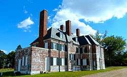
Morven Park |
|
February 18, 1975
(#75002022) |
1 mile (1.6 km) northwest of Leesburg off U.S. Route 15
39°08′26″N 77°34′25″W / 39.140556°N 77.573611°W / 39.140556; -77.573611 (Morven Park) |
Leesburg |
|
| 51 |
Mount Zion Old School Baptist Church-VDHR 53-339 |
|
May 8, 1998
(#98000452) |
40309 U.S. Route 50
38°57′50″N 77°36′36″W / 38.963750°N 77.610000°W / 38.963750; -77.610000 (Mount Zion Old School Baptist Church-VDHR 53-339) |
Aldie |
|
| 52 |
Mt. Olive Methodist Episcopal Church |
|
January 20, 2005
(#04001542) |
20460 Gleedsville Rd.
39°03′03″N 77°36′10″W / 39.050833°N 77.602778°W / 39.050833; -77.602778 (Mt. Olive Methodist Episcopal Church) |
Leesburg |
|
| 53 |
Much Haddam |
|
December 28, 1990
(#90001988) |
U.S. Route 50 west of its junction with The Plains Rd.
38°57′59″N 77°44′33″W / 38.966389°N 77.742500°W / 38.966389; -77.742500 (Much Haddam) |
Middleburg |
|
| 54 |
Murray Hill |
|
November 19, 2014
(#14000945) |
42910 Edwards Ferry Rd.
39°06′50″N 77°30′47″W / 39.113889°N 77.513056°W / 39.113889; -77.513056 (Murray Hill) |
Leesburg |
|
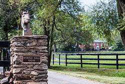
| 55 |
Myrtle Hall Farm |
|
May 17, 2006
(#06000408) |
19305 Ridgeside Rd.
39°05′01″N 77°50′07″W / 39.083611°N 77.835278°W / 39.083611; -77.835278 (Myrtle Hall Farm) |
Bluemont |
|
| 56 |
Edward Nichols House |
|
December 4, 1987
(#87002117) |
330 W. Market St.
39°07′05″N 77°34′23″W / 39.118194°N 77.573056°W / 39.118194; -77.573056 (Edward Nichols House) |
Leesburg |
|
| 57 |
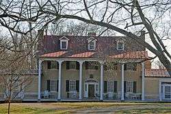
Oak Hill |
|
October 15, 1966
(#66000842) |
8 miles (13 km) south of Leesburg on U.S. Route 15
38°59′51″N 77°37′14″W / 38.997500°N 77.620556°W / 38.997500; -77.620556 (Oak Hill) |
Leesburg |
|
| 58 |
Oakham Farm |
|
February 2, 2016
(#15001039) |
23226 Oakham Farm Ln.
38°58′35″N 77°41′19″W / 38.976389°N 77.688611°W / 38.976389; -77.688611 (Oakham Farm) |
Middleburg |
|
| 59 |
Oatlands |
|
November 12, 1969
(#69000255) |
South of the junction of U.S. Route 15 and Gap Rd.
39°02′27″N 77°37′03″W / 39.040833°N 77.617500°W / 39.040833; -77.617500 (Oatlands) |
Leesburg |
|
| 60 |
Oatlands Historic District |
|
May 3, 1974
(#74002327) |
South of Leesburg off U.S. Route 15
39°01′48″N 77°37′20″W / 39.030138°N 77.622222°W / 39.030138; -77.622222 (Oatlands Historic District) |
Leesburg |
Expansion around Oatlands NHL incorporating scenic easements |
| 61 |
Old Stone Church Archeological Site (44LD376) |
|
September 7, 1989
(#89001402) |
110 Cornwall St., NW.
39°07′02″N 77°33′56″W / 39.117109°N 77.565635°W / 39.117109; -77.565635 (Old Stone Church Archeological Site (44LD376)) |
Leesburg |
|
| 62 |
Old Welbourne Farm and Dulany Family Cemetery |
|
February 6, 2014
(#13001172) |
21398 Willisville Rd.
39°01′44″N 77°49′21″W / 39.028861°N 77.822500°W / 39.028861; -77.822500 (Old Welbourne Farm and Dulany Family Cemetery) |
Bluemont |
|
| 63 |
Paeonian Springs Historic District |
|
May 1, 2006
(#06000352) |
Parts of Berry Bramble Ln., Catoctin Ridge St., Charles Town Pike, Highland Circle, and Simpson Circle
39°08′58″N 77°37′12″W / 39.149444°N 77.620000°W / 39.149444; -77.620000 (Paeonian Springs Historic District) |
Paeonian Springs |
|
| 64 |
Purcellville Historic District |
|
April 4, 2007
(#07000277) |
Roughly bounded by the Washington & Old Dominion Trail, S. 32nd St., W. F and E. G Sts., and Maple Ave.
39°08′13″N 77°42′54″W / 39.136944°N 77.715000°W / 39.136944; -77.715000 (Purcellville Historic District) |
Purcellville |
|
| 65 |
Purcellville Train Station |
|
May 28, 2010
(#10000307) |
200 N. 21st St.
39°08′18″N 77°42′58″W / 39.138472°N 77.716111°W / 39.138472; -77.716111 (Purcellville Train Station) |
Purcellville |
|
| 66 |
Red Fox Inn |
|
November 13, 1997
(#97001403) |
2 E. Washington St.
38°58′09″N 77°44′08″W / 38.969167°N 77.735417°W / 38.969167; -77.735417 (Red Fox Inn) |
Middleburg |
|
| 67 |
Rich Bottom Farm |
|
February 21, 1997
(#97000156) |
16860 Hillsboro Rd., 1.5 miles (2.4 km) north of Purcellville
39°08′59″N 77°44′01″W / 39.149722°N 77.733611°W / 39.149722; -77.733611 (Rich Bottom Farm) |
Purcellville |
|
| 68 |
Rock Hill Farm |
|
August 27, 2009
(#09000664) |
20775 Airmont Rd.
39°02′55″N 77°49′52″W / 39.048611°N 77.831111°W / 39.048611; -77.831111 (Rock Hill Farm) |
Bluemont |
|
| 69 |
Rock Spring Farm |
|
March 13, 2002
(#02000177) |
329 Loudoun St., SW.
39°06′58″N 77°34′26″W / 39.116111°N 77.573889°W / 39.116111; -77.573889 (Rock Spring Farm) |
Leesburg |
|
| 70 |
Rockland |
|
May 14, 1987
(#87000752) |
Eastern side of U.S. Route 15, north of Leesburg
39°09′50″N 77°32′05″W / 39.163889°N 77.534722°W / 39.163889; -77.534722 (Rockland) |
Leesburg |
|
| 71 |
Rokeby |
|
May 30, 1976
(#76002109) |
2.4 miles (3.9 km) southwest of Leesburg off Gleedsville Rd.
39°04′18″N 77°35′46″W / 39.071667°N 77.596111°W / 39.071667; -77.596111 (Rokeby) |
Leesburg |
|
| 72 |
Rose Hill Farm |
|
August 25, 1994
(#94000986) |
Northern side of U.S. Route 50, 1.5 miles (2.4 km) west of the junction with Atoka Rd.
38°59′00″N 77°49′41″W / 38.983333°N 77.828056°W / 38.983333; -77.828056 (Rose Hill Farm) |
Upperville |
|
| 73 |
Round Hill Historic District |
|
May 28, 2009
(#09000366) |
Roughly bounded by State Route 7 to the south, Locust St. to the west, Bridge St. on the east, and the northern edge of Main St. to the north
39°07′58″N 77°46′06″W / 39.132778°N 77.768333°W / 39.132778; -77.768333 (Round Hill Historic District) |
Round Hill |
|
| 74 |
Shiloh Baptist Church |
|
November 24, 2017
(#100001852) |
304 E. Marshall St.
38°58′18″N 77°43′54″W / 38.971667°N 77.731667°W / 38.971667; -77.731667 (Shiloh Baptist Church) |
Middleburg |
|
| 75 |
Sleepy Hollow Farm |
|
February 13, 2007
(#07000048) |
39902 Thomas Mill Rd.
39°06′57″N 77°37′27″W / 39.115972°N 77.624028°W / 39.115972; -77.624028 (Sleepy Hollow Farm) |
Leesburg |
|
| 76 |
William Smith House |
|
April 2, 2003
(#03000189) |
38678 Piggott Bottom Rd.
39°09′35″N 77°39′57″W / 39.159722°N 77.665833°W / 39.159722; -77.665833 (William Smith House) |
Hamilton |
|
| 77 |
Spring Hill Farm |
|
July 27, 2005
(#05000766) |
39018 Piggott Bottom Rd.
39°09′15″N 77°38′56″W / 39.154167°N 77.648889°W / 39.154167; -77.648889 (Spring Hill Farm) |
Hamilton |
|
| 78 |
Stoke |
|
December 8, 2015
(#15000878) |
23587 Stoke Farm Ln.
38°58′01″N 77°39′56″W / 38.966944°N 77.665556°W / 38.966944; -77.665556 (Stoke) |
Aldie |
|
| 79 |
Sunnyside Farm |
|
August 16, 1994
(#94000989) |
South side of State Route 7 Business, 1,150 feet (350 m) east of the junction with State Route 287
39°07′54″N 77°41′18″W / 39.131528°N 77.688472°W / 39.131528; -77.688472 (Sunnyside Farm) |
Hamilton |
|
| 80 |
The Tabernacle-Fireman's Field |
|
May 28, 2010
(#10000308) |
250 S. Nursery Ave.
39°08′00″N 77°42′54″W / 39.133333°N 77.715000°W / 39.133333; -77.715000 (The Tabernacle-Fireman's Field) |
Purcellville |
|
| 81 |
Taylorstown Historic District |
|
January 30, 1978
(#78003027) |
Around the junction of Taylorstown and Downey Mill Rds. at Catoctin Creek; also 13122 Furnace Mountain, 12969 and 13090 Taylorstown, and 12995 and 13000 Hoysville Rds.
39°15′15″N 77°34′31″W / 39.254167°N 77.575278°W / 39.254167; -77.575278 (Taylorstown Historic District) |
Taylorstown |
District includes Whiskey Hill. Second set of boundaries represents a boundary increase of May 26, 2005 |
| 82 |
Temple Hall |
|
February 13, 2007
(#07000053) |
15764 Temple Hall Ln.
39°10′41″N 77°31′43″W / 39.177917°N 77.528611°W / 39.177917; -77.528611 (Temple Hall) |
Leesburg |
|
| 83 |
Unison Battlefield Historic District |
|
November 22, 2011
(#11000835) |
Parts of Quaker Ln. and Jeb Stuart, Unison, Newlin Mill, Millville, Bloomfield, Welbourne, and Greengarden Rds.
39°02′12″N 77°47′15″W / 39.036667°N 77.787500°W / 39.036667; -77.787500 (Unison Battlefield Historic District) |
Unison |
|
| 84 |
Unison Historic District |
|
May 22, 2003
(#03000442) |
Parts of Unison and Bloomfield Rds.
39°02′07″N 77°47′28″W / 39.035278°N 77.791111°W / 39.035278; -77.791111 (Unison Historic District) |
Middleburg |
|
| 85 |
Vestal's Gap Road and Lanesville Historic District |
|
February 3, 2000
(#99001722) |
21544 Cascades Parkway
39°01′03″N 77°24′13″W / 39.017500°N 77.403611°W / 39.017500; -77.403611 (Vestal's Gap Road and Lanesville Historic District) |
Sterling |
|
| 86 |
William Virts House |
|
February 22, 2011
(#11000027) |
38670 Old Wheatland Rd.
39°11′16″N 77°39′57″W / 39.187639°N 77.665972°W / 39.187639; -77.665972 (William Virts House) |
Waterford |
|
| 87 |
Waterford Historic District |
|
June 3, 1969
(#69000256) |
Northwest of Leesburg on Loyalty Rd.
39°11′12″N 77°36′44″W / 39.186667°N 77.612222°W / 39.186667; -77.612222 (Waterford Historic District) |
Waterford |
|
| 88 |
Waverly |
|
February 10, 1983
(#83003288) |
212 S. King St.
39°06′22″N 77°34′05″W / 39.106111°N 77.567917°W / 39.106111; -77.567917 (Waverly) |
Leesburg |
|
| 89 |
Welbourne |
|
February 23, 1972
(#72001404) |
Northwest of the junction of Welbourne and St. Louis Rds.
39°00′04″N 77°48′44″W / 39.001111°N 77.812222°W / 39.001111; -77.812222 (Welbourne) |
Middleburg |
|
| 90 |
Woodburn |
|
December 12, 1976
(#76002111) |
3 miles (4.8 km) southwest of Leesburg off Harmony Church Rd.
39°05′22″N 77°37′10″W / 39.089444°N 77.619444°W / 39.089444; -77.619444 (Woodburn) |
Leesburg |
|
| 91 |
Woodgrove |
|
September 14, 2002
(#02001004) |
16860 Woodgrove Rd.
39°09′07″N 77°46′10″W / 39.151806°N 77.769444°W / 39.151806; -77.769444 (Woodgrove) |
Round Hill |
|

.jpg)