Albemarle County, Virginia
| Albemarle County, Virginia | ||
|---|---|---|
 The Albemarle County Office Building | ||
| ||
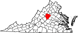 Location in the U.S. state of Virginia | ||
 Virginia's location in the U.S. | ||
| Founded | 1744 | |
| Named for | Willem Anne van Keppel, 2nd Earl of Albemarle[1] | |
| Seat | Charlottesville | |
| Largest community | Hollymead | |
| Area | ||
| • Total | 726 sq mi (1,880 km2) | |
| • Land | 721 sq mi (1,867 km2) | |
| • Water | 5 sq mi (13 km2), 0.7% | |
| Population (est.) | ||
| • (2016) | 106,878 | |
| • Density | 148/sq mi (57/km2) | |
| Congressional district | 5th | |
| Time zone | Eastern: UTC−5/−4 | |
| Website |
www | |

Albemarle County is a county located in the Piedmont region of the Commonwealth of Virginia. Its county seat is Charlottesville, which is an independent city and enclave entirely surrounded by the county.[2] Albemarle County is part of the Charlottesville Metropolitan Statistical Area. As of the 2010 census, the population of Albemarle County was 98,970,[3] more than triple the 1960 census count.
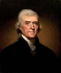
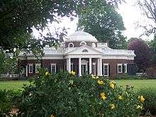
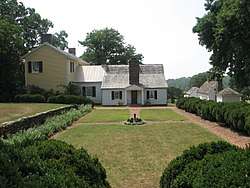
Albemarle County was created in 1744 from the western portion of Goochland County, though portions of Albemarle were later carved out to create other counties. Albemarle County was named in honor of Willem Anne van Keppel, 2nd Earl of Albemarle. However, its most famous inhabitant was Thomas Jefferson, who built his estate home, Monticello, in the county.
History
At the time of European encounter, the inhabitants of the area that became Albemarle County were a Siouan-speaking tribe called the Saponi.[4] In 1744, the Virginia General Assembly created Albemarle County from the western portion of Goochland County.[5] The county was named in honor of Willem Anne van Keppel, 2nd Earl of Albemarle and titular Governor of Virginia at the time.[6] The large county was partitioned in 1761, forming Buckingham and Amherst counties, at which time the county seat was moved from the formerly central Scottsville to a piece of newly central land, christened Charlottesville.[6] In 1777, Albemarle County was divided and Fluvanna County established, finalizing the boundaries of modern Albemarle County.
Albemarle County is well known for its association with President and Founding Father Thomas Jefferson, who was born in the County at Shadwell, though it was then part of Goochland County.[7] However, his home of Monticello is located in the County.[8]
Until the Civil War, the majority of Albemarle County's population consisted of enslaved African Americans.[9]
Geography
According to the U.S. Census Bureau, the county has a total area of 726 square miles (1,880 km2), of which 721 square miles (1,870 km2) is land and 5 square miles (13 km2) (0.7%) is water.[10]
Waterways
The Rivanna River's south fork forms in Albemarle County and was historically important for transportation. The south fork flows in-between Darden Towe Park and Pen Park. Boat ramp access is available at Darden Towe Park. The James River acts as a natural border between Albemarle and Buckingham Counties.
Major highways
Protected areas
Albemarle's western border with Augusta and Rockingham Counties is located within the Shenandoah National Park.
Adjacent counties
Albemarle County borders 8 other counties, more than any other county in Virginia.
- Charlottesville, Virginia (surrounded by Albemarle County)
- Greene County, Virginia (north)
- Orange County, Virginia (northeast)
- Louisa County, Virginia (east)
- Fluvanna County, Virginia (southeast)
- Buckingham County, Virginia (south)
- Nelson County, Virginia (southwest)
- Augusta County, Virginia (west)
- Rockingham County, Virginia (northwest)
Parks and recreation
- Preddy Creek Park
- Ivy Creek Nature Reserve
- Chris Green Lake
- Darden Towe Park
- Pen Park
- Walnut Creek Park
Demographics
| Historical population | |||
|---|---|---|---|
| Census | Pop. | %± | |
| 1790 | 12,585 | — | |
| 1800 | 16,439 | 30.6% | |
| 1810 | 18,268 | 11.1% | |
| 1820 | 19,750 | 8.1% | |
| 1830 | 22,618 | 14.5% | |
| 1840 | 22,294 | −1.4% | |
| 1850 | 25,800 | 15.7% | |
| 1860 | 26,625 | 3.2% | |
| 1870 | 27,544 | 3.5% | |
| 1880 | 32,618 | 18.4% | |
| 1890 | 32,379 | −0.7% | |
| 1900 | 28,473 | −12.1% | |
| 1910 | 29,871 | 4.9% | |
| 1920 | 26,005 | −12.9% | |
| 1930 | 26,981 | 3.8% | |
| 1940 | 24,652 | −8.6% | |
| 1950 | 26,662 | 8.2% | |
| 1960 | 30,969 | 16.2% | |
| 1970 | 37,780 | 22.0% | |
| 1980 | 55,783 | 47.7% | |
| 1990 | 68,040 | 22.0% | |
| 2000 | 79,236 | 16.5% | |
| 2010 | 98,970 | 24.9% | |
| Est. 2016 | 106,878 | [11] | 8.0% |
| U.S. Decennial Census[12] 1790-1960[13] 1900-1990[14] 1990-2000[15] 2010-2015[3] | |||
The largest self-reported ancestry groups in Albemarle County are English 16.3%, German 16.0%, Irish 12.7%, "American" 11.4% and Italian 5.2%.[16]
As of the census[17] of 2010, there were 98,970 people, 38,157 households, and 24,578 families residing in the county. The population density was 137 people per square mile (52.8/km²). There were 42,122 housing units at an average density of 58 per square mile (22.4/km²). The racial makeup of the county was 80.6% White, 9.7% Black or African American, 0.3% Native American, 4.7% Asian, 0.1% Pacific Islander, 2.3% from other races, and 2.4% from two or more races. 5.5% of the population were Hispanic or Latino of any race.
There were 38,157 households out of which 28.2% had children under the age of 18 living with them, 51.4% were married couples living together, 9.6% had a female householder with no husband present, and 35.6% were non-families. 28.0% of all households were made up of individuals and 25.9% had someone living alone who was 65 years of age or older. The average household size was 2.41 and the average family size was 2.96.
In the county, the population was spread out with 21.5% under the age of 18, 12.3% from 18 to 24, 24.7% from 25 to 44, 27.2% from 45 to 64, and 14.3% who were 65 years of age or older. The median age was 38.2 years. For every 100 females there were 92.69 males. For every 100 females age 18 and over, there were 89.59 males.
22% of Albemarle residents have a graduate or professional degree, compared with 10% nationwide.
The median income for a household in the county was $63,001, and the median income for a family was $98,934. Males had a median income of $55,530 versus $52,211 for females. The per capita income for the county was $36,718. About 3.8% of families and 10.4% of the population were below the poverty line, including 8.0% of those under age 18 and 2.4% of those age 65 or over.
Economy
35% of people working in Albemarle live in the county, while 65% commute in. 19% of those commuting in live in Charlottesville, while the remainder live in the surrounding counties. 26,800 people commute out of Albemarle for work. 48% of those commute to Charlottesville, making up 51% of Charlottesville's in-commuters. In 2016, Albemarle has a 3.5% unemployment rate, compare with a national rate of 4.9%.[18]
The top 10 employers as of 2016 were:[18]
- University of Virginia
- County of Albemarle
- Sentara Healthcare
- State Farm Mutual Automobile Insurance
- U.S. Department of Defense
- University of Virginia Medical Center
- Atlantic Coast Athletic Club
- Piedmont Virginia Community College
- Northrop Grumman Corporation
- Wegmans
36% of workers in Albemarle are employed by the government, with 898 working for the federal government, 12,476 working for the state government, and 4,127 working for the local government.[18]
Government
Albemarle is governed by an elected six-member Board of Supervisors. Management of the County is vested in a Board-appointed County Executive.[19]
| Name | Party | First election | District | |
|---|---|---|---|---|
| Rick Randolph | Dem | 2015 | Scottsville | |
| Diantha McKeel | Dem | 2013 | Jack Jouett | |
| Liz Palmer | Dem | 2013 | Samuel Miller | |
| Ned Gallaway | Dem | 2017 | Rio | |
| Ann Mallek (Chair) | Dem | 2007 | White Hall | |
| Norman Dill (Vice-Chair) | Dem | 2015 | Rivanna | |
There are also several elected Constitutional Officers:[21]
- Clerk of the Circuit Court: John Zugg (D)
- Commonwealth's Attorney: Robert Neira Tracci, (R)
- Sheriff: J.E. "Chip" Harding (R)
The nonpartisan School Board is also elected. Its members are:[22]
- Kate Acuff (Chair, Jack Jouett Magisterial District)
- Katrina Callsen (Rio Magisterial District)
- Jason Buyaki (Rivanna Magisterial District)
- Graham Paige (Samuel Miller Magisterial District)
- Stephen Koleszar (Vice Chair, Scottsville District)
- David Oberg (White Hall Magisterial District)
- Jonno Alcaro(Vice-Chairmen, At-Large)
Albemarle is represented by Republican Bryce Reeves and Democrat Creigh Deeds in the Virginia State Senate, Republican Steve Landes Democrat David Toscano, Republican Rob Bell, and Republican Matt Fariss in the Virginia House of Delegates, and Republican Tom Garrett Jr. in the U.S. House of Representatives.
| Year | Republican | Democratic | Third parties |
|---|---|---|---|
| 2016 | 34.0% 19,259 | 58.8% 33,345 | 7.3% 4,122 |
| 2012 | 43.2% 23,297 | 55.2% 29,757 | 1.6% 853 |
| 2008 | 40.4% 20,576 | 58.4% 29,792 | 1.2% 616 |
| 2004 | 48.5% 21,189 | 50.5% 22,088 | 1.0% 449 |
| 2000 | 49.6% 18,291 | 44.1% 16,255 | 6.2% 2,300 |
| 1996 | 48.8% 15,243 | 45.1% 14,089 | 6.1% 1,896 |
| 1992 | 43.7% 13,894 | 43.7% 13,886 | 12.7% 4,024 |
| 1988 | 58.7% 15,117 | 40.2% 10,363 | 1.1% 273 |
| 1984 | 64.2% 14,455 | 35.4% 7,982 | 0.4% 93 |
| 1980 | 53.2% 10,424 | 37.2% 7,293 | 9.5% 1,865 |
| 1976 | 54.6% 9,084 | 44.0% 7,310 | 1.4% 238 |
| 1972 | 65.2% 8,447 | 33.2% 4,303 | 1.6% 201 |
| 1968 | 53.5% 4,512 | 26.7% 2,255 | 19.8% 1,674 |
| 1964 | 51.5% 3,251 | 48.5% 3,062 | 0.0% 2 |
| 1960 | 59.5% 3,135 | 39.9% 2,102 | 0.7% 35 |
| 1956 | 57.2% 2,508 | 32.2% 1,412 | 10.6% 466 |
| 1952 | 60.3% 2,523 | 39.3% 1,642 | 0.4% 18 |
| 1948 | 40.3% 984 | 48.2% 1,178 | 11.5% 281 |
| 1944 | 35.7% 964 | 63.9% 1,725 | 0.4% 12 |
| 1940 | 32.7% 804 | 67.1% 1,648 | 0.2% 6 |
| 1936 | 25.7% 635 | 74.0% 1,825 | 0.3% 7 |
| 1932 | 20.4% 508 | 78.2% 1,949 | 1.4% 34 |
| 1928 | 35.0% 846 | 65.0% 1,571 | |
| 1924 | 20.3% 366 | 76.8% 1,383 | 3.0% 53 |
| 1920 | 25.4% 541 | 74.6% 1,587 | |
| 1916 | 14.0% 223 | 86.1% 1,376 | |
| 1912 | 9.6% 144 | 80.8% 1,215 | 9.6% 144 |
Emergency services
Albemarle County has two branches of law enforcement, the Albemarle County Police Department, which handles criminal matters and is directed by the appointed police chief, Colonel Steve Sellers. The second branch is the Albemarle County Sheriff's Office, which handles civil service in the county and they are directed by the elected Sheriff Chip Harding.
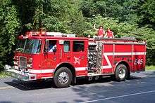
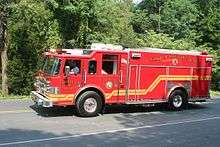
EMS services are provided by three volunteer rescue squads and Albemarle County Fire Rescue. The Charlottesville-Albemarle Rescue Squad, located in the City of Charlottesville, providing 24hr EMS services to the City of Charlottesville and on nights and weekends in particular areas of the county, the Western Albemarle Rescue Squad, located in Crozet, and the Scottsville Volunteer Rescue Squad, located in the town of Scottsville. Albemarle County Fire Rescue operates 6 Advance Life Support ambulances, Medic 4 (Earlysville), Medic 8 (Seminole), Medic 11 (Monticello), Medic 12 (Hollymead), Medic 15 (Ivy), and Medic 16 (Pantops).
Albemarle County Fire/Rescue system is a combination system that consists of seven volunteer fire stations and three career fire stations(Hollymead, Ivy and Monticello). Three of the volunteer stations (stations 3, 5, and 7) are covered 24 hours a day by volunteers. The other volunteer stations (2, 4, 6, and 8) are supplemented by career staff Monday - Friday, 6AM - 6PM. Volunteers operate these stations weeknights from 6PM - 6AM as well as weekends and holidays. The three career stations are staffed 24 hours by both career and volunteer firefighters Volunteer and career firefighters are trained and work together to provide Fire and EMS services to the population of Albemarle County.
Albemarle County Fire Rescue has begun building a station (Station 16) in the eastern portion of the county near Pantops area slated to open in Fall of 2018.
Fire stations[24]
- Crozet Volunteer Fire Department (Station 5)
- Earlysville Volunteer Fire Company (Station4)
- East Rivanna Volunteer Fire Company (Station 2)
- Hollymead Fire Rescue (Station 12)
- Ivy Fire Rescue (Station 15)
- Monticello Fire Rescue (Station 11)
- North Garden Volunteer Fire Company (Station 3)
- Scottsville Volunteer Fire Department (Station 7)
- Seminole Trail Volunteer Fire Department (Station 8)
- Stony Point Volunteer Fire Company (Station 6)
Rescue squads[24]
- Charlottesville-Albemarle Rescue Squad (Rescue 1)
- Scottsville Volunteer Rescue Squad (Rescue 7)
- Western Albemarle Rescue Squad (Rescue 5)
Education
The Albemarle County Public School System operates public education in the County. It provides education to nearly 14,000 students including preschool through high school. The Albemarle County Public School System's mission is to "establish a community of learners and learning, through relationships, relevance and rigor, one student at a time." [25] ACPS provides 25 school facilities[25] which include Murray High School, a charter school, that is located in the City of Charlottesville. , Albemarle High School, Western Albemarle High School, and Monticello High School.[26] The School Board and the Superintendent, Dr. Pamela Moran, work closely together in operating the Albemarle County Public School System.
The School Board has 7 members, elected by Magisterial District:
- Kate Acuff (Chair, Jack Jouett district)
- Pamela Moynihan (Rio district)
- Jason Buyaki (Rivanna district)
- Graham Paige (Samuel Miller district)
- Stephen Koleszar (Vice Chair, Scottsville district)
- David Oberg (White Hall district)
- Jonno Alcaro (At Large)
Many private schools in Albemarle serve the County and students from surrounding areas. These include:
- The Covenant School (upper campus)
- Field School of Charlottesville
- Free Union Country School
- The Miller School of Albemarle
- Montessori Community School
- North Branch School
- Peabody School
- St. Anne's-Belfield School
- Tandem Friends School
Some students attend several private schools in the City of Charlottesville.
Jefferson-Madison Regional Library is the regional library system that provides services to the citizens of Albemarle.
Communities
The city of Charlottesville is enclaved within Albemarle County. Under Virginia law in effect since 1871, all municipalities in the state incorporated as cities are legally and politically independent of any county.
Town
There is only one incorporated town in Albemarle County:
- Scottsville, the original county seat
Census-designated places
- Crozet
- Esmont
- Free Union
- Hollymead
- Ivy
- Pantops
- Piney Mountain
- Rivanna (east county)
- University of Virginia
Other unincorporated communities
- Advance Mills
- Afton
- Alberene
- Ardwood
- Arrowhead
- Ashcroft
- Ashmere
- Ballard Woods
- Barboursville
- Barracks
- Barterbrook
- Batesville
- Bedford Hills
- Bell Haven
- Bellair
- Bentivar
- Berkeley
- Berkmar
- Birnam Wood
- Blenheim
- Boiling Spring
- Boonesville
- Branchland
- Briarwood
- Brinnington
- Brookwood
- Brownsville
- Browntown
- Buckingham Circle
- Bungletown
- Burnley
- Camellia Garden
- Camelot
- Campbell
- Candlewyck
- Canterbury Hills
- Carrsbrook
- Cash Corner
- Cedarmere
- Chapel Hills
- Chestnut Grove
- Cismont
- Clover Hill
- Cobham
- Colthurst
- Commonwealth
- Country Green
- The Country Store
- Country View
- Covesville
- Damon
- Davis Shop
- Deer Run
- Deerwood
- Doylesville
- Earlysville
- Earlysville Heights
- Eastham
- Ednam
- Ehart
- Everettsville
- Fairgrove
- Farmington
- Fieldbrook
- Flordon
- Foxwood
- Franklin
- Freetown
- Gilbert
- Glenaire
- Glendower
- Glenmore
- Glenorchy
- Greenfields
- Greenwood
- Hatton
- Heards
- Howardsville
- Hunters Hall
- Hydraulic
- Inglecress
- Keene
- Keswick
- Key West
- Knollwood
- Langford
- Lexington
- Liberty Hill
- Lindsay
- Little Clover Hill
- Loch Leigh
- Lochridge
- Mallard Lake
- McCullough
- The Meadows
- Meriwether Hill
- Midway
- Midway
- Mill Creek
- Mill Ridge
- Mill Run
- Millington
- Milton
- Milton Heights
- Milton Hills
- Miran Forest
- Montvue
- Mountain Laurel
- Mountfair
- Newtown
- Nob Hill
- Northfields
- North Garden
- Nortonsville
- Norwood
- Oak Hill
- Oak Terrace
- Old Dominion
- Overton
- Owensville
- Parkview
- Patterson Store
- Peacock Hill
- The Pines
- Porters
- Powell Corner
- Proffit
- Queen Charlotte
- Raintree
- Redland
- Rio
- Rio Heights
- Rivanna (north county)
- Riverrun
- Rockbrook
- Rose Hill
- Rosena
- Rugby
- Running Deer
- Shadwell
- Simeon
- Solaris
- Springfield
- Squire Hill
- Stillfield
- Stonehenge
- Stony Point
- Tapscott
- Terrybrook
- Thurston
- Tillmans
- Totier Hills
- Townwood
- Warren
- Watts
- Waverly
- West Leigh
- Westfield
- Westgate
- Westmoreland
- Westover Hills
- White Hall
- Wildwood
- Wilhait
- Willoughby
- Windrift
- Windsor
- Woodbrook
- Woodridge
- Wyngate
- Yancey Mills
Notable residents
- Chilton Allan (1786–1858), born in Albemarle County, United States Congressman from Kentucky[27]
- Rev Samuel Black , Albemarle County's first Presbyterian minister. Built Sam Black's Tavern[28]
- Dabney Smith Carr (1802–1854), born in Albemarle County, founder of newspaper Baltimore Republican and Commercial Advertiser, United States minister to Turkey[27]
- Christopher Henderson Clark (1767–1828), United States Congressman from Virginia[27]
- George Rogers Clark (1752–1818), surveyor, soldier, and Revolutionary War hero and older brother of William Clark born in Albemarle County[27]
- Edward Coles (1786–1868), born in Albemarle County, Governor of Illinois[27]
- Rita Dove (1952-), former United States Poet Laureate and winner of the Pulitzer Prize for poetry, living in Albemarle County since 1989
- Greensville Dowell (1822–1876), born in Albemarle County, noted physician, professor, and author[27]
- Kathryn Erskine, National Book Award-winning novelist
- James T. Farley (1829–1886), born in Albemarle County, United States Senator from California[27]
- James Walker Gons (1812–1870), born in Albemarle County, Baptist church clergyman, later converting to Christian Church (Disciples of Christ), editor and publisher of church's Christian Intelligencer, educator.[27]
- John Grisham, author of The Whistler[29] and A Time to Kill[30]
- Claude Hall, historian who wrote definitive biography of Abel Parker Upshur[31]
- John Harvie (1742–1807), born in Albemarle County, member of the Continental Congress and mayor of Richmond, Virginia from 1785 to 1786[27]
- Samuel Hopkins (1753–1819), born in Albemarle County, United States Army officer and United States Congressman from Kentucky[27]
- Thomas Jefferson, third President of the United States and former Governor of Virginia
- Sarah Garland Boyd Jones (1866–1905), physician
- Jack Jouett (1754–1822), born in Albemarle County, known as the "Paul Revere of the South", influential in organizing Kentucky as a separate state, Virginia and Kentucky state legislator[27]
- Fiske Kimball (1888–1955), architectural historian, founder of the University of Virginia School of Architecture
- Walter Leake (1769?-1825), born in Albemarle County, United States Senator from Mississippi and later governor of that state[27]
- Peter Threewits (1725-1770), born in Sussex County, Virginia state legislator[27]
- Meriwether Lewis (1774–1809), born in Albemarle County, explorer, governor of Louisiana, and one of the leaders of the Lewis and Clark Expedition[27]
- Howie Long, former NFL player with the Oakland Raiders
- Joseph Martin (1740–1808), Revolutionary War general and explorer; namesake of Martinsville, Virginia
- Dave Matthews, of the Dave Matthews Band
- James Monroe, fifth President of the United States and former Governor of Virginia
- James Monroe (1799–1870), born in Albemarle County, United States Congressman from New York[27]
- Sissy Spacek, actress
- Bebe Williams, Xeric Award cartoonist/artist Art Comics Daily
- William Coleman, Olympic equestrian team member 2012
- Ben King (cyclist), professional cyclist
- Lottie Moon (1840–1912), Southern Baptist missionary to China; Southern Baptists worldwide take up a Christmas Offering every year for International missions in her name.
See also
References
- ↑ "County Overview". County of Albemarle. Archived from the original on 19 December 2008. Retrieved 2008-11-14.
- ↑ "Find a County". National Association of Counties. Archived from the original on 2011-05-31. Retrieved 2011-06-07.
- 1 2 "State & County QuickFacts". United States Census Bureau. Retrieved December 31, 2013.
- ↑ Swanton, John R. (1952), The Indian Tribes of North America, Smithsonian Institution, p. 72, ISBN 0-8063-1730-2, OCLC 52230544
- ↑ Pawlett, Nathaniel (1976). "An Index to Roads Shown in the Albemarle County Surveyors Books 1744-1853" (PDF). Charlottesville, Virginia: Virginia Highway & Transportation Research Council. Archived (PDF) from the original on 30 October 2008. Retrieved 2008-10-11.
- 1 2 Atkins, Ace (2007-03-27). "A county by any other name?". C-Ville Weekly. Portico Publications. Archived from the original on 2011-07-08. Retrieved 2008-10-11.
- ↑ Henry Stephens Randall, The Life of Thomas Jefferson
- ↑ "Albemarle County". Commonwealth of Virginia. Archived from the original on 2006-12-08. Retrieved 2008-10-11.
Albemarle County is widely recognized as rich in history and beauty. Among its historic attractions are Monticello, home to President Thomas Jefferson...
- ↑ "Enslaved Population in Virginia". www.encyclopediavirginia.org. Retrieved 2018-08-20.
- ↑ "US Gazetteer files: 2010, 2000, and 1990". United States Census Bureau. 2011-02-12. Retrieved 2011-04-23.
- ↑ "Population and Housing Unit Estimates". Retrieved June 9, 2017.
- ↑ "U.S. Decennial Census". United States Census Bureau. Archived from the original on May 12, 2015. Retrieved December 31, 2013.
- ↑ "Historical Census Browser". University of Virginia Library. Retrieved December 31, 2013.
- ↑ "Population of Counties by Decennial Census: 1900 to 1990". United States Census Bureau. Retrieved December 31, 2013.
- ↑ "Census 2000 PHC-T-4. Ranking Tables for Counties: 1990 and 2000" (PDF). United States Census Bureau. Retrieved December 31, 2013.
- ↑ "Archived copy". Archived from the original on 2016-04-17. Retrieved 2015-03-19.
- ↑ "American FactFinder". United States Census Bureau. Archived from the original on 2013-09-11. Retrieved 2011-05-14.
- 1 2 3 http://virginialmi.com/report_center/community_profiles/5104000003.pdf
- ↑ "County Executive". County of Albemarle, VA. Retrieved June 21, 2015.
- ↑ "Board of Supervisors Home". www.albemarle.org. Retrieved 2018-08-17.
- ↑ "Circuit Court Clerk's Office". www.albemarle.org. Retrieved 2018-08-17.
- ↑ "Meet the Board Members". www2.k12albemarle.org. Retrieved 2018-08-17.
- ↑ Leip, David. "Dave Leip's Atlas of U.S. Presidential Elections". uselectionatlas.org. Retrieved 2018-08-17.
- 1 2 "System & Stations". www.albemarle.org. Retrieved 2018-08-17.
- 1 2 "Division Fact Sheet". www2.k12albemarle.org. Retrieved 2017-11-07.
- ↑ "Our Schools". www2.k12albemarle.org. Retrieved 2017-11-07.
- 1 2 3 4 5 6 7 8 9 10 11 12 13 14 15 Who Was Who in America, Historical Volume, 1607-1896. Chicago: Marquis Who's Who. 1963.
- ↑ National Register of Historic Places Inventory Nomination Form: Mirador (Boundary Increase) (Report). Commonwealth of Virginia, Department of Historic Resources. 7 April 2003.
- ↑ "Inside The New York Times Book Review: John Grisham on 'The Whistler'". The New York Times. 2016-11-04. ISSN 0362-4331. Retrieved 2017-11-07.
- ↑ Healy, Patrick. "Grisham's 'Time to Kill' Coming to Broadway". ArtsBeat. Retrieved 2017-11-07.
- ↑ Obituary of Claude Hampton Hall (1922-2001), Bryan-College Station, Texas, Eagle, April 4, 2001
Further reading
- Richey, Homer, ed. (1920). Memorial History of the John Bowie Strange Camp, United Confederate Veterans: Including Some Account of Others Who Served in the Confederate Armies from Albemarle County, Together With Brief Sketches of the Albemarle Chapter of the United Daughters of the Confederacy and the R. T. W. Duke Camp, Sons of Confederate Veterans. Charlottesville, Va.: The Michie Co. Retrieved May 22, 2015.
External links
| Wikimedia Commons has media related to Albemarle County, Virginia. |
- Official website
- Architecture of Jefferson Country – images of historic buildings of Albemarle County (from UVA Libraries)
Places adjacent to Albemarle County, Virginia | ||||||||||
|---|---|---|---|---|---|---|---|---|---|---|
| ||||||||||
