New Kent County, Virginia
| New Kent County, Virginia | ||
|---|---|---|
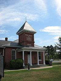 New Kent County Courthouse, built circa 1907 | ||
| ||
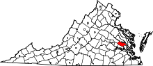 Location in the U.S. state of Virginia | ||
 Virginia's location in the U.S. | ||
| Founded | 1654 | |
| Named for | Kent, England | |
| Seat | New Kent | |
| Area | ||
| • Total | 223 sq mi (578 km2) | |
| • Land | 210 sq mi (544 km2) | |
| • Water | 14 sq mi (36 km2), 6.1% | |
| Population (est.) | ||
| • (2015) | 20,392 | |
| • Density | 91/sq mi (35/km2) | |
| Congressional district | 1st | |
| Time zone | Eastern: UTC−5/−4 | |
| Website |
www | |

New Kent County is a county located in the eastern part the Commonwealth of Virginia. As of the 2010 census, the population was 18,429.[1] Its county seat is New Kent.[2]
New Kent County is included in the Greater Richmond Region.[3]
History
New Kent County was established in 1654 from York County[4] and was organized and settled by William Claiborne.[5] The county's name originated because several prominent inhabitants, including William Claiborne, recently had been forced from their settlement at Kent Island, Maryland by Lord Baltimore upon the formation of Maryland.[5] Claiborne had named the island for his birthplace in Kent, England. New Kent County is the birthplace of two U. S. Presidents' wives - Martha Washington and Letitia Christian Tyler. The church where George and Martha Washington are believed to have been wed, St. Peters, still holds services today. The Chickahominy Indians frequented this area as well as nearby Charles City County and two tribes are still well-established in this area.
Among the earliest settlers of New Kent County was Nicholas Gentry, who settled in New Kent in 1684. The parish register books of St. Peter's Parish show that Nicholas Gentry's daughter was baptized in the church in 1687. The records also reflect other Gentrys, probably Nicholas Gentry's relations, Peter and Samuel Gentry.[6] As the result of arson confessed to by John Price Posey and Tho Green, and, allegedly, involving "a negro boy belonging to W. Chamberlayne" on 15 July 1787, many later county records were burned, making identifying relationships between family members difficult.[7]
Due to the "many Inconveniencys" suffered by the "Upper Inhabitants by reason of their Great distance from the Court house and other places usually appointed for publick meetings", New Kent County was divided "into Two distinct Countys and that that part of the County lyeing below the parish of Saint Paul shall for Ever thereafter be called and knowne by the Name of New Kent County And that that part of the County which lyeth in the parish of Saint Paul Shall be called and knowne by the Name of Hannover County" In 1720, a portion of New Kent County known then as St. Paul's Parish was formed into a separate county, now Hanover County.[8][9]
In 2006, the U.S. Census Bureau rated New Kent County among the top 100 fastest-growing counties in America.[10]
Geography
According to the U.S. Census Bureau, the county has a total area of 223 square miles (579 km²), of which 210 square miles (543 km²) is land and 14 square miles (36 km²) (6.23%) is water. The Chickahominy River borders the county to the south, the Pamunkey and York rivers border it to the north and east.
| Quinton, VA[11] | ||||||||||||||||||||||||||||||||||||||||||||||||||||||||||||
|---|---|---|---|---|---|---|---|---|---|---|---|---|---|---|---|---|---|---|---|---|---|---|---|---|---|---|---|---|---|---|---|---|---|---|---|---|---|---|---|---|---|---|---|---|---|---|---|---|---|---|---|---|---|---|---|---|---|---|---|---|
| Climate chart (explanation) | ||||||||||||||||||||||||||||||||||||||||||||||||||||||||||||
| ||||||||||||||||||||||||||||||||||||||||||||||||||||||||||||
| ||||||||||||||||||||||||||||||||||||||||||||||||||||||||||||
Adjacent counties
- Charles City County (south)
- Hanover County (west) -- created in 1720 from St. Paul's Parish of New Kent County.[9]
- Henrico County (southwest)
- James City County (southeast)
- King and Queen County (east) -- established in 1691 from part of New Kent County.
- King William County (north) -- formed in 1702 from part of King and Queen County.
Demographics
| Historical population | |||
|---|---|---|---|
| Census | Pop. | %± | |
| 1790 | 6,239 | — | |
| 1800 | 6,363 | 2.0% | |
| 1810 | 6,478 | 1.8% | |
| 1820 | 6,630 | 2.3% | |
| 1830 | 6,458 | −2.6% | |
| 1840 | 6,230 | −3.5% | |
| 1850 | 6,064 | −2.7% | |
| 1860 | 5,884 | −3.0% | |
| 1870 | 4,381 | −25.5% | |
| 1880 | 5,515 | 25.9% | |
| 1890 | 5,511 | −0.1% | |
| 1900 | 4,865 | −11.7% | |
| 1910 | 4,682 | −3.8% | |
| 1920 | 4,541 | −3.0% | |
| 1930 | 4,300 | −5.3% | |
| 1940 | 4,092 | −4.8% | |
| 1950 | 3,995 | −2.4% | |
| 1960 | 4,504 | 12.7% | |
| 1970 | 5,300 | 17.7% | |
| 1980 | 8,781 | 65.7% | |
| 1990 | 10,445 | 19.0% | |
| 2000 | 13,462 | 28.9% | |
| 2010 | 18,429 | 36.9% | |
| Est. 2016 | 21,147 | [12] | 14.7% |
| U.S. Decennial Census[13] 1790-1960[14] 1900-1990[15] 1990-2000[16] 2010-2012[1] | |||
As of the 2010 United States Census, there were 18,429 people residing in the county. 81.7% were White, 13.5% Black or African American, 1.1% Native American, 0.9% Asian, 0.5% of some other race and 2.3% of two or more races. 2.1% were Hispanic or Latino (of any race). 15.2% were of English, 11.7% American, 10.6% German and 9.4% Irish ancestry.[17]
At the 2000 census,[18] there were 13,462 people, 4,925 households and 3,895 families residing in the county. The population density was 64 per square mile (25/km²). There were 5,203 housing units at an average density of 25 per square mile (10/km²). The racial makeup of the county was 80.26% White, 16.20% Black or African American, 1.29% Native American, 0.53% Asian, 0.01% Pacific Islander, 0.53% from other races, and 1.17% from two or more races. 1.31% of the population were Hispanic or Latino of any race.
There were 4,925 households of which 34.70% had children under the age of 18 living with them, 66.60% were married couples living together, 9.00% had a female householder with no husband present, and 20.90% were non-families. 16.60% of all households were made up of individuals and 5.60% had someone living alone who was 65 years of age or older. The average household size was 2.65 and the average family size was 2.97.
Age distribution was 25.00% under the age of 18, 5.90% from 18 to 24, 32.00% from 25 to 44, 27.70% from 45 to 64, and 9.40% who were 65 years of age or older. The median age was 38 years. For every 100 females, there were 102.60 males. For every 100 females age 18 and over, there were 99.90 males.
The median household income was $53,595, and the median family income was $60,678. Males had a median income of $40,005 versus $28,894 for females. The per capita income for the county was $22,893. 4.90% of the population and 3.40% of families were below the poverty line. Out of the total people living in poverty, 7.40% are under the age of 18 and 7.00% are 65 or older.
Education
New Kent County has four schools within the school system.[19] There are two elementary schools, New Kent Elementary, and George W. Watkins Elementary. The school system also includes New Kent Middle School and New Kent High School. All four schools are fully accredited by the Virginia Department of Education. At the high school level various honors and advanced placement courses are available along with dual enrollment through Rappahannock Community College. Gifted and enrichment programs are offered in all grades K-12.[20]
There are over 430 employees including 220 licensed teachers, seven guidance counselors, four media specialists, four principals, five assistant principals, and a central office staff composed of 1 Superintendent and 5 Directors.[21] The current superintendent is Rick Richardson,[22] and the assistant superintendent is Ed Smith.
New Kent County received a new site for Rappahannock Community College in 2015,[23] located at the renovated "historic" New Kent High School site. The site offers engineering, nursing and basic college-level courses in New Kent.
Transportation
Highways
Railroads
The county is crossed by the railroad tracks of CSX Transportation and Norfolk Southern, but has no passenger rail stations. The nearest Amtrak service is at stations in Williamsburg and Richmond.
Air
New Kent Airport (W96[24]) is in the county's western end near Quinton. It is a general aviation facility. Commercial passenger services and cargo services are offered at Richmond International Airport, which is located in adjacent Henrico County, about 10 miles west of Bottoms Bridge.
Attractions
New Kent Winery & Vineyards opened on May 31, 2008 and is located just off Interstate 64.
Communities
There are no incorporated towns in New Kent County. Unincorporated towns and communities include:
Census-designated place
Other unincorporated communities
- Baltimore Crossroads
- Barhamsville
- Bottoms Bridge
- Eltham
- Lanexa
- Patriot's Landing (subdivision)
- Providence Forge
- Quinton
- Talleysville
- White House
Media
- New Kent Charles City Chronicle, online edition
- New Kent - Charles City Chronicle: Community newspaper, published every week.
- New Kent Cablevision
- Tidewater Review, online edition
Politics
| Year | Republican | Democratic | Third parties |
|---|---|---|---|
| 2016 | 66.4% 8,118 | 29.0% 3,546 | 4.7% 569 |
| 2012 | 66.2% 7,246 | 32.5% 3,555 | 1.4% 152 |
| 2008 | 63.9% 6,385 | 35.0% 3,493 | 1.1% 113 |
| 2004 | 68.1% 5,414 | 30.8% 2,443 | 1.1% 89 |
| 2000 | 64.3% 3,934 | 33.6% 2,055 | 2.0% 125 |
| 1996 | 54.2% 2,852 | 35.3% 1,859 | 10.6% 556 |
| 1992 | 49.4% 2,708 | 31.7% 1,738 | 18.9% 1,037 |
| 1988 | 66.5% 2,917 | 32.6% 1,427 | 0.9% 40 |
| 1984 | 68.7% 2,679 | 30.9% 1,204 | 0.4% 16 |
| 1980 | 57.3% 1,739 | 39.7% 1,204 | 3.0% 92 |
| 1976 | 47.6% 1,259 | 50.6% 1,338 | 1.8% 47 |
| 1972 | 67.5% 1,370 | 31.2% 633 | 1.3% 26 |
| 1968 | 27.6% 526 | 40.2% 765 | 32.2% 613 |
| 1964 | 49.6% 677 | 50.1% 684 | 0.3% 4 |
| 1960 | 51.7% 526 | 47.3% 481 | 1.1% 11 |
| 1956 | 58.0% 510 | 20.2% 178 | 21.8% 192 |
| 1952 | 52.8% 455 | 46.4% 400 | 0.8% 7 |
| 1948 | 27.2% 140 | 53.9% 277 | 18.9% 97 |
| 1944 | 32.4% 158 | 67.6% 329 | |
| 1940 | 31.7% 133 | 68.3% 286 | |
| 1936 | 28.1% 120 | 71.9% 307 | |
| 1932 | 28.3% 115 | 70.4% 286 | 1.2% 5 |
| 1928 | 54.9% 217 | 45.1% 178 | |
| 1924 | 30.8% 86 | 63.8% 178 | 5.4% 15 |
| 1920 | 36.5% 109 | 63.6% 190 | |
| 1916 | 26.1% 69 | 72.7% 192 | 1.1% 3 |
| 1912 | 12.7% 30 | 67.5% 160 | 19.8% 47 |
See also
References
- 1 2 "State & County QuickFacts". United States Census Bureau. Archived from the original on July 15, 2011. Retrieved January 4, 2014.
- ↑ "Find a County". National Association of Counties. Retrieved 2011-06-07.
- ↑ "Greater Richmond Region". Wikipedia. 2018-02-26.
- ↑ "Notes from the Records of York County". The William and Mary Quarterly. 22 (2): 73–89. 5 April 2018. doi:10.2307/1914974. JSTOR 1914974.
- 1 2 Claiborne, J. Herbert (5 April 2018). "William Claiborne of Kent Island". The William and Mary Quarterly. 1 (2): 74–99. doi:10.2307/1923023. JSTOR 1923023.
- ↑ Gentry, Richard (5 April 2018). "The Gentry family in America: 1676 to 1909, including notes on the following families related to the Gentrys: Claiborne, Harris, Hawkins, Robinson, Smith, Wyatt, Sharp, Fulkerson, Butler, Bush, Blythe, Pabody, Noble, Haggard, and Tindall". Printed for the author by the Grafton press. Retrieved 5 April 2018 – via Google Books.
- ↑ "New Kent County". The William and Mary Quarterly. 4 (2): 115–116. 5 April 1895. doi:10.2307/1915053. JSTOR 1915053.
- ↑ "OUR HISTORY". St. Paul's Episcopal Church. Retrieved 2018-03-11.
- 1 2 St. Paul's parish, Hanover co., Va.St. Paul's parish, Hanover co., Va. (1940). The vestry book of St. Paul's parish, Hanover county, Virginia, 1706-1786. https://hdl.handle.net/2027/mdp.39015011026666: Richmond,Division of purchase and printing,1940. p. 595.
- ↑ "100 Fastest Growing Counties". U.S. Census Bureau.
- ↑ http://www.usa.com/quinton-va-weather.htm#HistoricalTemperature
- ↑ "Population and Housing Unit Estimates". Retrieved June 9, 2017.
- ↑ "U.S. Decennial Census". United States Census Bureau. Retrieved January 4, 2014.
- ↑ "Historical Census Browser". University of Virginia Library. Retrieved January 4, 2014.
- ↑ "Population of Counties by Decennial Census: 1900 to 1990". United States Census Bureau. Retrieved January 4, 2014.
- ↑ "Census 2000 PHC-T-4. Ranking Tables for Counties: 1990 and 2000" (PDF). United States Census Bureau. Retrieved January 4, 2014.
- ↑ Bureau, U.S. Census. "American FactFinder". factfinder2.census.gov. Retrieved 5 April 2018.
- ↑ "American FactFinder". United States Census Bureau. Retrieved 2011-05-14.
- ↑ "New Kent County Schools. Retrieved 3/23/2014". schoolwebpages.com. Retrieved 5 April 2018.
- ↑ Education, Virginia Department of. "VDOE :: Gifted Education". www.doe.virginia.gov. Retrieved 5 April 2018.
- ↑ "NK Educational Foundation". nkeducationalfoundation.org. Retrieved 5 April 2018.
- ↑ "New Kent County Schools. Retrieved 3/23/2014". schoolwebpages.com. Retrieved 5 April 2018.
- ↑ "Open House and Fair launch RCC's New Kent County site - Rappahannock Community College". Rappahannock Community College. Retrieved 2016-01-29.
- ↑ "AirNav: W96 - New Kent County Airport". www.airnav.com. Retrieved 5 April 2018.
- ↑ Leip, David. "Dave Leip's Atlas of U.S. Presidential Elections". uselectionatlas.org. Retrieved 5 April 2018.
External links
- The Official Site of New Kent County
- New Kent's Web Site
- New Kent County Public Schools ("New" website)
- New Kent County Public Schools ("Old" website)
- New Kent County, Virginia - Economic Development Authority
- New Kent Travel and Tourism
- New Kent Winery
Places adjacent to New Kent County, Virginia | ||||||||||
|---|---|---|---|---|---|---|---|---|---|---|
| ||||||||||
