Lynchburg, Virginia
| Lynchburg, Virginia | |||||
|---|---|---|---|---|---|
| Independent city | |||||
| City of Lynchburg | |||||
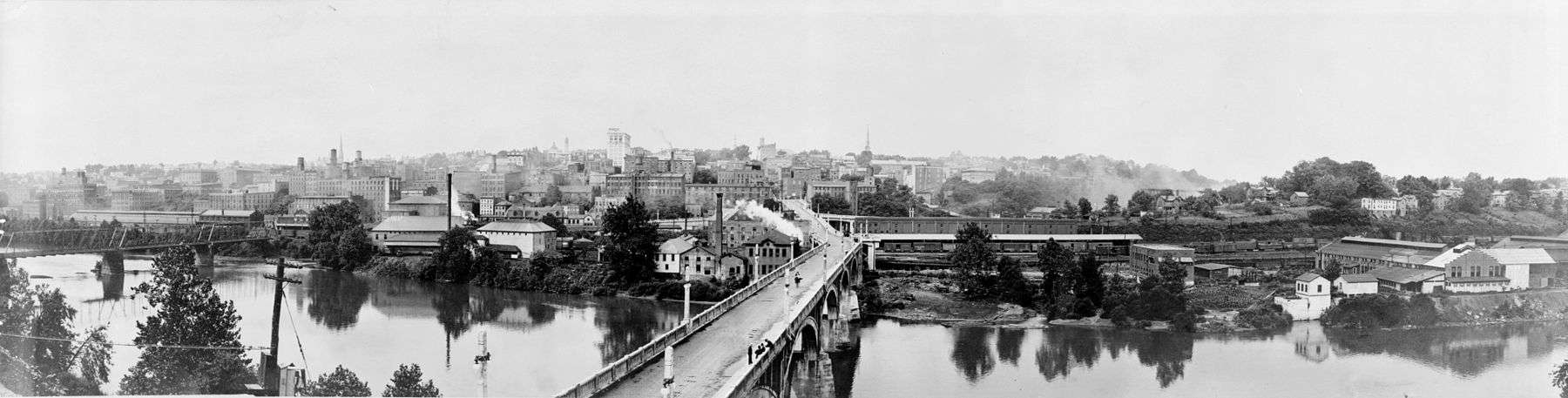
 Downtown Lynchburg skyline. | |||||
| |||||
| Nickname(s): "The Hill City"; "City of Seven Hills" | |||||
 Location within the Commonwealth of Virginia | |||||
 Lynchburg Location within the contiguous United States of America | |||||
| Coordinates: 37°24′13″N 79°10′12″W / 37.40361°N 79.17000°WCoordinates: 37°24′13″N 79°10′12″W / 37.40361°N 79.17000°W | |||||
| Country |
| ||||
| State |
| ||||
| Founded | 1786 | ||||
| Incorporated (town) | 1805 | ||||
| Incorporated (city) | 1852 | ||||
| Named for | John Lynch | ||||
| Government | |||||
| • Type | Council–Manager | ||||
| • Mayor | Treney Tweedy[1] | ||||
| • Vice Mayor | Mary Jane Dolan[1] | ||||
| • Council | Lynchburg City Council | ||||
| Area | |||||
| • Independent city | 100 km2 (50 sq mi) | ||||
| • Land | 128 km2 (49.5 sq mi) | ||||
| • Water | 1 km2 (0.5 sq mi) | ||||
| Elevation | 192 m (630 ft) | ||||
| Population (2017) | |||||
| • Independent city | 81,000(US: 416th) | ||||
| • Density | 594/km2 (1,539/sq mi) | ||||
| • Urban | 116,636 (US: 271st) | ||||
| • Metro | 260,320 (US: 184th) | ||||
| • Demonym | Lynchburger | ||||
| Time zone | UTC−5 (EST) | ||||
| • Summer (DST) | UTC−4 (EDT) | ||||
| ZIP code(s) | 24501, 24502, 24503, 24504, 24505, 24551 | ||||
| Area code(s) | 434 | ||||
| FIPS code | 51-47672 | ||||
| GNIS feature ID | 1479007[2] | ||||
| Major airport | LYH | ||||
| Website |
lynchburgva | ||||


Lynchburg is an independent city in the Commonwealth of Virginia in the United States. As of the 2010 census, the population was 75,568. The 2017 census estimates an increase to 81,000.[3] Located in the foothills of the Blue Ridge Mountains along the banks of the James River, Lynchburg is known as the "City of Seven Hills" or the "Hill City".[4] In the 1860s, Lynchburg was the only major city in Virginia that was not recaptured by the Union before the end of the American Civil War.[5]
Lynchburg lies at the center of a wider metropolitan area close to the geographic center of Virginia. It is the fifth largest MSA in Virginia with a population of 260,320[6] and hosts several institutions of higher education, including Liberty University, the nation's largest non-profit university, as well as University of Lynchburg, and Randolph College. Other nearby cities include Roanoke, Charlottesville, and Danville.
History
Monacan people and other Siouan Tutelo-speaking tribes had lived in the area since at least 1270, driving the Virginia Algonquians eastward. Explorer John Lederer visited one of the Siouan villages (Saponi) in 1670, on the Staunton River at Otter Creek, southwest of the present-day city, as did the Thomas Batts and Robert Fallam expedition in 1671.
Siouans occupied the area until about 1702; they had become weakened as a people and lost many to infectious diseases. The Seneca people (who spoke an Iroquois-related language) and were part of the Iroquois Confederacy based in New York, conquered them. The Seneca had been seeking new hunting ground through the Shenandoah Valley to the West. The Iroquois Five Nations ceded control of their land east of the Blue Ridge Mountains, including Lynchburg, to the Colony of Virginia, at the Treaty of Albany in 1718 and confirmed in 1721.
Founding and early growth
First settled by European Americans in 1757, Lynchburg was named for its founder, John Lynch. While about 17 years old, he started a ferry service at a ford across the James River to carry traffic to and from New London, where his parents had settled. The "City of Seven Hills" quickly developed along the hills surrounding Lynch's Ferry.
In 1786, Virginia's General Assembly recognized Lynchburg, the settlement by Lynch's Ferry on the James River. The James River Company had been incorporated the previous year (and President George Washington given stock, which he donated to charity) in order to "improve" the river down to Richmond, which was then growing and became the new Commonwealth's capitol. Shallow-draft James River bateau provided a relatively easy means of transportation through Lynchburg down to Richmond and eventually the Atlantic Ocean. Rocks, downed trees, and flood debris were constant hazards, so their removal became expensive ongoing maintenance; eventually the state built a canal and towpath along the river to make transportation easier. Lynchburg became a tobacco trading, then commercial, and much later an industrial center. By 1812, U.S. Chief Justice John Marshall, who lived in Richmond, reported on the navigation difficulties and construction problems on the canal and towpath.
The General Assembly recognized the settlement's growth by incorporating Lynchburg as a town in 1805; it was not incorporated as a city until 1852. In between, Lynch built Lynchburg's first bridge across the James River, a toll structure which replaced his ferry in 1812. A toll turnpike to Salem, Virginia was begun in 1817. Lynch died in 1820 and was buried beside his mother in the graveyard of the South River Friends Meetinghouse. Quakers later abandoned the town because of their opposition to slaveholding. Presbyterians took over the meetinghouse and adapted it as a church. It is now preserved as a historic site.
To avoid the many visitors at Monticello, Thomas Jefferson in 1806 built a home near Lynchburg, called Poplar Forest. He often visited the town, noting, "Nothing would give me greater pleasure than to be useful to the town of Lynchburg. I consider it as the most interesting spot in the state." In 1810, Jefferson wrote, "Lynchburg is perhaps the most rising place in the U.S.... It ranks now next to Richmond in importance...."
Early Lynchburg was not known for religiosity, although the Church of England supposedly built a log church in 1765. In 1804, evangelist Lorenzo Dow wrote: "...where I spoke in the open air in what I conceived to be the seat of Satan's Kingdom. Lynchburg was a deadly place for the worship of God'." That referred to the lack of churches, which was corrected the following year. Itinerant Methodist Francis Asbury visited the town; Methodists built its first church in 1805; and it hosted the last Virginia Methodist Conference that bishop Asbury attended (February 20, 1815).[7] Nonetheless, as Lynchburg grew, prostitution and other "rowdy" activities became part of the urban mix. They were often ignored, if not accepted, particularly in a downtown area referred to as the "Buzzard's Roost." Also, pro-slavery Methodist preacher and later bishop John Early became one of Lynchburg's civic leaders.
On December 3, 1840, the James River and Kanawha Canal from Richmond reached Lynchburg. It extended as far as Buchanan, Virginia in 1851, but never reached a tributary of the Ohio River as planned.[8] Lynchburg's population exceeded 6,000 by 1840, and a water works system was built. However, floods in 1842 and 1847 wreaked havoc with the canal and towpath. Both were repaired. Town businessmen began to lobby for a railroad, but Virginia's General Assembly refused to fund such construction. In 1848 civic boosters began selling subscriptions for the Lynchburg and Tennessee Railroad.
By the 1850s, Lynchburg (along with New Bedford, Massachusetts) was among the richest towns per capita in the US.[9] Tobacco (including the manufacture of plug tobacco in factories using rented slave labor), slave-trading, general commerce, and iron and steel manufacturing powered the economy.[10][11]
Railroads had become the wave of the future. Construction on the new Lynchburg and Tennessee railroad had begun in 1850 and a locomotive tested the track in 1852. A locomotive called the "Lynchburg" blew up in Forest, Virginia (near Poplar Forest) later that year, illustrating the new technology's dangers. By the Civil War, two more railroads had been built, including the South Side Railroad from Petersburg. It became known as the Atlantic, Mississippi and Ohio Railroad in 1870, then a line in the Norfolk and Western Railway, and last part of the Norfolk Southern Railway.[12] Also the Orange and Alexandria Railroad stopped in Lynchburg.
American Civil War
During the American Civil War, Lynchburg served as a Confederate transportation hub and supply depot. It also had 30 hospitals.
In June 1864, Union forces of General David Hunter approached within 1-mile (1.6 km) as they drove south from the Shenandoah Valley. Confederate troops under General John McCausland harassed them. Meanwhile, the city's defenders hastily erected breastworks on Amherst Heights. Defenders were led by General John C. Breckinridge, who was an invalid from wounds received at the Battle of Cold Harbor. Union General Philip Sheridan appeared headed for Lynchburg on June 10, as he crossed the Chickahominy River and cut the Virginia Central Railroad. However, Confederate cavalry under General Wade Hampton, including the 2nd Virginia Cavalry from Lynchburg under General Thomas T. Munford, defeated his forces at the two-day Battle of Trevillian Station in Louisa County, and they withdrew. This permitted fast-marching troops under Confederate General Jubal Early to reach within four miles of Lynchburg on June 16 and tear up the tracks of the Orange and Alexandria Railroad to inhibit travel by Union reinforcements, while Confederate reinforcements straggled in from Charlottesville.
On June 18, 1864, in the Battle of Lynchburg, Early's combined forces, though outnumbered, repelled Union General Hunter's troops. Lynchburg's defenders had taken pains to create a false impression that the Confederate forces within the city were much larger. For example, a train was continuously run up and down the tracks while drummers played and Lynchburg citizens cheered as if reinforcements were disembarking. Local prostitutes took part in the deception, misleading their Union clients about the large number of Confederate reinforcements. Narcissa Owen (Cherokee), wife of the President of the Lynchburg and Tennessee Railroad, later wrote about her similar deception of Union spies.[13]
From April 6 to 10, 1865, Lynchburg served as the capital of Virginia after the Confederate government fled from Richmond. Governor William Smith and the Commonwealth's executive and legislative branches escaped to Lynchburg as Richmond surrendered on April 3. Then, Gen. Robert E. Lee surrendered to Gen. Ulysses S. Grant at Appomattox Courthouse, roughly 20-mile (32 km) east of Lynchburg, ending the Civil War. Lynchburg surrendered on April 12, to Union General Ranald S. Mackenzie. Ten days later, Confederate Brigadier General James Dearing died. He was a native of nearby Campbell County and descendant of John Lynch; he had been wounded on April 6 at High Bridge during that Appomattox campaign. Mackenzie had visited his wounded friend and former West Point classmate, easing the transition of power.[14]
Postwar recovery
The railroads which powered Lynchburg's economy were destroyed by the war's end. The residents of the city deeply resented occupying forces under General J. L. Gregg. However, they worked more readily with his affable successor General N.M. Curtis. Thomas J. Kirkpatrick became superintendent for the public education established under Virginia's Reconstruction-era legislature and Constitution of 1869, and built four new public schools. Previously, the only education for students from poor families was provided through St. Paul's Episcopal Church.
Floods in 1870 and 1877 destroyed the city's bridges (which were rebuilt) and the James River and Kanahwa Canal. That was not rebuilt, but the towpath was used for constructing the rails of the Richmond and Allegheny Railroad, a project conceived five decades earlier. The city limits expanded in 1874. In 1881 not only was that railroad completed to Lynchburg, so was another railroad along the Shenandoah Valley. Lynchburg now had a telegraph, about 15,000 residents, and the beginnings of a streetcar system. Many citizens, believing their city crowded enough, did not join the boosters who wanted Lynchburg to become the junction of that valley line and what became the Norfolk and Western Railroad, so the junction was moved to Big Lick. This later developed as the City of Roanoke.
In the latter 19th century, Lynchburg embraced manufacturing (the city being sometimes referred to as the "Pittsburgh of the South") and, per capita, again became one of the wealthiest in the United States. In 1880, Lynchburg resident James Albert Bonsack invented the first cigarette-rolling machine. Shortly thereafter Dr. Charles Browne Fleet, a physician and pharmacological tinkerer, introduced the first mass marketed over-the-counter enema. By the city's centennial in 1886, banking activity had increased sixfold over the 1860 level, which some attributed to slavery's demise. Moreover, the Lynchburg Cotton Mill and Craddock-Terry Shoe Co. (which would become the largest shoe manufacturer in the south) were founded in 1888. The Reusens hydroelectric dam began in 1903 and soon delivered more power.[15]
In 1886, Virginia Baptists founded a training school, the Lynchburg Baptist Seminary. It began to offer a college-level program to African-American students in 1900. Now named the Virginia University of Lynchburg, it is the city's oldest institution of higher learning. Not far outside town, Randolph-Macon Woman's College and Sweet Briar College were founded as women's colleges in 1893 and 1901, respectively. In 1903, the Christian Church (Disciples of Christ) founded Lynchburg Christian College (later Lynchburg College) in what had been the Westover Hotel resort, which went bankrupt in the Panic of 1901. In the 2018/2019 year the college's name will be changed to the University of Lynchburg, reflecting its expansion of graduate-level programs and research. Lynchburg's first public library, Jones Memorial Library, opened in 1907.[15]

During World War I, the city's factories worked, and the area also supplied troops. The city powered through the Roaring Twenties and survived the Great Depression. Its first radio station, WLVA began in 1930 and its airport opened in 1931. In 1938 the former fairgrounds became side by side baseball and football stadiums. [15]
World War II and after
Lynchburg's factories again worked 24 hours daily during World War II. In 1955 both General Electric and Babcock & Wilcox built high technology factories in the area.[15]
However, Lynchburg lost its battle for an interstate highway. In the late 1950s, interested citizens, including Virginia Senator Mosby G. Perrow, Jr., asked the federal government to change its long-planned route for the interstate highway now known as I-64 between Clifton Forge and Richmond.[16] Since the 1940s, maps of the federal interstate highway system planned a northern route, missing the manufacturing centers at Lynchburg and Roanoke, but federal officials assured Virginia that the state would decide the route.[17] Although initially favoring that northern route, Virginia's State Highway Commission eventually supported a southern route from Richmond via US-360 and US-460, which connected Lynchburg and Roanoke via US-220 from Roanoke to Clifton Forge, then continued west following US-60 into West Virginia.[18] However, in July 1961 Governor Lindsay Almond and US Secretary of Commerce Luther Hodges announced that the route would not be changed.[19] Thus Lynchburg became the only city with a population in excess of 50,000 (at the time) not served by an interstate.[20]
The Virginia State Colony for Epileptics and Feebleminded (now known as the Central Virginia Training School), is just outside Lynchburg in Madison Heights. For several decades throughout the mid-20th century, the state of Virginia authorized compulsory sterilization of the mentally retarded for the purpose of eugenics. The operations were carried out at the institution, then an estimated 8,300 Virginians were sterilized and relocated to Lynchburg, which became a "dumping ground" of sorts for the feeble-minded, poor, blind, epileptic, and those otherwise seen as genetically "unfit"[21] Carrie Buck, whose sterilization the United States Supreme Court authorized in Buck v. Bell, was classified as "feeble-minded" and sterilized while a patient at that institution.
Sterilizations were carried out for 35 years until 1972, when operations were finally halted. Later in the late 1970s, the American Civil Liberties Union filed a class-action lawsuit against the state of Virginia on behalf of the sterilization victims. Victims received formal apologies and counseling if they chose, but the judiciary denied requests for reverse sterilization operations. In 1994, Buck's sterilization and litigation became a television drama, Against Her Will: The Carrie Buck Story. The Manic Street Preachers also address the issue in their song "Virginia State Epileptic Colony" on their 2009 album Journal For Plague Lovers.
Modern revitalization
In 1971, local pastor Jerry Falwell founded Lynchburg Baptist College, which since 1985 has been known as Liberty University, and is now the state's largest institution of higher education. In the 2014–2015 academic year Liberty generated over $1 billion dollars in economic activity to the Lynchburg area.[22]
Lynchburg now has ten recognized historic districts, four of them in the downtown residential area.[23][24] Since 1971, 40 buildings have also been individually listed on the National Register of Historic Places.[25] Especially since 2002, downtown Lynchburg has experienced significant revitalization, with hundreds of new loft apartments created through adaptive reuse of historic warehouses and mills. Since 2000, downtown has attracted private investments of more than $110 million and business activity increased by 205% from 2004 to 2014.[26] In 2014, 75 new apartments were added to downtown, with 155 further units under construction increasing the number of housing units downtown by 48% from 2010 to 2014.[26]
In 2015, the $5.8 million Lower Bluffwalk pedestrian street zone opened.[27] Notable projects underway in downtown by the end of 2015 include the $25 million Hilton Curio branded Virginian Hotel restoration project, $16.6 million restoration of the Academy Center of the Arts, and $4.6 million expansion of Amazement Square Children's Museum.[28][29][30][31]
Timeline
- 1786 – Lynchburg founded.[32]
- 1791 – Tobacco warehouse built.[32]
- 1798 – South River Friends Meetinghouse built.
- 1805 – Town of Lynchburg incorporated.[32]
- 1806
- City Cemetery established.
- Construction of Thomas Jefferson's Poplar Forest begins near Lynchburg.[33]
- 1830
- Elijah Fletcher becomes mayor.
- Population: 4,630.[34]
- 1840
- James River and Kanawha Canal to Richmond opens.[32]
- Population: 6,395.[34]
- 1850 – Population: 8,071.[34]
- 1852
- Virginia & Tennessee Railroad begins operating.[33]
- City of Lynchburg incorporated.[32]
- Lynchburg Daily Virginian newspaper begins publication.[35]
- 1855 – Lynchburg Courthouse built.[32]
- 1856 – Methodist Protestant Lynchburg College established.[32]
- 1864 – June 17–18: Battle of Lynchburg fought near city during the American Civil War.[33]
- 1866 – Southern Memorial Association founded.[36]
- 1870 – September: Flood.[37]
- 1879 – George D. Witt Shoe Corporation in business.
- 1880 – James Albert Bonsack invents cigarette rolling machine.
- 1886 – First Baptist Church built.
- 1888 – Virginia Theological Seminary founded.[33]
- 1893 – Randolph-Macon Woman's College opens.[32]
- 1895 – St. Paul's Church built.
- 1898 – "Confederate Infantryman" monument erected.[32]
- 1900 – Population: 18,891.
- 1903 – Virginia Christian College founded.[33]
- 1908 – Jones Memorial Library opens.[38]
- 1912 – Equal Suffrage League formed.[32]
- 1913 – Statue of John Warwick Daniel erected.[32]
- 1920 – Little Theater established.[32]
- 1928 – Monument Terrace built.[32]
- 1930
- 1932 – Civic Art League founded.[32]
- 1940 – City Stadium opens.[40]
- 1953 – WLVA-TV (television) begins broadcasting.[41]
- 1954 – Carter Glass Memorial Bridge opens.
- 1959 – Pittman Plaza shopping centre in business.[40]
- 1966
- Lynchburg Public Library opens.[38]
- Central Virginia Community College[33] and Lynchburg Baseball Corporation established.[40]
- 1971 – Lynchburg Baptist College (later Liberty University) founded.[33]
- 1978 – Point of Honor house museum opens.
- 1980 – Population: 66,743.
- 1990 – President George H. W. Bush gives commencement speech at Liberty University.[42]
- 1993 – Bob Goodlatte becomes U.S. representative for Virginia's 6th congressional district.[43]
- 1995 – Lynchburg Hillcats baseball team active.
- 2000 – City website online (approximate date).[44][45]
- 2010 – Population: 75,568.[46]
- 2016 – Joan Foster becomes mayor.
- 2017 – President Donald Trump gives commencement speech at Liberty University.[42]
Geography
According to the United States Census Bureau, the city has a total area of 49.6 square miles (128.5 km2), of which 49.2 square miles (127.4 km2) is land and 0.5 square miles (1.3 km2) (1.0%) is water.[47]
Climate
Lynchburg has a four-season humid subtropical climate (Köppen Cfa), with cool winters and hot, humid summers. The monthly daily average temperature ranges from 35.1 °F (1.7 °C) in January to 75.3 °F (24.1 °C) in July. Nights tend to be significantly cooler than days throughout much of the year due in part to the moderate elevation. In a typical year, there are 26 days with a high temperature 90 °F (32 °C) or above, and 7.5 days with a high of 32 °F (0 °C) or below.[48] Snowfall averages 12.9 inches (33 cm) per season but this amount varies highly with each winter; the snowiest winter is 1995–96 with 56.8 in (144 cm) of snow, but the following winter recorded only trace amounts, the least on record.[49]
Temperature extremes range from 106 °F (41 °C), recorded on July 10, 1936, down to −11 °F (−24 °C), recorded on February 20, 2015.[48] However, several decades may pass between 100 °F (38 °C) and 0 °F (−18 °C) readings, with the last such occurrences being July 8, 2012 and February 20, 2015, respectively.[48]
| Climate data for Lynchburg, Virginia (Lynchburg Regional Airport), 1981–2010 normals,[lower-alpha 1] extremes 1893–present[lower-alpha 2] | |||||||||||||
|---|---|---|---|---|---|---|---|---|---|---|---|---|---|
| Month | Jan | Feb | Mar | Apr | May | Jun | Jul | Aug | Sep | Oct | Nov | Dec | Year |
| Record high °F (°C) | 80 (27) |
82 (28) |
92 (33) |
95 (35) |
100 (38) |
104 (40) |
106 (41) |
105 (41) |
102 (39) |
98 (37) |
83 (28) |
79 (26) |
106 (41) |
| Mean maximum °F (°C) | 66.3 (19.1) |
69.3 (20.7) |
78.8 (26) |
86.0 (30) |
88.4 (31.3) |
92.5 (33.6) |
95.1 (35.1) |
94.1 (34.5) |
90.0 (32.2) |
83.7 (28.7) |
75.1 (23.9) |
66.9 (19.4) |
95.9 (35.5) |
| Average high °F (°C) | 45.4 (7.4) |
49.1 (9.5) |
57.9 (14.4) |
68.2 (20.1) |
75.4 (24.1) |
83.2 (28.4) |
86.5 (30.3) |
85.2 (29.6) |
78.3 (25.7) |
68.5 (20.3) |
58.5 (14.7) |
47.8 (8.8) |
67.0 (19.4) |
| Average low °F (°C) | 24.8 (−4) |
27.2 (−2.7) |
33.8 (1) |
42.6 (5.9) |
50.9 (10.5) |
60.1 (15.6) |
64.0 (17.8) |
63.0 (17.2) |
55.7 (13.2) |
44.0 (6.7) |
35.1 (1.7) |
27.3 (−2.6) |
44.0 (6.7) |
| Mean minimum °F (°C) | 6.9 (−13.9) |
12.7 (−10.7) |
18.9 (−7.3) |
28.2 (−2.1) |
38.1 (3.4) |
49.2 (9.6) |
55.4 (13) |
54.7 (12.6) |
42.1 (5.6) |
29.8 (−1.2) |
21.8 (−5.7) |
12.3 (−10.9) |
3.7 (−15.7) |
| Record low °F (°C) | −10 (−23) |
−11 (−24) |
5 (−15) |
20 (−7) |
31 (−1) |
40 (4) |
49 (9) |
45 (7) |
35 (2) |
21 (−6) |
8 (−13) |
−4 (−20) |
−11 (−24) |
| Average precipitation inches (mm) | 3.14 (79.8) |
2.93 (74.4) |
3.58 (90.9) |
3.31 (84.1) |
3.73 (94.7) |
3.62 (91.9) |
4.36 (110.7) |
3.26 (82.8) |
3.88 (98.6) |
3.11 (79) |
3.41 (86.6) |
3.24 (82.3) |
41.57 (1,055.9) |
| Average snowfall inches (cm) | 4.5 (11.4) |
4.2 (10.7) |
1.8 (4.6) |
0.1 (0.3) |
0 (0) |
0 (0) |
0 (0) |
0 (0) |
0 (0) |
0 (0) |
0.2 (0.5) |
2.1 (5.3) |
12.9 (32.8) |
| Average precipitation days (≥ 0.01 in) | 9.2 | 9.4 | 10.6 | 10.0 | 12.3 | 10.0 | 11.7 | 9.4 | 8.3 | 7.1 | 8.3 | 9.6 | 115.9 |
| Average snowy days (≥ 0.1 in) | 2.0 | 2.0 | 1.0 | 0.1 | 0 | 0 | 0 | 0 | 0 | 0 | 0.1 | 1.3 | 6.5 |
| Mean monthly sunshine hours | 167.0 | 168.2 | 221.7 | 243.7 | 272.3 | 287.5 | 273.4 | 256.6 | 226.5 | 215.4 | 169.6 | 155.9 | 2,657.8 |
| Percent possible sunshine | 54 | 56 | 60 | 62 | 62 | 65 | 61 | 61 | 61 | 62 | 55 | 52 | 60 |
| Source: NOAA (sun 1961–1990)[48][50][51] | |||||||||||||
Seven Hills
One of the most prominent nicknames of Lynchburg is the "City of Seven Hills." This is due to one prominent feature of its geography- the seven hills that are spread throughout the region. They are as follows: College Hill, Garland Hill, Daniel's Hill, Federal Hill, Diamond Hill, White Rock Hill, and Franklin Hill.[52]
Adjacent counties
- Amherst County, Virginia – northeast
- Bedford County, Virginia – west, northwest
- Campbell County, Virginia – south, southeast
Demographics
| Historical population | |||
|---|---|---|---|
| Census | Pop. | %± | |
| 1830 | 4,630 | — | |
| 1840 | 6,395 | 38.1% | |
| 1850 | 8,071 | 26.2% | |
| 1860 | 6,853 | −15.1% | |
| 1870 | 6,825 | −0.4% | |
| 1880 | 15,959 | 133.8% | |
| 1890 | 19,709 | 23.5% | |
| 1900 | 18,891 | −4.2% | |
| 1910 | 29,494 | 56.1% | |
| 1920 | 30,070 | 2.0% | |
| 1930 | 40,661 | 35.2% | |
| 1940 | 44,541 | 9.5% | |
| 1950 | 47,727 | 7.2% | |
| 1960 | 54,790 | 14.8% | |
| 1970 | 54,083 | −1.3% | |
| 1980 | 66,743 | 23.4% | |
| 1990 | 66,049 | −1.0% | |
| 2000 | 65,269 | −1.2% | |
| 2010 | 75,568 | 15.8% | |
| Est. 2017 | 81,000 | [53] | 7.2% |
| U.S. Decennial Census[54] 1790–1960[55] 1900–1990[56] 1990–2000[57] 2010–2012[3] | |||
As of the 2010 census,[58] there were 75,568 people, 25,477 households, and 31,992 families residing in the city. The population density was 1,321.5 people per square mile (510.2/km²). There were 27,640 housing units at an average density of 559.6 per square mile (216.1/km²). The racial makeup of the city was 63.0% White, 29.3% African American, 0.2% Native American, 2.5% Asian, 0.04% Pacific Islander, 0.63% from other races, and 1.7% from two or more races. Hispanic or Latino of any race were 3.0% of the population.
There were 25,477 households out of which 27.8% had children under the age of 18 living with them, 41.6% were married couples living together, 16.0% had a female householder with no husband present, and 38.8% were non-families. 32.7% of all households were made up of individuals and 12.9% had someone living alone who was 65 years of age or older. The average household size was 2.30 and the average family size was 2.92.
The age distribution of the city had: 22.1% under the age of 18, 15.5% from 18 to 24, 25.3% from 25 to 44, 20.8% from 45 to 64, and 16.3% who were 65 years of age or older. The median age was 35 years. For every 100 females, there were 84.2 males. For every 100 females age 18 and over, there were 79.1 males.
The median income for a household in the city was $32,234, and the median income for a family was $40,844. Males had a median income of $31,390 versus $22,431 for females. The per capita income for the city was $18,263. About 12.3% of families and 15.9% of the population were below the poverty line, including 22.4% of those under age 18 and 10.7% of those age 65 or over.
Lynchburg ranks below the 2006 median annual household income for the U.S. as a whole, which was $48,200, according to the US Census Bureau.[59]
The city's population was stable for 25+ years: in 2006, it was 67,720; in 2000, it was 65,269; in 1990, it was 66,049; in 1980, it was 66,743.[60]
In 2009 almost 27% of Lynchburg children lived in poverty. The state average that year was 14 percent.[61]
Economy


Lynchburg offers a skilled labor force, low unemployment rate,[62] and below average cost of living. Of Virginia's larger metro areas, Forbes Magazine ranked Lynchburg the 5th best place in Virginia for business in 2006, with Virginia being the best state in the country for business.[63] Only 6 places in Virginia were surveyed and most of Virginia's cities were grouped together by Forbes as "Northern Virginia". Lynchburg achieved the rank of 109th in the whole nation in the same survey.
Industries within the Lynchburg MSA include nuclear technology, pharmaceuticals and material handling. A diversity of small businesses with the region has helped maintain a stable economy and minimized the downturns of the national economy.[64][65] Reaching as high as 1st place (tied) in 2007, Lynchburg has been within the Top 10 Digital Cities survey for its population since the survey's inception in 2004.[66]
Top employers
According to Lynchburg's 2017 Comprehensive Annual Financial Report,[67] the top private employers in the city are:

| # | Employer | # of Employees |
|---|---|---|
| 1 | Liberty University | 8,000+ |
| 2 | Centra Health | 7,000+ |
| 3 | Lynchburg City Public Schools | 1,500+ |
| 4 | Framatome | 1,000+ |
| 5 | City of Lynchburg | 1,000+ |
| 6 | Genworth Financial | 1,000+ |
| 7 | Central Virginia Community College | 500+ |
| 8 | Horizon Behavioral Health | 500+ |
| 9 | J.Crew | 500+ |
| 10 | KDC | 500+ |
Government
The government of Lynchburg falls under a Council-Manager system. Its City Council is composed of seven members, each elected to a staggered four-year term. Three members represent at-large seats; the remaining four represent a ward. The City Council is also responsible for appointing a City Manager, City Attorney, and City Clerk.
The current council members are[68]:
Treney Tweedy - Mayor (at-large)
Mary Jane Dolan - Vice Mayor (Ward I)
Jeff Helgeson (Ward III)
Randy Nelson (at-large)
Turner Perrow (Ward IV)
Sterling Wilder (Ward II)
Beau Wright (at-large)
- John Wiatt, 1806[69]
- Roderick Taliaferro, 1807
- Samuel J. Harrison, 1808
- John Lynch, Jr., 1809
- M. Lambert, 1810
- John Schoolfield, 1811
- James Stewart, 1812
- Robert Morris, 1813
- Samuel J. Harrison, 1814
- James Stewart, 1815
- John M. Gordon, 1816
- Samuel J. Harrison, 1817
- William Morgan, 1818
- James Stewart, 1819
- John Thurman, 1820
- Micajah Davis, 1821
- John Hancock, 1822
- Thomas A. Holcombe, 1823
- Albon McDaniel, 1824
- John Victor, 1825
- Albon McDaniel, 1826
- Christopher Winfree, 1827
- Albon McDaniel, 1828
- Ammon Hancock, 1829
- Elijah Fletcher, 1830
- John R. D. Payne, 1831
- Elijah Fletcher, 1833
- John M. Warwick, 1833
- Henry M. Didlake, 1834
- Samuel J. Wiatt, 1835
- Pleasant Labby, 1836
- Ammon Hancock, 1837
- Martin W. Davenport, 1838
- John R. D. Payne, 1839
- Samuel Nowlin, 1840
- Ammon Hancock, 1841
- Henry M. Didlake, 1842
- Edwin Mathews, 1843
- David W. Burton, 1844
- M. Hart, 1845
- Henry M. Didlake, 1846
- Daniel J. Warwick, 1847
- Henry 0 Schoolfield, 1848
- Edwin Mathews, 1849
- Henry M. Didlake, 1850
- William D. Branch, 1851
- Albon McDaniel, 1869
- James M. Cobbs, 1870
- George H. Burch, 1872
- Samuel A. Bailey, 1876
- Samuel Griffin Wingfield, 1880[70]
- A. H. Pettigrew, 1882
- Nathaniel Clayton Manson, Jr., 1884–1891[71]
- Robert D. Yancey, circa 1900[72]
- Royston Jester, Jr., circa 1918[73]
- ?
- L. E. Litchford, circa 1937[74]
- Clarence G. Burton, 1946–1948[75]
- Jerome V. Morrison, circa 1952[74]
- John L. Suttenfield, circa 1953–1956[74]
- ?
- Elliott Shearer, circa 1982[76]
- Jimmie Bryan, circa 1986[73]
- ?
- M.W. "Teedy" Thornhill Jr., 1991–1992[77]
- James S. Whitaker, 1994–1998[78]
- Carl B. Hutcherson, Jr., circa 2002–2005[79]
- Michael Gillette, circa 2015[80]
- Joan Foster, 2016–2018[80]
- Treney Tweedy, 2018-present [81]
Education
The city is served by the Lynchburg City Public Schools. The school board is appointed by the Lynchburg City Council.
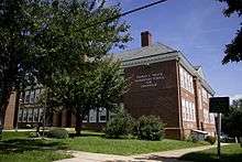
- E C Glass High School – 2111 Memorial Ave
- Heritage High School – 3020 Wards Ferry Rd
- Linkhorne Middle School – 2525 Linkhorne Dr
- Paul Laurence Dunbar Middle School – 1208 Polk St
- Sandusky Middle School – 805 Chinook Place
- William Marvin Bass Elementary School
- Bedford Hills Elementary School
- Dearington Elementary School for Innovation
- Heritage Elementary School
- Linkhorne Elementary School
- Paul M. Munro Elementary School
- Perrymont Elementary School
- Robert S. Payne Elementary School
- Sandusky Elementary School
- Sheffield Elementary School
- Thomas C. Miller Elementary School for Innovation
The city is also home to a number of religious and non-religious private schools, including Appomattox Christian Academy, Desmond T Doss Christian Academy, Holy Cross Regional Catholic School, James River Day School, Liberty Christian Academy, New Covenant Classical Christian School, Temple Christian School, Virginia Episcopal School, and New Vistas School.
Lynchburg is also home to the Central Virginia Governor's School for Science and Technology located in Heritage High School. This magnet school consists of juniors and seniors selected from each of the Lynchburg area high schools. As one of eighteen Governor's Schools in Virginia, the Central Virginia Governor's School focuses on infusing technology into both the math and science curriculum.
Further education options include a number of surrounding county public school systems.
Colleges and universities in Lynchburg include Central Virginia Community College, Liberty University, Randolph College, the University of Lynchburg, and Virginia University of Lynchburg.
Health care
- Centra Lynchburg General Hospital – Lynchburg, VA
- Centra Virginia Baptist Hospital – Lynchburg, VA
- Community Health Center – Lynchburg, VA[82]
Transportation
Local transit
The Greater Lynchburg Transit Company (GLTC) operates the local public transport bus service within the city. The GLTC additionally provides the shuttle bus service on the Liberty University campus.
The GLTC selected a property directly across from Lynchburg-Kemper Street Station as its top choice of sites upon which to build the new transfer center for their network of public buses. They were interested in facilitating intermodal connections between GLTC buses and the intercity bus and rail services which operate from that location. The project was completed and opened to the public on June 16, 2014.[83][84]
On August 23, 2017, the GLTC launched The Hopper, a free downtown circulator bus.[85] It was funded with a $479,348 grant from the Virginia Smart Scale program.[86]

Intercity transit
Intercity passenger rail and bus services are based out of Kemper Street Station, a historic, three-story train station recently restored and converted by the city of Lynchburg to serve as an intermodal hub for the community. The station is located at 825 Kemper Street.[87]
Bus
Greyhound Lines located their bus terminal in the main floor of Kemper Street Station following its 2002 restoration.[87] Greyhound offers transport to other cities throughout Virginia, the US, Canada, and Mexico.
Rail
Amtrak's long distance Crescent and a Northeast Regional connect Lynchburg with Boston, New York, Philadelphia, Baltimore, Washington, Charlotte, Atlanta, Birmingham, New Orleans and intermediate points.
In October 2009, Lynchburg became the southern terminus for a Northeast Regional that previously had overnighted in Washington. The forecast ridership was 51,000 for the 180-mile extension's first year, but the actual count was triple that estimate, and the train paid for itself without any subsidy.[88] By FY 2015, the Regional had 190,000 riders. The Lynchburg station alone served a total of 85,000 riders in 2015. It is located in the track level ground floor of Kemper Street Station.[89]
Lynchburg has two major freight railroads. It is the crossroads of two Norfolk Southern lines. One is the former mainline of the Southern Railway, upon which Kemper Street Station is situated. NS has a classification yard located next to the shopping mall. Various yard jobs can be seen. Railfans who wish to visit the NS Lynchburg yard are advised to inquire with an NS official. CSX Transportation also has a line through the city and a small yard.
Air
Lynchburg Regional Airport is solely served by American Eagle to Charlotte. American Eagle, a subsidiary of American Airlines, is the only current scheduled airline service provider, with seven daily arrivals and departures. In recent years air travel has increased with 157,517 passengers flying in and out of the airport in 2012, representing 78% of the total aircraft load factor for that time period.
Highway
Primary roadways include U.S. Route 29, U.S. Route 501, U.S. Route 221, running north-south, and U.S. Highway 460 (Richmond Highway), running east-west. While Lynchburg is the largest city in Virginia not served by an interstate, parts of Route 29 have been upgraded to interstate standards and significant improvements have been made to Highway 460 in the immediate vicinity to Lynchburg and suburban areas.
Arts and culture
In a Forbes magazine survey, Lynchburg ranked 189 for cultural and leisure out of 200 cities surveyed.[90]
- Lynchburg Symphony Orchestra: Created in 1983, throughout the years a variety of music has been presented, from the classical to the patriotic to the popular.
- Academy of Fine Arts.
- Renaissance Theatre.
- Lynchburg Art Club. Formed in March 1895 .
- Opera on the James: opera performed by national and regional artists in a wide variety of venues since 2005 including classic grand operas, small scale lesser-known operas, contemporary works, family operas, concerts of diverse repertoire, lectures, school tours and free community outreach.
Attractions and entertainment
The following attractions are located within the Lynchburg MSA:
- Amazement Square: Central Virginia's first multidisciplinary, hands-on children's museum.
- Appomattox Courthouse: The site of the Battle of Appomattox Court House, where the surrender of the Confederate Army under Robert E. Lee to Union commander Ulysses S. Grant took place on April 9, 1865, effectively ending the American Civil War.
- Crabtree Falls: The longest waterfall east of the Mississippi River, is located in Nelson County, Virginia. The trail leads hikers along a 1.7-mile hike with beautiful views of five cascades of Crabtree Falls. The land formerly in private ownership prior to the late 1970s is in the George Washington National Forest. Crabtree Falls sits near two undeveloped mountainous areas designated as Wilderness areas: The Priest & Three Ridges respectfully. Unfortunately since 1982, Thirty (30) people have fallen to their deaths due to navigating too far away from the trail. There are warning signs at the public trailhead because of this.
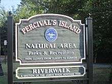
- James River Heritage Trail: Composed of two smaller trails, the Blackwater Creek Bikeway and RiverWalk.[91]
- Trails of Blackwater Creek: a network of paved and unpaved trails weaving through the Blackwater Creek natural area.[92][93]
- Miller-Claytor House: Pre-19th century townhouse where Thomas Jefferson allegedly proved to the owner of the house's garden that tomatoes were not poisonous by eating one of the fruit.[94] Home was dismantled in 1936 and rebuilt at its Riverside Park location, where the garden was also restored.
- National D-Day Memorial: Located in Bedford, Virginia, it commemorates all those who served the United States during the D-Day Invasion of Normandy, France on June 6, 1944 during World War II.
- Nature Zone: A division of Lynchburg Parks and Recreation.
- Old City Cemetery Museums & Arboretum: The most visited historic site in the City of Lynchburg. Established in 1806, the Old City Cemetery is Lynchburg's only publicly owned burial ground and one of its oldest cemeteries.[95] It is also home to the largest public collection of heirloom or "antique" roses in the Commonwealth of Virginia.[96]
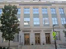
- The Old Court House: The Hill City's most famous historic landmark built in 1855. Fashioned as a Greek temple high above the James River, it is now the home of Central Virginia's best collection of memorabilia, fine furnishings, costumes and industrial history.
- Peaks of Otter: Three mountain peaks in the Blue Ridge Mountains, overlooking the town of Bedford, Virginia and in prominent view throughout most of Lynchburg.
- Point of Honor: The Federal-era mansion of Dr. George Cabell, Sr., friend and physician of the patriot Patrick Henry, and John S. Langhorne whose daughter Elizabeth Langhorne Lewis led the fight for women's suffrage.[97] His granddaughters include Mrs. Charles Dana Gibson, the original "Gibson Girl" and Nancy Langhorne, Lady Astor, the first woman elected to the British Parliament.[98]
- Poplar Forest: Thomas Jefferson's retreat home. Jefferson designed the octagonal house during his second term as president and sojourned here in his retirement to find rest and leisure and escape public life. Ongoing restoration and archaeology is taking place at the site. A future access road/parkway is planned between the property and the Wyndhurst community with an existing signalized intersection on Enterprise Drive.
- Smith Mountain Lake: The largest lake entirely within Virginia, located in Bedford County, Virginia and Franklin County, Virginia (part of the Lynchburg MSA), the man-made lake features about 20,000 surface acres and 500 miles of shoreline.
Sports and recreation

Lynchburg is home to sporting events and organizations including:
- 7 Hills Hash House Harriers: The local chapter of an international group of non-competitive running, social and drinking clubs.
- Hiking areas include the Appalachian Trail, Peaks of Otter, Apple Orchard Falls Trail, Blackwater Creek Natural Area, Liberty Mountain Trail System, Crabtree Falls, Holliday Lake, Mount Pleasant National Scenic Holliday Lake, and Otter Creek Trail.
- Liberty Flames: An NCAA Division I department of athletics competing in 20 sports. They are a member of the ASUN Conference.
- Lynchburg College: The Hornets are an NCAA Division III school competing in 13 sports, as a member of the Old Dominion Athletic Conference (ODAC).
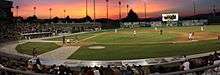
- Lynchburg Hillcats: A Class High-A professional baseball team in the Carolina League. They are affiliated with the Cleveland Indians of the American League.
- Liberty Mountain SnowFlex Centre: A synthetic ski slope featuring Snowflex, located near Liberty University. It includes beginner, intermediate and advanced slopes for year-round skiing, snowboarding, and innertubing. It is the first of its kind in the United States.
Neighborhoods
The first neighborhoods of Lynchburg developed upon seven hills adjacent to the original ferry landing. These neighborhoods include:
- College Hill
- Daniel's Hill
- Diamond Hill (Grace Street, Washington Street)
- Tinbridge Hill
- Franklin Hill
- Garland Hill
- White Rock Hill (Florida Avenue)
Other major neighborhoods include Boonsboro, Trents Ferry, Rivermont, Fairview Heights (Campbell Ave corridor), Jackson Heights, Federal Hill (Federal Street, Jackson Street, Harrison Street) Fort Hill, Forest Hill (Old Forest Rd. Area), Timberlake, Windsor Hills, Sandusky, Sheffield, Linkhorne, and Wyndhurst.
Notable people
Notable residents of Lynchburg include:
- Daniel Weisiger Adams (1820–1872), noted lawyer and Confederate Army officer[99]
- Beth Behrs (1985), actress
- Connie Britton (born 1967), actress
- James Albert Bonsack (1859–1924), invented first cigarette rolling machine in 1880
- Julie Story Byerley (born 1970), pediatrician and Vice Dean for Education for the University of North Carolina at Chapel Hill School of Medicine[100]
- George Cabell, Sr. (1766–1823), physician
- Desmond Doss (1919–2006), Medal of Honor recipient for actions during World War II, dramatized in Hacksaw Ridge
- Jubal Early (1816–1894), lawyer and Confederate General
- Arthur Earley (1926–1981), Pennsylvania State Representative
- Jerry Falwell (1933–2007), pastor and founder of Moral Majority
- Charles Browne Fleet (1843–1916), pharmacist and inventor of the enema
- Vinny Giles (1943-), golfer, U.S. Amateur, British Amateur and Walker Cup champion
- Brandon Inge (1977– ) MLB player, 2001–2013, 12 years for the Detroit Tigers,[101] American League All Star 2009[102]
- Rosa Kinckle Jones (1858–1932), African-American music teacher
- Randy Lanier (born 1954), professional race car driver and convicted drug trafficker
- Leland D. Melvin (1964-), engineer and NASA astronaut; named NASA's associate administrator for education in 2010
- Matt Mills (1996-) NASCAR driver for JD Motorsports
- Rosalie Slaughter Morton (1876–1968), physician and surgeon
- William Smith (1797–1887), U.S. Congressman, twice Governor of Virginia, Confederate Major General
- Phil Vassar (1964), Country Music Artist
- Bransford Vawter (1815–1838), Virginia's first poet
- Skeet Ulrich (born 1970), actor whose films include Scream and The Craft
Media
- The News & Advance, Lynchburg's daily newspaper that serves the Central Virginia region and is owned by Berkshire Hathaway.
- Lynchburg Living, bi-monthly periodical
- The Lynchburg Guide, quarterly resource directory
- The Burg, weekly entertainment newspaper published by The News & Advance
- Lynch's Ferry, a biannual journal of local history
- Liberty Champion, Liberty University student newspaper
Television
- WSET, ABC affiliate based in Lynchburg
- WSLS, NBC affiliate based in Roanoke
- WDBJ, CBS affiliate based in Roanoke
- WBRA, PBS affiliate based in Roanoke
- WFXR, Fox affiliate based in Roanoke
- WWCW, Fox affiliate based in Lynchburg, which was previously WJPR
- WPXR, ION affiliate based in Roanoke
- WFFP-TV, an Independent Station (formerly UPN) based in Roanoke, though licensed to Danville
- WLHG-CD, Liberty University channel based in Lynchburg
Radio
- WJJX 102.7, Urban Contemporary based in Lynchburg
- WLNI 105.9, Talk Radio based in Lynchburg
- WIQO-FM 100.9, Part of the Virginia Talk Radio Network based in Forest
- WLEQ 106.9, BOB-FM, Good Times, Great Oldies, Home of Rock'n'Roll's Great Hits, Lynchburg
- WNRN (WNRS 89.9), Modern Rock based in Charlottesville
- WROV 96.3, Classic Rock based in Roanoke
- WKHF 93.7, Hot AC based in Lynchburg
- WRMV 94.5, Southern Gospel based in Madison Heights
- WRVL 88.3, The Journey, Top 40 CCM Christian Radio based in Lynchburg
- WRXT 90.3, Contemporary Christian Radio based in Lynchburg, part of the "Spirit FM" (WPAR) network of Contemporary Christian stations
- W227BG 93.3 ESPN Sports translator of 106.3 Gretna – Translator at Timberlake – Low power
- WSLC 94.9, Country based in Roanoke
- WSLQ 99.1, Adult Contemporary based in Roanoke
- WSNZ 102.7, Adult Contemporary based in Roanoke
- WHTU 103.9, Oldies based in Lynchburg
- WVBE 100.1, Urban Contemporary based in Lynchburg
- WVTF 89.1, Public Radio based in Blacksburg
- W208AP 89.5 Radio IQ – BBC News/NPR talk translator of 89.9 WWVT-FM Ferrum – Translator at Candlers Mountain – Low power
- WWEM 91.7, Classical Music simulcast of WWED-FM in Spotsylvania/Fredericksburg
- WWMC 90.9, Christian CHR/Rock radio based at Liberty University
- WWZW 96.7, Hot AC based in Buena Vista
- WXLK 92.3, Top-40 Radio based in Roanoke
- WYYD 107.9, Country based in Lynchburg
- WZZI/WZZU 101.5, Roanoke/ 97.9, Lynchburg, Classic/Modern Rock based in Lynchburg
- WAMV 1420, Southern Gospel based in Madison Heights
- WBRG 1050, Talk/ Sports based in Lynchburg also simulcast on 104.5
- WKPA 1390, Religious based in Lynchburg
- WLLL 930, Gospel Music based in Lynchburg
- WLVA 580, (silent), based in Lynchburg
- WVGM 1320, ESPN Sports based in Lynchburg
- WKDE-FM 105.5, Classic & Modern Country based in Altavista
- WGVY 1000 AM, Talk Radio based in Altavista
Sister cities


Politics
| Year | Republican | Democratic | Third Parties |
|---|---|---|---|
| 2016 | 50.4% 17,982 | 41.5% 14,792 | 8.1% 2,883 |
| 2012 | 54.3% 19,806 | 43.8% 15,948 | 1.9% 694 |
| 2008 | 51.4% 17,638 | 47.4% 16,269 | 1.3% 434 |
| 2004 | 54.7% 14,400 | 44.5% 11,727 | 0.8% 213 |
| 2000 | 53.3% 12,518 | 44.1% 10,374 | 2.6% 614 |
| 1996 | 49.7% 11,441 | 44.7% 10,281 | 5.6% 1,290 |
| 1992 | 50.1% 12,518 | 38.4% 9,587 | 11.5% 2,864 |
| 1988 | 64.0% 15,323 | 34.6% 8,279 | 1.4% 324 |
| 1984 | 67.4% 18,047 | 31.9% 8,542 | 0.7% 183 |
| 1980 | 62.4% 15,245 | 31.9% 7,783 | 5.7% 1,389 |
| 1976 | 61.2% 14,564 | 34.6% 8,227 | 4.3% 1,013 |
| 1972 | 74.1% 13,259 | 23.5% 4,208 | 2.4% 423 |
| 1968 | 54.3% 9,943 | 23.5% 4,305 | 22.1% 4,051 |
| 1964 | 59.7% 10,044 | 40.1% 6,758 | 0.2% 32 |
| 1960 | 59.3% 7,271 | 40.5% 4,961 | 0.2% 24 |
| 1956 | 64.8% 6,806 | 32.0% 3,362 | 3.2% 334 |
| 1952 | 64.8% 7,090 | 35.1% 3,848 | 0.1% 11 |
| 1948 | 35.2% 2,373 | 36.8% 2,480 | 28.1% 1,894 |
| 1944 | 35.7% 2,396 | 64.1% 4,302 | 0.2% 15 |
| 1940 | 29.7% 1,966 | 70.2% 4,656 | 0.1% 9 |
| 1936 | 27.0% 1,373 | 72.6% 3,697 | 0.4% 22 |
| 1932 | 24.3% 1,200 | 74.1% 3,656 | 1.6% 80 |
| 1928 | 57.9% 2,730 | 42.1% 1,987 | |
| 1924 | 21.5% 606 | 74.0% 2,086 | 4.5% 128 |
| 1920 | 22.3% 609 | 76.8% 2,096 | 1.0% 26 |
| 1916 | 19.2% 353 | 79.5% 1,465 | 1.3% 24 |
| 1912 | 6.0% 111 | 80.8% 1,487 | 13.2% 242 |
See also
Notes
- ↑ Mean monthly maxima and minima (i.e. the expected highest and lowest temperature readings at any point during the year or given month) calculated based on data at said location from 1981 to 2010.
- ↑ Official records for Lynchburg were kept at the Weather Bureau Office from January 1893 to July 1944, and at Lynchburg Regional since August 1944. For more information, see ThreadEx
References
- 1 2 Tyree, Elizabeth. "Vice Mayor Joan Foster selected as new mayor of Lynchburg". Retrieved December 19, 2016.
- ↑ "US Board on Geographic Names". United States Geological Survey. October 25, 2007. Retrieved January 31, 2008.
- 1 2 "State & County QuickFacts". United States Census Bureau. Archived from the original on January 6, 2014. Retrieved January 6, 2014.
- ↑ "Lynchburg's History". Lynchburg Historical Foundation. Archived from the original on October 14, 2013. Retrieved February 20, 2014.
- ↑ Spencer Tucker, American Civil War : the definitive encyclopedia and document collection (Santa Barbara, CA: ABC-CLIO, LLC, 2013), 1174.
- ↑ Weldon Cooper. "Official 2010 Census Count Demographics". Cooper Center. Archived from the original on November 1, 2007. Retrieved January 28, 2011.
- ↑ William Warren Sweet, Virginia Methodism: A History (Richmond: Whitten & Shepparson, 1950) p. 151
- ↑ Patrick Dorin, The Chesapeake and Ohio Railroad, p. 10
- ↑ Potter, Clifton & Potter, Dorothy (2004). Lynchburg: A City Set on Seven Hills. Charleston, SC: Arcadia Publishing. p. 39. ISBN 0-7385-2461-1.
- ↑ Steven Eliott Tripp, Yankee town, Southern City: Race and Class Relations in Lynchburg, Virginia (NYU Press 1997 ISBN 9780814782057) p. 10-12
- ↑ https://networks.h-net.org/node/4113/reviews/4485/shifflett-tripp-yankee-town-southern-city-race-and-class-relations-civil
- ↑ Bright, David L. (2015). "Confederate Railroads – South Side". Confederate Railroads. Retrieved January 25, 2018.
- ↑ A Cherokee Woman's America: Memoirs of Narcissa Owen, 1831–1907. Edited by Karen L. Kilcup. Gainesville, FL. University Press of Florida, 2005. p.
- ↑ Philip Lightfoot Scruggs, The History of Lynchburg Virginia 1786–1946 (Lynchburg, J.P. Bell Co., Inc.) pp. 103–114
- 1 2 3 4 http://lynchburgva.gov/history
- ↑ "Additional Interstate Road Systems Approved," Petersburg-Colonial Heights Progress-Index, April 27, 1958 at 20.
- ↑ Routes of the Recommended Interregional Highway System, ca. 1943.
- ↑ Minutes of the Meeting of the State Highway Commission of Virginia, Held in Richmond September 11, 1945, page 12.
- ↑ "Opposition to Northern Route Dropped," Danville Bee, July 6, 1961 at 3
- ↑ Richmond Times-Dispatch, June 13, 1999.
- ↑ "A Simple Act of Mothering", Poor Magazine/PNN Archived August 22, 2009, at the Wayback Machine.
- ↑ "Economic report reveals Liberty's tremendous impact on Virginia". Liberty University. December 20, 2016. Retrieved February 20, 2018.
- ↑ http://www.dhr.virginia.gov/tax_credits/Historic_District_Maps/Lynchburg_20120927.pdf
- ↑ https://www.nps.gov/nr/travel/vamainstreet/lyn.htm
- ↑ National Park Service (2008-04-15). "National Register Information System". National Register of Historic Places. National Park Service.
- 1 2 http://www.downtownlynchburg.com/our-story/. "About Downtown Lynchburg". Downtown Lynchburg. Archived from the original on December 23, 2015. Retrieved December 22, 2015.
- ↑ "Lower Bluffwalk Grand Opening Article". News and Advance. August 12, 2015. Retrieved December 22, 2015.
- ↑ "Downtown Lynchburg Projects Map". Downtown Lynchburg Projects Map.
- ↑ "Academy Center of the Arts Article". News and Advance. October 13, 2015. Retrieved December 22, 2015.
- ↑ "Announcement of Hilton Curio Branded Virginian Hotel". News and Advance. November 20, 2015. Retrieved December 22, 2015.
- ↑ Amazement Square Education Center Expansion. "Amazement Square Education Center Expansion". Archived from the original on December 19, 2015. Retrieved December 22, 2015.
- 1 2 3 4 5 6 7 8 9 10 11 12 13 14 Federal Writers' Project 1941.
- 1 2 3 4 5 6 7 Hellmann 2006.
- 1 2 3 Population of the 100 Largest Cities and Other Urban Places in the United States: 1790 to 1990, U.S. Census Bureau, 1998
- ↑ "US Newspaper Directory". Chronicling America. Washington DC: Library of Congress. Retrieved March 17, 2017.
- ↑ American Association for State and Local History (2002). "Virginia: Lynchburg". Directory of Historical Organizations in the United States and Canada (15th ed.). pp. 824+. ISBN 0-7591-0002-0.
- ↑ "History of Lynchburg, Virginia". City of Lynchburg. Retrieved March 17, 2017.
- 1 2 "History of the Library". Jones Memorial Library. Retrieved March 18, 2017.
- ↑ Jack Alicoate, ed. (1939), "Radio Annual", Radio Daily, New York, OCLC 2459636
|chapter=ignored (help)
- 1 2 3 Nagy 1995.
- ↑ Charles A. Alicoate, ed. (1960), "Television Stations: Virginia", Radio Annual and Television Year Book, New York: Radio Daily Corp., OCLC 10512206
- 1 2 "Trump at Liberty University commencement: 'In America, we don't worship government; we worship God'", The Washington Post, May 13, 2017
- ↑ "Virginia". Official Congressional Directory. Washington, D.C.: Government Printing Office. 1993 – via HathiTrust.
- ↑ "City of Lynchburg, Virginia". Archived from the original on June 18, 2000 – via Internet Archive, Wayback Machine.
- ↑ Kevin Hyde; Tamie Hyde (eds.). "United States of America: Virginia". Official City Sites. Utah. OCLC 40169021. Archived from the original on August 24, 2000.
- ↑ "Lynchburg city, Virginia". QuickFacts. U.S. Census Bureau. Retrieved March 17, 2017.
- ↑ "US Gazetteer files: 2010, 2000, and 1990". United States Census Bureau. February 12, 2011. Retrieved April 23, 2011.
- 1 2 3 4 "NowData – NOAA Online Weather Data". National Oceanic and Atmospheric Administration. Retrieved March 30, 2018.
- ↑ "Snow Extremes: Lynchburg". National Weather Service Blacksburg, VA. Retrieved May 24, 2014.
- ↑ "Station Name: VA LYNCHBURG RGNL AP". National Oceanic and Atmospheric Administration. Retrieved March 13, 2014.
- ↑ "WMO Climate Normals for LYNCHBURG WSO AP, VA 1961–1990". National Oceanic and Atmospheric Administration. Retrieved March 11, 2014.
- ↑ http://www.lynchburgva.gov/25-city-facts
- ↑ "Population and Housing Unit Estimates". Retrieved June 9, 2017.
- ↑ "U.S. Decennial Census". United States Census Bureau. Retrieved January 6, 2014.
- ↑ "Historical Census Browser". University of Virginia Library. Retrieved January 6, 2014.
- ↑ "Population of Counties by Decennial Census: 1900 to 1990". United States Census Bureau. Retrieved January 6, 2014.
- ↑ "Census 2000 PHC-T-4. Ranking Tables for Counties: 1990 and 2000" (PDF). United States Census Bureau. Retrieved January 6, 2014.
- ↑ "American FactFinder". United States Census Bureau. Retrieved May 14, 2011.
- ↑
- ↑ http://www2.census.gov/prod2/decennial/documents/1980/tracts-cities/CensusTracts1980-LynchburgVA.pdf
- ↑
- ↑ U.S. Department of Labor Bureau of Labor Statistics<http://data.bls.gov/cgi-bin/surveymost?la+51>
- ↑ "Best Places For Business – Forbes.com". Retrieved December 19, 2016.
- ↑ City Quietly Growing ABC 13 – WSET-TV in Lynchburg, Virginia Archived November 21, 2007, at the Wayback Machine.
- ↑ Analysis, US Department of Commerce, BEA, Bureau of Economic. "Bureau of Economic Analysis". Retrieved December 19, 2016.
- ↑ Top 10 Digital Cities
- ↑
- ↑ http://www.lynchburgva.gov/city-council
- ↑ "Mayors of Lynchburg", Sketch Book of Lynchburg Va., Lynchburg: Edward Pollock and S.C. Judson, 1887
- ↑ R.A. Brock (1888). Virginia and Virginians. Richmond: H.H. Hardesty. OCLC 68181803.
- ↑ Alison Blanton (June 2001). "National Register of Historic Places Inventory/Nomination: Diamond Hill Historic District" (PDF). Virginia Department of Historic Resources.
- ↑ W. Asbury Christian (1900), Lynchburg and its People, J. P. Bell Company, printers, OCLC 2847898
- 1 2 Clifton Potter; Dorothy Potter (2004). Lynchburg: a City Set on Seven Hills. Charleston, SC: Arcadia. ISBN 978-0-7385-2461-0.
- 1 2 3 Lawrence Kestenbaum (ed.). "Mayors of Lynchburg, Virginia". Political Graveyard. Retrieved March 28, 2017.
- ↑ Marquis Who Was Who in America 1607–1984, New Providence, NJ: Marquis Who's Who, 2009, ISBN 978-1-84972-397-8
- ↑ "Lynchburg Applies for Loan From Japan", The Washington Post, May 12, 1982
- ↑ "First African American Mayor of Lynchburg dies", Wset.com, July 3, 2016
- ↑ News-7 at Six, Roanoke: WDBJ-7, February 28, 1998 – via Virginia Polytechnic Institute and State University, Digital Library and Archives, "Virginia News"
- ↑ "Former Lynchburg mayor Carl Hutcherson Jr. finds renewed purpose as Baptist pastor", News & Advance, Lynchburg, March 14, 2010
- 1 2 "City Council Meetings". City of Lynchburg, Virginia. Retrieved March 28, 2017.
- ↑ http://www.lynchburgva.gov/mayor-treney-tweedy-large
- ↑ Smith, Rachael. "$8M clinic opens on Fifth Street, aims to increase health care access in Lynchburg". NewsAdvance.com. Retrieved March 26, 2018.
- ↑ Petska, Alicia. "Long-awaited GLTC transfer center to open next week". NewsAdvance.com. Retrieved March 14, 2018.
- ↑ Petska, Alicia. "GLTC opens new transfer center". NewsAdvance.com. Retrieved March 14, 2018.
- ↑ Gore, Sherese. "Local, state officials launch free downtown circulator bus". NewsAdvance.com. Retrieved March 13, 2018.
- ↑ "Smart Scale Dashboard". dashboard.vasmartscale.org. Retrieved March 14, 2018.
- 1 2 "Lynchburg, VA (LYH)". Great American Stations.. Retrieved February 3, 2010.
- ↑ BOARD, THE EDITORIAL. "Is There Life Remaining in TDX Dream?". Retrieved December 19, 2016.
- ↑ "Northeast, Mid-Atlantic and Virginia Service Timetable", January 18, 2010. Amtrak. Retrieved February 3, 2010.
- ↑ Lynchburg News & Advance
- ↑ James River Heritage Trail Archived September 28, 2007, at the Wayback Machine.
- ↑ Marketing, 434. "Trails of Blackwater Creek – Lynchburg Parks & Recreation". Lynchburg Parks & Recreation. Retrieved March 15, 2018.
- ↑ Domonoske, Camila (August 3, 2018). "Concerns Of Dam Failure Prompt Evacuations in Lynchburg, Va". NPR News. Retrieved August 3, 2018.
- ↑ "Miller Claytor House". Archived from the original on January 16, 2010. Retrieved December 19, 2016.
- ↑ Lynchburg Department of Tourism; http://www.gravegarden.org/lynchburg-burial-grounds/
- ↑ Southern Memorial Association. "Old City Cemetery". gravegarden.org. Retrieved January 21, 2017.
- ↑ "Education from LVA: Public Speeches on Woman Suffrage". Retrieved December 19, 2016.
- ↑
- ↑ Who Was Who in America, Historical Volume, 1607–1896. Chicago: Marquis Who's Who. 1963.
- ↑ "Byerley appointed Vice Dean for Education". Vital Signs. UNC Health Care News. September 12, 2013. Retrieved April 13, 2015.
- ↑ "Brandon Inge Stats". Baseball Almanac. Retrieved December 10, 2012.
- ↑ "Brandon Inge Statistics and History – Baseball-Reference.com". Retrieved December 19, 2016.
- ↑ http://uselectionatlas.org/RESULTS
Bibliography
- Richard Edwards, ed. (1855), "Lynchburg", Statistical Gazetteer of the State of Virginia, Richmond
- Sketch Book of Lynchburg, Va., Lynchburg: Edward Pollock and S.C. Judson, 1887
- George E. Waring, Jr.; U.S. Department of the Interior, Census Office (1887), "Virginia: Lynchburg", Report on the Social Statistics of Cities: Southern and the Western States, Washington DC: Government Printing Office, pp. 60–64
- Blackford, Jr., Charles M. (1891). Annals of the Lynchburg Home Guard. Lynchburg, Va.: Lynchburg Home Guard – via John W. Rohr, Electric Power Printer and Binder.
- "Lynchburg", Rand, McNally & Co.'s Handy Guide to the Southeastern States, Chicago: Rand, McNally & Co., 1899 – via Internet Archive
- W. Asbury Christian (1900), Lynchburg and its People, J. P. Bell Company, printers, OCLC 2847898
- "ACTUAL ARTICLE TITLE BELONGS HERE!", Encyclopædia Britannica (11th ed.), New York, 1910, OCLC 14782424
|chapter=ignored (help) - Federal Writers' Project (1941), "Lynchburg", Virginia: a Guide to the Old Dominion, American Guide Series, Oxford University Press, pp. 246+ – via Google Books
- Ruth H. Blunt (1965). "Lynchburg's Tobacco Warehouses". Virginia Cavalcade. Library of Virginia. 14. ISSN 0042-6474.
- "Local Politics in Lynchburg, Virginia, in the 1880s Michael J. Schewel". Virginia Magazine of History and Biography. 89. 1981. JSTOR 4248478.
- Houck, Peter W. (1986). A Prototype of a Confederate Hospital Center in Lynchburg, Virginia. Lynchburg, Va.: Warwick House Publishing. LCCN 86-50952.
- Steven Elliot Tripp (1993). "Race, Class, and Religion: Lynchburg, Virginia's 'Great Revival of 1871'". Mid-America. Loyola University Chicago. 75. ISSN 0026-2927.
- John Nagy (1995). "Survival of Professional Baseball in Lynchburg, Virginia, 1950s-1990s". Essays in History. University of Virginia. 37. ISSN 0071-1411.
- Steven Elliot Tripp (1999). Yankee Town, Southern City: Race and Class Relations in Civil War Lynchburg. New York University Press. ISBN 978-0-8147-8237-8.
- Clifton Potter; Dorothy Potter (2004). Lynchburg: a City Set on Seven Hills. Charleston, SC: Arcadia. ISBN 978-0-7385-2461-0.
- James M. Elson. Lynchburg, Virginia: the First Two Hundred Years 1786–1986. Lynchburg: Warwick House Publishers, 2004.
- Paul T. Hellmann (2006). "Virginia: Lynchburg". Historical Gazetteer of the United States. Taylor & Francis. ISBN 1-135-94859-3.
- Dorothy Potter; Clifton Potter (2007). Lynchburg: 1757–2007. Images of America. Arcadia. ISBN 978-1-4396-3363-2.
External links
| Wikivoyage has a travel guide for Lynchburg. |
| Wikimedia Commons has media related to Lynchburg, Virginia. |
- Government
- Other

- Lynchburg History, old photos of Lynchburg
- Lynchburg Online
- The News & Advance, Lynchburg's daily newspaper
- "Blog". Lynchburg Museum.
- "City of Lynchburg". County and City Records. Richmond: Library of Virginia.
- Items related to Lynchburg, Virginia, various dates (via Digital Public Library of America)
Places adjacent to Lynchburg, Virginia | ||||||||||
|---|---|---|---|---|---|---|---|---|---|---|
| ||||||||||
