Garfield, Kentucky
| Garfield, Kentucky | |
|---|---|
| Unincorporated community | |
 Garfield | |
| Coordinates: 37°46′58″N 86°21′27″W / 37.78278°N 86.35750°WCoordinates: 37°46′58″N 86°21′27″W / 37.78278°N 86.35750°W | |
| Country | United States |
| State | Kentucky |
| County | Breckinridge |
| Elevation | 804 ft (245 m) |
| Time zone | UTC-6 (Central (CST)) |
| • Summer (DST) | UTC-5 (CDT) |
| ZIP code | 40140[1] |
| Area code(s) | 270 |
| GNIS feature ID | 492703[2] |
Garfield is an unincorporated community in Breckinridge County, Kentucky, United States.[2]
A post office was established in the community in 1880 and named for candidate and future president James A. Garfield.[3]
References
- ↑ United States Postal Service (2012). "USPS - Look Up a ZIP Code". Retrieved 2012-02-15.
- 1 2 "Garfield". Geographic Names Information System. United States Geological Survey.
- ↑ Rennick, Robert M. (1987). Kentucky Place Names. University Press of Kentucky. p. 113. Retrieved 2013-04-28.
Municipalities and communities of Breckinridge County, Kentucky, United States | ||
|---|---|---|
| Cities | 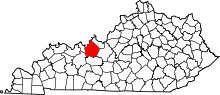 | |
| Unincorporated communities | ||
| Footnotes | ‡This populated place also has portions in an adjacent county or counties | |
This article is issued from
Wikipedia.
The text is licensed under Creative Commons - Attribution - Sharealike.
Additional terms may apply for the media files.