Toa Alta, Puerto Rico
Toa Alta (Spanish pronunciation: [ˈtoa ˈalta]) is a municipality of Puerto Rico located in the northern coast of the island, north of Naranjito; south of Dorado and Toa Baja; east of Vega Alta and Corozal; and west of Bayamón. Toa Alta is spread over eight wards and Toa Alta Pueblo (the downtown area and the administrative center of the city). It is part of the San Juan-Caguas-Guaynabo metropolitan statistical area.[1]
Toa Alta Municipio de Toa Alta | |
|---|---|
City and municipality | |
 Iglesia de Nuestra Señora de la Concepción y San Fernando | |
 Flag  Coat of arms | |
| Nicknames: La Ciudad del Toa, Cuna de Poetas, Ciudad del Josco | |
| Anthem: "Cuna de historia y de grandes poetas" | |
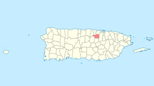 Location of Toa Alta in Puerto Rico | |
| Coordinates: 18°23′18″N 66°14′54″W | |
| Commonwealth | |
| Founded | 1751 |
| Government | |
| • Mayor | Clemente "Chito" Agosto (PPD) |
| • Senatorial dist. | 2 - Bayamón |
| • Representative dist. | 11 |
| Area | |
| • Total | 27.44 sq mi (71.08 km2) |
| • Land | 27.37 sq mi (70.88 km2) |
| • Water | 0.08 sq mi (0.20 km2) |
| Elevation | 236 ft (72 m) |
| Population (2010) | |
| • Total | 74,066 |
| • Density | 2,700/sq mi (1,000/km2) |
| Demonym(s) | Toalteños |
| Time zone | UTC−4 (AST) |
| Zip code | 00953, 00954 |
| Area code | +1 (spec. +1-787 and +1-939) |
| Major routes | |
History
Toa Alta is located west of the capital city of San Juan and was founded in 1751, making it one of the oldest towns on the island of Puerto Rico. The construction of the San Fernando Rey church in the town square began in 1752. The name Toa Alta comes from the Taíno word for mother or fertility, Thoa. Over the years, agriculture became an important economic force in the area. At the peak of the agricultural economy, the town was also known as the "Granja de los Reyes Católicos" (the Farm of the Catholic Monarchs). The town is also called Ciudad del Josco. The town is commonly known by its nickname La Cuna de los Poetas, or "Cradle of Poets", due to the numerous Spanish-language poets born there, such as Abelardo Díaz Alfaro and the musician Tomás "Masso" Rivera.[2]
Hurricane Maria
Hurricane Maria on September 20, 2017 triggered numerous landslides in Toa Alta with the significant amount of rainfall.[3][4]
Flood control project
In mid 2018, the United States Army Corps of Engineers announced it would be undertaking a major flood control project of a river that often causes flooding in Toa Alta, Río de la Plata.[5]
Geography
Toa Alta belongs to the Northern Coastal Plain and to the karst zone.[6]
Barrios
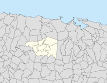
Like all municipalities of Puerto Rico, Toa Alta is subdivided into barrios. The municipal buildings, central square and large Catholic church are located in a barrio referred to as "el pueblo".[7][8][9][10]
Sectors
Barrios (which are like minor civil divisions)[11] in turn are further subdivided into smaller local populated place areas/units called sectores (sectors in English). The types of sectores may vary, from normally sector to urbanización to reparto to barriada to residencial, among others.[12][13][14]
Demographics
| Historical population | |||
|---|---|---|---|
| Census | Pop. | %± | |
| 1900 | 7,908 | — | |
| 1910 | 9,127 | 15.4% | |
| 1920 | 10,505 | 15.1% | |
| 1930 | 11,696 | 11.3% | |
| 1940 | 13,371 | 14.3% | |
| 1950 | 14,155 | 5.9% | |
| 1960 | 15,711 | 11.0% | |
| 1970 | 18,964 | 20.7% | |
| 1980 | 31,910 | 68.3% | |
| 1990 | 44,101 | 38.2% | |
| 2000 | 63,929 | 45.0% | |
| 2010 | 74,066 | 15.9% | |
| U.S. Decennial Census[17] 1899 (shown as 1900)[18] 1910-1930[19] 1930-1950[20] 1960-2000[21] 2010[9] | |||
Tourism
Landmarks and places of interest
- Legendary Tree Bala de Cañón
- Tomás "Maso" Rivera Municipal Teather
- Tomás "Maso" Rivera Statue
- Plaza Recreo Egozcué
- San Fernando Rey Parish
- Villa Tropical Recreation Center
- Plaza Aquarium Mall
- Valle El Toa
Economy
Culture
Festivals and events
- Festival El Josco - Festival of the mechanical bull, held in October [22]
- Chopa Marathon - March
- Festival de Bellas Artes - April
- Patron Celebrations - May
- Typical Music - November
Government
Like all municipalities in Puerto Rico, Toa Alta is administered by a mayor. The current mayor is Clemente Agosto, from the Popular Democratic Party (PPD). Agosto was elected at the 2012 general election.
The city belongs to the Puerto Rico Senatorial district II, which is represented by two senators. Migdalia Padilla and Carmelo Ríos Santiago have served as District Senators since 2005.[23]
Transportation
There are 16 bridges in Toa Alta.[24] In January, 2019 the mayor of Toa Alta fought for the reopening of highway 861, which, he stated, was closed without warning by Puerto Rico Public Works.[25]
Symbols
Flag
Horizontally divided in three, the bottom and top red stripes are double the size of the center yellow stripe. In the upper left corner is a yellow, eight-point star. The original design was elaborated by professor Herman E. Perez and adopted by the City Council in 1983.
Coat of arms
The shield in gold, a red board with a silver sword topped with a gold crown of the same metal, to each side two small shields in red, the right-hand one with a tower in gold and the left-hand one with a gold eight point star, a five tower crown lined in black with red openings. The motto is Non Deserit Alta and Professor Herman E. Pérez included it in the coat of arms so that present and future generations will remember to “not abandon higher principles and values”.
Education
There are several public and private schools in Toa Alta and public education is handled by the Puerto Rico Department of Education.[26]
Elementary schools
- Alejandro Junior Cruz
- Heraclio Rivera Colón
- José de Diego
- José María del Valle
- Luis Muñoz Rivera
- Manuel Velilla
- María C. Osorio
- Merced Marcano
- Secundino Díaz
- Violanta Jiménez
- Virgilio Morales
Middle and junior high schools
- José Pablo Morales
- Abelardo Díaz Alfaro
- Felipe Díaz González
High schools
- Adela Rolón Fuentes
- Nicolás Sevilla
- Tomás "Maso" Rivera Morales
Private schools
- Academia Cristiana Yarah
- Colegio Doriber
Notable natives and residents
- Sergeants José Díaz and Francisco Díaz – defended Puerto Rico from a British invasion in 1797
- Dayanara Torres Delgado – Miss Universe 1993
- Yarelis Salgado – model and actress
See also
- List of Puerto Ricans
- History of Puerto Rico
- Did you know-Puerto Rico?
References
- "Gobierno de Puerto Rico - Toa Alta, Puerto Rico". Archived from the original on 2009-06-18. Retrieved 2010-08-06.
- "Plan Ordenamiento Territorial del Municipio de Toa Alta" (PDF). Gobierno de Puerto Rico Oficina del Gobernador Junta de Planificación. Archived (PDF) from the original on 2019-06-13. Retrieved 2019-06-02.
- "Preliminary Locations of Landslide Impacts from Hurricane Maria, Puerto Rico". USGS Landslide Hazards Program. USGS. Archived from the original on 2019-03-03. Retrieved 2019-03-03.
- "Preliminary Locations of Landslide Impacts from Hurricane Maria, Puerto Rico" (PDF). USGS Landslide Hazards Program. USGS. Archived (PDF) from the original on 2019-03-03. Retrieved 2019-03-03.
- "USACE: $3.348 billion go toward reducing flood risk in Florida, Puerto Rico and USVI". Caribbean Business. 6 July 2018. Archived from the original on 1 June 2019. Retrieved 1 June 2019.
- "Toa Alta Municipality". enciclopediapr.org. Fundación Puertorriqueña de las Humanidades (FPH).
- Picó, Rafael; Buitrago de Santiago, Zayda; Berrios, Hector H. Nueva geografía de Puerto Rico: física, económica, y social, por Rafael Picó. Con la colaboración de Zayda Buitrago de Santiago y Héctor H. Berrios. San Juan Editorial Universitaria, Universidad de Puerto Rico,1969. Archived from the original on 2018-12-26. Retrieved 2018-12-30.
- Gwillim Law (20 May 2015). Administrative Subdivisions of Countries: A Comprehensive World Reference, 1900 through 1998. McFarland. p. 300. ISBN 978-1-4766-0447-3. Retrieved 25 December 2018.
- Puerto Rico:2010:population and housing unit counts.pdf (PDF). U.S. Dept. of Commerce Economics and Statistics Administration U.S. Census Bureau. 2010. Archived (PDF) from the original on 2017-02-20. Retrieved 2018-12-26.
- "Map of Toa Alta at the Wayback Machine" (PDF). Archived from the original (PDF) on 2018-03-24. Retrieved 2018-12-29.
- "US Census Barrio-Pueblo definition". factfinder.com. US Census. Archived from the original on 13 May 2017. Retrieved 5 January 2019.
- "Agencia: Oficina del Coordinador General para el Financiamiento Socioeconómico y la Autogestión (Proposed 2016 Budget)". Puerto Rico Budgets (in Spanish). Retrieved 28 June 2019.
- Rivera Quintero, Marcia (2014), El vuelo de la esperanza: Proyecto de las Comunidades Especiales Puerto Rico, 1997-2004 (first ed.), San Juan, Puerto Rico Fundación Sila M. Calderón, ISBN 978-0-9820806-1-0
- "Leyes del 2001". Lex Juris Puerto Rico (in Spanish). Retrieved 24 June 2020.
- Rivera Quintero, Marcia (2014), El vuelo de la esperanza: Proyecto de las Comunidades Especiales Puerto Rico, 1997-2004 (First ed.), San Juan, Puerto Rico Fundación Sila M. Calderón, p. 273, ISBN 978-0-9820806-1-0
- "Comunidades Especiales de Puerto Rico" (in Spanish). 8 August 2011. Archived from the original on 24 June 2019. Retrieved 24 June 2019.
- "U.S. Decennial Census". United States Census Bureau. Archived from the original on February 13, 2020. Retrieved September 21, 2017.
- "Report of the Census of Porto Rico 1899". War Department Office Director Census of Porto Rico. Archived from the original on July 16, 2017. Retrieved September 21, 2017.
- "Table 3-Population of Municipalities: 1930 1920 and 1910" (PDF). United States Census Bureau. Archived (PDF) from the original on August 17, 2017. Retrieved September 21, 2017.
- "Table 4-Area and Population of Municipalities Urban and Rural: 1930 to 1950" (PDF). United States Census Bureau. Archived (PDF) from the original on August 30, 2015. Retrieved September 21, 2014.
- "Table 2 Population and Housing Units: 1960 to 2000" (PDF). United States Census Bureau. Archived (PDF) from the original on July 24, 2017. Retrieved September 21, 2017.
- "Archived copy". Archived from the original on 2019-10-29. Retrieved 2019-10-29.CS1 maint: archived copy as title (link)
- Elecciones Generales 2008: Escrutinio General Archived 2011-11-20 at the Wayback Machine on CEEPUR
- "Toa Alta Bridges". National Bridge Inventory Data. US Dept. of Transportation. Archived from the original on 21 February 2019. Retrieved 20 February 2019.
- Claudio, Ronald Ávila. "Alcalde de Toa Alta dice enfrentará al DTOP para evitar cierre de carretera". Metro. Archived from the original on 2019-01-13. Retrieved 2019-03-15.
- "Educación". toalta.tripod.com. Archived from the original on 2011-07-17. Retrieved 2010-08-06.