Cabo Rojo, Puerto Rico
Cabo Rojo (Spanish pronunciation: [ˈkaβo ˈroxo]) is a municipality situated on the southwest coast of Puerto Rico and forms part of the San Germán–Cabo Rojo metropolitan area as well as the larger Mayagüez–San Germán–Cabo Rojo Combined Statistical Area.
Cabo Rojo Municipio Autónomo de Cabo Rojo | |
|---|---|
City and Municipality | |
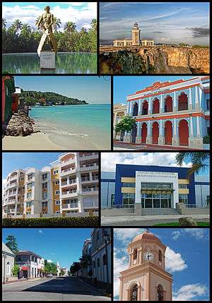 Collage of Cabo Rojo | |
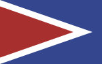 Flag 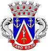 Coat of arms | |
| Nicknames: "Cuna de Cofresí", "Los Mata con Hacha", "Ciudad Maravillosa", "Cuna de Betances", "Capital del Turismo" | |
| Anthem: "Mi Cabo Rojo Querido" | |
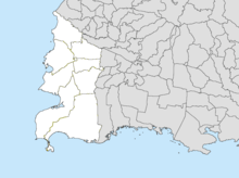
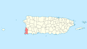 Location of Cabo Rojo in Puerto Rico | |
| Coordinates: 18°05′12″N 67°08′45″W | |
| Commonwealth | |
| Founded | December 17, 1771 |
| Government | |
| • Mayor | Bobby Ramírez Kurtz (PPD) |
| • Senatorial dist. | 4 - Mayagüez |
| • Representative dist. | 20 |
| Area | |
| • City and Municipality | 177.40 sq mi (459.5 km2) |
| • Land | 70.35 sq mi (182.2 km2) |
| • Water | 107.05 sq mi (277.3 km2) |
| Population (2010) | |
| • City and Municipality | 50,917 |
| • Density | 666.8/sq mi (257.5/km2) |
| • Metro | 136,212 |
| • CSA | 251,260 |
| Demonym(s) | Caborrojeños |
| Time zone | UTC−4 (AST) |
| Zip code | 00623, 00622 |
| Major routes | |
| Website | www |
History
The area near Las Salinas (salt flats) has been inhabited since 30 BC and AD 120 according to archaeological evidence. Punta Ostiones, listed in the National Register of Historic Places as an archeological site, was home to a large group of Archaic Indians.[2]
Despite the threat of pirates and natives, the Spanish settled the area of Los Morrillos around 1511. By 1525, salt mining was an important industry in the area. In 1759 the first request to establish itself as a town was denied. Cabo Rojo was founded on December 17, 1771 by Don Nicolás Alfonso Ramírez de Arellano y Martínez de Matos, a descendant of Spanish royalty and nobility, with the approval of Governor and Captain General Miguel de Muesas. According to Fray Iñigo Abbad y Lasierra by the end of the 18th century, Cabo Rojo had a population of 1,215 people.
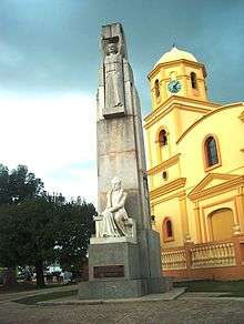
Cabo Rojo (Red Cape in English) derives its name from both the reddish color of its salt-flats and the reddish tint that characterizes the seaside cliffs along its southern coast. According to legend, the name was given by Christopher Columbus himself. The first church, founded in 1783, was called San José. The present-day main Catholic church is called San Miguel Arcángel Church located in the town's square.
Geography
The municipality of Cabo Rojo lies on the southern-west corner of the island of Puerto Rico, on the Western Coastal Plains. It is bordered by Mayagüez and Hormigueros to the north, San Germán and Lajas to the east, the Caribbean Sea to the south and the Mona Passage to the west. Cabo Rojo has a surface area of 72 square miles (187 km2).[3]
Cabo Rojo's terrain is plain. However, some notable peaks are Mariquita, Buena Vista, Vargas, and Peñones de Melones.
Barrios
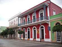
Like all municipalities of Puerto Rico, Cabo Rojo is subdivided into barrios. The municipal buildings, central square and large Catholic church are located in a small barrio referred to as "el pueblo", near the center of the municipality.[4][5] Cabo Rojo is a principal municipality of the San Germán–Cabo Rojo metropolitan area as well as the larger Mayagüez–San Germán–Cabo Rojo Combined Statistical Area.
People from the El Combate community in barrio Boquerón are known as mata con hacha ("those who kill with axes") based on an old folk tale about a fight over the salinas, where those from Cabo Rojo fought with axes against people from the adjacent town of Lajas. The latter apparently fought back by throwing stones and are thus known as tira piedras ("those who throw stones").[7]
Sectors
Barrios (which are like minor civil divisions)[6] in turn are further subdivided into smaller local populated place areas/units called sectores (sectors in English). The types of sectores may vary, from normally sector to urbanización to reparto to barriada to residencial, among others.[8][9][10]
Special Communities
Of the 742 places on the list of Comunidades Especiales de Puerto Rico, the following barrios, communities, sectors, or neighborhoods were in Cabo Rojo in 2014: Ballajá, Colacho, El Fuego y Las Piedras (Guaniquilla), Hoyo Bravo, Las Quebradas en Monte Grande, Pedernales, Puerto Real, and Sector Corozo.[11]
Climate
| Month | Jan | Feb | Mar | Apr | May | Jun | Jul | Aug | Sep | Oct | Nov | Dec | Year |
|---|---|---|---|---|---|---|---|---|---|---|---|---|---|
| Record high °F (°C) | 91 (33) |
92 (33) |
95 (35) |
95 (35) |
95 (35) |
99 (37) |
99 (37) |
97 (36) |
98 (37) |
97 (36) |
98 (37) |
98 (37) |
96.2 (35.7) |
| Average high °F (°C) | 87 (31) |
87 (31) |
88 (31) |
89 (32) |
90 (32) |
91 (33) |
92 (33) |
92 (33) |
91 (33) |
90 (32) |
89 (32) |
88 (31) |
89.5 (31.9) |
| Daily mean °F (°C) | 75 (24) |
75 (24) |
76 (24) |
78 (26) |
80 (27) |
81 (27) |
81 (27) |
81 (27) |
81 (27) |
80 (27) |
78 (26) |
76 (24) |
78.5 (25.8) |
| Average low °F (°C) | 62 (17) |
62 (17) |
64 (18) |
66 (19) |
69 (21) |
71 (22) |
70 (21) |
70 (21) |
70 (21) |
69 (21) |
67 (19) |
63 (17) |
66.9 (19.4) |
| Record low °F (°C) | 44 (7) |
51 (11) |
50 (10) |
50 (10) |
56 (13) |
58 (14) |
53 (12) |
58 (14) |
60 (16) |
56 (13) |
53 (12) |
49 (9) |
53.2 (11.8) |
| Average rainfall inches (mm) | 2.51 (64) |
2.19 (56) |
2.19 (56) |
3.43 (87) |
5.14 (131) |
2.70 (69) |
3.13 (80) |
5.23 (133) |
6.20 (157) |
7.29 (185) |
5.71 (145) |
2.33 (59) |
48.05 (1,220) |
| Source: Weather.com[12] | |||||||||||||
Demographics
The United States took control of Puerto Rico from Spain in the aftermath of the Spanish-American War under the terms of the Treaty of Paris of 1898 and conducted its first census of Puerto Rico, finding that the population of Cabo Rojo was 16,154.
| Historical population | |||
|---|---|---|---|
| Census | Pop. | %± | |
| 1900 | 16,154 | — | |
| 1910 | 19,562 | 21.1% | |
| 1920 | 22,412 | 14.6% | |
| 1930 | 23,792 | 6.2% | |
| 1940 | 28,586 | 20.1% | |
| 1950 | 29,546 | 3.4% | |
| 1960 | 24,868 | −15.8% | |
| 1970 | 26,060 | 4.8% | |
| 1980 | 34,045 | 30.6% | |
| 1990 | 38,521 | 13.1% | |
| 2000 | 46,911 | 21.8% | |
| 2010 | 50,917 | 8.5% | |
| U.S. Decennial Census[13] 1899 (shown as 1900)[14] 1910-1930[15] 1930-1950[16] 1960-2000[17] 2010[18] | |||
Tourism
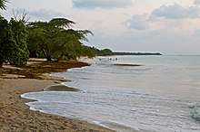
There are 127 beaches in Cabo Rojo, including Playa Sucia.[19]
Its tourism industry has flourished with the development of hotels and marinas, but local and international environmentalists are concerned that this development will endanger Cabo Rojo's rich and beautiful beaches, sunsets and natural resources. Cabo Rojo is also well known for its fishing, particularly the Puerto Real fishing village, and its many seafood restaurants, most of which are found in the barrio of Joyuda.
Landmarks and places of interest

The San Miguel Arcángel Church, in the town plaza, was built between 1773 and 1783. The famous Cabo Rojo lighthouse, Los Morrillos Lighthouse, known by locals as El Faro, was built in 1881 over limestone cliffs that rise 200 feet above sea level. This old lighthouse was automated and electrically charged in 1967 and is considered to have some, if not, the most spectacular ocean views on Puerto Rico's west coast. The lighthouse has undergone recent renovations which has created controversy because of the quality of the work. According to locals and scholars, the internal structure was gutted leaving nothing of historical significance behind.
The lighthouse is located near the Salinas, or salt mines. These salt mines are reported to be the oldest industry in the New World. Salt has been mined in this site non-stop since the time of the Taínos. Near the Salinas, a local civic group Caborrojeños Pro Salud y Ambiente run a visitor's center known as the Centro Interpretativo Las Salinas De Cabo Rojo don Efrén Pérez Rivera. They offer free guided tours of the local area, which is rich in flora and fauna.
- Boquerón Beach
- Cofresí Cave
- El Combate Beach
- Joyuda Beach
- Joyuda Lagoon
- Market Plaza
- Club Deportivo del Oeste
- Nautical Club
- Punta Arenas Beach
- Punta Real Beach
- Isla de Ratones
- Buyé Beach
- The Lighthouse (El Faro) Beach
- La Playuela in Los Morrillos (El Faro)
National protected areas
- The Cabo Rojo National Wildlife Refuge is home for a number of native bird species including the endangered yellow-shouldered blackbird also known as la mariquita de Puerto Rico or capitán.
- The Boquerón State Forest is one of seven state forests managed by the Puerto Rico Department of Natural and Environmental Resources.[20]
Culture
Festivals and events
- Pescao Festival - March
- Años Cuarenta Festival - April
- Chigüero Festival - April
- Betances Festival - April
- Oyster Festival - May
- Boquerón Bay Crossing - July
- Watermelon Festival - July
- Retorno a la Arena - July
- Patron Festivities - September
- La Pileta Festival - December
- Le Lo Lai Festival - December
Sports
Cabo Rojo had a BSN basketball team, Los Turistas de Cabo Rojo (the "Cabo Rojo Tourists") from 1989 to 1993.
Indias de Mayagüez, female Volleyball team from Liga de Voleibol Superior Femenino played the 2009 season at the Coliseo Rebekah Colberg Cabrera, because their home ground, Palacios de los Deportes, was under remodeling.[21]
Economy
Government
All municipalities in Puerto Rico are administered by a [mayor], elected every four years. The current mayor of Cabo Rojo is Bobby Ramírez Kurtz, who beat incumbent Perza Rodríguez at the 2012 general election. Rodríguez, a member of the New Progressive Party of Puerto Rico (PNP), became mayor after the death of Santos Padilla Ferrer in the year 2007.
The city belongs to the Puerto Rico Senatorial district IV, which is represented by two Senators. In 2012, María Teresa González and Gilberto Rodríguez were elected as District Senators.[22]
Symbols
Flag
The flag contains elements of the coat of arms, excluding the sword, the anchors and the crown.
Coat of arms
The point or red triangle symbolizes the "Cabo Bermejo" (Vermillion Cape) in Los Morillos. The blue and white, with the anchors, represent the sea that "bathes our coasts". The flaming sword, is an attribute to Archangel Saint Michael, the town's patron saint. Finally, the crown, which heightens and distinguishes the shield, stands for the status of Cabo Rojo.
Anthem
The anthem of Cabo Rojo is a composition with music and lyrics by Carlos Weber Asencio.
Transportation
Although Cabo Rojo lacks an airport, it is approximately 11 miles from the Eugenio María de Hostos Airport (MAZ), a commercial airport that serves direct flights to and from San Juan. Cabo Rojo has grown tremendously in the last few years as evidenced by its recent accreditation as a city. Cabo Rojo's nearest airport servicing international destinations is forty-five minutes away in Aguadilla's Rafael Hernández Airport (BQN). This airport was part of the now deactivated Ramey Air Force Base.
PR-100 is the main highway in the city, connecting northward to PR-2 between Hormigueros and Mayagüez, and southward to the Boquerón sector. Other mayor roads include PR-101, which connects to Lajas, PR-102, connecting to Mayagüez and San Germán, PR-103, an older road which parallels the newer PR-100, and PR-301, connecting to El Combate sector and the Los Morrillos Lighthouse.
There are 20 bridges in Cabo Rojo.[23]
Notable Caborrojeños
The following is a list of notable Caborrojeños:
- Antonio Fas Alzamora is the longest serving member of the Puerto Rico Legislative Assembly.
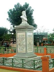
- Ramón Emeterio Betances y Alacán (1827–1898) was a nationalist and a medical doctor. He was the primary instigator of the Grito de Lares revolution and, as such, is considered to be the father of the Puerto Rican independence movement and, as well, the Father of the Country.
- Dr. Salvador Brau y Asencio (1842–1912) was a journalist, poet, writer and also a historian.
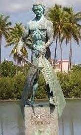
- Roberto Cofresí y Ramírez de Arellano (1791–1825), better known as "El Pirata Cofresí", was a pirate.
- Elisa Colberg (1903–1988) was the founder of the Puerto Rican Girl Scouts, the first troop of which formed in 1926 in Cabo Rojo.
- Efrén Pérez Rivera is a former college professor and noted Puerto Rican environmentalist leader.
- Colonel Carlos Betances Ramírez (1910–2001), was the only Puerto Rican to command a Battalion in the Korean War.
- Dra. Rebekah Colberg (1918–1985), is known as "The Mother of Women's Sports in Puerto Rico".
- Ramón López Irizarry (1897–1982) was an educator and scientist who invented an easier way to extract the cream from the coconut pulp and developed the original formula of "Coco Lopez".
Due to space limitations it is almost impossible to list all of the people of Cabo Rojo who have distinguished themselves, therefore a category has been created to this effect:
See also
- List of Puerto Ricans
- History of Puerto Rico
- National Register of Historic Places listings in Cabo Rojo, Puerto Rico
References
- "Archived copy". Archived from the original on 2020-02-12. Retrieved 2006-07-14.CS1 maint: archived copy as title (link)
- "Inventory of Historic Light Stations National Park Service". Archived from the original on 2010-06-28. Retrieved 2010-02-21.
- "Cabo Rojo Municipality". Fundación Puertorriqueña de las Humanidades (FPH).
- Gwillim Law (20 May 2015). Administrative Subdivisions of Countries: A Comprehensive World Reference, 1900 through 1998. McFarland. p. 300. ISBN 978-1-4766-0447-3. Retrieved 25 December 2018.
- "Map of Cabo Rojo at the Wayback Machine" (PDF). Archived from the original (PDF) on 2018-03-24. Retrieved 2018-12-29.
- "US Census Barrio-Pueblo definition". Fact Finder. US Census. Archived from the original on 13 May 2017. Retrieved 5 January 2019.
- "Página Oficial Municipio Autónomo de Cabo Rojo". Cabo Rojo PR. Archived from the original on 2019-04-04. Retrieved 2019-03-14.
- "Agencia: Oficina del Coordinador General para el Financiamiento Socioeconómico y la Autogestión (Proposed 2016 Budget)". Puerto Rico Budgets (in Spanish). Retrieved 28 June 2019.
- Rivera Quintero, Marcia (2014), El vuelo de la esperanza: Proyecto de las Comunidades Especiales Puerto Rico, 1997-2004 (first ed.), San Juan, Puerto Rico Fundación Sila M. Calderón, ISBN 978-0-9820806-1-0
- "Leyes del 2001". Lex Juris Puerto Rico (in Spanish). Retrieved 24 June 2020.
- Rivera Quintero, Marcia (2014), El vuelo de la esperanza:Proyecto de las Comunidades Especiales Puerto Rico, 1997-2004 (Primera edición ed.), San Juan, Puerto Rico Fundación Sila M. Calderón, p. 273, ISBN 978-0-9820806-1-0
- "Monthly Averages for Cabo Rojo, PR (00623)". Weather.com. Archived from the original on 2014-10-29. Retrieved September 26, 2014.
- "U.S. Decennial Census". United States Census Bureau. Archived from the original on February 13, 2020. Retrieved September 21, 2017.
- "Report of the Census of Porto Rico 1899". War Department Office Director Census of Porto Rico. Archived from the original on July 16, 2017. Retrieved September 21, 2017.
- "Table 3-Population of Municipalities: 1930 1920 and 1910" (PDF). United States Census Bureau. Archived (PDF) from the original on August 17, 2017. Retrieved September 21, 2017.
- "Table 4-Area and Population of Municipalities Urban and Rural: 1930 to 1950" (PDF). United States Census Bureau. Archived (PDF) from the original on August 30, 2015. Retrieved September 21, 2014.
- "Table 2 Population and Housing Units: 1960 to 2000" (PDF). United States Census Bureau. Archived (PDF) from the original on July 24, 2017. Retrieved September 21, 2017.
- Puerto Rico:2010:population and housing unit counts.pdf (PDF). U.S. Dept. of Commerce Economics and Statistics Administration U.S. Census Bureau. 2010. Archived (PDF) from the original on 2017-02-20. Retrieved 2018-12-28.
- "Las 1,200 playas de Puerto Rico [The 1200 beaches of Puerto Rico]". Primera Hora (in Spanish). April 14, 2017. Archived from the original on December 12, 2019. Retrieved December 12, 2019.
- "BOSQUE ESTATAL DE BOQUERÓN". Archived from the original on 2009-01-29. Retrieved 2009-03-19.
- "Beltrán aprueba usar cancha Mario Jiménez de Guaynabo". Primera Hora (in Spanish). January 7, 2009. Archived from the original on 2014-04-21.
- Elecciones Generales 2012: Escrutinio General Archived November 27, 2012, at the Wayback Machine on CEEPUR
- "Cabo Rojo Bridges". National Bridge Inventory Data. US Dept. of Transportation. Archived from the original on 20 February 2019. Retrieved 19 February 2019.
External links
| Wikimedia Commons has media related to Cabo Rojo. |
| Authority control |
|
|---|