Gurabo, Puerto Rico
Gurabo (Spanish pronunciation: [ɡuˈɾaβo]) is a municipality in eastern Puerto Rico (U.S.) located in the central eastern region, north of San Lorenzo; south of Trujillo Alto; east of Caguas; and west of Carolina and Juncos. Gurabo is spread over 9 wards and Gurabo Pueblo (the downtown area and the administrative center of the city). It is part of the San Juan-Caguas-Guaynabo Metropolitan Statistical Area.
Gurabo | |
|---|---|
Town and Municipality | |
 | |
 Flag | |
| Nicknames: El Pueblo de las Escaleras", "Puerta del Turismo del Sureste | |
| Anthem: "En un valle rodeado por montañas nace un" | |
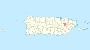 Location of Gurabo in Puerto Rico | |
| Coordinates: 18°15′16″N 65°58′23″W | |
| Commonwealth | |
| Founded | 1815 |
| Government | |
| • Mayor | Rosachely Rivera (NPP) |
| • Senatorial dist. | 7 - Humacao |
| • Representative dist. | 31,32 |
| Area | |
| • Total | 73.24 km2 (28.28 sq mi) |
| • Land | 72.11 km2 (27.84 sq mi) |
| • Water | 1.13 km2 (0.44 sq mi) |
| Population (2010) | |
| • Total | 45,369 |
| • Density | 620/km2 (1,600/sq mi) |
| Demonym(s) | Gurabeños |
| Time zone | UTC-4 (AST) |
| Zip code | 00778 |
| Area code | 787, 939 |
| Major routes | |
| Website | gurabopr.com |
History
Gurabo's history dates as far back as the 17th century, when Gurabo was actually part of Caguas. Then, the area was known as Burabo. By 1700, transportation, medical and economic trouble were crippling the population of the Burabo area; traveling to Caguas' center for business and medical help was not easy and took hours. This led to many of Burabos citizens to seek for the area to gain autonomy.
It would be long, however, before Gurabo was separated from Caguas. The separation movement was brought forward by an 1812 meeting of all 168 family leaders in Gurabo, who decided to have Luis del Carmen Echevarría lead them in their quest for autonomic independence, based on the large number of residents in Burabo.
In 1815, Gurabo became a municipality. In 1822, the first Catholic church in town was erected. In 1903, the first Baptist church opened its doors in Gurabo town.
Gurabo is also known as "La Ciudad de las Escaleras", or "city of the stairs". Located in the town center, the stairs are about twenty two floors high, and they are painted in bright colors. They cross an important business area of Gurabo. Gurabo's mayor is Rosachely Rivera Santana.[1]
Geography
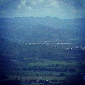
Gurabo is located on the east side of Puerto Rico.[2]
Hurricane Maria
Hurricane Maria on September 20, 2017 triggered numerous landslides in Gurabo with the significant amount of rainfall.[3][4]
Bodies of water
Located in Gurabo are a number of rivers, streams, and unnamed creeks.[5] Rio Gurabo is in Gurabo and a portion of the Río Grande de Loíza runs through Gurabo.[6][7] In 2018, the U.S. Army Corps of Engineers announced work would be done on Gurabo river.[1]
Barrios
Like all municipalities of Puerto Rico, Gurabo is subdivided into barrios. The municipal buildings, central square and large Catholic church are located in a small barrio referred to as "el pueblo", located near the center of the municipality.[8][9][10][11]
Sectors
Barrios (which are like minor civil divisions)[12] in turn are further subdivided into smaller local populated place areas/units called sectores (sectors in English). The types of sectores may vary, from normally sector to urbanización to reparto to barriada to residencial, among others.[13][14][15]
Special Communities
Of the 742 places on the list of Comunidades Especiales de Puerto Rico, the following barrios, communities, sectors, or neighborhoods were in Gurabo: El Cerro, Estancias de Hato Nuevo, and Villa Alegre.[16]
Economy
Agriculture
- Dairy Farms
Industry
Manufacturing (metal, paper, plastics, chemicals, pharmaceuticals, textiles, electrical and electronic equipment, and electrical machinery)
Tourism
Landmarks and places of interest
Some landmarks and places of interest in Gurabo include:[17]
- Centro de Exposición - Exhibition Center
- El Cerro
- Former City Hall and Clock
- San José Parish
- Luis Muñoz Marín Plaza
- Hacienda Mirador - Mirador Estate
- Loíza Lagoon
- University of Turabo Museum
- Cofresí Park
Culture
Festivals and events
- San José Patron Festivities - March
- Mapeyé Festival - October
- El Festival del Jodío, which roughly translates to the "Festival of the person who is down on their luck". The seventh annual fair was held in May, 2017. With the assistant of a local bank, funds are collected to help a person in the community with severe medical needs.[18]
Sports
Gurabo has a baseball academy named Puerto Rico Baseball Academy and High School (PRBAHS).
Colegio Bautista de Gurabo (Sports: Volleyball, Soccer, Basketball, Softball, Track and Field.) colegiobautistadegurabo.com
Demographics
| Historical population | |||
|---|---|---|---|
| Census | Pop. | %± | |
| 1900 | 8,700 | — | |
| 1910 | 11,139 | 28.0% | |
| 1920 | 12,882 | 15.6% | |
| 1930 | 15,095 | 17.2% | |
| 1940 | 15,870 | 5.1% | |
| 1950 | 16,395 | 3.3% | |
| 1960 | 16,603 | 1.3% | |
| 1970 | 18,289 | 10.2% | |
| 1980 | 23,574 | 28.9% | |
| 1990 | 28,737 | 21.9% | |
| 2000 | 36,743 | 27.9% | |
| 2010 | 45,369 | 23.5% | |
| U.S. Decennial Census[19] 1899 (shown as 1900)[20] 1910-1930[21] 1930-1950[22] 1960-2000[23] 2010[10] | |||
In 2000, Gurabo had a population of 36,743 and in 2010 it had a population of 45,369.[24]
Government
Like all municipalities in Puerto Rico, Gurabo is administered by a mayor. The current mayor is Rosachely Rivera, from the New Progressive Party (PNP). Rivera was elected at the Gurabo mayor special election, 2017.
The city belongs to the Puerto Rico Senatorial district VII, which is represented by two Senators. In 2016, Miguel Laureano and José Luis Dalmau were elected as District Senators.[25]
Transportation
There are 20 bridges in Gurabo.[5]
Symbols
The symbols of Gurabo are:[17]
Flag
With eleven stripes, six green and five yellow, alternated, the yellow with the superior (top) edge indented forming a stairway.
Coat of arms
In a green field resides a widened gold patriarchal cross. Below the bottom arm are two shields in silver. The one on the left has a fleur de lis and the one on the right three lilies with stems in a natural way. Three towers in gold crown the shield.
Education
- Turabo University
- Puerto Rico Criminal Justice College- Gurabo campus (Puerto Rico Police Academy)
See also
- List of Puerto Ricans
- History of Puerto Rico
- Did you know-Puerto Rico?
References
- "Canalizarán el Río Gurabo". Primera Hora (in Spanish). July 10, 2018. Archived from the original on 19 February 2019. Retrieved 18 February 2019.
- "Gurabo Municipality". enciclopediapr.org. Fundación Puertorriqueña de las Humanidades (FPH).
- "Preliminary Locations of Landslide Impacts from Hurricane Maria, Puerto Rico". USGS Landslide Hazards Program. USGS. Archived from the original on 2019-03-03. Retrieved 2019-03-03.
- "Preliminary Locations of Landslide Impacts from Hurricane Maria, Puerto Rico" (PDF). USGS Landslide Hazards Program. USGS. Archived (PDF) from the original on 2019-03-03. Retrieved 2019-03-03.
- "Gurabo Bridges". National Bridge Inventory Data. US Dept. of Transportation. Archived from the original on 20 February 2019. Retrieved 19 February 2019.
- "Rios de Puerto Rico" (in Spanish). Archived from the original on October 23, 2008.
- "Jacksonville District Navigable Waters Lists" (PDF). saj.usace.army.mil. SAJ. Archived (PDF) from the original on 2017-01-26. Retrieved 18 February 2019.
- Picó, Rafael; Buitrago de Santiago, Zayda; Berrios, Hector H. Nueva geografía de Puerto Rico: física, económica, y social, por Rafael Picó. Con la colaboración de Zayda Buitrago de Santiago y Héctor H. Berrios. San Juan Editorial Universitaria, Universidad de Puerto Rico,1969. Archived from the original on 2018-12-26. Retrieved 2019-01-04.
- Gwillim Law (20 May 2015). Administrative Subdivisions of Countries: A Comprehensive World Reference, 1900 through 1998. McFarland. p. 300. ISBN 978-1-4766-0447-3. Retrieved 25 December 2018.
- Puerto Rico:2010:population and housing unit counts.pdf (PDF). U.S. Dept. of Commerce Economics and Statistics Administration U.S. Census Bureau. 2010. Archived (PDF) from the original on 2017-02-20. Retrieved 2019-01-04.
- "Map of Gurabo at the Wayback Machine" (PDF). Archived from the original (PDF) on 2018-03-24. Retrieved 2018-12-29.
- "US Census Barrio-Pueblo definition". factfinder.com. US Census. Archived from the original on 13 May 2017. Retrieved 5 January 2019.
- "Agencia: Oficina del Coordinador General para el Financiamiento Socioeconómico y la Autogestión (Proposed 2016 Budget)". Puerto Rico Budgets (in Spanish). Retrieved 28 June 2019.
- Rivera Quintero, Marcia (2014), El vuelo de la esperanza: Proyecto de las Comunidades Especiales Puerto Rico, 1997-2004 (first ed.), San Juan, Puerto Rico Fundación Sila M. Calderón, ISBN 978-0-9820806-1-0
- "Leyes del 2001". Lex Juris Puerto Rico (in Spanish). Retrieved 24 June 2020.
- Rivera Quintero, Marcia (2014), El vuelo de la esperanza:Proyecto de las Comunidades Especiales Puerto Rico, 1997-2004 (Primera edición ed.), San Juan, Puerto Rico Fundación Sila M. Calderón, p. 273, ISBN 978-0-9820806-1-0
- "Gurabo Municipality - Municipalities | EnciclopediaPR".
- "Celebran "Festival del Jodío" en Gurabo". Primera Hora (in Spanish). May 26, 2017. Archived from the original on October 29, 2019. Retrieved October 29, 2019.
- "U.S. Decennial Census". United States Census Bureau. Archived from the original on February 13, 2020. Retrieved September 21, 2017.
- "Report of the Census of Porto Rico 1899". War Department Office Director Census of Porto Rico. Archived from the original on July 16, 2017. Retrieved September 21, 2017.
- "Table 3-Population of Municipalities: 1930 1920 and 1910" (PDF). United States Census Bureau. Archived (PDF) from the original on August 17, 2017. Retrieved September 21, 2017.
- "Table 4-Area and Population of Municipalities Urban and Rural: 1930 to 1950" (PDF). United States Census Bureau. Archived (PDF) from the original on August 30, 2015. Retrieved September 21, 2014.
- "Table 2 Population and Housing Units: 1960 to 2000" (PDF). United States Census Bureau. Archived (PDF) from the original on July 24, 2017. Retrieved September 21, 2017.
- "Gurabo". Fact Finder US Census. Archived from the original on 2020-02-12. Retrieved 2006-07-16.
- Elecciones Generales 2016: Escrutinio General Archived 2013-01-15 at the Wayback Machine on CEEPUR