Juana Díaz, Puerto Rico
Juana Díaz (Spanish pronunciation: [ˈxwana ˈði.as]) is a municipality of Puerto Rico (U.S.) located in the southern coast of the island, south of Jayuya, Ciales, Orocovis and Villalba; east of Ponce; and west of Coamo and Santa Isabel and the Caribbean Sea to the south. Juana Díaz is spread over 13 wards and Juana Diaz Pueblo (the downtown area and the administrative center of the city). It is part of the Ponce Metropolitan Statistical Area.
Juana Díaz Municipio de Juana Díaz | |
|---|---|
 | |
 Flag  Coat of arms | |
| Nicknames: "La Ciudad del Maví", "La Ciudad del Jacaguas", "El Belén de Puerto Rico" | |
| Anthem: "Juanadinos, alcemos las voces" | |
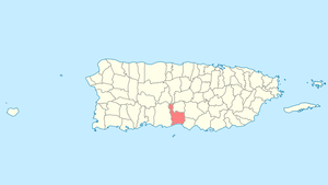 Location of Juana Díaz in Puerto Rico | |
| Coordinates: 18°03′09″N 66°30′24″W | |
| Commonwealth | |
| Founded | 1798 |
| Government | |
| • Mayor | Ramón "Ramoncito" Hernández (PPD) |
| • Senatorial District | 5 - Ponce (Half) |
| • Senatorial District | 6 - Guayama (Half) |
| • Representative District | 25 (Precinct 63) Ponce Senatorial District |
| • Representative District | 27 (Precinct 64) Guayama Senatorial District |
| Area | |
| • Total | 107.04 sq mi (277.23 km2) |
| • Land | 60.29 sq mi (156.15 km2) |
| • Water | 46.75 sq mi (121.08 km2) |
| Population (2010) | |
| • Total | 76,789 |
| • Density | 720/sq mi (280/km2) |
| Demonym(s) | Juanadinos |
| Time zone | UTC−4 (AST) |
| Zip code | 00795 |
| Area code | 787 |
| Major routes | |
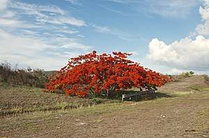
Juana Díaz is known as "La Ciudad del Mabí" (Mabí City). Mabi is a fermented Taíno beverage made out from the bark of the mabi tree Colubrina elliptica.
History
Juana Díaz was founded in 1798 and was known as Ciudad de Jacagua, in honor of the Taíno Cacique Jacaguax.[1] The civil government of this territory was established on April 25, 1798.[2]
In 1899, Juana Díaz had a population of 27,896.[3]
Geography
Juana Díaz is located on the southern coast. Several rivers run through the Juana Díaz territory, among them, Río Inabón and the Río Jacaguas, from which Juana Díaz takes its nickname, "Ciudad del Jacaguas". The Guayabal dam between Juana Díaz and Villalba is located in this river. Among its main tributaries are Río Toa Vaca in Villalba, also dammed. Both Guayabal and Toa Vaca lakes are visible in the map. Lake Toa Vaca is also the main source of drinking water for Juana Díaz, Ponce and other towns.[4]
Barrios

Like all municipalities of Puerto Rico, Juana Díaz is subdivided into barrios. The municipal buildings, central square and large Catholic church are located in a barrio referred to as "el pueblo". The 2010 Census population total for this municipality was 50,747 as follows:[5][6][7][8]
- Amuelas - 4,575
- Callabo - 2,237
- Capitanejo - 4,350
- Cintrona - 3,226
- Collores - 2,073
- Emajagual - 0
- Guayabal - 5,835
- Jacaguas - 3,957
- Juana Díaz barrio-pueblo[9] (pop. 3,977)
- Lomas - 938
- Río Cañas Abajo - 2,848
- Río Cañas Arriba - 2,165
- Sabana Llana 8,896
- Tijeras 5,670
Sectors
Barrios (which are like minor civil divisions)[9] in turn are further subdivided into smaller local populated place areas/units called sectores (sectors in English). The types of sectores may vary, from normally sector to urbanización to reparto to barriada to residencial, among others.[10][11][12]
Special Communities
Of the 742 places on the list of Comunidades Especiales de Puerto Rico, the following barrios, communities, sectors, or neighborhoods were in Juana Díaz: Arús (Pastillito), Callejón de los Perros (Los Buenos), Sector San Carlos in Collores, Sector Baldío in Cuevas, La Atómica, Las Palmas and Manzanilla.[13][14]
Demographics
| Historical population | |||
|---|---|---|---|
| Census | Pop. | %± | |
| 1900 | 27,896 | — | |
| 1910 | 29,157 | 4.5% | |
| 1920 | 18,529 | −36.5% | |
| 1930 | 19,516 | 5.3% | |
| 1940 | 23,396 | 19.9% | |
| 1950 | 27,697 | 18.4% | |
| 1960 | 30,043 | 8.5% | |
| 1970 | 36,270 | 20.7% | |
| 1980 | 43,505 | 19.9% | |
| 1990 | 45,198 | 3.9% | |
| 2000 | 50,531 | 11.8% | |
| 2010 | 50,747 | 0.4% | |
| U.S. Decennial Census[15] 1899 (shown as 1900)[16] 1910-1930[17] 1930-1950[18] 1960-2000[19] 2010[7] | |||
Tourism
Landmarks and places of interest
There are 30 beaches in Juana Díaz.[20]
- Plaza Román Baldorioty de Castro
- Efraín Daleccio Caves
- Lucero Caves
- Guayabal Lagoon
- Holy Kings monument
- Three Kings Museum
Economy
Agriculture
In the past, Juana Díaz was a large producer of sugarcane but with industrial development the sugar cane industry disappeared. Local rums are now produced from raw materials imported from other countries. Juana Díaz produces plantains, bananas, mangoes, and other crops that are consumed in the local markets and also exported to other countries. Cattle and pigs are also raised in local farms.
Industry
Juana Díaz is a producer of beige marble, one of the finest marbles in the world.
Culture
Festivals and events
- Three Kings Festival - January Página Oficial de los Reyes Magos de Juana Díaz This religious and cultural event began in 1884. It celebrates the visit of the Three Kings (Three Wisemen) to baby Jesus. Every year on January 6 people of all ages come to town to celebrate Three Kings Day. The main event is a parade down Comercio Street to the town's plaza where a big altar is set up for the celebration of the Holy Eucharist. The Eucharist begins with an act of the Prophets announcing the coming of a messiah. The prophesies are followed by the sighting of three kings by the shepherds. The holy mass follows and at the end the Three Kings find and adore baby Jesus. This is a must see activity if you are visiting Puerto Rico in January, and is an activity for all ages. If you can, come dressed as shepherds and be part of the celebration.
- Mabí Festival - March
- Bull Frog Festival - April
- Good Friday - Juana Díaz celebrates many activities during Holy Week each year. The most notable is the Good Friday procession that transists through many of the urban communities with representations of the Stations of the Cross. Thousands of juanadinos and people from other towns visit Juana Díaz on Good Friday.
- Llorensiana Week - May
- Patron Saint Festivities of San Ramón Nonato - August; San Ramón Nonato's celebration is August 31. Both religious and cultural events are celebrated at the end of August and early September in honor of San Ramón Nonato, the patron saint.
- Puerto Rican Festivities - December
Government
Like all municipalities in Puerto Rico, Juana Díaz is administered by a mayor. The current mayor is Ramón Hernández Torres, from the Popular Democratic Party (PPD). Hernández was elected at the 2000 general election.
Part of the city belongs to the Puerto Rico Senatorial district V, which is represented by two Senators. In 2012, Ramón Ruiz and Martín Vargas Morales, from the Popular Democratic Party, were elected as District Senators.[21] The other part of the city belongs to the Puerto Rico Senatorial district VI, which has been represented by Miguel Pereira Castillo and Angel M. Rodríguez since 2012.[22]
Symbols
Flag
The flag of Juana Díaz is rectangular in shape, formed by two triangles whose hypotenuse extends from the upper left corner to the lower right corner. The upper triangle is white, the symbol of silver and the lower triangle is yellow or gold. At its center is the coat of arms of Juana Díaz in its natural colors.[23]
Coat of arms
The coat of arms features The Nazarene Cross. It is in the center of the coat of arms. It stands out subtly between furrows and space, symbolizing the union of two races by means of the inalienable bond of the Christian faith. The cross also symbolizes the western Christian culture.[24]
The woman represents - Mrs. Juana Díaz, the towns namesake - with her hands the woman strews thirteen grains of corn into thirteen furrows, symbolizing the seeds that germinated and were the base for the foundation and growth of our town. The woman dresses as those of her time.[24]
The sun symbolizes a new horizon, hope in the formation of a town. The sun within the coat of arms has thirteen rays, each represents one of the barrios of Juana Díaz.[24]
Thirteen knolls stand out in the coat of arms symbolizing each of the thirteen wards or barrios of Juana Díaz. The mountains also symbolize that Juana Díaz has been one of the richest mineral towns in Puerto Rico.[24]
The Indians represents the natives who settled the village before the arrival of the white man. The native carries on his back thirteen sheathed arrows and a bow, and an arrow on his head. The bow and arrow represent the only effective means of defense useful for survival.[24]
The shackle and the whip represent Juana Díaz as the martyr of '87 because the most heinous, repressive institution known at the time was enforced in our town, "El Componte". It was in Juana Díaz where liberal politicians and dedicated patriots were martyred because they fought against the tyranny imposed by General Romualdo Palacios. Palacios was the most tyrannical and cruel of all the governors of our nation. "El Componte", a military tribunal, was used to quiet the rebel voices of those who loved law and order.[24]
The harp represents the music, the quill pen dipped in the ink well represents the verse, the poetry. Juana Díaz has generously given distinguished poets to Puerto Rican literature.[24]
Ciudad Del Jacaguas is the name by which Juana Díaz was known in the past. Many people knew Juana Díaz as the city of Jacaguas, but Luis Lloréns Torres dubbed it "La Versalles de Ponce" (Ponce's Versailles).[24]
Four Castles Represent that Juana Díaz reached the stature of city. Cities have five castles in their coat of arms, villages have four and smaller towns have three.[24]
Transportation
Among the most important roads in Juana Díaz are the Luis A. Ferré Expressway (PR-52) which connects Juana Díaz to Ponce and the airport in just minutes and San Juan in a little more than one hour. Other important roads include road PR-14 which runs through downtown Juana Díaz on its route between Ponce and Cayey, road PR-149 from Juana Díaz to Manatí running through Villalba and the "Cordillera Central" and road PR-1 which goes from Ponce to San Juan through barrio Pastillo in the south coast of Juana Díaz.
There are 51 bridges in Juana Díaz.[25]
See also
- List of Puerto Ricans
- History of Puerto Rico
- Did you know-Puerto Rico?
- Municipalities of Puerto Rico
References
- Cruz Ríos, Melissa (5 January 2019). "Para reyar y turistear en Juana Díaz". El Vocero de Puerto Rico (in Spanish). Retrieved 27 June 2020.
- Rodríguez, Luis E. "Historia". juanadiaz.org. Archived from the original on 2016-02-22. Retrieved 2019-01-11.
- Joseph Prentiss Sanger; Henry Gannett; Walter Francis Willcox (1900). Informe sobre el censo de Puerto Rico, 1899, United States. War Dept. Porto Rico Census Office. Imprenta del gobierno. p. 177. Retrieved 2019-01-11.
- "Juana Díaz Municipality". enciclopediapr.org. Fundación Puertorriqueña de las Humanidades (FPH).
- Picó, Rafael; Buitrago de Santiago, Zayda; Berrios, Hector H. Nueva geografía de Puerto Rico: física, económica, y social, por Rafael Picó. Con la colaboración de Zayda Buitrago de Santiago y Héctor H. Berrios. San Juan Editorial Universitaria, Universidad de Puerto Rico,1969. Archived from the original on 2018-12-26. Retrieved 2019-01-11.
- Gwillim Law (20 May 2015). Administrative Subdivisions of Countries: A Comprehensive World Reference, 1900 through 1998. McFarland. p. 300. ISBN 978-1-4766-0447-3. Retrieved 25 December 2018.
- Puerto Rico:2010:population and housing unit counts.pdf (PDF). U.S. Dept. of Commerce Economics and Statistics Administration U.S. Census Bureau. 2010. Archived (PDF) from the original on 2017-02-20. Retrieved 2019-01-11.
- "Map of Juana Díaz at the Wayback Machine" (PDF). Archived from the original (PDF) on 2018-03-24. Retrieved 2018-12-29.
- "US Census Barrio-Pueblo definition". factfinder.com. US Census. Archived from the original on 13 May 2017. Retrieved 5 January 2019.
- "Agencia: Oficina del Coordinador General para el Financiamiento Socioeconómico y la Autogestión (Proposed 2016 Budget)". Puerto Rico Budgets (in Spanish). Retrieved 28 June 2019.
- Rivera Quintero, Marcia (2014), El vuelo de la esperanza: Proyecto de las Comunidades Especiales Puerto Rico, 1997-2004 (first ed.), San Juan, Puerto Rico Fundación Sila M. Calderón, ISBN 978-0-9820806-1-0
- "Leyes del 2001". Lex Juris Puerto Rico (in Spanish). Retrieved 24 June 2020.
- Rivera Quintero, Marcia (2014), El vuelo de la esperanza:Proyecto de las Comunidades Especiales Puerto Rico, 1997-2004 (Primera edición ed.), San Juan, Puerto Rico Fundación Sila M. Calderón, p. 273, ISBN 978-0-9820806-1-0
- "Comunidades Especiales de Puerto Rico" (in Spanish). 8 August 2011. Archived from the original on 24 June 2019. Retrieved 24 June 2019.
- "U.S. Decennial Census". United States Census Bureau. Archived from the original on February 13, 2020. Retrieved September 21, 2017.
- "Report of the Census of Porto Rico 1899". War Department Office Director Census of Porto Rico. Archived from the original on July 16, 2017. Retrieved September 21, 2017.
- "Table 3-Population of Municipalities: 1930 1920 and 1910" (PDF). United States Census Bureau. Archived (PDF) from the original on August 17, 2017. Retrieved September 21, 2017.
- "Table 4-Area and Population of Municipalities Urban and Rural: 1930 to 1950" (PDF). United States Census Bureau. Archived (PDF) from the original on August 30, 2015. Retrieved September 21, 2014.
- "Table 2 Population and Housing Units: 1960 to 2000" (PDF). United States Census Bureau. Archived (PDF) from the original on July 24, 2017. Retrieved September 21, 2017.
- "Las 1,200 playas de Puerto Rico [The 1200 beaches of Puerto Rico]". Primera Hora (in Spanish). April 14, 2017. Archived from the original on December 12, 2019. Retrieved December 12, 2019.
- Elecciones Generales 2012: Escrutinio General Archived 2013-01-15 at the Wayback Machine on CEEPUR
- Elecciones Generales 2012: Escrutinio General Archived 2013-01-15 at the Wayback Machine on CEEPUR
- Rodríguez, Luis E. "Bandera oficial". juanadiaz.org. Archived from the original on 2016-02-22. Retrieved 11 January 2019.
- Rodríguez, Luis E. "Nuestros Símbolos". juanadiaz.org (in Spanish). Archived from the original on 2016-02-22. Retrieved 11 January 2019.
- "Juana Díaz Bridges". National Bridge Inventory Data. US Dept. of Transportation. Archived from the original on 21 February 2019. Retrieved 20 February 2019.
External links
- Juana Díaz and its barrios, United States Census Bureau
- Puerto Rico Government Directory - Juana Díaz