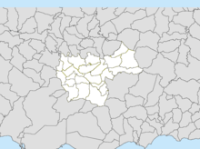
Cayey, Puerto Rico
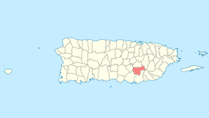
Cayey (Spanish pronunciation: [kaˈʝej]) (official name Cayey de Muesas) [1] is a mountain municipality in central Puerto Rico (U.S.) located on the Central Mountain range, north of Salinas and Guayama; south of Cidra and Caguas; east of Aibonito and Salinas; and west of San Lorenzo. Cayey is spread over 21 wards plus Cayey Pueblo (the downtown area and the administrative center). It is part of the San Juan-Caguas-Guaynabo Metropolitan Statistical Area.
Cayey Cayey de Muesas | |
|---|---|
Town and Municipality | |
 | |
 Flag 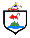 Coat of arms | |
| Nicknames: "Ciudad de las Brumas", "Ciudad del Torito", "Ciudad del Coquí Dorado" | |
| Anthem: "Alma Boricua" | |
 Location of Cayey in Puerto Rico | |
| Coordinates: 18°06′42″N 66°09′57″W | |
| Commonwealth | |
| Founded | August 17, 1773 |
| Government | |
| • Mayor | Rolando Ortíz Velázquez (PPD) |
| • Senatorial dist. | 6 – Guayama |
| • Representative dist. | 29 |
| Area | |
| • Total | 50.20 sq mi (130.01 km2) |
| • Land | 50 sq mi (130 km2) |
| • Water | 0.004 sq mi (.01 km2) |
| Population (2010) | |
| • Total | 48,119 |
| • Density | 960/sq mi (370/km2) |
| Demonym(s) | Cayeyanos |
| Time zone | UTC−4 (AST) |
| ZIP code | 00736, 00737 |
| Major routes | |
| Website | http://www.agencias.pr.gov/municipio/cayey/ |
Cayey is notable for its surrounding mountains. The city has been actively growing since the 1990s, evidenced by its designation as a Metropolitan Area by the U.S. Census Bureau. It has experienced significant growth in commerce, and many major retailers, such as Wal-Mart have opened stores in the city. Industries in Cayey include sugar, tobacco and poultry. For tobacco there is a well-known company called Consolidated Cigar Corp.[2] A new coliseum and hospital facilities have also been built. Coca-Cola is a major corporation that has a manufacturing facility in the town. Cayey is also host to one of the campuses of the University of Puerto Rico, the University of Puerto Rico at Cayey.
History

Cayey was founded on August 17, 1773, by Juan Mata Vázquez, who became its first mayor. It is said that Cayey derives its name from the Taino Indian word for "a place of waters". Its original name was "Cayey de Muesas" in honor of Miguel de Muesas, the then governor of Puerto Rico. The town is located in a valley nestled between Puerto Rico's Cordillera Central mountain range and the Sierra de Cayey at roughly the midpoint of routes PR-1 and PR-52. The routes lead to a road that provides a panoramic view of the island.
When after the Treaty of Paris (1898), the U.S. conducted its first census of Puerto Rico, the population of Cayey was 14,442.[3]
Cayey's economy has been and remains agriculturally based on tobacco, sugar cane and general fruits. Its agricultural economy that evolved starting in the 1950s has diminished considerably. Most of its agricultural products are imported from other islands in the Caribbean or mainland United States.
During the first half of the 20th century,[4] Cayey was basically an agricultural area of small farmers and local haciendas dedicated to the farming of crops for the local market. During the 1920s and 1930s farmers increasingly lost their land to absentee landowners, mostly American companies, that turned to the cultivation of sugar cane and, to a lesser extent, tobacco for export. In the 1950s and 1960s some manufacturing concerns established plants in Cayey taking advantage of tax incentives offered by "Operation Bootstrap", Puerto Rico's industrialization program.
An industrial base, in 1947 Cayey saw the beginning of industrial entrepreneurship. There were three factories in town, the Caribe Flower Co. in the Palo Seco neighborhood, a Baseball Factory in the Toita neighborhood, and a Uniform Factory in the back of the High School. These factories employed mostly females. By 1950 the men that worked agriculture became excess population and began migrating to the United States or join the military. In 1950 with the approval of Fomento Industrial and Operation Bootstrap there was a boom of light factories in Cayey. The Gordonshire Knitting Mill in the Guayama road had twelve large buildings and ran two shifts with more than 1,000 employees, and the Consolidated Cigar Corporation across from the road from the Reparto Montellano neighborhood operated three shifts employing over 2,500 from Cayey and surrounding towns.
An education base began in the early to mid-1950s when the Inter-American University opened a branch in Cayey providing teacher training through a night class scheme. In 1967 the University of Puerto Rico opened a campus in the former Henry Barracks Military Reservation, and in the early 1980s El Turabo University, subsidiary of the Ana G. Mendez conglomerate opened a campus in the old Tabaco Factory at the entrance of town. The Interamerican University will be opening a Graduate campus in front of the Plaza (Center of town), and there are conversations with a foreign educational concern to open a technology campus using the buildings left over by the Gordonshire Knitting Mills. There are three major private schools: Radians School, the long established Colegio de Nuestra Senora de la Merced and La Milagrosa School. Cayey's health care base expanded in the mid-1960s with the Mennoite Medical Center and a Municipal Hospital along with laboratories, and urgent care centers that cater to the poor and the elderly.
With the construction of the Interstate (route 52), Cayey has evolved into a "bedroom community" with gated housing developments, located just 30 minutes away from San Juan and 45 minutes away from Ponce. With pleasant weather and good private schools, Cayey has become a premium location for the affluent.
Impact of Henry Barracks Military Reservation
Henry Barracks Military Reservation was a lifeline for the residents of Cayey from 1901 to 1966, when it was declared excess land and passed to the General Services Administration for decommission. The property consisted of 439.92 acres ([5]). The property was divided into three prominent encampments: the Spanish Camp- Campamento Español (15 acres), Camp Henry or Henry Barracks, the Home of the third Battalion of the 65th Inf. Regiment that consisted of 372 acres, and 67 acres the Cayey Naval Radio Station (67 acres) [6]). This reservation is situated in the east of the town of Cayey. The Spanish Reservation containing an area of approximately 15 acres, known as Hospital Hill was set apart by Executive Order of June 30, 1903, under an Act of Congress approved on July 7, 1902.[7] The main army post was located in the northern part of the reservation, initially housing the Puerto Rico Volunteer Infantry Regiment.
The combined posts had approximately 1200 men who used the resources provided by the town people. Families moved into Punta Brava and Vieques neighborhoods. A laundry, show shop, and other smaller stores were located right outside the gate. By 1906 about 350 civilians had jobs in the two posts (Camp Henry and The Cayey Navy Radio Station).
The U.S. Department of the Navy submitted a proposal to raise three 620 feet tall masts as part of a global radio communication linkage. In 1916 the Department of the navy approved a budget of $40,000. At the time 300 men were hired to build the facility for a period of two year, the project was completed in 1918 [8]
On September 11, 1928, a category five hurricane called San Felipe destroyed the temporary buildings at Henry Barracks, and the Navy Radio Station.[9] A radio message was sent from the Cayey Navy Radio Station on 18 Sept 1928 to follow “All buildings Henry Barracks destroyed by hurricane September 13th”.[10] The Navy left Cayey and moved its station to Isla Grande and Stop 7 ½ in Puerto de Tierra. All the land held by the Navy included Magazine Hill (known in the community as "El Polvorin"), which was taken over by the U. S. Army. The 65th Infantry Regiment remained in the north side of the post. The south side was converted into two 1,000 feet shooting ranges[11] The decision was made to reconstruct all building for the regiment in the north side in concrete [12] One hundred and ninety buildings were completed, to include the north side of Henry Barracks.[13] Over 600 men were hired for a period of three years to work in these projects. During this period three large barrack buildings were constructed. The two one company barracks each had its own mess hall and kitchen and was occupied by an infantry company each. The two companies barrack located in the center of the quad occupied the Battalion Headquarters Co. and the Machine Gun Co.[14]
By 1953, the U.S. Department of the Army had reached the conclusion that Henry Barracks would be closed in the near future. A full complement of maintenance personnel composed of professional, technical, and daily laborers were maintained in the Reservation. The growth of three major housing developments is evidence of the economic impact of the Reservation (Reparto Montellano, El Polvorin, Urbanización Aponte)[15] While the all-Puerto Rican 65th Inf regiment would never return to its home base, several other initiatives were undertaken, which had a direct impact on the economic development of the town and the region, one such initiatives was the commissioning of the Caribbean Signal Agency in 1959. Over the coming years several tenants occupied the lands comprised by the Henry Barracks Military Reservation, among them:
- In the company size building to the west of the quad, the National Guard had its Officer Training School in 1965 and 1966. It was later moved to Camp Santiago in Salinas. The golf course was used as a helicopter landing strip.
- YMCA Cuerpos de Paz, and VESPRA (1965–68) had an Administration Building, a swimming pool, a golf course and three houses, which housed the majors and their families.[16]
- The Encampment for Citizenship held its 1966 six-week encampment in the two-company building in the middle of the quad. One hundred fifty-one young leaders from 56 countries from all over the world meet in Cayey to learn to develop self-government and to perform community development projects.[17]
- The Foundation for Community Development moved to the housing is located in the southeastern part of the Post until 1972.[18] Thousands of people received training in community development, and leadership during those years.
Hurricane Maria
.jpg)
Hurricane Maria on September 20, 2017 triggered numerous landslides in Cayey with the significant amount of rainfall.[19][20]
Geography
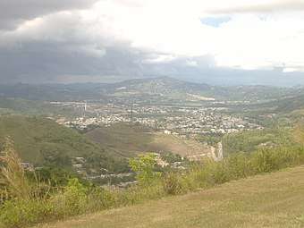
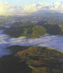
Cayey is located in a valley surrounded by La Sierra de Cayey, a mountain range where the Carite Forest Reserve is located, and the Cordillera Central, a mountain range that covers most of the central part of Puerto Rico. Because of its location, Cayey is known for its mountains, its cool weather and its misty mornings, especially in winter. During Spanish colonial rule, Spanish soldiers assigned to Puerto Rico were sent to Cayey. Its cool weather resembled the weather of Spain and soldiers could become acclimated to the tropical weather. In winter, it is not unusual for the temperature to drop into the 50s °F.[21]
The Carite Forest Reserve
- Rivers are: Río Grande de Loíza, Río Guavate, Río Jájome, Río de la Plata and Río Maton.
Latitude 18° 6′ 42 N
Longitude -66° 9' 57″ W[22]
Climate
Cayey's climate is humid, rainy and mild compared to lower-elevation areas of the island, the area of the town is nearly 1,500 feet (460 m) high, so the climate is subtropical high. In summer average high Temperatures are around 82 °F to 88 °F and 70 °F to 78 °F in winter, and low around 68 °F to 72 °F in summer and 57 °F to 63 °F in winter. The record maximum temperature is 94 °F (34 °C) and minimum 45 °F (7 °C). The average annual rainfall is 100 inches (2,540 mm) and maximum rainfall record in 24 hours is 20.87 inches (530 mm) of rain.
Flora and fauna

The golden coquí (Eleutherodactylus jasperi; Spanish: coquí dorado) is a rare and possibly extinct leptodactylid frog species endemic to Puerto Rico. Native from Cayey, Puerto Rico, golden coquís have only been found in areas of dense bromeliad growth in the Sierra de Cayey of Puerto Rico between 2,123 and 2,575 feet (647 and 785 meters) above sea level. They get their name from the song the male coquis sing at night. It sounds like "cokee, cokee" so that is why they are called coqui in Spanish. The golden coqui is the smallest of the coqui frogs in Puerto Rico. Mature adult coquis are only roughly the size of a dime. Male coquis are more bright yellow where females tend to be more light yellow and brown. The golden coqui is the only frog species in the New World known to give birth to live young. These frogs are known around the whole island of Puerto Rico.[23]
Barrios
Like all municipalities of Puerto Rico, Cayey is subdivided into barrios. The municipal buildings, central square and large Catholic church are located in a barrio referred to as "el pueblo", near the center of the municipality.[24][25]
Sectors
Barrios (which are like minor civil divisions)[26] in turn are further subdivided into smaller local populated place areas/units called sectores (sectors in English). The types of sectores may vary, from normally sector to urbanización to reparto to barriada to residencial, among others.[27][28][29]
Special Communities
Of the 742 places on the list of Comunidades Especiales de Puerto Rico, the following barrios, communities, sectors, or neighborhoods were in Cayey: Parcelas Nuevas in Beatriz, Cantera, Sector Jalda Abajo, Cedro, El Coquí, Jájome Bajo, La Placita, Saint Thomas, San Cristóbal, and La Vega.[30][31]
Buildings and structures
Telemundo WKAQ TV Tower

Telemundo WKAQ-TV Tower, situated at 18°6'47"N 66°3'9"W, is a 1,105 feet (336.8 m) tall guyed mast for FM-/TV-broadcasting. It was built in 1971 and it is the second tallest man-made structure of Puerto Rico.
Pedro Montañez Stadium
The new Pedro Montañez Municipal Stadium in Cayey, proceeded by the first Pedro Montañez Municipal Stadium in Cayey, is the home of the Toritos de Cayey Double A baseball team,[32] and the Benigno Fernandez Garcia Jr. High School's field day competitions.
Cayey Pegasus Broadcasting WAPA-TV Tower
The Cayey Pegasus Broadcasting tower, at coordinates 18°6'33"N and 66°3'2"W is the third-tallest structure in Puerto Rico. It is a guyed mast owned by Hemisphere Media Group with a height of 1,091 feet (332.5 m), which was built in 1966.
Economy
Crime in Cayey
By August 2019, El Vocero newspaper was reporting the third mass shooting of the year in Cayey.[33]
Tourism
Cayey is a mountainous municipality with many places of interest.[34]
Landmarks and places of interest
The city / municipality lists the following places of interest on its website:[35]
- Comsat Station
- Guavate
- Ramón Frade Exhibit[36]
- Sismograph
- Brisas De Cayey
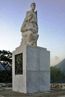
- Monumento al Jíbaro Puertorriqueño
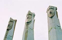
- Monumento a Los Tres Reyes Magos
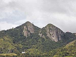
- Tetas de Cayey
- Carite Forest
- Charco Azul
- Lago Carite
- The Coca-Cola Company Bottling Facility
- Escuela de Bellas Artes
- El Salón de La Fama del Deporte
- El Faro del Saber
- University of Puerto Rico, Cayey Campus
- Museo de Arte Pio López
- Pedro Montañez Municipal Stadium
- Teatro Municipal
- Saloncito de CIMAT
- Banda Municipal de Cayey
- Tuna de Cayey
- Playa Machete
- Punta Pozuelo
- San Cristobol Canyon
- Casino Real[37]
Culture
Festivals and events
- Regional Fair – April
- Torito Olympics – April
- Patrona Festivities Nuestra Señora de Asunción – August
Cayey's Matron Festivities "Nuestra Señora de Asunción" are one of the most popular festival events in Puerto Rico. These festivities are celebrated during 10 days consecutively, bringing singers and bands from around the island. Cayey's Matron Festivities always pop out a surprise during the final days, such like Wisin & Yandel and others.
Demographics
| Historical population | |||
|---|---|---|---|
| Census | Pop. | %± | |
| 1900 | 14,442 | — | |
| 1910 | 17,711 | 22.6% | |
| 1920 | 23,618 | 33.4% | |
| 1930 | 28,797 | 21.9% | |
| 1940 | 31,391 | 9.0% | |
| 1950 | 36,656 | 16.8% | |
| 1960 | 38,061 | 3.8% | |
| 1970 | 38,432 | 1.0% | |
| 1980 | 41,099 | 6.9% | |
| 1990 | 46,553 | 13.3% | |
| 2000 | 47,370 | 1.8% | |
| 2010 | 48,119 | 1.6% | |
| U.S. Decennial Census[38] 1899 (shown as 1900)[39] 1910-1930[40] 1930-1950[41] 1960-2000[42] 2010[25] | |||
| Race – Cayey, Puerto Rico – 2000 Census[43] | ||
|---|---|---|
| Race | Population | % of Total |
| White | 41,771 | 88.2% |
| Black/African American | 1,834 | 3.9% |
| American Indian and Alaska Native | 89 | 0.2% |
| Asian | 64 | 0.1% |
| Native Hawaiian/Pacific Islander | 24 | 0.1% |
| Some other race | 2,602 | 5.5% |
| Two or more races | 986 | 2.1% |
Government
All municipalities in Puerto Rico are administered by a mayor, elected every four years. The current mayor of Cayey is Rolando Ortíz, of the Popular Democratic Party (PPD). He was elected at the 1996 general elections and has remained in office through all intervening elections since.
The city belongs to the Puerto Rico Senatorial district VI, which is represented by two Senators. In 2012, Miguel Pereira Castillo and Angel M. Rodríguez were elected as District Senators.[44]
Symbols
Flag
The flag derives its design and colors from the coat of arms, which is in the center of the flag encircled by a solid black ring. The centered coat of arms and has four triangles pointing to it, two white and two red.
Coat of arms
The coat of arms has a three tip mountain, a red bull, and a waving blue stripe representing the abundant water in the zone and also in reverence to the primitive matron of the town of Cayey. The shield is topped with the silver lamb symbol of San Juan of Puerto Rico, and a red book.
Transportation
Cayey has direct access to Puerto Rico Highway 52 and its downtown/business area is served by Puerto Rico Highway 14, which grants access to Aibonito to the west and is the main route to the University of Puerto Rico in town, and by Puerto Rico Highway 15 which grants access to south Cayey and Guayama. Puerto Rico Highway 1 Bypass runs through the town's business area. The municipality has good paved roads and is easily accessible from San Juan, being only 25 miles (40 kilometers) away, as well as from Ponce, being only 38 mi (61 km) away. Due to its proximity to Caguas and easy access via PR-52, Cayey has seen significant growth in the last years.
There are 82 bridges in Cayey many of which travel over Rio de la Plata.[45]
Education
- 23 public schools (2 high schools, 4 intermediate schools, 3 second units, 13 elementary schools and 1 special vocational center).
Higher education
- University of Puerto Rico at Cayey
- University of Turabo at Cayey
- Instituto de Banca y Comercio (satellite campus at Cayey)
- Liberty Technical College
Health care
- Hospital Menonita de Cayey
- Hospital Municipal de Cayey
Notable natives and residents
- Alexis y Fido
- Ricardo Aponte, Brigadier General
- Raymond Arrieta, comedian
- Hiram Burgos, pro baseball player, starting pitcher Milwaukee Brewers
- Christian Colón, pro baseball player, the hit that won the 2015 World Series
- Ramón Frade, visual artist/painter
- Luis Guzmán, actor
- Jorge López, birthplace of star Milwaukee Brewers pitcher
- Alberto Mercado, boxer, resides in Cayey
- Pedro Montañez, professional boxer
- Joseph O. Prewitt Díaz, psychologist, Recipient of the APA International Humanitarian Award 2008[46]
- Amazing Red, pro wrestler
- Zuleyka Rivera, Miss Puerto Rico Universe 2006, Miss Universe 2006
- Marcelino Sánchez, actor
- Wisin & Yandel, reggaeton group
- José Ortiz Puerto Rican Basketball Legend, Former NBA Player
- Lionel Fernández Méndez, Attorney at Law, Juris Doctor Georgetown University, Washington DC, Member Delegate of Cayey and the District of Guayama to the Puerto Rico Constitutional Assembly, Politician and Senator of Cayey and the District of Guayama, UPR ( University of Puerto Rico) Cayey founding member-claiming as Senator for education the land that was the Henry Barracks Army Camp of Cayey. Son of Lcdo. Benigno Fernández García.
Sister cities
- Middletown, Connecticut
- Melilli, Italy [47]
See also
| Wikimedia Commons has media related to Cayey, Puerto Rico. |
References
- "Manual de Información Sobre Cayey" (PDF). PR Gov (in Spanish).
- The Columbia Encyclopedia. Columbia University Press. 2016 – via Credo.
- Joseph Prentiss Sanger; Henry Gannett; Walter Francis Willcox (1900). Informe sobre el censo de Puerto Rico, 1899, United States. War Dept. Porto Rico Census Office (in Spanish). Imprenta del gobierno. p. 162.
- Life in Cayey during the first part of the 20th century, and the last part of the 19th century, is detailed in "Obras Completas" by Cayey's native son Miguel Melendez Muñoz
- FUDS (27 Sept 2006). Project Fact Sheet-August 2005. Jacksonville, FLA: Army Corps of Engineer
- (Department of the Navy (1915). Map showing boundary lines of the original Spanish Reservation and the present reservation February 7, 1903: Washington, D.C.: Bureau of Yards & Docks, Department of the Navy
- Executive Order of June 30, 1903, under an Act of Congress approved on July 7, 1902
- (Hopper, S.C. (1922) Development of high power radio and its practical applications in the Services of the United States Navy. Radio Broadcast Magazine 1(3), 484-489).
- Fassig, O.L. (September 1928). San Felipe-the Hurricane of September 13, 1928, at San Juan, P.R. San Juan, Puerto Rico: Station Report Weather Bureau Office-San Juan
- (Adjutant General 600.913).
- ( Parsons, Inc (2010). Site Inspection Report: Henry Barracks Military Reservation. Norcross, Georgia: U.S. Army Corps of Engineers-FUDS Project 102PR097902).
- (Quartermaster (July 31, 1929) Completion Report at Henry Barracks, Puerto Rico. Governors Island, New York: War Department.
- (Smith, C. (July 15, 1930). Completion Report for the construction of one two-company barracks and two one-company barracks at Henry Barracks, Cayey, Puerto Rico: Quartermaster Constructing Report. U.S. Army).
- (Smith, C. (July 15, 1930). Completion Report for the construction of one two-company barracks and two one-company barracks at Henry Barracks, Cayey, Puerto Rico: Quartermaster Constructing Report. U.S. Army. p.4
- Personal communication with Maj. Manuel Rivera Garcia (ret.) and Harry Benett, J.D.(August 24, 2014)
- El Mundo, 26 de enero 1965, p.7-8
- San Juan Star, Sunday Magazine p. 4 Agosto 1966
- Silva Gotay, S. (1967). Proposal for the development of the Instituto de Desarrollo Comunal de Puerto Rico. Funded by the Office of eEconomic Opportunity, Washington, D.C. under the Community Action Programs
- "Preliminary Locations of Landslide Impacts from Hurricane Maria, Puerto Rico". USGS Landslide Hazards Program. USGS.
- "Preliminary Locations of Landslide Impacts from Hurricane Maria, Puerto Rico" (PDF). USGS Landslide Hazards Program. USGS.
- "Cayey Municipality". enciclopediapr.org. Fundación Puertorriqueña de las Humanidades (FPH).
- "Geographical coordinates and cartography Cayey - Puerto Rico US". horlogeparlante. Retrieved 2016-05-05.
- "Natural history". Biological Diversity. Retrieved 2016-05-05.
- Gwillim Law (20 May 2015). Administrative Subdivisions of Countries: A Comprehensive World Reference, 1900 through 1998. McFarland. p. 300. ISBN 978-1-4766-0447-3. Retrieved 25 December 2018.
- Puerto Rico:2010:population and housing unit counts.pdf (PDF). U.S. Dept. of Commerce Economics and Statistics Administration U.S. Census Bureau. 2010.
- "US Census Barrio-Pueblo definition". factfinder.com. US Census. Archived from the original on 13 May 2017. Retrieved 5 January 2019.
- "Agencia: Oficina del Coordinador General para el Financiamiento Socioeconómico y la Autogestión (Proposed 2016 Budget)". Puerto Rico Budgets (in Spanish). Retrieved 28 June 2019.
- Rivera Quintero, Marcia (2014), El vuelo de la esperanza: Proyecto de las Comunidades Especiales Puerto Rico, 1997-2004 (first ed.), San Juan, Puerto Rico Fundación Sila M. Calderón, ISBN 978-0-9820806-1-0
- "Leyes del 2001". Lex Juris Puerto Rico (in Spanish). Retrieved 24 June 2020.
- Rivera Quintero, Marcia (2014), El vuelo de la esperanza: Proyecto de las Comunidades Especiales Puerto Rico, 1997-2004 (1st ed.), San Juan, Puerto Rico Fundación Sila M. Calderón, p. 273, ISBN 978-0-9820806-1-0
- "Comunidades Especiales de Puerto Rico" (in Spanish). 8 August 2011. Archived from the original on 24 June 2019. Retrieved 24 June 2019.
- "El Béisbol Recuerda A Héctor Ferrer". Isla News PR (in Spanish). November 6, 2018. Retrieved 1 February 2019.
- Rivera Puig, Miguel. "En Cayey la tercera masacre del año". El Vocero de Puerto Rico (in Spanish).
- "Información Municipio de Cayey" (in Spanish). Cayey Municipality Gov. 9 January 2019.
- "Lugares de Interés Turístico" (in Spanish). Cayey government. 9 January 2019. Retrieved 28 June 2019.
- "Ramón Frade - Museo de Arte de Puerto Rico". mapr.
- IIWINC. "Cayey Attractions | Caribya!". caribya. Retrieved 2016-05-06.
- "U.S. Decennial Census". United States Census Bureau. Archived from the original on February 13, 2020. Retrieved September 21, 2017.
- "Report of the Census of Porto Rico 1899". War Department Office Director Census of Porto Rico. Retrieved September 21, 2017.
- "Table 3-Population of Municipalities: 1930 1920 and 1910" (PDF). United States Census Bureau. Retrieved September 21, 2017.
- "Table 4-Area and Population of Municipalities Urban and Rural: 1930 to 1950" (PDF). United States Census Bureau. Retrieved September 21, 2014.
- "Table 2 Population and Housing Units: 1960 to 2000" (PDF). United States Census Bureau. Retrieved September 21, 2017.
- "Ethnicity 2000 census" (PDF).
- Elecciones Generales 2012: Escrutinio General Archived December 3, 2012, at the Wayback Machine on CEEPUR
- "Cayey Bridges". National Bridge Inventory Data. US Dept. of Transportation. Retrieved 20 February 2019.
- Am Psychol. 2008 Nov;63(8):818-20
- "Cities: Sister Cities (How many?) (rates, places, America, Los Angeles) - City vs. City - City-Data Forum". City Data. Retrieved 2016-05-06.
External links
| Wikisource has the text of the 1911 Encyclopædia Britannica article Cayey. |
- University of Puerto Rico, (UPR) Cayey (in Spanish)
- Cayey, Puerto Rico, a musical slideshow (YouTube). (in Spanish)
- Guavate Cayey, PR Guide to open market. (in English)