Hatillo, Puerto Rico
Hatillo (Spanish pronunciation: [aˈtiʎo]) is a municipality located on the U.S. territory of Puerto Rico's north coast, bordered by the Atlantic Ocean to the north, Lares and Utuado to the south, Camuy to the west, and Arecibo to the east. According to the 2000 US Census Hatillo is spread over nine wards and Hatillo Pueblo (the downtown area and the administrative center of the city). It is part of the San Juan-Caguas-Guaynabo Metropolitan Statistical Area.
Hatillo Municipio de Hatillo | |
|---|---|
City and Municipality | |
 | |
 Flag | |
| Nicknames: "El Pueblo sin Sopa", "Capital De La Industria Lechera"' "Hatillo Del Corazón De Riego", "Tierra de Campos Verdes", "Los Ganaderos" | |
| Anthem: "De un mar azul en el Atlántico" | |
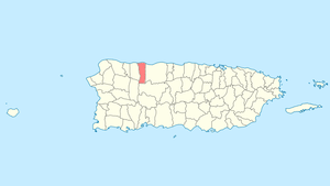 Location of Hatillo in Puerto Rico | |
| Coordinates: 18°29′11″N 66°49′32″W | |
| Commonwealth | |
| Founded | June 30, 1823 |
| Government | |
| • Mayor | José A. Rodríguez Cruz (PPD) |
| • Senatorial dist. | 3 - Arecibo |
| • Representative dist. | 15 |
| Area | |
| • Total | 58.73 sq mi (152.10 km2) |
| • Land | 41.78 sq mi (108.22 km2) |
| • Water | 16.94 sq mi (43.88 km2) |
| Population (2015) | |
| • Total | 41,047 |
| • Density | 700/sq mi (270/km2) |
| Demonym(s) | Hatillanos |
| Time zone | UTC-4 (AST) |
| Zip code | 00659 |
| Major routes | |
History
Don Agustín Ruiz Miranda, a Canarian immigrant, founded Hatillo on approximately ten cuerdas (a cuerda is 0.97 acre, also called a Spanish acre) in 1823. Miranda granted this land on the condition that public buildings be erected and wide streets be built, and that the remaining land be sold or used for homes.[1]
In its first year, Hatillo had 910 people; increasing to 2,663 inhabitants the following year distributed among the central town and the barrios of Carrizales, Capáez, Naranjito, Corcovado, Buena Vista, (formerly Yeguada Occidental), Campo Alegre, (formerly Yeguada Oriental), Pajuil, Bayaney, Aibonito, and Barrio Pueblo. Barrio Pajuil had disappeared by the 1940 census being divided up between Buena Vista, Naranjito, Corcovado and Campo Alegre barrios. There were also two sugarcane plantations named “Hacienda Santa Rosa” measuring 150 cuerdas and “Hacienda Perseverancia” at 50 cuerdas.
The United States took control of Puerto Rico from Spain in the aftermath of the Spanish-American War under the terms of the Treaty of Paris of 1898. In 1899, the United States conducted its first census of Puerto Rico, finding that the population of Espino barrio was 1,148.[2]
Hatillo, like several other municipalities on the island, experienced boundary changes from the 1902 municipality consolidation law (Consolidación de Ciertos Términos Municipales de Puerto Rico) in which Hatillo was annexed temporarily into neighboring Camuy. Three years later the territorial legislature approved the reformation of Hatillo as a separate municipality (independent town) from Camuy in 1905.[3] In 1910, Barrio Pueblo (rural) changed its name to Hatillo barrio (rural). In 1930, Yeguadilla Occidental and Yeguadilla Oriental barrios' names were changed to Buena Vista and Campo Alegre, respectively. As mentioned before, Pajuil barrio disappeared by the 1940 census being divided up between barrios Buena Vista, Naranjito, Corcovado and Campo Alegre. In 1947 the Planning Commission of Puerto Rico issued a new map of Hatillo municipality and its barrios. As a result of this new map, the central town was expanded to include part of Hatillo barrio (rural) and the name of “Corcovados” was changed to "Corcovado”.
Hurricane Maria
Hurricane Maria on September 20, 2017 triggered numerous landslides in Hatillo with the significant amount of rainfall.[4][5]
Geography
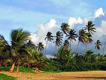
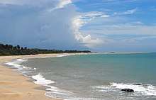
Hatillo is a coastal town on the northern side of Puerto Rico.[6] There are 9 bridges in Hatillo.[7]
Barrios
Like all municipalities of Puerto Rico, Hatillo is subdivided into barrios. The municipal buildings, central square and large Catholic church are located in a small barrio referred to as "el pueblo".[8][9][10][11]
Sectors
Barrios (which are like minor civil divisions)[12] in turn are further subdivided into smaller local populated place areas/units called sectores (sectors in English). The types of sectores may vary, from normally sector to urbanización to reparto to barriada to residencial, among others.[13][14][15]
Tourism
Landmarks and places of interest
There are 10 beaches in Hatillo.[18] Other places of interest in Hatillo include:[19]
- Antigua Central Bayaney
- Paseo del Carmen
- Francisco "Pancho" Deida Méndez Coliseum
- Hacienda Santa Rosa Ruins
- Iglesia de Nuestra Señora del Carmen
- Juan Carmelo "Tito" Rodríguez Donate Stadium
- José Antonio Monrouzeau Theater
- La Marina
- Los Ilustres Park
- Virgen del Carmen Parish
- Plaza del Norte Mall
- Sardinera Beach
- Trapiche de Santa Rosa
Economy

Agriculture
Today, Hatillo is the major producer of milk on the island and produces a third of the milk consumed in Puerto Rico.[6]
Business
Plaza del Norte is a shopping mall located in the barrio of Carrizales.
Demographics
| Historical population | |||
|---|---|---|---|
| Census | Pop. | %± | |
| 1900 | 10,449 | — | |
| 1910 | 10,630 | 1.7% | |
| 1920 | 13,979 | 31.5% | |
| 1930 | 16,168 | 15.7% | |
| 1940 | 18,322 | 13.3% | |
| 1950 | 20,877 | 13.9% | |
| 1960 | 20,238 | −3.1% | |
| 1970 | 21,913 | 8.3% | |
| 1980 | 28,958 | 32.1% | |
| 1990 | 32,703 | 12.9% | |
| 2000 | 38,925 | 19.0% | |
| 2010 | 41,953 | 7.8% | |
| U.S. Decennial Census[20] 1899 (shown as 1900)[21] 1910-1930[22] 1930-1950[23] 1960-2000[24] 2010[10] | |||
Culture
Festivals and events
Hatillo has many annual celebrations and festivals. "Las Tradicionales" Hatillo Mask Festival ("Día de las Máscaras") - The Mask Festival began in 1823, and was imported by the immigrants from the Canary Islands, where the traditional festival originated. The early tradition of the festival required that the male population dress as women and they would visit each residence where the owners would offer them food and drinks. Currently the festival is celebrated every year on December 28. The Masks are fashioned and based on the biblical story of King Herod (Herod the Great). The costumes used are very elaborate and the Masks represent the soldiers which were sent by the King to kill all the innocent Christian children of Israel. The festival, however is presented in humor and said soldiers only joke around and ride on chariots.[19]
Other Hatillo festivals include:
- Truco (card game) - all year
- Fiestas de la Cruz - May
- Festival de la Caña de Azucar- May; Very colorful and informative historical festival depicts how SugarCane was cultivated and Transported all around the island mostly on coastal towns from late 19th century through the 1960s. How the Puerto Rican "Jibaro" worked the land to support his family from sunrise to sunset.
- San Juan Day - June
- Matron Celebration - July; Its patron saint is Our lady of Mount Carmel. known as Virgen del Carmen. The patron saint festivities are held during the first two weeks of July and always includes the 16th of July in its weeks. The 16th of July is the Virgin of Carmel day, and it is celebrated with great pride and devotion still today. The day of the Virgin, La Patrona, is a very special day on our town with several all- day masses starting at 5 am with many penitents and favored-ones of the Patrona. Many people come every year for the High Mass at 3 pm. This mass includes the special procession and carriage of the venerated statue of the virgin through all the town center streets, and a special "trip" over to the near ocean shore by the local fishermen on their traditional boats known as "Yolas", because Our Lady Of Carmel is the Patron Saint of fishermen and it is a special devotion for our city.
- Festival Típico del Cooperativismo - October
- Festival de las Máscaras - 28 December (colorful mask festival)
- Typical Festivities - December
There is a Tradition each year on the 28th of December which is known as the Máscaras (Masks) of Hatillo. This Tradition dates back to 1823, when the town of Hatillo was founded. This Tradition came with settlers from the Canary Islands. The meaning of this tradition is the Holy Innocents, or Santos Inocentes: the first martyrs of Christian faith from Matthew's story in which small children were killed by Herod in an unsuccessful attempt to kill Jesus. It is a very special day with much fun and a large meeting of Mascaras: masked men and women of all ages, who wear costumes according to tradition, typically covered from head to toe, and parade through their town and nearby towns all day, making jokes and having fun, followed by a large multiple, and celebrated procession through all the town and nearby town's neighborhoods, and ending at the Hatillo town center. It is a multi-dynamic and wonderful experience for everyone in Hatillo and nearby towns. This special tradition came from the Canary Islands, the main place from Spain where the Hatillo, Camuy, and nearby town's Spanish immigrants arrived, mainly in the 1800s. Many of the native people of Hatillo, Camuy, Arecibo, and several nearby towns are proud to call themselves "Isleños", or people descendant from the Canary Island's immigrants.
The transportation to the events was traditionally on horseback, with still a few still doing it today, however, in more modern events the Jeep (carefully decorated to match the riders colors and costumes) and the "Carroza" (a homemade long cart with a long crankshaft and wheel, equally decorated) are used. You can usually see groups of riders that can be a few dozen to groups of 100+ marching all around the town with their "carrozas" equipped with loud speakers, air horns, bright lights and typical music playing. They make frequent stops at homes and stores making pranks and asking for "offerings". Usually food, drinks or money. Usually around mid-day the groups of riders (Usually with names that start with "Los" [name] Ex. Los Conservadores MEANING The Conservatives) head themselves to the center of the town for a parade and an award ceremony for best outfit, best sound, best "carroza" and others. With the occasional friendly wrestling with opposing groups. Rules are first man pinned or dog pile as well everyone must drink to show the opposing team respect and new found camaraderie.
Symbols
Flag
The flag consists of three broad stripes - Blue, Yellow and Green. Blue represents the sea, yellow represents the material and artistic wealth of the town, and green represents the vegetation of its fields in all its territorial extension.[1]
Coat of arms On top of the shield is a gold crown with three towers over a silver field a Custard Apple tree (annona reticulata) and a field with two cows in gold which is over eight blue and silver-plated waves. At the center is a shield of "La Orden del Carmen". Under the shield the motto is inscribed, Hatillo Del Corazón.[1]
Gallery
 Festival de la Caña, Hatillo
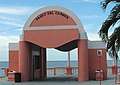 Paseo del Carmen
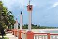 Paseo del Carmen
 Town Hall of Hatillo
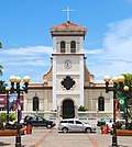 Parroquia Nuestra Señora del Carmen
 La Marina, Hatillo, PR
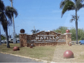 Welcome rock wall
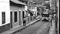 Street in Hatillo
References
- "Hatillo Municipality Founding History and Symbols". enciclopediapr.org. Fundación Puertorriqueña de las Humanidades (FPH). Archived from the original on 14 February 2019. Retrieved 14 February 2019.
- Joseph Prentiss Sanger; Henry Gannett; Walter Francis Willcox (1900). Informe sobre el censo de Puerto Rico, 1899, United States. War Dept. Porto Rico Census Office (in Spanish). Imprenta del gobierno. p. 161.
- "El futuro de los municipios". El Nuevo Dia. March 22, 2019.
- "Preliminary Locations of Landslide Impacts from Hurricane Maria, Puerto Rico". USGS Landslide Hazards Program. USGS. Archived from the original on 2019-03-03. Retrieved 2019-03-03.
- "Preliminary Locations of Landslide Impacts from Hurricane Maria, Puerto Rico" (PDF). USGS Landslide Hazards Program. USGS. Archived (PDF) from the original on 2019-03-03. Retrieved 2019-03-03.
- "Hatillo Municipality General Info (Location, Square Miles, Economy and Geography)". enciclopediapr.org. Fundación Puertorriqueña de las Humanidades (FPH). Archived from the original on 14 February 2019. Retrieved 14 February 2019.
- "Hatillo Bridges". National Bridge Inventory Data. US Dept. of Transportation. Archived from the original on 20 February 2019. Retrieved 19 February 2019.
- Picó, Rafael; Buitrago de Santiago, Zayda; Berrios, Hector H. Nueva geografía de Puerto Rico: física, económica, y social, por Rafael Picó. Con la colaboración de Zayda Buitrago de Santiago y Héctor H. Berrios. San Juan Editorial Universitaria, Universidad de Puerto Rico,1969. Archived from the original on 2018-12-26. Retrieved 2018-12-28.
- Gwillim Law (20 May 2015). Administrative Subdivisions of Countries: A Comprehensive World Reference, 1900 through 1998. McFarland. p. 300. ISBN 978-1-4766-0447-3. Retrieved 25 December 2018.
- Puerto Rico:2010:population and housing unit counts.pdf (PDF). U.S. Dept. of Commerce, Economics and Statistics Administration, U.S. Census Bureau. 2010. Archived (PDF) from the original on 2017-02-20. Retrieved 2018-12-28.
- "Map of Hatillo at the Wayback Machine" (PDF). Archived from the original (PDF) on 2018-03-24. Retrieved 2018-12-29.
- "US Census Barrio-Pueblo definition". factfinder.com. US Census. Archived from the original on 13 May 2017. Retrieved 5 January 2019.
- "Agencia: Oficina del Coordinador General para el Financiamiento Socioeconómico y la Autogestión (Proposed 2016 Budget)". Puerto Rico Budgets (in Spanish). Retrieved 28 June 2019.
- Rivera Quintero, Marcia (2014), El vuelo de la esperanza: Proyecto de las Comunidades Especiales Puerto Rico, 1997-2004 (first ed.), San Juan, Puerto Rico Fundación Sila M. Calderón, ISBN 978-0-9820806-1-0
- "Leyes del 2001". Lex Juris Puerto Rico (in Spanish). Retrieved 24 June 2020.
- Rivera Quintero, Marcia (2014), El vuelo de la esperanza: Proyecto de las Comunidades Especiales Puerto Rico, 1997-2004 (1st ed.), San Juan, Puerto Rico Fundación Sila M. Calderón, p. 273, ISBN 978-0-9820806-1-0
- "Comunidades Especiales de Puerto Rico" (in Spanish). 8 August 2011. Archived from the original on 24 June 2019. Retrieved 24 June 2019.
- "Las 1,200 playas de Puerto Rico [The 1200 beaches of Puerto Rico]". Primera Hora (in Spanish). April 14, 2017. Archived from the original on December 12, 2019. Retrieved December 12, 2019.
- "Hatillo Municipality Festivals, Places, Mayor". enciclopediapr.org. Fundación Puertorriqueña de las Humanidades (FPH). Archived from the original on 14 February 2019. Retrieved 14 February 2019.
- "U.S. Decennial Census". United States Census Bureau. Archived from the original on February 13, 2020. Retrieved September 21, 2017.
- "Report of the Census of Porto Rico 1899". War Department, Office Director Census of Porto Rico. Archived from the original on July 16, 2017. Retrieved September 21, 2017.
- "Table 3-Population of Municipalities: 1930, 1920, and 1910" (PDF). United States Census Bureau. Archived (PDF) from the original on August 17, 2017. Retrieved September 21, 2017.
- "Table 4-Area and Population of Municipalities, Urban and Rural: 1930 to 1950" (PDF). United States Census Bureau. Archived (PDF) from the original on August 30, 2015. Retrieved September 21, 2014.
- "Table 2 Population and Housing Units: 1960 to 2000" (PDF). United States Census Bureau. Archived (PDF) from the original on July 24, 2017. Retrieved September 21, 2017.