Lajas, Puerto Rico
Lajas (Spanish pronunciation: [ˈlaxas]) is a municipality of Puerto Rico located in southwestern Puerto Rico, on the southern coast of the island, bordering the Caribbean Sea, south of San Germán and Sabana Grande; east of Cabo Rojo; and west of Guánica. Lajas is spread over 11 wards plus Lajas Pueblo (the downtown area and the administrative center of the city). It is part of the San Germán-Cabo Rojo Metropolitan Statistical Area.
Lajas Municipio de Lajas | |
|---|---|
Town and Municipality | |
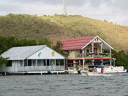 Homes in Lajas, Puerto Rico | |
 Flag | |
| Nicknames: "La Ciudad Cardenalicia", "Los Tira Piedras" | |
| Anthem: "Nuestro Lajas, pueblito querido" | |
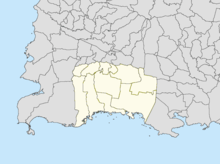
 Location of Lajas in Puerto Rico | |
| Coordinates: 18°03′07″N 67°03′35″W | |
| Commonwealth | |
| Founded | 1883 |
| Government | |
| • Mayor | Marcos Irizarry (PPD) |
| • Senatorial dist. | 5 - Ponce |
| • Representative dist. | 21 |
| Area | |
| • Total | 76.85 sq mi (199.04 km2) |
| • Land | 61 sq mi (158 km2) |
| • Water | 15.85 sq mi (41.04 km2) |
| Population (2010) | |
| • Total | 25,753 |
| • Density | 340/sq mi (130/km2) |
| Demonym(s) | Lajeños |
| Time zone | UTC−4 (AST) |
| Zip code | 00667 |
| Major routes | |
History
Located at the Lajas Valley, the town was founded in 1883 by the Xueta Teodoro Jacome Pagan. Xuetes (Chuetas) were Majorcan Jews (Sephardi Catalan Jews). Some families changed their names from Jacome to the Castilian form Santiago (Saint James the Righteous). Jacome is the Mallorquin form of James (Ia'akov). Catalan Jews from Majorca were part of the early settlers in the South of (Boriken) (Puerto Rico).
When after the Treaty of Paris (1898), the U.S. conducted its first census of Puerto Rico, the population of Lajas was 8,789.[1]
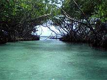
The village of La Parguera is a popular tourist destination to see the famous Bahía Fosforescente (Phosphorescent Bay) and its keys and islet's.[2]
People from the El Combate community in barrio Boquerón are known as mata con hacha ("those who kill with axes") based on folklore about a fight over the salinas, where those from Cabo Rojo fought with axes against people from the adjacent town of Lajas. Because the people from Lajas apparently fought back by throwing stones they are known as tira piedras ("those who throw stones").[3]
Geography
Lajas is located on the southern coast. Laguna Cartagena National Wildlife Refuge is a national protected area located in Lajas.[4]
Barrios
Like all municipalities of Puerto Rico, Lajas is subdivided into barrios. The municipal buildings, central square and large Catholic church are located in a small barrio referred to as "el pueblo".[5][6][7][8][9][10]
Sectors
Barrios (which are like minor civil divisions)[11] in turn are further subdivided into smaller local populated place areas/units called sectores (sectors in English). The types of sectores may vary, from normally sector to urbanización to reparto to barriada to residencial, among others.[12][13][14]
Demographics
| Historical population | |||
|---|---|---|---|
| Census | Pop. | %± | |
| 1900 | 8,789 | — | |
| 1910 | 11,071 | 26.0% | |
| 1920 | 11,908 | 7.6% | |
| 1930 | 12,454 | 4.6% | |
| 1940 | 14,736 | 18.3% | |
| 1950 | 16,326 | 10.8% | |
| 1960 | 15,375 | −5.8% | |
| 1970 | 16,545 | 7.6% | |
| 1980 | 21,236 | 28.4% | |
| 1990 | 23,271 | 9.6% | |
| 2000 | 26,261 | 12.8% | |
| 2010 | 25,753 | −1.9% | |
| U.S. Decennial Census[17] 1899 (shown as 1900)[18] 1910-1930[19] 1930-1950[20] 1960-2000[21] 2010[22] | |||
Tourism
Lajas is famous for its main touristic attraction, Phosphorescent Bay (La Parguera), a place where bioluminescent dinoflagellates of different colors appear when the water moves. The origin of the colored lights is the object of many legends. Lajas is also a fishing town.
Landmarks and places of interest
There are 5 beaches in Lajas.[23] Some of the main attractions of Lajas are:
- Cartagena Lagoon
- Indian Museum
- Old Train Station
- Old Silver Mines
- La Parguera
- Lajeño soldier Monument
- Isla Magueyes
- Isla Mata la Gata
- Pineapple Processing Plant Ruins
- Rosada Beach or Playita Rosada
- Caracoles
- Caribe Fisheries
- Alien route, which is a landing strip developed by a local from Lajas to welcome extraterrestrial landings.[24]
Culture
Festivals and events
- February: The Festival of Kites, and Our Lady of Candelaria Patron Saint Festival
- June: Pineapple Festival (Festival de la Piña Paradisíaca), where up to 50,000 people come for arts, crafts, music and 30,000 lbs. of pineapple[25]
- September: Lola Rodriguez of Tio Festival
Government
Like all municipalities in Puerto Rico, Lajas is administered by a mayor. The current mayor is Marcos Irizarry, from the Popular Democratic Party (PPD). Irizarry was elected at the 2012 general election, but he had served before from 1997 to 2009.
The city belongs to the Puerto Rico Senatorial district V, which is represented by two Senators. In 2012, Ramón Ruiz and Martín Vargas Morales, from the Popular Democratic Party, were elected as District Senators.[26]
Transportation
There are 5 bridges in Lajas.[27]
Symbols
Flag
The flag consists of three (3) horizontal stripes; the superior one green, the center white and the bottom one yellow. A fourth cross. In the center of that cross we have two arms united with a ripe yellow pineapple. The cross is surrounded by eleven gold stars; five in the superior (north) part and six in the inferior (south) part of the cross forming a circle.
Coat of arms
It is gold with a green band crossing it diagonally right to left; gold stands for the wealth of the land and green for the beauty of the valley, which is a gift from mother nature to Lajas. The band is adorned, at each end, with a pineapple bordered in gold and black. In the center of the band, also in gold, a marine shell. In the top left there is a red cardinal's hat and in the bottom a red anchor with green; the shield has a 3 tower castle, each one with two windows and a door. On the bottom, outside the shield, a banner with the inscription "Ciudad Cardenalicia" (Cardinality City). The banner and the inscription appear in black.
Gallery
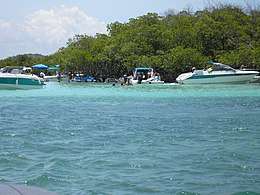 Boats in the Caribbean Sea in Lajas
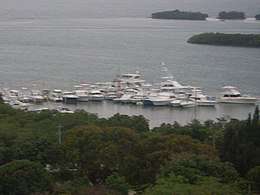 Boats at La Parguera
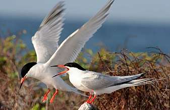 Roseate tern at La Parguera, (on the list of threatened species)
See also
- List of Puerto Ricans
- History of Puerto Rico
- National Register of Historic Places listings in Lajas, Puerto Rico
- Did you know-Puerto Rico?
References
- Joseph Prentiss Sanger; Henry Gannett; Walter Francis Willcox (1900). Informe sobre el censo de Puerto Rico, 1899, United States. War Dept. Porto Rico Census Office (in Spanish). Imprenta del gobierno. p. 164.
- "La Parguera". Lajas PR. Archived from the original on 2016-10-28. Retrieved 2019-03-15.
- "Página Oficial Municipio Autónomo de Cabo Rojo". Cabo Rojo PR. Archived from the original on 2019-04-04. Retrieved 2019-03-15.
- "Lajas Municipality". enciclopediapr.org. Fundación Puertorriqueña de las Humanidades (FPH).
- Picó, Rafael; Buitrago de Santiago, Zayda; Berrios, Hector H. Nueva geografía de Puerto Rico: física, económica, y social, por Rafael Picó. Con la colaboración de Zayda Buitrago de Santiago y Héctor H. Berrios. San Juan Editorial Universitaria, Universidad de Puerto Rico,1969. Archived from the original on 2018-12-26. Retrieved 2019-01-12.
- Gwillim Law (20 May 2015). Administrative Subdivisions of Countries: A Comprehensive World Reference, 1900 through 1998. McFarland. p. 300. ISBN 978-1-4766-0447-3. Retrieved 25 December 2018.
- Puerto Rico:2010:population and housing unit counts.pdf (PDF). U.S. Dept. of Commerce, Economics and Statistics Administration, U.S. Census Bureau. 2010. Archived (PDF) from the original on 2017-02-20. Retrieved 2019-01-12.
- "Map of Lajas" (PDF). Archived from the original (PDF) on 2012-07-30. Retrieved 2018-12-28.
- "Archived copy". Archived from the original on 2007-03-22. Retrieved 2007-12-18.CS1 maint: archived copy as title (link)
- "Map of the Neighborhoods (Barrios) of Lajas". Lajas PR. Archived from the original on 2007-12-21. Retrieved 2007-12-18.
- "US Census Barrio-Pueblo definition". factfinder.com. US Census. Archived from the original on 13 May 2017. Retrieved 5 January 2019.
- "Agencia: Oficina del Coordinador General para el Financiamiento Socioeconómico y la Autogestión (Proposed 2016 Budget)". Puerto Rico Budgets (in Spanish). Retrieved 28 June 2019.
- Rivera Quintero, Marcia (2014), El vuelo de la esperanza: Proyecto de las Comunidades Especiales Puerto Rico, 1997-2004 (first ed.), San Juan, Puerto Rico Fundación Sila M. Calderón, ISBN 978-0-9820806-1-0
- "Leyes del 2001". Lex Juris Puerto Rico (in Spanish). Retrieved 24 June 2020.
- Rivera Quintero, Marcia (2014), El vuelo de la esperanza:Proyecto de las Comunidades Especiales Puerto Rico, 1997-2004 (Primera edición ed.), San Juan, Puerto Rico Fundación Sila M. Calderón, p. 273, ISBN 978-0-9820806-1-0
- "Comunidades Especiales de Puerto Rico" (in Spanish). 8 August 2011. Archived from the original on 24 June 2019. Retrieved 24 June 2019.
- "U.S. Decennial Census". United States Census Bureau. Archived from the original on February 13, 2020. Retrieved September 21, 2017.
- "Report of the Census of Porto Rico 1899". War Department Office Director Census of Porto Rico. Archived from the original on July 16, 2017. Retrieved September 21, 2017.
- "Table 3-Population of Municipalities: 1930 1920 and 1910" (PDF). United States Census Bureau. Archived (PDF) from the original on August 17, 2017. Retrieved September 21, 2017.
- "Table 4-Area and Population of Municipalities Urban and Rural: 1930 to 1950" (PDF). United States Census Bureau. Archived (PDF) from the original on August 30, 2015. Retrieved September 21, 2014.
- "Table 2 Population and Housing Units: 1960 to 2000" (PDF). United States Census Bureau. Archived (PDF) from the original on July 24, 2017. Retrieved September 21, 2017.
- Puerto Rico:2010:population and housing unit counts.pdf (PDF). U.S. Dept. of Commerce Economics and Statistics Administration U.S. Census Bureau. 2010. Archived (PDF) from the original on 2017-02-20. Retrieved 2019-01-12.
- "Las 1,200 playas de Puerto Rico [The 1200 beaches of Puerto Rico]". Primera Hora (in Spanish). April 14, 2017. Archived from the original on December 12, 2019. Retrieved December 12, 2019.
- https://www.cbsnews.com/news/if-he-builds-it-will-they-come/
- "Esperan 50,000 personas en Festival de la Piña". Primera Hora (in Spanish). 20 May 2019. Archived from the original on 17 August 2019. Retrieved 17 August 2019.
- Elecciones Generales 2012: Escrutinio General Archived 2013-01-15 at the Wayback Machine on CEEPUR
- "Lajas Bridges". National Bridge Inventory Data. US Dept. of Transportation. Archived from the original on 20 February 2019. Retrieved 19 February 2019.
Famous lajeños
- Luis Aponte Martinez, Roman Catholic cardinal of the Archdiocese of San Juan
- Ulises Casiano, Roman Catholic bishop of the Diocese of Mayagüez
- Jacobo Morales, actor and film director
- Jose "Joe" Basora, Puerto Rican Boxer
![]()
Places adjacent to Lajas, Puerto Rico | |
|---|---|