Naranjito, Puerto Rico
Naranjito (Spanish pronunciation: [naɾaŋˈxito]) is a municipality of Puerto Rico located in the central region of the island, south of Toa Alta; north of Barranquitas and Comerío; east of Corozal; and west of Bayamón. Naranjito is spread over 15 wards and Naranjito Pueblo (the downtown area and the administrative center). It is part of the San Juan-Caguas-Guaynabo Metropolitan Statistical Area.
Naranjito Municipio de Naranjito | |
|---|---|
Town and Municipality | |
 | |
 Flag | |
| Nicknames: "La Ciudad de los Colores", "El Pueblo de los Changos" | |
| Motto(s): "Naranjito Brilla" | |
| Anthem: Naranjito, mi hogar predilecto | |
 Location of Naranjito in Puerto Rico | |
| Coordinates: 18°18′03″N 66°14′42″W | |
| Commonwealth | |
| Founded | December 3, 1824 |
| Founded by | Braulio Morales |
| Government | |
| • Mayor | Orlando Ortíz Chevres (PNP) |
| • Senatorial District | VI - Guayama Carlos J. Torres Torres (PNP) |
| • Representative District | 28 Rafael Rivera Ortega (PNP) |
| Area | |
| • Total | 28.4 sq mi (73.54 km2) |
| • Land | 28.2 sq mi (73.0 km2) |
| • Water | 0.2 sq mi (0.54 km2) |
| Elevation | 2,997 ft (700 m) |
| Population (2010) | |
| • Total | 30,402 |
| • Density | 1,100/sq mi (410/km2) |
| Demonym(s) | Naranjiteños |
| Time zone | UTC−4 (AST) |
| Zip code | 00719 |
| Area code | +1 (spec. +1-787 and +1-939) |
| Major routes | |
History
The struggle to form the Naranjito town began in 1810. After a series of major incidents with powerful political interests of the time, on December 3, 1824, Don Braulio Morales successfully founded the town of Naranjito. The town was founded in the neighborhood of the same name, on a land donated by Doña Manuela Rivera and Don Braulio Morales. Morales was named "Captain Settler" and at the same time was appointed mayor of the town in development. The name "Naranjito" is derived from a small orange tree that served as a reference point for travelers looking for in the shortest way to the town of Toa Alta. At the time of its foundation, Naranjito consisted of five wards/districts, "Lomas", "Guadiana", "Achiote", "Nuevo" and "Cedro". "Cedro" was divided in 1853 in "Cedro Arriba" and "Cedro Abajo", also having the urban zone composed by "San Miguel", "San Antonio" and "San Cristobal" districts.
Hurricane Maria
.jpg)
With its significant amount of rainfall, Hurricane Maria (on September 20, 2017) triggered numerous landslides in Naranjito.[1][2] Elderly, especially, struggled to recover.[3][4]
Geography

Naranjito is located in the central region.[5]
Hydrography
Rivers and streams of Naranjito include Río Cañas, Río Cibuco, Río Grande de Manatí, Río Guadiana and Río Mavilla.[6]
Barrios

Like all municipalities of Puerto Rico, Naranjito is subdivided into barrios. The municipal buildings, central square and large Catholic church are located in a barrio referred to as "el pueblo".[7][8][9]
- Achiote
- Anones
- Nuevo
- Cedro Abajo
- Cedro Arriba
- Guadiana
- Lomas, also known as Lomas Garcia[10]
- Naranjito barrio-pueblo[11]
Sectors
Barrios (which are like minor civil divisions)[11] in turn are further subdivided into smaller local populated place areas/units called sectores (sectors in English). The types of sectores may vary, from normally sector to urbanización to reparto to barriada to residencial, among others.[12][13][14]
Special Communities
Of the 742 places on the list of Comunidades Especiales de Puerto Rico, the following barrios, communities, sectors, or neighborhoods were in Naranjito: La Pajona (Los Alvarado) in Cedro Arriba, Las Parcelas in Lomas García, Los Pampers (Sico Martínez) in Lomas García, Sector Benito Nieves/Los Quilés in Lomas García, Comunidad Lago La Plata, La Colina, San Antonio y San Cristóbal, Casco Urbano (Las Barriadas), Parcelas Hevia, Sector Mulitas, Comunidad Cayito Ríos, Lomas Jaguas, Los Pelusa in Cedro Abajo, Comunidades Riíto 1 y II in Cedro Arriba, Comunidad El Palmar, Los López in Cedro Abajo, Fondo del Saco in Achiote and La Sabana in Cedro Abajo.[15]
Demographics
| Historical population | |||
|---|---|---|---|
| Census | Pop. | %± | |
| 1900 | 8,101 | — | |
| 1910 | 8,876 | 9.6% | |
| 1920 | 10,503 | 18.3% | |
| 1930 | 11,645 | 10.9% | |
| 1940 | 13,954 | 19.8% | |
| 1950 | 15,927 | 14.1% | |
| 1960 | 17,319 | 8.7% | |
| 1970 | 19,913 | 15.0% | |
| 1980 | 23,633 | 18.7% | |
| 1990 | 27,914 | 18.1% | |
| 2000 | 29,709 | 6.4% | |
| 2010 | 30,402 | 2.3% | |
| U.S. Decennial Census[16] 1899 (shown as 1900)[17] 1910-1930[18] 1930-1950[19] 1960-2000[20] 2010[8] | |||
Tourism
Landmarks and places of interest
- Anones Park
- Cancha Gelito Ortega
- Cedro Abajo Falls (Las Lagrimas Falls)
- La Marina Boardwalk
- La Plata Lake
- Las Avispas Hills
- Municipal Swimming Pool
- Trovador Plaza
- Mirador de Anones
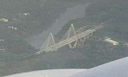
- Puente Atirantado Jesús Izcoa Moure
- El Cerro Community
Economy
Traditionally the main agricultural crops of Naranjito are coffee and the tobacco. In recent years have borne fruits such as bananas, oranges, papayas, and other tropical fruits; also in the town the poultry factory has been very popular, specifically the dairy cattle (fresh milk). Naranjito has many factories, most of these factories make garments (clothing).[21]
Culture
Festivals and events
- Mothers Day - May
- San Antonio Day - June
- Chango Festival - June
- Anon Festival - June
- Volleyball Tournament - February - June
- San Miguel Arcangel Day - September
- Patron Festivities - September - October
- Turkey marathon - November
Sports
The Naranjito Changos, better known as Los Changos De Naranjito, are a professional male volleyball team based in Naranjito. The team is one of the most successful sports franchises in Puerto Rico.[22]
Government
All municipalities in Puerto Rico are administered by a mayor, elected every four years. On November 4, 2008, Orlando Ortíz Chevres (of the New Progressive Party), won the elections.
The city belongs to the Puerto Rico Senatorial district VI, which is represented by two senators. In 2012, Miguel Pereira Castillo and Angel M. Rodríguez were elected as District Senators.[23]
Transportation
There are 19 bridges in Naranjito.[24]
Symbols
Flag
Naranjito's flag consists of an orange flag crossed by two narrow green stripes close to the superior and inferior edges. The orange color in the flag symbolizes the town of Naranjito (little orange tree), while the green symbolizes its green mountains.
Coat of arms
The coat of arms is a red cross, the symbol of San Miguel de Arcángel, Patron of Naranjito. The globe with the cross symbolizes the power and sovereignty of God. The gold and red stripes that appear in the second and third quarters, constitute the primitive baton of the Guadiana lineage. The lily twigs are a tribute of San Antonio de Padua, confessor and doctor of the Church. The orange tree represents the small tree that gave the town's name, Naranjito. The crown is symbol of moral unit of the town.
Education
Naranjito includes several public and private schools distributed through several regions. Public education is handled by the Puerto Rico Department of Education
Elementary schools
- Bernarda Robles De Hevia
- Don Manolo Rivera
- Felipa Sanchez Cruzado
- Jose Archilla Cabrera
- Jose Fina Marrero
- Francisco Roque Muñoz
- Rosa Luz Zayas
- Silvestre Martinez
Middle and junior high schools
- Coleen Vazquez Urrutia
- Mercedes Rosado
- S.U. Adolfo Garcia
- S.U. Fidel G Padilla
- S.U. Pedro Fernandez
High schools
- Francisco Morales
- Vocacional Rubén Rodríguez Figueroa
Private schools
- Academia Santa Teresita (K-12)
Media
A foot pursuit of the movie Fast & Furious 5 in which Dominic Toretto (Vin Diesel), Mia Toretto (Jordana Brewster) and Brian O'Connor (Paul Walker) are chased across favela rooftops by Luke Hobbs (Dwayne Johnson) and his team was filmed over the course of a week in the small hillside town of Naranjito, Puerto Rico. The scene was considered difficult to shoot, as pathways were slippery from moist tropical heat and the scene involved actors and stunt doubles running while avoiding dogs, chickens and other stray animals loose in the area. To capture the scene, a 420-foot cable-camera rig was used to allow for a fast moving, birds-eye view of the action, and cameras on cranes were set up on rooftops and in alleyways. Walker and Brewster made multiple takes of the conclusion of the scene, requiring them to jump nearly 30 feet from a building onto a waiting safety mat. In total the production employed 236 technicians, 13,145 extras, and generated 16,824 room nights at hotels, contributing $27 million to the Puerto Rican community.[25][26]
Notable People
- Yazaira Lopez, the winner of Va por Ti co-production of Univision and Televisa 2014
- Christian Nieves, an internationally known cuatro player
- Barbara Serrano, recognized writer and first runner-up of Miss World Puerto Rico 2000
Books about Naranjito
- El Chango. Apuntes Historicos del Pueblo de Naranjito-1824-1998, Author: Silvestre J. Morales 1999
See also
- List of Puerto Ricans
- History of Puerto Rico
- Did you know-Puerto Rico?
References
- "Preliminary Locations of Landslide Impacts from Hurricane Maria, Puerto Rico". USGS Landslide Hazards Program. USGS. Archived from the original on 2019-03-03. Retrieved 2019-03-03.
- "Preliminary Locations of Landslide Impacts from Hurricane Maria, Puerto Rico" (PDF). USGS Landslide Hazards Program. USGS. Archived (PDF) from the original on 2019-03-03. Retrieved 2019-03-03.
- Rivera, Lilliam (September 19, 2018). "One Year After Hurricane Maria, We Are Still Picking Up the Pieces". ELLE. Archived from the original on July 31, 2019. Retrieved July 31, 2019.
- "Amid new hurricane season, Maria still taking a toll on Puerto Rico's elderly". PBS NewsHour. July 11, 2018. Archived from the original on July 31, 2019. Retrieved July 31, 2019.
- "Naranjito Municipality". enciclopediapr.org. Fundación Puertorriqueña de las Humanidades (FPH). Archived from the original on 2019-04-04. Retrieved 2019-03-20.
- "GNIS". geonames.usgs.gov.
- Gwillim Law (20 May 2015). Administrative Subdivisions of Countries: A Comprehensive World Reference, 1900 through 1998. McFarland. p. 300. ISBN 978-1-4766-0447-3. Retrieved 25 December 2018.
- Puerto Rico:2010:population and housing unit counts.pdf (PDF). U.S. Dept. of Commerce Economics and Statistics Administration U.S. Census Bureau. 2010. Archived (PDF) from the original on 2017-02-20. Retrieved 2018-12-26.
- "Map of Naranjito at the Wayback Machine" (PDF). Archived from the original (PDF) on 2018-03-24. Retrieved 2018-12-29.
- "Asesinato en Naranjito". TuNoticiaPR (in Spanish). Archived from the original on 26 June 2019. Retrieved 26 June 2019.
- "US Census Barrio-Pueblo definition". factfinder.com. US Census. Archived from the original on 13 May 2017. Retrieved 5 January 2019.
- "Agencia: Oficina del Coordinador General para el Financiamiento Socioeconómico y la Autogestión (Proposed 2016 Budget)". Puerto Rico Budgets (in Spanish). Retrieved 28 June 2019.
- Rivera Quintero, Marcia (2014), El vuelo de la esperanza: Proyecto de las Comunidades Especiales Puerto Rico, 1997-2004 (first ed.), San Juan, Puerto Rico Fundación Sila M. Calderón, ISBN 978-0-9820806-1-0
- "Leyes del 2001". Lex Juris Puerto Rico (in Spanish). Retrieved 24 June 2020.
- Rivera Quintero, Marcia (2014), El vuelo de la esperanza:Proyecto de las Comunidades Especiales Puerto Rico, 1997-2004 (Primera edición ed.), San Juan, Puerto Rico Fundación Sila M. Calderón, p. 273, ISBN 978-0-9820806-1-0
- "U.S. Decennial Census". United States Census Bureau. Archived from the original on February 13, 2020. Retrieved September 21, 2017.
- "Report of the Census of Porto Rico 1899". War Department Office Director Census of Porto Rico. Archived from the original on July 16, 2017. Retrieved September 21, 2017.
- "Table 3-Population of Municipalities: 1930 1920 and 1910" (PDF). United States Census Bureau. Archived (PDF) from the original on August 17, 2017. Retrieved September 21, 2017.
- "Table 4-Area and Population of Municipalities Urban and Rural: 1930 to 1950" (PDF). United States Census Bureau. Archived (PDF) from the original on August 30, 2015. Retrieved September 21, 2014.
- "Table 2 Population and Housing Units: 1960 to 2000" (PDF). United States Census Bureau. Archived (PDF) from the original on July 24, 2017. Retrieved September 21, 2017.
- Naranjito 2009: 2
- Naranjito 2009: 3
- Elecciones Generales 2012: Escrutinio General Archived 2013-01-15 at the Wayback Machine on CEEPUR
- "Naranjito Adjuntas Bridges". National Bridge Inventory Data. US Dept. of Transportation. Archived from the original on 20 February 2019. Retrieved 19 February 2019.
- Verrier, Richard (May 14, 2011). "Puerto Rico hoping to ride box-office success of 'Fast Five'". Los Angeles Times. Tribune Company. Archived from the original on November 13, 2012. Retrieved November 13, 2012.
- "Fast Five" (PDF). Official Fast Five website. Universal Pictures. Archived from the original (PDF) on August 8, 2011. Retrieved March 5, 2012.
External links
- Morales, Papucho (2009). Manual informativo del Gobierno Municipal de Naranjito, Puerto Rico. Gobierno Municipal de Naranjito, PR.
- Puerto Rico Government Directory - Naranjito