Maricao, Puerto Rico
Maricao (Spanish pronunciation: [maɾiˈkao]) is the second-least populous municipality of Puerto Rico; it is located at the western edge of the Cordillera Central. It is a small town set around a small plaza in hilly terrain, north of San Germán, Sabana Grande and Yauco; south of Las Marías and Lares, southeast of Mayagüez, and west of Adjuntas. Maricao is spread over 15 wards and Maricao Pueblo (the downtown area and the administrative center of the city).
Maricao Municipio de Maricao | |
|---|---|
Town and Municipality | |
.jpg) | |
 Flag | |
| Nicknames: "Pueblo de las Indieras", "Ciudad del Monte del Estado", "Ciudad de Leyenda y Romance", "Tierra del Café" | |
| Anthem: "Sobre las verdes altura" | |
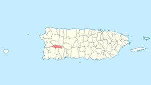 Location of Maricao in Puerto Rico | |
| Coordinates: 18°10′51″N 66°58′48″W | |
| Commonwealth | |
| Founded | April 10, 1874 |
| Government | |
| • Mayor | Gilberto Pérez Valentín |
| • Senatorial dist. | 5 - Ponce |
| • Representative dist. | 21 |
| Area | |
| • Total | 37.1 sq mi (96.0 km2) |
| • Land | 37.1 sq mi (96 km2) |
| • Water | 0 sq mi (0 km2) |
| Population (2010) | |
| • Total | 6,276 |
| • Density | 170/sq mi (65/km2) |
| Demonym(s) | Maricaeños |
| Time zone | UTC−4 (AST) |
| Zip code | 00606 |
| Major routes | |
The town borders the Maricao Fish Hatchery, a collection of tanks and ponds in a garden setting, where some 25,000 fish are raised yearly to stock farm fishponds and island lakes. The hatchery is part of the Maricao State Forest, also known as Monte del Estado. Though of dryer vegetation than the other mountain forest, Maricao is home to large number of bird species. Its stone observation tower provides far-flung views to the coast and the Mona Passage.
Maricao has a 2000 census population of 6,449. It has a land area of 37.1 square miles (96.87 km2).[1]
History
Maricao was founded on April 1, 1874 when Bernardo Collado, Julián Ayala, Francisco M. Sojo, Napoleón Pietri and Leoncio S. Martínez requested the Provincial Deputation authorization to establish an official town. It originally belonged to the district of San Germán, but they alleged the roads were too long and almost impassable. Their request made references to a parish already established in 1866.
During the 19th century coffee boom, Maricao and other regions surged economically. When the spurt of coffee in the island ended by the start of the 20th century, the economic conditions deteriorated again. Many of the old plantation houses have been turned into museums to stimulate the tourism industry. While Puerto Rico still has a niche in the gourmet coffee market, the large scale coffee growing which built Maricao is no longer economically feasible.
Hurricane Maria
Hurricane Maria on September 20, 2017 triggered numerous landslides in Maricao. In some areas of Maricao there were more than 25 landslides per square mile due to the significant amount of rainfall.[2][3] Elderly were especially affected.[4]
Symbols
Flag
The flag of Maricao derives its colors, design and symbolism from the municipal shield. It consists of a green cloth, with the three usual dimensions of the municipal flags of Puerto Rico, crossing from an end to another a yellow band with three points. The color green symbolizes the vegetation of the municipality and the yellow band symbolizes the mountains of the region.
Coat of arms
In a silver field, resides an inverted "V"-shaped green band. Contained in the band are five golden huts. To either side and below the band are a total of three Maricao (Byrsonima spicata) tree branches with flowers. Surrounding the shield below and to either side are two coffee tree branches. Above it is placed a gold mural crown with three towers outlined in black with green doors and windows.
Name
The origin of its name has two versions. It is said to come from the name of the Maricao tree (Byrsonima spicata) which has yellow flowers and grows in the region. The second version is a legend about a Taíno woman called María that, during the Spanish colonization, fell in love with a Spanish soldier. She informed him of an attack planned by her tribe and the Spanish took the offensive. María was then taken prisoner by her people and tried for treason. As was the tradition, she was tied to a tree and sacrificed. Allegedly "cao" means "sacrifice" so, Maricao means "María's sacrifice".
Geography

Maricao is mildly mountainous and belongs to the Western portion of the Cordillera Central.[5]
Barrios
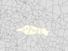
Like all municipalities of Puerto Rico, Maricao is subdivided into barrios. The municipal buildings, central square and large Catholic church are located in a barrio referred to as "el pueblo".[6][7][8]
Sectors
Barrios (which are like minor civil divisions)[9] in turn are further subdivided into smaller local populated place areas/units called sectores (sectors in English). The types of sectores may vary, from normally sector to urbanización to reparto to barriada to residencial, among others.[10][11][12]
Culture
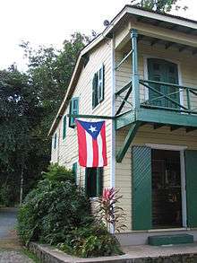
Tourism
.jpg)
Due to its importance as a coffee producer in the past, some of Maricao's coffee haciendas were turned into museums or guest houses: Hacienda Delicias and Hacienda Juanita, which has since closed. Other places for tourists to visit are the Bambúa Recreational Center and the Maricao Fish Nursery. Some natural spots to visit are the Monte del Estado forest reserve, the Prieto Lake and the Salto de Curet (a waterfall).
Festivals and events
Maricao has only one annual festival, the End of the Coffee Harvest festival, known locally as the Acabe de Café. It celebrates the traditional harvest festival wherein the Hacienda owners would feed their workers at the end of the harvest. It is held on President's Day weekend in February. It was founded in 1977 by the then mayor, Vicente Byron, and has been going on for over thirty years. Also, in the Indieras they celebrate Indigenous Day Festival in the month of April.
Economy
.jpg)
For decades, Maricao's economy has relied on agriculture, specifically coffee plantations. Fruits and vegetables are also grown in the town. Currently only one factory is established in Maricao, Fenwal Blood Technologies. Devices and materials that are used in blood donation, transfusion, transportation and storage are produced there. Tourism has also played an important role in the town's economy.
For two decades, this municipality has had the highest level of children living in poverty in Puerto Rico.[15]
Demographics
| Historical population | |||
|---|---|---|---|
| Census | Pop. | %± | |
| 1900 | 8,312 | — | |
| 1910 | 7,158 | −13.9% | |
| 1920 | 8,291 | 15.8% | |
| 1930 | 6,463 | −22.0% | |
| 1940 | 7,724 | 19.5% | |
| 1950 | 7,403 | −4.2% | |
| 1960 | 6,990 | −5.6% | |
| 1970 | 5,991 | −14.3% | |
| 1980 | 6,737 | 12.5% | |
| 1990 | 6,206 | −7.9% | |
| 2000 | 6,449 | 3.9% | |
| 2010 | 6,276 | −2.7% | |
| U.S. Decennial Census[16] 1899 (shown as 1900)[17] 1910-1930[18] 1930-1950[19] 1960-2000[20] 2010[8] | |||
According to the 2000 census, Maricao is the second least populous municipality in Puerto Rico, above the island municipality of Culebra, with 6,449 inhabitants. The population of the town has decreased during the past decades perhaps due to the decline in coffee production and the deteriorating economy. In 1899, the population was 8,312. The current population density is 174.2 people per square mile (67.0/km²).
As a whole, Puerto Rico is mainly made up of people from a Creole (born on the Island of European descent) or Spanish and European descent, with small groups of African and Asian people. Statistics taken from the 2000 census shows that 90.3% of Maricaeños have Spanish or White origin, 3.0% are black, 0.2% are Amerindian etc. The majority of the local population are partly descended from pre Columbian indigenous inhabitants.
There is a general consensus in Puerto Rico that the barrios of Indieras in Maricao have the most people of indigenous origin in Puerto Rico.[21]
| Race - Maricao, Puerto Rico - 2000 Census[22] | ||
|---|---|---|
| Race | Population | % of Total |
| White | 5,824 | 90.3% |
| Black/African American | 194 | 3.0% |
| American Indian and Alaska Native | 10 | 0.2% |
| Asian | 1 | 0.0% |
| Native Hawaiian/Pacific Islander | 0 | 0.0% |
| Some other race | 204 | 3.2% |
| Two or more races | 216 | 3.3% |
Government
Maricao's first mayor was Juan Ferrer y Arnijas, whose term ran from 1874 to 1876. The current mayor is Gilberto Pérez Valentín, alias "El Enano" or the Dwarf, who was elected for a seventh consecutive term in 2016.
The city belongs to the Puerto Rico Senatorial district V, which is represented by two Senators. In 2016, Luis Berdiel and Nelson Cruz, from the New Progressive Party, were elected as District Senators.[23]
Education
Maricao has several public and private schools distributed through several regions. Public education is handled by the Puerto Rico Department of Education.
Transportation
There is no direct highway connection to Maricao. Puerto Rico Highway 119 and Puerto Rico Highway 120 lead from the north, while Puerto Rico Highway 121 and Puerto Rico Highway 105 lead from the south. Maricao lies about three hours from San Juan.
There are 13 bridges in Maricao.[24]
Notable natives and residents
- Rafael Pico - Educator
- Pedro Segarra - Mayor of Hartford, Connecticut
See also
- List of Puerto Ricans
- History of Puerto Rico
- Did you know-Puerto Rico?
References
- Bureau, U. S. Census. "U.S. Census website". United States Census Bureau. Retrieved 2019-03-24.
- "Preliminary Locations of Landslide Impacts from Hurricane Maria, Puerto Rico". USGS Landslide Hazards Program. USGS. Archived from the original on 2019-03-03. Retrieved 2019-03-03.
- "Preliminary Locations of Landslide Impacts from Hurricane Maria, Puerto Rico" (PDF). USGS Landslide Hazards Program. USGS. Archived (PDF) from the original on 2019-03-03. Retrieved 2019-03-03.
- "Amid new hurricane season, Maria still taking a toll on Puerto Rico's elderly". PBS NewsHour. July 11, 2018. Archived from the original on July 31, 2019. Retrieved July 31, 2019.
- "Maricao Municipality". enciclopediapr.org. Fundación Puertorriqueña de las Humanidades (FPH). Archived from the original on 2019-06-21. Retrieved 2019-03-20.
- Picó, Rafael; Buitrago de Santiago, Zayda; Berrios, Hector H. Nueva geografía de Puerto Rico: física, económica, y social, por Rafael Picó. Con la colaboración de Zayda Buitrago de Santiago y Héctor H. Berrios. San Juan Editorial Universitaria, Universidad de Puerto Rico,1969. Archived from the original on 2018-12-26. Retrieved 2018-12-31.
- Gwillim Law (20 May 2015). Administrative Subdivisions of Countries: A Comprehensive World Reference, 1900 through 1998. McFarland. p. 300. ISBN 978-1-4766-0447-3. Retrieved 25 December 2018.
- Puerto Rico:2010:population and housing unit counts.pdf (PDF). U.S. Dept. of Commerce, Economics and Statistics Administration, U.S. Census Bureau. 2010. Archived (PDF) from the original on 2017-02-20. Retrieved 2018-12-26.
- "US Census Barrio-Pueblo definition". factfinder.com. US Census. Archived from the original on 13 May 2017. Retrieved 5 January 2019.
- "Agencia: Oficina del Coordinador General para el Financiamiento Socioeconómico y la Autogestión (Proposed 2016 Budget)". Puerto Rico Budgets (in Spanish). Retrieved 28 June 2019.
- Rivera Quintero, Marcia (2014), El vuelo de la esperanza: Proyecto de las Comunidades Especiales Puerto Rico, 1997-2004 (first ed.), San Juan, Puerto Rico Fundación Sila M. Calderón, ISBN 978-0-9820806-1-0
- "Leyes del 2001". Lex Juris Puerto Rico (in Spanish). Retrieved 24 June 2020.
- Rivera Quintero, Marcia (2014), El vuelo de la esperanza:Proyecto de las Comunidades Especiales Puerto Rico, 1997-2004 (1st ed.), San Juan, Puerto Rico Fundación Sila M. Calderón, p. 273, ISBN 978-0-9820806-1-0
- "Comunidades Especiales de Puerto Rico" (in Spanish). 8 August 2011. Archived from the original on 24 June 2019. Retrieved 24 June 2019.
- "No cede la pobreza infantil en Puerto Rico". El Nuevo Dia (in Spanish). 24 March 2019. Archived from the original on 24 March 2019. Retrieved 24 March 2019.
- "U.S. Decennial Census". United States Census Bureau. Archived from the original on February 13, 2020. Retrieved September 21, 2017.
- "Report of the Census of Porto Rico 1899". War Department, Office Director Census of Porto Rico. Archived from the original on July 16, 2017. Retrieved September 21, 2017.
- "Table 3-Population of Municipalities: 1930, 1920, and 1910" (PDF). United States Census Bureau. Archived (PDF) from the original on August 17, 2017. Retrieved September 21, 2017.
- "Table 4-Area and Population of Municipalities, Urban and Rural: 1930 to 1950" (PDF). United States Census Bureau. Archived (PDF) from the original on August 30, 2015. Retrieved September 21, 2014.
- "Table 2 Population and Housing Units: 1960 to 2000" (PDF). United States Census Bureau. Archived (PDF) from the original on July 24, 2017. Retrieved September 21, 2017.
- Martínez Cruzado, Juan C. (2002). The Use of Mitochondrial DNA to Discover Pre-Columbian Migrations to the Caribbean: Results for Puerto Rico and Expectations for the Dominican Republic. KACIKE: The Journal of Caribbean Amerindian History and Anthropology [On-line Journal], Special Issue, Lynne Guitar, Ed. Available at: "Archived copy" (PDF). Archived from the original (PDF) on 2004-06-22. Retrieved 2006-09-25.CS1 maint: archived copy as title (link) [Date of access: September 25, 2006]
- "Ethnicity 2000 census" (PDF). Archived (PDF) from the original on 2008-02-16. Retrieved 2009-04-04.
- Elecciones Generales 2012: Escrutinio General Archived 2013-01-15 at the Wayback Machine on CEEPUR
- "Maricao Bridges". National Bridge Inventory Data. US Dept. of Transportation. Archived from the original on 20 February 2019. Retrieved 19 February 2019.