Anones
Anones is a barrio in the municipality of Naranjito, Puerto Rico. Its population in 2010 was 4,976.[2][3][4] Anones is located to the South of the urban center of the municipality. There are schools and shops here and it is the most mountainous area of the municipality.[5]
Anones | |
|---|---|
Barrio | |
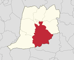 | |
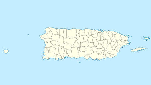 Anones Anones, Naranjito, Puerto Rico  Anones Anones (Caribbean) | |
| Coordinates: 18°16′18″N 66°14′37″W[1] | |
| Commonwealth | |
| Municipality | |
| Government | |
| • Mayor | Orlando Ortiz Chevres |
| Elevation | 1,634 ft (498 m) |
| Population (2010) | |
| • Total | 4,976 |
| Source: 2010 Census | |
| Time zone | UTC−4 (AST) |
| Zip code | 00719 |
History
The United States took control of Puerto Rico from Spain in the aftermath of the Spanish-American War under the terms of the Treaty of Paris of 1898. In 1899, the United States conducted its first census of Puerto Rico, finding that the population of Anones barrio was 1,420.[6]
Sectors and neighborhoods
The following are the sectors and neighborhoods of Anones: El Palmar, Cayito Ríos, La Maya, La Sierra, Anones Díaz, Villa Polilla, Merce Alicea, Anones Don Tito, Flor Maure, Carretera 152, Beltrán, Mirador, Hernández, El Pollito, Marcano, Cátala, Los Matos, Rodríguez, Camino Manolín González and Tito Cátala.[5]
See also
References
- U.S. Geological Survey Geographic Names Information System: Anones Barrio
- Picó, Rafael; Buitrago de Santiago, Zayda; Berrios, Hector H. Nueva geografía de Puerto Rico: física, económica, y social, por Rafael Picó. Con la colaboración de Zayda Buitrago de Santiago y Héctor H. Berrios. San Juan Editorial Universitaria, Universidad de Puerto Rico,1969.
- Gwillim Law (20 May 2015). Administrative Subdivisions of Countries: A Comprehensive World Reference, 1900 through 1998. McFarland. p. 300. ISBN 978-1-4766-0447-3. Retrieved 25 December 2018.
- Puerto Rico:2010:population and housing unit counts.pdf (PDF). U.S. Dept. of Commerce, Economics and Statistics Administration, U.S. Census Bureau. 2010.
- "Plan Territorial (2012)" (PDF). JP PR Gov (in Spanish). Gobierno Municipal de Naranjito -Oficina de Planificación y Ordenación Territorial. p. 42. Retrieved 26 June 2019.
- Joseph Prentiss Sanger; Henry Gannett; Walter Francis Willcox (1900). Informe sobre el censo de Puerto Rico, 1899, United States. War Dept. Porto Rico Census Office (in Spanish). Imprenta del gobierno. p. 162.