Guayanilla, Puerto Rico
Guayanilla (Spanish pronunciation: [ɡwaʝaˈniʎa]) is a municipality of Puerto Rico located in southern coast of the island, bordering the Caribbean Sea, south of Adjuntas, east of Yauco; and west of Peñuelas and about 12 miles (19 km) west of Ponce. Guayanilla is spread over 16 wards and Guayanilla Pueblo (the downtown area and the administrative center of the city). It is part of the Yauco Metropolitan Statistical Area.
Guayanilla Municipio de Guayanilla | |
|---|---|
Town and Municipality | |
 | |
 Flag | |
| Nicknames: "Tierra de Agüeybaná", "Los Corre en Yegua", "Capital Taina" | |
| Anthem: "Guayanillenses, cantemos unidos" | |
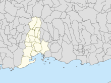
 Location of Guayanilla in Puerto Rico | |
| Coordinates: 18°01′09″N 66°47′31″W | |
| Commonwealth | |
| Founded | February 27, 1833 |
| Government | |
| • Mayor | Nelson Torres Yordán (PPD) |
| • Senatorial dist. | 5 - Ponce |
| • Representative dist. | Precinct 58 |
| Area | |
| • Total | 109.9 km2 (42.4 sq mi) |
| Elevation | 49 m (161 ft) |
| Population (2010) | |
| • Total | 21,581 |
| • Density | 200/km2 (510/sq mi) |
| Demonym(s) | Guayanillenses |
| Time zone | UTC−4 (AST) |
| Zip code | 00656 |
| Major routes | |
| GNIS feature ID | 1610861[1] |
History
Guayanilla was founded by Puerto Rican criollos. The original name was Guadianilla in memory of a river of the same name in Spain. However, it was changed to Guayanilla to resemble a native word in the Taíno dialect. The name Guayanilla is derived from a combination of Guaynia and Santa Maria de Guadianilla.
The first Europeans settled in this area in 1511. In 1756, Yauco was founded as a town. Then Guayanilla was a borough of Yauco. Due to the very fertile lands and access to the local port where most of the local commerce occurred, Guayanilla became an important agricultural center where sugar cane was cultivated. Guayanilla grew quickly and was established as a separate municipality on February 27, 1833 by Governor Miguel de la Torre.
2019 - 2020 Earthquakes
On January 6, 2020 a 5.8 magnitude earthquake was felt in Guayanilla and several structures and cars were destroyed. A family of eight escaped a home that was destroyed by the earthquake.[2][3]
On January 7, 2020 a 6.4 magnitude earthquake destroyed the Catholic church in Guayanilla barrio-pueblo.[4]
Geography
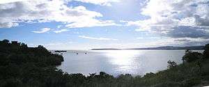
Guayanilla is located on the southern coast. The coastline forms the Guayanilla Bay, one of the best natural harbors in Puerto Rico, to the south, also. The nearest city is Ponce, which is 12 miles (19 km) to the east. The northern regions are bordered by mountains that reach 3,300 feet (1,000 m). In the central regions, the terrain descends where it does not exceed 1,410 feet (430 m). Finally in the coastal plain, the elevations do not exceed 951 feet (290 m). The Yauco, Guayanilla, and Macaná rivers all run through the municipality. The Yauco River briefly runs through the Boca borough, where its exit into the Caribbean Sea and accompanying marshlands are located.[5]
Hurricane Maria
Hurricane Maria, with its significant rainfall, triggered numerous landslides in Guayanilla on September 20, 2017.[6][7]
Barrios
Like all municipalities of Puerto Rico, Guayanilla is subdivided into barrios. The municipal buildings, central square and large Catholic church are located in a small barrio referred to as "el pueblo", near the center of the municipality.[8][9]
Sectors
Barrios (which are like minor civil divisions)[10] in turn are further subdivided into smaller local populated place areas/units called sectores (sectors in English). The types of sectores may vary, from normally sector to urbanización to reparto to barriada to residencial, among others.[11][12][13]
Special Communities
Of the 742 places on the list of Comunidades Especiales de Puerto Rico, the following barrios, communities, sectors, or neighborhoods are in Guayanilla: Magas Abajo, Villa del Carmen in Playa barrio, Piedras Blancas, Playita, and San Pedro.[14]
Tourism
There are 17 beaches in Guayanilla.[15]
- Places to visit: Mario Mercado Castle, Chorro de Oro Waterfall, Cuevas (Caves) del Convento, Guilarte Forest, Emajagua Beach, La Ventana Beach, Tamarindo Beach, Central Rufina Ruins. El Castillo del Niño (The Child's Castle) amusement park.
- Festivals: Town Carnival (April), Student Festival (May), Beach Festival (May), Cross Festivities (May), Fishing Festival (June), Seafood Festival (June), Our Lady of Mount Carmel Festival (July), Ladies' Marathon (November), Immaculate Conception Festivities (December)
Economy
Industry
The main industries in Guayanilla are the manufacturing of petrochemicals and the production of electricity by thermoelectrical plants. Guayanilla produces over half of Puerto Rico's electricity. The breakdown of occupations are as follows:
- 22.2% : Educational, medical, and social services
- 14.5% : Public administration
- 14.5% : Construction
- 11.3% : Manufacturing
- 9.6% : Retail trade
- 6.4% : Transportation and warehousing, and utilities
- 5.3% : Arts, entertainment, recreation, accommodation, and food services
- 4.5% : Other services
- 3.6% : Professional, scientific, management, administrative, and waste management services
- 2.9% : Agriculture, forestry, fishing and hunting, and mining
- 2.3% : Finance, insurance, real estate, and rental and leasing
- 1.8% : Wholesale trade
- 1.2% : Information
Demographics
| Historical population | |||
|---|---|---|---|
| Census | Pop. | %± | |
| 1900 | 9,540 | — | |
| 1910 | 10,354 | 8.5% | |
| 1920 | 12,083 | 16.7% | |
| 1930 | 13,121 | 8.6% | |
| 1940 | 15,577 | 18.7% | |
| 1950 | 17,402 | 11.7% | |
| 1960 | 17,396 | 0.0% | |
| 1970 | 18,144 | 4.3% | |
| 1980 | 21,050 | 16.0% | |
| 1990 | 21,581 | 2.5% | |
| 2000 | 23,072 | 6.9% | |
| 2010 | 21,581 | −6.5% | |
| U.S. Decennial Census[16] 1899 (shown as 1900)[17] 1910-1930[18] 1930-1950[19] 1960-2000[20] 2010[21] | |||
According to the Census in 2000, 99.2% Hispanic of any race. 65.5% white, 11.1% black, 19.3% mixed, 5.1% other. There were 7,209 households out of which 40.9% had children under the age of 18 living with them, 57.3% were married couples living together, 21.7% had a female householder with no husband present, and 16.4% were non-families. 15.2% live alone, and 7.1% live alone and were over 65 years of age. The average household size was 3.19, and the average family size was 3.55.
The age distribution of the population was 30.0% under the age of 18, 11.8% from 18 to 24, 26.2% from 25 to 44, 21.2% from 45 to 64, and 10.8% over 65. The median age was 31 years.
The median income for a household was $11,361, and the median income for a family was $13,187. The per capita income for the city was $5,954. 57.0% of the population and 54.9% of the families were below the poverty line.
Government
Like all municipalities in Puerto Rico, Guayanilla is administered by a mayor. The current mayor is Nelson Torres Yordán, from the Popular Democratic Party of Puerto Rico (PPD).
The city belongs to the Puerto Rico Senatorial district V, which is represented by two Senators. In 2012, Ramón Ruiz and Martín Vargas Morales, from the Popular Democratic Party, were elected as District Senators.[22]
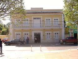
Education
.jpg)
The following schools are located in Guayanilla and students from both schools have participated in the Rose Parade in California on several occasions:[23][24]
- Escuela Arístides Cales Quirós
- Asunción Rodríguez de Sala
Transportation
There are 35 bridges in Guayanilla.[25]
Symbols
The Nazario Collection, a set of inscribed stones discovered by Catholic priest and amateur archeologist José M. Nazario (and which popular culture links to taíno high chief Agüeybaná II), has become a cultural symbol for the municipality. The statuettes serve as the center piece of Guayanilla's Father Nazario Museum of Lithic Epigraphy.
See also
References
- "Guayanilla – Populated Place". Geographic Names Information System. USGS. Retrieved 2008-05-13.
- "Colapsan cinco residencias en la barriada Esperanza en Guánica por el temblor [Five residences in the Esperanza neighborhood of Guánica collapse as a result of the earthquake]". El Nuevo Dia. January 6, 2020. Archived from the original on January 7, 2020. Retrieved January 7, 2020.
- "TERREMOTO DIA DE REYES DESDE EL EPICENTRO / EARTHQUAKE IN PUERTO RICO" – via www.youtube.com.
- "Colapsa la Parroquia Inmaculada Concepción de Guayanilla tras el temblor". El Nuevo Dia. January 7, 2020.
- "Guayanilla Municipality". enciclopediapr.org. Fundación Puertorriqueña de las Humanidades (FPH).
- "Preliminary Locations of Landslide Impacts from Hurricane Maria, Puerto Rico". USGS Landslide Hazards Program. USGS. Archived from the original on 2019-03-03. Retrieved 2019-03-03.
- "Preliminary Locations of Landslide Impacts from Hurricane Maria, Puerto Rico" (PDF). USGS Landslide Hazards Program. USGS. Archived (PDF) from the original on 2019-03-03. Retrieved 2019-03-03.
- Gwillim Law (20 May 2015). Administrative Subdivisions of Countries: A Comprehensive World Reference, 1900 through 1998. McFarland. p. 300. ISBN 978-1-4766-0447-3. Retrieved 25 December 2018.
- "Map of Guayanilla at the Wayback Machine" (PDF). Archived from the original (PDF) on 2018-03-24. Retrieved 2018-12-29.
- "US Census Barrio-Pueblo definition". factfinder.com. US Census. Archived from the original on 13 May 2017. Retrieved 5 January 2019.
- "Agencia: Oficina del Coordinador General para el Financiamiento Socioeconómico y la Autogestión (Proposed 2016 Budget)". Puerto Rico Budgets (in Spanish). Retrieved 28 June 2019.
- Rivera Quintero, Marcia (2014), El vuelo de la esperanza: Proyecto de las Comunidades Especiales Puerto Rico, 1997-2004 (first ed.), San Juan, Puerto Rico Fundación Sila M. Calderón, ISBN 978-0-9820806-1-0
- "Leyes del 2001". Lex Juris Puerto Rico (in Spanish). Retrieved 24 June 2020.
- Rivera Quintero, Marcia (2014), El vuelo de la esperanza:Proyecto de las Comunidades Especiales Puerto Rico, 1997-2004 (Primera edición ed.), San Juan, Puerto Rico Fundación Sila M. Calderón, p. 273, ISBN 978-0-9820806-1-0
- "Las 1,200 playas de Puerto Rico [The 1200 beaches of Puerto Rico]". Primera Hora (in Spanish). April 14, 2017. Archived from the original on December 12, 2019. Retrieved December 12, 2019.
- "U.S. Decennial Census". United States Census Bureau. Archived from the original on February 13, 2020. Retrieved September 21, 2017.
- "Report of the Census of Porto Rico 1899". War Department Office Director Census of Porto Rico. Archived from the original on July 16, 2017. Retrieved September 21, 2017.
- "Table 3-Population of Municipalities: 1930 1920 and 1910" (PDF). United States Census Bureau. Archived (PDF) from the original on August 17, 2017. Retrieved September 21, 2017.
- "Table 4-Area and Population of Municipalities Urban and Rural: 1930 to 1950" (PDF). United States Census Bureau. Archived (PDF) from the original on August 30, 2015. Retrieved September 21, 2014.
- "Table 2 Population and Housing Units: 1960 to 2000" (PDF). United States Census Bureau. Archived (PDF) from the original on July 24, 2017. Retrieved September 21, 2017.
- Puerto Rico:2010:population and housing unit counts.pdf (PDF). U.S. Dept. of Commerce Economics and Statistics Administration U.S. Census Bureau. 2010. Archived (PDF) from the original on 2017-02-20. Retrieved 2019-08-01.
- Elecciones Generales 2012: Escrutinio General Archived 2013-01-15 at the Wayback Machine on CEEPUR
- Torres, Michelle Estrada (January 2, 2019). "Banda Escolar de Guayanilla cumplió sueño de desfilar en Pasadena". Archived from the original on November 3, 2019. Retrieved November 3, 2019.
- "Banda Escolar de Guayanilla honra a Keylla Hernández". El Vocero de Puerto Rico. Archived from the original on 2019-11-03. Retrieved 2019-11-03.
- "Guayanilla Bridges". National Bridge Inventory Data. US Dept. of Transportation. Archived from the original on 21 February 2019. Retrieved 20 February 2019.