Clinton County, Michigan
Clinton County is a county in the U.S. state of Michigan. As of the 2010 census, the population was 75,382.[2] The county seat is St. Johns.[3] The county was created in 1831 and organized in 1839. It is named after early American politician DeWitt Clinton.[1]
Clinton County | |
|---|---|
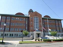 Clinton County Courthouse in St. Johns | |
 Seal | |
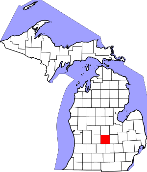 Location within the U.S. state of Michigan | |
 Michigan's location within the U.S. | |
| Coordinates: 42°56′N 84°37′W | |
| Country | |
| State | |
| Founded | 1831[1] |
| Named for | DeWitt Clinton |
| Seat | St. Johns |
| Largest city | St. Johns |
| Area | |
| • Total | 574 sq mi (1,490 km2) |
| • Land | 566 sq mi (1,470 km2) |
| • Water | 8.1 sq mi (21 km2) 1.4%% |
| Population | |
| • Estimate (2018) | 79,332 |
| • Density | 133/sq mi (51/km2) |
| Time zone | UTC−5 (Eastern) |
| • Summer (DST) | UTC−4 (EDT) |
| Congressional district | 4th |
| Website | www |
Clinton County is included in the Lansing-East Lansing, MI Metropolitan Statistical Area.
Geography
According to the U.S. Census Bureau, the county has a total area of 575 square miles (1,490 km2), of which 566 square miles (1,470 km2) is land and 8.1 square miles (21 km2) (1.4%) is water.[4]
Adjacent counties
- Saginaw County (northeast)
- Gratiot County (north)
- Montcalm County (northwest)
- Shiawassee County (east)
- Ionia County (west)
- Ingham County (southeast)
- Eaton County (southwest)
Demographics
| Historical population | |||
|---|---|---|---|
| Census | Pop. | %± | |
| 1840 | 1,614 | — | |
| 1850 | 5,102 | 216.1% | |
| 1860 | 13,916 | 172.8% | |
| 1870 | 22,845 | 64.2% | |
| 1880 | 28,100 | 23.0% | |
| 1890 | 26,509 | −5.7% | |
| 1900 | 25,136 | −5.2% | |
| 1910 | 23,129 | −8.0% | |
| 1920 | 23,110 | −0.1% | |
| 1930 | 24,174 | 4.6% | |
| 1940 | 26,671 | 10.3% | |
| 1950 | 31,195 | 17.0% | |
| 1960 | 37,969 | 21.7% | |
| 1970 | 48,492 | 27.7% | |
| 1980 | 55,893 | 15.3% | |
| 1990 | 57,883 | 3.6% | |
| 2000 | 64,753 | 11.9% | |
| 2010 | 75,382 | 16.4% | |
| Est. 2018 | 79,332 | [5] | 5.2% |
| U.S. Decennial Census[6] 1790-1960[7] 1900-1990[8] 1990-2000[9] 2010-2018[2] | |||
As of the census[10] of 2000, there were 64,753 people, 23,653 households, and 17,976 families residing in the county. The population density was 113 people per square mile (44/km²). There were 24,630 housing units at an average density of 43 per square mile (17/km²). The racial makeup of the county was 96.40% White, 0.63% Black or African American, 0.44% Native American, 0.52% Asian, 0.04% Pacific Islander, 0.81% from other races, and 1.17% from two or more races. 2.61% of the population were Hispanic or Latino of any race. 35.3% were of German, 11.4% English, 10.1% American and 8.5% Irish ancestry, 96.4% spoke English and 1.9% Spanish as their first language.
There were 23,653 households out of which 37.40% had children under the age of 18 living with them, 64.30% were married couples living together, 8.40% had a female householder with no husband present, and 24.00% were non-families. 19.80% of all households were made up of individuals and 7.10% had someone living alone who was 65 years of age or older. The average household size was 2.70 and the average family size was 3.12.
In the county, the population was spread out with 28.10% under the age of 18, 7.30% from 18 to 24, 29.20% from 25 to 44, 24.50% from 45 to 64, and 10.90% who were 65 years of age or older. The median age was 37 years. For every 100 females, there were 98.90 males. For every 100 females age 18 and over, there were 95.60 males.
The median income for a household in the county was $52,806, and the median income for a family was $60,491. Males had a median income of $42,379 versus $31,065 for females. The per capita income for the county was $22,913. About 3.30% of families and 4.60% of the population were below the poverty line, including 5.30% of those under age 18 and 6.00% of those age 65 or over.
Transportation
Highways


Airports
Capital Region International Airport (IATA: LAN, ICAO: KLAN, FAA LID: LAN) is a public, Class C airport located 3 miles (5 km) northwest of downtown Lansing, primarily in DeWitt Township. The airport accessible by Grand River Avenue (Business Route 96) and is located 1.5 miles (2.4 km) south of Interstate 69.
Abrams Municipal Airport (FAA LID: 4D0) is a city-owned, public-use airport located two nautical miles (3.7 km) north of the central business district of Grand Ledge, a city in Eaton County. The airport is accessible by road from Wright Road (M-100), and is located 2.1 miles (3.4 km) south of Interstate 96, just east of M-100.
Government
| Year | Republican | Democratic | Third Parties |
|---|---|---|---|
| 2016 | 52.9% 21,636 | 40.3% 16,492 | 6.9% 2,809 |
| 2012 | 52.6% 20,650 | 46.4% 18,191 | 1.0% 394 |
| 2008 | 48.9% 19,726 | 49.5% 20,005 | 1.6% 650 |
| 2004 | 58.2% 21,989 | 41.0% 15,483 | 0.9% 335 |
| 2000 | 56.1% 18,054 | 41.6% 13,394 | 2.3% 751 |
| 1996 | 47.9% 13,694 | 41.8% 11,945 | 10.4% 2,962 |
| 1992 | 40.3% 12,216 | 33.3% 10,116 | 26.4% 8,007 |
| 1988 | 62.4% 15,497 | 37.1% 9,225 | 0.5% 115 |
| 1984 | 73.3% 17,387 | 26.2% 6,226 | 0.5% 113 |
| 1980 | 60.6% 14,968 | 30.5% 7,539 | 8.8% 2,184 |
| 1976 | 63.1% 13,475 | 35.4% 7,549 | 1.5% 329 |
| 1972 | 68.4% 13,438 | 29.9% 5,870 | 1.8% 345 |
| 1968 | 56.8% 9,416 | 33.5% 5,548 | 9.8% 1,621 |
| 1964 | 39.7% 5,891 | 60.2% 8,932 | 0.1% 14 |
| 1960 | 67.9% 10,227 | 32.0% 4,822 | 0.2% 23 |
| 1956 | 74.4% 10,770 | 25.4% 3,673 | 0.2% 31 |
| 1952 | 77.5% 10,510 | 21.9% 2,977 | 0.6% 79 |
| 1948 | 73.7% 7,510 | 24.8% 2,523 | 1.6% 158 |
| 1944 | 76.7% 8,422 | 23.1% 2,533 | 0.3% 29 |
| 1940 | 75.0% 8,311 | 24.8% 2,745 | 0.2% 25 |
| 1936 | 50.0% 4,915 | 43.7% 4,296 | 6.2% 612 |
| 1932 | 47.2% 4,647 | 51.7% 5,098 | 1.1% 108 |
| 1928 | 75.0% 6,161 | 24.5% 2,013 | 0.4% 36 |
| 1924 | 76.8% 6,637 | 15.7% 1,359 | 7.5% 645 |
| 1920 | 78.9% 6,019 | 19.2% 1,464 | 1.9% 145 |
| 1916 | 60.6% 3,381 | 37.5% 2,094 | 1.9% 104 |
| 1912 | 32.0% 1,723 | 32.0% 1,723 | 36.1% 1,943 |
| 1908 | 59.6% 3,490 | 37.4% 2,188 | 3.0% 175 |
| 1904 | 64.6% 4,095 | 32.6% 2,068 | 2.8% 176 |
| 1900 | 55.1% 3,795 | 42.5% 2,928 | 2.4% 167 |
| 1896 | 49.0% 3,480 | 48.8% 3,467 | 2.3% 163 |
| 1892 | 48.4% 3,133 | 42.6% 2,756 | 9.0% 581 |
| 1888 | 48.7% 3,493 | 45.2% 3,248 | 6.1% 439 |
| 1884 | 44.0% 2,782 | 51.0% 3,220 | 5.0% 317 |
The county government operates the jail, maintains rural roads, coordinates local emergency management, operates the major local courts, keeps files of deeds and mortgages, maintains vital records, administers public health regulations, and participates with the state in the provision of welfare and other social services. The county board of commissioners controls the budget but has only limited authority to make laws or ordinances. In Michigan, most local government functions — police and fire, building and zoning, tax assessment, street maintenance, etc. — are the responsibility of individual cities and townships.
Elected officials
- Prosecuting Attorney: Charles D. Sherman
- Sheriff: Lawrence Jerue
- County Clerk/Register of Deeds: Diane Zuker
- County Treasurer: Tina Ward
- Drain Commissioner: Phil Hanses
County Board of Commissioners
7 members, elected from districts (6 Republicans, 1 Democrat)
Communities
Cities
- DeWitt
- East Lansing (part)
- Grand Ledge (part)
- Lansing (part)
- Ovid (part)
- St. Johns (county seat)
Villages
Census-designated places
Other unincorporated places
- Eureka
- Matherton (part)
- Shepardsville
Townships
- Bath Charter Township
- Bengal Township
- Bingham Township
- Dallas Township
- DeWitt Charter Township
- Duplain Township
- Eagle Township
- Essex Township
- Greenbush Township
- Lebanon Township
- Olive Township
- Ovid Township
- Riley Township
- Victor Township
- Watertown Charter Township
- Westphalia Township
See also
- List of Michigan State Historic Sites in Clinton County, Michigan
- National Register of Historic Places listings in Clinton County, Michigan
- Saint Johns High School
References
- "Bibliography on Clinton County". Clarke Historical Library, Central Michigan University. Retrieved January 19, 2013.
- "State & County QuickFacts". United States Census Bureau. Retrieved August 27, 2013.
- "Find a County". National Association of Counties. Archived from the original on 2011-05-31. Retrieved June 7, 2011.
- "2010 Census Gazetteer Files". United States Census Bureau. August 22, 2012. Archived from the original on November 13, 2013. Retrieved September 19, 2014.
- "American FactFinder". Archived from the original on February 14, 2020. Retrieved April 19, 2019.
- "U.S. Decennial Census". United States Census Bureau. Retrieved September 19, 2014.
- "Historical Census Browser". University of Virginia Library. Retrieved September 19, 2014.
- "Population of Counties by Decennial Census: 1900 to 1990". United States Census Bureau. Retrieved September 19, 2014.
- "Census 2000 PHC-T-4. Ranking Tables for Counties: 1990 and 2000" (PDF). United States Census Bureau. Retrieved September 19, 2014.
- "U.S. Census website". United States Census Bureau. Retrieved January 31, 2008.
- Dave Leip's Atlas of U.S. Presidential Elections
External links
- Clinton County government site
- Clinton County Chamber of Commerce
- Clinton County Economic Alliance
- Clinton Conservation District
- "Bibliography on Clinton County". Clarke Historical Library, Central Michigan University. Retrieved January 19, 2013.
Places adjacent to Clinton County, Michigan | ||||||||||
|---|---|---|---|---|---|---|---|---|---|---|
| ||||||||||
Municipalities and communities of Clinton County, Michigan, United States | ||
|---|---|---|
| Cities | Map of Michigan highlighting Clinton County.svg | |
| Villages | ||
| Charter townships | ||
| General law townships | ||
| CDPs | ||
| Footnotes | ‡This populated place also has portions in an adjacent county or counties | |
Central/Mid-Michigan including the Tri-Cities and Thumb | |||||||
|---|---|---|---|---|---|---|---|
| Central cities | |||||||
| Counties |
| ||||||
| Geography | |||||||
| Transportation | |||||||
| Economy |
| ||||||
| |||||||

| Authority control |
|
|---|