Bad River (Michigan)
The Bad River is a 44.3-mile-long (71.3 km)[2] river in Michigan. It rises in Newark Township near the city of Ithaca in Gratiot County and flows in a north-easterly direction into Saginaw County, and through the village of St. Charles, before emptying into the Shiawassee River within the bounds of the Shiawassee National Wildlife Refuge.[3]
| Bad River | |
|---|---|
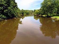 The Bad River in St. Charles | |
| Location | |
| Country | United States |
| State | Michigan |
| Counties | Gratiot, Saginaw |
| Physical characteristics | |
| Source | |
| • location | Newark Township |
| • coordinates | 43.24142°N 84.63972°W[1] |
| Mouth | Shiawassee River |
• location | Shiawassee National Wildlife Refuge |
• coordinates | 43.32363°N 84.08942°W |
| Length | 44.3 mi (71.3 km) |
The river and its tributaries have a total combined length of 175 miles (282 km); most of it channelized.[3] Land use within the surrounding watershed is 86.5 percent agricultural; as a result, the river system has been adversely impacted by sedimentation.[4]
See also
References
- "Bad River". Geographic Names Information System. United States Geological Survey.
- U.S. Geological Survey. National Hydrography Dataset high-resolution flowline data. The National Map Archived 2012-04-05 at WebCite, accessed November 7, 2011
- "Sedimentation Reduction Project in the Bad River Watershed". Ithaca, Michigan: Gratiot Conservation District. Retrieved January 13, 2018.
- "Funding Available in the Bad River Watershed!". Ithaca, Michigan: Gratiot Conservation District. Retrieved January 13, 2018.
Central/Mid-Michigan including the Tri-Cities and Thumb | |||||||
|---|---|---|---|---|---|---|---|
| Central cities | |||||||
| Counties |
| ||||||
| Geography | |||||||
| Transportation | |||||||
| Economy |
| ||||||
| |||||||
This article is issued from Wikipedia. The text is licensed under Creative Commons - Attribution - Sharealike. Additional terms may apply for the media files.