Barry County, Michigan
Barry County is a county in the U.S. state of Michigan. As of the 2010 United States Census, the population was 59,173.[1] The county seat is Hastings.[2]
Barry County | |
|---|---|
 Barry County Courthouse | |
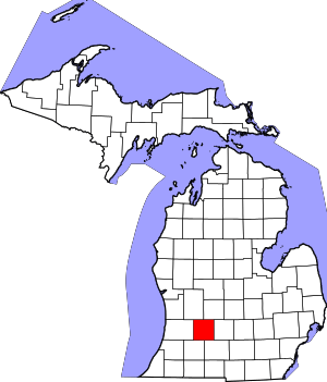 Location within the U.S. state of Michigan | |
 Michigan's location within the U.S. | |
| Coordinates: 42°36′N 85°19′W | |
| Country | |
| State | |
| Founded | April 29, 1829 (established) March 15, 1839 (organized) |
| Named for | William Taylor Barry |
| Seat | Hastings |
| Largest city | Hastings |
| Area | |
| • Total | 577 sq mi (1,490 km2) |
| • Land | 553 sq mi (1,430 km2) |
| • Water | 24 sq mi (60 km2) 4.2%% |
| Population | |
| • Estimate (2018) | 61,157 |
| • Density | 107/sq mi (41/km2) |
| Time zone | UTC−5 (Eastern) |
| • Summer (DST) | UTC−4 (EDT) |
| Congressional district | 3rd |
History
Before the present era, the Michigan peninsula was long occupied by bands of the Potowatomi and Ojibwe of the Lake Superior Band of Chippewa Indians. The United States government forced the tribes to cede their extensive territories to the federal government, in exchange for annuities and small reservations. The federally recognized Match-E-Be-Nash-She-Wish Band of Pottowatomi has a reservation in Allegan County, just west of Barry County.
Barry County was described and delineated by act of the Territorial legislature on April 29, 1829, carved out of previously unorganized lands in the Territory. It was named to honor William Taylor Barry, who was serving as United States Postmaster General at the time of the county's proclamation. Barry was one of US President Andrew Jackson's cabinet members who were memorialized in names of ten Michigan counties, the "cabinet counties".[3]
By 1839, the Territory had been admitted into the Union as Michigan State. In 1839, the Michigan State Legislature approved the organization of Barry County as an independent entity.
In the early years of the twentieth century, petroleum deposits of varying magnitudes were discovered and developed in Michigan's Lower Peninsula. This discovery was made in Barry County in 1939; similar discoveries in adjacent counties ranged from 1937 (Allegan County) to 1972 (Eaton County). Identifiable petroleum deposits had been identified in every county adjacent to Barry by 1972.[4]
Geography
According to the US Census Bureau, the county has a total area of 577 square miles (1,490 km2), of which 553 square miles (1,430 km2) is land and 24 square miles (62 km2) (4.2%) is water.[5]
Adjacent counties
- Ionia County – northeast
- Eaton County – east
- Calhoun County – southeast
- Kalamazoo County – southwest
- Allegan County – west
- Kent County – northwest
Transportation
Major highways


Railroads
There were once several minor railroads through the county. At present there are none.[6] The only railroad left in the county is a two mile section owned by CSX Transportation, running through the northeast corner of Woodland Township, Michigan
Demographics
| Historical population | |||
|---|---|---|---|
| Census | Pop. | %± | |
| 1840 | 1,078 | — | |
| 1850 | 5,072 | 370.5% | |
| 1860 | 13,858 | 173.2% | |
| 1870 | 22,199 | 60.2% | |
| 1880 | 25,317 | 14.0% | |
| 1890 | 23,783 | −6.1% | |
| 1900 | 22,514 | −5.3% | |
| 1910 | 22,633 | 0.5% | |
| 1920 | 21,383 | −5.5% | |
| 1930 | 20,928 | −2.1% | |
| 1940 | 22,613 | 8.1% | |
| 1950 | 26,183 | 15.8% | |
| 1960 | 31,738 | 21.2% | |
| 1970 | 38,166 | 20.3% | |
| 1980 | 45,781 | 20.0% | |
| 1990 | 50,057 | 9.3% | |
| 2000 | 56,755 | 13.4% | |
| 2010 | 59,173 | 4.3% | |
| Est. 2018 | 61,157 | [7] | 3.4% |
| US Decennial Census[8] 1790-1960[9] 1900-1990[10] 1990-2000[11] 2010-2018[1] | |||
As of the 2010 United States Census, there were 59,173 people living in the county. 96.9% were White, 0.5% Native American, 0.4% Black or African American, 0.4% Asian, 0.6% of some other race and 1.3% of two or more races. 2.3% were Hispanic or Latino (of any race). 19.8% were of German, 13.5% American, 12.1% English, 11.2% Dutch and 8.1% Irish ancestry.[12]
As of the 2000 United States Census,[13] there were 56,755 people, 21,035 households, and 15,986 families living in the county. The population density was 102 people per square mile (39/km²). There were 23,876 housing units at an average density of 43 per square mile (17/km²). The racial makeup of the county was 97.39% White, 0.24% African American, 0.46% Native American, 0.27% Asian, 0.01% Pacific Islander, 0.50% from other races, and 1.12% from two or more races. 1.46% of the population were Hispanic or Latino of any race. 21.8% were of German, 13.6% English, 12.5% Dutch, 12.4% American and 9.6% Irish ancestry according to Census 2000. 98.2% spoke only English at home.
There were 21,035 households out of which 35.20% had children under the age of 18 living with them, 64.10% were married couples living together, 7.70% had a female householder with no husband present, and 24.00% were non-families. 19.50% of all households were made up of individuals and 7.70% had someone living alone who was 65 years of age or older. The average household size was 2.68 and the average family size was 3.06.
The county population contained 27.20% under the age of 18, 7.50% from 18 to 24, 29.00% from 25 to 44, 24.60% from 45 to 64, and 11.80% who were 65 years of age or older. The median age was 37 years. For every 100 females, there were 99.70 males. For every 100 females age 18 and over, there were 98.80 males.
The median income for a household in the county was $46,820, and the median income for a family was $51,794. Males had a median income of $38,991 versus $26,387 for females. The per capita income for the county was $20,636. About 3.90% of families and 5.50% of the population were below the poverty line, including 5.90% of those under age 18 and 5.90% of those age 65 or over.
Government
Elections
Barry County has been strongly Republican from its start. Since 1884, the Republican Party nominee has carried the county vote in 91% of the elections (31 of 34 elections).
| Year | Republican | Democratic | Third Parties |
|---|---|---|---|
| 2016 | 62.9% 19,202 | 29.9% 9,114 | 7.2% 2,201 |
| 2012 | 58.2% 16,655 | 40.2% 11,491 | 1.7% 471 |
| 2008 | 53.7% 16,431 | 43.9% 13,449 | 2.5% 749 |
| 2004 | 61.6% 18,638 | 37.4% 11,312 | 1.1% 322 |
| 2000 | 59.9% 15,716 | 37.2% 9,769 | 2.9% 759 |
| 1996 | 48.2% 11,139 | 41.0% 9,467 | 10.9% 2,514 |
| 1992 | 38.6% 9,489 | 35.2% 8,652 | 26.3% 6,458 |
| 1988 | 60.7% 12,546 | 38.6% 7,983 | 0.7% 152 |
| 1984 | 70.3% 14,245 | 29.1% 5,898 | 0.6% 122 |
| 1980 | 58.1% 12,006 | 33.2% 6,857 | 8.7% 1,791 |
| 1976 | 60.8% 11,178 | 37.9% 6,967 | 1.3% 243 |
| 1972 | 64.0% 10,393 | 33.8% 5,484 | 2.2% 356 |
| 1968 | 55.1% 8,492 | 33.8% 5,206 | 11.1% 1,702 |
| 1964 | 40.4% 5,509 | 59.4% 8,102 | 0.3% 39 |
| 1960 | 67.5% 9,298 | 32.0% 4,406 | 0.5% 63 |
| 1956 | 70.2% 9,359 | 29.3% 3,907 | 0.5% 63 |
| 1952 | 72.7% 8,933 | 26.3% 3,230 | 1.0% 124 |
| 1948 | 64.8% 5,677 | 31.1% 2,726 | 4.2% 365 |
| 1944 | 69.2% 7,057 | 29.5% 3,010 | 1.3% 136 |
| 1940 | 68.6% 6,872 | 30.8% 3,091 | 0.6% 62 |
| 1936 | 53.5% 4,950 | 41.9% 3,880 | 4.6% 425 |
| 1932 | 49.2% 4,556 | 47.7% 4,416 | 3.1% 286 |
| 1928 | 79.9% 6,044 | 19.3% 1,459 | 0.8% 58 |
| 1924 | 70.7% 5,656 | 25.6% 2,046 | 3.7% 296 |
| 1920 | 70.7% 5,154 | 25.7% 1,874 | 3.6% 263 |
| 1916 | 53.8% 3,157 | 42.5% 2,491 | 3.7% 218 |
| 1912 | 28.8% 1,585 | 32.8% 1,800 | 38.4% 2,111 |
| 1908 | 57.5% 3,247 | 37.6% 2,126 | 4.9% 278 |
| 1904 | 63.1% 3,675 | 31.2% 1,817 | 5.7% 334 |
| 1900 | 51.4% 3,294 | 45.2% 2,895 | 3.3% 214 |
| 1896 | 49.6% 3,294 | 47.6% 3,157 | 2.8% 186 |
| 1892 | 49.2% 2,854 | 31.0% 1,800 | 19.8% 1,147 |
| 1888 | 49.8% 3,212 | 41.5% 2,676 | 8.7% 558 |
| 1884 | 44.7% 2,699 | 48.7% 2,937 | 6.6% 401 |
The county government operates the jail, maintains rural roads, operates the major local courts, records deeds, mortgages, and vital records, administers public health regulations, and participates with the state in the provision of social services. The county board of commissioners controls the budget, and has limited authority to make laws or ordinances. In Michigan, most local government functions—police and fire, building and zoning, tax assessment, street maintenance, etc.—are the responsibility of individual cities and townships.
Elected officials
- Prosecuting Attorney: Julie Nakfoor-Pratt
- Sheriff: Dar Leaf
- County Clerk: Pam Palmer
- County Treasurer: Susan L. Vandecar
- Register of Deeds: Barbara D. Hurless
- Drain Commissioner: James Dull
- County Surveyor: Brian Reynolds
- County Board of Commissioners: 7 Members (7 Republicans, 0 Democrats)
(information as of December 2012)
Education
Public schools in Barry County:
- Hastings – 7 public schools, 2 private schools, 1 community college (extension of Kellogg University) (see Hastings, Michigan#Education)
- Delton – 3 public schools, 3 private schools (see Delton, Michigan#Schools)
- Middleville – 5 public schools (see Middleville, Michigan#Education)
Sports
Barry County is the host of the annual Barry-Roubaix cycling race.
Communities
City
- Hastings (county seat)
Villages
Census-Designated Places
Unincorporated communities
- Assyria
- Banfield
- Cloverdale
- Coats Grove
- Lacey
- Maple Grove
- Prairieville
- Quimby
- Schultz
Townships
- Assyria Township
- Baltimore Township
- Barry Township
- Carlton Township
- Castleton Township
- Hastings Charter Township
- Hope Township
- Irving Township
- Johnstown Township
- Maple Grove Township
- Orangeville Township
- Prairieville Township
- Rutland Charter Township
- Thornapple Township
- Woodland Township
- Yankee Springs Township
See also
- List of Michigan State Historic Sites in Barry County, Michigan
- National Register of Historic Places listings in Barry County, Michigan
References
- "State & County QuickFacts". US Census Bureau. Archived from the original on July 6, 2011. Retrieved August 26, 2013.
- "Find a County". National Association of Counties. Archived from the original on July 4, 2012. Retrieved June 7, 2011.
- "Bibliography on Barry County". Clarke Historical Library, Central Michigan University. Retrieved January 19, 2013.
- Clark Historical Library, Date of the Discovery of Oil or Gas in Michigan . . (accessed 4 September 2018)
- "2010 Census Gazetteer Files". US Census Bureau. August 22, 2012. Archived from the original on November 13, 2013. Retrieved September 19, 2014.
- Google Maps, Barry County MI (accessed 4 September 2018)
- "Population and Housing Unit Estimates". Retrieved May 10, 2019.
- "US Decennial Census". US Census Bureau. Retrieved September 19, 2014.
- "Historical Census Browser". University of Virginia Library. Retrieved September 19, 2014.
- "Population of Counties by Decennial Census: 1900 to 1990". US Census Bureau. Retrieved September 19, 2014.
- "Census 2000 PHC-T-4. Ranking Tables for Counties: 1990 and 2000" (PDF). US Census Bureau. Retrieved September 19, 2014.
- Data Access and Dissemination Systems (DADS). "U.S. Census website". census.gov.
- Statistical profile of Barry County, Michigan Archived April 10, 2008, at the Wayback Machine
- US Election Atlas
External links
- Official Website of Barry County, Michigan
- "Bibliography on Barry County". Clarke Historical Library, Central Michigan University.
- Barry County, MI GenWeb. Many history and genealogy pages
Places adjacent to Barry County, Michigan | ||||||||||
|---|---|---|---|---|---|---|---|---|---|---|
| ||||||||||
Municipalities and communities of Barry County, Michigan, United States | ||
|---|---|---|
| City | Map of Michigan highlighting Barry County | |
| Villages | ||
| Charter townships | ||
| Civil townships | ||
| Unincorporated communities | ||
| Central cities | |||
|---|---|---|---|
| Counties |
| ||
| Geography | |||
| Transportation | |||
| Economy | |||
| |||

| Authority control |
|
|---|