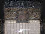
Chambers Street station (IRT Broadway–Seventh Avenue Line)
Chambers Street is an express station on the IRT Broadway–Seventh Avenue Line of the New York City Subway, located at the intersection of Chambers Street and West Broadway in Lower Manhattan. It is served by the 1 and 2 trains at all times, and by the 3 train at all times except late nights.
Chambers Street | |||||||||||||||||
|---|---|---|---|---|---|---|---|---|---|---|---|---|---|---|---|---|---|
_Platform.JPG) Uptown platform | |||||||||||||||||
| Station statistics | |||||||||||||||||
| Address | Chambers Street & West Broadway New York, NY 10013 | ||||||||||||||||
| Borough | Manhattan | ||||||||||||||||
| Locale | Financial District, Tribeca | ||||||||||||||||
| Coordinates | 40.715517°N 74.009233°W | ||||||||||||||||
| Division | A (IRT) | ||||||||||||||||
| Line | IRT Broadway–Seventh Avenue Line | ||||||||||||||||
| Services | 1 2 3 | ||||||||||||||||
| Transit connections | |||||||||||||||||
| Structure | Underground | ||||||||||||||||
| Platforms | 2 island platforms cross-platform interchange | ||||||||||||||||
| Tracks | 4 | ||||||||||||||||
| Other information | |||||||||||||||||
| Opened | July 1, 1918 | ||||||||||||||||
| Station code | 327[1] | ||||||||||||||||
| Accessible | |||||||||||||||||
| Wireless service | |||||||||||||||||
| Opposite-direction transfer available | Yes | ||||||||||||||||
| Traffic | |||||||||||||||||
| Passengers (2019) | 5,941,546[3] | ||||||||||||||||
| Rank | 70 out of 424[3] | ||||||||||||||||
| Station succession | |||||||||||||||||
| Next north | 14th Street (express): 2 Franklin Street (local): 1 | ||||||||||||||||
| Next | 34th Street–Penn Station: 1 | ||||||||||||||||
| Next south | Park Place (express): 2 WTC Cortlandt (local): 1 | ||||||||||||||||
| Next | Fulton Street: 2 WTC Cortlandt: 1 | ||||||||||||||||
| |||||||||||||||||
| |||||||||||||||||
| |||||||||||||||||
Chambers Street Subway Station (Dual System IRT) | |||||||||||||||||
| MPS | New York City Subway System MPS | ||||||||||||||||
| NRHP reference No. | 05000234[4] | ||||||||||||||||
| Added to NRHP | March 30, 2005 | ||||||||||||||||


%26groups%3D_7b5e4f83ae8f7ac3bc7e07d221487e5cfa36b8d2.svg)
History
The Dual Contracts, which were signed on March 19, 1913, were contracts for the construction and/or rehabilitation and operation of rapid transit lines in the City of New York. The contracts were "dual" in that they were signed between the City and two separate private companies (the Interborough Rapid Transit Company and the Brooklyn Rapid Transit Company), all working together to make the construction of the Dual Contracts possible. The Dual Contracts promised the construction of several lines in Brooklyn. As part of Contract 4, the IRT agreed to build a branch of the original subway line south down Seventh Avenue, Varick Street, and West Broadway to serve the West Side of Manhattan.[5][6][7]
The construction of this line, in conjunction with the construction of the Lexington Avenue Line, would change the operations of the IRT system. Instead of having trains go via Broadway, turning onto 42nd Street, before finally turning onto Park Avenue, there would be two trunk lines connected by the 42nd Street Shuttle. The system would be changed from looking like a "Z" system on a map to an "H" system. One trunk would run via the new Lexington Avenue Line down Park Avenue, and the other trunk would run via the new Seventh Avenue Line up Broadway. In order for the line to continue down Varick Street and West Broadway, these streets needed to be widened, and two new streets were built, the Seventh Avenue Extension and the Varick Street Extension.[8] It was predicted that the subway extension would lead to the growth of the Lower West Side, and to neighborhoods such as Chelsea and Greenwich Village.[9][10]
Chambers Street opened as the line was extended south to South Ferry from 34th Street–Penn Station on July 1, 1918, and was served by a shuttle.[11] The new "H" system was implemented on August 1, 1918, joining the two halves of the Broadway–Seventh Avenue Line and sending all West Side trains south from Times Square.[12] An immediate result of the switch was the need to transfer using the 42nd Street Shuttle. The completion of the "H" system doubled the capacity of the IRT system.[13]
Station layout
| G | Street level | Exit/entrance |
| M | Mezzanine | Fare control, station agent |
| P Platform level |
Northbound local | ← |
| Island platform | ||
| Northbound express | ← ← | |
| Southbound express | | |
| Island platform | ||
| Southbound local | | |
There are four tracks and two island platforms. The 1 train uses the local tracks, and the 2 and 3 trains use the express tracks. South of this station, the 2 and 3 trains curve east and branch off to Park Place, Fulton Street, Wall Street, and then Brooklyn. The 1 train continues directly south towards its terminal, South Ferry.
North of the station are diamond crossovers in both directions, allowing the 2 train to run local during late nights, switching over to the express tracks north of Chambers Street and then heading to Brooklyn; there are no crossovers south of the station due to its close proximity to Park Place. These switches were also used after the September 11, 2001 attacks, when the South Ferry branch of the line was impassable, and the 1 train was routed to Brooklyn in place of the 3 train and all trains that stopped here were local in Manhattan.
Exits
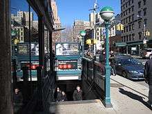
The station's only exits are through the mezzanine above the center of the station. Street stairs lead to four of the five corners of the intersection of Chambers Street, Hudson Streets, and West Broadway. The only corner without a street stair is the wedge between Hudson Street and West Broadway on the intersection's northern side, where the James Bogardus Plaza is located. The southwest corner of the intersection has two stairs.[14]
As part of a 2007–2009 renovation, three elevators were installed in the station (two from platform level to the mezzanine and one from fare control to the streets) to make it accessible for people with disabilities under the Americans with Disabilities Act of 1990.[15] The street elevator is on the northwest corner of Chambers and Hudson Streets.[14]
Nearby points of interest
References
- "Station Developers' Information". Metropolitan Transportation Authority. Retrieved June 13, 2017.
- "NYC Subway Wireless – Active Stations". Transit Wireless Wifi. Retrieved November 13, 2019.
- "Facts and Figures: Annual Subway Ridership 2014–2019". Metropolitan Transportation Authority. 2020. Retrieved May 26, 2020.
- "NPS Focus". National Register of Historic Places. National Park Service. Retrieved December 23, 2011.
- "Terms and Conditions of Dual System Contracts". nycsubway.org. Public Service Commission. March 19, 1913. Retrieved February 16, 2015.
- "The Dual System of Rapid Transit (1912)". nycsubway.org. Public Service Commission. September 1912. Retrieved May 30, 2017.
- "Most Recent Map of the Dual Subway System WhIch Shows How Brooklyn Borough Is Favored In New Transit Lines". The Brooklyn Daily Eagle. September 9, 1917. p. 37. Retrieved August 23, 2016 – via Brooklyn Newspapers.
- Engineering News-record. McGraw-Hill Publishing Company. 1916.
- Whitney, Travis H. (March 10, 1918). "The Seventh and Lexington Avenue Subways Will Revive Dormant Sections — Change in Operation That Will Transform Original Four-Tracked Subway Into Two Four-Tracked Systems and Double Present Capacity of the Interborough" (PDF). The New York Times. p. 12. Retrieved August 26, 2016.
- "Public Service Commission Fixes July 15 For Opening of The New Seventh and Lexington Avenue Subway Lines — Will Afford Better Service and Less Crowding — Shuttle Service for Forty-Second Street — How the Various Lines of the Dual System Are Grouped for Operation and List of Stations on All Lines" (PDF). The New York Times. May 19, 1918. p. 32. Retrieved November 6, 2016.
- "Open New Subway to Regular Traffic — First Train on Seventh Avenue Line Carries Mayor and Other Officials — To Serve Lower West Side — Whitney Predicts an Awakening of the District — New Extensions of Elevated Railroad Service" (PDF). The New York Times. July 2, 1918. p. 11. Retrieved November 6, 2016.
- "Open New Subway Lines to Traffic; Called a Triumph — Great H System Put in Operation Marks an Era in Railroad Construction — No Hitch in the Plans — But Public Gropes Blindly to Find the Way in Maze of New Stations — Thousands Go Astray — Leaders in City's Life Hail Accomplishment of Great Task at Meeting at the Astor" (PDF). The New York Times. August 2, 1918. p. 1. Retrieved November 6, 2016.
- Whitney, Travis H. (March 10, 1918). "The Seventh and Lexington Avenue Subways Will Revive Dormant Sections — Change in Operation That Will Transform Original Four-Tracked Subway Into Two Four-Tracked Systems and Double Present Capacity of the Interborough" (PDF). The New York Times. p. 12. Retrieved August 26, 2016.
- "MTA Neighborhood Maps: Lower Manhattan" (PDF). mta.info. Metropolitan Transportation Authority. 2015. Retrieved August 21, 2015.
- "2/3 Chambers Street Elevator Installation". Lower Manhattan Construction Command Center. Archived from the original on June 30, 2009. Retrieved June 27, 2009.
Further reading
- Stokey, Lee (1994). Subway Ceramics: A History and Iconography. ISBN 978-0-9635486-1-0.
External links
| Wikimedia Commons has media related to Chambers Street (IRT Broadway – Seventh Avenue Line). |
- nycsubway.org – IRT West Side Line: Chambers Street
- Station Reporter – 1 Train
- Station Reporter – 2 Train
- Station Reporter – 3 Train
- MTA's Arts For Transit – Chambers Street/Park Place (IRT Broadway–Seventh Avenue Line)
- Chambers Street entrance from Google Maps Street View
- Platforms from Google Maps Street View
| Topics |  | |
|---|---|---|
| Lists by county |
| |
| Lists by city | ||
| Other lists | ||
| ||