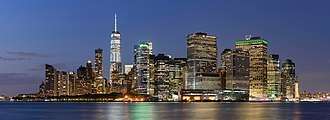
Financial District, Manhattan
The Financial District of Lower Manhattan, also known as FiDi,[3] is a neighborhood located on the southern tip of Manhattan island in New York City. It is bounded by the West Side Highway on the west, Chambers Street and City Hall Park on the north, Brooklyn Bridge on the northeast, the East River to the southeast, and The Battery on the south.
Financial District | |
|---|---|
 Financial District, Manhattan, as viewed from Governors Island | |
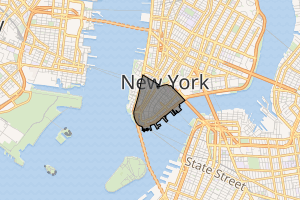
Location in New York City | |
| Coordinates: 40.708°N 74.011°W | |
| Country | |
| State | |
| City | New York City |
| Borough | Manhattan |
| Community District | Manhattan 1[1] |
| Area | |
| • Total | 1.17 km2 (0.453 sq mi) |
| Population (2011)[2] | |
| • Total | 57,627 |
| • Density | 49,000/km2 (130,000/sq mi) |
| Economics | |
| • Median income | $125,565 |
| Time zone | UTC−5 (Eastern) |
| ZIP Codes | 10004, 10005, 10006, 10038 |
| Area code | 212, 332, 646, and 917 |
The City of New York was created in the Financial District in 1624, and the neighborhood roughly overlaps with the boundaries of the New Amsterdam settlement in the late 17th century.[4] The district comprises the offices and headquarters of many of the city's major financial institutions, including the New York Stock Exchange and the Federal Reserve Bank of New York. Anchored on Wall Street in the Financial District, New York City has been called both the most financially powerful city and the leading financial center of the world,[5][6][7][8][9] and the New York Stock Exchange is the world's largest stock exchange by total market capitalization.[10][11] Several other major exchanges have or had headquarters in the Financial District, including the New York Mercantile Exchange, NASDAQ, the New York Board of Trade, and the former American Stock Exchange.
The Financial District is part of Manhattan Community District 1 and its primary ZIP Codes are 10004, 10005, 10006, and 10038.[1] It is patrolled by the 1st Precinct of the New York City Police Department.
Description

The Financial District encompasses roughly the area south of City Hall Park in Lower Manhattan but excludes Battery Park and Battery Park City. The former World Trade Center complex was located in the neighborhood until the September 11, 2001 attacks; the neighborhood includes the successor One World Trade Center. The heart of the Financial District is often considered to be the corner of Wall Street and Broad Street, both of which are contained entirely within the district.[12] The northeastern part of the financial district (along Fulton Street and John Street) was known in the early 20th century as the Insurance District, due to the large number of insurance companies that were either headquartered there, or maintained their New York offices there.
Although the term is sometimes used as a synonym for Wall Street, the latter term is often applied metonymously to the financial markets as a whole (and is also a street in the district), whereas "the Financial District" implies an actual geographical location. The Financial District is part of Manhattan Community Board 1, which also includes five other neighborhoods (Battery Park City, Civic Center, Greenwich South, Seaport, and Tribeca).[1]
Architecture
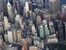
The Financial District's architecture is generally rooted in the Gilded Age, though there are also some art deco influences in the neighborhood. The area is distinguished by narrow streets, a steep topography, and high-rises[13] Construction in such narrow steep areas has resulted in occasional accidents such as a crane collapse.[14] One report divided lower Manhattan into three basic districts:[13]
- The Financial District proper—particularly along John Street
- South of the World Trade Center area—the handful of blocks south of the World Trade Center along Greenwich, Washington and West Streets
- Seaport district—characterized by century-old low-rise buildings and South Street Seaport; the seaport is "quiet, residential, and has an old world charm" according to one description.[13]
.jpg)
Federal Hall National Memorial, on the site of the first U.S. capitol and the first inauguration of George Washington as the first President of the United States, is located at the corner of Wall Street and Nassau Street.
The Financial District has a number of tourist attractions such as the South Street Seaport Historic District, newly renovated Pier 17, the New York City Police Museum, the Museum of American Finance, the National Museum of the American Indian, Trinity Church, St. Paul's Chapel, and the famous bull. Bowling Green is the starting point of traditional ticker-tape parades on Broadway, where here it is also known as the Canyon of Heroes. The Museum of Jewish Heritage and the Skyscraper Museum are both in adjacent Battery Park City which is also home to the Brookfield Place (formerly World Financial Center).
Another key anchor for the area is the New York Stock Exchange. City authorities realize its importance, and believed that it has "outgrown its neoclassical temple at the corner of Wall and Broad streets", and in 1998 offered substantial tax incentives to try to keep it in the Financial District.[15] Plans to rebuild it were delayed by the September 11, 2001 attacks.[15] The Exchange still occupies the same site. The Exchange is the locus for a large amount of technology and data. For example, to accommodate the three thousand persons who work directly on the Exchange floor requires 3,500 kilowatts of electricity, along with 8,000 phone circuits on the trading floor alone, and 200 miles of fiber-optic cable below ground.[16]
Official landmarks
Buildings in the Financial District can have one of several types of official landmark designations:
- The New York City Landmarks Preservation Commission is the New York City agency that is responsible for identifying and designating the city's landmarks and the buildings in the city's historic districts. New York City landmarks (NYCL) can be categorized into one of several groups: individual (exterior), interior, and scenic landmarks.[17]
- The National Register of Historic Places (NRHP) is the United States federal government's official list of districts, sites, buildings, structures and objects deemed worthy of preservation for their historical significance.[18]
- The National Historic Landmark (NHL) focuses on places of significance in American history, architecture, engineering, or culture; all NHL sites are also on the NRHP.[19]
The following landmarks are situated south of Morris Street and west of Whitehall Street/Broadway:[20]
- 21 West Street (NRHP, NYCL)[21]
- Alexander Hamilton U.S. Custom House, Bowling Green (NHL, NRHP, NYCL, NYCL interior)[22]
- Bowling Green fence (NYCL)[23]
- Bowling Green (NRHP)[24]
- Bowling Green Offices Building, 11 Broadway (NYCL)[25]
- Castle Clinton, the Battery (NRHP, NYCL)[26]
- City Pier A, the Battery (NRHP, NYCL)[27]
- Cunard Building, 25 Broadway (NYCL, NYCL interior)[28]
- Downtown Athletic Club, 19 West Street (NYCL)[29]
- Interborough Rapid Transit System, Battery Park Control House (NRHP, NYCL)[30]
- International Mercantile Marine Company Building, 1 Broadway (NRHP, NYCL)[31]
- James Watson House, 7 State Street (NRHP, NYCL)[32]
- Whitehall Building, 17 Battery Place (NYCL)[33]
The following landmarks are located west of Broadway between Morris and Barclay Streets:[20]
- American Stock Exchange Building (NHL, NRHP, NYCL)[34]
- 65 Broadway (NYCL)[35]
- 90 West Street (NRHP, NYCL)[36]
- 94 Greenwich Street (NYCL)[37]
- 195 Broadway (NYCL, NYCL interior)[38]
- Empire Building, 71 Broadway (NRHP, NYCL)[39]
- New York County Lawyers' Association Building, 14 Vesey Street (NRHP, NYCL)[40]
- Old New York Evening Post Building, 20 Vesey Street (NRHP, NYCL)[41]
- Robert and Anne Dickey House, 67 Greenwich Street (NYCL)[42]
- St. George's Syrian Catholic Church, 103 Washington Street (NYCL)[43]
- St. Paul's Chapel, Broadway at Fulton Street (NHL, NRHP, NYCL)[44]
- St. Peter's Roman Catholic Church, 22 Barclay Street (NRHP, NYCL)[45]
- Trinity and United States Realty Buildings, 111-115 Broadway (both NYCL)[46]
- Trinity Church, Broadway at Wall Street (NRHP, NYCL)[47]
- Verizon Building, 140 West Street (NRHP, NYCL, NYCL interior)[48]
The following landmarks are located south of Wall Street and east of Broadway/Whitehall Street:[20]
- 1 Hanover Square (NHL, NRHP, NYCL)[49]
- 1 Wall Street (NYCL)[50]
- 1 Wall Street Court (NRHP, NYCL)[51]
- 1 William Street (NYCL)[52]
- 20 Exchange Place (NYCL)[53]
- 23 Wall Street (NRHP, NYCL)[54]
- 26 Broadway (NYCL)[55]
- 55 Wall Street (NRHP, NYCL, NYCL interior)[56]
- American Bank Note Company Building, 70 Broad Street (NRHP, NYCL)[57]
- Battery Maritime Building, South Street (NRHP, NYCL)[58]
- Broad Exchange Building, 25 Broad Street (NRHP, NYCL)[59]
- Delmonico's Building, 56 Beaver Street (NYCL)[60]
- First Precinct Police Station, 100 Old Slip (NRHP, NYCL)[61]
- Fraunces Tavern, 54 Pearl Street (NRHP, NYCL)[62]
- New York Stock Exchange Building, 8-18 Broad Street (NHL, NRHP, NYCL)[63]
- Wall and Hanover Building, 59–63 Wall Street (NRHP)[64]
The following landmarks are located east of Broadway between Wall Street and Maiden Lane:[20]
- 14 Wall Street (NYCL)[65]
- 28 Liberty Street (NYCL)[66]
- 40 Wall Street (NRHP, NYCL)[67]
- 48 Wall Street (NRHP, NYCL)[68]
- 56 Pine Street (NRHP, NYCL)[69]
- 70 Pine Street (NYCL, NYCL interior)[70]
- 90–94 Maiden Lane (NYCL)[71]
- American Surety Building, 100 Broadway (NYCL)[72]
- Chamber of Commerce Building, 65 Liberty Street (NHL, NRHP, NYCL)[73]
- Down Town Association Building, 60 Pine Street (NYCL)[74]
- Equitable Building (NHL, NRHP, NYCL)[75]
- Federal Hal National Memorial, 26 Wall Street (NHL, NRHP, NYCL, NYCL interior)[76]
- Federal Reserve Bank of New York Building, 33 Liberty Street (NRHP, NYCL)[77]
- Liberty Tower, 55 Liberty Street (NRHP, NYCL)[78]
- Marine Midland Building, 140 Broadway (NYCL)[79]
The following landmarks are located east of Broadway and Park Row between Maiden Lane and the Brooklyn Bridge:[20]
- 5 Beekman Street (NYCL)[80]
- 63 Nassau Street (NYCL)[81]
- 150 Nassau Street (NYCL)[82]
- Bennett Building, 99 Nassau Street (NYCL)[83]
- Corbin Building, 13 John Street (NRHP, NYCL)[84]
- Excelsior Steam Power Company Building, 33–43 Gold Street (NYCL)[85]
- John Street Methodist Church, 44 John Street (NRHP, NYCL)[86]
- Keuffel & Esser Company Building, 127 Fulton Street (NYCL)[87]
- Morse Building, 138-42 Nassau Street (NYCL)[88]
- New York Times Building, 41 Park Row (NYCL)[89]
- Park Row Building, 15 Park Row (NRHP, NYCL)[90]
- Potter Building, 38 Park Row (NYCL)[91]
The following landmarks apply to multiple distinct areas:[20]
- Fraunces Tavern Block Historic District (NRHP, NYCL)[92]
- South Street Seaport Historic District (NRHP, NYCL; includes numerous individual landmarks)[93]
- Street Plan of New Amsterdam and Colonial New York (NYCL)[94]
- Stone Street Historic District (NYCL)[95]
- Wall Street, Fulton Street station interiors (NYCL)[96]
Surrounding neighborhood
During most of the 20th century, the Financial District was a business community with practically only offices which emptied out at night. A report in The New York Times in 1961 described a "deathlike stillness that settles on the district after 5:30 and all day Saturday and Sunday".[13] But there has been a change towards greater residential use of the area, pushed forwards by technological changes and shifting market conditions. The general pattern is for several hundred thousand workers to commute into the area during the day, sometimes by sharing a taxicab[97] from other parts of the city as well as from New Jersey and Long Island, and then leave at night. In 1970 only 833 people lived "south of Chambers Street"; by 1990, 13,782 people were residents with the addition of areas such as Battery Park City[15] and Southbridge Towers.[98] Battery Park City was built on 92 acres of landfill, and 3,000 people moved there beginning about 1982, but by 1986 there was evidence of more shops and stores and a park, along with plans for more residential development.[99]

According to one description in 1996, "The area dies at night ... It needs a neighborhood, a community."[98] During the past two decades there has been a shift towards greater residential living areas in the Financial District, with incentives from city authorities in some instances.[15] Many empty office buildings have been converted to lofts and apartments; for example, the office building of Harry Sinclair, the oil magnate involved with the Teapot Dome scandal, was converted to a co-op in 1979.[98] In 1996, a fifth of buildings and warehouses were empty, and many were converted to living areas.[98] Some conversions met with problems, such as aging gargoyles on building exteriors having to be expensively restored to meet with current building codes.[98] Residents in the area have sought to have a supermarket, a movie theater, a pharmacy, more schools, and a "good diner".[98] The discount retailer named Job Lot used to be located at the World Trade Center but moved to Church Street; merchants bought extra unsold items at steep prices and sold them as a discount to consumers, and shoppers included "thrifty homemakers and browsing retirees" who "rubbed elbows with City Hall workers and Wall Street executives"; but the firm went bust in 1993.[100]
There were reports that the number of residents increased by 60% during the 1990s to about 25,000 although a second estimate (based on the 2000 census based on a different map) places the residential population in 2000 at 12,042. By 2001 there were several grocery stores, dry cleaners, and two grade schools and a top high school.[15] There is also a long-standing barber shop across from the New York Stock Exchange.[101] Additionally, there were more signs of dogwalkers at night and a 24-hour neighborhood, although the general pattern of crowds during the working hours and emptiness at night was still apparent. There were also ten hotels and thirteen museums. Stuyvesant High School moved to its present location near Battery Park City in 1992 and has been described as one of the nation's premier high schools with emphasis on science and mathematics.[13] In 2007 the French fashion retailer Hermès opened a store in the Financial District to sell items such as a "$4,700 custom-made leather dressage saddle or a $47,000 limited edition alligator briefcase".[102] However, there are reports of panhandlers like elsewhere in the city.[103] By 2010 the residential population had increased to 24,400 residents.[104] and the area was growing with luxury high-end apartments and upscale retailers.[105]
Street grid
The streets in the area were laid out as part of the Castello Plan prior to the Commissioners' Plan of 1811, a grid plan that dictates the placement of most of Manhattan's streets north of Houston Street. Thus, it has small streets "barely wide enough for a single lane of traffic are bordered on both sides by some of the tallest buildings in the city", according to one description, which creates "breathtaking artificial canyons".[13] Some streets have been designated as pedestrian-only with vehicular traffic prohibited.[102]
Tourism
The Financial District is a major location of tourism in New York City. One report described lower Manhattan as "swarming with camera-carrying tourists".[106] Tour guides highlight places such as Trinity Church, the Federal Reserve gold vaults 80 feet below street level (worth $100 billion), and the NYSE.[107] A Scoundrels of Wall Street Tour is a walking historical tour which includes a museum visit and discussion of various financiers "who were adept at finding ways around finance laws or loopholes through them".[108] Occasionally artists make impromptu performances; for example, in 2010, a troupe of 22 dancers "contort their bodies and cram themselves into the nooks and crannies of the Financial District in Bodies in Urban Spaces" choreographed by Willi Donner.[109] One chief attraction, the Federal Reserve Building in lower Manhattan, paid $750,000 to open a visitors' gallery in 1997. The New York Stock Exchange and the American Stock Exchange also spent money in the late 1990s to upgrade facilities for visitors. Attractions include the gold vault beneath the Federal Reserve and that "staring down at the trading floor was as exciting as going to the Statue of Liberty".[106]
Demographics
For census purposes, the New York City government classifies the Financial District as part of a larger neighborhood tabulation area called Battery Park City-Lower Manhattan.[110] Based on data from the 2010 United States Census, the population of Battery Park City-Lower Manhattan was 39,699, an increase of 19,611 (97.6%) from the 20,088 counted in 2000. Covering an area of 479.77 acres (194.16 ha), the neighborhood had a population density of 82.7 inhabitants per acre (52,900/sq mi; 20,400/km2).[111] The racial makeup of the neighborhood was 65.4% (25,965) White, 3.2% (1,288) African American, 0.1% (35) Native American, 20.2% (8,016) Asian, 0.0% (17) Pacific Islander, 0.4% (153) from other races, and 3.0% (1,170) from two or more races. Hispanic or Latino of any race were 7.7% (3,055) of the population.[112]
The entirety of Community District 1, which comprises the Financial District and other Lower Manhattan neighborhoods, had 63,383 inhabitants as of NYC Health's 2018 Community Health Profile, with an average life expectancy of 85.8 years.[113]:2, 20 This is higher than the median life expectancy of 81.2 for all New York City neighborhoods.[114]:53 (PDF p. 84)[115] Most inhabitants are young to middle-aged adults: half (50%) are between the ages of 25–44, while 14% are between 0–17, and 18% between 45–64. The ratio of college-aged and elderly residents was lower, at 11% and 7% respectively.[113]:2
As of 2017, the median household income in Community Districts 1 and 2 (including Greenwich Village and SoHo) was $144,878,[116] though the median income in the Financial District individually was $125,565.[2] In 2018, an estimated 9% of Financial District and Lower Manhattan residents lived in poverty, compared to 14% in all of Manhattan and 20% in all of New York City. One in twenty-five residents (4%) were unemployed, compared to 7% in Manhattan and 9% in New York City. Rent burden, or the percentage of residents who have difficulty paying their rent, is 38% in Financial District and Lower Manhattan, compared to the boroughwide and citywide rates of 45% and 51% respectively. Based on this calculation, as of 2018, Financial District and Lower Manhattan are considered high-income relative to the rest of the city and not gentrifying.[113]:7
The population of the Financial District has grown to an estimated 61,000 residents as of 2018,[117] up from 43,000 as of 2014, which in turn was nearly double the 23,000 recorded at the 2000 Census.[118]
Political representation
Local
In the New York City Council, the Financial District is part of District 1, represented by Democrat Margaret Chin.[119][120]
List of aldermen/councilmen who have represented the Financial District
- 1922–1930: Martin F. Tanahey, Democratic
- 1938–1947: Borough-wide proportional representation
- 1965–1974: Saul Sharison
- 1974–1977: Anthony Gaeta, Democratic
- 1977–1985: Nicholas LaPorte, Democratic
- 1985: Frank Fossella, Democratic
- 1986–1990: Susan Molinari, Republican
- 1990–1991: Alfred C. Cerullo III, Republican
- 1991–2001: Kathryn E. Freed, Democratic
- 2002–2010: Alan Gerson, Democratic
- 2010–present: Margaret Chin, Democratic
State
The Financial District is part of the 26th State Senate district,[121][122] represented by Democrat Brian P. Kavanagh.[123] In the New York State Assembly, most of the neighborhood is in the 65th district, represented by Democrat Yuh-Line Niou, though the extreme northwestern area is part of the 66th district, represented by Democrat Deborah Glick.[123][124][125]
Federal
As of 2013, the Financial District is located within two congressional districts in the United States House of Representatives.[126][127] Most of the neighborhood is part of New York's 10th congressional district, represented by Democrat Jerrold Nadler, while the extreme northeastern section is part of New York's 12th congressional district, represented by Democrat Carolyn Maloney.[123]
Police and crime
Financial District and Lower Manhattan are patrolled by the 1st Precinct of the NYPD, located at 16 Ericsson Place.[128] The 1st Precinct ranked 63rd safest out of 69 patrol areas for per-capita crime in 2010. Though the number of crimes is low compared to other NYPD precincts, the residential population is also much lower.[129] With a non-fatal assault rate of 24 per 100,000 people, Financial District and Lower Manhattan's rate of violent crimes per capita is less than that of the city as a whole. The incarceration rate of 152 per 100,000 people is lower than that of the city as a whole.[113]:8
The 1st Precinct has a lower crime rate than in the 1990s, with crimes across all categories having decreased by 86.3% between 1990 and 2018. The precinct reported 1 murder, 23 rapes, 80 robberies, 61 felony assaults, 85 burglaries, 1,085 grand larcenies, and 21 grand larcenies auto in 2018.[130]
Fire safety
The Financial District is served by three New York City Fire Department (FDNY) fire stations:[131]
Health
Preterm and teenage births are less common in Financial District and Lower Manhattan than in other places citywide. In Financial District and Lower Manhattan, there were 77 preterm births per 1,000 live births (compared to 87 per 1,000 citywide), and 2.2 teenage births per 1,000 live births (compared to 19.3 per 1,000 citywide), though the teenage birth rate is based on a small sample size.[113]:11 Financial District and Lower Manhattan have a low population of residents who are uninsured. In 2018, this population of uninsured residents was estimated to be 4%, less than the citywide rate of 12%, though this was based on a small sample size.[113]:14
The concentration of fine particulate matter, the deadliest type of air pollutant, in Financial District and Lower Manhattan is 0.0096 milligrams per cubic metre (9.6×10⁻⁹ oz/cu ft), more than the city average.[113]:9 Sixteen percent of Financial District and Lower Manhattan residents are smokers, which is more than the city average of 14% of residents being smokers.[113]:13 In Financial District and Lower Manhattan, 4% of residents are obese, 3% are diabetic, and 15% have high blood pressure, the lowest rates in the city—compared to the citywide averages of 24%, 11%, and 28% respectively.[113]:16 In addition, 5% of children are obese, the lowest rate in the city, compared to the citywide average of 20%.[113]:12
Ninety-six percent of residents eat some fruits and vegetables every day, which is more than the city's average of 87%. In 2018, 88% of residents described their health as "good," "very good," or "excellent," more than the city's average of 78%.[113]:13 For every supermarket in Financial District and Lower Manhattan, there are 6 bodegas.[113]:10
The nearest major hospital is NewYork-Presbyterian Lower Manhattan Hospital in the Civic Center area.[135][136]
Post offices and ZIP Codes
Financial District is located within several ZIP Codes. The largest ZIP Codes are 10004, centered around the Battery; 10005, around Wall Street; 10006, around the World Trade Center; 10007, around City Hall; and 10038, around South Street Seaport. There are also several smaller ZIP Codes spanning one block, including 10045 around the Federal Reserve Bank; 10271 around the Equitable Building; and 10279 around the Woolworth Building.[137]
The United States Postal Service operates four post offices in the Financial District:
- Church Street Station – 90 Church Street[138]
- Hanover Station – 1 Hanover Street[139]
- Peck Slip Station – 114 John Street[140]
- Whitehall Station – 1 Whitehall Street[141]
Education
Financial District and Lower Manhattan generally have a higher rate of college-educated residents than the rest of the city. The vast majority of residents age 25 and older (84%) have a college education or higher, while 4% have less than a high school education and 12% are high school graduates or have some college education. By contrast, 64% of Manhattan residents and 43% of city residents have a college education or higher.[113]:6 The percentage of Financial District and Lower Manhattan students excelling in math rose from 61% in 2000 to 80% in 2011, and reading achievement increased from 66% to 68% during the same time period.[142]
Financial District and Lower Manhattan's rate of elementary school student absenteeism is lower than the rest of New York City. In Financial District and Lower Manhattan, 6% of elementary school students missed twenty or more days per school year, less than the citywide average of 20%.[113]:6[114]:24 (PDF p. 55) Additionally, 96% of high school students in Financial District and Lower Manhattan graduate on time, more than the citywide average of 75%.[113]:6
Schools
The New York City Department of Education operates the following public schools in the Financial District:[143]
- Urban Assembly School of Business for Young Women (grades 9-12)[144]
- Spruce Street School (grades PK-8)[145]
- Millennium High School (grades 9-12)[146]
- Leadership and Public Service High School (grades 9-12)[147]
- Manhattan Academy for Arts and Languages (grades 9-12)[148]
- High School of Economics and Finance (grades 9-12)[149]
Libraries
The New York Public Library (NYPL) operates two branches nearby. The New Amsterdam branch is located at 9 Murray Street near Broadway. It was established on the ground floor of an office building in 1989.[150] The Battery Park City branch is located at 175 North End Avenue near Murray Street. Completed in 2010, the two-story branch is NYPL's first LEED-certified branch.[151]
Transportation
The following New York City Subway stations are located in the Financial District:[152]
- Bowling Green, Wall Street (4 and 5 trains)
- Broad Street (J and Z trains)
- Chambers–WTC–Park Place–Cortlandt Street (2, 3, A, C, and E trains)
- City Hall, Rector Street (N, R, and W trains)
- Fulton Street (A and C trains)
- Rector Street, WTC Cortlandt (1, 2, and 3 trains)
- South Ferry/Whitehall Street (1, N, R, and W trains)
The largest transit hub, Fulton Center, was completed in 2014 after a $1.4 billion reconstruction project necessitated by the September 11, 2001 attacks, and involves at least five different sets of platforms. This transit hub was expected to serve 300,000 daily riders as of late 2014.[153] The World Trade Center Transportation Hub and PATH station opened in 2016.[154]
MTA Regional Bus Operations also operates several bus routes in the Financial District, namely the M15, M20, M15 SBS, M55 and M103 routes running north–south through the area, and the M9 and M22 routes running west–east through the area. There are also many MTA express bus routes running through the Financial District.[155] The Lower Manhattan Development Corporation operates a free shuttle bus, the Downtown Connection, which circulates around the Financial District during the daytime.[156]
Ferry services are also concentrated downtown, including the Staten Island Ferry at the Whitehall Terminal, NYC Ferry at Pier 11/Wall Street (and Battery Park City Ferry Terminal starting in 2020), and service to Governors Island at the Battery Maritime Building.[157]
Tallest buildings
| Name | Image | Height ft (m) |
Floors | Year | Notes |
|---|---|---|---|---|---|
| One World Trade Center | 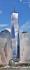 |
1,776 (541.3) | 104 | 2014 | Is the seventh-tallest building in the world and the tallest building in the United States since its topping out on May 10, 2013. It is also the tallest building in the Western Hemisphere and the tallest all-office building in the world.[158][159] |
| 3 World Trade Center |  |
1,079 (329) | 80 | 2018 | Mixed use; opened in 2018.[160] |
| 4 World Trade Center |  |
978 (298) | 74 | 2013 | Third-tallest building at the rebuilt World Trade Center and in the Financial District. The building opened to tenants in 2013.[161] |
| 70 Pine Street |  |
952 (290) | 66 | 1932 | 22nd-tallest building in the United States; formerly known as the American International Building and the Cities Service Building[162][163] 70 Pine is being transformed into a residential skyscraper with 644 rental residences, 132 hotel rooms and 35,000 square feet of retail[164] |
| 30 Park Place | 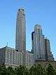 |
937 (286) | 82 | 2016 | Four Seasons Private Residences and Hotel. Topped-out in 2015 and completed in 2016.[165] |
| 40 Wall Street |  |
927 (283) | 70 | 1930 | 26th-tallest in the United States; was world's tallest building for less than two months in 1930; formerly known as the Bank of Manhattan Trust Building; also known as 40 Wall Street[166][167] |
| 28 Liberty Street | 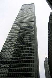 |
813 (248) | 60 | 1961 | [168][169] |
| 50 West Street | 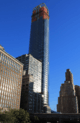 |
778 (237) | 63 | 2016 | [170][171] |
| 200 West Street | 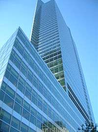 |
749 (228) | 44 | 2010 | Also known as Goldman Sachs World Headquarters[172][173] |
| 60 Wall Street |  |
745 (227) | 55 | 1989 | Also known as Deutsche Bank Building[174][175] |
| One Liberty Plaza | 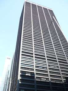 |
743 (226) | 54 | 1973 | Formerly known as the U.S. Steel Building[176][177] |
| 20 Exchange Place |  |
741 (226) | 57 | 1931 | Formerly known as the City Bank-Farmers Trust Building[178][179] |
| 200 Vesey Street | 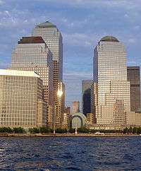 |
739 (225) | 51 | 1986 | Also known as Three World Financial Center[180][181] |
| HSBC Bank Building | 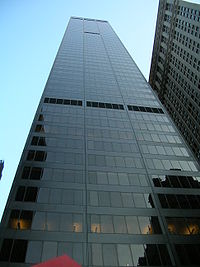 |
688 (210) | 52 | 1967 | Also known as Marine Midland Building[182][183] |
| 55 Water Street | 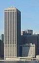 |
687 (209) | 53 | 1972 | [184][185] |
| 1 Wall Street | 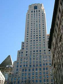 |
654 (199) | 50 | 1931 | Also known as Bank of New York Mellon Building[186][187] |
| 225 Liberty Street | |
645 (197) | 44 | 1987 | Also known as Two World Financial Center[188][189] |
| 1 New York Plaza |  |
640 (195) | 50 | 1969 | [190][191] |
| Home Insurance Plaza |  |
630 (192) | 45 | 1966 | [192][193] |
Gallery
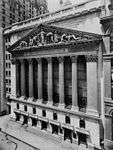 The Broad Street facade of the New York Stock Exchange
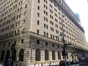 The Federal Reserve Bank of New York Building
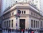 The former House of Morgan building at 23 Wall Street
 Federal Hall, once the U.S. Custom House, now a museum, with the towers of Wall Street behind it
 One Liberty Plaza, one of the many modern skyscrapers in the area
See also
References
- "NYC Planning | Community Profiles". communityprofiles.planning.nyc.gov. New York City Department of City Planning. Retrieved March 18, 2019.
- "Wall Street/Financial District neighborhood in New York". Retrieved March 18, 2019.
- Couzzo, Steve (April 25, 2007). "FiDi Soaring High". New York Post. Retrieved December 3, 2014.
The Financial District is over. So is the “Wall Street area.” But say hello to FiDi, the coinage of major downtown landlord Kent Swig, who decided it’s time to humanize the old F.D. with an easily remembered, fun-sounding acronym.
- "Manhattan, New York – Some of the Most Expensive Real Estate in the World Overlooks Central Park". The Pinnacle List. Retrieved November 24, 2014.
- Richard Florida (March 3, 2015). "Sorry, London: New York Is the World's Most Economically Powerful City". The Atlantic Monthly Group. Retrieved March 25, 2015.
Our new ranking puts the Big Apple firmly on top.
-
"Top 8 Cities by GDP: China vs. The U.S." Business Insider, Inc. July 31, 2011. Archived from the original on February 5, 2013. Retrieved March 25, 2015.
For instance, Shanghai, the largest Chinese city with the highest economic production, and a fast-growing global financial hub, is far from matching or surpassing New York, the largest city in the U.S. and the economic and financial super center of the world.
"PAL sets introductory fares to New York". Philippine Airlines. Retrieved March 25, 2015. - John Glover (November 23, 2014). "New York Boosts Lead on London as Leading Finance Center". Bloomberg L.P. Retrieved March 25, 2015.
- "UBS may move US investment bank to NYC". e-Eighteen.com Ltd. June 10, 2011. Retrieved March 25, 2015.
- Accessed March 23, 2019.
- "2013 WFE Market Highlights" (PDF). World Federation of Exchanges. Archived from the original (PDF) on March 27, 2014. Retrieved March 25, 2015.
- "NYSE Listings Directory". Archived from the original on July 19, 2008. Retrieved June 23, 2014.
- White, Norval; Willensky, Elliot & Leadon, Fran (2010). AIA Guide to New York City (5th ed.). New York: Oxford University Press. p. 7. ISBN 978-0-19538-386-7.
- Aaron Donovan (September 9, 2001). "If You're Thinking of Living In/The Financial District; In Wall Street's Canyons, Cliff Dwellers". The New York Times: Real Estate. Retrieved January 14, 2010.
- Sarah Wheaton and Ravi Somaiya (March 27, 2010). "Crane Falls Against Financial District Building". The New York Times. Retrieved January 14, 2010.
- Noelle Knox and Martha T. Moor (October 24, 2001). "'Wall Street' migrates to Midtown". USA Today. Retrieved January 14, 2010.
- Leslie Eaton and Kirk Johnson (September 16, 2001). "AFTER THE ATTACKS: WALL STREET; STRAINING TO RING THE OPENING BELL -- AFTER THE ATTACKS: WALL STREET". The New York Times. Retrieved January 15, 2011.
- "Landmark Types and Criteria - LPC". Welcome to NYC.gov. Retrieved December 22, 2019.
- "How to List a Property". National Register of Historic Places (U.S. National Park Service). November 26, 2019. Retrieved December 22, 2019.
- "Eligibility". National Historic Landmarks (U.S. National Park Service). August 29, 2018. Retrieved December 22, 2019.
- "Discover New York City Landmarks". New York City Landmarks Preservation Commission. Retrieved December 21, 2019 – via ArcGIS.
- "21 West Street Building" (PDF). New York City Landmarks Preservation Commission. June 16, 1998. Retrieved February 17, 2020.
"Historic Structures Report: Building at 21 West Street" (PDF). National Register of Historic Places, National Park Service. February 11, 1999. Retrieved February 17, 2020. - "Historic Structures Report: U.S. Custom House" (PDF). National Register of Historic Places, National Park Service. January 31, 1972. Retrieved February 17, 2020.
"United States Custom House" (PDF). New York City Landmarks Preservation Commission. October 14, 1965. Retrieved February 17, 2020.
"United States Custom House Interior" (PDF). New York City Landmarks Preservation Commission. January 9, 1979. Retrieved February 17, 2020. - "Bowling Green Fence" (PDF). New York City Landmarks Preservation Commission. July 14, 1970. Retrieved February 2, 2020.
- "Historic Structures Report: Bowling Green" (PDF). National Register of Historic Places, National Park Service. April 29, 1980. Retrieved February 17, 2020.
- "Bowling Green Offices Building" (PDF). New York City Landmarks Preservation Commission. September 19, 1995. Retrieved February 17, 2020.
- "Historic Structures Report: Castle Clinton National Monument" (PDF). National Register of Historic Places, National Park Service. October 15, 1966. Retrieved February 17, 2020.
"Castle Clinton" (PDF). New York City Landmarks Preservation Commission. November 23, 1965. Retrieved February 17, 2020. - "Historic Structures Report: City Pier A" (PDF). National Register of Historic Places, National Park Service. June 27, 1975. Retrieved February 17, 2020.
"Pier A" (PDF). New York City Landmarks Preservation Commission. July 12, 1977. Retrieved February 2, 2020. - "Cunard Building" (PDF). New York City Landmarks Preservation Commission. September 19, 1995. Retrieved February 17, 2020.
"Cunard Building, First Floor Interior" (PDF). New York City Landmarks Preservation Commission. September 19, 1995. Retrieved February 17, 2020. - "Downtown Athletic Club Building" (PDF). New York City Landmarks Preservation Commission. November 14, 2000. Retrieved February 17, 2020.
- "Historic Structures Report: Battery Park Control House" (PDF). National Register of Historic Places, National Park Service. May 6, 1980. Retrieved February 17, 2020.
"Interborough Rapid Transit System, Battery Park Control House" (PDF). New York City Landmarks Preservation Commission. November 22, 1973. Retrieved February 2, 2020. - "Historic Structures Report: International Mercantile Marine Company Building" (PDF). National Register of Historic Places, National Park Service. March 2, 1991. Retrieved February 17, 2020.
"International Mercantile Marine Company Building" (PDF). New York City Landmarks Preservation Commission. May 16, 1995. Retrieved February 17, 2020. - "Historic Structures Report: James Watson House" (PDF). National Register of Historic Places, National Park Service. July 24, 1972. Retrieved February 17, 2020.
"James Watson House" (PDF). New York City Landmarks Preservation Commission. November 23, 1965. Retrieved February 17, 2020. - "Whitehall Building" (PDF). New York City Landmarks Preservation Commission. October 17, 2000. Retrieved February 17, 2020.
- "Historic Structures Report: American Stock Exchange Building" (PDF). National Register of Historic Places, National Park Service. June 2, 1978. Retrieved February 17, 2020.
"New York Curb Exchange (incorporating the New York Curb Market Building), later known as the American Stock Exchange" (PDF). New York City Landmarks Preservation Commission. June 26, 2012. Retrieved February 17, 2020. - "American Express Company Building" (PDF). New York City Landmarks Preservation Commission. December 12, 1995. Retrieved February 17, 2020.
- "Historic Structures Report: West Street Building" (PDF). National Register of Historic Places, National Park Service. December 12, 2006. Retrieved February 17, 2020.
"West Street Building" (PDF). New York City Landmarks Preservation Commission. May 19, 1998. Retrieved February 17, 2020. - "94 Greenwich Street" (PDF). New York City Landmarks Preservation Commission. June 23, 2009. Retrieved February 17, 2020.
- "American Telephone and Telegraph Building" (PDF). New York City Landmarks Preservation Commission. July 25, 2006. Retrieved February 17, 2020.
"American Telephone and Telegraph Building Interior" (PDF). New York City Landmarks Preservation Commission. July 25, 2006. Retrieved February 17, 2020. - "Historic Structures Report: Empire Building" (PDF). National Register of Historic Places, National Park Service. January 13, 1983. Retrieved February 17, 2020.
"Empire Building" (PDF). New York City Landmarks Preservation Commission. June 25, 1996. Retrieved February 17, 2020. - "Historic Structures Report: Old New York County Lawyers' Association Building" (PDF). National Register of Historic Places, National Park Service. September 30, 1982. Retrieved February 2, 2020.
"New York County Lawyers' Association Building" (PDF). New York City Landmarks Preservation Commission. November 23, 1965. Retrieved February 16, 2020. - "Historic Structures Report: New York Evening Post Building" (PDF). National Register of Historic Places, National Park Service. August 16, 1977. Retrieved February 2, 2020.
"New York Evening Post Building" (PDF). New York City Landmarks Preservation Commission. November 23, 1965. Retrieved February 16, 2020. - "Robert and Anne Dickey House" (PDF). New York City Landmarks Preservation Commission. June 28, 2005. Retrieved February 17, 2020.
- "Saint George's Syrian Catholic Church" (PDF). New York City Landmarks Preservation Commission. July 14, 2009. Retrieved February 17, 2020.
- "Historic Structures Report: Saint Paul's Chapel" (PDF). National Register of Historic Places, National Park Service. April 23, 1980. Retrieved February 17, 2020.
"Saint Paul's Chapel and Graveyard" (PDF). New York City Landmarks Preservation Commission. August 18, 1966. Retrieved December 6, 2019. - "Historic Structures Report: Saint Peter's Roman Catholic Church" (PDF). National Register of Historic Places, National Park Service. April 23, 1980. Retrieved February 17, 2020.
"St. Peter's Church" (PDF). New York City Landmarks Preservation Commission. December 21, 1965. Retrieved December 6, 2019. - "Trinity Building" (PDF). New York City Landmarks Preservation Commission. June 7, 1988. Retrieved February 17, 2020.
"United States Realty Building" (PDF). New York City Landmarks Preservation Commission. June 7, 1988. Retrieved February 17, 2020. - "Historic Structures Report: Trinity Church and Graveyard" (PDF). National Register of Historic Places, National Park Service. December 8, 1976. Retrieved February 17, 2020.
"Trinity Church and Graveyard" (PDF). New York City Landmarks Preservation Commission. August 16, 1966. Retrieved July 28, 2019. - "Historic Structures Report: Barclay-Vesey Building" (PDF). National Register of Historic Places, National Park Service. April 30, 2009. Retrieved February 17, 2020.
"Barclay-Vesey Building" (PDF). New York City Landmarks Preservation Commission. October 1, 1991. Retrieved February 17, 2020.
"Barclay-Vesey Building Interior" (PDF). New York City Landmarks Preservation Commission. October 1, 1991. Retrieved February 17, 2020. - "Historic Structures Report: New York Cotton Exchange" (PDF). National Register of Historic Places, National Park Service. January 7, 1972. Retrieved February 17, 2020.
"Hanover Bank" (PDF). New York City Landmarks Preservation Commission. December 21, 1965. Retrieved February 17, 2020. - "1 Wall Street Building" (PDF). New York City Landmarks Preservation Commission. March 6, 2001. Retrieved February 17, 2020.
- "Historic Structures Report: Beaver Building" (PDF). National Register of Historic Places, National Park Service. July 6, 2005. Retrieved February 17, 2020.
"Beaver Building" (PDF). New York City Landmarks Preservation Commission. February 13, 1996. Retrieved February 17, 2020. - "J. & W. Seligman & Company Building" (PDF). New York City Landmarks Preservation Commission. February 13, 1996. Retrieved February 17, 2020.
- "City Bank-Farmers Trust Company Building" (PDF). New York City Landmarks Preservation Commission. June 25, 1996. Retrieved July 28, 2019.
- "Historic Structures Report: 23 Wall Street Building" (PDF). National Register of Historic Places, National Park Service. June 19, 1972. Retrieved February 17, 2020.
"J. P. Morgan & Co. Building" (PDF). New York City Landmarks Preservation Commission. December 21, 1965. Retrieved February 17, 2020. - "Standard Oil Building" (PDF). New York City Landmarks Preservation Commission. September 19, 1995. Retrieved February 17, 2020.
- "Historic Structures Report: National City Bank Building" (PDF). National Register of Historic Places, National Park Service. November 30, 1999. Retrieved February 17, 2020.
"National City Bank Building" (PDF). New York City Landmarks Preservation Commission. December 21, 1965. Retrieved February 17, 2020.
"National City Bank Building Interior" (PDF). New York City Landmarks Preservation Commission. January 12, 1999. Retrieved February 17, 2020. - "Historic Structures Report: American Bank Note Company Building" (PDF). National Register of Historic Places, National Park Service. November 30, 1999. Retrieved February 17, 2020.
"American Bank Note Company Office Building" (PDF). New York City Landmarks Preservation Commission. June 24, 1997. Retrieved February 17, 2020. - "Historic Structures Report: Municipal Ferry Pier" (PDF). National Register of Historic Places, National Park Service. December 12, 1976. Retrieved February 17, 2020.
"Whitehall Ferry Terminal, 11 South Street" (PDF). New York City Landmarks Preservation Commission. May 25, 1967. Retrieved February 17, 2020. - "Historic Structures Report: Broad Exchange Building" (PDF). National Register of Historic Places, National Park Service. April 13, 1998. Retrieved February 17, 2020.
"Broad Exchange Building" (PDF). New York City Landmarks Preservation Commission. June 27, 2000. Retrieved February 17, 2020. - "Delmonico's Building" (PDF). New York City Landmarks Preservation Commission. February 13, 1996. Retrieved February 17, 2020.
- "Historic Structures Report: First Police Precinct Station House" (PDF). National Register of Historic Places, National Park Service. October 29, 1982. Retrieved February 17, 2020.
"First Precinct Police Station" (PDF). New York City Landmarks Preservation Commission. September 20, 1977. Retrieved February 17, 2020. - "Historic Structures Report: Fraunces Tavern" (PDF). National Register of Historic Places, National Park Service. March 6, 2008. Retrieved February 17, 2020.
"Fraunces Tavern" (PDF). New York City Landmarks Preservation Commission. November 23, 1965. Retrieved February 17, 2020. - "Historic Structures Report: New York Stock Exchange" (PDF). National Register of Historic Places, National Park Service. June 2, 1978. Retrieved February 17, 2020.
"New York Stock Exchange" (PDF). New York City Landmarks Preservation Commission. July 9, 1985. Retrieved February 17, 2020. - 05001288.pdf "Historic Structures Report: Wall and Hanover Building" Check
|url=value (help) (PDF). National Register of Historic Places, National Park Service. November 16, 2005. Retrieved February 17, 2020. - "Bankers Trust Building" (PDF). New York City Landmarks Preservation Commission. June 24, 1997. Retrieved February 17, 2020.
- "One Chase Manhattan Plaza" (PDF). New York City Landmarks Preservation Commission. February 10, 2009. Retrieved February 17, 2020.
- "Historic Structures Report: Manhattan Company Building" (PDF). National Register of Historic Places, National Park Service. June 16, 2000. Retrieved February 17, 2020.
"Manhattan Company Building" (PDF). New York City Landmarks Preservation Commission. December 12, 1995. Retrieved February 17, 2020. - "Historic Structures Report: Bank of New York & Trust Company Building" (PDF). National Register of Historic Places, National Park Service. August 28, 2003. Retrieved February 17, 2020.
"Bank of New York & Trust Company Building" (PDF). New York City Landmarks Preservation Commission. October 13, 1998. Retrieved February 17, 2020. - "Historic Structures Report: Wallace Building" (PDF). National Register of Historic Places, National Park Service. August 28, 2003. Retrieved February 17, 2020.
"56-58 Pine Street" (PDF). New York City Landmarks Preservation Commission. February 11, 1997. Retrieved February 17, 2020. - "Cities Service Building" (PDF). New York City Landmarks Preservation Commission. June 21, 2011. Retrieved February 17, 2020.
"Cities Service Building, First Floor Interior" (PDF). New York City Landmarks Preservation Commission. June 21, 2011. Retrieved February 17, 2020. - "90–94 Maiden Lane Building" (PDF). New York City Landmarks Preservation Commission. August 1, 1989. Retrieved February 17, 2020.
- "American Surety Company Building" (PDF). New York City Landmarks Preservation Commission. June 24, 1997. Retrieved February 17, 2020.
- "Historic Structures Report: Chamber of Commerce Building" (PDF). National Register of Historic Places, National Park Service. February 6, 1973. Retrieved February 17, 2020.
"Chamber of Commerce of the State of New York" (PDF). New York City Landmarks Preservation Commission. January 18, 1966. Retrieved February 17, 2020. - "Down Town Association Building" (PDF). New York City Landmarks Preservation Commission. February 11, 1997. Retrieved February 17, 2020.
- "Historic Structures Report: Equitable Building" (PDF). National Register of Historic Places, National Park Service. June 2, 1975. Retrieved February 17, 2020.
"Equitable Building" (PDF). New York City Landmarks Preservation Commission. June 25, 1996. Retrieved February 17, 2020. - "Historic Structures Report: Federal Hall" (PDF). National Register of Historic Places, National Park Service. October 15, 1966. Retrieved February 17, 2020.
"United States Custom House" (PDF). New York City Landmarks Preservation Commission. December 21, 1965. Retrieved February 17, 2020.
"Federal Hall Interior" (PDF). New York City Landmarks Preservation Commission. May 27, 1975. Retrieved February 17, 2020. - "Historic Structures Report: Federal Reserve Bank of New York Building" (PDF). National Register of Historic Places, National Park Service. May 6, 1980. Retrieved February 17, 2020.
"Federal Reserve Bank of New York Building" (PDF). New York City Landmarks Preservation Commission. December 21, 1965. Retrieved February 17, 2020. - "Historic Structures Report: Liberty Tower" (PDF). National Register of Historic Places, National Park Service. September 15, 1983. Retrieved February 17, 2020.
"Liberty Tower" (PDF). New York City Landmarks Preservation Commission. August 24, 1982. Retrieved February 17, 2020. - "Marine Midland Building" (PDF). New York City Landmarks Preservation Commission. June 25, 2013. Retrieved February 17, 2020.
- "Temple Court Building and Annex" (PDF). New York City Landmarks Preservation Commission. February 10, 1998. Retrieved December 6, 2019.
- "63 Nassau Street Building" (PDF). New York City Landmarks Preservation Commission. May 15, 2007. Retrieved February 17, 2020.
- "American Tract Society Building" (PDF). New York City Landmarks Preservation Commission. June 15, 1999. Retrieved February 17, 2020.
- "Bennett Building" (PDF). New York City Landmarks Preservation Commission. November 21, 1995. Retrieved February 17, 2020.
- "Historic Structures Report: Corbin Building" (PDF). National Register of Historic Places, National Park Service. December 18, 2003. Retrieved February 17, 2020.
"Corbin Building" (PDF). New York City Landmarks Preservation Commission. June 24, 2015. Retrieved February 17, 2020. - "Excelsior Steam Power Company Building" (PDF). New York City Landmarks Preservation Commission. December 13, 2016. Retrieved December 6, 2019.
- "Historic Structures Report: John Street United Methodist Church" (PDF). National Register of Historic Places, National Park Service. June 4, 1973. Retrieved February 17, 2020.
"John Street Methodist Church" (PDF). New York City Landmarks Preservation Commission. December 21, 1965. Retrieved December 6, 2019. - "Keuffel & Esser Company Building" (PDF). New York City Landmarks Preservation Commission. April 26, 2005. Retrieved December 6, 2019.
- "Morse Building" (PDF). New York City Landmarks Preservation Commission. September 19, 2006. Retrieved December 6, 2019.
- "New York Times Building" (PDF). New York City Landmarks Preservation Commission. March 6, 1999. Retrieved December 6, 2019.
- "Historic Structures Report: Park Row Building" (PDF). National Register of Historic Places, National Park Service. November 16, 2005. Retrieved February 17, 2020.
"Park Row Building" (PDF). New York City Landmarks Preservation Commission. June 15, 1999. Retrieved February 17, 2020. - "Potter Building" (PDF). New York City Landmarks Preservation Commission. September 7, 1996. Retrieved December 6, 2019.
- "Historic Structures Report: Fraunces Tavern Historic District" (PDF). National Register of Historic Places, National Park Service. April 28, 1977. Retrieved February 17, 2020.
"Fraunces Tavern Block Historic District" (PDF). New York City Landmarks Preservation Commission. November 14, 1978. Retrieved February 17, 2020. - "Historic Structures Report: South Street Seaport Historic District" (PDF). National Register of Historic Places, National Park Service. December 12, 1978. Retrieved February 17, 2020.
"South Street Seaport Historic District" (PDF). New York City Landmarks Preservation Commission. May 10, 1977. Retrieved July 28, 2019. - "Street Plan of New Amsterdam and Colonial New York" (PDF). New York City Landmarks Preservation Commission. June 14, 1983. Retrieved February 17, 2020.
- "Stone Street Historic District" (PDF). New York City Landmarks Preservation Commission. June 25, 1996. Retrieved July 28, 2019.
- "IRT Subway System Underground Interior" (PDF). New York City Landmarks Preservation Commission. October 23, 1979. Retrieved July 28, 2019.
- Michael M. Grynbaum (June 18, 2009). "Stand That Blazed Cab-Sharing Path Has Etiquette All Its Own". The New York Times. Retrieved January 14, 2010.
- Michael Cooper (January 28, 1996). "NEW YORKERS & CO.: The Ghosts of Teapot Dome;Fabled Wall Street Offices Are Now Apartments, but Do Not Yet a Neighborhood Make". The New York Times. Retrieved January 14, 2010.
- Michael deCourcy Hinds (March 23, 1986). "SHAPING A LANDFILL INTO A NEIGHBORHOOD". The New York Times. Retrieved January 14, 2010.
- Bruce Lambert (December 19, 1993). "NEIGHBORHOOD REPORT: LOWER MANHATTAN; At Job Lot, the Final Bargain Days". The New York Times. Retrieved January 14, 2010.
- Simon Doolittle (February 27, 2009). "A Beer and a Haircut on Wall Street". The New York Times. Retrieved January 14, 2010.
- Claire Wilson (July 29, 2007). "Hermès Tempts the Men of Wall Street". The New York Times: Real Estate. Retrieved January 14, 2010.
- Patty Stonesifer and Sandy Stonesifer (January 23, 2009). "Sister, Can You Spare a Dime? I don't give to my neighborhood panhandlers. Should I?". Slate. Retrieved January 14, 2010.
- Sushil Cheema (May 29, 2010). "Financial District Rallies as Residential Area". Wall Street Journal. Retrieved January 14, 2010.
- Michael Stoler (June 28, 2007). "Refashioned: Financial District Is Booming With Business". New York Sun. Retrieved January 15, 2011.
- David M. Halbfinger (August 27, 1997). "New York's Financial District Is a Must-See Tourist Destination". The New York Times. Retrieved January 15, 2011.
- LIsa W. Foderaro (June 20, 1997). "A Financial District Tour". The New York Times. Retrieved January 15, 2011.
- T.L. Chancellor (January 14, 2010). "Walking Tours of NYC". USA Today: Travel. Retrieved January 14, 2010.
- Aaron Rutkoff (September 27, 2010). "'Bodies in Urban Spaces': Fitting In on Wall Street". Wall Street Journal. Retrieved January 14, 2010.
- New York City Neighborhood Tabulation Areas*, 2010, Population Division - New York City Department of City Planning, February 2012. Accessed June 16, 2016.
- Table PL-P5 NTA: Total Population and Persons Per Acre - New York City Neighborhood Tabulation Areas*, 2010, Population Division - New York City Department of City Planning, February 2012. Accessed June 16, 2016.
- Table PL-P3A NTA: Total Population by Mutually Exclusive Race and Hispanic Origin - New York City Neighborhood Tabulation Areas*, 2010, Population Division - New York City Department of City Planning, March 29, 2011. Accessed June 14, 2016.
- "Financial District (Including Battery Park City, Civic Center, Financial District, South Street Seaport and Tribeca)" (PDF). nyc.gov. NYC Health. 2018. Retrieved March 2, 2019.
- "2016-2018 Community Health Assessment and Community Health Improvement Plan: Take Care New York 2020" (PDF). nyc.gov. New York City Department of Health and Mental Hygiene. 2016. Retrieved September 8, 2017.
- "New Yorkers are living longer, happier and healthier lives". New York Post. June 4, 2017. Retrieved March 1, 2019.
- "NYC-Manhattan Community District 1 & 2--Battery Park City, Greenwich Village & Soho PUMA, NY". Retrieved July 17, 2018.
- Bob Pisani (May 18, 2018). "New 3 World Trade Center to mark another step in NYC's downtown revival". CNBC. Retrieved May 18, 2018.
- C. J. Hughes (August 8, 2014). "The Financial District Gains Momentum". The New York Times. Retrieved August 14, 2014.
- "Council Members & Districts". New York City Council. Retrieved December 1, 2019.
- "District 1". New York City Council. March 25, 2018. Retrieved March 4, 2019.
- "2012 Senate District Maps: New York City" (PDF). The New York State Legislative Task Force on Demographic Research and Reapportionment. 2012. Retrieved November 17, 2018.
- "NY Senate District 26". NY State Senate. Retrieved January 18, 2019.
- "Elected Officials & District Map". New York State Board of Elections. Retrieved December 1, 2019.
- "2012 Assembly District Maps: New York City" (PDF). The New York State Legislative Task Force on Demographic Research and Reapportionment. 2012. Retrieved November 17, 2018.
- "New York State Assembly Member Directory". Assembly Member Directory. Retrieved March 4, 2019.
- Congressional District 10, New York State Legislative Task Force on Demographic Research and Reapportionment. Retrieved May 5, 2017.
- Congressional District 12, New York State Legislative Task Force on Demographic Research and Reapportionment. Retrieved May 5, 2017.
- New York City Congressional Districts, New York State Legislative Task Force on Demographic Research and Reapportionment. Retrieved May 5, 2017.
- "NYPD – 1st Precinct". www.nyc.gov. New York City Police Department. Retrieved October 3, 2016.
- "Downtown: Battery Park, Financial District, SoHo, TriBeCa – DNAinfo.com Crime and Safety Report". www.dnainfo.com. Archived from the original on April 15, 2017. Retrieved October 6, 2016.
- "1st Precinct CompStat Report" (PDF). www.nyc.gov. New York City Police Department. Retrieved July 22, 2018.
- "FDNY Firehouse Listing – Location of Firehouses and companies". NYC Open Data; Socrata. New York City Fire Department. September 10, 2018. Retrieved March 14, 2019.
- "Engine Company 4/Ladder Company 15/Decontamination Unit". FDNYtrucks.com. Retrieved March 14, 2019.
- "Engine Company 6". FDNYtrucks.com. Retrieved March 14, 2019.
- "Engine Company 10/Ladder Company 10". FDNYtrucks.com. Retrieved March 14, 2019.
- "Manhattan Hospital Listings". New York Hospitals. Retrieved March 20, 2019.
- "Best Hospitals in New York, N.Y." US News & World Report. July 26, 2011. Retrieved March 20, 2019.
- "Financial District, New York City-Manhattan, New York Zip Code Boundary Map (NY)". United States Zip Code Boundary Map (USA). Retrieved March 20, 2019.
- "Location Details: Church Street". USPS.com. Retrieved March 7, 2019.
- "Location Details: Hanover". USPS.com. Retrieved March 7, 2019.
- "Location Details: Peck Slip". USPS.com. Retrieved March 7, 2019.
- "Location Details: Whitehall". USPS.com. Retrieved March 7, 2019.
- "Financial District – MN 01" (PDF). Furman Center for Real Estate and Urban Policy. 2011. Retrieved October 5, 2016.
- "Financial District New York School Ratings and Reviews". Zillow. Retrieved March 17, 2019.
- "Urban Assembly School of Business for Young Women, the". New York City Department of Education. December 19, 2018. Retrieved March 20, 2019.
- "Spruce Street School". New York City Department of Education. December 19, 2018. Retrieved March 20, 2019.
- "Millennium High School". New York City Department of Education. December 19, 2018. Retrieved March 20, 2019.
- "Leadership and Public Service High School". New York City Department of Education. December 19, 2018. Retrieved March 20, 2019.
- "Manhattan Academy For Arts & Language". New York City Department of Education. December 19, 2018. Retrieved March 20, 2019.
- "High School of Economics and Finance". New York City Department of Education. December 19, 2018. Retrieved March 20, 2019.
- "About the New Amsterdam Library". The New York Public Library. Retrieved March 14, 2019.
- "About the Battery Park City Library". The New York Public Library. Retrieved March 14, 2019.
- "Subway Map" (PDF). Metropolitan Transportation Authority. October 21, 2019. Retrieved January 18, 2018.
- "Biggest NY Subway Hub Opens; Expects 300,000 Daily". ABC News. December 10, 2014. Retrieved November 18, 2014.
- "World Trade Center transportation hub, dubbed Oculus, opens to public". ABC7 New York. March 3, 2016. Retrieved July 8, 2018.
- "Manhattan Bus Map" (PDF). Metropolitan Transportation Authority. December 2017. Retrieved April 24, 2018.
- "Brooklyn Bus Service" (PDF). Metropolitan Transportation Authority. November 2017. Retrieved April 24, 2018.
- "Bronx Bus Service" (PDF). Metropolitan Transportation Authority. September 2017. Retrieved April 24, 2018.
- "Queens Bus Map" (PDF). Metropolitan Transportation Authority. December 2017. Retrieved April 24, 2018.
- "Staten Island Bus Map" (PDF). Metropolitan Transportation Authority. August 2018. Retrieved August 18, 2018.
- "Downtown Connection Bus". www.downtownny.com. Alliance for Downtown New York. Retrieved March 11, 2018.
- "Route Map" (PDF). NYC Ferry. 2017. Archived from the original (PDF) on June 28, 2017. Retrieved July 13, 2017.
- "One World Trade Center". The Skyscraper Center. CTBUH. Retrieved May 14, 2013.
- Murray, Matt; Kim, Eun Kyung (May 14, 2013). "Cheers Erupt as Spire Tops One World Trade Center". CNBC. Retrieved May 12, 2013.
- Elizabeth Fazzare (June 11, 2018). "3 World Trade Center Is Officially Unveiled After Years of Delays". Architectural Digest.
- "Building Overview". Retrieved September 21, 2016.
- "American International". Emporis.com. Retrieved November 19, 2007.
- "American International Building". SkyscraperPage.com. Retrieved November 22, 2007.
- Cuozzo, Steve. "New plans for downtown’s 70 Pine St. are sky-high" New York Post (October 29, 2013)
- "Four Seasons Hotel at 30 Park Place Will Open in July 2016". Zoe Rosenberg. Retrieved August 30, 2015.
- "The Trump Building". Emporis.com. Retrieved November 19, 2007.
- "Trump Building". SkyscraperPage.com. Retrieved November 22, 2007.
- "One Chase Manhattan Plaza". Emporis.com. Retrieved November 19, 2007.
- "One Chase Manhattan Plaza". SkyscraperPage.com. Retrieved November 22, 2007.
- "Financial District, Manhattan". CTBUH Skyscraper Center.
- "50 West Street". SkyscraperPage.com. Retrieved February 14, 2016.
- "Goldman Sachs Headquarters". Emporis.com. Retrieved July 21, 2012.
- "Goldman Sachs New World Headquarters". SkyscraperPage.com. Retrieved July 21, 2012.
- "60 Wall Street". Emporis.com. Retrieved November 19, 2007.
- "60 Wall Street". SkyscraperPage.com. Retrieved November 22, 2007.
- "One Liberty Plaza". Emporis.com. Retrieved November 19, 2007.
- "1 Liberty Plaza". SkyscraperPage.com. Retrieved November 22, 2007.
- "20 Exchange Place". Emporis.com. Retrieved November 19, 2007.
- "20 Exchange Place". SkyscraperPage.com. Retrieved November 22, 2007.
- "Three World Financial Center". Emporis.com. Retrieved November 19, 2007.
- "Three World Financial Center". SkyscraperPage.com. Retrieved November 22, 2007.
- "HSBC Bank Building". Emporis.com. Retrieved November 19, 2007.
- "HSBC Bank Building". SkyscraperPage.com. Retrieved November 22, 2007.
- "55 Water Street". Emporis.com. Retrieved November 19, 2007.
- "55 Water Street". SkyscraperPage.com. Retrieved November 22, 2007.
- "Bank of New York Building". Emporis.com. Retrieved November 19, 2007.
- "Bank of New York Building". SkyscraperPage.com. Retrieved November 22, 2007.
- "Two World Financial Center". Emporis.com. Retrieved November 19, 2007.
- "Two World Financial Center". SkyscraperPage.com. Retrieved November 22, 2007.
- "One New York Plaza". Emporis.com. Retrieved November 19, 2007.
- "One New York Plaza". SkyscraperPage.com. Retrieved November 22, 2007.
- "Home Insurance Plaza". Emporis.com. Retrieved November 19, 2007.
- "Home Insurance Plaza". SkyscraperPage.com. Retrieved November 22, 2007.
External links
| Wikimedia Commons has media related to Financial District, Manhattan. |

- Photographs of Financial District
- Wikipages Financial District, a wiki-based business directory for the Financial District.
| Lower Manhattan below 14th St (CB 1, 2, 3) |
|   |
|---|---|---|
| Midtown (CB 5) | ||
| West Side (CB 4, 7) | ||
| East Side (CB 6, 8) | ||
| Upper Manhattan above 110th St (CB 9, 10, 11, 12) | ||
| Islands |
| |
| Former |
| |