National Register of Historic Places listings in Clinton County, New York
List of the National Register of Historic Places listings in Clinton County, New York
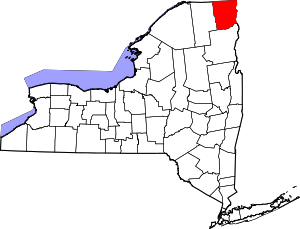
Location of Clinton County in New York
This is intended to be a complete list of National Register of Historic Places in Clinton County, New York. The locations of National Register properties and districts for which the latitude and longitude coordinates are included below, may be seen in a map.[1]
- This National Park Service list is complete through NPS recent listings posted June 19, 2020.[2]
| Albany (Albany) – Allegany – Bronx – Broome – Cattaraugus – Cayuga – Chautauqua – Chemung – Chenango – Clinton – Columbia – Cortland – Delaware – Dutchess (Poughkeepsie, Rhinebeck) – Erie (Buffalo) – Essex – Franklin – Fulton – Genesee – Greene – Hamilton – Herkimer – Jefferson – Kings – Lewis – Livingston – Madison – Monroe (Rochester) – Montgomery – Nassau – New York (Below 14th Street, 14th to 59th Streets, 59th to 110th Streets, Above 110th Street, Islands) – Niagara – Oneida – Onondaga – Ontario – Orange – Orleans – Oswego – Otsego – Putnam – Queens – Rensselaer – Richmond – Rockland – St. Lawrence – Saratoga – Schenectady – Schoharie – Schuyler – Seneca – Steuben – Suffolk – Sullivan – Tioga – Tompkins – Ulster – Warren – Washington – Wayne – Westchester (Northern, Southern, New Rochelle, Peekskill, Yonkers) – Wyoming – Yates |
Listings county-wide
| [3] | Name on the Register | Image | Date listed[4] | Location | City or town | Description |
|---|---|---|---|---|---|---|
| 1 | Adirondack Forest Preserve | 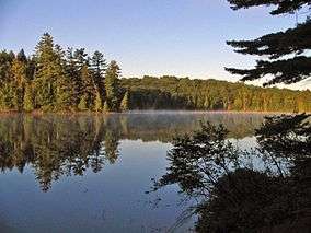 Adirondack Forest Preserve |
October 15, 1966 (#66000891) |
Northeast New York State 43°58′43″N 74°18′42″W |
Clinton County | |
| 2 | AuSable Chasm Bridge | 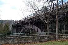 AuSable Chasm Bridge |
November 12, 1999 (#99001320) |
U.S. Route 9 over the Ausable River 44°31′29″N 73°27′48″W |
Ausable Chasm (Chesterfield) | |
| 3 | William Bailey House | 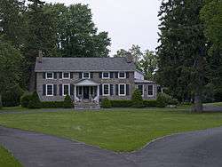 William Bailey House |
November 12, 1982 (#82001098) |
176 Cornelia St. 44°42′03″N 73°27′53″W |
Plattsburgh | |
| 4 | Brinkerhoff Street Historic District | 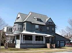 Brinkerhoff Street Historic District |
November 12, 1982 (#82001099) |
Brinkerhoff St. between Oak and N. Catherine Sts. 44°41′49″N 73°27′25″W |
Plattsburgh | |
| 5 | Carpenter's Flats Bridge | 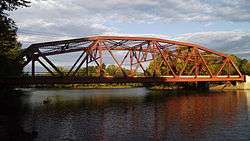 Carpenter's Flats Bridge |
November 12, 1999 (#99001321) |
U.S. Route 9 over the Ausable River 44°33′32″N 73°26′57″W |
AuSable and Peru | |
| 6 | John B. Carpenter House | November 12, 1982 (#82001100) |
42 Prospect Ave. 44°42′02″N 73°28′24″W |
Plattsburgh | ||
| 7 | Church of St. Dismas, the Good Thief | November 21, 1991 (#91001673) |
Clinton Correctional Facility, Cook St. 44°43′29″N 73°43′21″W |
Dannemora | ||
| 8 | City Hall |  City Hall |
December 12, 1973 (#73001170) |
City Hall Pl. 44°41′57″N 73°27′09″W |
Plattsburgh | |
| 9 | Clinton County Courthouse Complex | 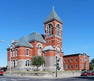 Clinton County Courthouse Complex |
November 12, 1982 (#82001101) |
135 Margaret St. 44°41′56″N 73°27′13″W |
Plattsburgh | |
| 10 | Court Street Historic District |  Court Street Historic District |
February 24, 1983 (#83001664) |
Court St. between Oak and Beekman Sts. 44°41′53″N 73°27′32″W |
Plattsburgh | |
| 11 | D & H Railroad Complex | 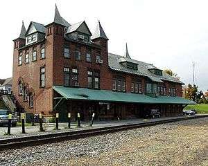 D & H Railroad Complex |
November 12, 1982 (#82001102) |
Bridge St. 44°41′51″N 73°26′43″W |
Plattsburgh | |
| 12 | D'Youville Academy | 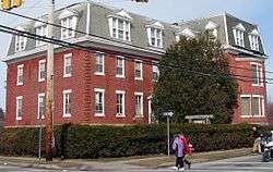 D'Youville Academy |
November 12, 1982 (#82001103) |
100 Cornelia St. 44°41′58″N 73°27′28″W |
Plattsburgh | |
| 13 | Delaware and Hudson Railroad Bridge | November 12, 1999 (#99001317) |
Over AuSable River northeast of Lakeside Rd. 44°33′20″N 73°26′05″W |
AuSable and Peru | ||
| 14 | Double-Span Metal Pratt Truss Bridge | 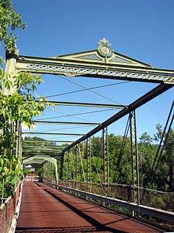 Double-Span Metal Pratt Truss Bridge |
May 20, 1983 (#83001665) |
AuSable St. 44°30′01″N 73°29′07″W |
Keeseville | |
| 15 | First Presbyterian Church |  First Presbyterian Church |
November 12, 1982 (#82001104) |
34 Brinkerhoff St. 44°41′50″N 73°27′16″W |
Plattsburgh | |
| 16 | Fort Brown Site | December 15, 1978 (#78001846) |
Northwest of the intersection of Elizabeth St. and State Route 9 44°41′19″N 73°27′01″W |
Plattsburgh | ||
| 17 | Fort Montgomery | 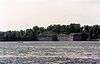 Fort Montgomery |
August 22, 1977 (#77000937) |
Address Restricted |
Rouses Point | Site of American fort built on Lake Champlain, accidentally located over the border in Canada |
| 18 | W. W. Hartwell House & Dependencies |  W. W. Hartwell House & Dependencies |
November 12, 1982 (#82001105) |
77 Brinkerhoff St. 44°41′47″N 73°27′32″W |
Plattsburgh | |
| 19 | Hawkins Hall | 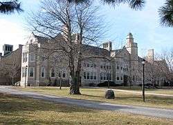 Hawkins Hall |
November 12, 1982 (#82001106) |
Beekman St. 44°41′50″N 73°28′04″W |
Plattsburgh | |
| 20 | Heyworth–Mason Industrial Building | 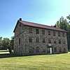 Heyworth–Mason Industrial Building |
May 6, 2011 (#11000250) |
Mason Hill Road 44°34′44″N 73°31′28″W |
Peru | |
| 21 | House at 56 Cornelia Street | 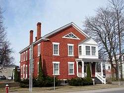 House at 56 Cornelia Street |
November 12, 1982 (#82001107) |
56 Cornelia St. 44°41′58″N 73°27′09″W |
Plattsburgh | |
| 22 | Keeseville Historic District | 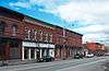 Keeseville Historic District |
May 20, 1983 (#83001666) |
Roughly bounded by Vine, Chesterfield, Clinton, Hill, Pleasant, Front, and Beech Sts. 44°30′16″N 73°28′58″W |
Keeseville | |
| 23 | Kent-Delord House | 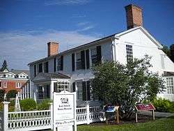 Kent-Delord House |
February 18, 1971 (#71000532) |
17 Cumberland Ave. 44°42′12″N 73°27′08″W |
Plattsburgh | |
| 24 | Lyon Mountain Railroad Station |  Lyon Mountain Railroad Station |
February 14, 2002 (#02000005) |
2914 First St. 44°43′35″N 73°54′39″W |
Lyon Mountain | |
| 25 | Lyon Street School | May 22, 2013 (#13000304) |
Rock & Lyons Rds. 44°36′25″N 73°27′41″W |
Peru | ||
| 26 | Paul Marshall House | 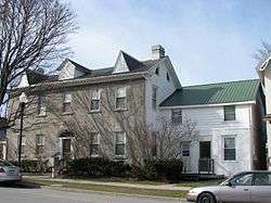 Paul Marshall House |
November 12, 1982 (#82001108) |
24-26 Cornelia St. 44°41′59″N 73°27′09″W |
Plattsburgh | |
| 27 | Miller Homestead | 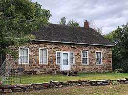 Miller Homestead |
July 28, 1999 (#99000910) |
664 Hallock Hill Rd. 44°31′26″N 73°33′40″W |
Au Sable | |
| 28 | Alice T. Miner Colonial Collection | 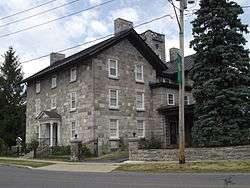 Alice T. Miner Colonial Collection |
September 24, 2010 (#10000799) |
9618 State Road Route 9 44°53′10″N 73°26′08″W |
Chazy | |
| 29 | Mooers Riverside Cemetery | September 14, 2018 (#100002921) |
U.S. Route 11 and Mill Street 44°57′36″N 73°35′11″W |
Mooers | Burial place of many early settlers of town, including General Benjamin Mooers, for whom it is named | |
| 30 | Old State Road Bridge | 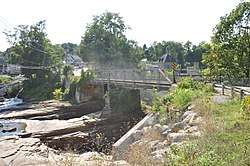 Old State Road Bridge |
November 12, 1999 (#99001319) |
Co. Rt. 17B over the Ausable River 44°31′25″N 73°27′37″W |
AuSable Chasm | Extends into Essex County, New York |
| 31 | Old Stone Barracks |  Old Stone Barracks |
February 18, 1971 (#71000533) |
Rhode Island Ave., Plattsburgh Air Force Base 44°40′51″N 73°26′42″W |
Plattsburgh | Now converted into a microbrewery, meeting place and bed and breakfast under the name "Valcour Brewing Company" |
| 32 | Palmer Brook Bridge | 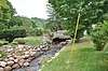 Palmer Brook Bridge |
November 12, 1999 (#99001318) |
Golf Course Rd. over Palmer Brook 44°26′37″N 73°40′29″W |
AuSable Forks | Replaced in 2003 |
| 33 | Peru Community Church | 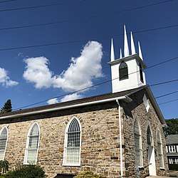 Peru Community Church |
February 2, 2001 (#01000054) |
12 Elm St. 44°34′43″N 73°31′40″W |
Peru | |
| 34 | Pike's Cantonment Site | August 14, 2012 (#12000508) |
Address Restricted |
Plattsburgh | ||
| 35 | Charles C. Platt Homestead | 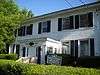 Charles C. Platt Homestead |
November 12, 1982 (#82001109) |
96-98 Boynton Ave. 44°42′30″N 73°27′40″W |
Plattsburgh | |
| 36 | Plattsburgh Bay | 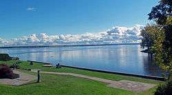 Plattsburgh Bay |
October 15, 1966 (#66000507) |
Cumberland Bay, east of Plattsburgh 44°41′17″N 73°24′58″W |
Plattsburgh | Site of naval Battle of Plattsburgh, last British attempt to invade northern states during War of 1812 |
| 37 | The Point Historic District |  The Point Historic District |
November 12, 1982 (#82001110) |
Roughly bounded by Jay, Hamilton, Peru, and Bridge Sts. 44°41′54″N 73°26′46″W |
Plattsburgh | |
| 38 | Z. Ritchie House | November 12, 1982 (#82001111) |
26 S. Catherine St. 44°42′02″N 73°27′27″W |
Plattsburgh | ||
| 39 | Rouses Point Railroad Station | Rouses Point Railroad Station |
January 5, 2005 (#04001454) |
68 Pratt St. 44°59′42″N 73°22′18″W |
Rouses Point | |
| 40 | St. John the Baptist Roman Catholic Church and Rectory |  St. John the Baptist Roman Catholic Church and Rectory |
November 12, 1982 (#82001112) |
20 Broad St. 44°41′44″N 73°27′17″W |
Plattsburgh | |
| 41 | Stone Arch Bridge | 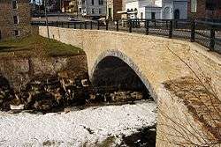 Stone Arch Bridge |
November 12, 1999 (#99001323) |
Main St. over the Ausable River 44°30′19″N 73°28′52″W |
Keeseville | |
| 42 | SPITFIRE (gunboat) | 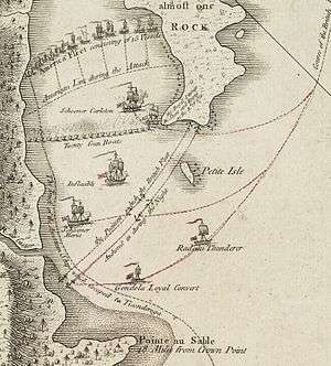 SPITFIRE (gunboat) |
July 24, 2008 (#08000694) |
At the bottom of Lake Champlain |
Lake Champlain | Shared with Essex County; Revolutionary War shipwreck |
| 43 | Strand Theater | 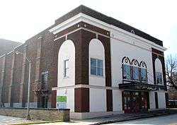 Strand Theater |
September 15, 2008 (#08000922) |
25 Brinkerhoff St. 44°30′13″N 73°28′58″W |
Plattsburgh | |
| 44 | Swing Bridge | 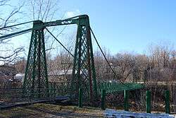 Swing Bridge |
November 12, 1999 (#99001322) |
Over the Ausable River between Clinton and S. AuSable Sts. 44°30′13″N 73°28′58″W |
Keeseville | |
| 45 | U.S. Inspection Station-Mooers, New York | 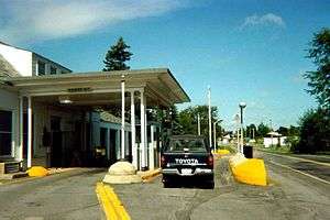 U.S. Inspection Station-Mooers, New York |
September 14, 2014 (#14000572) |
NY 22 45°00′16″N 73°36′11″W |
Mooers | |
| 46 | U.S. Inspection Station-Rouses Point (Overton Corners), New York | 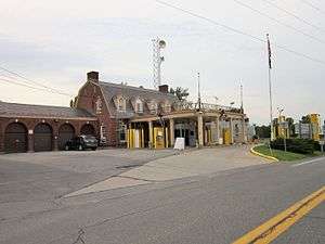 U.S. Inspection Station-Rouses Point (Overton Corners), New York |
September 14, 2014 (#14000573) |
NY 276 45°00′36″N 73°24′01″W |
Rouses Point | |
| 47 | U.S. Inspection Station-Rouses Point (St. John's Highway), New York | 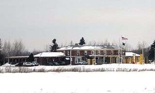 U.S. Inspection Station-Rouses Point (St. John's Highway), New York |
September 14, 2014 (#14000574) |
NY 9B 45°00′37″N 73°22′15″W |
Rouses Point | |
| 48 | United States Oval Historic District | 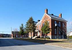 United States Oval Historic District |
August 30, 1989 (#85003766) |
Plattsburgh Air Force Base 44°41′11″N 73°26′53″W |
Plattsburgh | |
| 49 | Valcour Bay | 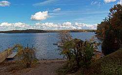 Valcour Bay |
October 15, 1966 (#66000508) |
7 miles (11 km) south of Plattsburgh on the west shore of Lake Champlain 44°38′05″N 73°25′47″W |
Plattsburgh | Site of Battle of Valcour Island during Revolutionary War |
| 50 | Valcour Island Lighthouse | 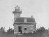 Valcour Island Lighthouse |
August 26, 1993 (#93000873) |
Valcour Island, Lake Champlain 44°37′24″N 73°25′55″W |
Peru | A.K.A. Point Bluff Light |
| 51 | S. F. Vilas Home for Aged & Infirmed Ladies |  S. F. Vilas Home for Aged & Infirmed Ladies |
November 12, 1982 (#82001113) |
Beekman and Cornelia Sts. 44°41′56″N 73°28′02″W |
Plattsburgh | |
| 52 | W. G. Wilcox House |  W. G. Wilcox House |
February 24, 1983 (#83001667) |
45-51 Lorraine St. 44°42′08″N 73°26′52″W |
Plattsburgh | |
| 53 | Werrenrath Camp | November 29, 2010 (#10000943) |
55 Island Dr. 44°45′19″N 73°48′05″W |
Dannemora | ||
| 54 | Winslow-Turner Carriage House |  Winslow-Turner Carriage House |
November 12, 1982 (#82001114) |
210 Cornelia St. 44°41′56″N 73°28′28″W |
Plattsburgh |
See also
| Wikimedia Commons has media related to National Register of Historic Places in Clinton County, New York. |
References
- The latitude and longitude information provided is primarily from the National Register Information System, and has been found to be fairly accurate for about 99% of listings. For 1%, the location info may be way off. We seek to correct the coordinate information wherever it is found to be erroneous. Please leave a note in the Discussion page for this article if you believe any specific location is incorrect.
- "National Register of Historic Places: Weekly List Actions". National Park Service, United States Department of the Interior. Retrieved on June 19, 2020.
- Numbers represent an ordering by significant words. Various colorings, defined here, differentiate National Historic Landmarks and historic districts from other NRHP buildings, structures, sites or objects.
- The eight-digit number below each date is the number assigned to each location in the National Register Information System database, which can be viewed by clicking the number.
External links
A useful list of the above sites, with street addresses and other information, is available at Clinton County, New York, listing, at National Register of Historic Places.Com, a private site serving up public domain information on NRHPs.
| Topics |  | |
|---|---|---|
| Lists by county |
| |
| Lists by city | ||
| Other lists | ||
| ||
This article is issued from Wikipedia. The text is licensed under Creative Commons - Attribution - Sharealike. Additional terms may apply for the media files.