National Register of Historic Places listings in Tompkins County, New York
List of the National Register of Historic Places listings in Tompkins County, New York
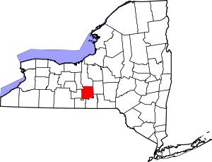
Location of Tompkins County in New York
This is intended to be a complete list of properties and districts listed on the National Register of Historic Places in Tompkins County, New York. The locations of National Register properties and districts (at least for all showing latitude and longitude coordinates below) may be seen in a map by clicking on "Map of all coordinates".[1] One property, Morrill Hall, is further designated a U.S. National Historic Landmark.
- This National Park Service list is complete through NPS recent listings posted June 19, 2020.[2]
| Albany (Albany) – Allegany – Bronx – Broome – Cattaraugus – Cayuga – Chautauqua – Chemung – Chenango – Clinton – Columbia – Cortland – Delaware – Dutchess (Poughkeepsie, Rhinebeck) – Erie (Buffalo) – Essex – Franklin – Fulton – Genesee – Greene – Hamilton – Herkimer – Jefferson – Kings – Lewis – Livingston – Madison – Monroe (Rochester) – Montgomery – Nassau – New York (Below 14th Street, 14th to 59th Streets, 59th to 110th Streets, Above 110th Street, Islands) – Niagara – Oneida – Onondaga – Ontario – Orange – Orleans – Oswego – Otsego – Putnam – Queens – Rensselaer – Richmond – Rockland – St. Lawrence – Saratoga – Schenectady – Schoharie – Schuyler – Seneca – Steuben – Suffolk – Sullivan – Tioga – Tompkins – Ulster – Warren – Washington – Wayne – Westchester (Northern, Southern, New Rochelle, Peekskill, Yonkers) – Wyoming – Yates |
Current listings
| [3] | Name on the Register | Image | Date listed[4] | Location | City or town | Description |
|---|---|---|---|---|---|---|
| 1 | William Austin House |  William Austin House |
July 19, 2002 (#02000798) |
34 Seneca St. 42°32′40″N 76°40′01″W |
Trumansburg | |
| 2 | Bailey Hall | 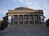 Bailey Hall |
September 24, 1984 (#84003113) |
Cornell University campus 42°26′58″N 76°28′50″W |
Ithaca | |
| 3 | Rufus and Flora Bates House | 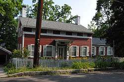 Rufus and Flora Bates House |
August 29, 2010 (#10000595) |
107 Giles St. 42°26′18″N 76°29′33″W |
Ithaca | |
| 4 | Boardman House | 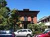 Boardman House |
May 6, 1971 (#71000559) |
120 E. Buffalo St. 42°25′01″N 76°27′31″W |
Ithaca | |
| 5 | Caldwell Hall |  Caldwell Hall |
September 24, 1984 (#84003117) |
Cornell University campus 42°26′58″N 76°28′43″W |
Ithaca | |
| 6 | Hermon Camp House | 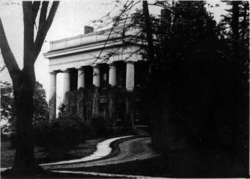 Hermon Camp House |
December 4, 1973 (#73001279) |
Camp St. 42°32′19″N 76°39′42″W |
Trumansburg | |
| 7 | Cascadilla School Boathouse | 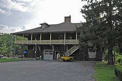 Cascadilla School Boathouse |
October 4, 1991 (#91001498) |
S. shore of Cayuga Lake at the mouth of Fall Cr., Stewart Park 42°27′37″N 76°30′33″W |
Ithaca | |
| 8 | Luther Clarke House | 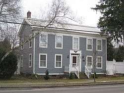 Luther Clarke House |
June 8, 1984 (#84003119) |
39 W. Main St. 42°29′25″N 76°18′03″W |
Dryden | |
| 9 | Clinton Hall |  Clinton Hall |
July 7, 1988 (#88001019) |
108-114 N. Cayuga St. 42°26′23″N 76°30′00″W |
Ithaca | |
| 10 | Clinton House | 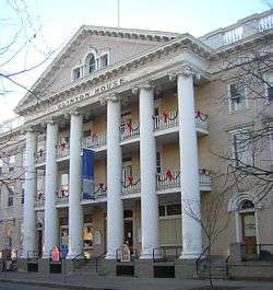 Clinton House |
August 12, 1971 (#71000560) |
116 N. Cayuga St. 42°26′25″N 76°29′58″W |
Ithaca | |
| 11 | Comstock Hall | 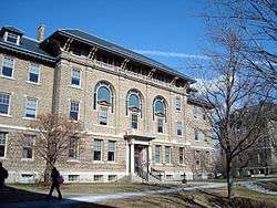 Comstock Hall |
September 24, 1984 (#84003122) |
235 Garden Avenue, Cornell University campus 42°26′58″N 76°28′44″W |
Ithaca | Now known as the Computing and Communications Center. |
| 12 | Cornell Heights Historic District | 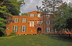 Cornell Heights Historic District |
September 14, 1989 (#89001205) |
Roughly bounded by Kline Rd., Highland Ave., Brock Ln., Triphammer Rd., Fall Creek, Stewart Ave., and Needham Pl. 42°27′18″N 76°29′13″W |
Cayuga Heights and Ithaca | |
| 13 | De Witt Park Historic District | 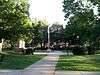 De Witt Park Historic District |
October 26, 1971 (#71000561) |
A square bounded roughly by properties fronting on E. Buffalo, E. Court, N. Cayuga, and N. Tioga Sts. 42°26′30″N 76°29′53″W |
Ithaca | |
| 14 | Deke House | 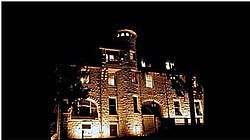 Deke House |
January 11, 1991 (#90002144) |
13 South Ave. 42°26′40″N 76°29′16″W |
Ithaca | |
| 15 | Dennis–Newton House | 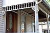 Dennis–Newton House |
September 6, 2016 (#16000590) |
421 N. Albany St. 42°26′36″N 76°30′06″W |
Ithaca | First black fraternity house in the U.S.; Alpha Phi Alpha used this 1870 house when established at Cornell in 1905 |
| 16 | District No. 2 School, Caroline and Dryden |  District No. 2 School, Caroline and Dryden |
January 5, 2005 (#04001453) |
2670 Slaterville Rd. 42°23′40″N 76°21′00″W |
Slaterville Springs | |
| 17 | District Number 7 School | 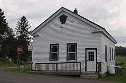 District Number 7 School |
November 30, 2004 (#04000701) |
Mill Rd. at the Park 42°18′15″N 76°15′12″W |
Speedsville | |
| 18 | Dryden District School No. 5 | 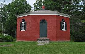 Dryden District School No. 5 |
November 4, 1994 (#94001282) |
1756 Hanshaw Rd. 42°28′26″N 76°25′53″W |
Dryden | |
| 19 | Dryden Historic District |  Dryden Historic District |
June 15, 1984 (#84003921) |
Roughly bounded by E. Main, James, Lake and South Sts. 42°29′21″N 76°17′46″W |
Dryden | |
| 20 | East Hill Historic District | 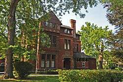 East Hill Historic District |
August 14, 1986 (#86001652) |
Roughly bounded by Cascadilla Creek, Eddy St., Six Mile Creek, and Aurora St. 42°22′27″N 76°29′11″W |
Ithaca | |
| 21 | East Roberts Hall | .jpg) East Roberts Hall |
September 24, 1984 (#84003178) |
Cornell University campus 42°26′55″N 76°28′42″W |
Ithaca | Building demolished ca 1988 |
| 22 | Ellis Methodist Episcopal Church | 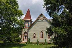 Ellis Methodist Episcopal Church |
May 27, 1993 (#93000443) |
Ellis Hollow Rd. 42°25′00″N 76°23′00″W |
Ellis Hollow | |
| 23 | Enfield Falls Mill and Miller's House | 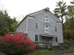 Enfield Falls Mill and Miller's House |
February 25, 1979 (#79001637) |
SW of Ithaca in Robert H. Treman State Park 42°24′05″N 76°35′26″W |
Ithaca | |
| 24 | Fernow Hall | 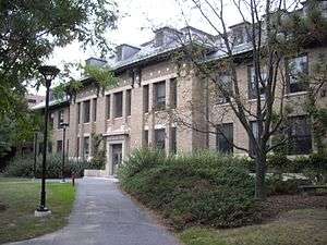 Fernow Hall |
September 24, 1984 (#84003183) |
Cornell University campus 42°26′55″N 76°28′33″W |
Ithaca | |
| 25 | First Presbyterian Church of Ulysses | .jpg) First Presbyterian Church of Ulysses |
June 3, 1999 (#99000669) |
Main St. 42°32′29″N 76°39′34″W |
Trumansburg | |
| 26 | Forest Home Historic District |  Forest Home Historic District |
August 6, 1998 (#98000999) |
Roughly along NY392 42°27′06″N 76°28′11″W |
Forest Home | |
| 27 | Groton High School | 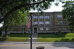 Groton High School |
July 24, 1992 (#92000953) |
177 Main St. 42°35′17″N 76°22′00″W |
Groton | |
| 28 | Nicoll Halsey House and Halseyville Archeological Sites | 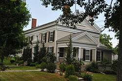 Nicoll Halsey House and Halseyville Archeological Sites |
June 24, 1993 (#93000504) |
Address Restricted 42°31′50″N 76°38′15″W |
Halseyville | |
| 29 | Hayt's Chapel and Schoolhouse |  Hayt's Chapel and Schoolhouse |
December 22, 2005 (#05001453) |
1296-1298 Trumansburg Rd. 42°28′08″N 76°32′43″W |
Ithaca | |
| 30 | Indian Fort Road Site | September 30, 1983 (#83001810) |
Address Restricted |
Trumansburg | ||
| 31 | Ithaca Downtown Historic District | 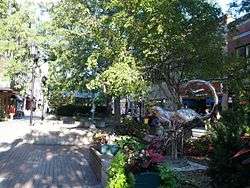 Ithaca Downtown Historic District |
February 9, 2005 (#05000018) |
E. and W. State, N & S Cayuga, N. Aurora, N. Tioga Sts. 42°26′23″N 76°29′53″W |
Ithaca | |
| 32 | Ithaca Pottery Site | 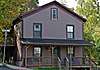 Ithaca Pottery Site |
July 17, 1979 (#79001635) |
Address Restricted |
Ithaca | |
| 33 | Jennings-Marvin House | 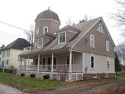 Jennings-Marvin House |
June 8, 1984 (#84003184) |
9 Library St. 42°29′30″N 76°17′59″W |
Dryden | |
| 34 | Lacy-Van Vleet House | 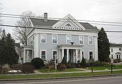 Lacy-Van Vleet House |
June 8, 1984 (#84003187) |
45 W. Main St. 42°29′25″N 76°18′07″W |
Dryden | |
| 35 | Lehigh Valley Railroad Station |  Lehigh Valley Railroad Station |
December 31, 1974 (#74001311) |
W. Buffalo St. and Taughannock Blvd. 42°26′28″N 76°30′41″W |
Ithaca | |
| 36 | Llenroc | 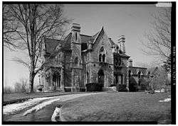 Llenroc |
April 16, 1980 (#80002781) |
100 Cornell Ave. 42°26′48″N 76°29′32″W |
Ithaca | Home of Ezra Cornell |
| 37 | Methodist Episcopal Church |  Methodist Episcopal Church |
June 8, 1984 (#84003189) |
2 North St. 42°29′26″N 76°17′51″W |
Dryden | |
| 38 | Methodist Episcopal Church of Jacksonville | November 9, 2018 (#100003120) |
5020 Jacksonville Road 42°30′33″N 76°36′53″W |
Jacksonville | 1827 former Greek Revival church building, heavily renovated in 1855, was home to first Methodist congregation established in county | |
| 39 | Morrill Hall, Cornell University | 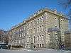 Morrill Hall, Cornell University |
October 15, 1966 (#66000576) |
Cornell University campus 42°26′55″N 76°29′08″W |
Ithaca | |
| 40 | Newfield Covered Bridge | 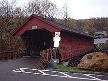 Newfield Covered Bridge |
February 25, 2000 (#00000095) |
Covered Bridge St. 42°21′47″N 76°35′27″W |
Newfield | |
| 41 | Rice Hall | 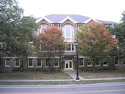 Rice Hall |
September 24, 1984 (#84003190) |
Cornell University campus 42°26′53″N 76°28′28″W |
Ithaca | |
| 42 | Roberts Hall | 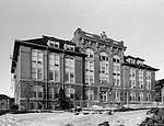 Roberts Hall |
September 24, 1984 (#84003191) |
Cornell University campus 42°26′55″N 76°28′44″W |
Ithaca | Demolished ca 1990 |
| 43 | Rockwell House |  Rockwell House |
June 8, 1984 (#84003192) |
52 W. Main St. 42°29′26″N 76°18′10″W |
Dryden | |
| 44 | Rogues' Harbor Inn | 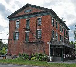 Rogues' Harbor Inn |
August 26, 2009 (#09000657) |
2079 E. Shore Dr. 42°32′16″N 76°30′20″W |
Lansing | |
| 45 | St. James AME Zion Church | 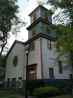 St. James AME Zion Church |
July 22, 1982 (#82003407) |
116-118 Cleveland Ave. 42°26′16″N 76°30′18″W |
Ithaca | |
| 46 | St. John's Episcopal | 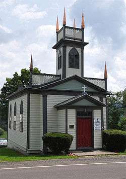 St. John's Episcopal |
November 22, 2000 (#00001407) |
1504 Seventy Six Rd. 42°18′10″N 76°15′16″W |
Speedsville | |
| 47 | St. Thomas Episcopal Church | 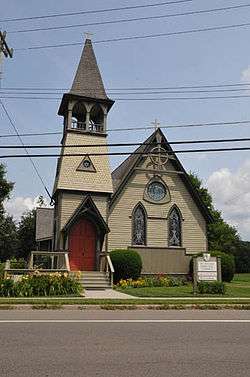 St. Thomas Episcopal Church |
April 20, 1995 (#95000458) |
2740 Slaterville Rd. (NY 79) 42°23′39″N 76°20′44″W |
Slaterville Springs | |
| 48 | Second Baptist Society of Ulysses | 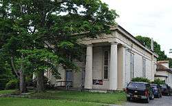 Second Baptist Society of Ulysses |
December 28, 2001 (#01001381) |
1 Congress St. 42°32′35″N 76°39′45″W |
Trumansburg | |
| 49 | Second Tompkins County Courthouse | 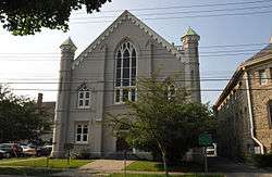 Second Tompkins County Courthouse |
March 18, 1971 (#71000562) |
121 E. Court St. 42°26′31″N 76°32′48″W |
Ithaca | |
| 50 | Southworth House | 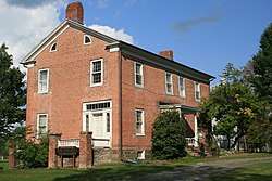 Southworth House |
June 8, 1984 (#84003193) |
14 North St. 42°29′32″N 76°17′52″W |
Dryden | |
| 51 | Southworth Library | 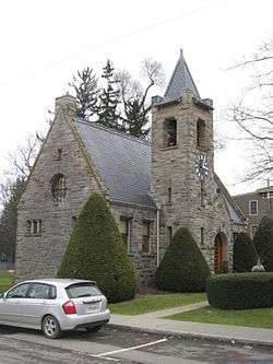 Southworth Library |
June 8, 1984 (#84003195) |
24 W. Main St. 42°29′26″N 76°17′58″W |
Dryden | |
| 52 | State Theater |  State Theater |
June 14, 1996 (#96000613) |
107-119 W. State St. 42°26′21″N 76°29′59″W |
Ithaca | |
| 53 | Stone Hall | _(cropped).jpg) Stone Hall |
September 24, 1984 (#84003860) |
Cornell University campus 42°26′55″N 76°28′46″W |
Ithaca | Demolished ca 1988 |
| 54 | Telluride House | 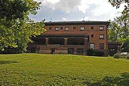 Telluride House |
February 22, 2011 (#11000042) |
217 West Ave. 42°26′46″N 76°29′13″W |
Ithaca | |
| 55 | Tibbetts–Rumsey House | 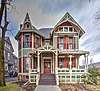 Tibbetts–Rumsey House |
May 25, 2018 (#100002515) |
310 W. State St. 42°26′23″N 76°30′08″W |
Ithaca | 1880 house built for locally prominent family, built by early Cornell architecture school graduate, later renovated and expanded by another locally prominent family, combines Eastern Stick and Queen Anne styles |
| 56 | US Post Office-Ithaca | 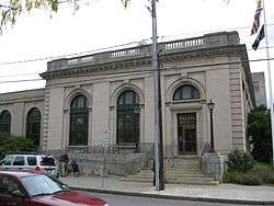 US Post Office-Ithaca |
May 11, 1989 (#88002514) |
213 N. Tioga St. 42°26′28″N 76°29′48″W |
Ithaca | |
| 57 | West Dryden Methodist Episcopal Church | 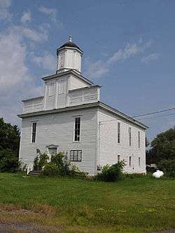 West Dryden Methodist Episcopal Church |
August 9, 1991 (#91001029) |
Jct. of W. Dryden and Sheldon Rds. 42°31′02″N 76°24′54″W |
Dryden | |
| 58 | Andrew Dickson White House | 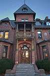 Andrew Dickson White House |
December 4, 1973 (#73001278) |
27 East Ave. 42°26′54″N 76°28′57″W |
Ithaca | |
| 59 | Wing Hall | 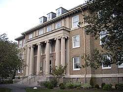 Wing Hall |
September 24, 1984 (#84003204) |
Cornell University campus 42°26′49″N 76°28′19″W |
Ithaca |
Former listing
| [3] | Name on the Register | Image | Date listed | Date removed | Location | City or town | Summary |
|---|---|---|---|---|---|---|---|
| 1 | Strand Theatre | 1979 (#79001636) | 1999 | 310 E. State St. |
Ithaca |
See also
| Wikimedia Commons has media related to National Register of Historic Places in Tompkins County, New York. |
References
- The latitude and longitude information provided in this table was derived originally from the National Register Information System, which has been found to be fairly accurate for about 99% of listings. Some locations in this table may have been corrected to current GPS standards.
- "National Register of Historic Places: Weekly List Actions". National Park Service, United States Department of the Interior. Retrieved on June 19, 2020.
- Numbers represent an ordering by significant words. Various colorings, defined here, differentiate National Historic Landmarks and historic districts from other NRHP buildings, structures, sites or objects.
- The eight-digit number below each date is the number assigned to each location in the National Register Information System database, which can be viewed by clicking the number.
| Topics |  | |
|---|---|---|
| Lists by county |
| |
| Lists by city | ||
| Other lists | ||
| ||
This article is issued from Wikipedia. The text is licensed under Creative Commons - Attribution - Sharealike. Additional terms may apply for the media files.