National Register of Historic Places listings in Chautauqua County, New York
This is a list of the National Register of Historic Places listings in Chautauqua County, New York.
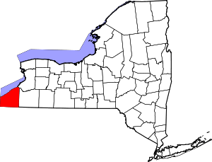
Location of Chautauqua County in New York
This is intended to be a complete list of properties and districts listed on the National Register of Historic Places in Chautauqua County, New York, United States. The locations of National Register properties and districts for which the latitude and longitude coordinates are included below, may be seen in a map.[1]
There are 45 properties and districts listed on the National Register in the county, including 2 National Historic Landmarks.
- This National Park Service list is complete through NPS recent listings posted June 19, 2020.[2]
| Albany (Albany) – Allegany – Bronx – Broome – Cattaraugus – Cayuga – Chautauqua – Chemung – Chenango – Clinton – Columbia – Cortland – Delaware – Dutchess (Poughkeepsie, Rhinebeck) – Erie (Buffalo) – Essex – Franklin – Fulton – Genesee – Greene – Hamilton – Herkimer – Jefferson – Kings – Lewis – Livingston – Madison – Monroe (Rochester) – Montgomery – Nassau – New York (Below 14th Street, 14th to 59th Streets, 59th to 110th Streets, Above 110th Street, Islands) – Niagara – Oneida – Onondaga – Ontario – Orange – Orleans – Oswego – Otsego – Putnam – Queens – Rensselaer – Richmond – Rockland – St. Lawrence – Saratoga – Schenectady – Schoharie – Schuyler – Seneca – Steuben – Suffolk – Sullivan – Tioga – Tompkins – Ulster – Warren – Washington – Wayne – Westchester (Northern, Southern, New Rochelle, Peekskill, Yonkers) – Wyoming – Yates |
Current listings
| [3] | Name on the Register | Image | Date listed[4] | Location | City or town | Description |
|---|---|---|---|---|---|---|
| 1 | Atwater-Stone House | 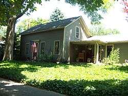 Atwater-Stone House |
December 16, 1983 (#83003887) |
29 Water St. 42°19′08″N 79°34′46″W |
Westfield | |
| 2 | Barcelona Lighthouse and Keeper's Cottage |  Barcelona Lighthouse and Keeper's Cottage |
April 13, 1972 (#72000825) |
East Lake Rd. 42°20′28″N 79°35′43″W |
Westfield | |
| 3 | L. Bliss House | 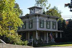 L. Bliss House |
September 26, 1983 (#83001647) |
90 W. Main St. 42°19′09″N 79°34′54″W |
Westfield | |
| 4 | Smith Bly House | 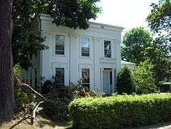 Smith Bly House |
October 1, 1974 (#74001223) |
4 N. Maple St. 42°05′34″N 79°22′30″W |
Ashville | |
| 5 | Brocton Arch | 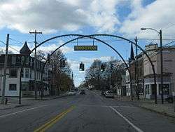 Brocton Arch |
February 22, 1996 (#96000133) |
Jct. of Main St. with Lake and Highland Aves. 42°23′19″N 79°26′28″W |
Brocton | |
| 6 | Busti Mill | 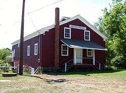 Busti Mill |
July 23, 1976 (#76001208) |
Lawson Rd. 42°02′02″N 79°16′52″W |
Busti | |
| 7 | Harriet Campbell-Taylor House | 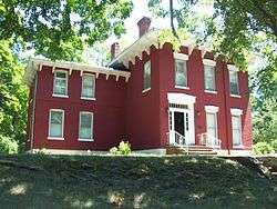 Harriet Campbell-Taylor House |
September 26, 1983 (#83001648) |
145 S. Portage St. 42°18′52″N 79°34′27″W |
Westfield | |
| 8 | Chautauqua Institution Historic District | 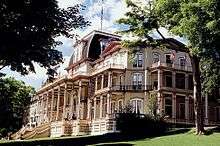 Chautauqua Institution Historic District |
June 19, 1973 (#73001168) |
Bounded by Chautauqua Lake and NY 394 42°12′33″N 79°28′02″W |
Chautauqua | |
| 9 | Clymer District School No. 5 |  Clymer District School No. 5 |
August 29, 1994 (#94001004) |
7929 Clymer Center Rd. (Co. Rt. 613) 42°03′17″N 79°34′57″W |
Clymer | |
| 10 | Dunkirk Light | 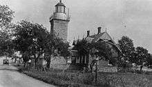 Dunkirk Light |
July 19, 1984 (#84002067) |
Dunkirk Harbor 42°29′38″N 79°21′15″W |
Dunkirk | |
| 11 | Dunkirk Schooner Site | May 1, 2009 (#09000285) |
Lake Erie 42°33′00″N 79°36′00″W |
Dunkirk | ||
| 12 | East Main Street Historic District | 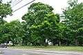 East Main Street Historic District |
December 16, 1983 (#83003893) |
E. Main St. 42°19′33″N 79°34′09″W |
Westfield | |
| 13 | Empire Worsted Mills | January 30, 2020 (#100004916) |
31 Water St. 42°05′37″N 79°13′53″W |
Jamestown | Exemplary late 19th-century textile mill later used as hardware factory. Now Gateway Center, home of various community organizations | |
| 14 | Erie Railroad Station | 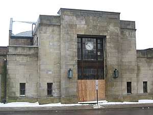 Erie Railroad Station |
May 2, 2003 (#03000045) |
211-217 W. Second St. 42°05′40″N 79°14′41″W |
Jamestown | |
| 15 | Euclid Avenue School | 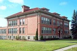 Euclid Avenue School |
March 21, 1985 (#85000628) |
28 Euclid Ave. 42°06′30″N 79°14′24″W |
Jamestown | |
| 16 | Fay-Usborne Mill | 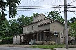 Fay-Usborne Mill |
September 26, 1983 (#83001649) |
48 Pearl St. 42°19′38″N 79°34′38″W |
Westfield | |
| 17 | Gov. Reuben Fenton Mansion | 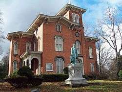 Gov. Reuben Fenton Mansion |
October 18, 1972 (#72000824) |
68 S. Main St. 42°05′29″N 79°14′20″W |
Jamestown | |
| 18 | Fredonia Commons Historic District | 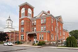 Fredonia Commons Historic District |
October 19, 1978 (#78001843) |
Main, Temple, Church, Day, and Center Sts. 42°26′25″N 79°19′55″W |
Fredonia | |
| 19 | French Portage Road Historic District |  French Portage Road Historic District |
December 16, 1983 (#83003895) |
E. Main and Portage Sts. 42°19′11″N 79°34′33″W |
Westfield | |
| 20 | Frank A. Hall House |  Frank A. Hall House |
September 26, 1983 (#83001650) |
34 Washington St. 42°19′31″N 79°34′41″W |
Westfield | |
| 21 | Jamestown Armory | 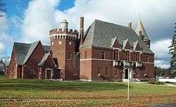 Jamestown Armory |
January 12, 1995 (#94001542) |
34 Porter Ave. 42°05′35″N 79°15′18″W |
Jamestown | |
| 22 | Jamestown Downtown Historic District | .jpg) Jamestown Downtown Historic District |
November 19, 2014 (#14000935) |
23-28, 20-408 N. Main, 200-322 Washington, 201-326 Cherry, 207-317 Pine, 215-417 Spring, 8-21, 100-200 E. 4th Sts. 42°05′47″N 79°14′29″W |
Jamestown | Historic commercial core of small industrial city |
| 23 | Lake Shore & Michigan Southern Freight Depot | 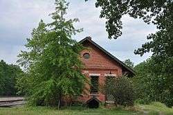 Lake Shore & Michigan Southern Freight Depot |
September 26, 1983 (#83001651) |
English St. 42°19′52″N 79°34′35″W |
Westfield | |
| 24 | Lake Shore and Michigan Southern Railway Station | 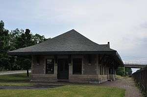 Lake Shore and Michigan Southern Railway Station |
December 16, 1983 (#83003897) |
English St. 42°19′41″N 79°34′56″W |
Westfield | |
| 25 | Lakeview Avenue Historic District | March 13, 2017 (#100000753) |
3-907 Lakeview & 55 Newton Aves., 500 E. 6th, 25-47 (odd) & 28 Liberty, 225 & 301 E. 8th, 7 Falconer, 18-19 Strong, Sts., 42°06′15″N 79°14′12″W |
Jamestown | Late 19th-century residential neighborhood home to many of city's wealthier residents at that time | |
| 26 | Dr. John Lord House | 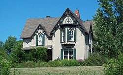 Dr. John Lord House |
March 2, 1991 (#91000104) |
Forest Rd. Extension 42°02′34″N 79°16′50″W |
Busti | |
| 27 | Gerald Mack House |  Gerald Mack House |
September 26, 1983 (#83001652) |
79 N. Portage St. 42°19′31″N 79°34′52″W |
Westfield | |
| 28 | McMahan Homestead |  McMahan Homestead |
September 26, 1983 (#83001653) |
232 W. Main Rd. 42°18′46″N 79°35′30″W |
Westfield | |
| 29 | Midway Park | 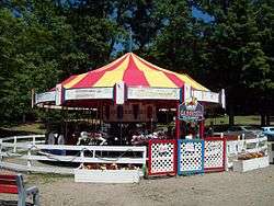 Midway Park |
March 9, 2009 (#09000133) |
NY 430 42°12′06″N 79°25′20″W |
Maple Springs | |
| 30 | Lewis Miller Cottage, Chautauqua Institution |  Lewis Miller Cottage, Chautauqua Institution |
October 15, 1966 (#66000506) |
NY 17J 42°12′30″N 79°27′56″W |
Chautauqua | |
| 31 | Nixon Homestead | 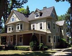 Nixon Homestead |
September 26, 1983 (#83001654) |
119 W. Main St. 42°19′03″N 79°35′05″W |
Westfield | |
| 32 | Partridge-Sheldon House |  Partridge-Sheldon House |
June 2, 2000 (#00000572) |
70 Prospect St. 42°05′21″N 79°14′15″W |
Jamestown | |
| 33 | Pennsylvania Railroad Station | 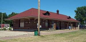 Pennsylvania Railroad Station |
August 6, 1993 (#93000680) |
Water St. 42°14′43″N 79°29′43″W |
Mayville | |
| 34 | Point Chautauqua Historic District |  Point Chautauqua Historic District |
May 17, 1996 (#96000521) |
Roughly bounded by NY 430 and Chautauqua Lake between Lake and Leet Aves. 42°14′15″N 79°27′37″W |
Mayville | |
| 35 | Point Gratiot Lighthouse Complex |  Point Gratiot Lighthouse Complex |
December 18, 1979 (#79001568) |
Sycamore Rd. 42°29′37″N 79°21′15″W |
Dunkirk | |
| 36 | Rorig Bridge |  Rorig Bridge |
September 26, 1983 (#83001655) |
Water St. at Chautauqua Creek 42°18′56″N 79°34′43″W |
Westfield | |
| 37 | School No. 7 | 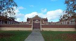 School No. 7 |
March 5, 1992 (#92000068) |
Jct. of E. Lake Shore Dr. and N. Serval St. 42°29′46″N 79°19′00″W |
Dunkirk | |
| 38 | Henry Dwight Thompson House | 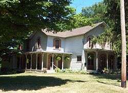 Henry Dwight Thompson House |
September 26, 1983 (#83001656) |
29 Wood St. 42°19′00″N 79°34′10″W |
Westfield | |
| 39 | US Post Office-Dunkirk |  US Post Office-Dunkirk |
November 17, 1988 (#88002488) |
410 Central Ave. 42°28′54″N 79°20′01″W |
Dunkirk | |
| 40 | US Post Office-Fredonia | 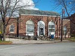 US Post Office-Fredonia |
November 17, 1988 (#88002515) |
21 Day St. 42°26′28″N 79°19′57″W |
Fredonia | |
| 41 | Ward House | 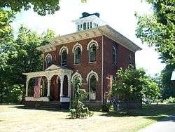 Ward House |
September 26, 1983 (#83001657) |
118 W. Main St. 42°19′03″N 79°35′03″W |
Westfield | |
| 42 | Welch Factory Building No. 1 | 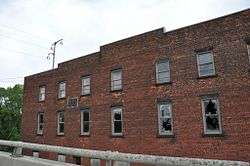 Welch Factory Building No. 1 |
September 26, 1983 (#83001658) |
101 N. Portage St. 42°19′35″N 79°34′55″W |
Westfield | |
| 43 | The Wellman Building | 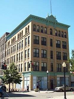 The Wellman Building |
August 21, 2009 (#09000629) |
101-103 W. 3rd St. and 215-217 Cherry St. 42°05′46″N 79°14′33″W |
Jamestown | |
| 44 | Reuben Gridley Wright Farm Complex |  Reuben Gridley Wright Farm Complex |
September 26, 1983 (#83001659) |
233 E. Main St. 42°19′48″N 79°33′59″W |
Westfield | |
| 45 | Reuben Wright House | 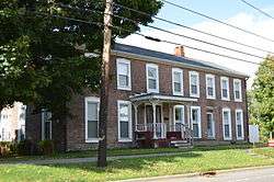 Reuben Wright House |
September 26, 1983 (#83001660) |
309 E. Main St. 42°19′58″N 79°33′37″W |
Westfield | |
| 46 | York-Skinner House |  York-Skinner House |
September 26, 1983 (#83001661) |
31 Union St. 42°19′21″N 79°34′28″W |
Westfield |
See also
| Wikimedia Commons has media related to National Register of Historic Places in Chautauqua County, New York. |
References
- The latitude and longitude information provided in this table was derived originally from the National Register Information System, which has been found to be fairly accurate for about 99% of listings. Some locations in this table may have been corrected to current GPS standards.
- "National Register of Historic Places: Weekly List Actions". National Park Service, United States Department of the Interior. Retrieved on June 19, 2020.
- Numbers represent an ordering by significant words. Various colorings, defined here, differentiate National Historic Landmarks and historic districts from other NRHP buildings, structures, sites or objects.
- The eight-digit number below each date is the number assigned to each location in the National Register Information System database, which can be viewed by clicking the number.
| Topics |  | |
|---|---|---|
| Lists by county |
| |
| Lists by city | ||
| Other lists | ||
| ||
This article is issued from Wikipedia. The text is licensed under Creative Commons - Attribution - Sharealike. Additional terms may apply for the media files.