Chambers Street (Manhattan)
Chambers Street is a two-way street in the New York City borough of Manhattan.
Location
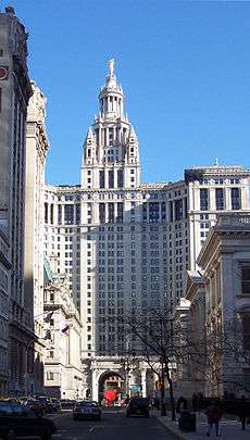
It runs from River Terrace, Battery Park City, in the west, past PS 234 (the Independence School) and Stuyvesant High School to 1 Centre Street, the Manhattan Municipal Building, to the east. Between Broadway and Centre Street, Chambers Street forms the northern boundary of the grounds surrounding New York City Hall and the Tweed Courthouse. Opposite the Tweed Courthouse sits the Surrogate's Courthouse for Manhattan. 280 Broadway the Marble Palace, lies west of there, on the north side of Chambers. Beginning in 2010, Chambers Street was fully reconstructed.[1]
History
Chambers Street is named for attorney John Chambers (1710–1764), an important parishioner at Trinity Church in Manhattan, where he was vestryman (1726–1757) and warden (1757–1765) of the church for 38 years, son of William Chambers, and husband of Anna Van Cortlandt.[2][3][4][5][6] Chambers's nephew was John Jay.[7][8] John Murray, Chambers' law partner, has nearby Murray Street named after him.[9]
Before 1971, Chambers Street continued east of Centre Street as a street called New Chambers Street, which ran through the Municipal Building's archway. In its final configuration, New Chambers Street carried traffic westbound from the intersection of Park Row, the Brooklyn Bridge off-ramp, and Duane Street. In 1971, the street was closed to make way for the construction of the pedestrian plaza at 1 Police Plaza.[10] Duane Street was also closed and the intersection with Park Row was eliminated, with Park Row rerouted underneath the pedestrian plaza.[11]
Transportation
The New York City Subway has three stations on Chambers Street:[12]
- Chambers Street–World Trade Center (IND Eighth Avenue Line), at Church Street serving the A, C, and E trains[12]
- Chambers Street (BMT Nassau Street Line), at Centre Street serving the J and Z trains
- Chambers Street (IRT Broadway–Seventh Avenue Line), at West Broadway serving the 1, 2, and 3 trains[12]
References
Notes
- Lower Manhattan : Chambers Street Reconstruction Archived January 5, 2013, at the Wayback Machine
- Senft, Bret (1993-09-26). "If You're Thinking of Living In/TriBeCa; Families Are the Catalyst for Change". The New York Times. Retrieved 2011-07-07.
- Berrian, William (1847). An Historical Sketch of Trinity Church, New York. New York: Stanford and Swords. pp. 94, 356. Retrieved 29 December 2016.
- "Bio: John Chambers". Markham of Chesterfield. Retrieved 29 December 2016.
- Tempey, Nathan (6 July 2015). "NYC Doesn't Fly Confederate Flags, But It's Still A Shrine To Slaveowners & Slave Profiteers". Gothamist. Archived from the original on 22 March 2017. Retrieved 29 December 2016.
- A History of the parish of Trinity Church in the City of New York. Morgan Dir, S.U.D., D.C.R. 1906. p. 576. Retrieved 29 December 2016.
- "Will: John Chambers, 1764 New York". Markham of Chesterfield. Retrieved 29 December 2016.
- Stahr, Walter (2012). John Jay: Founding Father. Diversion Books. Retrieved 29 December 2016.
- "new york architecture walks- tribeca". nyc-architecture. Retrieved 29 December 2016.
- "New Brooklyn Bridge Car Routes". The New York Times. 1971-07-06. ISSN 0362-4331. Retrieved 2020-05-18.
- Goldberger, Paul (1973-10-27). "New Police Building". The New York Times. ISSN 0362-4331. Retrieved 2020-05-18.
- "Subway Map" (PDF). Metropolitan Transportation Authority. October 21, 2019. Retrieved January 18, 2018.