National Register of Historic Places listings in Oneida County, New York
List of the National Register of Historic Places listings in Oneida County, New York
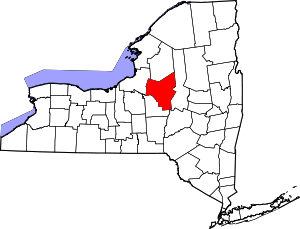
Location of Oneida County in New York
This is intended to be a complete list of properties and districts listed on the National Register of Historic Places in Oneida County, New York. The locations of National Register properties and districts (at least for all showing latitude and longitude coordinates below) may be seen in a map by clicking on "Map of all coordinates".[1] Seven of the properties are further designated National Historic Landmarks.
- This National Park Service list is complete through NPS recent listings posted June 26, 2020.[2]
| Albany (Albany) – Allegany – Bronx – Broome – Cattaraugus – Cayuga – Chautauqua – Chemung – Chenango – Clinton – Columbia – Cortland – Delaware – Dutchess (Poughkeepsie, Rhinebeck) – Erie (Buffalo) – Essex – Franklin – Fulton – Genesee – Greene – Hamilton – Herkimer – Jefferson – Kings – Lewis – Livingston – Madison – Monroe (Rochester) – Montgomery – Nassau – New York (Below 14th Street, 14th to 59th Streets, 59th to 110th Streets, Above 110th Street, Islands) – Niagara – Oneida – Onondaga – Ontario – Orange – Orleans – Oswego – Otsego – Putnam – Queens – Rensselaer – Richmond – Rockland – St. Lawrence – Saratoga – Schenectady – Schoharie – Schuyler – Seneca – Steuben – Suffolk – Sullivan – Tioga – Tompkins – Ulster – Warren – Washington – Wayne – Westchester (Northern, Southern, New Rochelle, Peekskill, Yonkers) – Wyoming – Yates |
Listings county-wide
| [3] | Name on the Register | Image | Date listed[4] | Location | City or town | Description |
|---|---|---|---|---|---|---|
| 1 | Arsenal House | 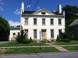 Arsenal House |
July 18, 1974 (#74001284) |
514 W. Dominick St. 43°12′56″N 75°28′04″W |
Rome | |
| 2 | Ava Town Hall | 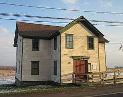 Ava Town Hall |
May 18, 1992 (#92000453) |
NY 26 south of the junction with Ava Rd. 43°25′00″N 75°28′50″W |
Ava | |
| 3 | Bagg's Square East Historic District | 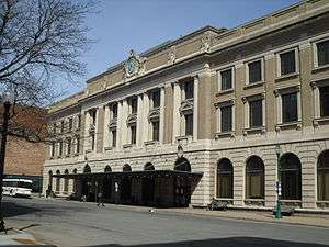 Bagg's Square East Historic District |
July 24, 2017 (#100001362) |
Broad, Catherine, 1st, John, Main, Oriskany, Railroad & 2nd Sts. 43°06′11″N 75°13′24″W |
Utica | Downtown area with buildings that served canal and railroad traffic from late 19th to mid-20th century |
| 4 | Black River Canal Warehouse | March 7, 2003 (#03000093) |
502 Water St. 43°28′52″N 75°19′40″W |
Boonville | ||
| 5 | Boonville Historic District | 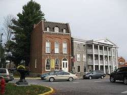 Boonville Historic District |
November 16, 1979 (#79001608) |
Schuyler, Post, W. Main and Summit Sts. 43°29′04″N 75°20′13″W |
Boonville | |
| 6 | Brick Store Building | April 26, 1996 (#96000486) |
Jct. of US 20 and NY 8 42°52′44″N 75°15′07″W |
Bridgewater | ||
| 7 | Bridgewater Railroad Station | April 12, 2006 (#06000264) |
US 20 42°52′45″N 75°14′48″W |
Bridgewater | ||
| 8 | Byington Mill (Frisbie & Stansfield Knitting Company) | 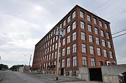 Byington Mill (Frisbie & Stansfield Knitting Company) |
May 27, 1993 (#93000458) |
421-423 Broad St. 43°06′09″N 75°13′18″W |
Utica | |
| 9 | Calvary Episcopal Church | July 3, 2008 (#08000595) |
1101 Howard Ave. 43°05′43″N 75°13′52″W |
Utica | ||
| 10 | Camroden Presbyterian Church | January 4, 2007 (#06001204) |
8049 E. Floyd Rd. 43°15′11″N 75°21′19″W |
Floyd | ||
| 11 | Clinton Village Historic District | June 14, 1982 (#82003389) |
North, South, East, West Park Rows, Marvin, Williams, Chestnut, Fountain, College and Utica Sts. 43°02′09″N 75°22′51″W |
Clinton | ||
| 12 | Roscoe Conkling House | 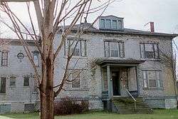 Roscoe Conkling House |
May 15, 1975 (#75001214) |
3 Rutger St. 43°05′46″N 75°13′47″W |
Utica | |
| 13 | Deansboro Railroad Station | 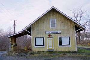 Deansboro Railroad Station |
November 15, 2002 (#02001327) |
2707 NY 315 42°59′37″N 75°25′38″W |
Deansboro | |
| 14 | W.H. Dorrance House | April 29, 1999 (#99000506) |
32 Church St. 43°20′11″N 75°44′39″W |
Camden | ||
| 15 | Downtown Genesee Street Historic District | August 24, 2018 (#100002668) |
Generally bounded by Park Ave., Oriskany, John, Park, South, Court & Columbia Sts. 43°06′03″N 75°13′58″W |
Utica | ||
| 16 | Doyle Hardware Building | 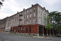 Doyle Hardware Building |
June 10, 1993 (#93000498) |
330-334 Main St. 43°06′13″N 75°13′24″W |
Utica | |
| 17 | Erwin Library and Pratt House | August 14, 1973 (#73001228) |
104 and 106 Schuyler St. 43°29′02″N 75°20′13″W |
Boonville | ||
| 18 | First Baptist Church of Deerfield |  First Baptist Church of Deerfield |
July 11, 1985 (#85001497) |
Herkimer Rd. 43°06′51″N 75°12′08″W |
Utica | |
| 19 | First Congregational Free Church | 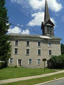 First Congregational Free Church |
January 25, 1979 (#79001609) |
177 N. Main St. 42°56′25″N 75°27′38″W |
Oriskany Falls | |
| 20 | First Methodist Episcopal Church of Rome | January 29, 2010 (#09001286) |
400 N. George St. 43°12′59″N 75°27′31″W |
Rome | ||
| 21 | First Presbyterian Church | 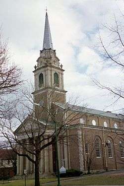 First Presbyterian Church |
November 3, 1988 (#88002172) |
1605 Genesee St. 43°05′29″N 75°15′01″W |
Utica | Church designed by architect Ralph Adams Cram |
| 22 | Five Lock Combine and Locks 37 and 38, Black River Canal | March 20, 1973 (#73001229) |
NY 46 43°24′11″N 75°21′49″W |
Boonville | ||
| 23 | Gen. William Floyd House | 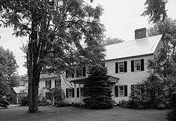 Gen. William Floyd House |
June 17, 1971 (#71000549) |
W side of Main St. 43°18′22″N 75°23′02″W |
Westernville | |
| 24 | Forest Hill Cemetery | 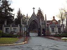 Forest Hill Cemetery |
November 9, 2017 (#100001804) |
2201 Oneida St. 43°04′43″N 75°15′26″W |
Utica | Non-sectarian cemetery established in 1850 is final resting place of many locally prominent citizens, including Roscoe Conkling and other members of Congress from the late 19th and early 20th centuries |
| 25 | Fort Schuyler Club Building | 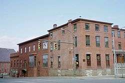 Fort Schuyler Club Building |
May 12, 2004 (#04000436) |
254 Genesee St. 43°05′59″N 75°14′07″W |
Utica | |
| 26 | Fort Stanwix National Monument | 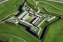 Fort Stanwix National Monument |
October 15, 1966 (#66000057) |
Bounded by Dominick, Spring, Liberty, and James Sts. 43°12′42″N 75°27′23″W |
Rome | |
| 27 | Fort Wood Creek Site | March 14, 2019 (#100003434) |
Address Restricted |
Rome vicinity | Adjacent to remains of Fort Bull. | |
| 28 | Fountain Elms |  Fountain Elms |
November 3, 1972 (#72001599) |
318 Genesee St. 43°05′49″N 75°14′29″W |
Utica | |
| 29 | Gansevoort-Bellamy Historic District | 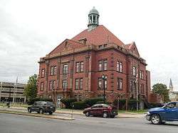 Gansevoort-Bellamy Historic District |
November 12, 1975 (#75001213) |
Roughly bounded by Liberty, Stuben, and Huntington Sts. to Bissel 43°12′47″N 75°27′21″W |
Rome | |
| 30 | Globe Woolen Company Mills | 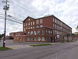 Globe Woolen Company Mills |
January 5, 2016 (#15000823) |
805, 809, 811-827 Court & 933 Stark Sts 43°06′09″N 75°14′53″W |
Utica | Intact remnant of the city's heritage as a textile manufacturing center operated from 1873 to 1953 |
| 31 | Grace Church | 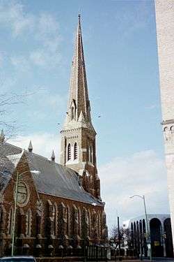 Grace Church |
May 23, 1997 (#97000419) |
193 Genesee St. 43°06′03″N 75°13′53″W |
Utica | |
| 32 | Hamilton College Chapel | 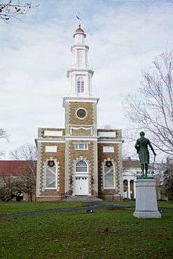 Hamilton College Chapel |
November 3, 1972 (#72000892) |
Hamilton College campus 43°03′07″N 75°24′22″W |
Clinton | |
| 33 | John C. Hieber Building |  John C. Hieber Building |
July 24, 2007 (#07000756) |
311 Main St. 43°06′15″N 75°13′27″W |
Utica | Now home to the Utica Children's Museum |
| 34 | Holland Patent Railroad Station | 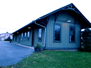 Holland Patent Railroad Station |
February 25, 2000 (#00000089) |
Park Ave. 43°14′24″N 75°15′17″W |
Holland Patent | |
| 35 | Holland Patent Stone Churches Historic District |  Holland Patent Stone Churches Historic District |
November 21, 1991 (#91001670) |
Roughly bounded by Main St., Park Ave., Park Pl. and Willow Cr. 43°14′28″N 75°15′26″W |
Holland Patent | |
| 36 | Hurd & Fitzgerald Building | 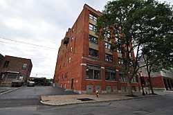 Hurd & Fitzgerald Building |
June 25, 1993 (#93000500) |
400 Main St. 43°06′12″N 75°13′22″W |
Utica | |
| 37 | Jervis Public Library | November 4, 1982 (#82001208) |
613 N. Washington St. 43°13′07″N 75°27′16″W |
Rome | ||
| 38 | Lower Genesee Street Historic District | 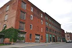 Lower Genesee Street Historic District |
October 29, 1982 (#82001209) |
Roughly bounded by Genesee, Liberty, Seneca, and Whitesboro Sts. (both sides) 43°06′15″N 75°13′42″W |
Utica | |
| 39 | Mappa Hall |  Mappa Hall |
May 12, 1982 (#82003388) |
Mappa Ave. 43°16′23″N 75°11′22″W |
Barneveld | |
| 40 | Memorial Church of the Holy Cross | July 20, 2000 (#00000823) |
841 Bleecker St. 43°05′50″N 75°12′49″W |
Utica | ||
| 41 | Middle Mill Historic District | May 28, 1976 (#76001254) |
NY 5A 43°06′18″N 75°17′34″W |
New York Mills | ||
| 42 | Millar-Wheeler House | 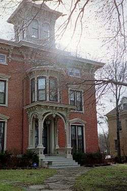 Millar-Wheeler House |
February 10, 2000 (#00000093) |
1423 Genesee St. 43°05′43″N 75°14′37″W |
Utica | |
| 43 | Mills House | June 13, 1997 (#97000566) |
507 N. George St. 43°13′05″N 75°27′28″W |
Rome | ||
| 44 | Munson-Williams-Proctor Arts Institute |  Munson-Williams-Proctor Arts Institute |
September 9, 2010 (#10000727) |
310 Genesee St. 43°05′49″N 75°14′29″W |
Utica | |
| 45 | Neck Canal of 1730 | August 15, 1995 (#95001011) |
Cavanaugh Rd. (Co. Rt. 30) 43°07′48″N 75°16′28″W |
Marcy | ||
| 46 | New Century Club | 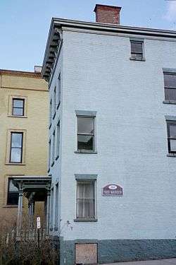 New Century Club |
September 12, 1985 (#85002289) |
253 Genesee St. 43°05′58″N 75°14′06″W |
Utica | |
| 47 | New York Central Railroad Adirondack Division Historic District | 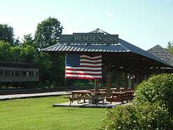 New York Central Railroad Adirondack Division Historic District |
December 23, 1993 (#93001451) |
NYCRR Right-of-Way 43°53′40″N 74°26′26″W |
Remsen | |
| 48 | New York State Barge Canal |  New York State Barge Canal |
October 15, 2014 (#14000860) |
Linear across county 43°12′06″N 75°26′56″W |
Floyd, Lee, Marcy, Remsen, Rome, Sylvan Beach, Trenton, Utica, Verona, Western | Successor to Erie Canal approved by state voters in early 20th century to compete with railroads; listing includes two of canal's reservoirs in Adirondacks. |
| 49 | Rev. Asahel Norton Homestead | July 11, 1985 (#85001546) |
Norton Rd. 43°03′51″N 75°25′07″W |
Kirkland | ||
| 50 | Oriskany Battlefield | 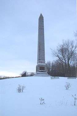 Oriskany Battlefield |
October 15, 1966 (#66000558) |
5 miles (8.0 km) east of Rome on NY 69 43°10′07″N 75°22′08″W |
Rome | |
| 51 | Otter Lake Community Church | 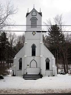 Otter Lake Community Church |
July 9, 2004 (#04000704) |
NY 28 43°35′30″N 75°06′46″W |
Otter Lake | |
| 52 | Pleasant Valley Grange Hall | February 12, 1999 (#99000058) |
US 20, 2 miles (3.2 km) west of Pleasant Valley 42°55′02″N 75°26′25″W |
Sangerfield | ||
| 53 | Rome Elks Lodge No. 96 | 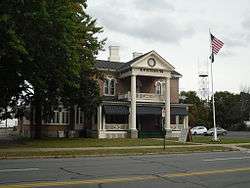 Rome Elks Lodge No. 96 |
June 5, 2013 (#13000359) |
126 W. Liberty St 43°12′44″N 75°27′33″W |
Rome | |
| 54 | Elihu Root House |  Elihu Root House |
November 28, 1972 (#72000893) |
101 College Hill Rd. 43°02′59″N 75°24′18″W |
Clinton | |
| 55 | Rutger-Steuben Park Historic District | September 19, 1973 (#73001230) |
Roughly bounded by Taylor and Howard Aves. including both sides of Rutger Ave. and Steuben Park 43°05′47″N 75°13′39″W |
Utica | ||
| 56 | St. Joseph's Church | August 22, 1977 (#77000967) |
704-708 Columbia St. 43°06′18″N 75°14′29″W |
Utica | ||
| 57 | St. Mark's Church | August 30, 1996 (#96000957) |
19 White St. 43°05′25″N 75°22′47″W |
Clark Mills | ||
| 58 | St. Paul's Church and Cemetery | 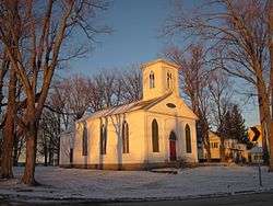 St. Paul's Church and Cemetery |
August 30, 1996 (#96000961) |
Rt. 12, junction with Snowden Hill Rd. 43°00′04″N 75°18′53″W |
Paris Hill | |
| 59 | St. Stephen's Church | 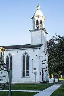 St. Stephen's Church |
August 30, 1996 (#96000959) |
22-27 Oxford St. 43°04′17″N 75°17′12″W |
New Hartford | |
| 60 | Edward W. Stanley Recreation Center |  Edward W. Stanley Recreation Center |
February 17, 2010 (#10000029) |
36 Kirkland Ave. 43°03′11″N 75°22′41″W |
Clinton | New listing; refnum 10000029 |
| 61 | Stanley Theater | 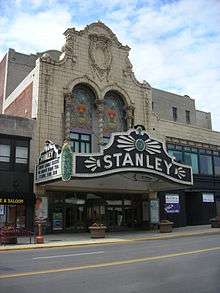 Stanley Theater |
August 13, 1976 (#76001255) |
259 Genesee St. 43°05′56″N 75°14′10″W |
Utica | |
| 62 | Tower Homestead and Masonic Temple | October 5, 1977 (#77000968) |
210 Tower St. and Sanger St. 42°55′51″N 75°23′01″W |
Waterville | ||
| 63 | Union Station | 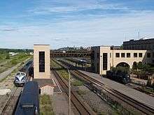 Union Station |
April 28, 1975 (#75001215) |
Main St. between John and 1st Sts. 43°06′15″N 75°13′26″W |
Utica | |
| 64 | US Post Office-Boonville | 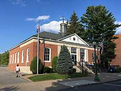 US Post Office-Boonville |
November 17, 1988 (#88002457) |
101 Main St. 43°29′03″N 75°20′09″W |
Boonville | |
| 65 | U.S. Post Office, Court House and Custom House |  U.S. Post Office, Court House and Custom House |
September 17, 2015 (#15000609) |
10 Broad St. 43°06′14″N 75°13′42″W |
Utica | 1929 building renamed after former area congressman is excellent example of Starved Classicism. |
| 66 | Utica Armory | March 2, 1995 (#95000083) |
1700 Parkway Blvd. E. 43°04′47″N 75°12′33″W |
Utica | ||
| 67 | Utica Daily Press Building | 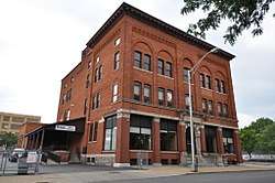 Utica Daily Press Building |
June 10, 1993 (#93000501) |
310-312 Main St. 43°06′14″N 75°13′28″W |
Utica | |
| 68 | Utica Parks and Parkway Historic District | 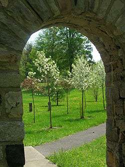 Utica Parks and Parkway Historic District |
July 3, 2008 (#08000594) |
Parkway and Pleasant St. 43°04′47″N 75°13′56″W |
Utica | (new listing, refnum 08000594) |
| 69 | Utica Public Library | 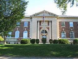 Utica Public Library |
October 29, 1982 (#82001210) |
303 Genesee St. 43°05′49″N 75°14′21″W |
Utica | |
| 70 | Utica State Hospital | 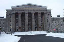 Utica State Hospital |
October 26, 1971 (#71000548) |
1213 Court St. 43°06′18″N 75°15′13″W |
Utica | |
| 71 | Vernon Center Green Historic District | September 19, 1985 (#85002431) |
Roughly bounded by Park St. 43°03′08″N 75°30′07″W |
Vernon | ||
| 72 | Vernon Methodist Church | May 20, 1998 (#98000547) |
Jct. of NY 5 and Sconondoa St. 43°04′43″N 75°32′29″W |
Vernon | ||
| 73 | Baron von Steuben Memorial Site | 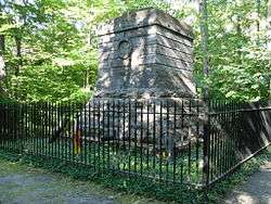 Baron von Steuben Memorial Site |
August 21, 2009 (#09000635) |
Starr Hill Road 43°20′18″N 75°13′57″W |
Remsen | New listing; refnum 09000635 |
| 74 | Sylvan Beach Union Chapel | 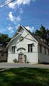 Sylvan Beach Union Chapel |
July 24, 2009 (#09000560) |
805 Park Ave. 43°11′57″N 75°43′47″W |
Sylvan Beach | |
| 75 | Tabernacle Baptist Church | 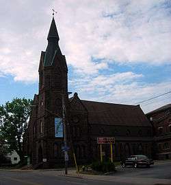 Tabernacle Baptist Church |
January 4, 2012 (#11001003) |
8 Hopper St. 43°05′55″N 75°14′04″W |
Utica | |
| 76 | Waterville Triangle Historic District | 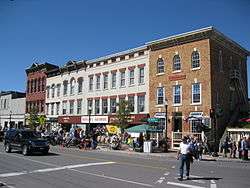 Waterville Triangle Historic District |
April 4, 1978 (#78001888) |
Stafford Ave., Main and White Sts. 42°55′50″N 75°22′43″W |
Waterville | |
| 77 | Gen. John G. Weaver House | 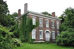 Gen. John G. Weaver House |
December 7, 1989 (#89002093) |
711 Herkimer Rd. 43°06′47″N 75°11′50″W |
Utica | |
| 78 | Welsh Calvinistic Methodist Church | January 13, 1988 (#87002275) |
Prospect St. 43°19′34″N 75°11′02″W |
Remsen | ||
| 79 | Western Town Hall |  Western Town Hall |
November 7, 1995 (#95001277) |
Main St. at the junction with Stokes-Westernville Rd. 43°18′29″N 75°22′52″W |
Westernville | |
| 80 | Wethersfield Stone Schoolhouse | September 7, 2005 (#05000991) |
NY 365 43°15′30″N 75°13′15″W |
Trenton | ||
| 81 | Whiffen–Ribyat Building |  Whiffen–Ribyat Building |
February 23, 2016 (#16000037) |
327-331 Bleecker St. 43°06′03″N 75°13′33″W |
Utica | 1893 building for local meatpacking company later used by furniture retailer |
| 82 | Whitestown Town Hall |  Whitestown Town Hall |
November 26, 1973 (#73001231) |
8 Park Ave. 43°07′16″N 75°17′30″W |
Whitesboro | |
| 83 | Wright Settlement Cemetery | May 8, 2012 (#12000256) |
Cemetery Rd. 43°14′55″N 75°24′30″W |
Rome | ||
| 84 | Zion Church | August 21, 1997 (#97000950) |
140 W. Liberty St. 43°12′46″N 75°27′29″W |
Rome |
See also
| Wikimedia Commons has media related to National Register of Historic Places in Oneida County, New York. |
References
- The latitude and longitude information provided in this table was derived originally from the National Register Information System, which has been found to be fairly accurate for about 99% of listings. Some locations in this table may have been corrected to current GPS standards.
- "National Register of Historic Places: Weekly List Actions". National Park Service, United States Department of the Interior. Retrieved on June 26, 2020.
- Numbers represent an ordering by significant words. Various colorings, defined here, differentiate National Historic Landmarks and historic districts from other NRHP buildings, structures, sites or objects.
- The eight-digit number below each date is the number assigned to each location in the National Register Information System database, which can be viewed by clicking the number.
| Topics |  | |
|---|---|---|
| Lists by county |
| |
| Lists by city | ||
| Other lists | ||
| ||
This article is issued from Wikipedia. The text is licensed under Creative Commons - Attribution - Sharealike. Additional terms may apply for the media files.