National Register of Historic Places listings in Monroe County, New York
This is a description of the National Register of Historic Places listings in Monroe County, New York. The locations of properties and districts listed on the National Register of Historic Places in Monroe County, New York may be seen on a map by clicking on "Map all coordinates" to the right.[1]
There are 208 properties and districts listed on the National Register in the county, including three National Historic Landmarks. The city of Rochester includes 110 of these properties and districts, including all National Historic Landmarks; the Rochester properties and districts are listed separately, while the remaining properties and districts in Monroe County are listed here. One property, the New York State Barge Canal, a National Historic Landmark District, spans both the city and the remainder of the county.
Current listings
- This National Park Service list is complete through NPS recent listings posted June 19, 2020.[2]
Rochester
Outside Rochester
| [3] | Name on the Register | Image | Date listed[4] | Location | City or town | Description |
|---|---|---|---|---|---|---|
| 1 | Adams-Ryan House | 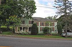 Adams-Ryan House |
September 5, 1985 (#85001957) |
425 Washington St. 43°11′46″N 77°51′17″W |
Adams Basin | |
| 2 | Adsit Cobblestone Farmhouse | 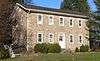 Adsit Cobblestone Farmhouse |
November 29, 1996 (#96001393) |
3871 Clover St. 43°00′51″N 77°35′05″W |
Mendon | Federal style cobblestone farmhouse from c.1832. Operated as an inn during the mid-19th century, it was used by farmers delivering grain on the road from Canandaigua to Rochester.[5] |
| 3 | Alcoa Care-free Home | 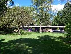 Alcoa Care-free Home |
June 18, 2010 (#10000358) |
1589 Clover St. 43°07′39″N 77°32′49″W |
Brighton | |
| 4 | Antoinette Louisa Brown Blackwell Childhood Home |  Antoinette Louisa Brown Blackwell Childhood Home |
November 16, 1989 (#89002003) |
1099 Pinnacle Rd. 43°03′05″N 77°36′00″W |
Henrietta | |
| 5 | Brockport Cemetery | 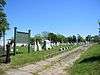 Brockport Cemetery |
March 8, 2016 (#16000061) |
56-98 High St. 43°12′39″N 77°56′02″W |
Brockport | Community's primary burial ground for most of the 19th century |
| 6 | Brockport Central Rural High School | 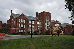 Brockport Central Rural High School |
November 10, 2011 (#11000805) |
40 Allen St. 43°12′26″N 77°56′51″W |
Brockport | |
| 7 | Horace and Grace Bush House | 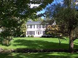 Horace and Grace Bush House |
June 10, 1994 (#94000590) |
1932 Five Mile Line Rd. 43°08′33″N 77°28′36″W |
Penfield | |
| 8 | Chase Cobblestone Farmhouse | 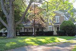 Chase Cobblestone Farmhouse |
November 7, 1995 (#95001279) |
1191 Manitou Rd., Town of Parma 43°15′21″N 77°45′21″W |
Hilton | |
| 9 | Chili Mills Conservation Area | March 12, 1975 (#75001198) |
1 mi. SW of West Chili off Stuart Rd. along Black Creek 43°04′56″N 77°49′10″W |
West Chili | ||
| 10 | Clarkson Corners Historic District |  Clarkson Corners Historic District |
September 2, 1994 (#94001076) |
Jct. of Ridge and Lake Rds. and E and W along Ridge and S along Lake 43°13′57″N 77°55′44″W |
Clarkson Corners | |
| 11 | Cole Cobblestone Farmhouse | 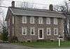 Cole Cobblestone Farmhouse |
November 29, 1996 (#96001394) |
933 Mile Square Rd. 43°00′52″N 77°29′47″W |
Mendon | |
| 12 | Austin R. Conant House | 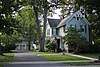 Austin R. Conant House |
August 23, 2016 (#16000554) |
30 West St. 43°06′00″N 77°26′48″W |
Fairport | 1876 Gothic Revival house was home to a number of important early residents of Fairport as it boomed around the Erie Canal |
| 13 | William Covert Cobblestone Farmhouse | 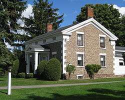 William Covert Cobblestone Farmhouse |
November 7, 1995 (#95001280) |
978 N. Greece Rd. 43°13′48″N 77°43′51″W |
Greece | |
| 14 | Isaac Cox Cobblestone Farmstead | 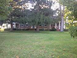 Isaac Cox Cobblestone Farmstead |
March 7, 2003 (#03000092) |
5015 River Rd. 42°59′42″N 77°44′43″W |
Scottsville | |
| 15 | Cox–Budlong House |  Cox–Budlong House |
February 12, 2015 (#15000007) |
4396 River Rd. 43°00′50″N 77°44′48″W |
Scottsville | 1820 Federal style house by early settler of Wheatland later renovated in Greek Revival and Italianate styles |
| 16 | Curtis-Crumb Farm | 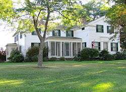 Curtis-Crumb Farm |
January 3, 1997 (#96001509) |
307 Curtis Rd. 43°18′24″N 77°46′53″W |
Hilton | |
| 17 | Daisy Flour Mill, Inc. | 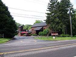 Daisy Flour Mill, Inc. |
June 26, 1972 (#72000855) |
1880 Blossom Rd. 43°08′49″N 77°30′45″W |
Penfield | A former flour mill, now a restaurant and party house. |
| 18 | Dayton's Corners School | 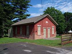 Dayton's Corners School |
July 5, 2001 (#01000716) |
1363 Creek St. 43°10′56″N 77°30′09″W |
Penfield | A one-room schoolhouse, Penfield District #9. Now used for fourth-grade local history studies. |
| 19 | Henry DeLand House |  Henry DeLand House |
April 17, 1980 (#80004610) |
99 S. Main St. 43°05′55″N 77°26′31″W |
Fairport | Home of Henry Addison DeLand, it later became an inn, restaurant, speakeasy, bar and a catering hall. |
| 20 | Minerva and Daniel DeLand House | January 30, 2020 (#100004913) |
185 N. Main St. 43°06′29″N 77°26′32″W |
Fairport | 1852 farmhouse renovated in Italian villa style 15 years later for founders of local chemical company; also includes nearby barn | |
| 21 | Fairport Public Library | December 8, 2017 (#100001886) |
18 Perrin St. 43°06′01″N 77°26′38″W |
Fairport | ||
| 22 | First Baptist Church | 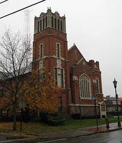 First Baptist Church |
October 20, 2011 (#11000752) |
124 Main St. 43°12′50″N 77°56′22″W |
Brockport | |
| 23 | First Baptist Church of Fairport |  First Baptist Church of Fairport |
September 28, 2006 (#06000892) |
94 S. Main St. 43°06′02″N 77°26′32″W |
Fairport | A church undergoing restoration |
| 24 | First Baptist Church of Mumford |  First Baptist Church of Mumford |
March 23, 2010 (#10000100) |
5 Dakin St. 42°59′25″N 77°51′35″W |
Mumford | |
| 25 | First Congregational Church of Fairport | August 28, 2018 (#100002835) |
26 E Church St. 43°05′55″N 77°26′25″W |
Fairport | Well-preserved 1868 Romanesque Revival church by John Rochester Thomas | |
| 26 | First Presbyterian Church |  First Presbyterian Church |
June 25, 1999 (#99000752) |
35 State St. 43°12′52″N 77°56′14″W |
Brockport | |
| 27 | First Presbyterian Church of Mumford |  First Presbyterian Church of Mumford |
April 1, 2002 (#02000299) |
George and William Sts. 42°59′32″N 77°51′42″W |
Mumford | |
| 28 | Garbuttsville Cemetery |  Garbuttsville Cemetery |
November 29, 2006 (#06001077) |
Union St. 43°00′54″N 77°47′29″W |
Garbutt | |
| 29 | Gates-Livermore Cobblestone Farmhouse | Gates-Livermore Cobblestone Farmhouse |
November 29, 1996 (#96001390) |
4389 Clover St. 42°59′29″N 77°34′51″W |
Mendon | |
| 30 | Grace Church | 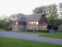 Grace Church |
July 30, 2010 (#10000514) |
9 Browns Ave. 43°01′22″N 77°45′05″W |
Scottsville | |
| 31 | Greece Memorial Hall |  Greece Memorial Hall |
April 23, 1998 (#98000395) |
2595 Ridge Rd. W 43°12′34″N 77°41′43″W |
Greece | |
| 32 | Edward Harrison House | 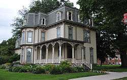 Edward Harrison House |
October 22, 2010 (#10000854) |
75 College St. 43°12′42″N 77°56′42″W |
Brockport | |
| 33 | Hildreth-Lord-Hawley Farm |  Hildreth-Lord-Hawley Farm |
October 29, 1996 (#96001169) |
44 N. Main St. 43°05′37″N 77°30′48″W |
Pittsford | |
| 34 | Franklin Hinchey House |  Franklin Hinchey House |
November 10, 1983 (#83004045) |
634 Hinchey Rd. 43°08′12″N 77°41′27″W |
Gates | |
| 35 | Hipp-Kennedy House | 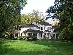 Hipp-Kennedy House |
February 4, 1994 (#94000003) |
1931 Five Mile Line Rd. 43°08′34″N 77°28′35″W |
Penfield | |
| 36 | Honeoye Falls Village Historic District | 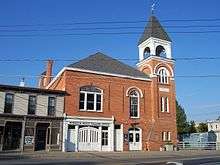 Honeoye Falls Village Historic District |
November 24, 1993 (#93001225) |
Roughly, jct. of Main, Monroe and Ontario Sts. and adjacent areas 42°56′54″N 77°35′32″W |
Honeoye Falls | |
| 37 | Hopkins Farm | 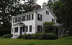 Hopkins Farm |
October 6, 2000 (#00001153) |
3151 Clover St. 43°03′40″N 77°33′28″W |
Pittsford | |
| 38 | House at 288 Wimbledon Road | 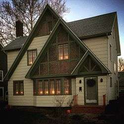 House at 288 Wimbledon Road |
November 24, 2015 (#15000822) |
288 Wimbledon Rd. 43°12′18″N 77°36′36″W |
Irondequoit | Demonstration house built in 1928 by Fred P. Tosch Inc. and co-sponsored by the Democrat & Chronicle and Home Owners Service Institute to promote high quality design and cutting edge construction for middle income families. |
| 39 | Thomas L. Hulburt House | 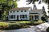 Thomas L. Hulburt House |
February 16, 2016 (#16000019) |
106 Hulburt Rd 43°05′36″N 77°27′11″W |
Fairport | 1853 Greek Revival house of lawyer and developer instrumental to Fairport's growth |
| 40 | Jayne and Mason Bank Building | 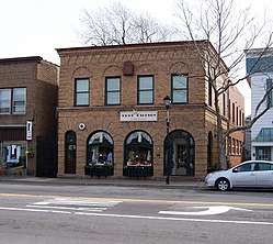 Jayne and Mason Bank Building |
November 1, 2006 (#06000970) |
11 E. Main St. 43°12′50″N 77°25′47″W |
Webster | Currently a secondhand shop called "Nest Things" |
| 41 | William C. Jayne House | 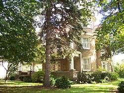 William C. Jayne House |
September 28, 2006 (#06000891) |
183 E. Main St. 43°12′53″N 77°25′23″W |
Webster | |
| 42 | Koda-Vista Historic District | August 16, 2019 (#100004270) |
Hoover & Vista Drs., Merrick, Allerton, Hammond, Maiden, Acton, Ayer & Elmguard Sts., portion of West Ridge Rd. 43°12′10″N 77°40′05″W |
Greece | ||
| 43 | Lake View Cemetery |  Lake View Cemetery |
July 24, 2009 (#09000559) |
NY 19 43°12′38″N 77°56′02″W |
Brockport | |
| 44 | Adolph Lomb House | 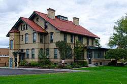 Adolph Lomb House |
January 24, 1995 (#94001597) |
Jct. of Sutherland St. and W. Jefferson Rd. 43°05′20″N 77°31′26″W |
Pittsford | |
| 45 | Lower Mill | 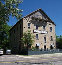 Lower Mill |
May 17, 1973 (#73001200) |
N. Main St. 42°57′22″N 77°35′20″W |
Honeoye Falls | |
| 46 | Main Street Historic District | 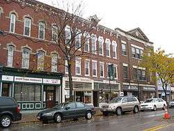 Main Street Historic District |
April 2, 2004 (#04000227) |
Main, Market and King Sts. 43°13′00″N 77°56′18″W |
Brockport | |
| 47 | Donald Mann House | 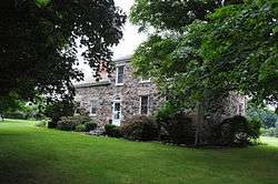 Donald Mann House |
June 25, 2013 (#13000449) |
327 Stewart Rd. 43°00′02″N 77°48′24″W |
Scottsville | |
| 48 | George G. Mason House | 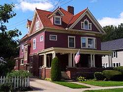 George G. Mason House |
October 27, 2004 (#04001206) |
39 Dunning Ave. 43°12′49″N 77°25′34″W |
Webster | |
| 49 | David McVean House | 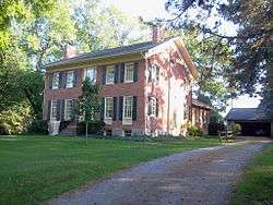 David McVean House |
January 18, 2006 (#05001531) |
805 North Rd. 43°01′41″N 77°45′38″W |
Scottsville | |
| 50 | Mendon Cobblestone Academy | 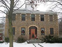 Mendon Cobblestone Academy |
November 29, 1996 (#96001395) |
16 Mendon-Ionia Rd. 42°59′48″N 77°30′18″W |
Mendon | |
| 51 | Mendon Presbyterian Church |  Mendon Presbyterian Church |
December 23, 2005 (#05001455) |
3886 Rush-Mendon Rd. 43°00′00″N 77°30′25″W |
Mendon | |
| 52 | Romanta T. Miller House |  Romanta T. Miller House |
April 11, 2014 (#14000144) |
1089 Bowerman Rd. 42°59′25″N 77°46′11″W |
Wheatland | |
| 53 | Miller–Horton–Barben Farm | 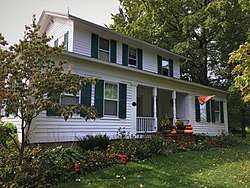 Miller–Horton–Barben Farm |
January 14, 2015 (#14001161) |
983 W. Bloomfield Rd. 42°59′34″N 77°31′42″W |
Mendon | Established in 1808, this 90-acre (36 ha) farm is one of the oldest in town |
| 54 | Morgan-Manning House | 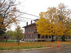 Morgan-Manning House |
April 25, 1991 (#91000443) |
151 Main St. 43°12′45″N 77°56′22″W |
Brockport | |
| 55 | Mud House |  Mud House |
October 11, 1978 (#78001862) |
1000 Whalen Rd. 43°08′31″N 77°27′36″W |
Penfield | |
| 56 | New York State Barge Canal | 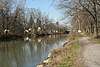 New York State Barge Canal |
October 15, 2014 (#14000860) |
Linear across county 43°05′30″N 77°32′48″W |
Brighton, Brockport, Chili, Clarkson, Fairport, Gates, Greece, Henrietta, Ogden, Perinton, Pittsford, Spencerport, Sweden | Successor to Erie Canal approved by state voters in early 20th century to compete with railroads. |
| 57 | North Star School District No. 11 | September 10, 2014 (#14000579) |
660 Walker Lake Ontario Rd. 43°19′08″N 77°51′36″W |
Hamlin | Late 19th-century one-room schoolhouse now serves as local history museum | |
| 58 | Oatka Cemetery |  Oatka Cemetery |
February 24, 2014 (#14000025) |
411 Scottsville-Mumford Rd. 43°00′51″N 77°46′32″W |
Wheatland | |
| 59 | Our Mother of Sorrows Roman Catholic Church Complex | _from_SW_1.jpg) Our Mother of Sorrows Roman Catholic Church Complex |
November 30, 1989 (#89002001) |
1785 Latta Rd. 43°15′10″N 77°39′33″W |
Greece | |
| 60 | Park Avenue and State Street Historic District | 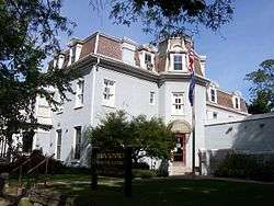 Park Avenue and State Street Historic District |
August 24, 2015 (#15000538) |
15–121 Park Ave., 15-118 State, 36–54 South, 6 & 12 High & 14 & 20 Spring Sts. 43°12′47″N 77°56′16″W |
Brockport | Residential core of village with intact houses in various 19th-century styles |
| 61 | William Payne House | 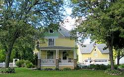 William Payne House |
June 20, 2012 (#12000343) |
505 Elmgrove Rd. 43°10′46″N 77°44′00″W |
Greece | |
| 62 | Penfield Road Historic District | 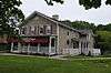 Penfield Road Historic District |
December 7, 2005 (#05001381) |
1862-1895 Penfield Rd. 43°07′49″N 77°28′04″W |
Penfield | |
| 63 | Stephen Phelps House | 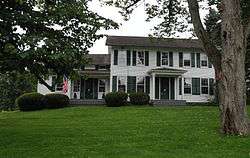 Stephen Phelps House |
February 2, 1995 (#94001635) |
2701 Penfield Rd. 43°07′39″N 77°23′32″W |
Penfield | |
| 64 | Phoenix Building | 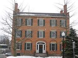 Phoenix Building |
August 7, 1974 (#74001257) |
S. Main and State Sts. 43°05′26″N 77°30′56″W |
Pittsford | |
| 65 | Pittsford Village Historic District | 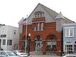 Pittsford Village Historic District |
September 7, 1984 April 12, 2016 (#84002736)16000163 |
High, Church, Grove, Line, Locust, Maple, N. & S. Main, State, Sutherland, Wood, Boughton, E. Jefferson, Golf, Rand, 43°05′21″N 77°31′05″W |
Pittsford | Collection of sophisticated houses reflecting styles from 1810s to 1930s |
| 66 | Potter Historic District |  Potter Historic District |
August 18, 2017 (#100001485) |
1-60 Potter Place, 53, 73 & 69 W. Church St. 43°05′48″N 77°26′50″W |
Fairport | |
| 67 | Samuel Rich House | 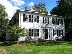 Samuel Rich House |
December 30, 1987 (#87002199) |
2204 Five Mile Line Rd. 43°07′26″N 77°28′34″W |
Penfield | |
| 68 | Richardson's Tavern | 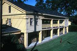 Richardson's Tavern |
May 6, 1980 (#80002652) |
1474 Marsh Rd. 43°03′43″N 77°28′38″W |
Perinton | |
| 69 | Riga Academy |  Riga Academy |
November 21, 1980 (#80002653) |
3 Riga-Mumford Rd. 43°04′09″N 77°52′47″W |
Riga | |
| 70 | Rochester Street Historic District |  Rochester Street Historic District |
October 25, 1973 (#73001205) |
Both sides of Rochester St. 43°01′25″N 77°44′49″W |
Scottsville | |
| 71 | Simeon Sage House | 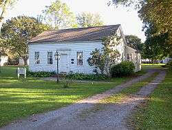 Simeon Sage House |
January 29, 2010 (#09001285) |
69 Main St. 43°01′09″N 77°45′24″W |
Scottsville | |
| 72 | Sheldon Cobblestone House | 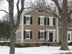 Sheldon Cobblestone House |
November 29, 1996 (#96001392) |
21 Mendon-Ionia Rd., S of jct. with NY 251 42°59′49″N 77°30′16″W |
Mendon | |
| 73 | William Shirts House | 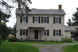 William Shirts House |
April 16, 2004 (#04000286) |
196 Harmon Rd. 43°01′30″N 77°51′16″W |
Scottsville | |
| 74 | Andrew Short House |  Andrew Short House |
February 14, 2014 (#14000005) |
1294 Lehigh Station Rd. 43°03′34″N 77°37′54″W |
Henreietta | |
| 75 | Hiram Sibley Homestead | September 12, 1985 (#85002291) |
29 Sibley Rd. 42°58′06″N 77°36′56″W |
Sibleyville | ||
| 76 | Soldiers' Memorial Tower | 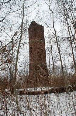 Soldiers' Memorial Tower |
April 8, 1994 (#94000332) |
Owens Rd. N of Conrail RR tracks 43°12′28″N 77°55′07″W |
Brockport | |
| 77 | Spencerport Methodist Church | 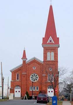 Spencerport Methodist Church |
April 11, 2008 (#08000274) |
32 Amity St. 43°11′34″N 77°48′08″W |
Spencerport | |
| 78 | Spring House |  Spring House |
November 20, 1975 (#75001199) |
3001 Monroe Ave. 43°06′33″N 77°32′47″W |
Pittsford | An inn along the original Erie Canal, now a restaurant |
| 79 | St. John's Episcopal Church | 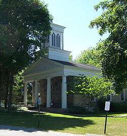 St. John's Episcopal Church |
July 7, 1988 (#88001014) |
11 Episcopal Ave. 42°57′12″N 77°35′35″W |
Honeoye Falls | |
| 80 | St. Luke's Episcopal Church | 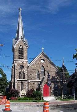 St. Luke's Episcopal Church |
April 26, 1990 (#90000686) |
14 State St. 43°12′51″N 77°56′18″W |
Brockport | |
| 81 | Stewart Cobblestone Farmhouse | Stewart Cobblestone Farmhouse |
March 4, 1997 (#96001391) |
Douglas Rd., S of jct. with Canfield Rd. 43°01′57″N 77°33′23″W |
Mendon | |
| 82 | Stone-Tolan House | 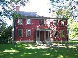 Stone-Tolan House |
July 21, 1983 (#83001710) |
2370 East Ave. 43°08′23″N 77°32′32″W |
Brighton | |
| 83 | Tall Maples Miniature Golf Course | 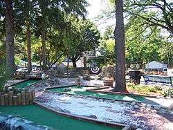 Tall Maples Miniature Golf Course |
December 31, 2002 (#02001653) |
4083 Culver Rd. 43°13′42″N 77°32′50″W |
Sea Breeze | Now known as Parkside Whispering Pines[6] |
| 84 | Tinker Cobblestone Farmstead | 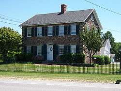 Tinker Cobblestone Farmstead |
April 27, 1995 (#95000502) |
1585 Calkins Rd. 43°04′08″N 77°34′30″W |
Henrietta | |
| 85 | Totiakton Site | 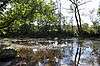 Totiakton Site |
September 21, 1978 (#78001861) |
Address Restricted |
Honeoye Falls | |
| 86 | Union Presbyterian Church |  Union Presbyterian Church |
December 13, 2004 (#04001439) |
Church St. 43°01′18″N 77°45′07″W |
Scottsville | |
| 87 | United Congregational Church of Irondequoit |  United Congregational Church of Irondequoit |
August 2, 2002 (#02000822) |
644 Titus Ave. 43°12′39″N 77°35′59″W |
Irondequoit | |
| 88 | US Post Office-East Rochester | 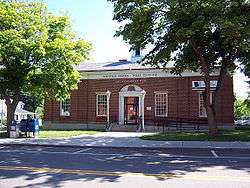 US Post Office-East Rochester |
November 17, 1988 (#88002495) |
206 W. Commercial St. 43°06′49″N 77°29′19″W |
East Rochester | Named the Officer Daryl R. Pierson Memorial Post Office Building in 2015. |
| 89 | US Post Office-Honeoye Falls |  US Post Office-Honeoye Falls |
May 11, 1989 (#88002505) |
39 W. Main St.[7] 42°57′08″N 77°35′33″W |
Honeoye Falls | |
| 90 | Webster Baptist Church | _Baptist_Church.jpg) Webster Baptist Church |
November 7, 1991 (#91001672) |
59 South Ave. 43°12′38″N 77°25′52″W |
Webster | |
| 91 | Webster Grange No. 436 | August 22, 2016 (#16000555) |
58 E. Main St., 43°12′46″N 77°25′42″W |
Webster | 1900 meeting place for what was at one time largest Grange chapter in the country; now shared with local singing group. | |
| 92 | Harvey Whalen House | 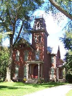 Harvey Whalen House |
November 21, 1994 (#94001342) |
140 Whalen Rd. 43°08′29″N 77°26′45″W |
Penfield | |
| 93 | Wheatland Baptist Cemetery | 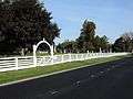 Wheatland Baptist Cemetery |
January 18, 2006 (#05001536) |
McGinnis, Belcoda and Harmon Rds. 43°01′33″N 77°50′49″W |
Belcoda | |
| 94 | Whitcomb Cobblestone Farmhouse |  Whitcomb Cobblestone Farmhouse |
November 29, 1996 (#96001396) |
437 Pond Rd. 43°00′24″N 77°31′58″W |
Mendon | |
| 95 | John and Chauncey White House | January 15, 2014 (#13001091) |
854 White Rd. 43°10′38″N 77°59′13″W |
West Sweden | ||
| 96 | Whiteside, Barnett and Co. Agricultural Works | Whiteside, Barnett and Co. Agricultural Works |
February 22, 2001 (#00001157) |
60 Clinton St. 43°12′59″N 77°56′29″W |
Brockport | |
| 97 | Wilbur House |  Wilbur House |
May 6, 1980 (#80002651) |
187 S. Main St. 43°05′40″N 77°26′30″W |
Fairport | |
| 98 | Windom Hall |  Windom Hall |
August 5, 1994 (#94000803) |
28 Main St. 43°01′11″N 77°45′01″W |
Scottsville | |
| 99 | Thomas Youngs House |  Thomas Youngs House |
June 24, 1993 (#93000546) |
50 Mitchell Rd. 43°05′00″N 77°30′17″W |
Pittsford |
See also
| Wikimedia Commons has media related to National Register of Historic Places in Monroe County, New York. |
References
- The latitude and longitude information provided in this table was derived originally from the National Register Information System, which has been found to be fairly accurate for about 99% of listings. Some locations in this table may have been corrected to current GPS standards.
- "National Register of Historic Places: Weekly List Actions". National Park Service, United States Department of the Interior. Retrieved on June 19, 2020.
- Numbers represent an ordering by significant words. Various colorings, defined here, differentiate National Historic Landmarks and historic districts from other NRHP buildings, structures, sites or objects.
- The eight-digit number below each date is the number assigned to each location in the National Register Information System database, which can be viewed by clicking the number.
- Nancy L. Todd (July 1996). "National Register of Historic Places Registration: Adsit Cobblestone Farmhouse". New York State Office of Parks, Recreation and Historic Preservation. Retrieved 2009-10-01. See also: "Accompanying three photos".
- http://www.democratandchronicle.com/article/20090602/NEWS05/906030309/Whispering+Pines+miniature+golf+brightens+image
- Address based on USPS website. Accessed March 31, 2016.
| Topics |  | |
|---|---|---|
| Lists by county |
| |
| Lists by city | ||
| Other lists | ||
| ||