National Register of Historic Places listings in Greene County, New York
List of the National Register of Historic Places listings in Greene County, New York
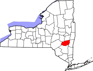
Location of Greene County in New York
This is intended to be a complete list of properties and districts listed on the National Register of Historic Places in Greene County, New York. The locations of National Register properties and districts (at least for all showing latitude and longitude coordinates below) may be seen in a map by clicking on "Map of all coordinates".[1] Two properties, the Pieter Bronck House and the Thomas Cole House, are further designated U.S. National Historic Landmarks, and the latter is also a National Historic Site.
- This National Park Service list is complete through NPS recent listings posted June 26, 2020.[2]
| Albany (Albany) – Allegany – Bronx – Broome – Cattaraugus – Cayuga – Chautauqua – Chemung – Chenango – Clinton – Columbia – Cortland – Delaware – Dutchess (Poughkeepsie, Rhinebeck) – Erie (Buffalo) – Essex – Franklin – Fulton – Genesee – Greene – Hamilton – Herkimer – Jefferson – Kings – Lewis – Livingston – Madison – Monroe (Rochester) – Montgomery – Nassau – New York (Below 14th Street, 14th to 59th Streets, 59th to 110th Streets, Above 110th Street, Islands) – Niagara – Oneida – Onondaga – Ontario – Orange – Orleans – Oswego – Otsego – Putnam – Queens – Rensselaer – Richmond – Rockland – St. Lawrence – Saratoga – Schenectady – Schoharie – Schuyler – Seneca – Steuben – Suffolk – Sullivan – Tioga – Tompkins – Ulster – Warren – Washington – Wayne – Westchester (Northern, Southern, New Rochelle, Peekskill, Yonkers) – Wyoming – Yates |
Listings county-wide
| [3] | Name on the Register | Image | Date listed[4] | Location | City or town | Description |
|---|---|---|---|---|---|---|
| 1 | A. T. House | A. T. House |
January 18, 2006 (#05001538) |
435 Main St. 42°24′40″N 74°09′14″W |
Oak Hill | |
| 2 | All Souls Church |  All Souls Church |
November 24, 1993 (#93001223) |
Rt. 23-C north of Tannersville 42°13′29″N 74°08′05″W |
Tannersville | |
| 3 | Allan Teator Road Stone Arch Bridge | 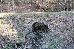 Allan Teator Road Stone Arch Bridge |
January 9, 2008 (#07001365) |
Allan Teator Rd. 42°24′27″N 74°13′12″W |
West Durham | |
| 4 | Athens Lower Village Historic District | 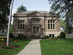 Athens Lower Village Historic District |
November 28, 1980 (#80002616) |
Roughly bounded by Hudson River, NY 385, Vernon and Market Sts. 42°15′34″N 73°48′46″W |
Athens | |
| 5 | Henry T. Botsford House |  Henry T. Botsford House |
November 12, 1993 (#93001224) |
NY 81 west of the junction with NY 32 42°24′24″N 74°01′28″W |
Greenville | |
| 6 | Brand Hollow Road Stone Arch Bridge |  Brand Hollow Road Stone Arch Bridge |
April 10, 2008 (#08000271) |
Brand Hollow Road 42°24′12″N 74°14′22″W |
West Durham | |
| 7 | William Brandow House | William Brandow House |
November 10, 2009 (#09000908) |
480 Rt. 385 42°15′04″N 73°50′06″W |
Athens | |
| 8 | Brick Row Historic District | 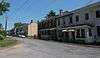 Brick Row Historic District |
November 28, 1980 (#80002617) |
Off NY 385 42°16′39″N 73°47′55″W |
Athens | |
| 9 | Bronck Farm 13-Sided Barn | 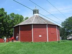 Bronck Farm 13-Sided Barn |
September 29, 1984 (#84002395) |
Old Kings Rd. 42°20′46″N 73°50′42″W |
Coxsackie | |
| 10 | Pieter Bronck House | 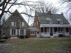 Pieter Bronck House |
December 24, 1967 (#67000012) |
2 miles (3.2 km) west of Coxsackie on west side of U.S. 9W 42°20′44″N 73°50′49″W |
Coxsackie | |
| 11 | Bronk-Silvester House | 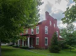 Bronk-Silvester House |
March 12, 2002 (#02000140) |
188 Mansion St. 42°21′33″N 73°48′51″W |
Coxsackie | |
| 12 | Centre Presbyterian Church | 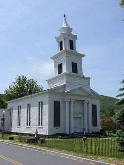 Centre Presbyterian Church |
September 7, 1979 (#79001586) |
Main and Church Sts 42°18′24″N 74°15′09″W |
Windham | |
| 13 | Christ Church | 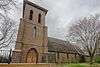 Christ Church |
November 16, 2015 (#15000800) |
11228 NY 32 42°25′01″N 74°01′20″W |
Greenville | Also called Christ Episcopal Church; well-preserved 1857 Gothic Revival church made of locally quarried red sandstone |
| 14 | Church of St. John the Evangelist | 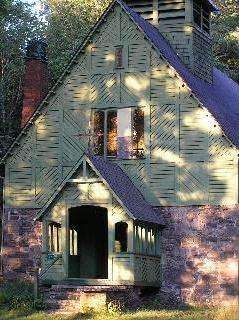 Church of St. John the Evangelist |
April 21, 2004 (#04000352) |
Philadelphia Hill Rd. 42°10′56″N 74°08′53″W |
Hunter | |
| 15 | L.E. Cleveland House | 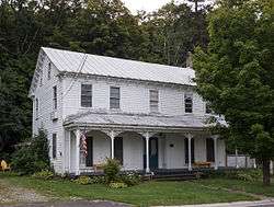 L.E. Cleveland House |
December 28, 2001 (#01001385) |
7818 NY 81 42°24′38″N 74°09′10″W |
Durham | |
| 16 | Thomas Cole House | 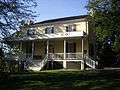 Thomas Cole House |
October 15, 1966 (#66000522) |
218 Spring St. 42°13′33″N 73°51′43″W |
Catskill | |
| 17 | Commercial Building at 32 West Bridge Street | 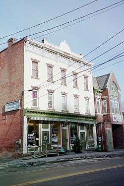 Commercial Building at 32 West Bridge Street |
August 10, 1995 (#95000961) |
32 W. Bridge St. 42°13′01″N 73°52′12″W |
Catskill | |
| 18 | Cornwallville Cemetery | 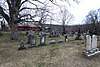 Cornwallville Cemetery |
January 31, 2017 (#100000613) |
County Road 20 42°22′02″N 74°09′25″W |
Cornwallville | 1824 cemetery has graves of many of the area's first settlers, including Daniel Cornwall, a Revolutionary War veteran from Connecticut who gave the hamlet its name |
| 19 | Croswell-Parsons Paper Mill Ruin | 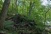 Croswell-Parsons Paper Mill Ruin |
November 9, 2008 (#07001366) |
NY 144 42°27′30″N 73°48′01″W |
New Baltimore | |
| 20 | W. F. DeWitt Hotel | 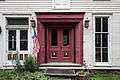 W. F. DeWitt Hotel |
December 28, 2001 (#01001389) |
7803 NY 81 42°24′35″N 74°09′11″W |
Durham | |
| 21 | District School No. 11 | 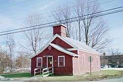 District School No. 11 |
August 10, 1995 (#95000964) |
S. Jefferson Ave. 42°13′51″N 73°52′51″W |
Catskill | |
| 22 | DuBois Stone House |  DuBois Stone House |
November 22, 1995 (#95001336) |
347 W. Main St. 42°13′09″N 73°52′11″W |
Catskill | |
| 23 | Benjamin DuBois Stone House-Captain Martin Stone House | 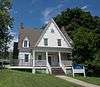 Benjamin DuBois Stone House-Captain Martin Stone House |
November 22, 1995 (#95001333) |
347 W. Main St. 42°13′14″N 73°52′12″W |
Catskill | (distinct from DuBois Stone House though listed at same address) |
| 24 | Dunix | Dunix |
April 30, 2018 (#100002364) |
593 Cornwallville Road 42°20′44″N 74°08′33″W |
Cornwallville | 1855 stone house turned into summer retreat later by John Matthews, pioneering manufacturer of soda fountain equipment |
| 25 | East Side Historic District | 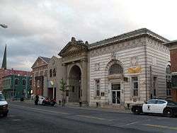 East Side Historic District |
August 9, 1982 (#82004779) |
Roughly bounded by Catskill Creek, the Hudson River, and River, Harrison, Day, and Gardner Sts. 42°13′07″N 73°51′44″W |
Catskill | |
| 26 | ELEANOR (Sailing Sloop) | December 27, 1982 (#82001174) |
Off Lower Main St. in Catskill Creek 42°12′44″N 73°51′41″W |
Catskill | ||
| 27 | Elka Park Historic District | May 22, 1993 (#93000399) |
Southeast of the Hunter town center 42°09′19″N 74°10′05″W |
Hunter | ||
| 28 | Harry Fischel House | 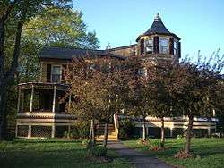 Harry Fischel House |
April 21, 2000 (#00000348) |
6302 Main St. 42°12′40″N 74°12′56″W |
Hunter | |
| 29 | Flint Mine Hill Archeological District | November 29, 1978 (#78001852) |
Address Restricted |
Coxsackie | ||
| 30 | Ford's Store | 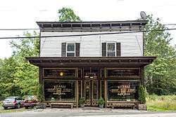 Ford's Store |
December 28, 2001 (#01001395) |
7811 NY 81 42°24′35″N 74°09′11″W |
Durham | |
| 31 | Forestville Commonwealth | November 20, 1974 (#74001242) |
Address Restricted |
Earlton | ||
| 32 | Greenville Presbyterian Church Complex |  Greenville Presbyterian Church Complex |
March 28, 1985 (#85000657) |
North St., NY 32 42°24′58″N 74°01′23″W |
Greenville | 1860 Greek Revival church is home to first non-Dutch congregation established in Catskill region |
| 33 | Aaron Haines Family Cemetery | 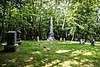 Aaron Haines Family Cemetery |
May 18, 2018 (#SG100002462) |
5132 NY 23A 42°11′47″N 74°05′35″W |
Haines Falls | Final resting place of members of family that gave Haines Falls its name |
| 34 | Halcott Grange No. 881 |  Halcott Grange No. 881 |
April 6, 2000 (#00000351) |
County Route 3 42°11′27″N 74°29′10″W |
Halcott | |
| 35 | Joseph Hallock House | 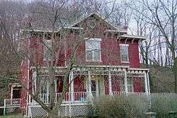 Joseph Hallock House |
August 10, 1995 (#95000958) |
241 W. Main St. 42°12′59″N 73°52′08″W |
Catskill | |
| 36 | Hathaway | 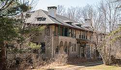 Hathaway |
February 12, 2008 (#08000023) |
781 County Road 25 42°13′27″N 74°07′40″W |
Tannersville | |
| 37 | Haxton–Griffin Farm | 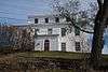 Haxton–Griffin Farm |
January 4, 2012 (#11000999) |
84 Howard Hall Rd. 42°15′23″N 73°50′10″W |
Athens | |
| 38 | Hervey Street Road Stone Arch Bridge | 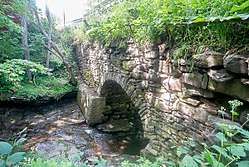 Hervey Street Road Stone Arch Bridge |
January 9, 2008 (#07001367) |
Hervey Street Rd., & Hervey Street-Sunside Rd. 42°20′42″N 74°07′37″W |
Hervey Street | |
| 39 | Hop-o'-Nose Knitting Mill | 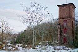 Hop-o'-Nose Knitting Mill |
August 10, 1995 (#95000959) |
130 W. Main St. 42°12′46″N 73°52′01″W |
Catskill | |
| 40 | Peter Houghtaling Farm and Lime Kiln |  Peter Houghtaling Farm and Lime Kiln |
March 20, 1986 (#86000491) |
Lime Kiln Rd. 42°23′36″N 73°51′18″W |
West Coxsackie | |
| 41 | Hudson/Athens Lighthouse | 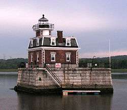 Hudson/Athens Lighthouse |
May 29, 1979 (#79003796) |
South of Middle Ground Flats in Hudson River 42°15′06″N 73°48′32″W |
Athens | |
| 42 | Hunter Mountain Fire Tower | 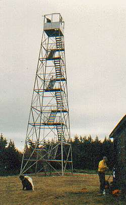 Hunter Mountain Fire Tower |
June 30, 1997 (#97000569) |
Roughly following Hunter Brook from Spruceton Rd. to Hunter Mountain 42°11′03″N 74°15′06″W |
Hunter | First site in the Catskills manned by the state as fire lookout tower in 1909 |
| 43 | Hunter Synagogue | 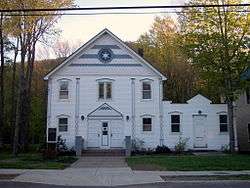 Hunter Synagogue |
December 9, 1999 (#99001484) |
Main St. 42°12′38″N 74°12′57″W |
Hunter | |
| 44 | IOOF Hall | 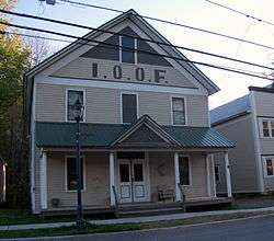 IOOF Hall |
December 31, 2002 (#02001642) |
6325 Main St. 42°12′43″N 74°13′03″W |
Hunter | |
| 45 | Jewett Presbyterian Church Complex |  Jewett Presbyterian Church Complex |
December 28, 2001 (#01001382) |
Church St. 42°16′12″N 74°18′15″W |
Jewett | |
| 46 | William Lampman House | 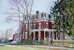 William Lampman House |
August 10, 1995 (#95000960) |
147 Grandview Ave. 42°12′42″N 73°52′22″W |
Catskill | |
| 47 | John and Martinus Laraway Inn | 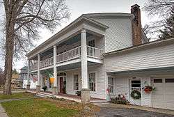 John and Martinus Laraway Inn |
July 17, 2012 (#12000419) |
Main St. 42°19′07″N 74°26′08″W |
Prattsville | |
| 48 | Frank D. Layman Memorial | 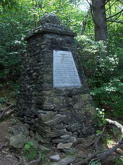 Frank D. Layman Memorial |
June 6, 2003 (#03000022) |
Near Kaaterskill Falls 42°11′24″N 74°03′55″W |
Hunter | Monument on Catskill Escarpment Trail to firefighter who perished fighting forest fire there in 1901 |
| 49 | Leeds Dutch Reformed Church |  Leeds Dutch Reformed Church |
February 22, 1996 (#96000141) |
Co. Rt. 23B (Susquehanna Tpk.) 42°15′17″N 73°54′04″W |
Leeds | |
| 50 | Leeds Flat Site |  Leeds Flat Site |
October 1, 1998 (#98001223) |
Address Restricted |
Catskill | |
| 51 | Lexington House | 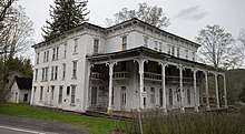 Lexington House |
September 4, 1986 (#86002175) |
NY 42 42°14′23″N 74°22′00″W |
Lexington | |
| 52 | Methodist Episcopal Church of Windham Centre |  Methodist Episcopal Church of Windham Centre |
April 27, 2009 (#09000255) |
1843 NY 23 42°18′29″N 74°14′57″W |
Windham | |
| 53 | Moore-Howland Estate | August 30, 2010 (#10000609) |
4 New York State Route 385 42°13′46″N 73°51′27″W |
Catskill | ||
| 54 | Moore Road Stone Arch Bridge | 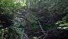 Moore Road Stone Arch Bridge |
April 10, 2008 (#08000272) |
Moore Rd. 42°21′11″N 74°10′19″W |
Cornwallville | |
| 55 | Morss Homestead/Federal City Homestead | Morss Homestead/Federal City Homestead |
September 30, 1983 (#83001680) |
NY 23 42°18′35″N 74°23′45″W |
Red Falls | |
| 56 | New Baltimore Hamlet Historic District | 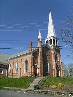 New Baltimore Hamlet Historic District |
February 23, 1996 (#96000139) |
Roughly, Main St. from NY 144 to south junction with Mill St. and along NY 144, Church and New Sts. and Washington and Madison 42°26′46″N 73°47′18″W |
New Baltimore | |
| 57 | Newkirk Homestead | 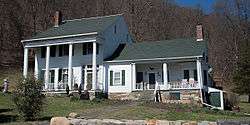 Newkirk Homestead |
July 22, 1979 (#79001584) |
Northwest of Leeds on Sandy Plains Rd. 42°15′59″N 73°54′26″W |
Leeds | |
| 58 | North Settlement Methodist Church | 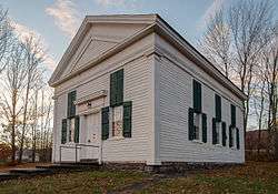 North Settlement Methodist Church |
May 16, 1996 (#96000561) |
Co. Rt. 10, east of the junction with Co. Rt. 32C 42°20′16″N 74°17′46″W |
Ashland | |
| 59 | Oak Hill Cemetery | 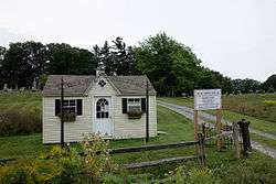 Oak Hill Cemetery |
May 11, 2011 (#11000274) |
NY 81 42°24′43″N 74°09′38″W |
Oak Hill | |
| 60 | Oak Hill Historic District | September 11, 2017 (#100001586) |
NY 81, Oak Hill Rd., Giles Ln. 42°24′35″N 74°09′08″W |
Oak Hill | Late 18th-century rural hamlet with many buildings from that period and early 19th century | |
| 61 | Oak Hill Methodist Episcopal Church |  Oak Hill Methodist Episcopal Church |
November 1, 2006 (#06000972) |
427 Main St. 42°24′45″N 74°09′18″W |
Oak Hill | |
| 62 | Old Episcopal Manse | Old Episcopal Manse |
November 22, 2000 (#00001415) |
NY 23, Main St. 42°18′51″N 74°25′59″W |
Prattsville | |
| 63 | Onteora Park Historic District | February 12, 2003 (#03000023) |
Onteora Club Property 42°12′36″N 74°09′06″W |
Hunter | ||
| 64 | Mrs. Osburn House | 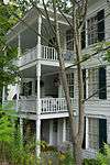 Mrs. Osburn House |
December 28, 2001 (#01001390) |
7872 NY 81 42°24′43″N 74°09′16″W |
Durham | |
| 65 | The Parsonage |  The Parsonage |
April 6, 2005 (#05000262) |
424 Main St. 42°24′45″N 74°09′21″W |
Oak Hill | |
| 66 | Charles Pierce House |  Charles Pierce House |
December 28, 2001 (#01001386) |
7846 NY 81 42°24′41″N 74°09′12″W |
Durham | |
| 67 | Old Platte Clove Post Office |  Old Platte Clove Post Office |
June 30, 2005 (#05000637) |
2340 Platte Clove Rd. 42°08′02″N 74°05′18″W |
Elka Park | |
| 68 | Pratt Rock Park |  Pratt Rock Park |
December 10, 1992 (#92001645) |
NY 23 northwest of the junction with NY 23A 42°18′43″N 74°24′39″W |
Prattsville | Rock etchings by tanner and later U.S. Congressman Zadock Pratt |
| 69 | Zadock Pratt House |  Zadock Pratt House |
August 14, 1986 (#86001654) |
Main St. 42°18′52″N 74°25′56″W |
Prattsville | |
| 70 | Prattsville Commercial Building | 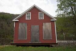 Prattsville Commercial Building |
March 1, 1996 (#96000203) |
NY 23 42°19′01″N 74°26′06″W |
Prattsville | |
| 71 | Prattsville Reformed Dutch Church |  Prattsville Reformed Dutch Church |
December 6, 1996 (#96001430) |
Main St., northwest of the junction with Co. Rd. 10 42°19′00″N 74°26′09″W |
Prattsville | |
| 72 | Prevost Manor House | 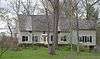 Prevost Manor House |
November 15, 1972 (#72000842) |
West of Greenville off NY 81 42°24′50″N 74°03′03″W |
Greenville | |
| 73 | Reed Street Historic District | 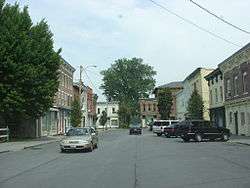 Reed Street Historic District |
May 6, 1980 (#80002621) |
Reed, Ely, Mansion, and River Sts. 42°21′06″N 73°47′50″W |
Coxsackie | |
| 74 | Rowena Memorial School | 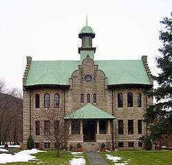 Rowena Memorial School |
August 22, 2002 (#02000879) |
NY 23A 42°10′30″N 74°01′12″W |
Palenville | Built early 20th century by local vacationer as gift to local community in memory of his wife; used through early 1970s. |
| 75 | Rushmore Farm | 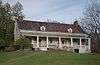 Rushmore Farm |
June 18, 2010 (#10000364) |
8748 US 9W 42°20′05″N 73°50′58″W |
Athens | |
| 76 | St. Francis DeSales Church | St. Francis DeSales Church |
December 9, 1999 (#99001485) |
Church St. 42°14′20″N 74°21′41″W |
Lexington | |
| 77 | St. Mary's of the Mountain Church |  St. Mary's of the Mountain Church |
January 27, 1999 (#99000057) |
NY 23A 42°12′14″N 74°12′01″W |
Hunter | |
| 78 | St. Paul's Lutheran Church | 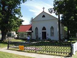 St. Paul's Lutheran Church |
July 6, 2005 (#05000682) |
464 Main St. 42°24′29″N 74°09′06″W |
Oak Hill | |
| 79 | Salisbury Manor | 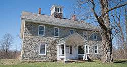 Salisbury Manor |
June 19, 1979 (#79001585) |
Northwest of Leeds on NY 145 42°15′47″N 73°55′10″W |
Leeds | |
| 80 | Shady Glen Road Stone Arch Bridge | 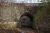 Shady Glen Road Stone Arch Bridge |
January 9, 2008 (#07001368) |
Shady Glen Rd. at Stone Bridge Rd. 42°22′47″N 74°08′44″W |
Cornwallville | |
| 81 | Stanton Hill Cemetery | 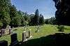 Stanton Hill Cemetery |
April 26, 2016 (#16000201) |
County Route 50 42°25′53″N 73°52′23″W |
Hannacroix | Cemetery established by local Quakers in 1820s, later opened to all, has collection of gravestones and funerary art from different periods |
| 82 | Stevens Hill Farm | 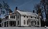 Stevens Hill Farm |
November 9, 2018 (#100003119) |
4082 Grapeville Road 42°24′56″N 74°01′00″W |
Greenville | 1743 farmhouse at center of farm that remained in same family for eight generations |
| 83 | Stranahan-DelVecchio House | 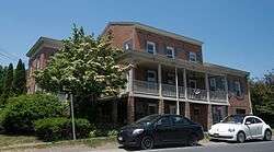 Stranahan-DelVecchio House |
November 28, 1980 (#80002618) |
N. Washington St. 42°16′07″N 73°48′18″W |
Athens | |
| 84 | Elijah Strong House | 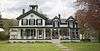 Elijah Strong House |
January 15, 2003 (#02001711) |
12278 NY 23 42°18′14″N 74°20′30″W |
Ashland | |
| 85 | Susquehannah Turnpike |  Susquehannah Turnpike |
January 2, 1974 (#74001241) |
Beginning at Catskill, follows the Mohican Trail (NY 145) and CR 20 and 22 NW to the Schoharie County line 42°18′35″N 74°00′58″W |
Catskill | |
| 86 | Tannersville Main Street Historic District |  Tannersville Main Street Historic District |
November 14, 2008 (#08001047) |
5898-6144 Main St., 10 Spring St. 42°11′45″N 74°07′40″W |
Tannersville | |
| 87 | Torry-Chittendon Farmhouse | 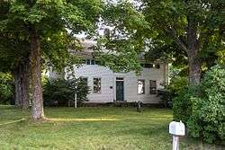 Torry-Chittendon Farmhouse |
August 30, 2010 (#10000612) |
4268 County Road 20 42°23′54″N 74°10′52″W |
Durham | |
| 88 | Trinity Episcopal Church | 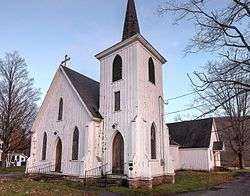 Trinity Episcopal Church |
December 6, 1996 (#96001438) |
NY 23, southwest of the junction with Co. Rd. 19 42°17′53″N 74°17′54″W |
Ashland | |
| 89 | Tripp House and Store Complex | 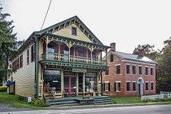 Tripp House and Store Complex |
March 12, 2001 (#01000240) |
NY 81 42°24′44″N 74°09′20″W |
Durham | |
| 90 | Twilight Park Historic District | 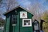 Twilight Park Historic District |
June 27, 2007 (#07000626) |
Ledge End Rd., Spray Falls Rd., Upper Level Rd., and vicinity 42°11′21″N 74°05′15″W |
Haines Falls | |
| 91 | Ulster and Delaware Railroad Station |  Ulster and Delaware Railroad Station |
August 8, 1996 (#96000861) |
NY 23A, Hamlet of Haines Falls 42°11′45″N 74°05′29″W |
Hunter | |
| 92 | Union Chapel | 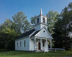 Union Chapel |
December 28, 2001 (#01001394) |
Mill Rd. 42°21′11″N 74°14′43″W |
Windham | |
| 93 | US Post Office-Catskill | 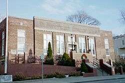 US Post Office-Catskill |
November 17, 1988 (#88002471) |
270 Main St. 42°12′56″N 73°51′51″W |
Catskill | |
| 94 | Van Bergen House | 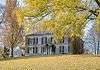 Van Bergen House |
April 25, 1991 (#91000444) |
Junction of U.S. 9W and Schiller Park Rd. 42°23′04″N 73°50′04″W |
New Baltimore | |
| 95 | David Van Gelder Octagon House | 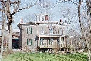 David Van Gelder Octagon House |
January 16, 1998 (#97001620) |
47 Division St. 42°13′04″N 73°52′26″W |
Catskill | |
| 96 | Albertus Van Loon House | 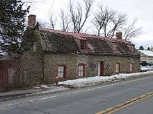 Albertus Van Loon House |
November 28, 1980 (#80002619) |
N. Washington St. 42°16′03″N 73°48′20″W |
Athens | |
| 97 | John Van Vechten House |  John Van Vechten House |
March 10, 1995 (#95000212) |
Susquehanna Tpk. (Co. Rd. 23B) 42°15′19″N 73°54′14″W |
Leeds | |
| 98 | Weldon House | 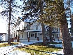 Weldon House |
January 7, 2000 (#99001658) |
NY 145 42°21′55″N 74°04′53″W |
East Durham | |
| 99 | West Athens Hill Site | March 20, 1973 (#73001194) |
Address Restricted |
Athens | ||
| 100 | West Settlement Methodist Church |  West Settlement Methodist Church |
December 6, 1996 (#96001435) |
West Settlement Rd. at its junction with Cleveland Rd. 42°19′57″N 74°22′13″W |
Ashland | |
| 101 | Wiley Hose Company Building | 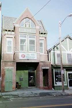 Wiley Hose Company Building |
August 10, 1995 (#95000962) |
30 W. Bridge St. 42°13′01″N 73°52′09″W |
Catskill | |
| 102 | Woodward Road Stone Arch Bridge | 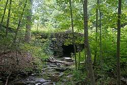 Woodward Road Stone Arch Bridge |
March 9, 2009 (#09000134) |
Woodward Road 42°22′17″N 74°05′46″W |
East Durham | |
| 103 | Zion Lutheran Church |  Zion Lutheran Church |
November 28, 1980 (#80002620) |
N. Washington St. 42°16′05″N 73°48′21″W |
Athens |
See also
| Wikimedia Commons has media related to National Register of Historic Places in Greene County, New York. |
References
- The latitude and longitude information provided in this table was derived originally from the National Register Information System, which has been found to be fairly accurate for about 99% of listings. Some locations in this table may have been corrected to current GPS standards.
- "National Register of Historic Places: Weekly List Actions". National Park Service, United States Department of the Interior. Retrieved on June 26, 2020.
- Numbers represent an ordering by significant words. Various colorings, defined here, differentiate National Historic Landmarks and historic districts from other NRHP buildings, structures, sites or objects.
- The eight-digit number below each date is the number assigned to each location in the National Register Information System database, which can be viewed by clicking the number.
| Topics |  | |
|---|---|---|
| Lists by county |
| |
| Lists by city | ||
| Other lists | ||
| ||
This article is issued from Wikipedia. The text is licensed under Creative Commons - Attribution - Sharealike. Additional terms may apply for the media files.