National Register of Historic Places listings in the Bronx
List of Registered Historic Places in Bronx County, New York (Borough of The Bronx):

Location of Bronx County in New York
This is intended to be a complete list of the 73 properties and districts listed on the National Register of Historic Places in Bronx County, New York. The locations of National Register properties and districts (at least for all showing latitude and longitude coordinates below) may be seen in a map by clicking on "Map of all coordinates".[1] Seven of the properties and districts are further designated National Historic Landmarks.
- This National Park Service list is complete through NPS recent listings posted June 19, 2020.[2]
| Albany (Albany) – Allegany – Bronx – Broome – Cattaraugus – Cayuga – Chautauqua – Chemung – Chenango – Clinton – Columbia – Cortland – Delaware – Dutchess (Poughkeepsie, Rhinebeck) – Erie (Buffalo) – Essex – Franklin – Fulton – Genesee – Greene – Hamilton – Herkimer – Jefferson – Kings – Lewis – Livingston – Madison – Monroe (Rochester) – Montgomery – Nassau – New York (Below 14th Street, 14th to 59th Streets, 59th to 110th Streets, Above 110th Street, Islands) – Niagara – Oneida – Onondaga – Ontario – Orange – Orleans – Oswego – Otsego – Putnam – Queens – Rensselaer – Richmond – Rockland – St. Lawrence – Saratoga – Schenectady – Schoharie – Schuyler – Seneca – Steuben – Suffolk – Sullivan – Tioga – Tompkins – Ulster – Warren – Washington – Wayne – Westchester (Northern, Southern, New Rochelle, Peekskill, Yonkers) – Wyoming – Yates |
Current listings
| [3] | Name on the Register | Image | Date listed[4] | Location | City or town | Description |
|---|---|---|---|---|---|---|
| 1 | 242nd Street – Van Cortlandt Park Station (IRT) | 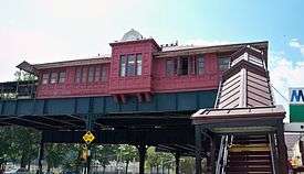 242nd Street – Van Cortlandt Park Station (IRT) |
March 30, 2005 (#05000226) |
Above Broadway at the junction of W. 242nd St. 40°53′20″N 73°53′56″W |
Riverdale | Subway station (1 train); Only remaining terminal elevated subway station in Victorian Gothic architectural style. Also has only remaining scrolled station sign in entire system |
| 2 | 48th Police Precinct Station | 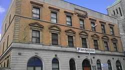 48th Police Precinct Station |
May 6, 1983 (#83001639) |
1925 Bathgate Ave. 40°50′49″N 73°53′52″W |
Tremont | |
| 3 | 52nd Police Precinct Station House and Stable | 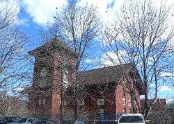 52nd Police Precinct Station House and Stable |
October 29, 1982 (#82001091) |
3016 Webster Ave. 40°52′09″N 73°52′46″W |
Norwood | |
| 4 | Bartow-Pell Mansion and Carriage House | 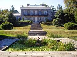 Bartow-Pell Mansion and Carriage House |
December 30, 1974 (#74001220) |
Pelham Bay Park, Shore Rd. 40°52′18″N 73°48′21″W |
Pelham Bay Park | |
| 5 | Bronx Borough Courthouse | 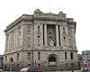 Bronx Borough Courthouse |
February 25, 1982 (#82003344) |
E. 161st St., 3rd and Brook Aves. 40°49′22″N 73°54′38″W |
Melrose | |
| 6 | Bronx Central Annex-U.S. Post Office |  Bronx Central Annex-U.S. Post Office |
May 6, 1980 (#80002584) |
558 Grand Concourse 40°49′08″N 73°55′37″W |
Mott Haven | |
| 7 | Bronx County Courthouse |  Bronx County Courthouse |
September 8, 1983 (#83001636) |
851 Grand Concourse 40°49′34″N 73°55′27″W |
Concourse | |
| 8 | Casa Amadeo, antigua Casa Hernandez |  Casa Amadeo, antigua Casa Hernandez |
March 23, 2001 (#01000244) |
786 Prospect Ave. 40°49′09″N 73°54′08″W |
Longwood | |
| 9 | Chevra Linas Hazedek Synagogue of Harlem and the Bronx |  Chevra Linas Hazedek Synagogue of Harlem and the Bronx |
November 19, 2014 (#14000934) |
1115 Ward Ave. 40°49′36″N 73°52′37″W |
Soundview | Remaining synagogue from early Jewish settlement of neighborhood |
| 10 | Christ Church Complex | 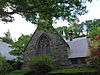 Christ Church Complex |
September 8, 1983 (#83001637) |
5030 Riverdale Ave. 40°53′56″N 73°54′25″W |
Riverdale | |
| 11 | Robert Colgate House | 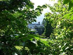 Robert Colgate House |
September 8, 1983 (#83001638) |
5225 Sycamore Ave. 40°54′07″N 73°54′45″W |
Hudson Hill | |
| 12 | Concourse Yard Entry Buildings | 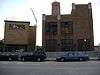 Concourse Yard Entry Buildings |
February 9, 2006 (#06000014) |
W. 205th St., bet. Jerome and Paul Aves. 40°52′34″N 73°53′21″W |
Jerome Park | |
| 13 | Concourse Yard Substation | 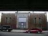 Concourse Yard Substation |
February 9, 2006 (#06000013) |
3119 Jerome Ave. 40°52′30″N 73°53′22″W |
Jerome Park | |
| 14 | Crotona Play Center | _(16639600986).jpg) Crotona Play Center |
April 28, 2015 (#15000177) |
1700 Fulton Ave 40°50′23″N 73°53′53″W |
Crotona Park | Only WPA-built swimming pool complex in the Bronx |
| 15 | William E. Dodge House | 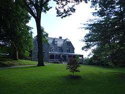 William E. Dodge House |
August 28, 1977 (#77000934) |
690 W. 247th St. 40°53′42″N 73°54′56″W |
Riverdale | |
| 16 | Dollar Savings Bank | 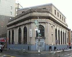 Dollar Savings Bank |
April 27, 2011 (#11000228) |
2792 3rd Ave. 40°48′54″N 73°55′08″W |
The Hub | New listing; refnum 11000228 |
| 17 | Edgehill Church at Spuyten Duyvil | 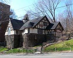 Edgehill Church at Spuyten Duyvil |
October 29, 1982 (#82001089) |
2550 Independence Ave. 40°52′48″N 73°55′13″W |
Spuyten Duyvil | |
| 18 | Eighth Regiment Armory | 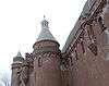 Eighth Regiment Armory |
December 21, 1982 (#82001090) |
29 W. Kingsbridge Rd. 40°52′07″N 73°53′55″W |
Jerome Park | Eighth Regiment Armory is commonly known as Kingsbridge Armory. Romanesque structure with five-acre (2 ha) footprint built in 1910s is believed to be the world's largest armory. |
| 19 | Admiral David Glasgow Farragut Gravesite | 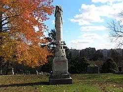 Admiral David Glasgow Farragut Gravesite |
October 16, 2012 (#12001008) |
Lot 1429-44, Section 14, Aurora Hill Plot, Woodlawn Cemetery 40°53′24″N 73°52′27″W |
Woodlawn | |
| 20 | Fonthill Castle and the Administration Building of the College of Mount St. Vincent | 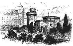 Fonthill Castle and the Administration Building of the College of Mount St. Vincent |
July 11, 1980 (#80002585) |
W. 261st St. and Riverdale Ave. 40°54′49″N 73°54′34″W |
Riverdale | |
| 21 | Fort Independence Historic District |  Fort Independence Historic District |
August 23, 2016 (#16000551) |
Cannon Place, Orloff and Sedgwick Aves., and Giles Place 40°52′52″N 73°53′50″W |
Kingsbridge | Hill where Revolutionary War fort was sited retains unusual street plan designed around topography by Frederick Law Olmsted in 1877 |
| 22 | Fort Schuyler | 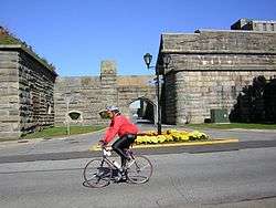 Fort Schuyler |
June 29, 1976 (#76001206) |
Throggs Neck at East River and Long Island Sound 40°48′20″N 73°47′34″W |
Throggs Neck | |
| 23 | Grace Episcopal Church | 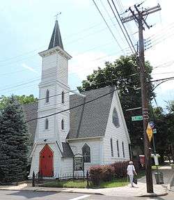 Grace Episcopal Church |
September 13, 2006 (#06000820) |
116 City Island Ave. 40°50′27″N 73°47′04″W |
City Island | |
| 24 | Grand Concourse Historic District |  Grand Concourse Historic District |
August 24, 1987 (#87001388) |
730-1000, 1100-1520, 1560, and 851-1675 Grand Concourse 40°49′52″N 73°55′26″W |
Concourse | |
| 25 | Hall of Fame Complex | 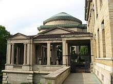 Hall of Fame Complex |
September 7, 1979 (#79001567) |
Bronx Community College campus 40°51′31″N 73°54′52″W |
University Heights | |
| 26 | Hertlein and Schlatter Silk Trimmings Factory | 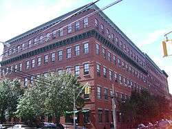 Hertlein and Schlatter Silk Trimmings Factory |
February 5, 2001 (#00001683) |
454-464 E. 148th St. 40°48′51″N 73°54′59″W |
Mott Haven | |
| 27 | High Pumping Station | 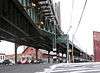 High Pumping Station |
November 10, 1983 (#83003882) |
Jerome Ave. 40°52′42″N 73°53′12″W |
Jerome Park | |
| 28 | House at 175 Belden Street | 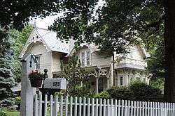 House at 175 Belden Street |
June 3, 1982 (#82003345) |
175 Belden St. 40°50′17″N 73°46′57″W |
City Island | |
| 29 | Jackson Avenue Subway Station (IRT) | 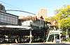 Jackson Avenue Subway Station (IRT) |
September 17, 2004 (#04001025) |
Junction of E. 152nd St. and Jackson and Westchester Aves. 40°49′00″N 73°54′29″W |
Melrose | Subway station (2 and 5 trains) |
| 30 | Jerome Park Reservoir |  Jerome Park Reservoir |
September 7, 2000 (#00001014) |
Goulden, Reservoir and Sedgwick Aves. 40°52′40″N 73°53′44″W |
Jerome Park | |
| 31 | Keeper's House at Williamsbridge Reservoir | 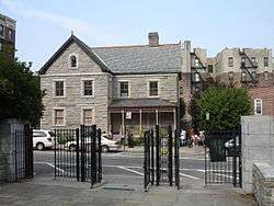 Keeper's House at Williamsbridge Reservoir |
September 24, 1999 (#99001131) |
3400 Reservoir Oval 40°52′43″N 73°52′34″W |
Norwood | |
| 32 | Lisanti Chapel | 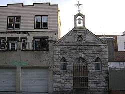 Lisanti Chapel |
January 11, 2002 (#01001447) |
740 E. 215th St. 40°52′48″N 73°51′48″W |
Baychester | |
| 33 | Longwood Historic District | 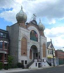 Longwood Historic District |
September 26, 1983 (#83001640) |
Roughly bounded by Beck St., Longwood, Leggett, and Prospect Aves. 40°49′00″N 73°54′00″W |
Longwood | |
| 34 | Lorillard Snuff Mill | 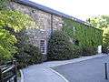 Lorillard Snuff Mill |
December 22, 1977 (#77000935) |
Bronx Botanical Garden 40°51′36″N 73°52′35″W |
Bronx Park | |
| 35 | Morris High School Historic District | 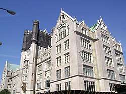 Morris High School Historic District |
September 15, 1983 (#83001641) |
Roughly bounded by Boston Rd., Jackson and Forrest Aves., and E. 166th and Home Sts. 40°49′38″N 73°54′15″W |
Morrisania | |
| 36 | Morris Park Station | 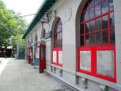 Morris Park Station |
July 6, 2005 (#05000677) |
Under Espalanade at Bogart and Colden Ave. and Hone Ave. 40°51′17″N 73°51′37″W |
Morris Park | Subway station (5 train) |
| 37 | Mott Avenue Control House | Mott Avenue Control House |
May 6, 1980 (#80002590) |
149th St. and Grand Concourse 40°49′07″N 73°55′39″W |
Mott Haven | Subway control house for 2, 4, and 5 trains |
| 38 | Mott Haven Historic District | 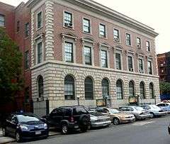 Mott Haven Historic District |
March 25, 1980 (#80002586) |
An irregular pattern along Alexander Ave. and E. 140th St. 40°48′37″N 73°55′32″W |
Mott Haven | |
| 39 | New York Botanical Garden |  New York Botanical Garden |
May 28, 1967 (#67000009) |
Southern and Bedford Park Blvds. 40°51′49″N 73°52′34″W |
Bronx Park | |
| 40 | New York, Westchester and Boston Railroad Administration Building |  New York, Westchester and Boston Railroad Administration Building |
April 23, 1980 (#80002587) |
481 Morris Park Ave. 40°50′29″N 73°52′23″W |
Van Nest | |
| 41 | Park Plaza Apartments | 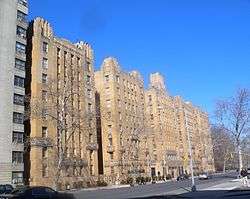 Park Plaza Apartments |
June 3, 1982 (#82003346) |
1005 Jerome Ave. 40°49′50″N 73°55′30″W |
Concourse | |
| 42 | Pelham Parkway Station (Dual System IRT) | 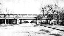 Pelham Parkway Station (Dual System IRT) |
March 30, 2005 (#05000228) |
Junction of White Plains Rd. and Pelham Pkwy 40°51′26″N 73°52′03″W |
Pelham Parkway | Subway station (2 and 5 trains) |
| 43 | Poe Cottage | 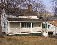 Poe Cottage |
August 19, 1980 (#80002588) |
2640 Grand Concourse 40°51′55″N 73°53′40″W |
Fordham | |
| 44 | Port Morris Ferry Bridges |  Port Morris Ferry Bridges |
February 5, 2014 (#13001150) |
106 Locust Ave. 40°47′58″N 73°54′29″W |
Port Morris | |
| 45 | Prospect Avenue Subway Station (IRT) | Prospect Avenue Subway Station (IRT) |
September 17, 2004 (#04001026) |
Junction of Westchester and Lonwood Aves. and Prospect St. 40°49′11″N 73°54′08″W |
Melrose and Longwood | Subway station (2 and 5 trains) |
| 46 | Public School 11 | 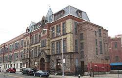 Public School 11 |
September 8, 1983 (#83001642) |
1257 Ogden Ave. 40°50′23″N 73°55′35″W |
Highbridge | |
| 47 | Public School 15 | 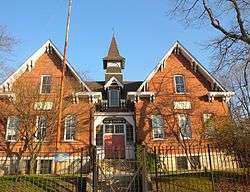 Public School 15 |
December 10, 1981 (#81000401) |
4010 Dyre Ave. 40°53′27″N 73°49′52″W |
Eastchester | |
| 48 | Public School 17 | 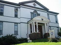 Public School 17 |
September 27, 1984 (#84002065) |
190 Fordham St. 40°50′49″N 73°47′05″W |
City Island | |
| 49 | Rainey Memorial Gates | .jpg) Rainey Memorial Gates |
March 16, 1972 (#72000823) |
New York Zoological Park 40°51′18″N 73°52′40″W |
Bronx Park | Paul Manship, Sculptor; Charles A Platt, architect |
| 50 | C. Rieger's Sons Factory | 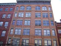 C. Rieger's Sons Factory |
May 27, 2004 (#04000543) |
450-452 E. 148th St. 40°48′51″N 73°55′01″W |
Mott Haven | |
| 51 | Riverdale–Spuyten Duyvil–Kingsbridge Memorial Bell Tower | 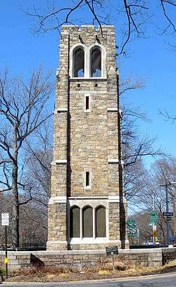 Riverdale–Spuyten Duyvil–Kingsbridge Memorial Bell Tower |
January 3, 2012 (#11000967) |
Riverdale Ave. at W. 239th St. & Henry Hudson Pkwy. 40°53′21″N 73°54′30″W |
Riverdale | |
| 52 | Riverdale Presbyterian Church Complex | 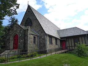 Riverdale Presbyterian Church Complex |
October 14, 1982 (#82001092) |
4761-4765 Henry Hudson Parkway 40°53′45″N 73°54′32″W |
Riverdale | |
| 53 | St. Ann's Church Complex |  St. Ann's Church Complex |
April 16, 1980 (#80002589) |
295 St. Ann's Ave. 40°48′30″N 73°55′03″W |
Mott Haven | |
| 54 | St. Anselm's Roman Catholic Church and School |  St. Anselm's Roman Catholic Church and School |
February 5, 2014 (#13001151) |
683 Tinton Ave. 40°48′58″N 73°54′20″W |
Mott Haven | |
| 55 | St. James' Episcopal Church and Parish House | 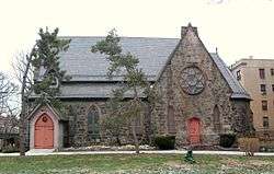 St. James' Episcopal Church and Parish House |
September 30, 1982 (#82003347) |
2500 Jerome Ave. 40°51′50″N 73°54′00″W |
Fordham | |
| 56 | St. Peter's Church, Chapel and Cemetery Complex |  St. Peter's Church, Chapel and Cemetery Complex |
September 26, 1983 (#83001643) |
2500 Westchester Ave. 40°50′17″N 73°50′41″W |
Westchester Square | |
| 57 | St. Stephen's Methodist Church | 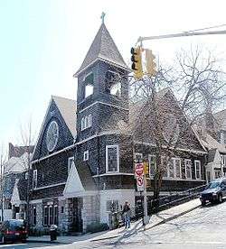 St. Stephen's Methodist Church |
February 8, 2012 (#12000008) |
146 W. 228th St. 40°52′37″N 73°54′33″W |
Marble Hill, Manhattan | |
| 58 | Saxe Embroidery Company Building | 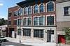 Saxe Embroidery Company Building |
February 22, 2018 (#100002072) |
511-513 E 164th St. 40°49′33″N 73°54′31″W |
Morrisania | 1904 factory is only architect-designed textile manufacturing facility in the Bronx; has housed a number of different industrial concerns over the years |
| 59 | Simpson Street Subway Station and Substation #18 (IRT) | 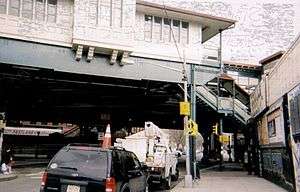 Simpson Street Subway Station and Substation #18 (IRT) |
September 17, 2004 (#04001027) |
Junction of Westchester Ave., bet. Simpson St. and Southern Blvd. 40°49′27″N 73°53′37″W |
Longwood | Subway station (2 and 5 trains) and Substation #18 |
| 60 | Henry F. Spaulding Coachman's House | 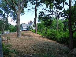 Henry F. Spaulding Coachman's House |
November 4, 1982 (#82001093) |
4970 Independence Ave. 40°53′53″N 73°54′41″W |
Riverdale | |
| 61 | Sunnyslope | 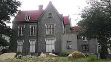 Sunnyslope |
September 15, 1983 (#83001644) |
812 Faile St. 40°49′02″N 73°53′14″W |
Hunts Point | |
| 62 | Tremont Baptist Church |  Tremont Baptist Church |
October 16, 2009 (#09000831) |
324 E. Tremont Ave. 40°50′54″N 73°54′08″W |
Tremont | |
| 63 | United Workers Cooperatives | 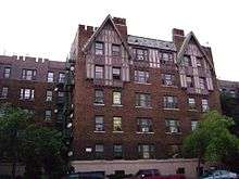 United Workers Cooperatives |
September 11, 1986 (#86002518) |
2700-2870 Bronx Park E 40°51′59″N 73°52′11″W |
Bronx Park | |
| 64 | US Post Office-Morrisania | 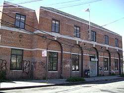 US Post Office-Morrisania |
November 17, 1988 (#88002458) |
442 E. 167th St. 40°49′47″N 73°54′34″W |
Morrisania | |
| 65 | University Heights Campus (Bronx Community College of The City University of New York) | 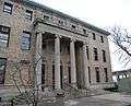 University Heights Campus (Bronx Community College of The City University of New York) |
October 16, 2012 (#12001013) |
West 181st St. and University Ave. 40°51′29″N 73°54′45″W |
University Heights | |
| 66 | Valentine-Varian House | 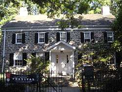 Valentine-Varian House |
March 21, 1978 (#78001841) |
3266 Bainbridge Ave. 40°52′38″N 73°52′47″W |
Norwood | |
| 67 | Frederick Van Cortlandt House | 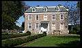 Frederick Van Cortlandt House |
December 24, 1967 (#67000010) |
Van Cortlandt Park at 242nd St. 40°53′40″N 73°53′35″W |
Van Cortlandt Park | |
| 68 | Washington Bridge | 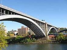 Washington Bridge |
September 22, 1983 (#83001645) |
Between Amsterdam and Undercliff Aves. 40°50′42″N 73°55′29″W |
Morris Heights | Bridge from Harlem to the Bronx |
| 69 | Wave Hill | 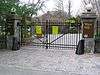 Wave Hill |
September 9, 1983 (#83001646) |
675 W. 252nd St. 40°53′55″N 73°54′47″W |
Riverdale | |
| 70 | Westchester Square Station (Dual System IRT) | 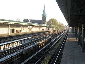 Westchester Square Station (Dual System IRT) |
March 30, 2005 (#05000227) |
Above Westchester Ave., from Overing St. to Ferris Place 40°50′23″N 73°50′38″W |
Westchester Square | Subway station (6 and <6> trains) |
| 71 | Williamsbridge Oval Park | 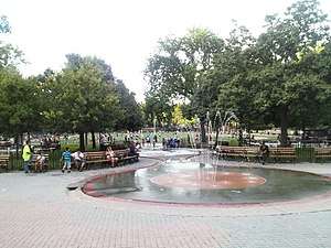 Williamsbridge Oval Park |
May 14, 2015 (#15000229) |
Reservoir Oval E. & W. 40°52′39″N 73°52′39″W |
Norwood | WPA-funded park built on former reservoir site in 1937 features a Beaux Arts landscape and modernist recreation center |
| 72 | Woodlawn Cemetery |  Woodlawn Cemetery |
June 23, 2011 (#11000563) |
Webster Avenue & East 233rd Street 40°53′43″N 73°51′49″W |
Woodlawn | Cemetery illustrates transition from rural cemetery to 20th-century styles; final resting place of Robert Moses, Elizabeth Cady Stanton and Jay Gould, among others. |
| 73 | Woodlawn Station (Dual System IRT) | 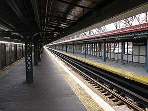 Woodlawn Station (Dual System IRT) |
July 6, 2005 (#05000679) |
Junction of Bainbridge Ave. and Jerome Ave. 40°53′09″N 73°52′45″W |
Norwood near Woodlawn | Subway station (4 train); Arts and Crafts-inspired terminal station |
See also
| Wikimedia Commons has media related to National Register of Historic Places in Bronx County, New York. |
- Statewide: National Register of Historic Places listings in New York
- Citywide: Manhattan, Queens, Staten Island, Brooklyn
- List of New York City Designated Landmarks in The Bronx
References
- The latitude and longitude information provided in this table was derived originally from the National Register Information System, which has been found to be fairly accurate for about 99% of listings. Some locations in this table may have been corrected to current GPS standards.
- "National Register of Historic Places: Weekly List Actions". National Park Service, United States Department of the Interior. Retrieved on June 19, 2020.
- Numbers represent an ordering by significant words. Various colorings, defined here, differentiate National Historic Landmarks and historic districts from other NRHP buildings, structures, sites or objects.
- The eight-digit number below each date is the number assigned to each location in the National Register Information System database, which can be viewed by clicking the number.
External links
- A useful list of the above sites, with street addresses and other information, is available at Bronx County listing, at National Register of Historic Places.Com, a private site serving up public domain information on NRHPs.
| Topics |  | |
|---|---|---|
| Lists by county |
| |
| Lists by city | ||
| Other lists | ||
| ||
| South Bronx |  | |
|---|---|---|
| West Bronx | ||
| East Bronx | ||
| Related areas |
| |
This article is issued from Wikipedia. The text is licensed under Creative Commons - Attribution - Sharealike. Additional terms may apply for the media files.