National Register of Historic Places listings in Montgomery County, New York
List of the National Register of Historic Places listings in Montgomery County, New York
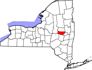
Location of Montgomery County in New York
This is intended to be a complete list of properties and districts listed on the National Register of Historic Places in Montgomery County, New York. The locations of National Register properties and districts (at least for all showing latitude and longitude coordinates below) may be seen in a map by clicking on "Map of all coordinates".[1] Four properties are further designated National Historic Landmarks.
- This National Park Service list is complete through NPS recent listings posted June 19, 2020.[2]
| Albany (Albany) – Allegany – Bronx – Broome – Cattaraugus – Cayuga – Chautauqua – Chemung – Chenango – Clinton – Columbia – Cortland – Delaware – Dutchess (Poughkeepsie, Rhinebeck) – Erie (Buffalo) – Essex – Franklin – Fulton – Genesee – Greene – Hamilton – Herkimer – Jefferson – Kings – Lewis – Livingston – Madison – Monroe (Rochester) – Montgomery – Nassau – New York (Below 14th Street, 14th to 59th Streets, 59th to 110th Streets, Above 110th Street, Islands) – Niagara – Oneida – Onondaga – Ontario – Orange – Orleans – Oswego – Otsego – Putnam – Queens – Rensselaer – Richmond – Rockland – St. Lawrence – Saratoga – Schenectady – Schoharie – Schuyler – Seneca – Steuben – Suffolk – Sullivan – Tioga – Tompkins – Ulster – Warren – Washington – Wayne – Westchester (Northern, Southern, New Rochelle, Peekskill, Yonkers) – Wyoming – Yates |
Listings county-wide
| [3] | Name on the Register | Image | Date listed[4] | Location | City or town | Description |
|---|---|---|---|---|---|---|
| 1 | Ames Academy Building | 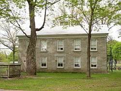 Ames Academy Building |
January 24, 2002 (#01001496) |
611 Latimer Hill Rd. 42°50′13″N 74°36′00″W |
Ames | |
| 2 | Amsterdam (46th Separate Company) Armory |  Amsterdam (46th Separate Company) Armory |
July 1, 1994 (#94000658) |
Junction of Florida Ave. and Dewitt St., southwest corner 42°55′58″N 74°11′59″W |
Amsterdam | |
| 3 | Amsterdam City Hall | February 5, 2001 (#00001687) |
61 Church St. 42°56′20″N 74°11′19″W |
Amsterdam | ||
| 4 | Amsterdam Free Library | December 23, 2019 (#100004800) |
28 Church St. 42°56′15″N 74°11′27″W |
Amsterdam | 1903 Beaux-Arts building by Albany architect Albert W. Fuller | |
| 5 | Bates-Englehardt Mansion | 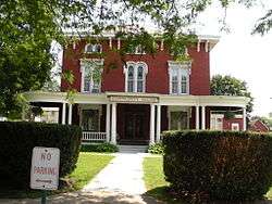 Bates-Englehardt Mansion |
December 7, 1989 (#89002091) |
19 Washington St. 42°59′59″N 74°40′38″W |
St. Johnsville | |
| 6 | Bragdon-Lipe House | 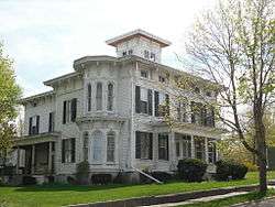 Bragdon-Lipe House |
October 5, 2005 (#05001123) |
17 Otsego St. 42°54′14″N 74°34′28″W |
Canajoharie | |
| 7 | Walter Butler Homestead | June 23, 1976 (#76001229) |
Northeast of Fonda on Old Trail Rd. 42°57′43″N 74°21′17″W |
Fonda | ||
| 8 | Canajoharie Historic District |  Canajoharie Historic District |
May 18, 2015 (#15000233) |
Roughly Church, Cliff, E. and W. Main, Mill, Moyer, Rock, and Reed Sts., and Erie Boulevard 42°54′11″N 74°34′16″W |
Canajoharie | Historic Mohawk Valley village |
| 9 | Caughnawaga Indian Village Site | 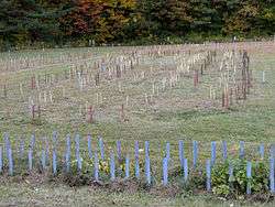 Caughnawaga Indian Village Site |
August 28, 1973 (#73001207) |
Address Restricted 42°57′07″N 74°23′26″W |
Fonda | |
| 10 | Chalmers Knitting Mills | 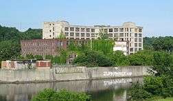 Chalmers Knitting Mills |
February 22, 2010 (#10000028) |
21-41 Bridge St. 42°56′07″N 74°11′47″W |
Amsterdam | Demolished. |
| 11 | Danascara Place | December 30, 2019 (#100004819) |
662 Mohawk Dr. 42°56′23″N 74°19′03″W |
Tribes Hill | 18th-century house of Revolutionary War veteran renovated in Italian villa style in 1870 | |
| 12 | Ehle House Site | Ehle House Site |
June 14, 1982 (#82004780) |
Address Restricted |
Nelliston | |
| 13 | Peter Ehle House | September 27, 1980 (#80002655) |
E. Main St. 42°55′24″N 74°36′05″W |
Nelliston | ||
| 14 | Enlarged Double Lock No. 33 Old Erie Canal | 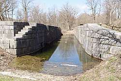 Enlarged Double Lock No. 33 Old Erie Canal |
April 1, 2002 (#02000315) |
Towpath Rd. 42°59′26″N 74°40′02″W |
St. Johnsville | |
| 15 | Erie Canal | 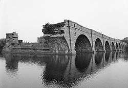 Erie Canal |
October 15, 1966 (#66000530) |
6 miles (9.7 km) west of Amsterdam on NY 5S 42°56′38″N 74°16′02″W |
Fort Hunter | Ruins of Erie Canal aqueduct over Schoharie Creek, and 3.5 mile segment of canal |
| 16 | First Baptist Church | .jpg) First Baptist Church |
January 21, 1994 (#93001546) |
Polin Rd. 42°50′55″N 74°20′43″W |
Charleston | |
| 17 | First Methodist Episcopal Church of St. Johnsville | 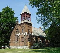 First Methodist Episcopal Church of St. Johnsville |
February 5, 2013 (#12001259) |
5 W. Main St. 42°59′55″N 74°40′45″W |
St. Johnsville | |
| 18 | Fort Johnson |  Fort Johnson |
November 28, 1972 (#72000858) |
Junction of NY 5 and NY 67 42°57′30″N 74°14′00″W |
Fort Johnson | |
| 19 | Fort Klock | 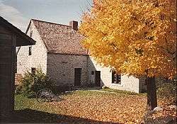 Fort Klock |
November 28, 1972 (#72000859) |
2 miles (3.2 km) east of St. Johnsville on NY 5 42°59′06″N 74°39′01″W |
St. Johnsville | |
| 20 | Fort Plain Conservation Area | November 15, 1979 (#79001591) |
Address Restricted |
Fort Plain | ||
| 21 | Fort Plain Historic District |  Fort Plain Historic District |
August 15, 2012 (#12000510) |
Roughly area around Canal & Main Sts. 42°55′51″N 74°37′22″W |
Fort Plain | |
| 22 | Frey House | %2C_Palatine_Bridge_(Montgomery_County%2C_New_York).jpg) Frey House |
December 31, 2002 (#02001644) |
NY 5 42°54′43″N 74°35′04″W |
Palatine Bridge | |
| 23 | Fultonville Historic District | August 8, 2019 (#100004242) |
Generally Main St., Prospect St., Franklin St., Union St., Riverside Dr. 42°56′52″N 74°21′56″W |
Fultonville | Village with many intact buildings reflecting development from early settlement through canal era and after | |
| 24 | Caspar Getman Farmstead | August 30, 2010 (#10000594) |
1311 Stone Arabia Rd. 42°57′50″N 74°30′43″W |
Stone Arabia | ||
| 25 | Glen Historic District |  Glen Historic District |
August 8, 2001 (#01000844) |
NY 30A, NY 161 and Logtown Rd. 42°53′40″N 74°20′33″W |
Glen | |
| 26 | Gray-Jewett House | October 5, 2005 (#05001127) |
80 Florida Ave. 42°56′01″N 74°12′00″W |
Amsterdam | ||
| 27 | Green Hill Cemetery | March 15, 2005 (#05000166) |
Church and Cornell Sts. 42°56′16″N 74°11′05″W |
Amsterdam | ||
| 28 | Greene Mansion | 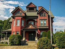 Greene Mansion |
December 31, 1979 (#79001590) |
92 Market St. 42°56′24″N 74°11′27″W |
Amsterdam | |
| 29 | Guy Park | 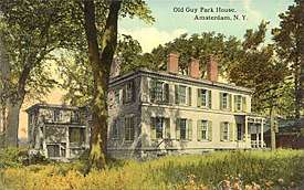 Guy Park |
February 6, 1973 (#73001206) |
W. Main St. 42°56′49″N 74°12′36″W |
Amsterdam | |
| 30 | Guy Park Avenue School | June 2, 1995 (#95000669) |
300 Guy Park Ave. 42°56′59″N 74°12′31″W |
Amsterdam | ||
| 31 | Hurricana Stock Farm | May 22, 2013 (#13000308) |
NY 30 42°57′30″N 74°11′08″W |
Amsterdam | ||
| 32 | Samuel and Johanna Jones Farm | May 27, 1993 (#93000460) |
NY 67 west of the junction with NY 296 42°57′51″N 74°06′29″W |
Amsterdam | ||
| 33 | Kilts Farmstead | September 18, 2009 (#09000721) |
Address restricted |
Stone Arabia | ||
| 34 | Lasher-Davis House | September 27, 1980 (#80002656) |
U.S. 5 42°56′09″N 74°36′55″W |
Nelliston | ||
| 35 | Nellis Tavern | 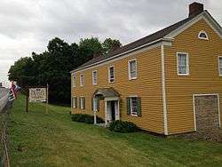 Nellis Tavern |
May 10, 1990 (#90000685) |
SR 5 42°59′37″N 74°39′33″W |
St. Johnsville | |
| 36 | Jacob Nellis Farmhouse | September 27, 1980 (#80002657) |
Nellis St. 42°56′00″N 74°36′27″W |
Nelliston | ||
| 37 | Nelliston Historic District | 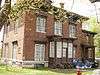 Nelliston Historic District |
September 27, 1980 (#80002658) |
Prospect, River, Railroad and Berthoud Sts. 42°56′02″N 74°37′00″W |
Nelliston | |
| 38 | Nelliston School | December 31, 2002 (#02001645) |
Stone Arabia St. 42°56′08″N 74°36′49″W |
Nelliston | ||
| 39 | New York State Barge Canal | .jpg) New York State Barge Canal |
October 15, 2014 (#14000860) |
Linear across county 42°56′46″N 74°12′40″W |
Amsterdam, Canajoharie, Fonda, Glen, Minden, Mohawk, Palatine and St. Johnsville | Successor to Erie Canal approved by state voters in early 20th century to compete with railroads |
| 40 | Palatine Bridge Freight House | March 7, 1973 (#73001208) |
East of Palatine Bridge on NY 5 42°54′36″N 74°33′59″W |
Palatine Bridge | ||
| 41 | Palatine Bridge Historic District | September 6, 2019 (#100004358) |
Carman Ct., Center St., Frey Dr./Ln., Grand (E&W) St., Humbert Ln., Lafeyette St., Spring St., Tilton Rd. 42°54′40″N 74°34′27″E |
Palatine Bridge | 136-acre (55 ha) core of historic village settled by Palatine Germans in late 18th-century, with development from subsequent eras up to World War II. | |
| 42 | Palatine Church | 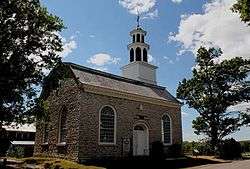 Palatine Church |
January 25, 1973 (#73001209) |
Mohawk Tpke. 42°58′08″N 74°37′44″W |
Palatine | |
| 43 | Pawling Hall | November 15, 2002 (#02001331) |
86 Pawling St. 42°58′39″N 74°09′07″W |
Hagaman | ||
| 44 | Margaret Reaney Memorial Library |  Margaret Reaney Memorial Library |
April 16, 2012 (#12000210) |
19 Kingsbury Ave. 42°59′49″N 74°40′38″W |
St. Johnsville | |
| 45 | Reformed Dutch Church of Stone Arabia | 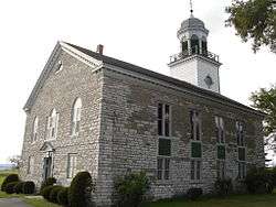 Reformed Dutch Church of Stone Arabia |
September 14, 1977 (#77000951) |
East of Nelliston on NY 10 42°56′33″N 74°33′24″W |
Nelliston | |
| 46 | Rice's Woods | July 18, 1980 (#80002654) |
Address Restricted |
Canajoharie | ||
| 47 | John Smith Farm | January 31, 2012 (#11001061) |
1059 NY 80 42°56′08″N 74°42′17″W |
Hallsville | ||
| 48 | St. Johnsville Historic District | April 5, 2019 (#100003628) |
Generally E. & W. Main, N. & S. Division, Bridge, Lion, Falling, Monroe, Center, Kingsbury, Church, William, Hough & Sanders Sts. 42°59′56″N 74°40′44″W |
St. Johnsville | Almost the entire village included in district that documents the village's evolution from a late 18th century mill into a 19th-century industrial town | |
| 49 | Saint Stanislaus Roman Catholic Church Complex |  Saint Stanislaus Roman Catholic Church Complex |
April 29, 1999 (#99000505) |
42, 46, 50 Cornell St., 73 Reid St. 42°56′39″N 74°10′58″W |
Amsterdam | |
| 50 | Stone Grist Mill Complex | February 23, 1996 (#96000140) |
1679 Mill Rd. 43°00′17″N 74°41′47″W |
St. Johnsville | ||
| 51 | Samuel Sweet Canal Store | September 19, 1989 (#89001389) |
65 Bridge St. 42°56′04″N 74°11′54″W |
Amsterdam | ||
| 52 | Temple of Israel | 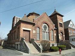 Temple of Israel |
August 27, 1992 (#92001043) |
8 Mohawk Pl. 42°56′22″N 74°11′41″W |
Amsterdam | |
| 53 | Trinity Lutheran Church and Cemetery | .jpg) Trinity Lutheran Church and Cemetery |
January 5, 2005 (#04001440) |
5430 NY 10 42°56′28″N 74°33′46″W |
Stone Arabia | |
| 54 | US Post Office-Amsterdam | 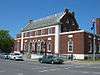 US Post Office-Amsterdam |
November 17, 1988 (#88002451) |
12-16 Church St. 42°56′14″N 74°11′31″W |
Amsterdam | |
| 55 | US Post Office-Canajoharie | November 17, 1988 (#88002464) |
50 W. Main St. 42°54′23″N 74°33′41″W |
Canajoharie | ||
| 56 | US Post Office-Fort Plain | 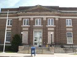 US Post Office-Fort Plain |
May 11, 1989 (#88002510) |
41 River St. 42°55′54″N 74°37′23″W |
Fort Plain | |
| 57 | US Post Office-St. Johnsville | 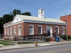 US Post Office-St. Johnsville |
May 11, 1989 (#88002434) |
15 E. Main St.[5] 42°59′55″N 74°40′42″W |
St. Johnsville | |
| 58 | Van Alstyne House | .jpg) Van Alstyne House |
September 8, 1983 (#83001711) |
Moyer St. 42°54′12″N 74°34′22″W |
Canajoharie | |
| 59 | Van Wie Farmstead | July 14, 2011 (#11000450) |
269 Brower Rd. 42°54′10″N 74°31′31″W |
McKinley | ||
| 60 | Vrooman Avenue School | June 30, 1983 (#83001712) |
Vrooman Ave. 42°56′08″N 74°10′30″W |
Amsterdam | ||
| 61 | Webster Wagner House | 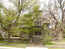 Webster Wagner House |
March 7, 1973 (#73001210) |
E. Grand St. 42°54′39″N 74°34′10″W |
Palatine Bridge | |
| 62 | Walrath-Van Horne House |  Walrath-Van Horne House |
September 27, 1980 (#80002659) |
W. Main St. 42°56′29″N 74°37′08″W |
Nelliston | |
| 63 | Waterman-Gramps House | September 27, 1980 (#80002660) |
School St. 42°56′13″N 74°36′45″W |
Nelliston | ||
| 64 | West Hill School |  West Hill School |
April 11, 2002 (#02000359) |
3 Otsego St. 42°54′17″N 74°34′25″W |
Canajoharie | |
| 65 | Windfall Dutch Barn | November 22, 2000 (#00001411) |
Clinton Rd. at the junction with Ripple Rd. 42°51′32″N 74°44′40″W |
Salt Springville |
See also
| Wikimedia Commons has media related to National Register of Historic Places in Montgomery County, New York. |
References
- The latitude and longitude information provided in this table was derived originally from the National Register Information System, which has been found to be fairly accurate for about 99% of listings. Some locations in this table may have been corrected to current GPS standards.
- "National Register of Historic Places: Weekly List Actions". National Park Service, United States Department of the Interior. Retrieved on June 19, 2020.
- Numbers represent an ordering by significant words. Various colorings, defined here, differentiate National Historic Landmarks and historic districts from other NRHP buildings, structures, sites or objects.
- The eight-digit number below each date is the number assigned to each location in the National Register Information System database, which can be viewed by clicking the number.
- Address based on USPS website. Accessed April 1, 2016.
| Topics |  | |
|---|---|---|
| Lists by county |
| |
| Lists by city | ||
| Other lists | ||
| ||
This article is issued from Wikipedia. The text is licensed under Creative Commons - Attribution - Sharealike. Additional terms may apply for the media files.