National Register of Historic Places listings in Manhattan below 14th Street
List of the National Register of Historic Places listings in Manhattan below 14th Street
This is intended to be a complete list of properties and districts listed on the National Register of Historic Places in Manhattan below 14th Street, which is a large portion of New York County, New York. For properties and districts in other parts of Manhattan and the other islands of New York County, see National Register of Historic Places listings in New York County, New York. The locations of National Register properties and districts (at least for all showing latitude and longitude coordinates below) may be seen in an online map by clicking on "Map of all coordinates".[1]
There are 184 properties and districts, including eight ships.
- This National Park Service list is complete through NPS recent listings posted June 19, 2020.[2]
| Albany (Albany) – Allegany – Bronx – Broome – Cattaraugus – Cayuga – Chautauqua – Chemung – Chenango – Clinton – Columbia – Cortland – Delaware – Dutchess (Poughkeepsie, Rhinebeck) – Erie (Buffalo) – Essex – Franklin – Fulton – Genesee – Greene – Hamilton – Herkimer – Jefferson – Kings – Lewis – Livingston – Madison – Monroe (Rochester) – Montgomery – Nassau – New York (Below 14th Street, 14th to 59th Streets, 59th to 110th Streets, Above 110th Street, Islands) – Niagara – Oneida – Onondaga – Ontario – Orange – Orleans – Oswego – Otsego – Putnam – Queens – Rensselaer – Richmond – Rockland – St. Lawrence – Saratoga – Schenectady – Schoharie – Schuyler – Seneca – Steuben – Suffolk – Sullivan – Tioga – Tompkins – Ulster – Warren – Washington – Wayne – Westchester (Northern, Southern, New Rochelle, Peekskill, Yonkers) – Wyoming – Yates |
Listings in Manhattan below 14th Street
| [3] | Name on the Register | Image | Date listed[4] | Location | Neighborhood | Description |
|---|---|---|---|---|---|---|
| 1 | 75 Murray Street Building | 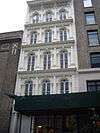 75 Murray Street Building |
April 3, 1973 (#73001213) |
75 Murray St. 40°42′53″N 74°00′40″W |
Tribeca | One of the earliest cast iron façades; created by James Bogardus; built in 1858 |
| 2 | ADMIRAL DEWEY (tugboat) | 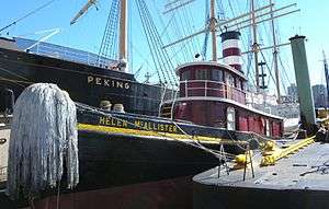 ADMIRAL DEWEY (tugboat) |
December 27, 2002 (#02001619) |
Pier 16, East River 40°42′19″N 74°00′11″W |
South Street Seaport | |
| 3 | African Burying Ground |  African Burying Ground |
April 19, 1993 (#93001597) |
Vicinity of Broadway and Reade St. 40°42′49″N 73°59′38″W |
Civic Center | Site containing the remains of over 400 Africans buried during the 17th and 18th centuries. |
| 4 | AMBROSE (lightship) | 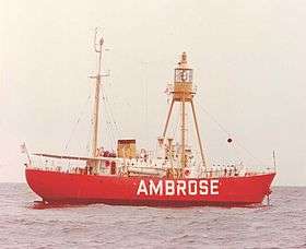 AMBROSE (lightship) |
September 7, 1984 (#84002758) |
Pier 16, East River, Manhattan 40°42′17″N 74°00′09″W |
South Street Seaport | Beacon for New York Harbor, 1908-1933; now at South Street Seaport Museum |
| 5 | American Bank Note Company Building | 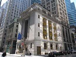 American Bank Note Company Building |
November 30, 1999 (#99001436) |
70 Broad St. 40°42′17″N 74°00′45″W |
Financial District | 1908 home of American Bank Note Company, engravers. Now owned by Global Financial Capital of New York, founded by the Maharishi Mahesh Yogi. |
| 6 | American Stock Exchange | 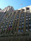 American Stock Exchange |
June 2, 1978 (#78001867) |
86 Trinity Pl. 40°42′30″N 74°00′48″W |
Financial District | Built in 1921; former headquarters of the American Stock Exchange |
| 7 | American Thread Building | 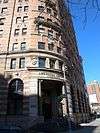 American Thread Building |
January 20, 2005 (#04001532) |
260 West Broadway 40°43′14″N 74°00′22″W |
Tribeca | |
| 8 | Astor Place Subway Station (IRT) | _by_David_Shankbone.jpg) Astor Place Subway Station (IRT) |
September 17, 2004 (#04001013) |
Junction of Bowery, Astor Place and Lafayette St. 40°43′48″N 73°59′30″W |
East Village | Subway station (4, 6, and <6> trains) completed in 1904; one of the original twenty-eight stations |
| 9 | Bank of New York Building | 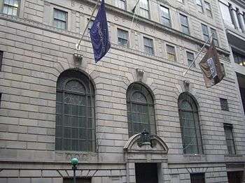 Bank of New York Building |
August 28, 2003 (#03000847) |
48 Wall St. 40°42′23″N 74°00′34″W |
Financial District | Built in 1928; land used by the bank since 1797; modified to house the Museum of American Finance |
| 10 | Battery Park Control House | 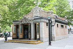 Battery Park Control House |
May 6, 1980 (#80002669) |
State St. and Battery Pl. 40°42′14″N 74°00′54″W |
Financial District | Subway control house for the 4 and 5 trains built in 1929; brick and stone structures meant to resemble garden pavilions; "Control house" refers to controlling the passenger flow |
| 11 | Bayard-Condict Building | 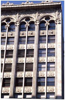 Bayard-Condict Building |
December 8, 1976 (#76001236) |
65-69 Bleecker St. 40°43′35″N 73°59′43″W |
Greenwich Village | Only work of architect Louis Sullivan in New York City; built between 1897 and 1899; Chicago school style |
| 12 | Beaver Building | 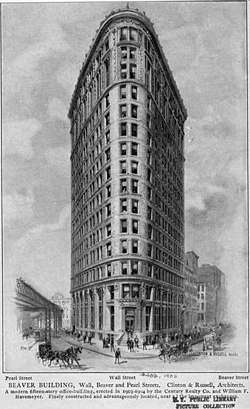 Beaver Building |
July 6, 2005 (#05000668) |
82-92 Beaver St. 40°42′18″N 74°00′32″W |
Financial District | Triangular-shaped building; designed by Clinton and Russell; completed in 1904 |
| 13 | Bell Telephone Laboratories |  Bell Telephone Laboratories |
May 15, 1975 (#75001202) |
463 West St. 40°44′12″N 74°00′35″W |
West Village | 13 building complex; home of Bell Telephone Laboratories between 1898 and 1966. See also Westbeth, which is for the same buildings but a different reason. |
| 14 | Beth Hamedrash Hagodol Synagogue |  Beth Hamedrash Hagodol Synagogue |
November 30, 1999 (#99001438) |
60-64 Norfolk St. 40°43′01″N 73°59′18″W |
Lower East Side | Orthodox synagogue; oldest Orthodox Russian Jewish congregation in the United States; Gothic Revival structure; 1850 |
| 15 | Bialystoker Synagogue |  Bialystoker Synagogue |
April 26, 1972 (#72000861) |
7-13 Willett St. 40°42′56″N 73°59′01″W |
Lower East Side | Fieldstone building; built in 1826; late Federal style architecture; originally Methodist Episcopal Church; now an Orthodox Jewish synagogue |
| 16 | Bleecker Street Subway Station (IRT) | 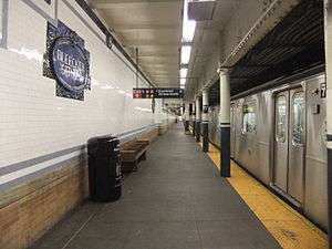 Bleecker Street Subway Station (IRT) |
September 17, 2004 (#04001012) |
Junction of Bleecker and Lafayette Sts. 40°43′35″N 73°59′43″W |
Greenwich Village | Subway station (4, 6, and <6> trains); features decorative ceramic plaques made for the original IRT subway by the Grueby Faience Company in 1904 |
| 17 | Bouwerie Lane Theater | 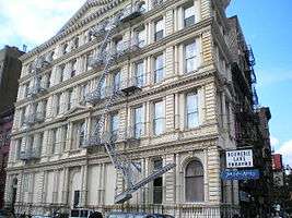 Bouwerie Lane Theater |
April 23, 1980 (#80002671) |
330 Bowery 40°43′32″N 73°59′11″W |
NoHo | Designed by Henry Engelbert; constructed from 1873-74; originally the Bond Street Savings Bank; cast iron building; French Second Empire style; converted to a theater in 1963 |
| 18 | The Bowery Historic District | 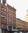 The Bowery Historic District |
February 20, 2013 (#13000027) |
Bowery between Chatham Square and Cooper Square 40°43′17″N 73°59′37″W |
The Bowery | One of the most architecturally diverse and historically significant streetscapes in the city; first residence for many immigrant groups. |
| 19 | Bowery Savings Bank | 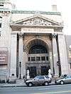 Bowery Savings Bank |
April 23, 1980 (#80002672) |
130 Bowery St. 40°43′08″N 73°59′44″W |
The Bowery | First headquarters of the Bowery Savings Bank; designed by Stanford White; built in 1893 |
| 20 | Bowling Green Fence and Park |  Bowling Green Fence and Park |
April 9, 1980 (#80002673) |
Broadway and Beaver Sts. 40°42′18″N 74°00′51″W |
South Ferry | Small public park in Lower Manhattan; oldest existing public park in New York City; origin point for ticker-tape parades |
| 21 | Broad Exchange Building | 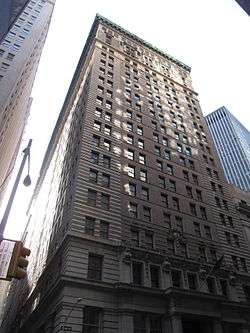 Broad Exchange Building |
April 13, 1998 (#98000366) |
25 Broad St. 40°42′21″N 74°00′41″W |
Financial District | 1902 building was the largest office building in the Financial District. It is now a luxury residential building. |
| 22 | Brooklyn Bridge |  Brooklyn Bridge |
October 15, 1966 (#66000523) |
Across the East River from Brooklyn to Manhattan 40°42′23″N 73°59′51″W |
Civic Center | One of the oldest suspension bridges in the United States; 5,989 feet (1825 m) long; iconic part of the New York skyline |
| 23 | Brooklyn Bridge-City Hall Subway Station (IRT) | 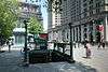 Brooklyn Bridge-City Hall Subway Station (IRT) |
July 6, 2005 (#05000674) |
Under Centre St. bet. Chambers and Frankfort Sts. 40°42′47″N 74°00′16″W |
Civic Center | Subway station (4, 5, 6, and <6> trains) |
| 24 | James Brown House | 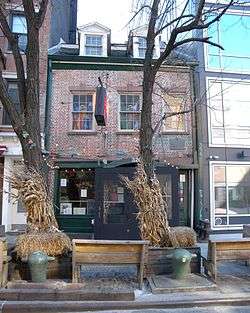 James Brown House |
August 11, 1983 (#83001717) |
326 Spring St. 40°43′33″N 74°00′35″W |
Hudson Square | Rare example of Federal architecture in New York; built before 1812; home of James Brown, Revolutionary War veteran; site of one of the oldest bars in the City |
| 25 | Building at 19 Rector St. |  Building at 19 Rector St. |
May 22, 2002 (#02000551) |
19 Rector St., 88 Greenwich St. 40°42′28″N 74°00′52″W |
Financial District | |
| 26 | Building at 21 West Street |  Building at 21 West Street |
March 12, 1999 (#99000316) |
21 West St. 40°42′22″N 74°00′57″W |
Financial District | |
| 27 | Building at 116 John Street | 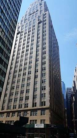 Building at 116 John Street |
June 20, 2014 (#14000331) |
116 John St. 40°42′27″N 74°00′22″W |
Financial District | Art Deco building from early 1930s is one of the last skyscrapers erected during 1920s building boom. Converted into apartments in 2010s. |
| 28 | Building at 254-260 Canal Street |  Building at 254-260 Canal Street |
June 7, 2006 (#06000475) |
254-260 Canal St. 40°43′06″N 74°00′05″W |
Chinatown | |
| 29 | Building at 376-380 Lafayette Street | 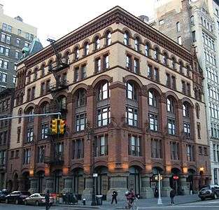 Building at 376-380 Lafayette Street |
December 28, 1979 (#79001600) |
376-380 Lafayette Street 40°43′38″N 73°59′41″W |
NoHo | |
| 30 | Building at 361 Broadway | 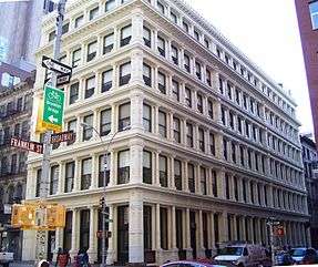 Building at 361 Broadway |
September 15, 1983 (#83001718) |
361 Broadway 40°43′02″N 74°00′15″W |
Tribeca | |
| 31 | Building at 85 Leonard Street | 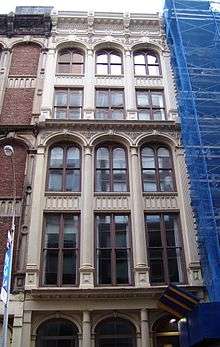 Building at 85 Leonard Street |
April 23, 1980 (#80002675) |
85 Leonard St. 40°43′03″N 74°00′19″W |
Tribeca | |
| 32 | Caffe Cino | November 9, 2017 (#100001802) |
31 Cornelia St. 40°43′53″N 74°00′08″W |
West Village | Café recognized as the birthplace of off-off-Broadway theatre, and for pioneering gay theatre in early 1970s. | |
| 33 | Cary Building | 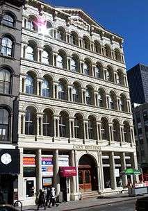 Cary Building |
September 15, 1983 (#83001719) |
105-107 Chambers St. 40°42′55″N 74°00′30″W |
Tribeca | |
| 34 | Castle Clinton National Monument | 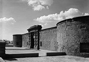 Castle Clinton National Monument |
October 15, 1966 (#66000537) |
South Ferry 40°42′12″N 74°01′01″W |
Battery Park | |
| 35 | Chamber of Commerce | 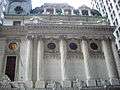 Chamber of Commerce |
February 6, 1973 (#73001214) |
65 Liberty St. 40°42′32″N 74°00′36″W |
Financial District | |
| 36 | Chambers Street Subway station (Dual System BMT) | 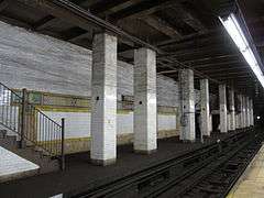 Chambers Street Subway station (Dual System BMT) |
July 6, 2005 (#05000669) |
Beneath the Municipal Building at Chambers, Centre and Duane Sts. and Lafayette Plaza 40°42′47″N 74°00′14″W |
Civic Center | Subway station (J and Z trains) |
| 37 | Chambers Street Subway station (Dual System IRT) | 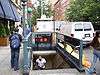 Chambers Street Subway station (Dual System IRT) |
March 30, 2005 (#05000234) |
Under West Broadway bet Warren, Chambers and Reade Sts. 40°42′56″N 74°00′35″W |
Financial District, and Tribeca | Subway station (1, 2, and 3 trains) |
| 38 | Charles Street House at No. 131 |  Charles Street House at No. 131 |
November 3, 1972 (#72000866) |
131 Charles St. 40°44′04″N 74°00′28″W |
West Village | |
| 39 | Charlton-King-Vandam Historic District |  Charlton-King-Vandam Historic District |
July 20, 1973 (#73001215) |
Roughly bounded by Varick, Vandam, MacDougal and King Sts. 40°43′38″N 74°00′15″W |
South Village | |
| 40 | Chinatown and Little Italy Historic District |  Chinatown and Little Italy Historic District |
February 12, 2010 (#10000012) |
Roughly bounded by Baxter St., Centre St., Cleveland Pl. and Lafayette St. to the W; Jersey St. and E. Houston 40°43′11″N 73°59′55″W |
Chinatown and Little Italy | Chinatown and Little Italy are two of the city's most significant ethnic enclaves |
| 41 | Christodora House |  Christodora House |
March 20, 1986 (#86000486) |
147 Ave. B 40°43′35″N 73°58′50″W |
East Village and Alphabet City | Apex of idealistic settlement movement in New York |
| 42 | Church of the Ascension (Protestant Episcopal) |  Church of the Ascension (Protestant Episcopal) |
December 23, 1987 (#87002593) |
36-38 Fifth Ave. 40°44′01″N 73°59′46″W |
Greenwich Village | |
| 43 | Church of the Transfiguration | Church of the Transfiguration |
April 16, 1980 (#80002682) |
25 Mott St. 40°42′53″N 73°59′57″W |
Chinatown | |
| 44 | City Hall | 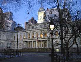 City Hall |
October 15, 1966 (#66000539) |
Broadway and Chambers St. 40°42′48″N 74°00′20″W |
Civic Center | |
| 45 | City Hall Subway Station (IRT) | 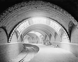 City Hall Subway Station (IRT) |
September 17, 2004 (#04001010) |
Park Row and City Hall Park 40°42′42″N 74°00′26″W |
Civic Center | Subway station (closed) |
| 46 | City Pier A | 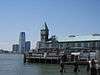 City Pier A |
June 27, 1975 (#75001203) |
S end of Battery Pl. at Hudson River 40°42′15″N 74°01′06″W |
Battery Park | |
| 47 | Cooper Union | 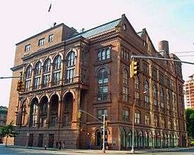 Cooper Union |
October 15, 1966 (#66000540) |
Cooper Square, 7th St., and 4th Ave. 40°43′45″N 73°59′27″W |
East Village | |
| 48 | Corbin Building | 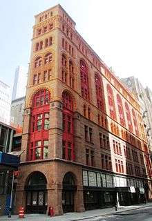 Corbin Building |
December 18, 2003 (#03001302) |
192 Broadway 40°42′36″N 74°00′34″W |
Financial District | |
| 49 | Devinne Press Building | 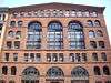 Devinne Press Building |
September 14, 1977 (#77000955) |
393-399 Lafayette St. 40°43′40″N 73°59′36″W |
NoHo | |
| 50 | Eldridge Street Synagogue | 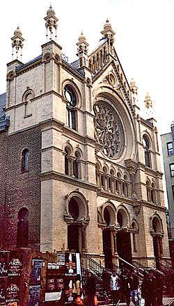 Eldridge Street Synagogue |
March 28, 1980 (#80002687) |
12-16 Eldridge St. 40°42′53″N 73°59′39″W |
Chinatown | |
| 51 | Eleventh Street Methodist Episcopal Church | 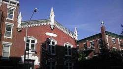 Eleventh Street Methodist Episcopal Church |
December 30, 2011 (#11000968) |
543-547 E. 11th St. 40°43′40″N 73°58′47″W |
East Village | |
| 52 | Empire Building | 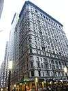 Empire Building |
August 28, 1998 (#83004643) |
71 Broadway 40°42′26″N 74°00′47″W |
Financial District | |
| 53 | Equitable Building |  Equitable Building |
June 2, 1978 (#78001869) |
120 Broadway 40°42′29″N 74°00′39″W |
Financial District | |
| 54 | Federal Hall National Memorial |  Federal Hall National Memorial |
October 15, 1966 (#66000095) |
Wall and Nassau Sts. 40°42′26″N 74°00′38″W |
Financial District | |
| 55 | Federal Office Building | 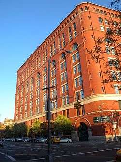 Federal Office Building |
August 30, 1974 (#74001267) |
641 Washington St. 40°43′56″N 74°00′31″W |
Greenwich Village | |
| 56 | Federal Reserve Bank of New York | 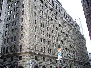 Federal Reserve Bank of New York |
May 6, 1980 (#80002688) |
33 Liberty St. 40°42′33″N 74°00′36″W |
Financial District | |
| 57 | Firehouse, Engine Company 31 | 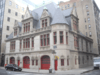 Firehouse, Engine Company 31 |
January 20, 1972 (#72000870) |
87 Lafayette St. 40°43′02″N 74°00′05″W |
Civic Center | |
| 58 | Firehouse, Engine Company 33 | 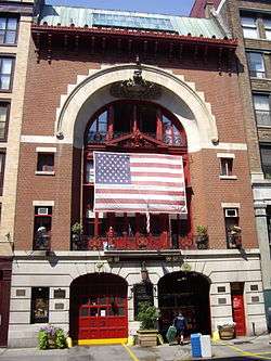 Firehouse, Engine Company 33 |
March 16, 1972 (#72000871) |
44 Great Jones St. 40°43′37″N 73°59′35″W |
NoHo | |
| 59 | First Houses | 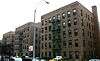 First Houses |
December 18, 1979 (#79001602) |
E. 3rd St. and Ave. A 40°43′25″N 73°59′09″W |
East Village | |
| 60 | First National City Bank | 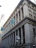 First National City Bank |
August 18, 1972 (#72000872) |
55 Wall St. 40°42′22″N 74°00′36″W |
Financial District | |
| 61 | First Police Precinct Station House | 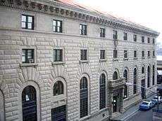 First Police Precinct Station House |
October 29, 1982 (#82001193) |
South St. and Old Slip 40°42′12″N 74°00′31″W |
Financial District | |
| 62 | First Romanian-American Congregation Synagogue | 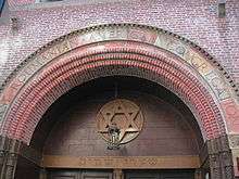 First Romanian-American Congregation Synagogue |
March 12, 1998 (#98000239) |
89-93 Rivington St. 40°43′12″N 73°59′21″W |
Lower East Side | |
| 63 | First Shearith Israel Graveyard | 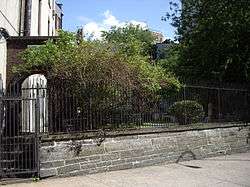 First Shearith Israel Graveyard |
April 17, 1980 (#80002689) |
55-57 St. James Pl. 40°42′46″N 73°59′56″W |
Lower East Side | |
| 64 | Hamilton Fish House | 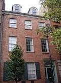 Hamilton Fish House |
July 31, 1972 (#72001456) |
21 Stuyvesant St. 40°43′49″N 73°59′20″W |
East Village | |
| 65 | Former Emigrant Industrial Savings Bank | 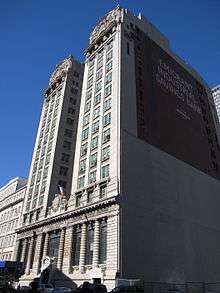 Former Emigrant Industrial Savings Bank |
February 25, 1982 (#82003375) |
51 Chambers St. 40°42′50″N 74°00′19″W |
Civic Center | |
| 66 | Former New York Life Insurance Company Building |  Former New York Life Insurance Company Building |
June 28, 1982 (#82003376) |
346 Broadway 40°42′58″N 74°00′13″W |
Civic Center | |
| 67 | Former Police Headquarters Building | 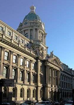 Former Police Headquarters Building |
March 28, 1980 (#80002690) |
240 Centre St. 40°43′12″N 73°59′56″W |
Little Italy | |
| 68 | Fourteenth Ward Industrial School |  Fourteenth Ward Industrial School |
January 27, 1983 (#83001724) |
256-258 Mott St. 40°43′25″N 73°59′41″W |
Nolita | |
| 69 | Fraunces Tavern Block | 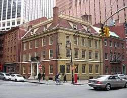 Fraunces Tavern Block |
April 28, 1977 (#77000957) |
Bounded by Pearl, Water, Broad Sts. and Coenties Slip 40°42′12″N 74°00′41″W |
Financial District | |
| 70 | Fraunces Tavern | 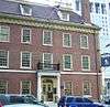 Fraunces Tavern |
March 6, 2008 (#08000140) |
54 Pearl Street 40°42′13″N 74°00′42″W |
Financial District | |
| 71 | Fulton-Nassau Historic District |  Fulton-Nassau Historic District |
September 7, 2005 (#05000988) |
Roughly bounded by Broadway and Park Row, Nassau, Dutch and William Sts, Ann and Spruce Sts. and Liberty St. 40°42′37″N 74°00′29″W |
Lower Manhattan | |
| 72 | Gansevoort Market Historic District | 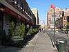 Gansevoort Market Historic District |
May 30, 2007 (#07000487) |
Roughly bounded by W 16th St., Ninth Ave., and Hudson St., Gansevoort St.; West St. and Eleventh Ave. 40°44′28″N 74°00′27″W |
Meatpacking District | |
| 73 | German Evangelical Lutheran Church of St. Mark | 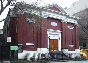 German Evangelical Lutheran Church of St. Mark |
April 15, 2004 (#04000296) |
323 E. 6th St. 40°43′37″N 73°59′15″W |
East Village | |
| 74 | Gouverneur Hospital | 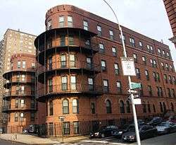 Gouverneur Hospital |
October 29, 1982 (#82001194) |
621 Water St. 40°42′39″N 73°59′05″W |
Lower East Side | |
| 75 | Grace Church and Dependencies | 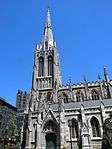 Grace Church and Dependencies |
June 28, 1974 (#74001270) |
Broadway, 10th St., and 4th Ave. 40°43′55″N 73°59′28″W |
Greenwich Village | |
| 76 | Greenwich Village Historic District |  Greenwich Village Historic District |
June 19, 1979 (#79001604) |
Roughly bounded by W. 13th St., St. Luke's Pl., University Pl., and Washington St. 40°44′02″N 74°00′04″W |
Greenwich Village | |
| 77 | E. V. Haughwout Building | 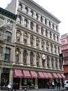 E. V. Haughwout Building |
August 28, 1973 (#73001218) |
488-492 Broadway 40°43′24″N 74°00′10″W |
SoHo | Home of the world's first successful passenger elevator, a hydraulic lift designed for the building by Elisha Graves Otis |
| 78 | Henry Street Settlement and Neighborhood Playhouse | 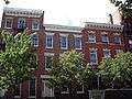 Henry Street Settlement and Neighborhood Playhouse |
September 13, 1974 (#74001272) |
263-267 Henry St. and 466 Grand St. 40°42′50″N 73°59′07″W |
Lower East Side | |
| 79 | Holland Tunnel | 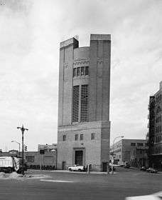 Holland Tunnel |
November 4, 1993 (#93001619) |
Connecting Lower Manhattan and Jersey City, running under the Hudson R. 40°43′38″N 74°00′41″W |
Tribeca and Hudson Square | |
| 80 | Hotel Albert | 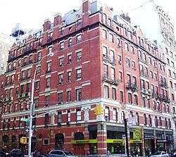 Hotel Albert |
June 13, 2012 (#12000329) |
23 E. 10th St. 40°43′58″N 73°59′37″W |
Greenwich Village | |
| 81 | Houses at 26, 28 and 30 Jones Street | 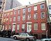 Houses at 26, 28 and 30 Jones Street |
June 3, 1982 (#82003379) |
26, 28 and 30 Jones St. 40°43′53″N 74°00′10″W |
Greenwich Village | |
| 82 | Isaac T. Hopper House | 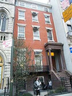 Isaac T. Hopper House |
May 22, 1986 (#86001155) |
110 Second Ave. 40°43′39″N 73°59′19″W |
East Village | |
| 83 | House at 203 Prince Street | 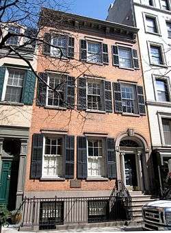 House at 203 Prince Street |
May 26, 1983 (#83001731) |
203 Prince St. 40°43′37″N 74°00′12″W |
SoHo | |
| 84 | House at 37 East 4th Street | 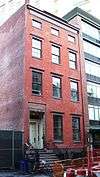 House at 37 East 4th Street |
January 3, 1980 (#80002695) |
37 E. 4th St. 40°43′39″N 73°59′32″W |
NoHo | |
| 85 | House at 51 Market Street | 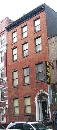 House at 51 Market Street |
July 29, 1977 (#77000959) |
51 Market St. 40°42′42″N 73°59′42″W |
Two Bridges | |
| 86 | Houses at 83 and 85 Sullivan Street | 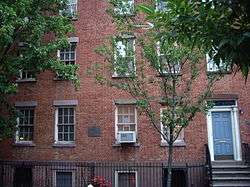 Houses at 83 and 85 Sullivan Street |
November 17, 1980 (#80002696) |
83-85 Sullivan St. 40°43′29″N 74°00′14″W |
SoHo | |
| 87 | Insurance Company of North America Building | 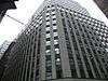 Insurance Company of North America Building |
November 30, 1999 (#99001425) |
99 John St. 40°42′30″N 74°00′23″W |
Financial District | |
| 88 | International Mercantile Marine Company Building | 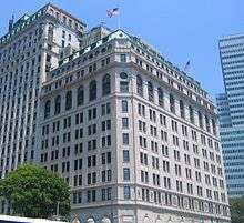 International Mercantile Marine Company Building |
March 2, 1991 (#91000108) |
1 Broadway 40°42′17″N 74°00′54″W |
Financial District | |
| 89 | J. P. Morgan & Co. Building | 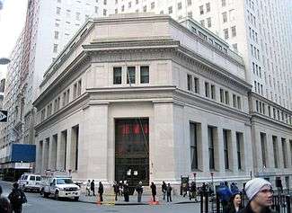 J. P. Morgan & Co. Building |
June 19, 1972 (#72000874) |
23 Wall St. 40°42′27″N 74°00′42″W |
Financial District | |
| 90 | JOHN A. LYNCH (ferryboat) |  JOHN A. LYNCH (ferryboat) |
September 7, 1984 (#84002775) |
Pier 15, East River, Manhattan 40°42′18″N 74°00′08″W |
South Street Seaport | No longer docked at Pier 15. Now half submerged at 40.560532°N 74.232159°W |
| 91 | John Street Building No. 170-176 | .jpg) John Street Building No. 170-176 |
May 13, 1971 (#71000546) |
170-176 John St. 40°42′21″N 74°00′17″W |
Financial District | |
| 92 | John Street Methodist Church |  John Street Methodist Church |
June 4, 1973 (#73001219) |
44 John St. 40°42′33″N 74°00′31″W |
Financial District | |
| 93 | Joralemon Street Tunnel |  Joralemon Street Tunnel |
February 9, 2006 (#06000015) |
Tunnel beneath East River from Bowling Green (State St.) to Joralemon St. and Willow Place 40°41′53″N 74°00′27″W |
Bowling Green | Subway tunnel for the 4 and 5 trains |
| 94 | Judson Memorial Church, Campanile, and Judson Hall |  Judson Memorial Church, Campanile, and Judson Hall |
October 16, 1974 (#74001274) |
Washington Sq. at Thompson St. 40°43′50″N 73°59′51″W |
Greenwich Village | |
| 95 | Julius' Bar |  Julius' Bar |
April 20, 2016 (#16000242) |
188 Waverly Place 40°44′04″N 74°00′06″W |
West Village | Often described as New York's oldest continuously operating gay bar. Site of 1966 protest that allowed it to operate as one. |
| 96 | Kehila Kedosha Janina Synagogue | 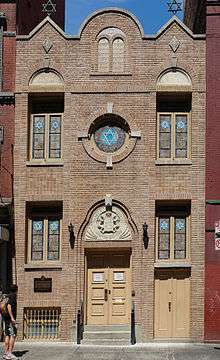 Kehila Kedosha Janina Synagogue |
November 30, 1999 (#99001430) |
280 Broome St. 40°43′07″N 73°59′30″W |
Lower East Side | |
| 97 | LaGrange Terrace | 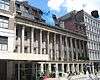 LaGrange Terrace |
December 12, 1976 (#76001242) |
428-434 Lafayette St. 40°43′46″N 73°59′34″W |
NoHo | Known also as Colonnade Row |
| 98 | Lee, Higginson & Company Bank Building | 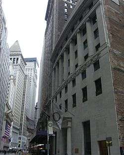 Lee, Higginson & Company Bank Building |
June 7, 2006 (#06000476) |
41 Broad St. 40°42′20″N 74°00′41″W |
Financial District | |
| 99 | Daniel LeRoy House | 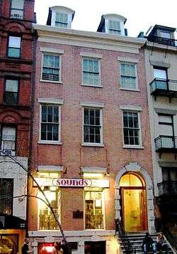 Daniel LeRoy House |
October 29, 1982 (#82001200) |
20 St. Mark's Pl. 40°43′43″N 73°59′20″W |
East Village | |
| 100 | LETTIE G. HOWARD (schooner) | .jpg) LETTIE G. HOWARD (schooner) |
September 7, 1984 (#84002779) |
South Street Seaport Museum 40°42′17″N 74°00′15″W |
South Street Seaport | |
| 101 | Liberty Tower | 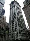 Liberty Tower |
September 15, 1983 (#83001734) |
55 Liberty St. 40°42′31″N 74°00′35″W |
Financial District | |
| 102 | LILAC, United States Lighthouse Tender |  LILAC, United States Lighthouse Tender |
January 7, 2005 (#04001441) |
Pier 40 40°43′58″N 74°00′46″W |
Greenwich Village | |
| 103 | Lower East Side Historic District | 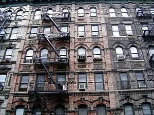 Lower East Side Historic District |
September 7, 2000 (#00001015) |
Roughly bounded by Allen St., E. Houston, Essex St., Canal St., Eldridge St., E. Broadway, and Grand St. 40°43′02″N 73°59′23″W |
Lower East Side | |
| 104 | MacDougal-Sullivan Gardens Historic District | 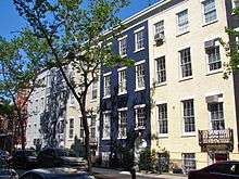 MacDougal-Sullivan Gardens Historic District |
June 30, 1983 (#83001736) |
74-76 MacDougal St., 170-188 Sullivan St. 40°43′42″N 74°00′10″W |
South Village | |
| 105 | MACHIGONNE (ferry) | 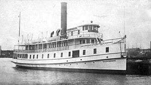 MACHIGONNE (ferry) |
December 3, 1992 (#92001610) |
Pier 25 40°43′18″N 74°00′57″W |
TriBeCa | |
| 106 | Macmillan Building | 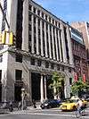 Macmillan Building |
November 1, 2006 (#06000973) |
60-62 Fifth Ave. 40°44′06″N 73°59′43″W |
Greenwich Village | Now used by Forbes Magazine |
| 107 | Manhattan Bridge | 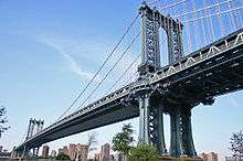 Manhattan Bridge |
August 30, 1983 (#83001694) |
Spans East River between Front and Canal St. 40°42′36″N 73°59′18″W |
Two Bridges | |
| 108 | Manhattan Company Building | 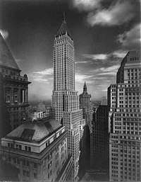 Manhattan Company Building |
June 16, 2000 (#00000577) |
40 Wall St. 40°42′25″N 74°00′36″W |
Financial District | |
| 109 | Mariner's Temple | 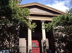 Mariner's Temple |
April 16, 1980 (#80002700) |
12 Oliver St. 40°42′46″N 73°59′54″W |
Two Bridges | |
| 110 | Metropolitan Savings Bank Building | 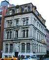 Metropolitan Savings Bank Building |
December 12, 1976 (#76001243) |
9 E. 7th St. 40°43′44″N 73°59′26″W |
East Village | |
| 111 | Edward Mooney House | 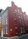 Edward Mooney House |
December 12, 1976 (#76001245) |
18 Bowery 40°42′52″N 73°59′53″W |
Chinatown | |
| 112 | Municipal Building |  Municipal Building |
October 18, 1972 (#72000879) |
Chambers at Centre St. 40°42′47″N 74°00′14″W |
Civic Center | |
| 113 | Municipal Ferry Pier | 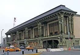 Municipal Ferry Pier |
December 12, 1976 (#76001246) |
11 South St. 40°42′03″N 74°00′43″W |
South Ferry | |
| 114 | National City Bank | National City Bank |
June 2, 1978 (#78001875) |
55 Wall St. 40°42′21″N 74°00′35″W |
Financial District | |
| 115 | New York City Marble Cemetery | 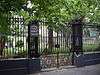 New York City Marble Cemetery |
September 17, 1980 (#80002703) |
52-74 E. 2nd St. 40°43′28″N 73°59′23″W |
East Village | |
| 116 | New York Cotton Exchange | 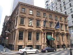 New York Cotton Exchange |
January 7, 1972 (#72001586) |
1 Hanover Sq. 40°42′16″N 74°00′37″W |
Financial District | |
| 117 | New York County Lawyers Association Building | 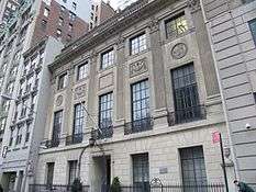 New York County Lawyers Association Building |
October 29, 1982 (#82001201) |
14 Vesey St. 40°42′43″N 74°00′35″W |
Financial District | |
| 118 | New York Evening Post Building |  New York Evening Post Building |
September 22, 2000 (#00001160) |
75 West St. 40°42′32″N 74°00′54″W |
Financial District | |
| 119 | New York Marble Cemetery |  New York Marble Cemetery |
September 17, 1980 (#80004475) |
Between East 2nd and 3rd Sts.,2nd Ave. and Bowery 40°44′04″N 73°59′29″W |
East Village | |
| 120 | New York Shakespeare Festival Public Theater | 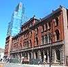 New York Shakespeare Festival Public Theater |
December 2, 1970 (#70000424) |
425 Lafayette St. 40°43′41″N 73°59′33″W |
NoHo | |
| 121 | New York Stock Exchange | 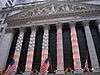 New York Stock Exchange |
June 2, 1978 (#78001877) |
11 Wall St. 40°42′24″N 74°00′42″W |
Financial District | |
| 122 | New York Studio School of Drawing, Painting and Sculpture |  New York Studio School of Drawing, Painting and Sculpture |
April 27, 1992 (#92001877) |
8-14 W. 8th St. 40°43′57″N 73°59′53″W |
Greenwich Village | |
| 123 | New York Telephone Company Building | 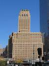 New York Telephone Company Building |
April 30, 2009 (#09000257) |
140 West St. 40°42′50″N 74°00′47″W |
Tribeca | |
| 124 | No. 8 Thomas Street Building | 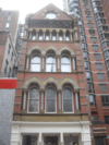 No. 8 Thomas Street Building |
April 30, 1980 (#80002705) |
8 Thomas St. 40°42′57″N 74°00′22″W |
Lower Manhattan | |
| 125 | Odd Fellows Hall | 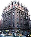 Odd Fellows Hall |
September 22, 1983 (#83001737) |
165-171 Grand St. 40°43′11″N 73°59′53″W |
Little Italy | |
| 126 | Old Merchant's House | 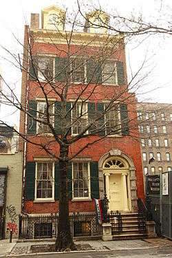 Old Merchant's House |
October 15, 1966 (#66000548) |
29 E. 4th St. 40°43′40″N 73°59′33″W |
Lower Manhattan | Known also as Merchant's House Museum |
| 127 | Old New York Evening Post Building | 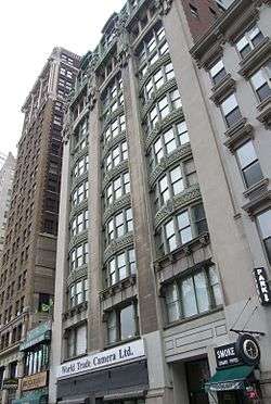 Old New York Evening Post Building |
August 16, 1977 (#77000963) |
20 Vesey St. 40°42′43″N 74°00′36″W |
Financial District | |
| 128 | Old St. Patrick's Cathedral Complex | 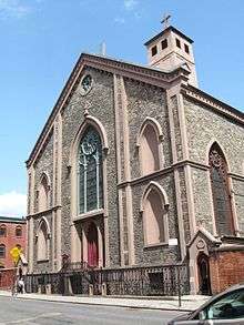 Old St. Patrick's Cathedral Complex |
August 29, 1977 (#77000964) |
Mott and Prince Sts. 40°43′25″N 73°59′44″W |
Nolita | |
| 129 | Ottendorfer Public Library and Stuyvesant Polyclinic Hospital |  Ottendorfer Public Library and Stuyvesant Polyclinic Hospital |
July 22, 1979 (#79001607) |
135 and 137 2nd Ave. 40°43′47″N 73°59′15″W |
East Village | |
| 130 | Park Row Building | 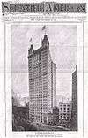 Park Row Building |
November 16, 2005 (#05001287) |
15 Park Row 40°42′40″N 74°00′30″W |
Financial District | |
| 131 | Charlie Parker Residence | 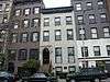 Charlie Parker Residence |
April 7, 1994 (#94000262) |
151 Charlie Parker Pl. (Avenue B) 40°43′36″N 73°58′50″W |
Alphabet City | |
| 132 | Puck Building | 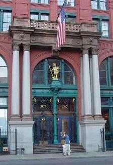 Puck Building |
July 21, 1983 (#83001740) |
295-309 Lafayette St. 40°43′28″N 73°59′46″W |
Nolita | |
| 133 | Robbins & Appleton Building | 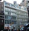 Robbins & Appleton Building |
October 29, 1982 (#82001204) |
1-5 Bond St. 40°43′36″N 73°59′45″W |
NoHo | |
| 134 | St. Augustine's Chapel | 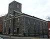 St. Augustine's Chapel |
May 6, 1980 (#80002718) |
290 Henry St. 40°42′48″N 73°59′02″W |
Lower East Side | (also known as All Saints Free Church) |
| 135 | St. James Church | 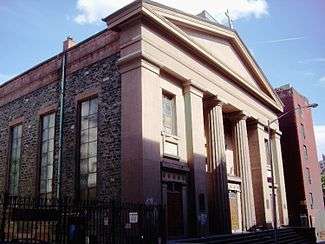 St. James Church |
July 24, 1972 (#72000884) |
32 James St. 40°42′44″N 73°59′57″W |
Two Bridges | |
| 136 | St.-Marks-In-The-Bowery | 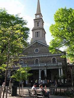 St.-Marks-In-The-Bowery |
June 19, 1972 (#72000885) |
E. 10th St. and 2nd Ave. 40°43′49″N 73°59′15″W |
East Village | |
| 137 | St. Mark's Historic District |  St. Mark's Historic District |
November 13, 1974 (#74001276) |
Roughly bounded by 2nd and 3rd Aves. and E. 9th and 11th Sts. 40°43′50″N 73°59′17″W |
East Village | |
| 138 | St. Paul's Chapel | 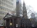 St. Paul's Chapel |
October 15, 1966 (#66000551) |
209 Broadway, between Fulton and Vesey Sts. 40°42′41″N 74°00′36″W |
Financial District | |
| 139 | St. Peter's Roman Catholic Church | 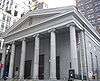 St. Peter's Roman Catholic Church |
April 23, 1980 (#80002721) |
22 Barclay St. 40°42′44″N 74°00′36″W |
Financial District | |
| 140 | Schermerhorn Row Block | 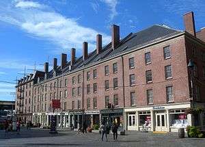 Schermerhorn Row Block |
February 18, 1971 (#71000547) |
Block bounded by Front, Fulton, and South Sts., and Burling Slip 40°42′17″N 74°00′23″W |
South Street Seaport | |
| 141 | Gen. Winfield Scott House | 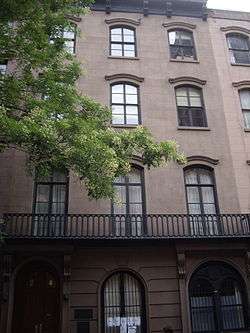 Gen. Winfield Scott House |
November 7, 1973 (#73001222) |
24 W. 12th St. 40°44′06″N 73°59′48″W |
Greenwich Village | |
| 142 | Sea and Land Church | 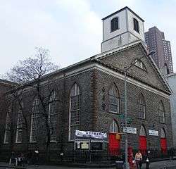 Sea and Land Church |
April 9, 1980 (#80002716) |
61 Henry St. 40°42′46″N 73°59′42″W |
Lower East Side | (near the Manhattan Bridge) |
| 143 | SHEARWATER (schooner) | 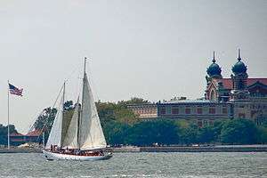 SHEARWATER (schooner) |
March 9, 2009 (#09000135) |
North Cove Marina 40°42′46″N 74°01′02″W |
Lower Manhattan | |
| 144 | Alfred E. Smith House |  Alfred E. Smith House |
November 28, 1972 (#72000882) |
25 Oliver St. 40°42′44″N 73°59′55″W |
Two Bridges | |
| 145 | Fleming Smith Warehouse | 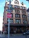 Fleming Smith Warehouse |
May 26, 1983 (#83001745) |
451-453 Washington St. 40°43′26″N 74°00′38″W |
TriBeCa | |
| 146 | Soho Historic District |  Soho Historic District |
June 29, 1978 (#78001883) |
Roughly bounded by W. Broadway, Houston, Crosby, and Canal Sts. 40°43′23″N 74°00′03″W |
SoHo | Largest collection of cast iron buildings in the world |
| 147 | South Street Seaport | 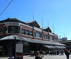 South Street Seaport |
October 18, 1972 (#72000883) |
Bounded by Burling (John St.) and Peck Slips, and Water and South Sts. 40°42′22″N 74°00′12″W |
South Street Seaport | |
| 148 | South Street Seaport Historic District | 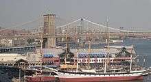 South Street Seaport Historic District |
December 12, 1978 (#78001884) |
Roughly bounded by East River, Brooklyn Bridge, Fletcher Allry, Pearl, and South Sts. 40°42′24″N 74°00′10″W |
South Street Seaport | |
| 149 | South Village Historic District | .jpg) South Village Historic District |
February 24, 2014 (#14000026) |
Roughly Bedford, Carmine, Downing, Grand, Jones, Leroy, MacDougal, Prince, W. 3rd, W. Houston Sts., LaGuardia Pl. 40°43′44″N 74°00′00″W |
South Village | |
| 150 | Stanton Street Shul |  Stanton Street Shul |
October 10, 2002 (#02001116) |
180 Stanton St. 40°43′12″N 73°59′04″W |
Lower East Side | |
| 151 | A. T. Stewart Company Store | 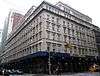 A. T. Stewart Company Store |
June 2, 1978 (#78001885) |
280 Broadway 40°42′51″N 74°00′22″W |
Civic Center | |
| 152 | Stone Street Historic District |  Stone Street Historic District |
November 12, 1999 (#99001330) |
Stone, Pearl and S. William Sts. and Mill Ln. 40°42′15″N 74°00′38″W |
Financial District | |
| 153 | Stonewall |  Stonewall |
May 27, 1999 (#99000562) |
Roughly bounded by Greenwich Ave., Seventh Ave., Washington Place, and Sixth Ave. 40°44′02″N 74°00′04″W |
Greenwich Village | Site of Stonewall riots, beginning of the modern gay rights movement |
| 154 | Substation 235 |  Substation 235 |
February 9, 2006 (#06000022) |
23 W. 13th St. 40°44′20″N 74°00′10″W |
Greenwich Village | |
| 155 | Substation 409 |  Substation 409 |
February 9, 2006 (#06000020) |
163 Essex St. 40°43′17″N 73°59′15″W |
Lower East Side | |
| 156 | Surrogate's Court |  Surrogate's Court |
January 29, 1972 (#72000888) |
31 Chambers St. 40°42′49″N 74°00′17″W |
Civic Center | |
| 157 | Tenement Building at 97 Orchard Street |  Tenement Building at 97 Orchard Street |
May 19, 1992 (#92000556) |
97 Orchard St. 40°43′07″N 73°59′28″W |
Lower East Side | Operated as Lower East Side Tenement National Historic Site |
| 158 | Third Judicial District Courthouse |  Third Judicial District Courthouse |
November 9, 1972 (#72000875) |
425 Avenue of the Americas 40°44′05″N 74°00′41″W |
Greenwich Village | Now known as Jefferson Market Library |
| 159 | Triangle Shirtwaist Factory |  Triangle Shirtwaist Factory |
July 17, 1991 (#91002050) |
23-29 Washington Pl. 40°43′48″N 73°59′45″W |
Greenwich Village | Site of the Triangle Shirtwaist Factory fire which led to workplace safety reforms. Now the Brown Building of Science, part of NYU |
| 160 | Trinity Church and Graveyard | 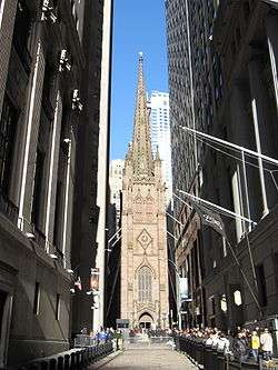 Trinity Church and Graveyard |
December 8, 1976 (#76001252) |
Broadway and Wall St. 40°42′28″N 74°00′45″W |
Financial District | |
| 161 | Tweed Courthouse |  Tweed Courthouse |
September 25, 1974 (#74001277) |
52 Chambers St. 40°42′47″N 74°00′22″W |
Civic Center | |
| 162 | Two Bridges Historic District |  Two Bridges Historic District |
August 29, 2003 (#03000845) |
Roughly bounded by E. Broadway, Market St., Cherry St., Catherine St., Madison St., and St. James Place 40°42′43″N 73°59′47″W |
Two Bridges | |
| 163 | US Courthouse | 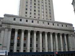 US Courthouse |
September 2, 1987 (#87001596) |
40 Foley Sq. 40°42′49″N 74°00′10″W |
Civic Center | |
| 164 | U.S. Customhouse | 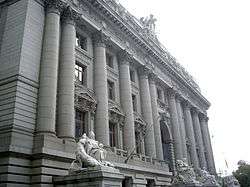 U.S. Customhouse |
January 31, 1972 (#72000889) |
1 Bowling Green 40°42′16″N 74°00′49″W |
Financial District | Now operated as National Museum of the American Indian |
| 165 | United States Appraisers Store |  United States Appraisers Store |
January 11, 2017 (#100000496) |
201 Varick St. 40°43′42″N 74°00′21″W |
Hudson Square | 1929 Art Deco building now used as federal government offices |
| 166 | US Post Office-Canal Street Station | 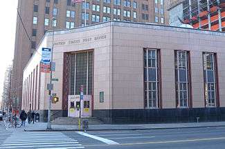 US Post Office-Canal Street Station |
May 11, 1989 (#88002358) |
350 Canal St. 40°44′18″N 74°00′14″W |
Tribeca | |
| 167 | US Post Office-Church Street Station | 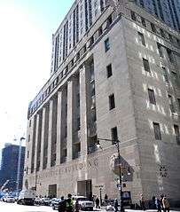 US Post Office-Church Street Station |
May 11, 1989 (#88002359) |
90 Church St. 40°42′45″N 74°00′40″W |
Civic Center | |
| 168 | US Post Office-Cooper Station | 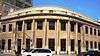 US Post Office-Cooper Station |
May 11, 1989 (#88002360) |
96 4th St. 40°43′55″N 73°59′24″W |
East Village | |
| 169 | US Post Office--Knickerbocker Station |  US Post Office--Knickerbocker Station |
May 11, 1989 (#88002362) |
130 E. Broadway 40°42′50″N 73°59′31″W |
Lower East Side | |
| 170 | University Settlement House | 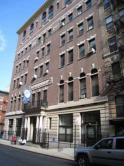 University Settlement House |
September 11, 1986 (#86002515) |
184 Eldridge St. 40°43′14″N 73°59′27″W |
Lower East Side | |
| 171 | Stephen Van Rensselar House |  Stephen Van Rensselar House |
June 16, 1983 (#83001751) |
149 Mulberry St. 40°43′08″N 73°59′53″W |
Little Italy | |
| 172 | Van Tassell and Kearney Horse Auction Mart | 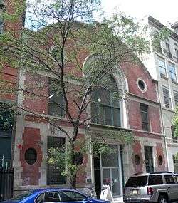 Van Tassell and Kearney Horse Auction Mart |
November 29, 2007 (#07001233) |
126-128 E 13th St. 40°43′58″N 73°59′21″W |
East Village | |
| 173 | W. O. DECKER (tugboat) | 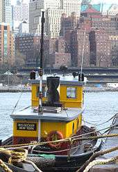 W. O. DECKER (tugboat) |
September 13, 1996 (#96000962) |
207 Front St., Pier No. 16 40°42′19″N 74°00′11″W |
South Street Seaport | |
| 174 | Wall and Hanover Building | 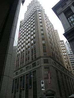 Wall and Hanover Building |
November 16, 2005 (#05001288) |
63 Wall St. 40°42′20″N 74°00′33″W |
Wall Street | |
| 175 | Wall Street Historic District | 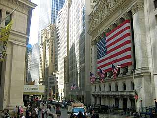 Wall Street Historic District |
February 20, 2007 (#07000063) |
Roughly bounded by Cedar St. and Maiden Ln., Pearl St., Bridge and S. William St., and Greenwich St. and Trinity Pl. 40°42′23″N 74°00′40″W |
Wall Street | |
| 176 | Wall Street Subway Station (IRT) | 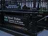 Wall Street Subway Station (IRT) |
September 17, 2004 (#04001011) |
Under Broadway at Wall, Pine, Rector Sts. and Exchange Place 40°42′27″N 74°00′44″W |
Financial District | Subway station (4 and 5 trains) |
| 177 | Wallace Building | 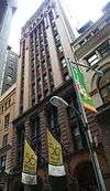 Wallace Building |
August 28, 2003 (#03000848) |
56-58 Pine St. 40°42′24″N 74°00′32″W |
Financial District | |
| 178 | James Watson House | 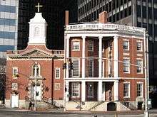 James Watson House |
July 24, 1972 (#72000891) |
7 State St. 40°42′09″N 74°00′51″W |
South Ferry | |
| 179 | WAVERTREE | 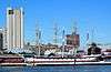 WAVERTREE |
June 13, 1978 (#78001887) |
Pier 17, foot of Fulton St. 40°42′20″N 74°00′10″W |
South Street Seaport | |
| 180 | West 4th Street Subway Station (IND) | 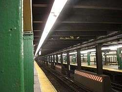 West 4th Street Subway Station (IND) |
March 30, 2005 (#05000223) |
Under Sixth Ave. Bet W 3rd St. and Waverly Place 40°43′54″N 74°00′05″W |
Greenwich Village | Subway station (A, B, C, D, E, F, <F>, and M trains) |
| 181 | West Street Building |  West Street Building |
January 25, 2007 (#06001303) |
90 West St. 40°42′36″N 74°00′53″W |
Financial District | |
| 182 | Westbeth | Westbeth |
December 8, 2009 (#09001085) |
55 Bethune Street 40°44′13″N 74°00′30″W |
West Village | Industrial buildings turned into space for artists is one of first instances of adaptive reuse in U.S. See also Bell Telephone Laboratories, the same buildings listed for a different reason. |
| 183 | Westchester House |  Westchester House |
March 20, 1986 (#86000450) |
541-551 Broome St. (southwest corner of Broome and Bowery) 40°43′10″N 73°59′41″W |
The Bowery | (Also known as Pioneer Hotel) |
| 184 | Woolworth Building |  Woolworth Building |
November 13, 1966 (#66000554) |
233 Broadway 40°42′45″N 74°00′30″W |
Civic Center | |
| 185 | Village East Cinema | 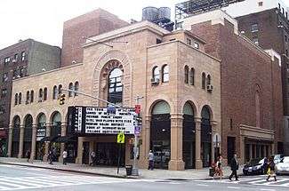 Village East Cinema |
September 19, 1985 (#85002427) |
189 Second Ave. 40°43′51″N 73°59′11″W |
East Village | Moorish Revival theatre built 1925–1926 for the Yiddish Art Theatre, later housed the Phoenix Theatre |
See also
| Wikimedia Commons has media related to National Register of Historic Places in Manhattan. |
- County: National Register of Historic Places listings in New York County, New York
- State: National Register of Historic Places listings in New York
- Municipal: List of New York City Designated Landmarks in Manhattan below 14th Street
References
- The latitude and longitude information provided in this table was derived originally from the National Register Information System, which has been found to be fairly accurate for about 99% of listings. Some locations in this table may have been corrected to current GPS standards.
- "National Register of Historic Places: Weekly List Actions". National Park Service, United States Department of the Interior. Retrieved on June 19, 2020.
- Numbers represent an ordering by significant words. Various colorings, defined here, differentiate National Historic Landmarks and historic districts from other NRHP buildings, structures, sites or objects.
- The eight-digit number below each date is the number assigned to each location in the National Register Information System database, which can be viewed by clicking the number.
| Topics |  | |
|---|---|---|
| Lists by county |
| |
| Lists by city | ||
| Other lists | ||
| ||
This article is issued from Wikipedia. The text is licensed under Creative Commons - Attribution - Sharealike. Additional terms may apply for the media files.