National Register of Historic Places listings in Madison County, New York
List of the National Register of Historic Places listings in Madison County, New York
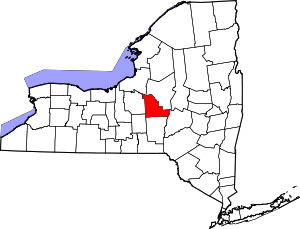
Location of Madison County in New York
This is intended to be a complete list of properties and districts listed on the National Register of Historic Places in Madison County, New York. The locations of National Register properties and districts (at least for all showing latitude and longitude coordinates below) may be seen in a map by clicking on "Map of all coordinates".[1] Three properties are further designated a National Historic Landmarks.
- This National Park Service list is complete through NPS recent listings posted June 19, 2020.[2]
| Albany (Albany) – Allegany – Bronx – Broome – Cattaraugus – Cayuga – Chautauqua – Chemung – Chenango – Clinton – Columbia – Cortland – Delaware – Dutchess (Poughkeepsie, Rhinebeck) – Erie (Buffalo) – Essex – Franklin – Fulton – Genesee – Greene – Hamilton – Herkimer – Jefferson – Kings – Lewis – Livingston – Madison – Monroe (Rochester) – Montgomery – Nassau – New York (Below 14th Street, 14th to 59th Streets, 59th to 110th Streets, Above 110th Street, Islands) – Niagara – Oneida – Onondaga – Ontario – Orange – Orleans – Oswego – Otsego – Putnam – Queens – Rensselaer – Richmond – Rockland – St. Lawrence – Saratoga – Schenectady – Schoharie – Schuyler – Seneca – Steuben – Suffolk – Sullivan – Tioga – Tompkins – Ulster – Warren – Washington – Wayne – Westchester (Northern, Southern, New Rochelle, Peekskill, Yonkers) – Wyoming – Yates |
Listings county-wide
| [3] | Name on the Register | Image | Date listed[4] | Location | City or town | Description |
|---|---|---|---|---|---|---|
| 1 | Abell Farmhouse and Barn | November 2, 1987 (#87001860) |
Ballina Rd. 42°54′11″N 75°49′31″W |
Cazenovia | ||
| 2 | Albany Street Historic District | 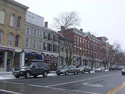 Albany Street Historic District |
October 10, 1978 (#78001859) |
Irregular pattern along Albany St. 42°55′47″N 75°51′19″W |
Cazenovia | |
| 3 | Annas Farmhouse | 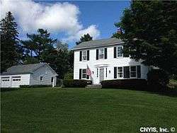 Annas Farmhouse |
February 18, 1988 (#87001861) |
4812 Ridge Rd. 42°57′25″N 75°51′20″W |
Cazenovia | |
| 4 | Beckwith Farmhouse | November 2, 1987 (#87001862) |
4652 Syracuse Rd. 42°56′51″N 75°53′07″W |
Cazenovia | ||
| 5 | Brick House | February 18, 1988 (#87001863) |
3318 Rippleton Rd. 42°54′22″N 75°52′22″W |
Cazenovia | ||
| 6 | Canal Town Museum |  Canal Town Museum |
May 23, 1986 (#86001292) |
122 Canal St. 43°04′47″N 75°45′06″W |
Canastota | |
| 7 | Canastota Methodist Church | 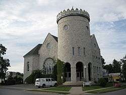 Canastota Methodist Church |
May 23, 1986 (#86001293) |
Main and New Boston Sts. 43°04′52″N 75°45′19″W |
Canastota | |
| 8 | Canastota Public Library | 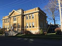 Canastota Public Library |
May 23, 1986 (#86001294) |
102 W. Center St. 43°04′42″N 75°45′20″W |
Canastota | |
| 9 | Cazenovia Village Historic District | 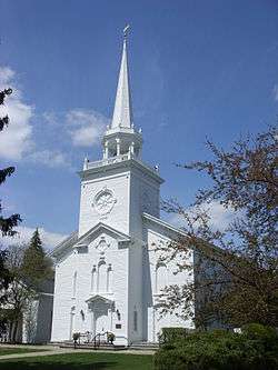 Cazenovia Village Historic District |
June 19, 1986 (#86001352) |
Roughly bounded by Union, Lincklean and Chenango Sts., and Rippleton Rd. and Foreman St. 42°55′43″N 75°51′24″W |
Cazenovia | |
| 10 | Cedar Cove | July 15, 1991 (#91000867) |
W side of E. Lake Rd. 42°57′00″N 75°51′49″W |
Cazenovia | ||
| 11 | Chappell Farmhouse | November 2, 1987 (#87001864) |
Ridge Rd. 42°56′52″N 75°51′23″W |
Cazenovia | ||
| 12 | Chenango Canal Summit Level | 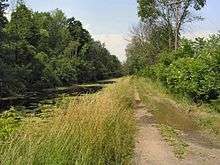 Chenango Canal Summit Level |
July 6, 2005 (#05000684) |
Along Canal Rd. 42°52′19″N 75°33′33″W |
Bouckville | A portion of Chenango Canal |
| 13 | Chittenango Landing Dry Dock Complex | April 30, 1992 (#92000458) |
Lakeport Rd. at Old Erie Canal 43°03′36″N 75°52′26″W |
Sullivan | ||
| 14 | Chittenango Pottery | December 11, 2009 (#09001083) |
11-13 Pottery St. 43°03′33″N 75°52′07″W |
Chittenango | ||
| 15 | Cobblestone House | November 2, 1987 (#87001865) |
Syracuse Rd. 42°56′35″N 75°52′59″W |
Cazenovia | ||
| 16 | Zephnia Comstock Farmhouse | November 2, 1987 (#87001866) |
2363 Nelson St. 42°55′30″N 75°50′19″W |
Cazenovia | ||
| 17 | Coolidge Stores Building | 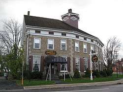 Coolidge Stores Building |
January 26, 2001 (#00001686) |
US 20 42°53′21″N 75°33′07″W |
Bouckville | |
| 18 | Cottage Lawn | November 6, 1980 (#80002650) |
435 Main St. 43°05′14″N 75°38′50″W |
Oneida | ||
| 19 | Crandall Farm Complex | November 2, 1987 (#87001867) |
2430 Ballina Rd. 42°53′35″N 75°50′13″W |
Cazenovia | ||
| 20 | DeFerriere House | March 1, 2007 (#07000097) |
2089 Genesee St. 43°04′26″N 75°41′39″W |
Oneida | ||
| 21 | Earlville Historic District | 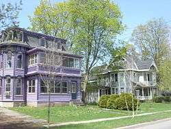 Earlville Historic District |
October 29, 1982 (#82001096) |
Fayette, N., S., E., and W. Main Sts. 42°44′25″N 75°32′42″W |
Earlville | |
| 22 | Evergreen Acres | November 2, 1987 (#87001868) |
Syracuse Rd. 42°55′38″N 75°52′38″W |
Cazenovia | ||
| 23 | Fenner Baptist Church | 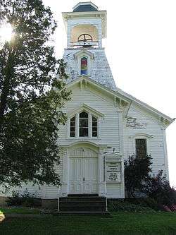 Fenner Baptist Church |
January 24, 2002 (#01001501) |
3122 Bingley Rd. 42°58′09″N 75°47′17″W |
Fenner | |
| 24 | First National Bank of Morrisville | 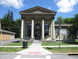 First National Bank of Morrisville |
September 12, 1985 (#85002365) |
Main St. 42°53′56″N 75°38′37″W |
Morrisville | |
| 25 | Hamilton Village Historic District | 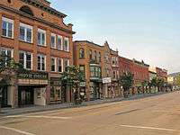 Hamilton Village Historic District |
September 13, 1984 (#84002494) |
Roughly Kendrick Ave., Broad, Payne, Hamilton, Madison, Pleasant and Lewbanon Sts. 42°49′22″N 75°32′33″W |
Hamilton | |
| 26 | Hillcrest | July 15, 1991 (#91000869) |
Ridge Rd. S of Hoffman 42°56′20″N 75°51′27″W |
Cazenovia | ||
| 27 | House at 107 Stroud Street | May 23, 1986 (#86001302) |
107 Stroud St. 43°04′27″N 75°45′41″W |
Canastota | ||
| 28 | House at 115 South Main Street | May 23, 1986 (#86001289) |
115 S. Main St. 43°04′43″N 75°45′20″W |
Canastota | ||
| 29 | House at 205 North Main Street | May 23, 1986 (#86001296) |
205 N. Main St. 43°04′53″N 75°45′19″W |
Canastota | ||
| 30 | House at 233 James Street | May 23, 1986 (#86001295) |
233 James St. 43°04′31″N 75°45′35″W |
Canastota | ||
| 31 | House at 313 North Main Street | May 23, 1986 (#86001298) |
313 N. Main St. 43°05′03″N 75°45′18″W |
Canastota | ||
| 32 | House at 326 North Peterboro Street | May 23, 1986 (#86001299) |
326 N. Peterboro St. 43°05′08″N 75°45′01″W |
Canastota | ||
| 33 | House at 328 North Peterboro Street | May 23, 1986 (#86001301) |
328 N. Peterboro St. 43°05′09″N 75°45′01″W |
Canastota | ||
| 34 | Lehigh Valley Railroad Depot | Lehigh Valley Railroad Depot |
July 15, 1991 (#91000874) |
William St. 42°55′58″N 75°50′56″W |
Cazenovia | |
| 35 | Lenox District No. 4 Schoolhouse | 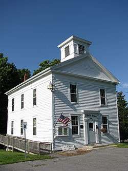 Lenox District No. 4 Schoolhouse |
February 23, 1996 (#96000135) |
Timmerman Rd. N side, at jct. with Old Co. Rd. 43°02′31″N 75°44′32″W |
Clockville | |
| 36 | Lorenzo | 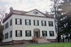 Lorenzo |
February 18, 1971 (#71000541) |
Ledyard St. (U.S. 20) 42°55′23″N 75°51′56″W |
Cazenovia | |
| 37 | Main-Broad-Grove Streets Historic District | 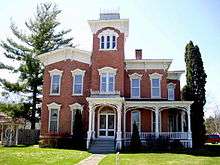 Main-Broad-Grove Streets Historic District |
September 15, 1983 (#83001705) |
Roughly bounded by Main, Broad, E. Grove, W. Grove, Wilbur, Elizabeth, E. Walnut, W. Walnut, and Stone Sts. 43°05′11″N 75°38′47″W |
Oneida | |
| 38 | The Maples | November 2, 1987 (#87001876) |
2420 Nelson Rd. 42°55′19″N 75°50′08″W |
Cazenovia | ||
| 39 | Meadows Farm Complex | November 2, 1987 (#87001869) |
Rippleton Rd. 42°55′01″N 75°51′40″W |
Cazenovia | ||
| 40 | Middle Farmhouse | November 2, 1987 (#87001870) |
4875 W. Lake Rd. 42°57′29″N 75°52′58″W |
Cazenovia | ||
| 41 | Morrisville Public Library | 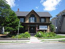 Morrisville Public Library |
October 5, 2005 (#05001126) |
87 East Main St. 42°53′56″N 75°38′35″W |
Morrisville | |
| 42 | Mount Hope Reservoir | August 29, 1997 (#97000981) |
Between Mt. Hope and Fairview Aves. 43°03′34″N 75°38′47″W |
Oneida | ||
| 43 | Nelson Methodist Episcopal Church | April 17, 2017 (#100000894) |
3333 U.S. 20 E. 42°55′02″N 75°46′29″W |
Nelson | 19th century wooden church | |
| 44 | Nelson Welsh Congregational Church | 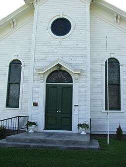 Nelson Welsh Congregational Church |
August 6, 1993 (#93000681) |
Jct. of Welsh Church and Old State Rds. 42°54′07″N 75°45′17″W |
Nelson | |
| 45 | New York State Barge Canal |  New York State Barge Canal |
October 15, 2014 (#14000860) |
Mainly Oneida Lake 43°09′51″N 75°48′52″W |
Lenox, Sullivan | Successor to Erie Canal approved by state voters in early 20th century to compete with railroads. |
| 46 | Niles Farmhouse | November 2, 1987 (#87001871) |
Rippleton Rd. 42°54′45″N 75°52′08″W |
Cazenovia | ||
| 47 | Notleymere | 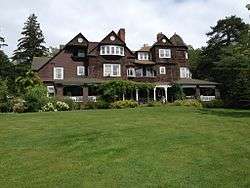 Notleymere |
July 15, 1991 (#91000868) |
4641 E. Lake Rd. 42°56′52″N 75°51′47″W |
Cazenovia | |
| 48 | Old Biology Hall |  Old Biology Hall |
September 20, 1973 (#73001199) |
Colgate University 42°49′04″N 75°32′06″W |
Hamilton | |
| 49 | Old Madison County Courthouse | 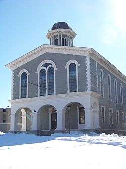 Old Madison County Courthouse |
June 15, 1978 (#78001860) |
E. Main St. 42°53′53″N 75°38′30″W |
Morrisville | |
| 50 | Old Trees | July 15, 1991 (#91000865) |
W side of Rippleton Rd. 42°54′59″N 75°52′35″W |
Cazenovia | ||
| 51 | Oneida Armory | March 2, 1995 (#95000084) |
217 Cedar St. 43°05′36″N 75°39′01″W |
Oneida | ||
| 52 | Oneida Community Mansion House | 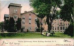 Oneida Community Mansion House |
October 15, 1966 (#66000527) |
Sherrill Rd. 43°03′37″N 75°36′19″W |
Oneida | |
| 53 | Oneida Downtown Commercial Historic District | July 13, 2018 (#100002667) |
Broad, Main & Cedar Sts., S of Elm, N of Washington 43°05′41″N 75°39′06″W |
Oneida | ||
| 54 | Oneida Lake Congregational Church | March 22, 2006 (#06000159) |
2508 NY 31 43°09′28″N 75°49′45″W |
Oneida Lake | ||
| 55 | Ormonde | July 15, 1991 (#91000866) |
Between E. Lake Rd. and Ormonde Dr. 42°57′20″N 75°51′41″W |
Cazenovia | ||
| 56 | Parker Farmhouse | November 2, 1987 (#87001872) |
3981 East Rd. 42°54′58″N 75°51′04″W |
Cazenovia | ||
| 57 | Peterboro Land Office |  Peterboro Land Office |
September 7, 1984 (#84002498) |
Peterboro Rd. 42°58′03″N 75°41′14″W |
Peterboro | |
| 58 | Peterboro Street Elementary School |  Peterboro Street Elementary School |
May 23, 1986 (#86001304) |
220 N. Peterboro St. 43°04′54″N 75°45′00″W |
Canastota | |
| 59 | Dorothy Riester House and Studio | March 19, 2014 (#14000066) |
3883 Stone Quarry Rd. 42°54′42″N 75°50′04″W |
Cazenovia | ||
| 60 | Rippleton Schoolhouse | August 6, 1998 (#98000996) |
Rippleton Rd., 15 mi. SE of Syracuse 42°55′16″N 75°51′46″W |
Cazenovia | ||
| 61 | Judge Nathan S. Roberts House | .jpg) Judge Nathan S. Roberts House |
May 23, 1986 (#86001305) |
W. Seneca Ave. 43°04′06″N 75°45′32″W |
Canastota | |
| 62 | Rolling Ridge Farm | November 2, 1987 (#87001873) |
3937 Number Nine Rd. 42°54′46″N 75°50′45″W |
Cazenovia | ||
| 63 | Seventh Day Baptist Church | 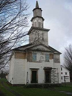 Seventh Day Baptist Church |
October 5, 2005 (#05001136) |
Utica St. 42°45′40″N 75°53′07″W |
DeRuyter | |
| 64 | Shattuck House | July 15, 1991 (#91000873) |
W. Lake Rd. 42°58′16″N 75°53′04″W |
Cazenovia | ||
| 65 | Adon Smith House | 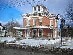 Adon Smith House |
May 2, 1974 (#74001256) |
3 Broad St. 42°49′37″N 75°32′36″W |
Hamilton | |
| 66 | Gerrit Smith Estate |  Gerrit Smith Estate |
November 24, 1997 (#97001386) |
Jct. of Main and Nelson Sts. 42°58′05″N 75°41′13″W |
Peterboro | |
| 67 | Smithfield Presbyterian Church | 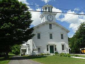 Smithfield Presbyterian Church |
December 12, 1994 (#94001370) |
Pleasant Valley Rd. between Elizabeth and Park Sts. 42°57′56″N 75°41′17″W |
Peterboro | |
| 68 | South Peterboro Street Commercial Historic District | 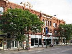 South Peterboro Street Commercial Historic District |
May 23, 1986 (#86001287) |
Roughly bounded by NY 76, Diamond St., Penn Central RR tracks, and Commerce Ave. 43°04′41″N 75°45′06″W |
Canastota | |
| 69 | South Peterboro Street Residential Historic District | May 23, 1986 (#86001288) |
S. Peterboro St. between Terrace and Rasbach Sts. 43°04′30″N 75°45′09″W |
Canastota | ||
| 70 | Spirit House |  Spirit House |
March 22, 2006 (#06000160) |
NY 26 42°40′32″N 75°44′15″W |
Georgetown | |
| 71 | St. Paul's Church | 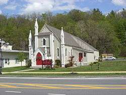 St. Paul's Church |
August 30, 1996 (#96000956) |
204 Genesee St. 43°02′37″N 75°52′00″W |
Chittenango | |
| 72 | Sweetland Farmhouse | November 2, 1987 (#87001874) |
Number Nine Rd. 42°54′52″N 75°50′44″W |
Cazenovia | ||
| 73 | Tall Pines | November 2, 1987 (#87001875) |
Ridge Rd. 42°57′03″N 75°51′23″W |
Cazenovia | ||
| 74 | The Hickories | July 15, 1991 (#91000870) |
47 Forman St. 42°56′04″N 75°51′37″W |
Cazenovia | ||
| 75 | United Church of Canastota | 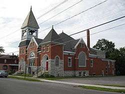 United Church of Canastota |
May 23, 1986 (#86001306) |
144 W. Center St. 43°04′42″N 75°45′14″W |
Canastota | |
| 76 | Upenough | July 15, 1991 (#91000871) |
Rippleton St. 42°54′12″N 75°52′34″W |
Cazenovia | ||
| 77 | US Post Office-Canastota | November 17, 1988 (#88002467) |
118 S. Peterboro St. 43°04′43″N 75°45′05″W |
Canastota | ||
| 78 | US Post Office-Hamilton | US Post Office-Hamilton |
May 11, 1989 (#88002522) |
32 Broad St. 42°49′00″N 75°32′40″W |
Hamilton | |
| 79 | US Post Office-Oneida | May 11, 1989 (#88002390) |
133 Farrier Ave. 43°05′39″N 75°39′12″W |
Oneida | ||
| 80 | Wampsville Presbyterian Church | February 2, 2018 (#100002075) |
109 Genesee St. 43°04′30″N 75°42′20″W |
Wampsville | 1830 church, converted from meeting house, was first one in Wampsville; has been altered several times since but retains basic form | |
| 81 | Wheeler House Complex | September 22, 1983 (#83001706) |
NY 8 42°48′32″N 75°15′10″W |
Leonardsville | ||
| 82 | York Lodge | July 15, 1991 (#91000872) |
4448 E. Lake Rd. 42°56′21″N 75°51′29″W |
Cazenovia |
See also
| Wikimedia Commons has media related to National Register of Historic Places in Madison County, New York. |
References
- The latitude and longitude information provided in this table was derived originally from the National Register Information System, which has been found to be fairly accurate for about 99% of listings. Some locations in this table may have been corrected to current GPS standards.
- "National Register of Historic Places: Weekly List Actions". National Park Service, United States Department of the Interior. Retrieved on June 19, 2020.
- Numbers represent an ordering by significant words. Various colorings, defined here, differentiate National Historic Landmarks and historic districts from other NRHP buildings, structures, sites or objects.
- The eight-digit number below each date is the number assigned to each location in the National Register Information System database, which can be viewed by clicking the number.
| Topics |  | |
|---|---|---|
| Lists by county |
| |
| Lists by city | ||
| Other lists | ||
| ||
This article is issued from Wikipedia. The text is licensed under Creative Commons - Attribution - Sharealike. Additional terms may apply for the media files.