National Register of Historic Places listings in Ulster County, New York
List of the National Register of Historic Places listings in Ulster County, New York
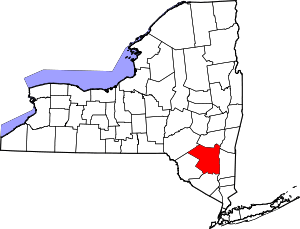
Location of Ulster County in New York
This is intended to be a complete list of properties and districts listed on the National Register of Historic Places in Ulster County, New York. The locations of National Register properties and districts (at least for all showing latitude and longitude coordinates below) may be seen in a map by clicking on "Map of all coordinates".[1] Eight of the properties and districts are further designated as U.S. National Historic Landmarks.
- This National Park Service list is complete through NPS recent listings posted June 19, 2020.[2]
| Albany (Albany) – Allegany – Bronx – Broome – Cattaraugus – Cayuga – Chautauqua – Chemung – Chenango – Clinton – Columbia – Cortland – Delaware – Dutchess (Poughkeepsie, Rhinebeck) – Erie (Buffalo) – Essex – Franklin – Fulton – Genesee – Greene – Hamilton – Herkimer – Jefferson – Kings – Lewis – Livingston – Madison – Monroe (Rochester) – Montgomery – Nassau – New York (Below 14th Street, 14th to 59th Streets, 59th to 110th Streets, Above 110th Street, Islands) – Niagara – Oneida – Onondaga – Ontario – Orange – Orleans – Oswego – Otsego – Putnam – Queens – Rensselaer – Richmond – Rockland – St. Lawrence – Saratoga – Schenectady – Schoharie – Schuyler – Seneca – Steuben – Suffolk – Sullivan – Tioga – Tompkins – Ulster – Warren – Washington – Wayne – Westchester (Northern, Southern, New Rochelle, Peekskill, Yonkers) – Wyoming – Yates |
Listings county-wide
| [3] | Name on the Register | Image | Date listed[4] | Location | City or town | Description |
|---|---|---|---|---|---|---|
| 1 | Accord Historic District | January 24, 2020 (#100004909) |
Devoe Ln., Granite Rd., Main St., Scenic Rd. Schoolhouse Rd., Tobacco Rd., Tow Path Rd. 41°47′09″N 74°13′47″W |
Accord | ||
| 2 | Peter Aldrich Homestead | September 26, 1983 (#83001811) |
168 Decker Rd. 41°40′11″N 74°15′24″W |
Gardiner | 1750 frame house of early settler; later expanded; part of the Shawangunk Valley Multiple Resource Area (MRA) | |
| 3 | All Saints' Chapel | 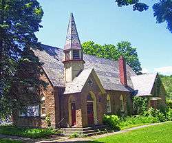 All Saints' Chapel |
September 11, 1986 (#86002511) |
Main St. 41°50′44″N 74°04′35″W |
Rosendale | Unusual 1876 Gothic Revival church building with Ruskinesque touches finished in locally mined Rosendale cement. Used as Rosendale library since 1959. |
| 4 | Alligerville Historic District | 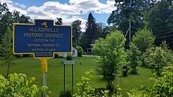 Alligerville Historic District |
June 30, 2015 (#15000370) |
Berme, Church Hill, Creek, Rose Hill & Towpath Rds., Cty. Rd. 6, Church & Purcell Lns. 41°47′45″N 74°11′48″W |
Alligerville | Well-preserved Delaware and Hudson Canal town |
| 5 | Appeldoorn Farm | March 20, 2013 (#13000099) |
4938 US 209 41°47′47″N 74°12′56″W |
Accord | Farmstead has remained in same family, with many original buildings, for almost 300 years. | |
| 6 | Ashokan Field Campus Historic District | April 16, 2019 (#100003622) |
477 Beaverkill Rd. 41°55′46″N 74°12′08″W |
Olive Bridge | Oldest outdoor environmental education center in state built on property first developed for farming in the 18th century | |
| 7 | Ashokan-Turnwood Covered Bridge |  Ashokan-Turnwood Covered Bridge |
July 20, 2000 (#00000822) |
477 Beaverkill Rd. 41°55′36″N 74°11′58″W |
Olive Bridge | |
| 8 | Sebastian Baker Stone House | February 22, 1996 (#96000136) |
10 Dug Rd. 41°49′55″N 74°14′40″W |
Rochester | part of the Rochester Multiple Property Submission (MPS) | |
| 9 | Balsam Lake Mountain Fire Observation Station | 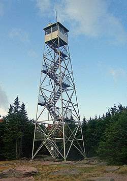 Balsam Lake Mountain Fire Observation Station |
September 23, 2001 (#01001038) |
Balsam Lake Mountain 42°04′11″N 74°34′28″W |
Hardenburgh | Earliest site of a fire lookout in the Catskills. Current tower built in 1930 and used till 1988. Part of the Fire Observation Stations of New York State Forest Preserve MPS |
| 10 | Zachariah Barley Stone House | _Zachariah_Barley_Stone_House%2C_193_Whitfield_Rd.%2C_Rochester%2C_Ulster_Cnty%2C_NY_1.png) Zachariah Barley Stone House |
August 10, 1995 (#95000951) |
193 Whitfield Rd. 41°49′32″N 74°14′22″W |
Rochester | part of the Rochester MPS |
| 11 | Beaverkill Valley Inn | 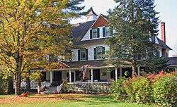 Beaverkill Valley Inn |
September 12, 1985 (#85002280) |
Beaverkill Rd. 42°01′24″N 74°45′06″W |
Lew Beach | 1895 inn is one of few surviving fishing lodges from early years of Beaverkill angling |
| 12 | George W. Bellows House | February 2, 2018 (#100002081) |
9 Bellows Ln. 42°02′46″N 74°07′16″W |
Woodstock | 1921 cottage built as summer retreat by artist George Bellows | |
| 13 | Bevier House | 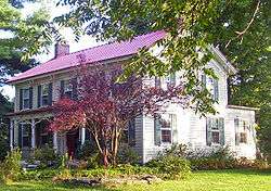 Bevier House |
September 26, 1983 (#83001812) |
Bevier Rd. 41°40′57″N 74°10′19″W |
Gardiner | Mid-19th-century farmhouse, one of few intact ones in Shawangunk Valley that predate Civil War; part of the Shawangunk Valley MRA |
| 14 | Bevier Stone House | .jpg) Bevier Stone House |
March 12, 2002 (#02000135) |
2687 US 209 41°53′25″N 74°06′11″W |
Marbletown | |
| 15 | Binnewater Historic District | 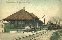 Binnewater Historic District |
November 4, 1982 (#82001272) |
Sawdust Ave., Breezy Hill and Binnewater Rds. 41°51′27″N 74°05′10″W |
Rosendale | |
| 16 | Boice House | 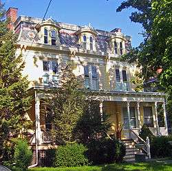 Boice House |
December 28, 2001 (#01001388) |
110 Fair St. 41°55′40″N 74°00′58″W |
Kingston | 1850s Greek Revival home remodeled in Second Empire style by local quarry owner |
| 17 | Brown–Ellis House | June 17, 2014 (#14000316) |
382 Crescent Ave. 41°42′12″N 74°02′33″W |
Highland | Well-preserved farmhouse of early settler | |
| 18 | Emile Brunel Studio and Sculpture Garden |  Emile Brunel Studio and Sculpture Garden |
August 10, 1999 (#99000909) |
NY 28 41°59′49″N 74°15′52″W |
Boiceville | Surviving pre–World War II Catskills roadside attraction. Studio built in imitation of European farmhouse, an unusual style in the region. |
| 19 | Bruynswick School No. 8 | 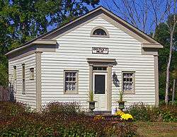 Bruynswick School No. 8 |
November 2, 2000 (#00001277) |
2146 Bruynswick Rd. 41°39′33″N 74°13′36″W |
Shawangunk | Intact 19th-century wooden one-room schoolhouse |
| 20 | Brykill | 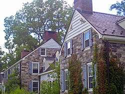 Brykill |
September 26, 1983 (#83001813) |
Bruynswick Rd. 41°39′56″N 74°13′02″W |
Gardiner | 1724 stone house greatly expanded into sympathetic Colonial Revival mansion by Myron Teller in 1927. Now an organic grass-fed beef ranch. Part of the Shawangunk Valley MRA |
| 21 | John Burroughs Cabin | 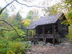 John Burroughs Cabin |
November 24, 1968 (#68000034) |
West of West Park 41°47′48″N 73°58′26″W |
West Park | Naturalist John Burroughs' cabin known as "Slabsides" |
| 22 | John Burroughs Riverby Study |  John Burroughs Riverby Study |
November 24, 1968 (#68000035) |
Between US 9W and the Hudson River 41°48′17″N 73°58′25″W |
West Park | Burroughs' study at his West Park estate |
| 23 | Byrdcliffe Historic District | 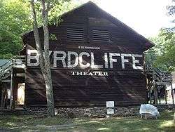 Byrdcliffe Historic District |
May 7, 1979 (#79001643) |
West of Woodstock at Glasco Tpke. and Larks Nest Rd. 42°03′14″N 74°08′17″W |
Woodstock | Utopian artists' community |
| 24 | Camp Wapanachki |  Camp Wapanachki |
November 25, 1994 (#94001372) |
S. Plank Rd. (Old Co. Rt 28) at the junction with Miller Rd., Shandaken 42°02′56″N 74°16′21″W |
Mt. Tremper | |
| 25 | Chapel Hill Bible Church |  Chapel Hill Bible Church |
January 7, 2005 (#04001450) |
49 Bingham Rd. 41°35′12″N 73°59′42″W |
Marlboro | Gothic Revival church originally built 1860 in Manhattan moved to Marlboro in 1905. |
| 26 | Chestnut Street Historic District |  Chestnut Street Historic District |
September 19, 1985 (#85002443) |
Roughly bounded by W. Chestnut St., Broadway, E. Chestnut, Livingston & Stuyvesant Sts. 41°55′24″N 73°59′22″W |
Kingston | |
| 27 | Chetolah |  Chetolah |
October 21, 1980 (#80002782) |
South of Cragsmoor on Vista Maria Rd. 41°39′39″N 74°22′39″W |
Cragsmoor | Late 19th-century estate |
| 28 | Chichester House |  Chichester House |
December 28, 2001 (#01001392) |
116 Fair St. 41°55′41″N 74°00′58″W |
Kingston | Intact 1870s Second Empire house |
| 29 | Walstein Childs House | July 3, 2003 (#03000602) |
Sand Hill Rd., Wallkill Correctional Facility 41°38′33″N 74°10′08″W |
Wallkill | Intact late 18th-century stone house | |
| 30 | Christ Episcopal Church | 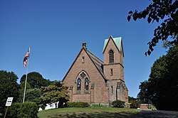 Christ Episcopal Church |
November 10, 2010 (#10000916) |
426 Old Post Road 41°36′01″N 73°58′18″W |
Marlboro | |
| 31 | Christ Lutheran Church and Parsonage |  Christ Lutheran Church and Parsonage |
May 28, 2010 (#10000304) |
105-107 Center Street 41°42′54″N 74°23′34″W |
Ellenville | |
| 32 | Church of the Holy Transfiguration of Christ-on-the-Mount | Church of the Holy Transfiguration of Christ-on-the-Mount |
December 9, 2005 (#05001385) |
Mead's Mountain Rd. 42°03′42″N 74°07′18″W |
Woodstock | |
| 33 | Clinton Avenue Historic District |  Clinton Avenue Historic District |
February 5, 1970 (#70000434) |
Clinton Ave. and Fair St. 41°56′05″N 74°01′29″W |
Kingston | Neighborhood around Senate House was first historic district in city; now part of larger Stockade District |
| 34 | Cole-Hasbrouck Farm Historic District |  Cole-Hasbrouck Farm Historic District |
November 10, 1994 (#94001240) |
NY 32, north of the junction with US 44 and NY 55 41°40′08″N 74°06′24″W |
Modena | |
| 35 | Common School No. 10 | September 15, 1988 (#88001439) |
Northside of Upper Cherrytown Rd. 41°52′47″N 74°19′18″W |
Accord | ||
| 36 | Community Theatre |  Community Theatre |
July 22, 1979 (#79001639) |
601 Broadway 41°55′46″N 74°00′17″W |
Kingston | 1926 Classical Revival theater is only pre–World War II theater left in city and one of only three in the Hudson Valley. Now Ulster Performing Arts Center and home to the Hudson Valley Philharmonic |
| 37 | Congregation Tifereth Yehuda Veyisroel | 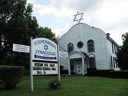 Congregation Tifereth Yehuda Veyisroel |
August 27, 2013 (#13000632) |
24–26 Minnewaska Trail 41°46′14″N 74°17′52″W |
Kerhonkson | One of 20 intact early 20th-century Catskill synagogues |
| 38 | Cordts Mansion |  Cordts Mansion |
October 3, 2007 (#07001039) |
82-152 Lindsley Ave. 41°55′46″N 73°58′22″W |
Kingston | |
| 39 | Coykendall Lodge | January 11, 2002 (#01001441) |
Off Alder Lake Rd. 42°03′15″N 74°40′27″W |
Hardenburgh | Lodge of rail magnate Samuel Coykendall, now one of the few non-fire tower structures allowed to remain on Forest Preserve land | |
| 40 | Cragsmoor Historic District | 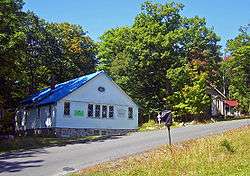 Cragsmoor Historic District |
August 8, 1996 (#96000860) |
Roughly bounded by Henry, Cragsmoor, and Sam's Pt. Rds., Hamlet of Cragsmoor 41°40′13″N 74°22′36″W |
Cragsmoor | Artists' community with many ornate 19th-century houses |
| 41 | J. B. Crowell and Son Brick Mould Mill Complex | 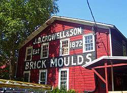 J. B. Crowell and Son Brick Mould Mill Complex |
June 30, 1983 (#83001814) |
Lippencott Rd. 41°37′25″N 74°11′49″W |
Wallkill | Intact late-19th-century commercial complex still in use |
| 42 | Cumming-Parker House | February 12, 2010 (#10000014) |
50 Appletree Road 41°49′59″N 73°57′31″W |
Esopus | ||
| 43 | Davis Stone House | August 12, 1999 (#99000995) |
4652 US 209 41°49′09″N 74°12′01″W |
Rochester | part of the Rochester MPS | |
| 44 | Johannes Decker Farm |  Johannes Decker Farm |
March 5, 1974 (#74001312) |
Southwest of Gardiner on Red Mill Rd. and Shawangunk Kill 41°38′33″N 74°14′03″W |
Gardiner | |
| 45 | William Decker House |  William Decker House |
September 26, 1983 (#83001815) |
New Prospect Rd. 41°38′51″N 74°15′49″W |
Shawangunk | Stone house of early settler of Town of Shawangunk; part of the Shawangunk Valley MRA |
| 46 | Delaware and Hudson Canal |  Delaware and Hudson Canal |
November 24, 1968 (#68000051) |
Delaware and Hudson Canal Coordinates missing |
Linear through county from Spring Glen to Creeklocks | Remains of canal and locks that provided anthracite coal from Northeastern Pennsylvania to New York City in the 19th century, spurring city's growth |
| 47 | Dill Farm | 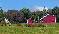 Dill Farm |
September 26, 1983 (#83001816) |
Off Goebel Rd. 41°38′35″N 74°15′45″W |
Shawangunk | Ca. 1760 family farm with original buildings from the early 19th century. Part of the Shawangunk Valley MRA |
| 48 | District School No. 14 | 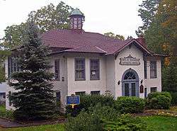 District School No. 14 |
February 21, 1997 (#97000111) |
Academy St., south of the junction with Birch Cr. Rd. 42°08′06″N 74°28′47″W |
Pine Hill | 1925 building reflects changes in state standards for rural schools and combines Colonial Revival and Craftsman styles. |
| 49 | Andries DuBois House | 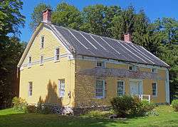 Andries DuBois House |
August 6, 1998 (#98001011) |
75 Wallkill Ave. 41°36′36″N 74°11′13″W |
Wallkill | Oldest house in Wallkill; recently restored to original appearance |
| 50 | DuBois-Deyo House | 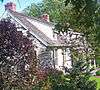 DuBois-Deyo House |
November 25, 1994 (#94001374) |
437 Springtown Rd. 41°48′16″N 74°05′12″W |
Rosendale | |
| 51 | Dubois-Kierstede Stone House | 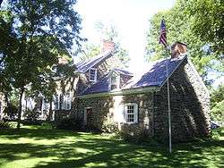 Dubois-Kierstede Stone House |
May 20, 1998 (#98000550) |
119 Main St. 42°04′45″N 73°56′59″W |
Saugerties | 1727 stone house used as museum |
| 52 | Dubois-Sarles Octagon |  Dubois-Sarles Octagon |
November 15, 2002 (#02001322) |
16 South St. 41°36′02″N 73°58′27″W |
Marlboro | Second Empire-style octagon house built in the 1850s and modified 1872. Rare such home built on a sidehall plan. |
| 53 | Hendrikus DuBois House |  Hendrikus DuBois House |
July 8, 1982 (#82003410) |
600 Albany Post Rd. 41°43′15″N 74°08′56″W |
Libertyville | House of son of "Duzine" who served in militia during Revolution |
| 54 | Ephriam DuPuy Stone House |  Ephriam DuPuy Stone House |
August 10, 1995 (#95000952) |
193 Whitfield Rd. 41°49′10″N 74°13′18″W |
Rochester | Mid-18th-century stone house; part of the Rochester MPS |
| 55 | J. Dupuy Stone House |  J. Dupuy Stone House |
February 21, 1997 (#97000110) |
Krum Rd., west of the junction with Queens Hwy. 41°48′09″N 74°16′45″W |
Rochester | 1840 stone house was raised only on front facade; part of the Rochester MPS |
| 56 | Ellenville Downtown Historic District | 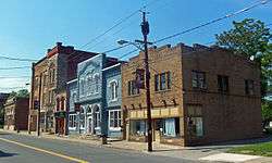 Ellenville Downtown Historic District |
June 20, 2012 (#12000344) |
Canal, Center, Liberty, Main, & Market Sts. 41°43′01″N 74°23′36″W |
Ellenville | Core of village reflecting change from 19th-century canal town to early 20th-century resort area. |
| 57 | Elliot–Buckley House |  Elliot–Buckley House |
September 29, 2011 (#11000710) |
204 Old Post Rd. 41°35′04″N 73°58′14″W |
Marlboro | Built in 1843 by Dr. Daniel Elliot, sold to the Buckley family in 1866. |
| 58 | Elm Street Stone Arch Bridge |  Elm Street Stone Arch Bridge |
December 16, 1996 (#96001437) |
Elm St., over Alton Creek 42°08′00″N 74°28′48″W |
Pine Hill | 1900 bridge is one of few stone arch bridges remaining in county |
| 59 | Elting Memorial Library | Elting Memorial Library |
May 12, 2004 (#04000432) |
93 Main St. 41°44′54″N 74°05′07″W |
New Paltz | Main library of New Paltz; expanded from old stone house |
| 60 | Esopus Meadows Lighthouse | 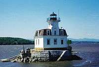 Esopus Meadows Lighthouse |
May 29, 1979 (#79001638) |
Spans Hudson River 41°52′16″N 73°56′45″W |
Esopus | part of the Hudson River Lighthouses Thematic Resource (TR) |
| 61 | First Reformed Protestant Dutch Church of Kingston | 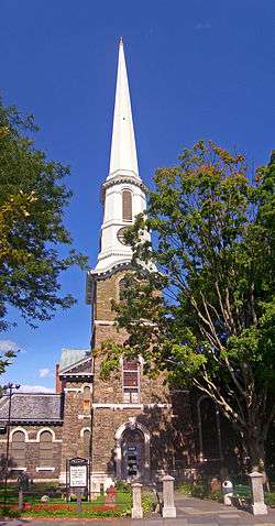 First Reformed Protestant Dutch Church of Kingston |
October 10, 2008 (#08001089) |
272 Wall Street 41°55′58″N 74°01′10″W |
Kingston | Minard Lefever-designed 1852 church for congregation dating to 1659, one of oldest in U.S. in continuous existence. Only Lafever stone church, and his only Renaissance Revival church retaining its original integrity. |
| 62 | Fitch Bluestone Company Office | 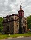 Fitch Bluestone Company Office |
May 16, 2016 (#16000256) |
532-574 Abeel St. 41°54′35″N 74°00′09″W |
Kingston | Distinctive 1870 office made, unusually, entirely of bluestone |
| 63 | James and Mary Forsyth House | 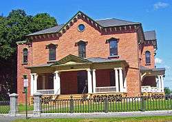 James and Mary Forsyth House |
July 3, 2003 (#03000603) |
31 Albany Ave. 41°55′58″N 74°00′53″W |
Kingston | 1849 Richard Upjohn Italian villa is one of only two pre-Civil War buildings, and only house, by a nationally prominent architect in the city |
| 64 | Fuller Shirt Company Factory |  Fuller Shirt Company Factory |
July 27, 2018 (#100002745) |
45 Pine Grove Avenue 41°55′36″N 74°00′07″W |
Kingston | Main manufactuting facility of local garment company built in 1906 and used through 1965 |
| 65 | Gardiner School | 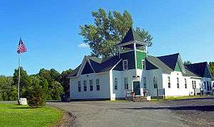 Gardiner School |
November 22, 2000 (#00001423) |
2340 US 44/NY 55 41°40′43″N 74°08′59″W |
Gardiner | Late-19th-century wooden school building now used as town hall following restoration |
| 66 | Grant Mills Covered Bridge | 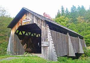 Grant Mills Covered Bridge |
December 17, 1998 (#98001538) |
Mill Brook Rd., over Mill Brook 42°04′48″N 74°37′45″W |
Hardenburgh | Intact 1902 covered bridge, highest one in Catskills. Now carries foot traffic only |
| 67 | Guilford-Bower Farm House | July 8, 1999 (#99000810) |
Albany Post Rd. 41°42′40″N 74°09′30″W |
New Paltz | ||
| 68 | Thaddeus Hait Farm | Thaddeus Hait Farm |
December 29, 1988 (#88003075) |
75 Allhusen Rd. 41°40′43″N 74°05′23″W |
Modena | Mostly intact early-19th-century farm now returned to original use as winery |
| 69 | Jean Hasbrouck House | 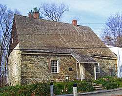 Jean Hasbrouck House |
December 24, 1967 (#67000016) |
Huguenot and N. Front Sts. 41°45′06″N 74°05′20″W |
New Paltz | Best example of Belgian stone house among the Huguenot Street homes; only one with jambless fireplace |
| 70 | Major Jacob Hasbrouck Jr. House |  Major Jacob Hasbrouck Jr. House |
July 23, 1999 (#99000808) |
193 Huguenot St. 41°45′38″N 74°05′11″W |
New Paltz | Home built in 1786 by Jean Hasbrouck's grandson, a veteran of the Revolution and town supervisor; modified in different ways by descendants over 19th century. Last major stone house in Ulster County and only one still owned by descendants of same family |
| 71 | Judge Jonathan Hasbrouck House |  Judge Jonathan Hasbrouck House |
March 6, 2013 (#13000056) |
20 Elwyn Lane 42°02′29″N 74°06′49″W |
Woodstock | Stone house built ca. 1800 is excellent example of Ulster County residential architecture from that time. |
| 72 | High Falls Historic District |  High Falls Historic District |
August 6, 1998 (#98001005) |
Roughly along NY 213 and Main St. 41°49′36″N 74°07′42″W |
High Falls | Semi-planned area around major stopping point on D & H Canal |
| 73 | Holy Cross Monastery |  Holy Cross Monastery |
February 24, 1995 (#95000045) |
US 9W, east side 41°48′07″N 73°57′26″W |
West Park | First house established in Order of the Holy Cross by founder The Rev. James Otis Sargent Huntington, in 1904. |
| 74 | Jacob Hoornbeck Stone House |  Jacob Hoornbeck Stone House |
February 21, 1997 (#97000108) |
Boice Mill Rd., junction with Krum Rd. 41°47′48″N 74°17′33″W |
Rochester | 1800 stone house in Georgian style built onto smaller earlier rear wing; part of the Rochester MPS |
| 75 | Hoornbeek Store Complex |  Hoornbeek Store Complex |
February 9, 1984 (#84003229) |
Main St. between Clinton & Church Sts. 41°44′28″N 74°22′27″W |
Napanoch | Early-19th-century store complex shows transition between Federal and Greek Revival styles. |
| 76 | Hornbeck Stone House | 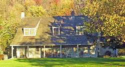 Hornbeck Stone House |
August 10, 1995 (#95000957) |
149 Whitfield Rd. 41°49′02″N 74°13′18″W |
Rochester | 1750 stone house; part of the Rochester MPS |
| 77 | House at 184 Albany Avenue | 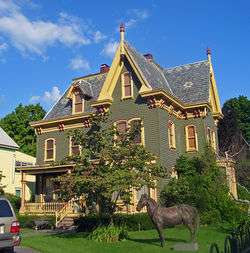 House at 184 Albany Avenue |
November 15, 2002 (#02001317) |
184 Albany Ave. 41°56′01″N 74°00′29″W |
Kingston | Intact ca. 1860 Picturesque house; part of the Albany Avenue, Kingston, Ulster County, New York MPS |
| 78 | House at 313 Albany Avenue |  House at 313 Albany Avenue |
November 15, 2002 (#02001313) |
313 Albany Ave. 41°56′16″N 74°00′17″W |
Kingston | 1896 "Hutton House" in "Free Classical" mode of Queen Anne Style, showing transition to Colonial Revival; part of the Albany Avenue, Kingston, Ulster County, New York MPS |
| 79 | House at 322 Albany Avenue | 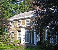 House at 322 Albany Avenue |
November 15, 2002 (#02001319) |
322 Albany Ave. 41°56′15″N 74°00′15″W |
Kingston | Early-19th-century stone house renovated in 1840s Greek Revival and 1930s Colonial Revival; part of the Albany Avenue, Kingston, Ulster County, New York MPS |
| 80 | House at 356 Albany Avenue | 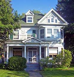 House at 356 Albany Avenue |
November 15, 2002 (#02001318) |
356 Albany Ave. 41°55′57″N 74°00′32″W |
Kingston | 1897 house in Queen Anne "Free Classical" phase; part of the Albany Avenue, Kingston, Ulster County, New York MPS |
| 81 | Huguenot Street Historic District | Huguenot Street Historic District |
October 15, 1966 (#66000578) |
Huguenot St. 41°45′06″N 74°05′19″W |
New Paltz | Late-17th-century stone houses built by founders of New Paltz; one of the oldest continuously inhabited neighborhoods in Anglo-America |
| 82 | George and John R. Hunt Memorial Building | 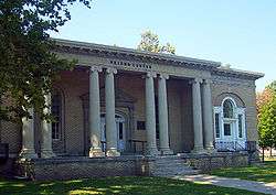 George and John R. Hunt Memorial Building |
January 14, 2005 (#04001481) |
2 Liberty St., corner of Liberty and Canal Sts. 41°43′02″N 74°23′38″W |
Ellenville | Neoclassical building from the early 20th century has seen a variety of uses, mainly as village library. |
| 83 | Hurley Historic District | 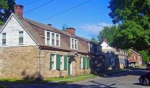 Hurley Historic District |
October 15, 1966 (#66000577) |
Hurley St., Hurley Mountain Rd., and Schoonmaker Lane 41°55′39″N 74°03′58″W |
Hurley | Well-preserved early-18th-century Dutch stone houses; temporary capitol of New York for two months after burning of nearby Kingston |
| 84 | Johannes Jansen House and Dutch Barn |  Johannes Jansen House and Dutch Barn |
September 26, 1983 (#83001818) |
Decker Rd. 41°40′01″N 74°16′11″W |
Shawangunk | Stone house and farm of early settler; part of the Shawangunk Valley MRA |
| 85 | Thomas Jansen House | 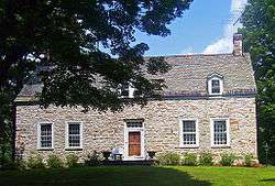 Thomas Jansen House |
September 26, 1983 (#83001817) |
Jansen Rd. 41°39′07″N 74°17′32″W |
Shawangunk | Jansen's original 1727 stone house still stands as kitchen wing of Federal-style stone house his grandson built in the 1820s. Part of the Shawangunk Valley MRA |
| 86 | Jenkins-DuBois Farm and Mill Site | 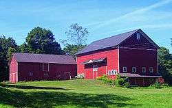 Jenkins-DuBois Farm and Mill Site |
May 30, 2001 (#01000581) |
Jenkinstown Rd. 41°41′46″N 74°06′38″W |
Gardiner | 1793 farm on land still owned by original family. |
| 87 | K. WHITTELSEY (tugboat) | November 21, 2002 (#02001395) |
3 North St. at Rondout Creek 41°55′20″N 73°58′13″W |
Kingston | Scrapped in 2008.[5] | |
| 88 | William Kenyon House |  William Kenyon House |
December 28, 2001 (#01001387) |
104 Fair St. 41°55′39″N 74°00′57″W |
Kingston | Intact 1850 Italian villa-style house of local congressman |
| 89 | Kingston City Almshouse | 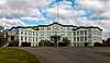 Kingston City Almshouse |
February 2, 2018 (#100002082) |
300 Flatbush Ave. 41°56′28″N 73°59′20″W |
Kingston | 1872-74 stone Italianate building to care for city's poor; later used by county health department and currently vacant |
| 90 | Kingston City Hall |  Kingston City Hall |
December 9, 1971 (#71000563) |
408 Broadway 41°55′37″N 73°59′48″W |
Kingston | 1873 building, recently restored, sat on former Kingston-Rondout boundary to symbolize merged city. |
| 91 | Kingston City Library |  Kingston City Library |
December 7, 1995 (#95001404) |
399 Broadway 41°55′34″N 73°59′47″W |
Kingston | 1903 neoclassical Carnegie library |
| 92 | Kingston Stockade District |  Kingston Stockade District |
June 19, 1975 (#75001231) |
Area bounded by both sides of Clinton Ave., Main, Green, and Front Sts. 41°56′02″N 74°01′13″W |
Kingston | Area inside 1654 stockade, commonly known as Uptown Kingston |
| 93 | Kingston-Port Ewen Suspension Bridge | 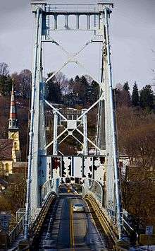 Kingston-Port Ewen Suspension Bridge |
April 30, 1980 (#80002783) |
Wurtz St. (old U.S. 9W), across Rondout Creek 41°55′02″N 73°59′08″W |
Kingston and Port Ewen | Suspension bridge, started in 1916, completed in 1921 (interrupted by WWI steel shortage),
was final link in US 9W up west side of Hudson, replacing the Skillypot ferry. 3 ton load limit; extensive reconstruction scheduled to commence in 2015. |
| 94 | Kingston/Rondout 2 Lighthouse | .jpg) Kingston/Rondout 2 Lighthouse |
May 29, 1979 (#79001640) |
Hudson River and Rondout Creek 41°55′38″N 73°58′19″W |
Kingston | part of the Hudson River Lighthouses TR |
| 95 | Kirkland Hotel | 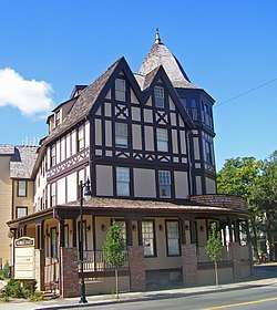 Kirkland Hotel |
November 15, 2002 (#02001323) |
2 Main St. 41°55′59″N 74°01′01″W |
Kingston | Rare surviving wood-frame urban hotel built in 1899 |
| 96 | Kripplebush Historic District | 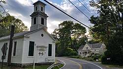 Kripplebush Historic District |
October 4, 1994 (#94001173) |
Roughly, area surrounding Kripplebush and Pine Bush Rds. 41°50′18″N 74°11′17″W |
Marbletown | |
| 97 | Krom Stone House and Dutch Barn | 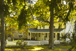 Krom Stone House and Dutch Barn |
August 10, 1995 (#95000955) |
Airport Rd. 41°49′01″N 74°12′35″W |
Rochester | part of the Rochester MPS |
| 98 | Krom Stone House at 31 Upper Whitfield Road | _Krom_Stone_House_at_31_Upper_Whitfield_Rd.%2C_Rochester%2C_Ulster_Cnty%2C_NY_1.png) Krom Stone House at 31 Upper Whitfield Road |
August 10, 1995 (#95000954) |
31 Upper Whitfield Rd. 41°49′43″N 74°13′39″W |
Rochester | part of the Rochester MPS |
| 99 | Krom Stone House at 45 Upper Whitfield Road | 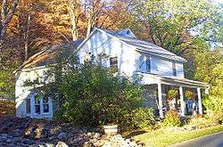 Krom Stone House at 45 Upper Whitfield Road |
August 10, 1995 (#95000950) |
45 Upper Whitfield Rd. 41°49′43″N 74°13′52″W |
Rochester | 1780 stone house with frame rear wing added in the late 19th century; part of the Rochester MPS |
| 100 | Lucas Krom Stone House | Lucas Krom Stone House |
August 10, 1995 (#95000953) |
286 Whitfield Rd. 41°49′37″N 74°13′23″W |
Rochester | part of the Rochester MPS |
| 101 | John A. Lafevre House and School |  John A. Lafevre House and School |
November 16, 1989 (#89002023) |
NY 208, south of New Paltz 41°41′50″N 74°07′09″W |
Gardiner | Stone house built 1772 by New Paltz Huguenot descendant; one-room schoolhouse on property built 1838. |
| 102 | Lattingtown Baptist Church | 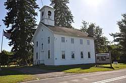 Lattingtown Baptist Church |
October 20, 2010 (#10000855) |
425 Old Indian Road 41°38′39″N 74°00′24″W |
Lattingtown | |
| 103 | Lake Mohonk Mountain House Complex | 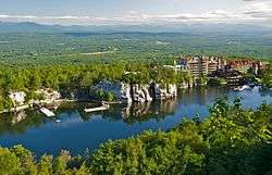 Lake Mohonk Mountain House Complex |
July 16, 1973 (#73001280) |
Northwest of New Paltz, between Wallkill Valley on the east and Roundout Valley on the west 41°46′48″N 74°09′41″W |
New Paltz | Architecturally eclectic ridgetop resort has been site of several important international conferences. |
| 104 | Abraham and Maria LeFevre House |  Abraham and Maria LeFevre House |
July 28, 2006 (#06000645) |
56 Forest Glen Rd. 41°41′56″N 74°07′48″W |
Gardiner | |
| 105 | Lock Tender's House and Canal Store Ruin | 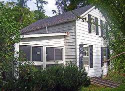 Lock Tender's House and Canal Store Ruin |
August 6, 1998 (#98001010) |
40 Canal Rd. 41°49′25″N 74°07′51″W |
High Falls | 1848 house for keeper of D&H Canal Lock 20 and contemporary foundation for canal store |
| 106 | Locust Lawn Estate |  Locust Lawn Estate |
May 17, 1974 (#74001313) |
NY 32, southeast of Gardiner 41°41′51″N 74°06′08″W |
Gardiner | 1814 Federal-style estate of Josiah Hasbrouck, descendant of the Huguenot Hasbroucks and U.S. Congressman |
| 107 | Loerzel Beer Hall | 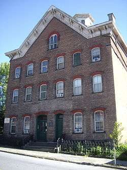 Loerzel Beer Hall |
September 7, 1984 (#84003234) |
213 Partition St. 42°04′29″N 73°57′04″W |
Saugerties | 1873 brewery now used as apartments |
| 108 | Main Street Historic District |  Main Street Historic District |
June 7, 1988 (#88000666) |
US 209 41°50′49″N 74°08′41″W |
Stone Ridge | Late-18th- and early-19th-century houses and church. |
| 109 | Main-Partition Streets Historic District |  Main-Partition Streets Historic District |
July 8, 1982 (#82003411) |
Roughly bounded by Main, Partition, Market and Jane Sts. 42°04′37″N 73°57′10″W |
Saugerties | |
| 110 | Jacob F. Markle Stone House |  Jacob F. Markle Stone House |
August 10, 1995 (#95000948) |
335 Whitfield Rd. 41°49′59″N 74°13′03″W |
Rochester | part of the Rochester MPS |
| 111 | Maverick Concert Hall |  Maverick Concert Hall |
December 9, 1999 (#99001492) |
Off Maverick Rd. 42°00′51″N 74°07′06″W |
Hurley | |
| 112 | Middaugh-Stone House and Dutch Barn | December 29, 1994 (#94001514) |
476 Mill Rd. 41°49′09″N 74°13′49″W |
Rochester | ||
| 113 | Mill Street Stone Arch Bridge |  Mill Street Stone Arch Bridge |
December 16, 1996 (#96001439) |
Mill St., over Birch Cr. 42°08′01″N 74°29′00″W |
Pine Hill | 1897 bridge built by same builder as Elm Street bridge |
| 114 | Miller's House at Red Mills | September 26, 1983 (#83001819) |
Red Mills Rd. and Wallkill Ave. 41°37′42″N 74°16′29″W |
Shawangunk | part of the Shawangunk Valley MRA | |
| 115 | Milton Railroad Station | 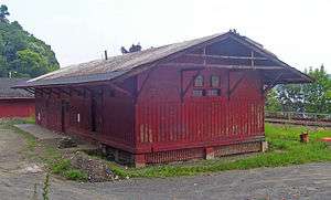 Milton Railroad Station |
August 28, 2007 (#07000873) |
41 Dock Rd. 41°39′10″N 73°57′17″W |
Milton | One of the few remaining passenger stations from the West Shore Railroad. Built in 1883; remains relatively intact today. |
| 116 | Morton Memorial Library |  Morton Memorial Library |
February 21, 1997 (#97000119) |
Elm St., southwest of NY 28 42°08′03″N 74°28′47″W |
Pine Hill | 1902 Georgian Revival library built by summer resident and local philanthropist |
| 117 | Mount Tremper Fire Observation Station | 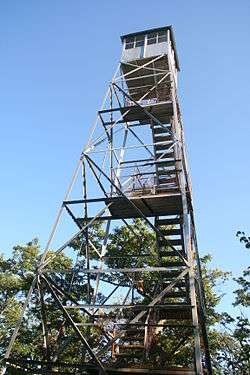 Mount Tremper Fire Observation Station |
September 23, 2001 (#01001032) |
Mount Tremper 42°04′27″N 74°16′40″W |
Shandaken | part of the Fire Observation Stations of New York State Forest Preserve MPS |
| 118 | National Youth Administration Woodstock Resident Work Center |  National Youth Administration Woodstock Resident Work Center |
April 30, 1992 (#92000455) |
NY 212 north side, east of Woodstock 42°02′25″N 74°05′39″W |
Woodstock | Now Woodstock School of Art |
| 119 | New Paltz Downtown Historic District |  New Paltz Downtown Historic District |
July 24, 2009 (#09000561) |
Main, N. Chestnut, S. Chestnut, Church, N. Front, Academy and W. Center Sts., Innis and Plattekill Aves. 41°44′53″N 74°05′06″W |
New Paltz | Intact 19th-century core of funky college town |
| 120 | O&W Railroad Station at Port Ben |  O&W Railroad Station at Port Ben |
January 11, 2002 (#01001448) |
Tow Path Rd. 41°45′00″N 74°20′50″W |
Wawarsing | Abandoned 1912 passenger station and right-of-way of former track |
| 121 | Old Dutch Church Parsonage |  Old Dutch Church Parsonage |
August 15, 2001 (#01000845) |
109 Pearl St. 41°55′51″N 74°01′16″W |
Kingston | |
| 122 | Osterhoudt Stone House | July 5, 2001 (#01000717) |
1880 NY 32 42°01′03″N 73°57′32″W |
Saugerties | ||
| 123 | Olive and Hurley Old School Baptist Church |  Olive and Hurley Old School Baptist Church |
November 19, 1998 (#98001392) |
NY 28, junction with NY 30 41°58′24″N 74°12′45″W |
Shokan | |
| 124 | Ontario and Western Railroad Passenger Station |  Ontario and Western Railroad Passenger Station |
February 22, 1999 (#99000086) |
Institution Rd. 41°44′24″N 74°21′57″W |
Napanoch | Intact 1903 train station next to D&H canal bed |
| 125 | Opus 40 | 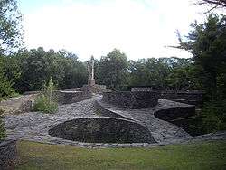 Opus 40 |
March 12, 2001 (#01000238) |
Fite Rd. 42°03′03″N 74°02′02″W |
Saugerties | Environmental sculpture garden created by Bard College professor Harry Fite in the 1930s |
| 126 | Frank A. Palen House |  Frank A. Palen House |
February 9, 2005 (#05000015) |
74-76 St. James St. 41°55′50″N 74°00′53″W |
Kingston | Intact 1892 Queen Anne Style house of local businessman |
| 127 | Alton B. Parker Estate | August 23, 2016 (#16000558) |
14 Lamont Landing Rd. 41°49′45″N 73°57′27″W |
Esopus | 1860 Italian-villa style estate, the culmination of a century of work, was home of 1904 Democratic presidenital candidate | |
| 128 | Col. Oliver Hazard Payne Estate | 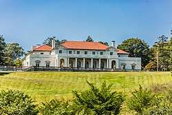 Col. Oliver Hazard Payne Estate |
November 15, 2002 (#02001324) |
US 9W 41°48′35″N 73°57′34″W |
Esopus | |
| 129 | Pearl Street Schoolhouse | 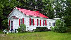 Pearl Street Schoolhouse |
September 26, 1983 (#83001820) |
Awosting and Decker Rds. 41°39′22″N 74°16′37″W |
Shawangunk | Intact 1850 one-room schoolhouse, now used as house; part of the Shawangunk Valley MRA |
| 130 | Perrine's Bridge |  Perrine's Bridge |
April 13, 1973 (#73001281) |
Off I-87 over Wallkill River 41°48′53″N 74°03′13″W |
Rosendale | Second-oldest covered bridge in New York and only one along the entire length of the Wallkill |
| 131 | Phoenicia Railroad Station | 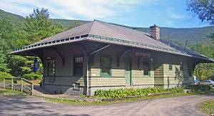 Phoenicia Railroad Station |
April 20, 1995 (#95000474) |
High St. 42°04′49″N 74°18′31″W |
Phoenicia | Surviving Ulster and Delaware Railroad station from 1899 now home to Empire State Rail Museum |
| 132 | Pilgrim Furniture Company Factory |  Pilgrim Furniture Company Factory |
May 4, 2018 (#100002390) |
2 S. Prospect Street 41°55′33″N 74°00′26″W |
Kingston | First factory built in city after World War II, with financing from federal program to make jobs available for returning veterans |
| 133 | Pine Hill Historic District | 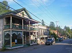 Pine Hill Historic District |
August 14, 2012 (#12000513) |
Main, Academy, Elm, & Mill Sts., Bonnieview Ave., Pine Hill, Salomone, Station, & Old Turnpike Rds. 42°07′58″N 74°28′49″W |
Pine Hill | Core of 19th-century mountain resort town |
| 134 | Ponckhockie Union Chapel | 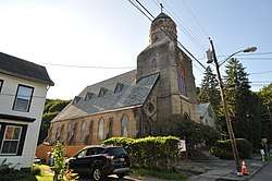 Ponckhockie Union Chapel |
April 23, 1980 (#80002784) |
91 Abruyn St. 41°55′34″N 73°58′28″W |
Kingston | |
| 135 | Poppletown Farmhouse |  Poppletown Farmhouse |
November 7, 1991 (#91001656) |
Junction of Old Post Rd. and Swarte Kill Rd. 41°49′16″N 73°58′31″W |
Esopus | |
| 136 | Red Hill Fire Observation Station | 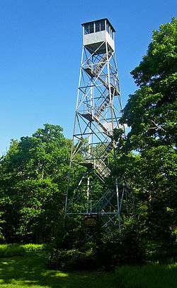 Red Hill Fire Observation Station |
September 23, 2001 (#01001030) |
Red Hill 41°55′25″N 74°31′04″W |
Denning | Last Catskill fire tower still in use when it was closed in 1990 after 70 years; first one restored and reopened in the late 1990s. 1931 observer's cabin is one of the oldest extant in New York. Part of the Fire Observation Stations of New York State Forest Preserve MPS |
| 137 | Reformed Church of Shawangunk Complex | 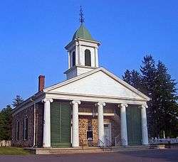 Reformed Church of Shawangunk Complex |
June 3, 1982 (#82003408) |
Hoagerburgh Rd. 41°39′12″N 74°12′52″W |
Shawangunk | Mid-18th-century stone church is oldest building in continuous use by American Dutch Reformed Church congregation |
| 138 | Reformed Dutch Church of New Hurley | 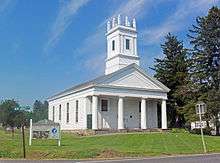 Reformed Dutch Church of New Hurley |
November 10, 1982 (#82001273) |
North of Wallkill on NY 208 41°38′18″N 74°08′37″W |
Wallkill | 1820s Greek Revival church replaced one of the first churches built in county |
| 139 | Reformed Protestant Dutch Church of Klyne Esopus | 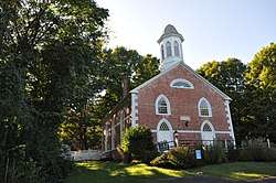 Reformed Protestant Dutch Church of Klyne Esopus |
November 15, 2002 (#02001321) |
764 US 9W 41°51′14″N 73°58′10″W |
Esopus | |
| 140 | Rest Plaus Historic District | June 1, 1995 (#95000602) |
Roughly, along Old Kings Hwy., Rest Plaus Rd. and Lucas Tpk. (Co. Rt. 1) 41°49′12″N 74°09′52″W |
Marbletown | ||
| 141 | Johannes Rider Stone House | 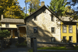 Johannes Rider Stone House |
August 10, 1995 (#95000956) |
7 Upper Whitfield Rd. 41°49′33″N 74°13′26″W |
Rochester | part of the Rochester MPS |
| 142 | Rondout–West Strand Historic District |  Rondout–West Strand Historic District |
August 24, 1979 (#79001641) |
Roughly bounded by Broadway, Roundout Creek, Ravine, Hone and McEntee Sts. 41°55′04″N 73°59′18″W |
Kingston | Former village of Rondout and port area at northern terminus of D&H Canal preserved and restored after nearby bridge resulted in some other demolitions; now a popular nightlife and shopping area. |
| 143 | Sahler Stone House | _Sahler_Stone_House%2C_Kyserike_Rd.%2C_Rochester%2C_Ulster_Cnty%2C_NY_1.png) Sahler Stone House |
August 12, 1999 (#99000992) |
Kyserike Rd. 41°49′09″N 74°11′17″W |
Rochester | part of the Rochester MPS |
| 144 | Sahler Stone House and Dutch Barn | 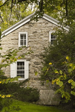 Sahler Stone House and Dutch Barn |
August 12, 1999 (#99000998) |
Winfield Rd. 41°49′33″N 74°11′52″W |
Rochester | part of the Rochester MPS |
| 145 | J. Sahler House | May 1, 2000 (#97000118) |
US 209, southwest of the junction with County Road 63 41°49′28″N 74°11′27″W |
Rochester | part of the Rochester MPS | |
| 146 | Saugerties Lighthouse | 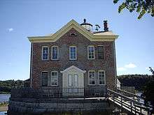 Saugerties Lighthouse |
May 29, 1979 (#79001642) |
Hudson River at Esopus Creek 42°04′19″N 73°55′49″W |
Saugerties | 1869 lighthouse on the Hudson River, no longer in use; part of the Hudson River Lighthouses TR |
| 147 | Saugerties and New York Steamboat Company Warehouses |  Saugerties and New York Steamboat Company Warehouses |
November 9, 2017 (#100001812) |
2 Ferry St. 42°04′13″N 73°56′38″W |
Saugerties | Pair of brick structures built in late 1870s are remnant of once-thriving Hudson River transportation industry |
| 148 | Augusta Savage House and Studio | March 21, 2001 (#01000248) |
189 Old Rte. 32 42°06′45″N 73°58′36″W |
Saugerties | ||
| 149 | Schoonmaker Stone House and Farm | _Schoonmaker_Stone_House_%26_Farm%2C_Samsonville_Rd.%2C_Rochester%2C_Ulster_Cnty%2C_NY_1_edited-1.png) Schoonmaker Stone House and Farm |
February 21, 1997 (#97000109) |
Samsonville Rd., near the junction of NY 76 and Cherrytown Rd. 41°47′46″N 74°18′44″W |
Rochester | part of the Rochester MPS |
| 150 | Joachim Schoonmaker Farm | May 8, 2013 (#13000244) |
41 Garden Ln. 41°47′08″N 74°12′48″W |
Accord | Farm owned by same family since the 18th century; part of Rochester MPS | |
| 151 | C. K. Schoonmaker Stone House |  C. K. Schoonmaker Stone House |
February 21, 1997 (#97000107) |
294 Queens Hwy. 41°48′33″N 74°16′13″W |
Rochester | Well-preserved early-19th-century stone bank house; part of the Rochester MPS |
| 152 | Second Reformed Dutch Church of Kingston | .jpg) Second Reformed Dutch Church of Kingston |
December 28, 2001 (#01001393) |
213-223 Fair St. 41°55′53″N 74°01′05″W |
Kingston | |
| 153 | Senate House | 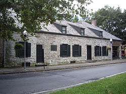 Senate House |
August 12, 1971 (#71000564) |
Northwest side of Clinton Ave. near the junction with N. Front St. 41°56′06″N 74°01′09″W |
Kingston | First meeting place of New York State Senate in 1777. First building in Kingston listed. |
| 154 | Shady Brook Farm |  Shady Brook Farm |
November 21, 2012 (#12000961) |
351 Old Post Road 41°35′38″N 73°58′16″W |
Marlboro vicinity | |
| 155 | Sharp Burial Ground |  Sharp Burial Ground |
November 15, 2002 (#02001320) |
Albany Ave. 41°56′18″N 74°00′11″W |
Kingston | Intact second-generation burying ground with some excellent early-19th-century funerary art; part of the Albany Avenue, Kingston, Ulster County, New York MPS |
| 156 | Shuart-Van Orden Stone House | 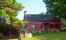 Shuart-Van Orden Stone House |
November 22, 1995 (#95001335) |
41 Allhusen Rd. 41°40′55″N 74°05′51″W |
Plattekill | Built in 1772 and heavily modified since, this is one of the oldest houses in Plattekill |
| 157 | George J. Smith House | 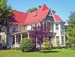 George J. Smith House |
November 15, 2002 (#02001316) |
109 Albany Ave. 41°55′58″N 74°00′41″W |
Kingston | 1885 Queen Anne house of area congressman; part of the Albany Avenue, Kingston, Ulster County, New York MPS |
| 158 | John Smith House | 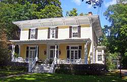 John Smith House |
November 15, 2002 (#02001315) |
103 Albany Ave. 41°55′58″N 74°00′42″W |
Kingston | Intact 1860s Italianate house; part of the Albany Avenue, Kingston, Ulster County, New York MPS |
| 159 | Snyder Estate Natural Cement Historic District | 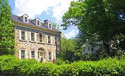 Snyder Estate Natural Cement Historic District |
June 9, 1992 (#92000695) |
NY 213, 0.5 miles (0.80 km) west of Rosendale 41°50′50″N 74°05′44″W |
Rosendale | 275-acre (111 ha) tract with many plants, mines and other infrastructure used in the production of Rosendale cement, as well as homes of the Snyder family dating to 1809. |
| 160 | Spring Glen Synagogue | 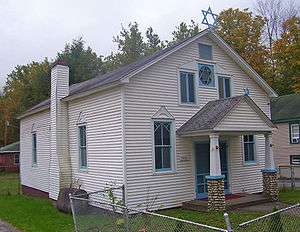 Spring Glen Synagogue |
January 15, 1999 (#98001622) |
Old US 209 41°39′59″N 74°25′49″W |
Spring Glen | Early-20th-century synagogue built by first wave of Jews settling in the Catskills |
| 161 | Stilwell Stone House | 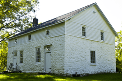 Stilwell Stone House |
August 12, 1999 (#99000996) |
189 Old Kings Highway 41°48′40″N 74°11′19″W |
Rochester | part of the Rochester MPS |
| 162 | Stilwill-Westbrook Stone House | 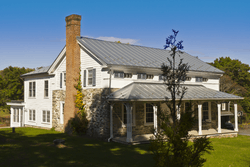 Stilwill-Westbrook Stone House |
August 12, 1999 (#99000997) |
482 Old Kings Highway 41°48′25″N 74°11′43″W |
Rochester | part of the Rochester MPS |
| 163 | Benjamin Ten Broeck House |  Benjamin Ten Broeck House |
December 7, 2005 (#05001395) |
1019 Flatbush Rd. 41°58′36″N 73°58′15″W |
Kingston | Tenant house built in three stages from the 1750s to 1770s is only remnant of Ten Broeck estate north of Kingston |
| 164 | Jacob Ten Broeck Stone House | 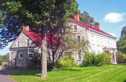 Jacob Ten Broeck Stone House |
November 15, 2002 (#02001312) |
169 Albany Ave. 41°56′00″N 74°00′34″W |
Kingston | 1803 stone house expanded and renovated later in the 19th century; part of the Albany Avenue, Kingston, Ulster County, New York MPS |
| 165 | Terwilliger House |  Terwilliger House |
September 26, 1983 (#83001821) |
Hoagerburgh Rd. 41°38′59″N 74°12′19″W |
Shawangunk | Early-19th-century Federal-style stone house; part of the Shawangunk Valley MRA |
| 166 | Terwilliger-Smith Farm | 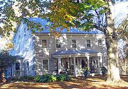 Terwilliger-Smith Farm |
December 31, 2002 (#02001658) |
160 Cherrytown Rd. 41°47′45″N 74°19′05″W |
Rochester | Rare surviving complete farmstead in county from 19th and early 20th centuries |
| 167 | The Locusts | 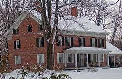 The Locusts |
December 16, 1996 (#96001440) |
160 Plains Rd. 41°43′46″N 74°06′10″W |
New Paltz | 1826 brick farmhouse was first major house in New Paltz area to be built of brick rather than stone, reflecting abandonment of Dutch and Belgian-style stone houses |
| 168 | Trapps Mountain Hamlet Historic District |  Trapps Mountain Hamlet Historic District |
November 2, 2000 (#00001275) |
Off NY 44/55 41°44′00″N 74°12′51″W |
Gardiner | Remains of abandoned 1797–1940s community on Shawangunk Ridge |
| 169 | Trinity Episcopal Church Complex | 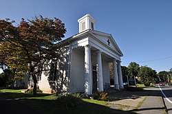 Trinity Episcopal Church Complex |
August 6, 1998 (#98001006) |
Junction of Church St. and Barclay St. 42°04′04″N 73°56′55″W |
Saugerties | |
| 170 | John H. and Sarah Trumbull House |  John H. and Sarah Trumbull House |
February 2, 2018 (#100002083) |
80 Marius St. 41°55′27″N 74°01′01″W |
Kingston | Arthur Crooks-designed 1876 Victorian house for socially prominent local couple, later home to avant-garde artist Maryanne Amacher |
| 171 | Trumpbour Homestead Farm | September 19, 1985 (#85002422) |
1789 Old Kings Hwy. 42°08′23″N 73°57′00″W |
Saugerties | ||
| 172 | Tuthilltown Gristmill |  Tuthilltown Gristmill |
June 14, 1982 (#82003409) |
Albany Post Rd. 41°41′12″N 74°10′32″W |
Gardiner | Was oldest continuously operating gristmill in New York State until the early 2000s |
| 173 | Ulster Heights Synagogue |  Ulster Heights Synagogue |
February 19, 2001 (#01000045) |
Ulster Heights Rd and Beaver Dam Rd. 41°46′48″N 74°31′04″W |
Ulster Heights | Knesset Israel congregation built 1924 by early Jewish settlers in Catskills; still used on High Holy Days |
| 174 | Ulster House Hotel |  Ulster House Hotel |
November 21, 2002 (#02001399) |
Main St. at Academy Rd. 42°08′00″N 74°28′54″W |
Pine Hill | 1882 Italianate building is rare surviving wood frame hotel from peak Catskill resort era |
| 175 | United States Lace Curtain Mills | 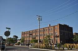 United States Lace Curtain Mills |
March 20, 2013 (#13000100) |
165 Cornell St. 41°56′05″N 74°00′03″W |
Kingston | |
| 176 | US Post Office-Ellenville | 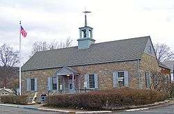 US Post Office-Ellenville |
November 17, 1988 (#88002496) |
1 Liberty St. 41°43′03″N 74°23′35″W |
Ellenville | Franklin D. Roosevelt personally approved design after residents complained to him about proposed brick building |
| 177 | Benjamin Van Keuren House Ruin | 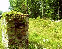 Benjamin Van Keuren House Ruin |
November 22, 2000 (#00001424) |
Off of Bruyn Turnpike 41°38′39″N 74°18′39″W |
Shawangunk | Site of 1745 home of Van Keuren, early settler and Revolutionary War veteran who served four terms as supervisor |
| 178 | Tobias Van Steenburgh House | 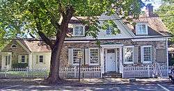 Tobias Van Steenburgh House |
December 9, 1999 (#99001493) |
93 Wall St. 41°55′37″N 74°00′59″W |
Kingston | Stone house built ca. 1700 is one of few in city not burned by British in 1777 |
| 179 | Van Wagenen Stone House and Farm Complex | August 12, 1999 (#99000994) |
2732 Lucas Turnpike 41°48′20″N 74°10′56″W |
Rochester | part of the Rochester MPS | |
| 180 | Jacobus Van Wagenen Stone House |  Jacobus Van Wagenen Stone House |
August 12, 1999 (#99000999) |
2659 Lucas Turnpike 41°48′15″N 74°10′39″W |
Rochester | part of the Rochester MPS |
| 181 | Vernooy–Bevier Stone House and Barns | May 4, 2018 (#100002365) |
7075 US 209 41°45′33″N 74°21′11″W |
Wawarsing | Early 18th-century stone house with 19th-century farm buildings | |
| 182 | Vosburg Turning Mill Complex | 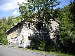 Vosburg Turning Mill Complex |
October 10, 2002 (#02001120) |
52 Hutchin Hill Rd. 42°04′13″N 74°13′55″W |
Woodstock | |
| 183 | West Strand Historic District |  West Strand Historic District |
June 28, 1974 (#74001314) |
West Strand and Broadway 41°55′04″N 73°59′01″W |
Kingston | |
| 184 | Dirck Westbrook Stone House | 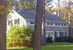 Dirck Westbrook Stone House |
August 10, 1995 (#95000949) |
18 Old Whitfield Rd. 41°48′22″N 74°13′17″W |
Rochester | 1709 stone house now rear wing on early-19th-century Greek Revival front; part of the Rochester MPS |
| 185 | Winfield Corners Stone House | _Winfield_Corners_Stone_House%2C_Winfield_Rd.%2C_Rochester%2C_Ulster_Cnty%2C_NY_2.png) Winfield Corners Stone House |
August 12, 1999 (#99000993) |
Winfield Rd. 41°49′20″N 74°11′43″W |
Rochester | part of the Rochester MPS |
| 186 | Wynkoop House | Wynkoop House |
September 7, 1984 (#84003237) |
NY 32 42°05′16″N 73°58′29″W |
Saugerties | Intact 1730s long Dutch stone house |
| 187 | Cornelius Wynkoop Stone House | 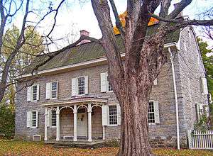 Cornelius Wynkoop Stone House |
February 23, 1996 (#96000138) |
US 209 41°50′51″N 74°08′33″W |
Marbletown | George Washington was an overnight guest in this 1770s Georgian stone house that has been used as a backdrop in contemporary clothing catalogs. |
| 188 | Moses Yeomans House | 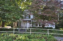 Moses Yeomans House |
February 20, 2009 (#09000041) |
252-278 Delaware Ave. 41°55′41″N 73°58′23″W |
Kingston | |
| 189 | Anthony Yelverton House |  Anthony Yelverton House |
September 22, 1983 (#83001823) |
39 Maple Ave. 41°43′01″N 73°57′05″W |
Highland |
Former listing
| [3] | Name on the Register | Image | Date listed | Date removed | Location | City or town | Summary |
|---|---|---|---|---|---|---|---|
| 1 | Van Vleck House | September 26, 1983 (#83001822) | December 27, 1993 | Bruynswick Road |
Gardiner |
References
- The latitude and longitude information provided in this table was derived originally from the National Register Information System, which has been found to be fairly accurate for about 99% of listings. Some locations in this table may have been corrected to current GPS standards.
- "National Register of Historic Places: Weekly List Actions". National Park Service, United States Department of the Interior. Retrieved on June 19, 2020.
- Numbers represent an ordering by significant words. Various colorings, defined here, differentiate National Historic Landmarks and historic districts from other NRHP buildings, structures, sites or objects.
- The eight-digit number below each date is the number assigned to each location in the National Register Information System database, which can be viewed by clicking the number.
- "K.Whittelsey". Tugboatinformation.com. Retrieved 2019-09-10.
External links
| Wikimedia Commons has media related to National Register of Historic Places in Ulster County, New York. |
- Kingston, New York National Register of Historic Places travel itinerary
| Topics |  | |
|---|---|---|
| Lists by county |
| |
| Lists by city | ||
| Other lists | ||
| ||
This article is issued from Wikipedia. The text is licensed under Creative Commons - Attribution - Sharealike. Additional terms may apply for the media files.