National Register of Historic Places listings in Essex County, New York
List of the National Register of Historic Places listings in Essex County, New York.
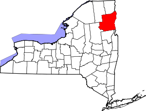
Location of Essex County in New York
This is intended to be a complete list of properties and districts listed on the National Register of Historic Places in Essex County, New York, United States. The locations of National Register properties and districts (at least for all showing latitude and longitude coordinates below) can be seen in a map by clicking on "Map of all coordinates".[1] Seven of the properties and districts are further designated National Historic Landmarks and are indicated by light blue color in the table below.
- This National Park Service list is complete through NPS recent listings posted June 26, 2020.[2]
| Albany (Albany) – Allegany – Bronx – Broome – Cattaraugus – Cayuga – Chautauqua – Chemung – Chenango – Clinton – Columbia – Cortland – Delaware – Dutchess (Poughkeepsie, Rhinebeck) – Erie (Buffalo) – Essex – Franklin – Fulton – Genesee – Greene – Hamilton – Herkimer – Jefferson – Kings – Lewis – Livingston – Madison – Monroe (Rochester) – Montgomery – Nassau – New York (Below 14th Street, 14th to 59th Streets, 59th to 110th Streets, Above 110th Street, Islands) – Niagara – Oneida – Onondaga – Ontario – Orange – Orleans – Oswego – Otsego – Putnam – Queens – Rensselaer – Richmond – Rockland – St. Lawrence – Saratoga – Schenectady – Schoharie – Schuyler – Seneca – Steuben – Suffolk – Sullivan – Tioga – Tompkins – Ulster – Warren – Washington – Wayne – Westchester (Northern, Southern, New Rochelle, Peekskill, Yonkers) – Wyoming – Yates |
Current listings
| [3] | Name on the Register | Image | Date listed[4] | Location | City or town | Description |
|---|---|---|---|---|---|---|
| 1 | Adirondack Forest Preserve |  Adirondack Forest Preserve |
October 15, 1966 (#66000891) |
Northeast New York State 43°58′43″N 74°18′42″W |
Not applicable | All of Essex County is in the six million acre (24,000 square miles (62,000 km2)) Adirondack Park. |
| 2 | Adirondack Iron and Steel Company | 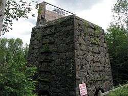 Adirondack Iron and Steel Company |
October 5, 1977 (#77000940) |
Upper Works Rd. 44°04′41″N 74°03′22″W |
Tahawus | The remains of the "Upper Works" iron foundry that date back to 1826. Iron from the site was contaminated with titanium, which, together with its isolation, made for an unprofitable venture. |
| 3 | Adsit Log House |  Adsit Log House |
August 18, 1992 (#92001053) |
Point Rd. north of Ligonier Pt. 44°25′18″N 73°22′35″W |
Willsboro | Built by an American Revolutionary War veteran, one of oldest log cabins in the United States that still exists in its original location |
| 4 | Abraham Aiken House | 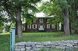 Abraham Aiken House |
June 8, 1989 (#89000465) |
NY 22/Lakeshore Rd. 44°20′36″N 73°21′46″W |
Willsboro | A 2 1⁄2-story brick, gable-roofed historic house and estate built about 1807 in the Georgian style featuring a central Palladian window. Also on the property are a horse barn, tenants' cottage, and five stone lined wells. |
| 5 | Amherst Avenue Historic District | 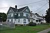 Amherst Avenue Historic District |
June 16, 1989 (#89000473) |
322-340 Amherst Ave. 43°50′38″N 73°25′34″W |
Ticonderoga | part of the Ticonderoga Multiple Resource Area (MRA) |
| 6 | Asgaard Farm |  Asgaard Farm |
January 24, 2020 (#100004907) |
74 Asgaard Way 44°25′23″N 73°40′31″W |
Au Sable Forks | |
| 7 | Ausable Club | 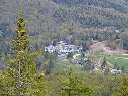 Ausable Club |
July 6, 2005 (#05000683) |
137 Ausable Rd. 44°09′07″N 73°46′51″W |
St. Huberts | The 1890 clubhouse of the Adirondack Mountain Reserve, which was formed in 1887 to save 25,000 acres (100 km2) of the Adirondack High Peaks from lumbering. The Reserve once owned most of the High Peaks; it still owns 7,000 acres (28 km2), and provides public access to many high peaks trails. |
| 8 | Beer's Bridge | 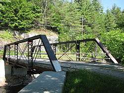 Beer's Bridge |
November 12, 1999 (#99001327) |
Private Rd. off NY 73 over Ausable River 44°10′11″N 73°46′57″W |
Keene Valley | Beer's Bridge is a historic Pratt Pony truss bridge over the Ausable River built in 1900 by the Pratt, Tomas & Caleb Company. The site is part of the AuSable River Valley Bridges Multiple Property Submission (MPS) |
| 9 | Black Watch Library |  Black Watch Library |
November 15, 1988 (#88002199) |
161 Montcalm St. 43°50′54″N 73°25′34″W |
Ticonderoga | Black Watch Library is a historic library building built in 1905.It is a one-story brick structure with a cruciform plan in the Jacobean Revival style. It features a blue/green slate gable roof with projecting rafter ends. |
| 10 | Bogie Cottage | 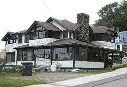 Bogie Cottage |
November 6, 1992 (#92001464) |
59 Franklin St. 44°19′30″N 74°07′33″W |
Saranac Lake | A 1908, American Craftsman-inspired "cure cottage"; part of the Saranac Lake MPS |
| 11 | John Brown Farm and Gravesite | 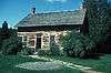 John Brown Farm and Gravesite |
June 19, 1972 (#72000840) |
John Brown Rd. 44°14′58″N 73°58′23″W |
Lake Placid | The home from 1849, and final resting place, of abolitionist John Brown. |
| 12 | H. G. Burleigh House | 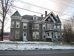 H. G. Burleigh House |
November 15, 1988 (#88002192) |
307 Champlain Ave. 43°50′45″N 73°25′27″W |
Ticonderoga | part of the Ticonderoga MRA |
| 13 | Camp Dudley Road Historic District | 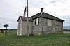 Camp Dudley Road Historic District |
October 21, 1993 (#93001136) |
Roughly bounded by NY 22, Stacy Br., Lake Champlain and the Westport village line 44°09′15″N 73°25′04″W |
Westport | With 131 contributing buildings this late-19th and early-20th century historic district includes vernacular farmhouses in a variety of styles, barn complexes, a stone 1816 schoolhouse, Skenewood Estate, the Stable Inn properties, Germain property, "Kenjockety," Barber's Point Lighthouse, and Camp Dudley, the oldest continuing boy's camp. |
| 14 | Camp Santanoni | 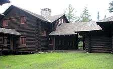 Camp Santanoni |
April 3, 1987 (#86002955) |
North of NY 28N 43°59′35″N 74°08′45″W |
Newcomb | A 13,000-acre (53 km2) preserve and Adirondack Great Camp established between 1892 and 1905 by Albany banker and businessman Robert C. Pruyn. Part of the Great Camps of the Adirondacks Thematic Resource (TR) |
| 15 | Central Powerhouse |  Central Powerhouse |
June 1, 1995 (#95000591) |
Jct. of Tracy Rd. and New Bed Rd., SE corner, Town of Moriah 44°05′23″N 73°32′13″W |
Witherbee | part of the Moriah MPS. It has been demolished. |
| 16 | Central School | November 15, 1988 (#88002202) |
324 Champlain Ave. 43°50′40″N 73°25′25″W |
Ticonderoga | Demolished in 2001; part of the Ticonderoga MRA | |
| 17 | Champlain II Shipwreck | Champlain II Shipwreck |
September 15, 1997 (#97000980) |
On the bottom of Lake Champlain 44°12′21″N 73°22′39″W |
Westport | |
| 18 | Church of the Nazarene | %2C_NY.JPG) Church of the Nazarene |
June 19, 1973 (#73001189) |
West of Essex on NY 22 44°18′07″N 73°24′07″W |
Essex | Built in 1855 as St. John's Episcopal Church, it became the Union Church at Boquet Chapel in 1880, the Church of the Nazarene in 1949 and Foothills Baptist Church in 2005.[5] |
| 19 | Clark House | 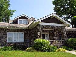 Clark House |
November 15, 1988 (#88002204) |
331 Montcalm St. 43°50′54″N 73°26′32″W |
Ticonderoga | part of the Ticonderoga MRA |
| 20 | Peyton Clark Cottage | 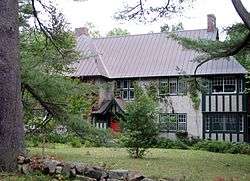 Peyton Clark Cottage |
November 6, 1992 (#92001435) |
9 Rockledge Rd. 44°19′48″N 74°07′21″W |
Saranac Lake | A 1915 large, Tudor-style, 2 and 1/2 story "cure cottage" designed by William H. Scopes. The owner was a civil engineer whose wife had tuberculosis. Part of the Saranac Lake MPS |
| 21 | Community Building | 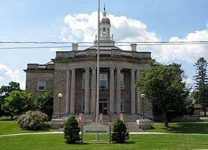 Community Building |
November 15, 1988 (#88002198) |
Montcalm and Champlain Sts. 43°50′54″N 73°26′18″W |
Ticonderoga | part of the Ticonderoga MRA |
| 22 | Coulter Cottage |  Coulter Cottage |
November 6, 1992 (#92001438) |
34 Shepard Ave. 44°19′32″N 74°07′35″W |
Saranac Lake | A 2½-story "cure cottage" designed by William L. Coulter and built between 1897 and 1899 as his residence. Part of the Saranac Lake MPS |
| 23 | Clayton H. Delano House | 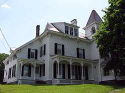 Clayton H. Delano House |
November 15, 1988 (#88002195) |
25 Father Jogues Pl. 43°50′50″N 73°25′37″W |
Ticonderoga | part of the Ticonderoga MRA |
| 24 | Crandall Marine Railway | May 4, 2011 (#11000251) |
11 Dry Dock Lane 43°48′27″N 73°26′55″W |
Ticonderoga | ||
| 25 | Crown Point Green Historic District |  Crown Point Green Historic District |
May 18, 2015 (#15000231) |
Park Ave., Creek Rd., NY 9N/22 43°57′07″N 73°25′59″W |
Crown Point | Village's central green is surrounded by many of its important early buildings |
| 26 | Cure Cottage at 43 Forest Hill Avenue |  Cure Cottage at 43 Forest Hill Avenue |
November 21, 2012 (#12000954) |
43 Forest Hill Ave. 44°19′47″N 74°07′23″W |
Saranac Lake | This is a historic "cure cottage" built about 1912. It is a two-story, clapboarded wood frame dwelling on a stone foundation with a steep gable roof with overhanging eaves. It features a second floor cure porch. |
| 27 | Delaware & Hudson Railroad Depot | 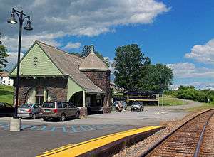 Delaware & Hudson Railroad Depot |
June 1, 1995 (#95000593) |
Park Pl., Town of Moriah 44°02′33″N 73°27′31″W |
Port Henry | Stone 1888 D&H station also used as community meeting place and senior center; part of the Moriah MPS |
| 28 | Denny Cottage | 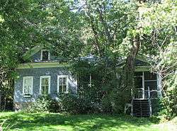 Denny Cottage |
November 6, 1992 (#92001452) |
76 Bloomingdale Ave. 44°20′24″N 74°07′38″W |
Saranac Lake | A "cure cottage" built about 1910. Part of the Saranac Lake MPS |
| 29 | Double-Span Metal Pratt Truss Bridge | 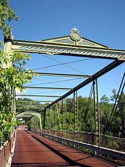 Double-Span Metal Pratt Truss Bridge |
May 20, 1983 (#83001665) |
AuSable St. 44°30′01″N 73°29′07″W |
Keeseville | part of the Keeseville Village MRA |
| 30 | Edgewater Farm | 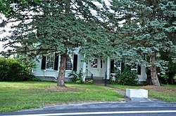 Edgewater Farm |
February 17, 1988 (#88000035) |
470 Point Rd. 44°24′05″N 73°23′04″W |
Willsboro Point | |
| 31 | Essex County Fairgrounds | 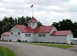 Essex County Fairgrounds |
September 7, 2005 (#05000993) |
3 Sisco St. 44°11′11″N 73°26′56″W |
Westport | |
| 32 | Essex County Home and Farm |  Essex County Home and Farm |
September 23, 1982 (#82003357) |
Southwest of Whallonsburg on NY 22 44°15′23″N 73°24′38″W |
Whallonsburg | |
| 33 | Essex County Municipal Complex | .jpg) Essex County Municipal Complex |
May 3, 2016 (#16000224) |
7551–7559 Court St. 44°12′51″N 73°35′41″W |
Elizabethtown | 1824 courthouse forms core of county government buildings |
| 34 | Essex Village Historic District | 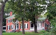 Essex Village Historic District |
May 28, 1975 (#75001187) |
Town of Essex and surroundings on W bank of Lake Champlain 44°18′44″N 73°21′10″W |
Essex | |
| 35 | Fallon Cottage Annex | 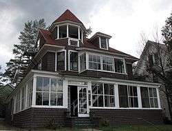 Fallon Cottage Annex |
November 6, 1992 (#92001463) |
31 Franklin St. 44°19′36″N 74°07′34″W |
Saranac Lake | A 1901 "cure cottage".[6] Part of the Saranac Lake MPS |
| 36 | Ferris House | 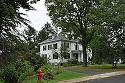 Ferris House |
November 15, 1988 (#88002203) |
16 Carillon Rd. 43°50′25″N 73°25′23″W |
Ticonderoga | part of the Ticonderoga MRA |
| 37 | First Congregational and Presbyterian Society Church of Westport | 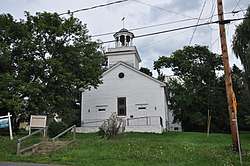 First Congregational and Presbyterian Society Church of Westport |
December 19, 1988 (#88002750) |
Main St./CR 10 44°13′50″N 73°27′33″W |
Westport | |
| 38 | First Congregational Church and Cemetery | 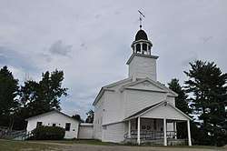 First Congregational Church and Cemetery |
January 5, 2005 (#04001457) |
NY 9 at Elizabeth-Lewis Rd. 44°16′40″N 73°34′05″W |
Lewis | |
| 39 | Flat Rock Camp | 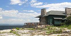 Flat Rock Camp |
July 26, 2006 (#06000642) |
7 Willsboro Point Rd. 44°22′34″N 73°22′14″W |
Willsboro | An Adirondack Great Camp; part of the Great Camps of the Adirondacks TR |
| 40 | Fort Crown Point |  Fort Crown Point |
November 24, 1968 (#68000033) |
Crown Point Reservation, Southwest of Lake Champlain Bridge and NY 8 44°00′21″N 73°25′42″W |
Crown Point | A British fort built in 1759 to secure the region against the French. |
| 41 | Fort St. Frederic | 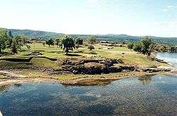 Fort St. Frederic |
October 15, 1966 (#66000517) |
Jct. of NY 8 and 9N 44°01′43″N 73°25′22″W |
Crown Point | A French fort started in 1734 to gain control of the New France/Vermont border region in the Lake Champlain Valley. The walls were twelve feet thick and four stories high, with cannons on each level, manned by over a thousand officers and men.[7] |
| 42 | Fort Ticonderoga | 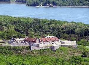 Fort Ticonderoga |
October 15, 1966 (#66000519) |
2.5 mi (4.0 km). south of Ticonderoga on NY 22 43°50′00″N 73°23′45″W |
Ticonderoga | A large 18th-century fort built by the French starting in 1755 that controlled both commonly used trade routes between the English-controlled Hudson River Valley and the French-controlled Saint Lawrence River Valley. It played a part in the American Revolutionary War. |
| 43 | Frazier Bridge | 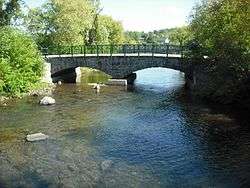 Frazier Bridge |
December 17, 1998 (#98001540) |
Champlain Ave., at Lachute R. 43°51′01″N 73°25′21″W |
Ticonderoga | part of the Ticonderoga MRA |
| 44 | Samson Fried Estate | February 26, 1987 (#87000225) |
NY 74 43°52′32″N 73°42′54″W |
Severance | ||
| 45 | Gilligan and Stevens Block | 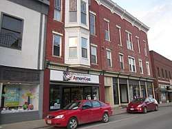 Gilligan and Stevens Block |
November 15, 1988 (#88002193) |
115 Montclam St. 43°50′56″N 73°25′30″W |
Ticonderoga | part of the Ticonderoga MRA |
| 46 | Gooley Club | May 4, 2018 (#100002383) |
Gooley Club Road 43°52′16″N 74°14′48″W |
Newcomb | Buildings used by private hunting club through early 21st century | |
| 47 | Hancock House |  Hancock House |
November 15, 1988 (#88002197) |
Montcalm and Wicker Sts. 43°50′54″N 73°26′06″W |
Ticonderoga | part of the Ticonderoga MRA |
| 48 | Hand–Hale Historic District |  Hand–Hale Historic District |
March 5, 1979 (#79001582) |
River and Maple Sts. 44°12′54″N 73°35′19″W |
Elizabethtown | |
| 49 | Helen Hill Historic District | Helen Hill Historic District |
October 23, 2015 (#15000754) |
Prescott Place, Helen & Front Sts., Sheppard, Franklin & Clinton Aves. 44°19′30″N 74°07′40″W |
Saranac Lake | Residential neighborhood from early 20th century, with many cottages retaining the "cure porches" that distinguished the area's early days as a sanitarium. |
| 50 | Highland Park Historic District | 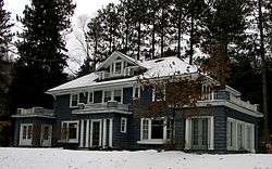 Highland Park Historic District |
November 6, 1992 (#92001474) |
Roughly, Park Ave. from Military Rd. to 170 Park Ave. 44°20′10″N 74°07′32″W |
Saranac Lake | Seventeen private, single-family homes built between 1896 and 1930; most include "cure cottage" features. Part of the Saranac Lake MPS |
| 51 | Hill Cottage | 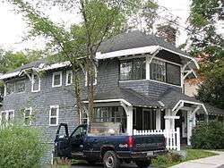 Hill Cottage |
November 6, 1992 (#92001475) |
36 Franklin Ave. 44°19′36″N 74°07′32″W |
Saranac Lake | A 1913 Craftsman-style "cure cottage". |
| 52 | Hubbard Hall | 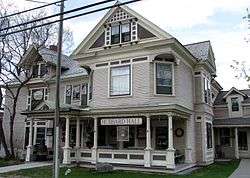 Hubbard Hall |
January 21, 1999 (#98001584) |
Court St. 44°12′56″N 73°35′33″W |
Elizabethtown | Burned to the ground, 1/2011[8] |
| 53 | Hurricane Mountain Fire Observation Station |  Hurricane Mountain Fire Observation Station |
January 29, 2007 (#06001145) |
Hurricane Mountain Summit 44°14′06″N 73°42′38″W |
Keene | A 35-foot (11 m) fire tower built in 1919 on 3,964-foot (1,208 m) Hurricane Mountain. Part of the Fire Observation Stations of New York State Forest Preserve MPS |
| 54 | Ironville Historic District |  Ironville Historic District |
December 27, 1974 (#74001237) |
Area surrounding Ironville including Furnace St. and Penfield Pond 43°55′17″N 73°32′07″W |
Ironville | |
| 55 | Keith and Branch Ford Motors Factory and Showroom | 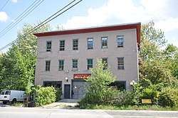 Keith and Branch Ford Motors Factory and Showroom |
May 28, 2013 (#13000329) |
12198 NY 9N 44°20′11″N 73°46′43″W |
Upper Jay | Built in the 1920s to sell Ford Model T's, this is a rare early example of automobile-oriented architecture in the Adirondacks |
| 56 | Keene Valley Library | 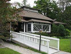 Keene Valley Library |
December 13, 2000 (#00001528) |
Main St. 44°11′25″N 73°47′11″W |
Keene Valley | |
| 57 | Keeseville Historic District | 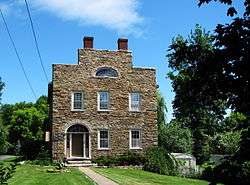 Keeseville Historic District |
May 20, 1983 (#83001666) |
Roughly bounded by Vine, Chesterfield, Clinton, Hill, Pleasant, Front, and Beech Sts. 44°30′16″N 73°28′58″W |
Keeseville | part of the Keeseville Village MRA |
| 58 | Kennedy Cottage | 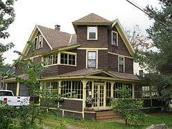 Kennedy Cottage |
November 6, 1992 (#92001437) |
26 Shepard St. 44°19′37″N 74°07′36″W |
Saranac Lake | A 1987 "cure cottage" that was used by the National Vaudeville Artists Philanthropic Association prior to the construction of the Will Rogers Hospital. Part of the Saranac Lake MPS |
| 59 | Lake George Avenue Historic District | 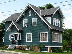 Lake George Avenue Historic District |
June 16, 1989 (#89000472) |
301-331 Lake George Ave. 43°50′44″N 73°25′43″W |
Ticonderoga | part of the Ticonderoga MRA |
| 60 | Lake View Grange No. 970 | 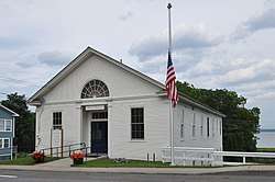 Lake View Grange No. 970 |
August 27, 2013 (#13000626) |
22 Champlain Ave. 44°11′09″N 73°26′15″W |
Westport | Classically-decorated building later used as roller rink; now town hall |
| 61 | Lane Cottage | 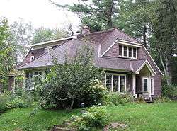 Lane Cottage |
November 6, 1992 (#92001434) |
4 Rockledge Rd. 44°19′47″N 74°07′22″W |
Saranac Lake | A 1923 "cure cottage" built by Edward Shaw for his wife, who had tuberculosis. The Shaws had two young children; fearing that they would contract TB from Mrs. Shaw, a separate house was built for them, nearby. Part of the Saranac Lake MPS |
| 62 | Dr. Henry Leetch House | 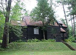 Dr. Henry Leetch House |
November 6, 1992 (#92001471) |
3 Johnson Rd. 44°19′35″N 74°07′14″W |
Saranac Lake | A 1932 "cure cottage" designed by William L. Distin for Dr. Henry Leetch, who specialized in treating tuberculosis, and who had the disease himself. Part of the Saranac Lake MPS |
| 63 | Lent Cottage | 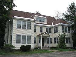 Lent Cottage |
November 6, 1992 (#92001462) |
18 Franklin Ave. 44°19′43″N 74°07′33″W |
Saranac Lake | An apartment house, built about 1920 as a "cure cottage". Part of the Saranac Lake MPS |
| 64 | Liberty Monument |  Liberty Monument |
November 16, 1989 (#89002014) |
NY 9N at Montcalm St. 43°50′53″N 73°26′07″W |
Ticonderoga | part of the Ticonderoga MRA |
| 65 | Ligonier Point Historic District | 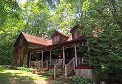 Ligonier Point Historic District |
January 2, 2013 (#12001129) |
Point Rd., Ligonier Way 44°24′56″N 73°22′31″W |
Willsboro | The Ligonier Point Historic District consists of eight buildings and two dozen contributing structures and sites, related to stone quarrying, boat building, and farming by the Clark family during the 19th century. |
| 66 | Marquay Cottage | 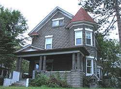 Marquay Cottage |
November 6, 1992 (#92001439) |
6 Slater St. 44°19′18″N 74°07′20″W |
Saranac Lake | A 1914, Queen Anne-style "cure cottage" built of rusticated cast-concrete blocks, with an octagonal corner tower. Part of the Saranac Lake MPS |
| 67 | Marvin Cottage | 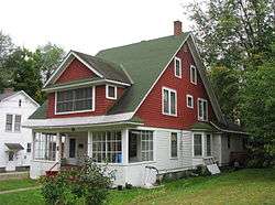 Marvin Cottage |
November 6, 1992 (#92001461) |
15 Franklin St. 44°19′43″N 74°07′36″W |
Saranac Lake | A "cure cottage" built about 1900. Part of the Saranac Lake MPS |
| 68 | Silas B. Moore Gristmill | 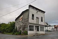 Silas B. Moore Gristmill |
November 15, 1988 (#88002190) |
218 Montcalm St. 43°50′53″N 73°25′41″W |
Ticonderoga | part of the Ticonderoga MRA |
| 69 | Moriah Town Office Building | 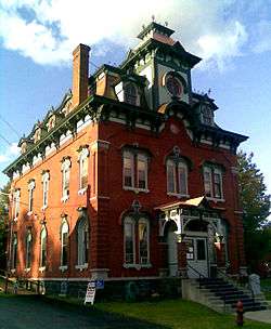 Moriah Town Office Building |
May 18, 1995 (#95000594) |
Cedar St., Town of Moriah 44°02′56″N 73°27′44″W |
Port Henry | part of the Moriah MPS |
| 70 | Mount Adams Fire Observation Station | April 12, 2006 (#06000253) |
Mount Adams 44°04′52″N 74°03′21″W |
Newcomb | part of the Fire Observation Stations of New York State Forest Preserve MPS | |
| 71 | Mount Moriah Presbyterian Church | 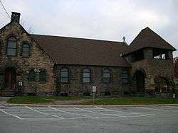 Mount Moriah Presbyterian Church |
June 1, 1995 (#95000592) |
Jct. of Church and S. Main Sts., NW corner, Town of Moriah 44°02′53″N 73°27′39″W |
Port Henry | part of the Moriah MPS |
| 72 | Mount Van Hoevenberg Olympic Bobsled Run | 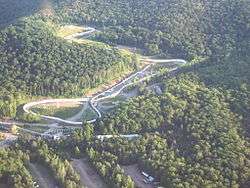 Mount Van Hoevenberg Olympic Bobsled Run |
February 4, 2010 (#10000008) |
200 Bob Run Lane 44°13′11″N 73°55′15″W |
Lake Placid | |
| 73 | New York Central Railroad Adirondack Division Historic District | 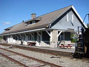 New York Central Railroad Adirondack Division Historic District |
December 23, 1993 (#93001451) |
NYCRR Right-of-Way from Remsen to Lake Placid 44°16′34″N 73°59′09″W |
Lake Placid | The New York Central Adirondack Line ended in Lake Placid. There are extant stations in Ray Brook and Lake Placid; the Adirondack Scenic Railroad runs a tourist train between Lake Placid and the station in Saranac Lake. |
| 74 | Notman Bridge | 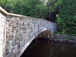 Notman Bridge |
November 12, 1999 (#99001328) |
Country Club Rd. over AuSable R. 44°11′29″N 73°47′05″W |
Keene Valley | part of the AuSable River Valley Bridges MPS |
| 75 | NYS Armory |  NYS Armory |
November 15, 1988 (#88002200) |
315 Champlain Ave. 43°50′42″N 73°25′29″W |
Ticonderoga | part of the Ticonderoga MRA |
| 76 | Octagonal Schoolhouse | 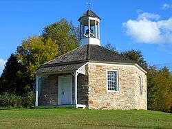 Octagonal Schoolhouse |
January 17, 1973 (#73001190) |
On Rte. 22 in Bouquet 44°18′14″N 73°24′08″W |
Essex | An 1827 stone octagonal school building |
| 77 | Old State Road Bridge | 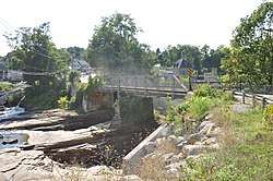 Old State Road Bridge |
November 12, 1999 (#99001319) |
Old State Rd. over AuSable R. 44°31′25″N 73°27′37″W |
Chesterfield | part of the AuSable River Valley Bridges MPS; crosses into Clinton County |
| 78 | Pad Factory | 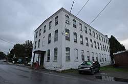 Pad Factory |
November 15, 1988 (#88002205) |
109 Lake George Ave. 43°50′53″N 73°25′39″W |
Ticonderoga | part of the Ticonderoga MRA |
| 79 | Partridge Cottage | 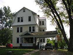 Partridge Cottage |
March 31, 1992 (#92001440) |
15 South St. 44°19′27″N 74°07′27″W |
Saranac Lake | A 1925 Colonial Revival apartment house, with three apartments used as a cure cottages for three families. Part of the Saranac Lake MPS |
| 80 | Pittenger Cottage | 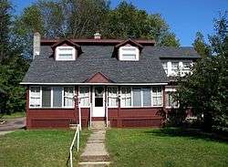 Pittenger Cottage |
November 6, 1992 (#92001460) |
14 Forest Hill Ave. 44°19′43″N 74°07′19″W |
Saranac Lake | A "cure cottage" with five cure porches, built about 1920. Part of the Saranac Lake MPS |
| 81 | Poke-O-Moonshine Mountain Fire Observation Station | 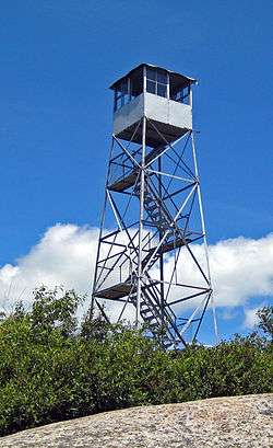 Poke-O-Moonshine Mountain Fire Observation Station |
September 23, 2001 (#01001034) |
Poke-O-Moonshine Mountain 44°23′16″N 73°30′29″W |
Chesterfield | 1917 fire tower was first in state to employ alidade to help triangulate location of fires. |
| 82 | Port Henry Fire Department Building | 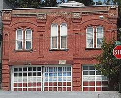 Port Henry Fire Department Building |
June 1, 1995 (#95000590) |
33 Broad St., Town of Moriah 44°02′56″N 73°27′44″W |
Port Henry | part of the Moriah MPS |
| 83 | Putnam Camp | October 17, 2012 (#12000876) |
1196 NY 73 44°09′13″N 73°46′05″W |
St. Huberts | ||
| 84 | Ranney Bridge | 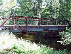 Ranney Bridge |
November 12, 1999 (#99001329) |
Private Rd. off NY 73 over East Branch of AuSable R. 44°10′55″N 73°47′03″W |
Keene Valley | part of the AuSable River Valley Bridges MPS |
| 85 | Rembrandt Hall | 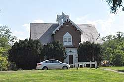 Rembrandt Hall |
May 20, 1983 (#83001677) |
Clinton St. 44°30′07″N 73°28′39″W |
Keeseville | part of the Keeseville Village MRA |
| 86 | Sheldon–Owens Farm | 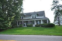 Sheldon–Owens Farm |
April 1, 1993 (#93000171) |
Lake Shore Rd. southeast of the junction with Middle and West Rds. 44°20′44″N 73°22′28″W |
Willsboro | Sheldon–Owens Farm is a historic district set on a property assembled between 1784 and 1945. The oldest structure is a barn dated to the late 18th century. Outbuildings include barns, a granary, brick smokehouse, and sugar house. The farmhouse dates to 1853. |
| 87 | Sherman Free Library | 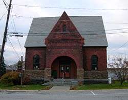 Sherman Free Library |
June 1, 1995 (#95000595) |
4 Church St., Town of Moriah 44°02′51″N 73°27′38″W |
Port Henry | part of the Moriah MPS |
| 88 | Slater Bridge | November 12, 1999 (#99001325) |
East Branch of AuSable R. off St. Hubert's Rd. 44°09′31″N 73°46′40″W |
Keene Valley | part of the AuSable River Valley Bridges MPS | |
| 89 | Spitfire (gunboat) |  Spitfire (gunboat) |
July 24, 2008 (#08000694) |
On the seafloor of Lake Champlain near Schuyler Island |
Lake Champlain | Extends into Clinton County |
| 90 | Stevenson Cottage |  Stevenson Cottage |
November 6, 1992 (#92001441) |
Stevenson Ln. 44°19′51″N 74°07′26″W |
Saranac Lake | A "cure cottage" used by Robert Louis Stevenson in 1887. Part of the Saranac Lake MPS |
| 91 | Stone Arch Bridge |  Stone Arch Bridge |
November 12, 1999 (#99001323) |
Main St. over AuSable R. 44°30′19″N 73°28′52″W |
Keeseville | part of the AuSable River Valley Bridges MPS |
| 92 | Stuckman Cottage |  Stuckman Cottage |
November 6, 1992 (#92001459) |
6 Clinton Ave. 44°19′39″N 74°07′28″W |
Saranac Lake | A "cure cottage" built between 1897 and 1900. |
| 93 | Swing Bridge | 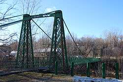 Swing Bridge |
November 12, 1999 (#99001322) |
Over the Ausable River between Clinton and S. AuSable Sts. 44°30′13″N 73°28′58″W |
Keeseville | part of the AuSable River Valley Bridges MPS |
| 94 | Talichito | August 22, 2012 (#12000533) |
Nesa Rd. 43°50′06″N 73°44′34″W |
Schroon Lake | ||
| 95 | Ticonderoga High School | 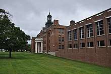 Ticonderoga High School |
November 15, 1988 (#88002201) |
5 Calkins Pl. 43°50′32″N 73°25′40″W |
Ticonderoga | part of the Ticonderoga MRA |
| 96 | Ticonderoga National Bank |  Ticonderoga National Bank |
November 15, 1988 (#88002194) |
101 Montcalm St. 43°50′51″N 73°25′26″W |
Ticonderoga | part of the Ticonderoga MRA |
| 97 | Ticonderoga Pulp and Paper Company Office | 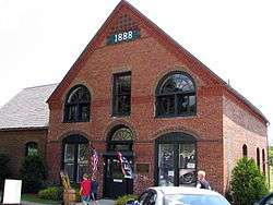 Ticonderoga Pulp and Paper Company Office |
November 15, 1988 (#88002191) |
Montcalm St. 43°50′55″N 73°25′17″W |
Ticonderoga | part of the Ticonderoga MRA |
| 98 | Tomlinson House | 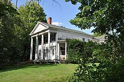 Tomlinson House |
May 20, 1983 (#83001678) |
Kent St. 44°30′10″N 73°28′41″W |
Keeseville | part of the Keeseville Village MRA |
| 99 | Trudeau Sanatorium | 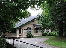 Trudeau Sanatorium |
April 20, 1995 (#95000479) |
Trudeau Rd. 44°20′31″N 74°07′21″W |
Saranac Lake | A tuberculosis sanitorium established in 1882 by Dr. Edward Livingston Trudeau, originally called the Adirondack Cottage Sanatorium. Part of the Saranac Lake MPS |
| 100 | US Post Office–Lake Placid | 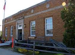 US Post Office–Lake Placid |
November 17, 1988 (#88002339) |
2591 Main St.[9] 44°17′07″N 73°59′02″W |
Lake Placid | part of the US Post Offices in New York State, 1858-1943, TR |
| 101 | US Post Office-Ticonderoga | 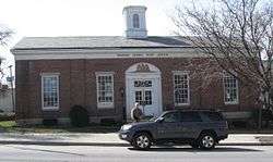 US Post Office-Ticonderoga |
May 11, 1989 (#88002436) |
123 Champlain Ave. 43°50′51″N 73°25′26″W |
Ticonderoga | part of the US Post Offices in New York State, 1858-1943, TR |
| 102 | The Uplands | 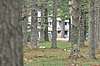 The Uplands |
March 22, 2016 (#16000109) |
35 Thorne Way 44°11′53″N 73°47′29″W |
Keene Valley | Well-preserved 1910 Adirondack camp |
| 103 | Van Ornam & Murdock Block | 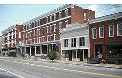 Van Ornam & Murdock Block |
November 14, 1982 (#82001172) |
Main St. 44°02′54″N 73°27′36″W |
Port Henry | |
| 104 | VERGENNES (canal boat) |  VERGENNES (canal boat) |
August 7, 2012 (#12000477) |
Address Restricted |
Westport | |
| 105 | Walton Bridge | 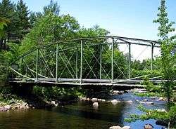 Walton Bridge |
November 12, 1999 (#99001326) |
Dr. Ray Rd. access over AuSable R. 44°14′41″N 73°47′53″W |
Keene | part of the AuSable River Valley Bridges MPS |
| 106 | Elkanah Watson House | 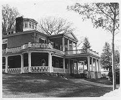 Elkanah Watson House |
October 15, 1966 (#66000518) |
3 mi (4.8 km). east of US 9 44°31′30″N 73°24′21″W |
Port Kent | Home of Elkanah Watson, Revolutionary-era diplomat, founder of the county fair and early promoter of canals, who occupied it in May 1828. Designed by Sheldon & Merritt and constructed under the supervision of Watson's son Charles. |
| 107 | Wells Memorial Library |  Wells Memorial Library |
May 18, 2011 (#11000289) |
12230 NY 9N 44°20′17″N 73°46′25″W |
Upper Jay | |
| 108 | Wellscroft | January 28, 2004 (#03001513) |
158 NY 9N 44°20′37″N 73°46′21″W |
Upper Jay | ||
| 109 | Whiteface Veterans Memorial Highway Complex | .JPG) Whiteface Veterans Memorial Highway Complex |
October 10, 2008 (#06001147) |
New York State Route 431 44°23′59″N 73°51′49″W |
Wilmington | Highest road in state built to honor WWI veterans in late 1920s. |
| 110 | Will Rogers Memorial Hospital | 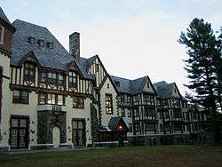 Will Rogers Memorial Hospital |
September 8, 1983 (#83001679) |
NY 86 44°18′39″N 74°06′51″W |
Saranac Lake | A 100-bed tuberculosis sanitarium for vaudeville performers built by the National Vaudeville Artists in 1930.[10] |
| 111 | Willsboro Congregational Church |  Willsboro Congregational Church |
May 31, 1984 (#84002391) |
NY 22 44°21′49″N 73°23′35″W |
Willsboro | |
| 112 | The Willsboro School |  The Willsboro School |
March 31, 2010 (#10000135) |
10 Gilliland Lane (formerly 29 School St.) 44°21′53″N 73°23′24″W |
Willsboro | |
| 113 | Wilmington Bridge | November 12, 1999 (#99001324) |
NY 86 over AuSable R. 44°23′20″N 73°49′04″W |
Wilmington | part of the AuSable River Valley Bridges MPS | |
| 114 | Witherbee Memorial Hall | 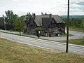 Witherbee Memorial Hall |
April 22, 1991 (#91000421) |
Broad St. east of the junction with Office Rd. 44°05′17″N 73°31′41″W |
Mineville |
Former listing
| [3] | Name on the Register | Image | Date listed | Date removed | Location | City or town | Summary |
|---|---|---|---|---|---|---|---|
| 1 | St. Mary's Church and Rectory | November 5, 1988 (#88002196) | May 25, 1989 | 10-12 Father Jogues Pl. |
Ticonderoga | ||
| 2 | State Theater | April 30, 1992 (#92000454) | September 17, 1999 | 18 Montcalm St. |
Ticonderoga |
See also
| Wikimedia Commons has media related to National Register of Historic Places in Essex County, New York. |
References
- The latitude and longitude information provided in this table was derived originally from the National Register Information System, which has been found to be fairly accurate for about 99% of listings. Some locations in this table may have been corrected to current GPS standards.
- "National Register of Historic Places: Weekly List Actions". National Park Service, United States Department of the Interior. Retrieved on June 26, 2020.
- Numbers represent an ordering by significant words. Various colorings, defined here, differentiate National Historic Landmarks and historic districts from other NRHP buildings, structures, sites or objects.
- The eight-digit number below each date is the number assigned to each location in the National Register Information System database, which can be viewed by clicking the number.
- The Press Republican - Tour of Essex churches today
- Gallos, Phillip L., Cure Cottages of Saranac Lake, Historic Saranac Lake, 1985, ISBN 0-9615159-0-2.
- p. 18, Folwell, Elizabeth, and Amy Godine, Adirondack Odysseys, The Adirondack Museum, Blue Mountain Lake, New York, 1997, ISBN 0-936399-78-3
- http://pressrepublican.com/0100_news/x1100994401/Hubbard-Hall-being-demolished
- Address based on USPS website. Accessed March 31, 2016.
- History of Saranac Lake Archived 2008-05-15 at the Wayback Machine
| Topics |  | |
|---|---|---|
| Lists by county |
| |
| Lists by city | ||
| Other lists | ||
| ||
This article is issued from Wikipedia. The text is licensed under Creative Commons - Attribution - Sharealike. Additional terms may apply for the media files.