National Register of Historic Places listings in Cattaraugus County, New York
This is intended to be a complete list of properties and districts listed on the National Register of Historic Places in Cattaraugus County, New York. The locations of National Register properties and districts for which the latitude and longitude coordinates are included below, may be seen in a map.[1]
- This National Park Service list is complete through NPS recent listings posted June 19, 2020.[2]
| Albany (Albany) – Allegany – Bronx – Broome – Cattaraugus – Cayuga – Chautauqua – Chemung – Chenango – Clinton – Columbia – Cortland – Delaware – Dutchess (Poughkeepsie, Rhinebeck) – Erie (Buffalo) – Essex – Franklin – Fulton – Genesee – Greene – Hamilton – Herkimer – Jefferson – Kings – Lewis – Livingston – Madison – Monroe (Rochester) – Montgomery – Nassau – New York (Below 14th Street, 14th to 59th Streets, 59th to 110th Streets, Above 110th Street, Islands) – Niagara – Oneida – Onondaga – Ontario – Orange – Orleans – Oswego – Otsego – Putnam – Queens – Rensselaer – Richmond – Rockland – St. Lawrence – Saratoga – Schenectady – Schoharie – Schuyler – Seneca – Steuben – Suffolk – Sullivan – Tioga – Tompkins – Ulster – Warren – Washington – Wayne – Westchester (Northern, Southern, New Rochelle, Peekskill, Yonkers) – Wyoming – Yates |
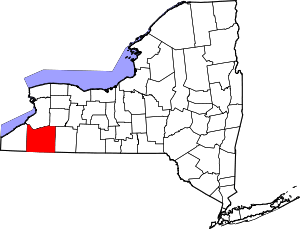
Location of Cattaraugus County in New York
Listings county-wide
| [3] | Name on the Register | Image | Date listed[4] | Location | City or town | Description |
|---|---|---|---|---|---|---|
| 1 | John J. Aiken House | 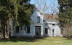 John J. Aiken House |
February 20, 2013 (#13000025) |
6805 Poverty Hill Rd. 42°18′00″N 78°41′01″W |
Ellicottville | |
| 2 | Allegany Council House | October 27, 2017 (#100001768) |
8156 Old State Route 17 42°09′33″N 78°45′35″W |
Jimerson Town | ||
| 3 | Bank of Gowanda | 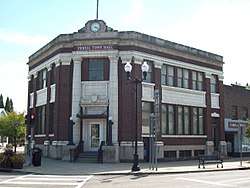 Bank of Gowanda |
May 25, 2001 (#01000553) |
8 W. Main St. 42°27′45″N 78°56′10″W |
Gowanda | |
| 4 | Beardsley-Oliver House | 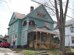 Beardsley-Oliver House |
February 28, 2008 (#08000097) |
312 Laurel Ave. 42°04′42″N 78°25′36″W |
Olean | |
| 5 | Bedford Corners Historic District | 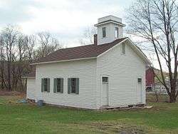 Bedford Corners Historic District |
July 5, 2003 (#03000590) |
NY 305 at Deer Creek and Dodge Creek Rds. 42°03′14″N 78°18′38″W |
Portville | |
| 6 | Bryant Hill Cemetery | 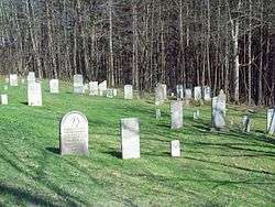 Bryant Hill Cemetery |
July 5, 2003 (#03000605) |
Bryant Hill Rd. near Crane Rd. 42°18′19″N 78°36′07″W |
Ellicottville | |
| 7 | Cattaraugus Village Commercial Historic District | 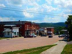 Cattaraugus Village Commercial Historic District |
January 15, 2014 (#13001113) |
9-52 Main, 1-17 Washington, 14 Waverly Sts. 42°19′47″N 78°52′04″W |
Cattaraugus | Core of small village |
| 8 | Conklin Mountain House | 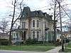 Conklin Mountain House |
November 19, 1998 (#98001386) |
304 E. State St. 42°04′38″N 78°25′33″W |
Olean | |
| 9 | East Otto Union School |  East Otto Union School |
September 15, 2004 (#04000993) |
9014 East Otto-Springville Rd. 42°23′28″N 78°45′16″W |
East Otto | |
| 10 | Ellicottville Historic District | 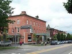 Ellicottville Historic District |
August 22, 1991 (#91001028) |
Roughly bounded by Elizabeth, Monroe, Martha and Adams Sts. 42°16′30″N 78°40′23″W |
Ellicottville | |
| 11 | Ellicottville Town Hall | 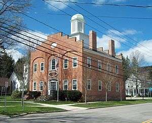 Ellicottville Town Hall |
April 3, 1973 (#73001166) |
Village Sq., NW corner of Washington and Jefferson Sts. 42°16′31″N 78°40′25″W |
Ellicottville | |
| 12 | First Congregational Church of Otto | 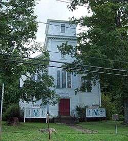 First Congregational Church of Otto |
February 12, 1999 (#99000194) |
9019 Main St. 42°21′19″N 78°49′40″W |
Otto | |
| 13 | Gladden Windmill | 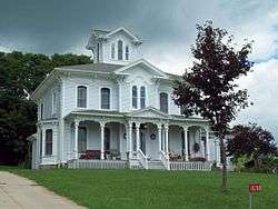 Gladden Windmill |
July 16, 1973 (#73001167) |
Pigeon Valley Rd. 42°14′07″N 78°53′44″W |
Napoli | |
| 14 | Gowanda Village Historic District | 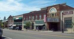 Gowanda Village Historic District |
September 22, 1986 (#86002691) |
37, 39, 41-45, 47-49, and 53 W. Main St. 42°27′47″N 78°56′12″W |
Gowanda | |
| 15 | House at 520 Hostageh Road |  House at 520 Hostageh Road |
February 20, 2009 (#09000038) |
520 Ho-Sta-Geh Road 42°00′53″N 78°28′17″W |
Rock City | |
| 16 | Jefferson Street Cemetery | 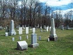 Jefferson Street Cemetery |
January 4, 2012 (#11000994) |
East side of Jefferson St. between Martha St. & Aspen Dr. 42°16′13″N 78°40′07″W |
Ellicottville | |
| 17 | Leon Grange No. 795 | 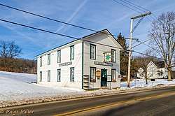 Leon Grange No. 795 |
January 15, 2014 (#13001089) |
US 62 near Leon–New Albion Rd. 42°17′39″N 79°01′00″W |
Leon | |
| 18 | Leon United Methodist Church |  Leon United Methodist Church |
November 22, 2000 (#00001413) |
Junction of Cattaraugus Co. 6 and U.S. Route 62 42°17′36″N 79°01′03″W |
Leon | |
| 19 | North Lyndon Schoolhouse | 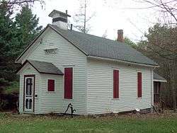 North Lyndon Schoolhouse |
September 15, 2000 (#00000571) |
7617 North Center Rd. 42°19′51″N 78°21′16″W |
Lyndon | |
| 20 | Oak Hill Park Historic District | 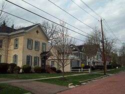 Oak Hill Park Historic District |
December 1, 1997 (#97001495) |
Roughly along Laurens, N. Second, Third, Fourth, and W. Sullivan Sts. 42°04′50″N 78°26′04″W |
Olean | |
| 21 | Olean Armory | 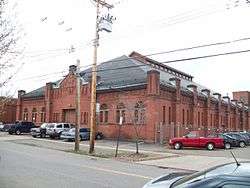 Olean Armory |
March 2, 1995 (#95000080) |
119 Times Sq. 42°04′41″N 78°25′43″W |
Olean | |
| 22 | Olean Public Library | 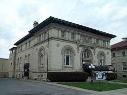 Olean Public Library |
July 11, 1985 (#85001498) |
116 S. Union St. 42°04′36″N 78°25′50″W |
Olean | |
| 23 | Olean School No. 10 | 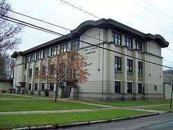 Olean School No. 10 |
October 1, 2010 (#10000810) |
411 W. Henley St. 42°04′32″N 78°26′04″W |
Olean | |
| 24 | Park Square Historic District | 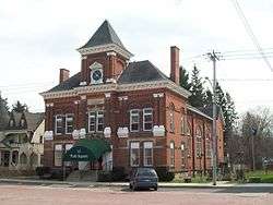 Park Square Historic District |
September 22, 1986 (#86002719) |
Park Square roughly bounded by N. Main, Pine, Chestnut, S. Main, Elm, and Church Sts. 42°20′14″N 78°27′27″W |
Franklinville | |
| 25 | Pfeiffer-Wheeler American Chestnut Cabin | 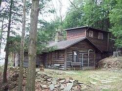 Pfeiffer-Wheeler American Chestnut Cabin |
January 11, 2002 (#01001436) |
Lillibridge Rd. 42°05′34″N 78°19′29″W |
Portville | |
| 26 | Portville Free Library | 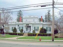 Portville Free Library |
November 7, 1991 (#91001671) |
2 N. Main St. 42°02′20″N 78°20′25″W |
Portville | |
| 27 | Randolph Historic District | 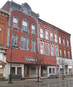 Randolph Historic District |
December 12, 2012 (#12001035) |
Junction of Main & Jamestown to Borden Sts. 42°09′49″N 78°58′50″W |
Randolph | |
| 28 | Simeon B. Robbins House |  Simeon B. Robbins House |
March 7, 2003 (#03000091) |
9 Pine St. 42°20′16″N 78°27′23″W |
Franklinville | |
| 29 | St. Stephen's Episcopal Church Complex | 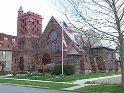 St. Stephen's Episcopal Church Complex |
January 26, 2001 (#00001684) |
109 S. Barry St. 42°04′36″N 78°25′40″W |
Olean | |
| 30 | Salem Welsh Church |  Salem Welsh Church |
September 7, 1995 (#95001065) |
11141 NY 98 at junction with Galen Hill Rd. 42°29′12″N 78°21′31″W |
Freedom | |
| 31 | Temple B'Nai Israel | 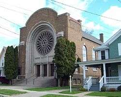 Temple B'Nai Israel |
January 4, 2012 (#11000995) |
127 S. Barry St. 42°04′35″N 78°25′39″W |
Olean | |
| 32 | Union and State Streets Historic District | 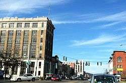 Union and State Streets Historic District |
May 21, 2015 (#15000265) |
Roughly 101-133 N. Union, 110-114, 116 W. State & 102, 116, 120 S. Union Sts. 42°04′40″N 78°25′59″W |
Olean | Intact core of downtown commercial area, with buildings from post-Civil War era to pre-World War II |
| 33 | US Post Office-Little Valley |  US Post Office-Little Valley |
May 11, 1989 (#88002344) |
115 Main St. 42°14′57″N 78°47′55″W |
Little Valley | |
| 34 | US Post Office-Olean | 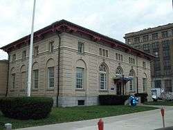 US Post Office-Olean |
May 11, 1989 (#88002388) |
102 S. Union St. 42°04′37″N 78°25′50″W |
Olean | |
| 35 | William E. Wheeler House | 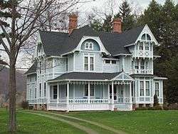 William E. Wheeler House |
January 11, 2002 (#01001435) |
29 Maple Ave. 42°02′26″N 78°20′21″W |
Portville |
References
- The latitude and longitude information provided in this table was derived originally from the National Register Information System, which has been found to be fairly accurate for about 99% of listings. Some locations in this table may have been corrected to current GPS standards.
- "National Register of Historic Places: Weekly List Actions". National Park Service, United States Department of the Interior. Retrieved on June 19, 2020.
- Numbers represent an ordering by significant words. Various colorings, defined here, differentiate National Historic Landmarks and historic districts from other NRHP buildings, structures, sites or objects.
- The eight-digit number below each date is the number assigned to each location in the National Register Information System database, which can be viewed by clicking the number.
External links
A useful list of the above sites, with street addresses and other information, is available at Cattaraugus County listing, at National Register of Historic Places.Com, a private site serving up public domain information on NRHPs.
| Topics |  | |
|---|---|---|
| Lists by county |
| |
| Lists by city | ||
| Other lists | ||
| ||
| Wikimedia Commons has media related to National Register of Historic Places in Cattaraugus County, New York. |
This article is issued from Wikipedia. The text is licensed under Creative Commons - Attribution - Sharealike. Additional terms may apply for the media files.