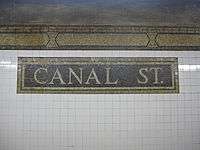
Canal Street station (IRT Broadway–Seventh Avenue Line)
Canal Street is a local station on the IRT Broadway–Seventh Avenue Line of the New York City Subway, located in Lower Manhattan at the intersection of Canal and Varick Streets. It is served by the 1 train at all times and by the 2 train during late nights.
Canal Street | |||||||||||
|---|---|---|---|---|---|---|---|---|---|---|---|
.jpg) Platform towards South Ferry and Brooklyn | |||||||||||
| Station statistics | |||||||||||
| Address | Canal Street & Varick Street New York, NY 10013 | ||||||||||
| Borough | Manhattan | ||||||||||
| Locale | SoHo, Tribeca | ||||||||||
| Coordinates | 40.722°N 74.006°W | ||||||||||
| Division | A (IRT) | ||||||||||
| Line | IRT Broadway–Seventh Avenue Line | ||||||||||
| Services | 1 2 | ||||||||||
| Transit connections | |||||||||||
| Structure | Underground | ||||||||||
| Platforms | 2 side platforms | ||||||||||
| Tracks | 4 | ||||||||||
| Other information | |||||||||||
| Opened | July 1, 1918 | ||||||||||
| Station code | 325[1] | ||||||||||
| Wireless service | |||||||||||
| Opposite-direction transfer available | No | ||||||||||
| Traffic | |||||||||||
| Passengers (2019) | 1,984,827[3] | ||||||||||
| Rank | 237 out of 424[3] | ||||||||||
| Station succession | |||||||||||
| Next north | Houston Street: 1 | ||||||||||
| Next south | Franklin Street: 1 | ||||||||||
| |||||||||||
| |||||||||||
| |||||||||||


%26groups%3D_d50e6ed296a70028c1f473731a440d6cde08c3d9.svg)
History
The Dual Contracts, which were signed on March 19, 1913, were contracts for the construction and/or rehabilitation and operation of rapid transit lines in the City of New York. The contracts were "dual" in that they were signed between the City and two separate private companies (the Interborough Rapid Transit Company and the Brooklyn Rapid Transit Company), all working together to make the construction of the Dual Contracts possible. The Dual Contracts promised the construction of several lines in Brooklyn. As part of Contract 4, the IRT agreed to build a branch of the original subway line south down Seventh Avenue, Varick Street, and West Broadway to serve the West Side of Manhattan.[4][5][6] The construction of this line, in conjunction with the construction of the Lexington Avenue Line, would change the operations of the IRT system. Instead of having trains go via Broadway, turning onto 42nd Street, before finally turning onto Park Avenue, there would be two trunk lines connected by the 42nd Street Shuttle. The system would be changed from looking like a "Z" system on a map to an "H" system. One trunk would run via the new Lexington Avenue Line down Park Avenue, and the other trunk would run via the new Seventh Avenue Line up Broadway. In order for the line to continue down Varick Street and West Broadway, these streets needed to be widened, and two new streets were built, the Seventh Avenue Extension and the Varick Street Extension.[7] It was predicted that the subway extension would lead to the growth of the Lower West Side, and to neighborhoods such as Chelsea and Greenwich Village.[8][9]
Canal Street opened as the line was extended south to South Ferry from 34th Street–Penn Station on July 1, 1918, and was served by a shuttle.[10] The new "H" system was implemented on August 1, 1918, joining the two halves of the Broadway–Seventh Avenue Line and sending all West Side trains south from Times Square.[11] An immediate result of the switch was the need to transfer using the 42nd Street Shuttle. The completion of the "H" system doubled the capacity of the IRT system.[12]
The station was renovated in 1992 by MTA New York City Transit's in-house staff.
Station layout
| G | Street level | Exit/entrance |
| P Platform level |
Side platform | |
| Northbound local | ← ← | |
| Northbound express | ← | |
| Southbound express | | |
| Southbound local | | |
| Side platform | ||
This station has two side platforms and four tracks, numbered 1 to 4 from west to east, with center tracks 2 and 3 serving the 2 and 3 express trains that bypass the station during daytime hours. The platforms are mildly offset and, although there are no crossovers or crossunders to allow free transfers between directions, there is evidence of a sealed crossunder on both of the platforms.
This underground station is located on the street of the same name, which is the boundary of SoHo and Tribeca. Lying within a block of three different pocket parks (St. John's Park, Duane Park, and Cavala Park), the station sits at the entrance to the Holland Tunnel outside of the Tribeca North Historic District.[13] Much of the surrounding area is characterized by its historic loft architecture.
References
- "Station Developers' Information". Metropolitan Transportation Authority. Retrieved June 13, 2017.
- "NYC Subway Wireless – Active Stations". Transit Wireless Wifi. Retrieved November 13, 2019.
- "Facts and Figures: Annual Subway Ridership 2014–2019". Metropolitan Transportation Authority. 2020. Retrieved May 26, 2020.
- "Terms and Conditions of Dual System Contracts". nycsubway.org. Public Service Commission. March 19, 1913. Retrieved February 16, 2015.
- "The Dual System of Rapid Transit (1912)". nycsubway.org. Public Service Commission. September 1912. Retrieved May 30, 2017.
- "Most Recent Map of the Dual Subway System WhIch Shows How Brooklyn Borough Is Favored In New Transit Lines". The Brooklyn Daily Eagle. September 9, 1917. p. 37. Retrieved August 23, 2016 – via Brooklyn Newspapers.
- Engineering News-record. McGraw-Hill Publishing Company. 1916.
- Whitney, Travis H. (March 10, 1918). "The Seventh and Lexington Avenue Subways Will Revive Dormant Sections — Change in Operation That Will Transform Original Four-Tracked Subway Into Two Four-Tracked Systems and Double Present Capacity of the Interborough" (PDF). The New York Times. p. 12. Retrieved August 26, 2016.
- "Public Service Commission Fixes July 15 For Opening of The New Seventh and Lexington Avenue Subway Lines — Will Afford Better Service and Less Crowding — Shuttle Service for Forty-Second Street — How the Various Lines of the Dual System Are Grouped for Operation and List of Stations on All Lines" (PDF). The New York Times. May 19, 1918. p. 32. Retrieved November 6, 2016.
- "Open New Subway to Regular Traffic — First Train on Seventh Avenue Line Carries Mayor and Other Officials — To Serve Lower West Side — Whitney Predicts an Awakening of the District — New Extensions of Elevated Railroad Service" (PDF). The New York Times. July 2, 1918. p. 11. Retrieved November 6, 2016.
- "Open New Subway Lines to Traffic; Called a Triumph — Great H System Put in Operation Marks an Era in Railroad Construction — No Hitch in the Plans — But Public Gropes Blindly to Find the Way in Maze of New Stations — Thousands Go Astray — Leaders in City's Life Hail Accomplishment of Great Task at Meeting at the Astor" (PDF). The New York Times. August 2, 1918. p. 1. Retrieved November 6, 2016.
- Whitney, Travis H. (March 10, 1918). "The Seventh and Lexington Avenue Subways Will Revive Dormant Sections — Change in Operation That Will Transform Original Four-Tracked Subway Into Two Four-Tracked Systems and Double Present Capacity of the Interborough" (PDF). The New York Times. p. 12. Retrieved August 26, 2016.
- "Tribeca North Historic District" (PDF). New York City Landmarks Commission. Archived from the original (PDF) on August 6, 2012. Retrieved July 10, 2011.
- "MTA Neighborhood Maps: SoHo / Tribeca" (PDF). Metropolitan Transportation Authority. 2015. Retrieved August 6, 2015.
- Kirby, Jen (April 7, 2016). "Here's One Way the MTA Is Getting the Subway Ready for the Next Superstorm Sandy". Daily Intelligencer. Retrieved January 1, 2017.
- "Can We Make Our Subways Flood-Proof Or What?". Popular Science. August 3, 2016. Retrieved January 1, 2017.
Further reading
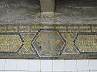
- Stookey, Lee (1994). Subway ceramics : a history and iconography of mosaic and bas relief signs and plaques in the New York City subway system. Brattleboro, Vt: L. Stookey. ISBN 978-0-9635486-1-0. OCLC 31901471.
External links
| Wikimedia Commons has media related to Canal Street (IRT Broadway – Seventh Avenue Line). |
- nycsubway.org – IRT West Side Line: Canal Street
- Station Reporter – 1 Train
- Canal Street entrance from Google Maps Street View
- Platforms from Google Maps Street View