National Register of Historic Places listings in Queens, New York
List of the National Register of Historic Places listings in Queens, New York
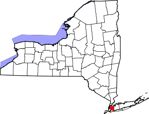
Location of Queens County in New York
This is intended to be a complete list of properties and districts listed on the National Register of Historic Places in Queens, New York. The locations of National Register properties and districts (at least for all showing latitude and longitude coordinates below) may be seen in a map by clicking on "Map of all coordinates".[1] Four of the properties are further designated as U.S. National Historic Landmarks.
- This National Park Service list is complete through NPS recent listings posted June 19, 2020.[2]
| Albany (Albany) – Allegany – Bronx – Broome – Cattaraugus – Cayuga – Chautauqua – Chemung – Chenango – Clinton – Columbia – Cortland – Delaware – Dutchess (Poughkeepsie, Rhinebeck) – Erie (Buffalo) – Essex – Franklin – Fulton – Genesee – Greene – Hamilton – Herkimer – Jefferson – Kings – Lewis – Livingston – Madison – Monroe (Rochester) – Montgomery – Nassau – New York (Below 14th Street, 14th to 59th Streets, 59th to 110th Streets, Above 110th Street, Islands) – Niagara – Oneida – Onondaga – Ontario – Orange – Orleans – Oswego – Otsego – Putnam – Queens – Rensselaer – Richmond – Rockland – St. Lawrence – Saratoga – Schenectady – Schoharie – Schuyler – Seneca – Steuben – Suffolk – Sullivan – Tioga – Tompkins – Ulster – Warren – Washington – Wayne – Westchester (Northern, Southern, New Rochelle, Peekskill, Yonkers) – Wyoming – Yates |
Listings county-wide
| [3] | Name on the Register | Image | Date listed[4] | Location | Neighborhood | Description |
|---|---|---|---|---|---|---|
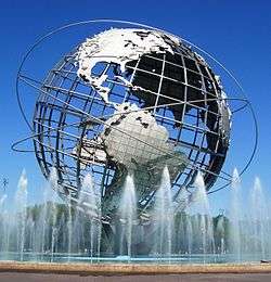
| 1 | 1964-1965 New York World's Fair New York State Pavilion |  1964-1965 New York World's Fair New York State Pavilion |
November 20, 2009 (#09000942) |
Flushing Meadows – Corona Park 40°44′39″N 73°50′40″W |
Flushing | |
| 2 | 1964-1965 New York World's Fair Carousel | 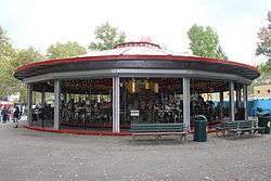 1964-1965 New York World's Fair Carousel |
February 23, 2016 (#16000038) |
54th & 56th Aves. on 111th St. 40°44′36″N 73°50′57″W |
Flushing | Combination of two old Coney Island carousels for World's Fair is one of few fairground attractions left from it |
| 3 | 45th Road – Court House Square Station (Dual System IRT) | 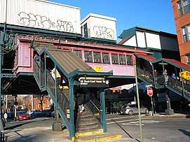 45th Road – Court House Square Station (Dual System IRT) |
March 30, 2005 (#05000229) |
Above 23rd St. bet. 44th Dr. and 45ht Rd. 40°44′47″N 73°56′45″W |
Long Island City | Subway station (7 and <7> trains) |
| 4 | 68th Avenue-64th Place Historic District | 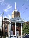 68th Avenue-64th Place Historic District |
September 30, 1983 (#83001763) |
Roughly 64th Pl. from Catalpa Ave. to 68th Ave. from 64th St. to 65th St. 40°42′20″N 73°53′40″W |
Ridgewood | |
| 5 | 75th Avenue-61st Street Historic District | 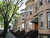 75th Avenue-61st Street Historic District |
September 30, 1983 (#83001764) |
60th Lane, 60th and 62nd Sts. bounded by St. Felix, Myrtle, and Cooper Aves. 40°41′55″N 73°53′41″W |
Ridgewood | Limited to brick two-story rowhouses in the designated area. |
| 6 | Allen-Beville House | 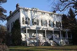 Allen-Beville House |
September 22, 1983 (#83001760) |
29 Center Dr. 40°46′22″N 73°45′03″W |
Douglaston | |
| 7 | Louis Armstrong House | 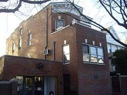 Louis Armstrong House |
May 11, 1976 (#76001265) |
3456 107th St. 40°45′20″N 73°51′43″W |
Corona | |
| 8 | Astoria Center of Israel |  Astoria Center of Israel |
October 16, 2009 (#09000833) |
27-35 Crescent St. 40°46′13″N 73°55′26″W |
Astoria | |
| 9 | Benevolent and Protective Order of Elks, Lodge #878 | 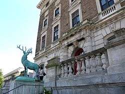 Benevolent and Protective Order of Elks, Lodge #878 |
November 19, 2014 (#14000938) |
82-10, 82-20 Queens Blvd. 40°44′14″N 73°52′58″W |
Elmhurst | Early fraternal organization building |
| 10 | Beth Olam Cemetery | 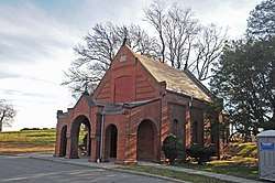 Beth Olam Cemetery |
May 16, 2016 (#16000254) |
2 Cypress Hills St. 40°41′26″N 73°52′48″W |
Cypress Hills | Rural cemetery started in 1851 by the three oldest Jewish congregations in the city; contains many different examples of architecture and funerary art. Shared with Brooklyn |
| 11 | Bohemian Hall and Park | 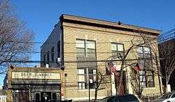 Bohemian Hall and Park |
March 23, 2001 (#01000239) |
29-19 24th Ave. 40°46′22″N 73°54′59″W |
Astoria | |
| 12 | John Bowne House | .jpg) John Bowne House |
September 13, 1977 (#77000974) |
37-01 Bowne St. 40°45′46″N 73°49′32″W |
Flushing | |
| 13 | Broadway-Flushing Historic District | 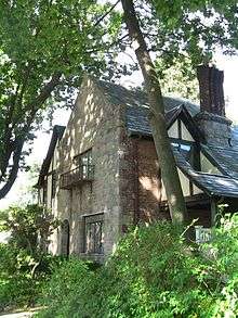 Broadway-Flushing Historic District |
May 12, 2006 (#06000373) |
Roughly bounded by 29th Ave., 163rd St., 32nd Ave., 192nd St., 154th and 153rd Sts. 40°46′00″N 73°48′05″W |
Flushing | |
| 14 | Ralph Bunche House | 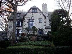 Ralph Bunche House |
May 11, 1976 (#76001266) |
115-125 Grosvenor Rd. 40°42′25″N 73°50′16″W |
Kew Gardens | |
| 15 | Central Avenue Historic District | 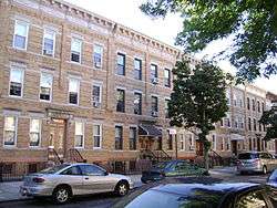 Central Avenue Historic District |
September 30, 1983 (#83001761) |
Roughly bounded by Myrtle and 70th Ave., and 65th and 66th Sts. 40°42′10″N 73°53′25″W |
Ridgewood | |
| 16 | Central Ridgewood Historic District |  Central Ridgewood Historic District |
September 30, 1983 (#83001762) |
Roughly bounded by Fresh Pond Rd., Putnam, 68th, Forest, Catalpa, Onderdonk, and 71st Aves. 40°42′10″N 73°53′57″W |
Ridgewood | |
| 17 | The Church-in-the-Gardens | 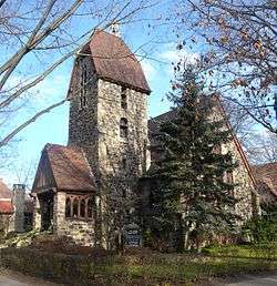 The Church-in-the-Gardens |
December 11, 2009 (#09001086) |
50 Ascan Ave. 40°42′55″N 73°50′33″W |
Forest Hills | |
| 18 | Church of the Resurrection | _1.jpg) Church of the Resurrection |
March 7, 2003 (#03000090) |
85-09 118th St. 40°42′08″N 73°49′57″W |
Kew Gardens/Richmond Hill | |
| 19 | Congregation Tifereth Israel | 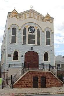 Congregation Tifereth Israel |
November 21, 2002 (#02001357) |
109-18 and 109-20 54th Ave. 40°44′32″N 73°51′12″W |
Corona | |
| 20 | Cooper Avenue Row Historic District | 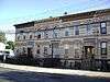 Cooper Avenue Row Historic District |
September 30, 1983 (#83001765) |
6434-6446 Cooper Ave. 40°41′53″N 73°53′27″W |
Ridgewood | |
| 21 | Cornelia-Putnam Historic District | 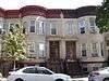 Cornelia-Putnam Historic District |
September 30, 1983 (#83001766) |
Residential rowhouses on Cornelia St. and Putnam Ave, bounded by Jefferson St., Wyckoff, and Myrtle Aves. 40°41′56″N 73°54′27″W |
Ridgewood | |
| 22 | Cornell Farmhouse |  Cornell Farmhouse |
July 24, 1979 (#79001620) |
73-50 Little Neck Pkwy 40°44′54″N 73°43′14″W |
Glen Oaks | |
| 23 | Cypress Avenue East Historic District | 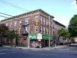 Cypress Avenue East Historic District |
September 30, 1983 (#83001767) |
Roughly bounded by Linden and Cornelia Sts., Seneca and St. Nicholas Aves. 40°42′06″N 73°54′31″W |
Ridgewood | |
| 24 | Cypress Avenue West Historic District | 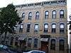 Cypress Avenue West Historic District |
September 30, 1983 (#83001768) |
Roughly bounded by St. Nicholas and Seneca Aves., Linden and Stockholm Sts. 40°42′06″N 73°54′15″W |
Ridgewood | |
| 25 | Douglaston Hill Historic District | 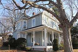 Douglaston Hill Historic District |
August 31, 2000 (#00001016) |
Roughly bounded by Douglaston Pkwy., Northern Blvd., 244th St., 243rd St., and Long Island RR 40°46′03″N 73°44′43″W |
Douglaston | |
| 26 | Douglaston Historic District |  Douglaston Historic District |
September 1, 2005 (#05000937) |
Roughly bounded by Shore Rd., Marinette St., Douglas Rd. and Cherry St. 40°46′33″N 73°45′02″W |
Douglaston | |
| 27 | Elmhurst Avenue Subway Station (IND) | 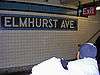 Elmhurst Avenue Subway Station (IND) |
July 6, 2005 (#05000627) |
Beneath Broadway at 82nd St. and 45th Ave. and Elmhurst Ave. 40°44′33″N 73°52′56″W |
Elmhurst | Subway station (E, M, and R trains) |
| 28 | Evergreens Cemetery | 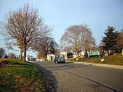 Evergreens Cemetery |
November 15, 2007 (#07001192) |
1629 Bushwick Ave. 40°41′02″N 73°54′04″W |
Ridgewood | |
| 29 | Far Rockaway Beach Bungalow Historic District | 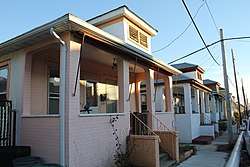 Far Rockaway Beach Bungalow Historic District |
July 17, 2013 (#13000499) |
Beach 24th, Beach 25th & Beach 26th Sts. 40°35′39″N 73°45′30″W |
Far Rockaway | Small beach bungalows that have survived suburbanization of area and Superstorm Sandy |
| 30 | Firemen's Hall |  Firemen's Hall |
August 31, 2000 (#00001013) |
13-28 123rd St. 40°47′09″N 73°50′44″W |
College Point | |
| 31 | First Presbyterian Church of Newtown | 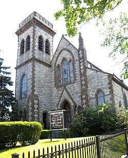 First Presbyterian Church of Newtown |
September 9, 2013 (#13000696) |
54-05 Seabury St. 40°44′08″N 73°52′46″W |
Elmhurst | 1873 High Victorian Gothic brick and stone church built as a replica of one upstate |
| 32 | First Reformed Church | _20180215.jpg) First Reformed Church |
April 16, 1980 (#80002753) |
153-10 Jamaica Ave. 40°42′09″N 73°48′08″W |
Jamaica | |
| 33 | First Reformed Church of College Point | 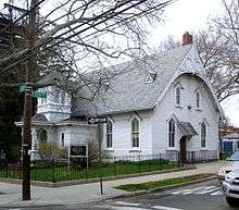 First Reformed Church of College Point |
November 16, 2018 (#100003117) |
18-07, 118-09, 118-19 14th Ave. 40°47′09″N 73°50′55″W |
College Point | 1872 church and accompanying parsonage are rare examples of remaining wooden rural church buildings in Queens |
| 34 | Flushing Armory |  Flushing Armory |
March 23, 1995 (#95000270) |
137-58 Northern Boulevard 40°45′47″N 73°49′46″W |
Flushing | |
| 35 | Flushing High School | .jpg) Flushing High School |
February 10, 1992 (#91002036) |
35-01 Union St. 40°45′54″N 73°49′39″W |
Flushing | |
| 36 | Flushing Town Hall | 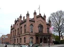 Flushing Town Hall |
March 16, 1972 (#72000904) |
137-35 Northern Blvd. 40°45′50″N 73°49′49″W |
Flushing | 1862, now Flushing Council on the Arts |
| 37 | Forest Park Carousel | 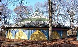 Forest Park Carousel |
July 16, 2004 (#04000706) |
Woodhaven Blvd. and Myrtle Ave. 40°42′03″N 73°51′31″W |
Woodhaven | |
| 38 | Forest-Norman Historic District |  Forest-Norman Historic District |
September 30, 1983 (#83001769) |
Forest Ave. from Summerfield to Stephen St. and Norman St. to Myrtle Ave. 40°41′59″N 73°53′58″W |
Middle Village | |
| 39 | Fort Tilden Historic District | 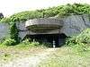 Fort Tilden Historic District |
April 20, 1984 (#84002917) |
Rockaway Beach Boulevard 40°33′50″N 73°53′28″W |
Rockaway | |
| 40 | Fort Totten Officers' Club | 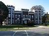 Fort Totten Officers' Club |
March 17, 1986 (#86000446) |
Totten and Murray Aves. 40°47′32″N 73°46′41″W |
Bayside | |
| 41 | Free Synagogue of Flushing | 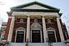 Free Synagogue of Flushing |
October 16, 2009 (#09000834) |
41-60 Kissena Blvd. 40°45′27″N 73°49′40″W |
Flushing | |
| 42 | Fresh Pond-Traffic Historic District | 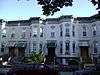 Fresh Pond-Traffic Historic District |
September 30, 1983 (#83001770) |
Roughly bounded by Fresh Pond Rd., Traffic Ave., Woodbine and Linden Sts. 40°42′34″N 73°53′49″W |
Ridgewood | Residential row houses on Linden, Gates, and Palmetto Aves. |
| 43 | Grace Episcopal Church Complex | 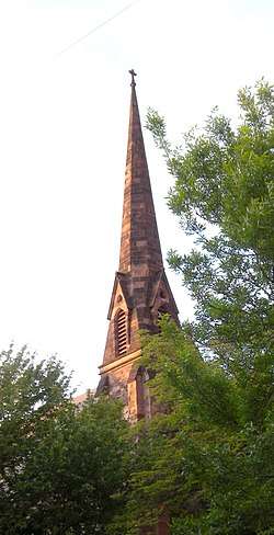 Grace Episcopal Church Complex |
September 8, 1983 (#83001771) |
15515 Jamaica Avenue 40°42′14″N 73°48′07″W |
Jamaica | |
| 44 | Grove-Linden-St. John's Historic District |  Grove-Linden-St. John's Historic District |
September 30, 1983 (#83001772) |
Fairview Ave., St. John's Rd., Linden and Grove Sts. 40°42′23″N 73°54′26″W |
Middle Village | |
| 45 | Hunters Point Historic District |  Hunters Point Historic District |
September 19, 1973 (#73001251) |
Along 45th Ave., between 21st and 23rd Sts. 40°44′49″N 73°56′48″W |
Long Island City | |
| 46 | Jackson Heights Historic District |  Jackson Heights Historic District |
January 27, 1999 (#99000059) |
Bounded by Roosevelt Ave., Broadway, Leverich St., Northern Blvd., and 90th St. 40°45′05″N 73°53′13″W |
Jackson Heights | |
| 47 | Jacob Riis Park Historic District |  Jacob Riis Park Historic District |
June 17, 1981 (#81000081) |
Rockaway Beach Blvd. 40°34′03″N 73°52′24″W |
Rockaway | Presumably including but larger than Jacob Riis Park |
| 48 | Jamaica Chamber of Commerce Building |  Jamaica Chamber of Commerce Building |
September 8, 1983 (#83001773) |
8931 161st St. 40°42′19″N 73°48′00″W |
Jamaica | |
| 49 | Jamaica Savings Bank |  Jamaica Savings Bank |
May 19, 1983 (#83001774) |
161-02 Jamaica Ave. 40°42′14″N 73°47′57″W |
Jamaica | |
| 50 | King Manor | 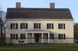 King Manor |
December 2, 1974 (#74001295) |
150th St. and Jamaica Ave. 40°42′11″N 73°51′43″W |
Jamaica | |
| 51 | Kingsland Homestead | 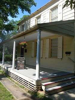 Kingsland Homestead |
May 31, 1972 (#72000905) |
37th St. and Parsons Blvd. 40°45′49″N 73°49′27″W |
Flushing | |
| 52 | J. Kurtz and Sons Store Building |  J. Kurtz and Sons Store Building |
September 8, 1983 (#83001775) |
162-24 Jamaica Ave. 40°42′15″N 73°47′50″W |
Jamaica | |
| 53 | La Casina |  La Casina |
March 1, 1990 (#89002259) |
90-33 160th St. 40°42′16″N 73°48′00″W |
Jamaica | |
| 54 | Lent Homestead and Cemetery | 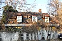 Lent Homestead and Cemetery |
February 2, 1984 (#84002918) |
78-03 19th Rd. 40°46′23″N 73°53′31″W |
Jackson Heights | |
| 55 | Long Island City Courthouse Complex | 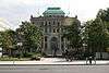 Long Island City Courthouse Complex |
September 26, 1983 (#83001776) |
25-10 Court Sq. 40°44′45″N 73°56′36″W |
Long Island City | |
| 56 | Long Island Motor Parkway | 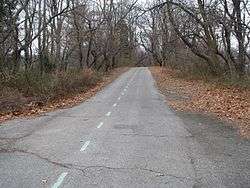 Long Island Motor Parkway |
April 1, 2002 (#02000301) |
Roughly Alley Pond and Cunningham Parks, bet. Winchester Blvd. and Clearview Expressway, bet. 73rd Ave. and Peck Ave. 40°44′13″N 73°45′35″W |
Fresh Meadows through Oakland Gardens | |
| 57 | Madison-Putnam-60th Place Historic District |  Madison-Putnam-60th Place Historic District |
September 30, 1983 (#83001777) |
Roughly bounded by Woodbine St., 60th Pl., 67th and Forest Aves. 40°42′21″N 73°54′06″W |
Ridgewood | |
| 58 | Main Street Subway Station (Dual System IRT) |  Main Street Subway Station (Dual System IRT) |
October 14, 2004 (#04001147) |
Near jct. of Roosevelt Ave. and Main St. 40°45′34″N 73°49′51″W |
Flushing | Subway station (7 and <7> trains) |
| 59 | Maple Grove Cemetery | 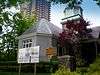 Maple Grove Cemetery |
August 20, 2004 (#04000874) |
83-15 Kew Gardens Rd. 40°42′31″N 73°49′27″W |
Kew Gardens | |
| 60 | Marine Air Terminal |  Marine Air Terminal |
July 9, 1982 (#82003397) |
La Guardia Airport 40°46′25″N 73°53′10″W |
La Guardia Airport | |
| 61 | Office of the Register | 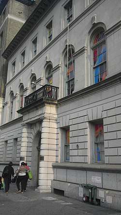 Office of the Register |
January 3, 1980 (#80002754) |
161-04 Jamaica Ave. 40°42′13″N 73°47′57″W |
Jamaica | |
| 62 | Old Quaker Meetinghouse | 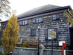 Old Quaker Meetinghouse |
December 24, 1967 (#67000015) |
S side of Northern Blvd. 40°45′47″N 73°49′51″W |
Flushing | |
| 63 | Old Town of Flushing Burial Ground | 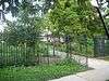 Old Town of Flushing Burial Ground |
February 2, 2018 (#100002079) |
46th Ave. between 164th & 165th St. 40°45′15″N 73°48′09″W |
Flushing | 19th-century local pauper's graveyard is final resting place of many African-American and Native American residents |
| 64 | Paramount Studios Complex | 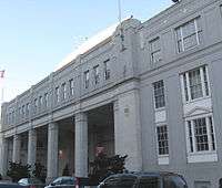 Paramount Studios Complex |
November 14, 1978 (#78001897) |
35th Ave., 35th, 36th, and 37th Sts. 40°45′24″N 73°55′30″W |
Astoria | Now Kaufman Astoria Studios |
| 65 | Parkway Village |  Parkway Village |
February 28, 2012 (#12000052) |
Bounded by Union Tpk., 150th St., Goethals Ave., Parsons Blvd., Grand Central Pkwy., & Main St. 40°43′02″N 73°48′46″W |
Kew Gardens Hills | 675 unit apartment complex built 1947 for UN employees |
| 66 | Poppenhusen Institute | 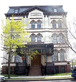 Poppenhusen Institute |
August 18, 1977 (#77000973) |
114-04 14th Rd. 40°47′04″N 73°51′13″W |
College Point | |
| 67 | Prospect Cemetery | 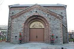 Prospect Cemetery |
January 11, 2002 (#01001438) |
159th St. and Beaver Rd. 40°42′04″N 73°48′01″W |
Jamaica | |
| 68 | Public School 66 | 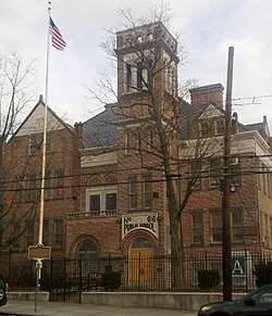 Public School 66 |
August 28, 2003 (#03000850) |
85-11 102nd St. 40°41′52″N 73°50′47″W |
Richmond Hill | |
| 69 | Queens County Savings Bank |  Queens County Savings Bank |
June 16, 2005 (#05000620) |
75-44 Main St. 40°43′21″N 73°49′14″W |
Kew Gardens Hills | |
| 70 | Queensboro Bridge |  Queensboro Bridge |
December 20, 1978 (#78001879) |
59th St. 40°45′26″N 73°57′22″W |
Long Island City | Also listed in the Borough of Manhattan |
| 71 | Reformed Church of Newtown Complex | 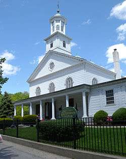 Reformed Church of Newtown Complex |
April 23, 1980 (#80002751) |
85-15 Broadway 40°44′23″N 73°52′42″W |
Elmhurst | |
| 72 | Rego Park Jewish Center | 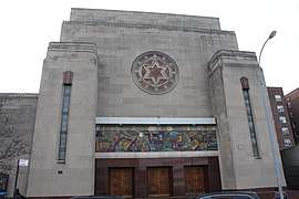 Rego Park Jewish Center |
October 28, 2009 (#09000864) |
97-30 Queens Blvd. 40°43′41″N 73°51′34″W |
Rego Park | |
| 73 | Richmond Hill Historic District | March 7, 2019 (#100003430) |
Generally 84th-85th Aves. & 113th to 118th Sts. 40°42′11″N 73°50′07″W |
Richmond Hill | Covers a small portion of the larger Richmond Hill neighborhood. | |
| 74 | RKO Keith's Theater | 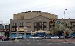 RKO Keith's Theater |
October 29, 1982 (#82001260) |
129-143 Northern Boulevard 40°45′48″N 73°49′57″W |
Flushing | |
| 75 | Rockaway Courthouse | 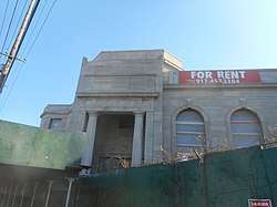 Rockaway Courthouse |
February 5, 2014 (#13001155) |
90-01 Beach Channel Dr. 40°35′20″N 73°48′58″W |
Rockaway Beach | |
| 76 | Russell Sage Memorial Church | 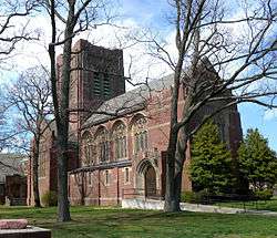 Russell Sage Memorial Church |
September 22, 1986 (#86002678) |
1324 Beach 12 St. 40°36′34″N 73°44′51″W |
Far Rockaway | Church designed by Ralph Adams Cram with Louis Tiffany windows, recently restored. |
| 77 | Saint Benedict Joseph Labre Parish | _1.jpg) Saint Benedict Joseph Labre Parish |
January 25, 2007 (#06001297) |
94-40 118th St. 40°41′33″N 73°49′47″W |
Richmond Hill | |
| 78 | St. George's Church | 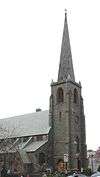 St. George's Church |
March 7, 2008 (#08000143) |
135-32 38th Ave. 40°45′37″N 73°49′55″W |
Flushing | |
| 79 | St. James Church, Elmhurst | 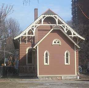 St. James Church, Elmhurst |
November 12, 1999 (#99001331) |
86-02 Broadway 40°44′18″N 73°52′41″W |
Elmhurst | |
| 80 | St. Luke's Episcopal Church | .jpg) St. Luke's Episcopal Church |
November 10, 2010 (#10000900) |
85 Greenway South 40°42′50″N 73°50′41″W |
Forest Hills | |
| 81 | St. Matthew's Episcopal Church | _Episcopal_Church%2C_Woodhaven_jeh.jpg) St. Matthew's Episcopal Church |
May 25, 2001 (#01000550) |
85-45 96th St. 40°41′46″N 73°50′58″W |
Woodhaven | |
| 82 | St. Matthias Roman Catholic Church Complex | 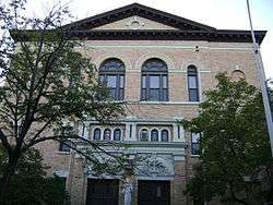 St. Matthias Roman Catholic Church Complex |
September 4, 2012 (#12000599) |
58-15 Catalpa Ave. 40°42′07″N 73°54′10″W |
Ridgewood | |
| 83 | St. Monica's Church | _20180930_ded.1856_02.jpg) St. Monica's Church |
April 9, 1980 (#80002752) |
94-20 160th St. 40°42′07″N 73°47′53″W |
Jamaica | |
| 84 | Seneca Avenue East Historic District |  Seneca Avenue East Historic District |
September 30, 1983 (#83001778) |
Roughly Seneca Ave. E. between Hancock and Summerfield Sts. 40°41′59″N 73°54′07″W |
Ridgewood | |
| 85 | Seneca-Onderdonk-Woodward Historic District |  Seneca-Onderdonk-Woodward Historic District |
September 30, 1983 (#83001779) |
Roughly bounded by Woodward, Seneca, Catalpa Aves., and Woodbine St. 40°42′09″N 73°54′17″W |
Middle Village | |
| 86 | Sidewalk Clock at 161-11 Jamaica Avenue, New York, NY | _Street_Clock.JPG) Sidewalk Clock at 161-11 Jamaica Avenue, New York, NY |
April 18, 1985 (#85000931) |
161-11 Jamaica Ave. 40°42′15″N 73°47′52″W |
Jamaica | |
| 87 | Sohmer and Company Piano Factory | 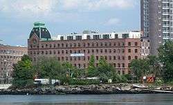 Sohmer and Company Piano Factory |
February 14, 2014 (#14000007) |
31-01 Vernon Blvd. 40°46′10″N 73°56′07″W |
Astoria | |
| 88 | Spear and Company Factory | 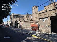 Spear and Company Factory |
November 9, 2017 (#100001807) |
94-15 100th St. 40°41′19″N 73°50′36″W |
Ozone Park | Intact early 20th-century reinforced concrete factory complex used for making hats and, later, novelty candles, characterized by simplicity of design. |
| 89 | Steinway Mansion | 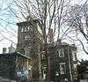 Steinway Mansion |
September 8, 1983 (#83001780) |
18-22 41st St. 40°46′42″N 73°53′52″W |
Astoria | |
| 90 | Stockholm-DeKalb-Hart Historic District | 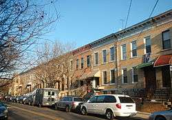 Stockholm-DeKalb-Hart Historic District |
September 30, 1983 (#83004618) |
Roughly DeKalb and Woodward Aves., Stockholm and Hart Sts. 40°42′32″N 73°54′52″W |
Ridgewood | |
| 91 | Summerfield Street Row Historic District | 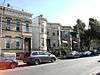 Summerfield Street Row Historic District |
September 30, 1983 (#83001781) |
59-12 to 59-48 Summerfield St. 40°42′01″N 73°53′48″W |
Ridgewood | |
| 92 | Sunnyside Gardens Historic District |  Sunnyside Gardens Historic District |
September 7, 1984 (#84002919) |
Roughly bounded by Queens Blvd., 43rd and 52nd Sts. Barnett and Skillman Aves. 40°44′49″N 73°55′03″W |
Sunnyside Gardens | |
| 93 | Temple of Israel Synagogue | 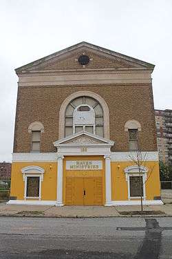 Temple of Israel Synagogue |
February 5, 2014 (#13001156) |
1-88 Beach 84th St. 40°35′14″N 73°48′34″W |
Rockaway Beach | |
| 94 | Trans World Airlines Flight Center | 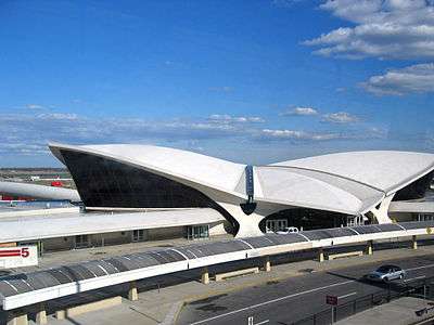 Trans World Airlines Flight Center |
September 7, 2005 (#05000994) |
John F. Kennedy International Airport 40°38′45″N 73°46′39″W |
Jamaica | Designed by Eero Saarinen |
| 95 | Triboro Hospital for Tuberculosis |  Triboro Hospital for Tuberculosis |
January 31, 2019 (#100003397) |
82-41 Parsons Blvd. 40°43′02″N 73°48′28″W |
Jamaica | |
| 96 | Trinity Chapel |  Trinity Chapel |
January 11, 2002 (#01001445) |
1874 Mott Avenue 40°36′13″N 73°45′05″W |
Far Rockaway | |
| 97 | Trinity Lutheran Church |  Trinity Lutheran Church |
May 29, 2008 (#08000471) |
31-18 37th St. 40°45′42″N 73°55′09″W |
Astoria | |
| 98 | US Post Office-Far Rockaway |  US Post Office-Far Rockaway |
November 17, 1988 (#88002500) |
1836 Mott Ave.[5] 40°36′12″N 73°45′03″W |
Far Rockaway | |
| 99 | US Post Office-Flushing Main | 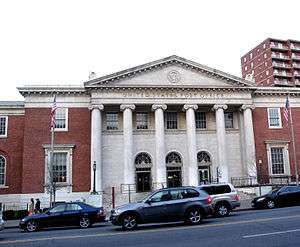 US Post Office-Flushing Main |
November 17, 1988 (#88002507) |
4165 Main St.[6] 40°45′23″N 73°49′42″W |
Flushing | |
| 100 | US Post Office-Forest Hills Station |  US Post Office-Forest Hills Station |
November 17, 1988 (#88002503) |
10628 Queens Blvd.[7] 40°43′18″N 73°50′50″W |
Forest Hills | |
| 101 | US Post Office-Jackson Heights Station |  US Post Office-Jackson Heights Station |
November 17, 1988 (#88002504) |
7802 37th Ave.[8] 40°44′57″N 73°53′16″W |
Jackson Heights | |
| 102 | US Post Office-Jamaica Main | 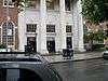 US Post Office-Jamaica Main |
November 17, 1988 (#88002335) |
8840 164th St.[9] 40°42′00″N 73°48′00″W |
Jamaica | |
| 103 | US Post Office-Long Island City | 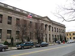 US Post Office-Long Island City |
May 11, 1989 (#88002348) |
4602 21st St.[10] 40°44′44″N 73°56′57″W |
Long Island City | |
| 104 | Cornelius Van Wyck House | 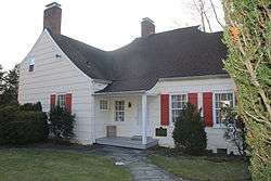 Cornelius Van Wyck House |
October 6, 1983 (#83004149) |
37-04 Douglaston Parkway 40°46′23″N 73°45′12″W |
Douglaston | |
| 105 | Vander Ende-Onderdonk House Site | 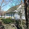 Vander Ende-Onderdonk House Site |
January 31, 1977 (#77000975) |
1820 Flushing Ave. 40°42′40″N 73°55′12″W |
Ridgewood | |
| 106 | Woodbine-Palmetto-Gates Historic District | 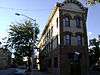 Woodbine-Palmetto-Gates Historic District |
September 30, 1983 (#83001783) |
Roughly bounded by Forest and Fairview Aves., Woodbine and Linden Sts. 40°42′25″N 73°54′15″W |
Middle Village | |
| 107 | Wyckoff-Snediker Family Cemetery | _08.jpg) Wyckoff-Snediker Family Cemetery |
May 25, 2001 (#01000549) |
85-45 96th St. 40°41′46″N 73°50′57″W |
Woodhaven | Located behind St. Matthew's Episcopal Church (see above) and not clearly visible from the street. |
See also
| Wikimedia Commons has media related to National Register of Historic Places in Queens County, New York. |
- Statewide: National Register of Historic Places listings in New York
- Citywide: Manhattan, Brooklyn, Staten Island, Bronx
- List of New York City Designated Landmarks in Queens
References
- The latitude and longitude information provided in this table was derived originally from the National Register Information System, which has been found to be fairly accurate for about 99% of listings. Some locations in this table may have been corrected to current GPS standards.
- "National Register of Historic Places: Weekly List Actions". National Park Service, United States Department of the Interior. Retrieved on June 19, 2020.
- Numbers represent an ordering by significant words. Various colorings, defined here, differentiate National Historic Landmarks and historic districts from other NRHP buildings, structures, sites or objects.
- The eight-digit number below each date is the number assigned to each location in the National Register Information System database, which can be viewed by clicking the number.
- Address based on USPS website. Accessed April 1, 2016.
- Address based on USPS website. Accessed April 1, 2016.
- Address based on USPS website. Accessed April 1, 2016.
- Address based on USPS website. Accessed April 1, 2016.
- Address based on USPS website. Accessed April 1, 2016.
- Address based on USPS website. Accessed April 1, 2016.
External links
| Topics |  | |
|---|---|---|
| Lists by county |
| |
| Lists by city | ||
| Other lists | ||
| ||
This article is issued from Wikipedia. The text is licensed under Creative Commons - Attribution - Sharealike. Additional terms may apply for the media files.