National Register of Historic Places listings in Delaware County, New York
List of the National Register of Historic Places listings in Delaware County, New York
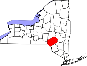
Location of Delaware County in New York
This is intended to be a complete list of properties and districts listed on the National Register of Historic Places in Delaware County, New York. The locations of National Register properties and districts (at least for all showing latitude and longitude coordinates below) may be seen in a map by clicking on "Map of all coordinates".[1] There is just one property in the county which is further designated a National Historic Landmark, the John Burroughs Home.
- This National Park Service list is complete through NPS recent listings posted June 19, 2020.[2]
| Albany (Albany) – Allegany – Bronx – Broome – Cattaraugus – Cayuga – Chautauqua – Chemung – Chenango – Clinton – Columbia – Cortland – Delaware – Dutchess (Poughkeepsie, Rhinebeck) – Erie (Buffalo) – Essex – Franklin – Fulton – Genesee – Greene – Hamilton – Herkimer – Jefferson – Kings – Lewis – Livingston – Madison – Monroe (Rochester) – Montgomery – Nassau – New York (Below 14th Street, 14th to 59th Streets, 59th to 110th Streets, Above 110th Street, Islands) – Niagara – Oneida – Onondaga – Ontario – Orange – Orleans – Oswego – Otsego – Putnam – Queens – Rensselaer – Richmond – Rockland – St. Lawrence – Saratoga – Schenectady – Schoharie – Schuyler – Seneca – Steuben – Suffolk – Sullivan – Tioga – Tompkins – Ulster – Warren – Washington – Wayne – Westchester (Northern, Southern, New Rochelle, Peekskill, Yonkers) – Wyoming – Yates |
Current listings
| [3] | Name on the Register | Image | Date listed[4] | Location | City or town | Description |
|---|---|---|---|---|---|---|
| 1 | Andes Historic District | 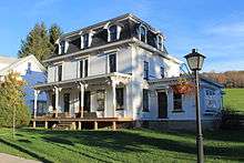 Andes Historic District |
June 28, 1984 (#84002215) |
Delaware Ave., Main and High Sts., and Tremperskill Rd. 42°11′22″N 74°46′51″W |
Andes | |
| 2 | Bloomville Methodist Episcopal Church | 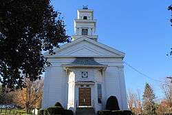 Bloomville Methodist Episcopal Church |
November 29, 2006 (#06001080) |
35 Church St. 42°19′59″N 74°48′36″W |
Bloomville | |
| 3 | Bovina Center Historic District | June 2, 2000 (#00000574) |
Roughly Co. Rt. 6, Creamery Rd., Maple and Pink Sts. 42°15′34″N 74°47′20″W |
Bovina Center | ||
| 4 | Amos Bristol Tavern | December 13, 2000 (#00001526) |
Cty Rte 14 42°20′55″N 75°00′51″W |
West Meredith | ||
| 5 | Burns Family Farm | May 30, 2007 (#07000486) |
Crescent Valley Rd. 42°17′59″N 74°40′48″W |
Bovina | ||
| 6 | John Burroughs Home | 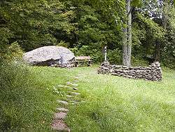 John Burroughs Home |
October 15, 1966 (#66000512) |
2 mi. from Roxbury on Roxbury Rd. 42°17′47″N 74°35′03″W |
Roxbury | A home of naturalist John Burroughs |
| 7 | Christ Episcopal Church | 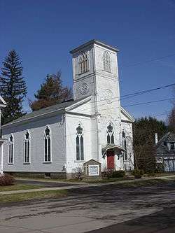 Christ Episcopal Church |
May 18, 1999 (#99000563) |
41 Gardiner Pl. 42°10′11″N 75°07′45″W |
Walton | |
| 8 | Christian Church | 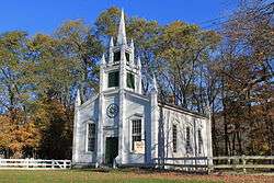 Christian Church |
March 12, 2001 (#01000250) |
NY 10 42°17′56″N 74°52′45″W |
East Delhi | |
| 9 | Churchill Park Historic District | November 17, 1980 (#80004609) |
NY 10 and NY 23 and W. Main St. 42°24′52″N 74°37′30″W |
Stamford | ||
| 10 | Common School 32 |  Common School 32 |
March 27, 2017 (#100000811) |
25 Bridge St. 42°12′21″N 75°14′58″W |
Trout Creek | Intact 1860 one-room schoolhouse was used until 1968 |
| 11 | Congregation B'nai Israel Synagogue | 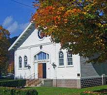 Congregation B'nai Israel Synagogue |
November 21, 2002 (#02001396) |
Wagner Ave. 42°09′19″N 74°31′59″W |
Fleischmanns | 1920 synagogue is only one listed in county and only one in Catskills with exposed truss roof |
| 12 | Delaware and Northern Railroad Station |  Delaware and Northern Railroad Station |
August 20, 2004 (#04000872) |
Cabin Hill Rd. 42°11′14″N 74°47′21″W |
Andes | |
| 13 | Delaware County Courthouse Square District | 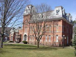 Delaware County Courthouse Square District |
July 16, 1973 (#73001177) |
Roughly bounded by 2nd, Church, Main, and Court Sts. 42°16′42″N 74°55′01″W |
Delhi | |
| 14 | District 10 School | 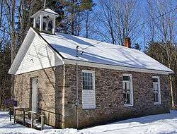 District 10 School |
February 20, 1998 (#98000131) |
NY 28, 2 mi SW of Margaretville 42°07′20″N 74°40′32″W |
Margaretville | 1820s school demolished in the 1850s, reassembled in 1860. Only building left standing in Pepacton Reservoir area |
| 15 | Downsville Covered Bridge | 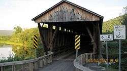 Downsville Covered Bridge |
April 29, 1999 (#99000503) |
Bridge St. 42°04′34″N 74°59′28″W |
Downsville | |
| 16 | First Congregational Church of Walton | 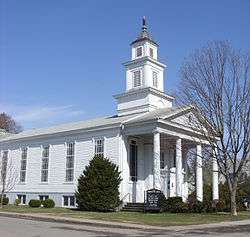 First Congregational Church of Walton |
July 27, 2015 (#15000476) |
4 Mead St. 42°10′15″N 75°07′40″W |
Walton | 1840s neoclassical church has long been an important part of the village |
| 17 | First Old School Baptist Church of Roxbury and Vega Cemetery | 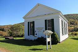 First Old School Baptist Church of Roxbury and Vega Cemetery |
April 12, 1996 (#96000371) |
Near Jct. of Co. Rt. 36 and Cartwright Rd. 42°14′58″N 74°32′10″W |
Roxbury | |
| 18 | First Presbyterian Church | 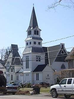 First Presbyterian Church |
February 1, 2006 (#05001616) |
Clinton St. 42°16′28″N 74°55′21″W |
Delhi | |
| 19 | First Presbyterian Church of Deposit | (#100004734) |
129 Second St. 42°03′48″N 75°25′21″W |
Deposit | 1880 Lawrence Valk church with auditorium plan, shared with Broome County | |
| 20 | First Presbyterian Church of Margaretville | 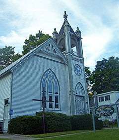 First Presbyterian Church of Margaretville |
April 21, 2004 (#04000348) |
169 Orchard Ave. 42°08′58″N 74°39′07″W |
Margaretville | Intact 1894 late Victorian church |
| 21 | Fitches Covered Bridge | 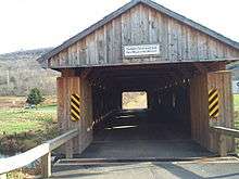 Fitches Covered Bridge |
April 29, 1999 (#99000508) |
Fitches Bridge Rd. 42°17′53″N 74°52′47″W |
East Delhi | |
| 22 | Franklin Village Historic District | 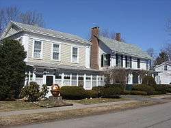 Franklin Village Historic District |
September 7, 1984 (#84002220) |
Wakeman and Institute Aves., Main, Center, Maple, Water, 2nd, 3rd, and West Sts. 42°20′24″N 75°09′58″W |
Franklin | |
| 23 | Judge Gideon Frisbee House | 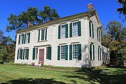 Judge Gideon Frisbee House |
December 12, 1976 (#76001211) |
NE of Delhi on NY 10 42°17′57″N 74°53′29″W |
Delhi | |
| 24 | Amelita Galli-Curci Estate | August 19, 2010 (#10000556) |
352 and 374 Galli-Curci Road 42°08′21″N 74°32′09″W |
Fleischmanns vicinity | New listing; refnum 10000556 | |
| 25 | Galli-Curci Theatre | 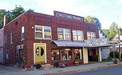 Galli-Curci Theatre |
April 12, 2006 (#06000254) |
801 Main St. 42°08′56″N 74°38′56″W |
Margaretville | 1922 movie theatre was also one of region's first car dealerships |
| 26 | Gardiner Place Historic District | 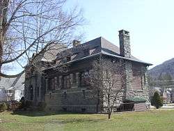 Gardiner Place Historic District |
May 24, 1984 (#84002222) |
Gardiner Place 42°10′08″N 75°07′43″W |
Walton | |
| 27 | Hamden Covered Bridge | 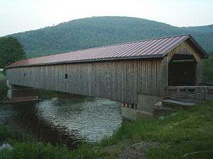 Hamden Covered Bridge |
April 29, 1999 (#99000502) |
Basin Clove Rd. 42°11′44″N 74°59′19″W |
Hamden | |
| 28 | Hamden District No.1 School | December 3, 2018 (#100003152) |
5594 E River Rd. Coordinates missing |
Hawleys vicinity | ||
| 29 | Hanford Mill |  Hanford Mill |
March 26, 1973 (#73001178) |
On CR 12 42°25′47″N 74°52′16″W |
East Meredith | |
| 30 | Isaac Hardenbergh House | December 12, 1994 (#94001369) |
NY 23 N of jct. with William Lutz Rd. 42°20′14″N 74°27′11″W |
Roxbury | ||
| 31 | Hobart Masonic Hall | December 28, 2001 (#01001399) |
6 Cornell Ave. 42°22′22″N 74°40′02″W |
Hobart | ||
| 32 | Hotel Delaware | 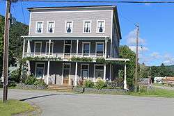 Hotel Delaware |
December 6, 2004 (#04001342) |
391 Main St. 41°59′17″N 75°08′04″W |
East Branch | |
| 33 | Hubbell Family Farm and Kelly's Corners Cemetery | 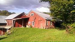 Hubbell Family Farm and Kelly's Corners Cemetery |
August 17, 2001 (#01000892) |
NY 30 42°11′25″N 74°35′40″W |
Kelly's Corners | |
| 34 | Jackson-Aitken Farm | 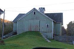 Jackson-Aitken Farm |
February 20, 2003 (#03000044) |
3240 Fall Clove Rd. 42°09′28″N 74°52′10″W |
Andes | |
| 35 | Kelly Round Barn | 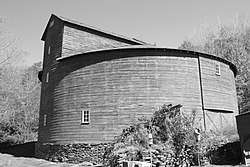 Kelly Round Barn |
September 29, 1984 (#84003857) |
NY 30 42°12′01″N 74°35′48″W |
Halcottsville | |
| 36 | Lordville Presbyterian Church | 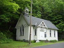 Lordville Presbyterian Church |
February 4, 2000 (#00000052) |
Lordville Rd. 41°52′11″N 75°12′57″W |
Lordville | |
| 37 | Lower Shavertown Covered Bridge | 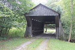 Lower Shavertown Covered Bridge |
April 29, 1999 (#99000504) |
682 Methol Rd. 41°55′24″N 75°00′49″W |
Methol | |
| 38 | MacDonald Farm | April 3, 1973 (#73001179) |
Elk Creek and Monroe Rds. 42°21′14″N 74°51′44″W |
Meredith | ||
| 39 | Main Street Historic District | 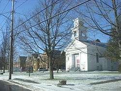 Main Street Historic District |
February 29, 1988 (#88000111) |
Main St. 42°17′22″N 74°33′44″W |
Roxbury | |
| 40 | Maxbilt Theatre | 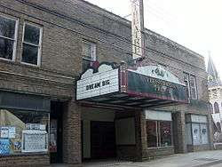 Maxbilt Theatre |
December 10, 2014 (#14001019) |
932 Main St. 42°09′22″N 74°31′58″W |
Fleischmanns | Small regional theater built in 1929 by Russian immigrant who went on to become a major regional developer during Catskill resort era; soon to be renovated into dinner theater |
| 41 | McArthur-Martin Hexadecagon Barn |  McArthur-Martin Hexadecagon Barn |
September 29, 1984 (#84002237) |
McArthur Hill Rd. 42°22′18″N 74°46′51″W |
Bloomville | |
| 42 | McNaught Family Farm |  McNaught Family Farm |
August 8, 2019 (#100004241) |
289 McNaught Hill Road 42°18′00″N 74°44′30″W |
Bovina Center | Early 19th-century farmstead established by family of Scottish immigrants displaced by the Lowland Clearances |
| 43 | Murray Hill |  Murray Hill |
June 3, 1982 (#82003354) |
Murray Hill Rd. 42°16′35″N 74°54′16″W |
Delhi | |
| 44 | New Kingston Historic District | February 19, 2008 (#08000037) |
Co. Rd. 6 42°12′52″N 74°40′53″W |
New Kingston | ||
| 45 | New Kingston Presbyterian Church | May 22, 2002 (#02000554) |
CR 6 42°12′48″N 74°40′57″W |
New Kingston | ||
| 46 | New Stone Hall | 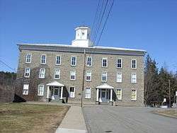 New Stone Hall |
May 6, 1980 (#80002600) |
Center St. 42°20′20″N 75°10′06″W |
Franklin | |
| 47 | Old School Baptist Church of Halcottsville | 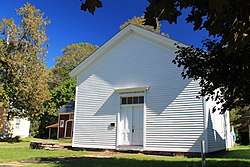 Old School Baptist Church of Halcottsville |
July 8, 1999 (#99000809) |
Old NY 30 42°12′25″N 74°36′05″W |
Halcottsville | |
| 48 | Pakatakan Artists Colony Historic District | 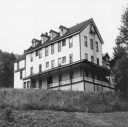 Pakatakan Artists Colony Historic District |
February 21, 1989 (#89000046) |
NY 28 at jct. with Dry Brook Rd. 42°08′33″N 74°37′30″W |
Arkville | |
| 49 | Pioneer Cemetery | 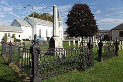 Pioneer Cemetery |
July 24, 2007 (#07000754) |
Main St. 42°18′59″N 75°23′39″W |
Sidney | |
| 50 | Ravina | February 4, 2000 (#00000048) |
Bouchouxville 41°52′16″N 75°12′28″W |
Lordville | ||
| 51 | Rock Rift Fire Observation Tower |  Rock Rift Fire Observation Tower |
December 7, 2018 (#100003231) |
Tower Lane 42°06′14″N 75°13′36″W |
Tompkins vicinity | 1934 fire tower in original state, manned until 1987 |
| 52 | Rock Valley School | 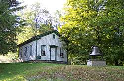 Rock Valley School |
May 12, 2008 (#08000406) |
9598 Rock Valley Rd. 41°53′33″N 75°05′04″W |
Rock Valley | (new listing; refnum 08000406) |
| 53 | St. John's Church Complex | 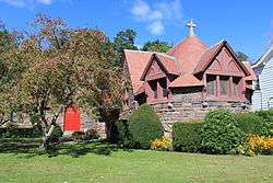 St. John's Church Complex |
July 21, 1995 (#95000879) |
136 Main St. 42°16′45″N 74°55′00″W |
Delhi | |
| 54 | St. Peter's Episcopal Church Complex | July 31, 1998 (#98000948) |
Jct. of Pine and Church Sts. 42°22′13″N 74°40′13″W |
Hobart | ||
| 55 | Schoolhouse No. 5 | 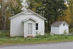 Schoolhouse No. 5 |
June 1, 2011 (#11000326) |
5942 Dunk Hill Rd. 42°16′05″N 75°05′08″W |
Hamden vicinity | New listing; refnum 11000326 |
| 56 | Second Old School Baptist Church of Roxbury | 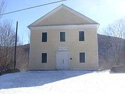 Second Old School Baptist Church of Roxbury |
July 28, 1999 (#99000908) |
Cty. Rd. 41 42°15′53″N 74°35′43″W |
Roxbury | |
| 57 | Second Walton Armory (33rd Separate Company) | %2C_Walton%2C_NY.jpg) Second Walton Armory (33rd Separate Company) |
September 6, 2016 (#16000591) |
139 Stockton Ave. 42°09′57″N 75°07′50″W |
Walton | 1890s armory by Isaac Perry now known as Castle on the Hudson, used as restaurant, events center |
| 58 | Erskine L. Seeley House | August 30, 2010 (#10000593) |
46 Main St. 42°24′28″N 74°36′48″W |
Stamford | New listing; refnum 10000593 | |
| 59 | Sherwood Family Estate | December 31, 2002 (#02001648) |
484 Sherwood Rd. 42°15′50″N 74°56′03″W |
Delhi | ||
| 60 | Sidney Historic District | 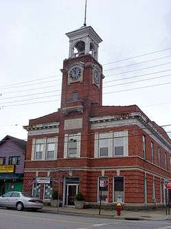 Sidney Historic District |
September 4, 2013 (#13000679) |
Railroad Ave., River, Bridge & Main Sts. 42°18′57″N 75°23′42″W |
Sidney | |
| 61 | Skene Memorial Library | 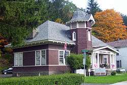 Skene Memorial Library |
May 30, 2001 (#01000576) |
Main St.-Old NY 28 42°09′19″N 74°31′46″W |
Fleischmanns | Queen Anne/Shingle Style Carnegie library built by Alexander Skene's widow in his memory in 1901 |
| 62 | Walter Stratton House | December 31, 2002 (#02001660) |
New Kingston Mountain Rd. 42°15′21″N 74°37′00″W |
Roxbury | ||
| 63 | Thomson Family Farm | September 15, 2004 (#04001000) |
Thomson Hollow Rd. 42°16′03″N 74°38′03″W |
New Kingston | ||
| 64 | Ulster and Delaware Railroad Depot and Mill Complex | 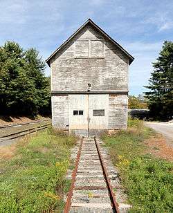 Ulster and Delaware Railroad Depot and Mill Complex |
April 18, 2003 (#03000254) |
Depot St. 42°17′04″N 74°34′11″W |
Roxbury | |
| 65 | Union Free School | 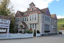 Union Free School |
December 6, 2004 (#04001345) |
28218 NY 206 42°04′59″N 74°59′53″W |
Downsville | |
| 66 | United Presbyterian Church of Davenport | July 24, 2017 (#100001360) |
15673 & 15705 NY 23 42°28′13″N 74°50′52″W |
Davenport | 1868 Greek Revival church with features from 1890s Victorian renovation; now Charlotte Valley Presbyterian | |
| 67 | US Post Office-Delhi | 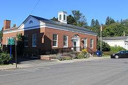 US Post Office-Delhi |
November 17, 1988 (#88002477) |
10 Court St. 42°16′40″N 74°55′07″W |
Delhi | |
| 68 | US Post Office-Walton | 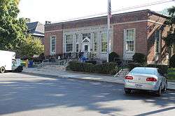 US Post Office-Walton |
May 11, 1989 (#88002439) |
34-36 Gardner Pl. 42°10′09″N 75°07′42″W |
Walton | |
| 69 | Van Benschoten House and Guest House | April 1, 2002 (#02000302) |
Margaretville Mountain Rd. 42°10′02″N 74°40′08″W |
Margaretville | ||
| 70 | Walton Grange 1454-Former Armory | 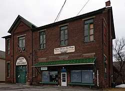 Walton Grange 1454-Former Armory |
June 22, 1998 (#98000666) |
57 Stockton Ave. 42°09′56″N 75°07′50″W |
Walton | 1886 armory later used as Grange hall, school and clubhouse |
| 71 | West Delhi Presbyterian Church, Manse, and Cemetery | 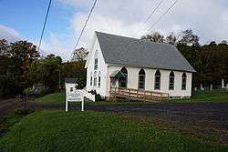 West Delhi Presbyterian Church, Manse, and Cemetery |
November 7, 2008 (#08001032) |
18 and 45 Sutherland Rd. 42°18′00″N 75°00′25″W |
West Delhi | New listing; refnum#08001032 |
| 72 | West Kortright Presbyterian Church | 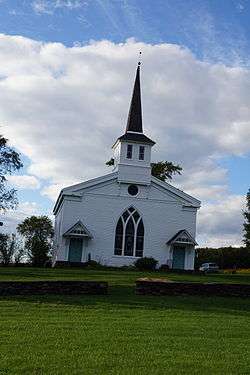 West Kortright Presbyterian Church |
November 15, 2002 (#02001326) |
49 W. Kortright Church Rd. 42°24′08″N 74°51′08″W |
West Kortright | |
| 73 | West Meredith Cemetery |  West Meredith Cemetery |
November 7, 2003 (#03001119) |
Cty Rte. 14 42°20′48″N 75°01′36″W |
West Meredith |
See also
| Wikimedia Commons has media related to National Register of Historic Places in Delaware County, New York. |
References
- The latitude and longitude information provided in this table was derived originally from the National Register Information System, which has been found to be fairly accurate for about 99% of listings. Some locations in this table may have been corrected to current GPS standards.
- "National Register of Historic Places: Weekly List Actions". National Park Service, United States Department of the Interior. Retrieved on June 19, 2020.
- Numbers represent an ordering by significant words. Various colorings, defined here, differentiate National Historic Landmarks and historic districts from other NRHP buildings, structures, sites or objects.
- The eight-digit number below each date is the number assigned to each location in the National Register Information System database, which can be viewed by clicking the number.
| Topics |  | |
|---|---|---|
| Lists by county |
| |
| Lists by city | ||
| Other lists | ||
| ||
This article is issued from Wikipedia. The text is licensed under Creative Commons - Attribution - Sharealike. Additional terms may apply for the media files.