National Register of Historic Places listings in Manhattan above 110th Street
List of the National Register of Historic Places listings in Manhattan above 110th Street
This is intended to be a complete list of properties and districts listed on the National Register of Historic Places above 110th Street in Manhattan. For properties and districts in other parts of Manhattan and the other islands of New York County, see National Register of Historic Places listings in New York County, New York. The locations of National Register properties and districts (at least for all showing latitude and longitude coordinates below) may be seen in an online map by clicking on "Map of all coordinates".[1]
- This National Park Service list is complete through NPS recent listings posted June 26, 2020.[2]
| Albany (Albany) – Allegany – Bronx – Broome – Cattaraugus – Cayuga – Chautauqua – Chemung – Chenango – Clinton – Columbia – Cortland – Delaware – Dutchess (Poughkeepsie, Rhinebeck) – Erie (Buffalo) – Essex – Franklin – Fulton – Genesee – Greene – Hamilton – Herkimer – Jefferson – Kings – Lewis – Livingston – Madison – Monroe (Rochester) – Montgomery – Nassau – New York (Below 14th Street, 14th to 59th Streets, 59th to 110th Streets, Above 110th Street, Islands) – Niagara – Oneida – Onondaga – Ontario – Orange – Orleans – Oswego – Otsego – Putnam – Queens – Rensselaer – Richmond – Rockland – St. Lawrence – Saratoga – Schenectady – Schoharie – Schuyler – Seneca – Steuben – Suffolk – Sullivan – Tioga – Tompkins – Ulster – Warren – Washington – Wayne – Westchester (Northern, Southern, New Rochelle, Peekskill, Yonkers) – Wyoming – Yates |
Listings above 110th Street
| [3] | Name on the Register | Image | Date listed[4] | Location | City or town | Description |
|---|---|---|---|---|---|---|
| 1 | 32nd Police Precinct Station House Complex | 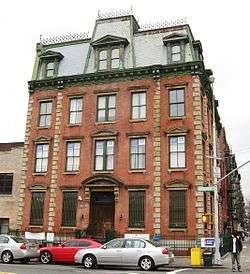 32nd Police Precinct Station House Complex |
August 8, 2019 (#100004243) |
1850-1854 Amsterdam Avenue 40°49′47″N 73°56′41″W |
Harlem | 1870s Second Empire police station complex, now offices for community groups, reflects changing role of police at time of construction; was in use for almost a century |
| 2 | 116th Street-Columbia University Subway Station (IRT) | 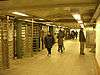 116th Street-Columbia University Subway Station (IRT) |
September 17, 2004 (#04001020) |
Junction of Broadway and West 116th St. 40°48′28″N 73°57′52″W |
Morningside Heights | Subway station (1 train) |
| 3 | 145th Street Subway Station (IRT) |  145th Street Subway Station (IRT) |
March 30, 2005 (#05000231) |
Under Lenox Avenue at the jct. with 145th St. 40°49′13″N 73°56′12″W |
Harlem | Subway station (3 train) |
| 4 | 168th Street Subway Station (IRT) |  168th Street Subway Station (IRT) |
March 30, 2005 (#05000232) |
Under Broadway at the jct. of W. 168th St. 40°50′26″N 73°56′26″W |
Washington Heights | Subway station (1 train). Lower set of tracks (1 train) is only station along Fort George Tunnel where its semicircular vaulted ceiling is visible. |
| 5 | 181st Street Subway Station (IND) |  181st Street Subway Station (IND) |
March 30, 2005 (#05000233) |
Fort Washington Ave., Vet. W. 185th and 181st Sts. 40°51′06″N 73°56′18″W |
Washington Heights | Subway station (A train) |
| 6 | 181st Street Subway Station (IRT) | 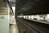 181st Street Subway Station (IRT) |
March 30, 2005 (#05000224) |
Under St. Nicholas Ave. bet. W. 181st and W. 180th St.s 40°50′58″N 73°56′03″W |
Washington Heights | Subway station (1 train) |
| 7 | 190th Street Subway Station (IND) | .jpg) 190th Street Subway Station (IND) |
March 30, 2005 (#05000225) |
Under Fort Washington Ave. bet. Fort Tryon Park (Cabrini Blvd.) and W. 190th St/ 40°51′32″N 73°56′05″W |
Washington Heights | Subway station (A train) |
| 8 | 207th Street Yard – Signal Service Building and Tower B | 207th Street Yard – Signal Service Building and Tower B |
February 9, 2006 (#06000018) |
W. 215th St. bet. Tenth Ave. and the Harlem R 40°52′06″N 73°54′49″W |
Inwood | |
| 9 | 369th Regiment Armory | 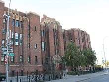 369th Regiment Armory |
January 28, 1994 (#93001537) |
2366 Fifth Ave. 40°49′03″N 73°56′04″W |
Harlem | Home of the 369th Regiment, Harlem Hellfighters |
| 10 | Ansche Chesed Synagogue | 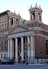 Ansche Chesed Synagogue |
June 9, 2014 (#14000289) |
1883 Adam Clayton Powell Jr. Blvd. 40°48′07″N 73°57′11″W |
Harlem | Congregation founded in late 1820s was the largest synagogue in the country by mid-19th century. Now Mount Neboh Baptist Church. |
| 11 | Apollo Theater | .jpg) Apollo Theater |
November 17, 1983 (#83004059) |
253 W. 125th St. 40°48′36″N 73°57′01″W |
Harlem | Venue for African-American mid-20th century popular musicians |
| 12 | Audubon Terrace Historic District |  Audubon Terrace Historic District |
May 30, 1980 (#80002667) |
Bounded by Broadway, W. 155th and W. 156th Sts. 40°50′00″N 73°56′49″W |
Washington Heights | |
| 13 | James Bailey House | 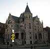 James Bailey House |
April 23, 1980 (#80002668) |
10 St. Nicholas Pl. (at 150th St.) 40°49′38″N 73°56′33″W |
Harlem | (Ed. note: see NYTimes article) |
| 14 | Broadway Synagogue, Old | 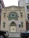 Broadway Synagogue, Old |
January 11, 2002 (#01001440) |
15 Old Broadway (nr 125th St & Bway) 40°48′55″N 73°57′27″W |
Harlem | |
| 15 | Brooks and Hewitt Halls | 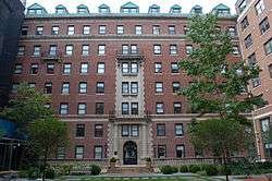 Brooks and Hewitt Halls |
November 15, 2003 (#03001151) |
Jct. W. 116th St. and Claremont Ave. 40°48′30″N 73°57′54″W |
Morningside Heights | |
| 16 | Calvary Methodist Episcopal Church |  Calvary Methodist Episcopal Church |
May 16, 2016 (#16000255) |
211 W. 129th St., 2190 Adam Clayton Powell, Jr. Blvd. 40°48′43″N 73°56′48″W |
Harlem | Elaborate Romanesque John Rochester Thomas church was largest in city upon 1887 construction; later expanded and sold to black congregation which renamed it Salem United Methodist Church. |
| 17 | Casa Italiana | 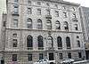 Casa Italiana |
October 29, 1982 (#82001188) |
1151-1161 Amsterdam Ave. (@ 116th) 40°48′26″N 73°57′39″W |
Morningside Heights | |
| 18 | Chapel of the Intercession Complex and Trinity Cemetery |  Chapel of the Intercession Complex and Trinity Cemetery |
July 24, 1980 (#80002677) |
550 W. 155th St. 40°49′56″N 73°56′50″W |
Washington Heights | |
| 19 | Church of Notre Dame and Rectory | 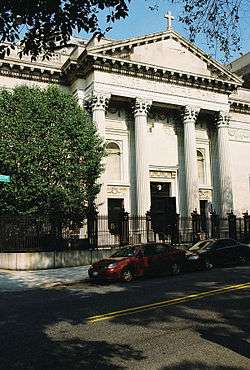 Church of Notre Dame and Rectory |
May 6, 1980 (#80002678) |
405 W. 114th St. and 40 Morningside Dr. 40°48′18″N 73°57′38″W |
Morningside Heights | |
| 20 | College of the City of New York |  College of the City of New York |
September 7, 1984 (#84002763) |
Bounded by Amsterdam Ave., St. Nicholas Terr., W. 138th, and W. 140th Sts. 40°49′15″N 73°56′58″W |
Upper Manhattan | |
| 21 | Congregation Shaare Zedek of Harlem |  Congregation Shaare Zedek of Harlem |
February 23, 2015 (#15000031) |
23 W. 118th St. 40°48′10″N 73°56′48″W |
Harlem | 1901 Moorish Revival synagogue built for one of city's oldest Jewish congregations has primarily been a Protestant church since 1930s serving local African-American community. |
| 22 | Will Marion Cook House | 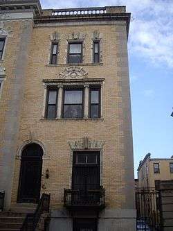 Will Marion Cook House |
May 11, 1976 (#76001238) |
221 W. 138th St. 40°49′04″N 73°56′37″W |
Harlem | Musician Will Marion Cook lived here |
| 23 | Croton Aqueduct Gate House | 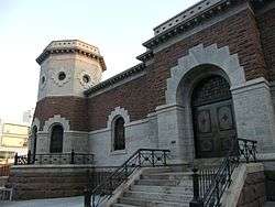 Croton Aqueduct Gate House |
September 22, 1983 (#83001721) |
135th St. and Convent Ave. 40°49′06″N 73°57′06″W |
Upper Manhattan | |
| 24 | Delta Psi, Alpha Chapter |  Delta Psi, Alpha Chapter |
April 26, 1996 (#96000484) |
434 Riverside Dr. (@ 115th) 40°48′30″N 73°57′59″W |
Morningside Heights | |
| 25 | Dorrance Brooks Square Historic District | August 8, 2019 (#100004239) |
Edgecombe Avenue, West 136th-140th Streets 40°49′08″N 73°56′45″W |
Harlem | Neighborhood that takes its name from black serviceman killed during World War I was closely associated with many Harlem Renaissance figures; also contains many of the rowhouses that characterized Harlem's early development | |
| 26 | Dunbar Apartments | 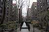 Dunbar Apartments |
March 29, 1979 (#79001601) |
Bounded by 7th and 8th Aves. and W. 149th and 150th Sts. 40°49′30″N 73°56′20″W |
Harlem | |
| 27 | Dyckman Street Subway Station (IRT) | 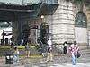 Dyckman Street Subway Station (IRT) |
September 17, 2004 (#04001021) |
Bet. Hillside and St. Nicholas Aves., jct. of Dyckman St. and Nagle Ave. 40°51′39″N 73°55′34″W |
Inwood | Subway station (1 train) |
| 28 | William Dyckman House | 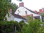 William Dyckman House |
December 24, 1967 (#67000014) |
4881 Broadway 40°52′03″N 73°55′24″W |
Inwood | Last remaining farmhouse in Manhattan, dating to late 18th century. Now a museum run by the Parks Department. |
| 29 | Earl Hall | 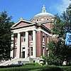 Earl Hall |
March 12, 2018 (#100002189) |
2980 Broadway 40°48′31″N 73°57′46″W |
Morningside Heights | 1902 McKim, Mead and White building was one of first on Columbia's Morningside Heights campus; later housed offices of Student Homophile Society, first U.S. student LGBT organization |
| 30 | East Harlem Historic District | 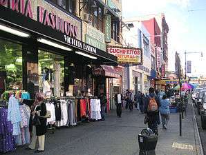 East Harlem Historic District |
July 10, 2019 (#100004218) |
Generally E. 111th-120th Sts., Park, Lexington, Pleasant, 1st-3rd Aves. 40°47′54″N 73°56′19″W |
East Harlem | Neighborhood mostly developed between Civil War and World War I, reflecting occupancy by several different ethnic groups |
| 31 | Edward Kennedy "Duke" Ellington House | 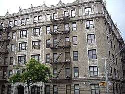 Edward Kennedy "Duke" Ellington House |
May 11, 1976 (#76001239) |
935 St. Nicholas Ave., Apt. 4A 40°49′56″N 73°56′29″W |
Harlem | Home of jazz legend Duke Ellington for much of his adult life |
| 32 | Elmendorf Reformed Church |  Elmendorf Reformed Church |
April 27, 2010 (#10000225) |
171 E. 121st St. 40°48′05″N 73°56′18″W |
Harlem | |
| 33 | Fire Hook and Ladder Company No. 14 |  Fire Hook and Ladder Company No. 14 |
May 22, 2013 (#13000309) |
120 E. 125th St. 40°48′16″N 73°56′17″W |
Harlem | currently accommodates the Caribbean Cultural Center African Diaspora Institute |
| 34 | First African Methodist Episcopal Church, Bethel | 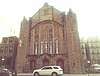 First African Methodist Episcopal Church, Bethel |
November 9, 2018 (#100003116) |
60 W. 132nd St. 40°48′41″N 73°56′28″W |
Harlem | Neo-Gothic church houses one of Harlem's most important black churches, key to neighborhood development throughout 20th century; Marcus Garvey gave his first Harlem speech here. |
| 35 | Fort Tryon Park and the Cloisters | 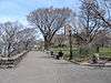 Fort Tryon Park and the Cloisters |
December 19, 1978 (#78001870) |
Broadway and Dyckman St. 40°51′39″N 73°55′57″W |
Hudson Heights within Washington Heights | |
| 36 | Fort Washington Avenue Armory | 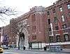 Fort Washington Avenue Armory |
March 2, 1995 (#95000085) |
216 Fort Washington Ave. (jct. with 168th St.) 40°50′31″N 73°56′31″W |
Washington Heights | 1911 neoclassical armory was one of first in city in that style. Now home to National Track and Field Hall of Fame. |
| 37 | Fort Washington Presbyterian Church |  Fort Washington Presbyterian Church |
January 7, 2010 (#09001209) |
21 Wadsworth Ave. 40°50′43″N 73°56′16″W |
Washington Heights | New listing; refnum 0900120 |
| 38 | The Fourth Church of Christ, Scientist | 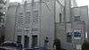 The Fourth Church of Christ, Scientist |
August 31, 2011 (#11000620) |
551 Ft. Washington Ave. 40°51′13″N 73°56′16″W |
Washington Heights | New listing; refnum 11000620 |
| 39 | Fort Washington Site | 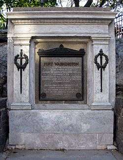 Fort Washington Site |
December 6, 1978 (#78001871) |
Bennett Park, Ft. Washington Ave. at 183rd St. "Address Restricted" |
Washington Heights | |
| 40 | General Grant National Memorial | 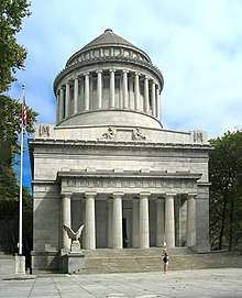 General Grant National Memorial |
October 15, 1966 (#66000055) |
Riverside Dr. and W. 122nd St. 40°48′48″N 73°57′49″W |
Morningside Heights | |
| 41 | Hamilton Grange National Memorial |  Hamilton Grange National Memorial |
October 15, 1966 (#66000097) |
414 W. 141st Street 40°49′17″N 73°56′50″W |
Hamilton Heights | Home of Alexander Hamilton. Recently moved for preservation purposes |
| 42 | Hamilton Heights Historic District |  Hamilton Heights Historic District |
September 30, 1983 (#83001727) |
Roughly bounded by St. Nicholas and Amsterdam Aves, W. 145 and W. 140th Sts. 40°49′21″N 73°56′54″W |
Hamilton Heights | |
| 43 | Harlem African Burial Ground | January 29, 2018 (#100002055) |
2460 2nd Ave. 40°48′10″N 73°55′52″W |
Harlem | Burial ground of enslaved Africans from 1660s to 1858 rediscovered by 21st-century archaeologists; currently under 126th Street bus garage but will be preserved in redevelopment | |
| 44 | Harlem Courthouse | 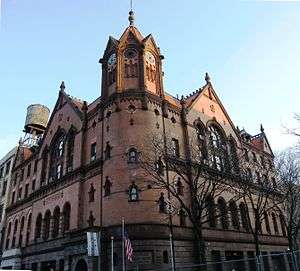 Harlem Courthouse |
April 16, 1980 (#80002692) |
170 E. 121st St. 40°48′04″N 73°56′21″W |
Harlem | |
| 45 | Harlem Fire Watchtower | 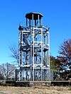 Harlem Fire Watchtower |
June 21, 1976 (#76001240) |
Marcus Garvey Park at E. 122nd St. 40°48′14″N 73°56′38″W |
Harlem | Only survivor of 11 fire watchtowers once covering Manhattan and/or the city |
| 46 | Harlem River Houses | 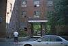 Harlem River Houses |
December 18, 1979 (#79001605) |
151st to 153rd St., Macombs Pl. and Harlem River Dr. 40°49′33″N 73°56′12″W |
Harlem | |
| 47 | Harlem Savings Bank | 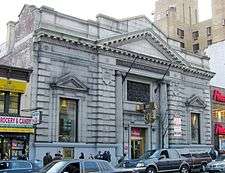 Harlem Savings Bank |
August 28, 2003 (#03000849) |
124 E. 125th St. 40°48′13″N 73°56′20″W |
Harlem | |
| 48 | Matthew Henson Residence |  Matthew Henson Residence |
May 15, 1975 (#75001207) |
246 W. 150th St., Apt. 3F 40°49′32″N 73°56′19″W |
Harlem | |
| 49 | High Bridge Aqueduct and Water Tower |  High Bridge Aqueduct and Water Tower |
December 4, 1972 (#72001560) |
Harlem River at W. 170th St. and High Bridge Park 40°50′34″N 73°55′57″W |
Washington Heights | |
| 50 | Hispanic Society of America Complex | 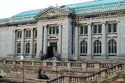 Hispanic Society of America Complex |
October 16, 2012 (#12001009) |
613 W. 155th St. 40°50′01″N 73°56′48″W |
Washington Heights | |
| 51 | Holy Cross African Orthodox Pro-Cathedral |  Holy Cross African Orthodox Pro-Cathedral |
November 9, 2017 (#100001803) |
122 W. 129th St. 40°48′38″N 73°56′41″W |
Harlem | First and only African Orthodox Church cathedral |
| 52 | Hotel Theresa |  Hotel Theresa |
June 16, 2005 (#05000618) |
2082-2096 Adam Clayton Powell, Jr. Blvd. 40°48′31″N 73°56′58″W |
Harlem | |
| 53 | Hudson View Gardens | 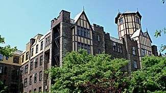 Hudson View Gardens |
February 16, 2016 (#16000020) |
116 Pinehurst Ave. 40°51′12″N 73°56′20″W |
Hudson Heights | Largest housing cooperative in the U.S. when built in early 1920s |
| 54 | Langston Hughes House | 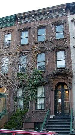 Langston Hughes House |
October 29, 1982 (#82001198) |
20 E. 127th St. 40°48′26″N 73°56′27″W |
Harlem | Home of Langston Hughes, important African-American poet |
| 55 | International House | 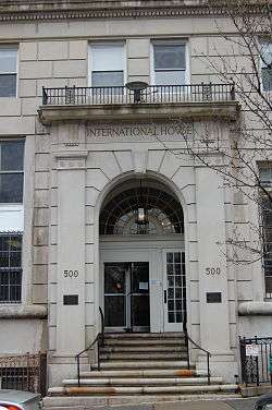 International House |
September 10, 1999 (#99001129) |
500 Riverside Dr. 40°48′49″N 73°57′43″W |
Morningside Heights | |
| 56 | IRT Broadway Line Viaduct | 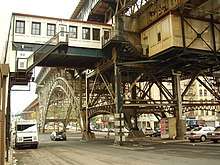 IRT Broadway Line Viaduct |
September 15, 1983 (#83001749) |
W. 122nd St. to W. 135th St., Broadway 40°49′12″N 73°57′20″W |
Harlem | Viaduct station on the 1 train. |
| 57 | Ivey Delph Apartments |  Ivey Delph Apartments |
January 20, 2005 (#04001531) |
17-19 Hamilton Terrace (at 141st St.) 40°49′20″N 73°56′50″W |
Hamilton Heights | |
| 58 | Jeffrey's Hook Lighthouse | 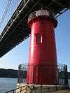 Jeffrey's Hook Lighthouse |
May 29, 1979 (#79003130) |
Fort Washington Park 40°51′00″N 73°56′52″W |
Washington Heights | Famous as Little Red Lighthouse underneath the giant G W bridge |
| 59 | James Weldon Johnson House |  James Weldon Johnson House |
May 11, 1976 (#76001241) |
187 W. 135th St. 40°48′55″N 73°56′36″W |
Harlem | Home of James Weldon Johnson |
| 60 | Jumel Terrace Historic District |  Jumel Terrace Historic District |
April 3, 1973 (#73001220) |
W. 160th and 162nd Sts. between St. Nicholas and Edgecombe Aves. 40°50′05″N 73°56′21″W |
Washington Heights | |
| 61 | Low Memorial Library, Columbia University | 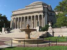 Low Memorial Library, Columbia University |
December 23, 1987 (#87002599) |
W. Sixteenth St. between Broadway and Amsterdam Ave. 40°48′29″N 73°57′45″W |
Morningside Heights | Largest granite domed building in U.S. Now used as Columbia's main administration building |
| 62 | Manhattan Avenue-West 120th-123rd Streets Historic District |  Manhattan Avenue-West 120th-123rd Streets Historic District |
January 17, 1992 (#91001920) |
242-262 W. 120th St., 341-362 W. 121st St., 341-362 W. 122nd St., 344-373 123rd St., 481-553 Manhattan Ave. W side 40°48′32″N 73°57′19″W |
Harlem | |
| 63 | Claude McKay Residence |  Claude McKay Residence |
December 8, 1976 (#76002143) |
180 W. 135th St. 40°48′54″N 73°56′34″W |
Harlem | Also known as Harlem YMCA |
| 64 | Milbank, Brinckerhoff, and Fiske Halls | 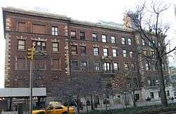 Milbank, Brinckerhoff, and Fiske Halls |
November 15, 2003 (#03001152) |
Roughly bounded by W. 119th and W. 120th Sts., and Broadway and Claremont Aves. 40°48′38″N 73°57′48″W |
Morningside Heights | |
| 65 | Minton's Playhouse | 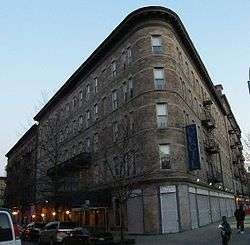 Minton's Playhouse |
September 18, 1985 (#85002423) |
206-210 W. 118th St. 40°48′17″N 73°57′12″W |
Harlem | |
| 66 | Morris-Jumel Mansion |  Morris-Jumel Mansion |
October 15, 1966 (#66000545) |
160th St. and Edgecombe Ave. 40°50′04″N 73°56′19″W |
Washington Heights | |
| 67 | Mount Morris Bank | Mount Morris Bank |
December 7, 1989 (#89002087) |
E. 125th St. and Park Ave. 40°48′19″N 73°56′22″W |
Harlem | |
| 68 | Mount Morris Park Historic District |  Mount Morris Park Historic District |
February 6, 1973 (#73001221) |
Bounded roughly by Lenox Ave., Mount Morris Park West, and W. 124th and W. 119th Sts. 40°48′17″N 73°56′49″W |
Harlem | |
| 69 | New York Amsterdam News Building |  New York Amsterdam News Building |
May 11, 1976 (#76001247) |
2293 7th Ave. 40°48′54″N 73°56′41″W |
Harlem | Once offices of major early 20th-century African-American newspaper, New York Amsterdam News. |
| 70 | New York Presbyterian Church | 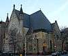 New York Presbyterian Church |
June 3, 1982 (#82003385) |
151 W. 128th St & 7th Ave. 40°48′39″N 73°56′49″W |
Harlem | Sign on church says it is Baptist |
| 71 | National Headquarters, March on Washington for Jobs and Freedom | February 3, 2020 (#100004933) |
170 W. 130th St. 40°48′42″N 73°56′44″W |
Harlem | Townhouse where 1963 civil rights march where Martin Luther King Jr. gave his "I Have a Dream" speech was organized and planned | |
| 72 | New York Public Library, 115th Street Branch |  New York Public Library, 115th Street Branch |
May 6, 1980 (#80002704) |
203 W. 115th St. 40°48′10″N 73°57′14″W |
Harlem | |
| 73 | New York Public Library, Hamilton Grange Branch |  New York Public Library, Hamilton Grange Branch |
July 23, 1981 (#81000410) |
503 and 505 W. 145th St. 40°49′32″N 73°56′54″W |
Washington Heights | |
| 74 | North Presbyterian Church | 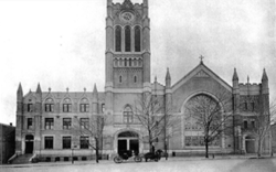 North Presbyterian Church |
February 5, 2014 (#13001153) |
525 W. 155th St. 40°49′57″N 73°56′39″W |
Washington Heights | |
| 75 | Park and Tilford Building |  Park and Tilford Building |
May 1, 2009 (#09000258) |
310 Lenox Ave. 40°48′29″N 73°56′41″W |
Harlem | |
| 76 | Philosophy Hall | 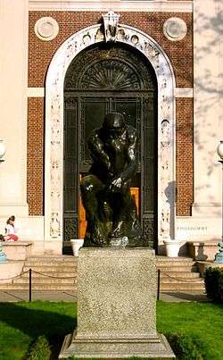 Philosophy Hall |
July 31, 2003 (#03001046) |
1150 Amsterdam Avenue 40°48′26″N 73°57′41″W |
Morningside Heights | Edwin Howard Armstrong invented FM radio in a basement lab |
| 77 | Public School 157 | 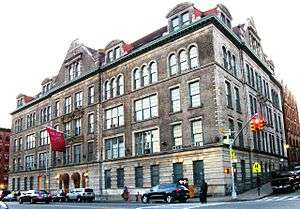 Public School 157 |
December 10, 1982 (#82003387) |
327 St. Nicholas Ave. 40°48′42″N 73°57′09″W |
Harlem | |
| 78 | Pupin Physics Laboratories, Columbia University |  Pupin Physics Laboratories, Columbia University |
October 15, 1966 (#66000550) |
Broadway and 120th St. 40°48′36″N 73°57′42″W |
Morningside Heights | First successful atom splitting on U.S. soil performed in basement lab |
| 79 | Riverside Church |  Riverside Church |
December 12, 2012 (#12001036) |
478, 490 Riverside Dr. & 81 Claremont Ave. 40°48′43″N 73°57′48″W |
Morningside Heights | John D. Rockefeller and Harry Emerson Fosdick established this interdenominational church in 1930, known for its role in social and political activism. Its 392-foot (119 m) tower makes it the tallest church in the U.S. |
| 80 | Riverside Park and Drive | 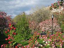 Riverside Park and Drive |
September 2, 1983 (#83001743) |
From 72nd St. to 129th St. 40°47′53″N 73°58′31″W |
Upper West Side to Inwood | First major Robert Moses project in Manhattan sped travel to Bronx and made riverfront accessible as park |
| 81 | Paul Robeson Home |  Paul Robeson Home |
December 8, 1976 (#76001248) |
555 Edgecombe Ave. 40°50′04″N 73°56′20″W |
Washington Heights | |
| 82 | St. Andrew's Episcopal Church | 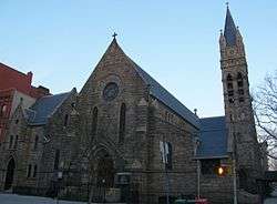 St. Andrew's Episcopal Church |
March 18, 1980 (#80002717) |
2067 5th Ave. 40°48′28″N 73°56′33″W |
Harlem | |
| 83 | St. Luke's Hospital |  St. Luke's Hospital |
May 20, 2019 (#100003934) |
30 Morningside Drive 40°48′19″N 73°57′39″W |
Morningside Heights | Complex of 11 pavilions built mostly between 1896 and 1928 that epitomizes changing role of large urban hospital. |
| 84 | St. Nicholas Historic District | 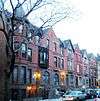 St. Nicholas Historic District |
October 29, 1975 (#75001209) |
W. 138th and W. 139th Sts. (both sides) between 7th and 8th Aves. 40°49′05″N 73°56′37″W |
Harlem | |
| 85 | St. Philip's Church |  St. Philip's Church |
September 25, 2008 (#08000933) |
210-216 West 134th St. 40°48′53″N 73°56′43″W |
Harlem | |
| 86 | St. Walburga's Academy | 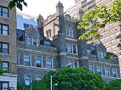 St. Walburga's Academy |
July 28, 2004 (#04000755) |
630 Riverside Dr. (@ 140th) 40°49′27″N 73°57′18″W |
Hamilton Heights | |
| 87 | Schomburg Center for Research in Black Culture |  Schomburg Center for Research in Black Culture |
September 21, 1978 (#78001881) |
103 W. 135th St. 40°48′52″N 73°56′29″W |
Harlem | |
| 88 | Sheffield Farms Stable | 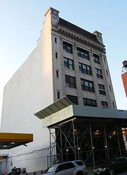 Sheffield Farms Stable |
November 9, 2005 (#05001285) |
3229 Broadway (@ 130th) 40°49′00″N 73°57′30″W |
Manhattanville | |
| 89 | Students' Hall |  Students' Hall |
November 15, 2003 (#03001150) |
Barnard College, 3005 Broadway 40°48′32″N 73°57′52″W |
Morningside Heights | built in 1916, now known as Barnard Hall |
| 90 | Substation 17 | 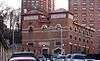 Substation 17 |
February 9, 2006 (#06000025) |
127-129 Hillside Ave. (nr Ft Tryon) 40°51′36″N 73°55′37″W |
Washington Heights | |
| 91 | Substation 219 |  Substation 219 |
February 9, 2006 (#06000023) |
309 W. 133rd St. 40°48′56″N 73°56′55″W |
Harlem | |
| 92 | Sugar Hill Historic District |  Sugar Hill Historic District |
April 11, 2002 (#02000360) |
Roughly bounded by W. 155th St., 145th St., Bradhurst Ave. and Convent Ave. 40°49′38″N 73°56′36″W |
Harlem | |
| 93 | Union Theological Seminary | 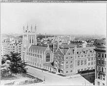 Union Theological Seminary |
April 23, 1980 (#80002725) |
W. 120th St. and Broadway 40°48′41″N 73°57′51″W |
Morningside Heights | |
| 94 | US Post Office-Inwood Station | US Post Office-Inwood Station |
May 11, 1989 (#88002361) |
90 Vermilyea Ave. 40°51′58″N 73°55′26″W |
Inwood | |
| 95 | Washington Bridge |  Washington Bridge |
September 22, 1983 (#83001645) |
Between Amsterdam and Undercliff Aves. 40°50′42″N 73°55′29″W |
Washington Heights | |
| 96 | West 114th Street Historic District |  West 114th Street Historic District |
July 16, 2014 (#14000399) |
204-246 & 215-277 W. 114th St. 40°48′09″N 73°57′18″W |
Morningside Heights | Brick rowhouses erected in last years of 19th century eventually became one of Harlem's most desirable blocks when African-Americans started moving in during Great Migration. |
| 97 | West 147th-149th Streets Historic District | 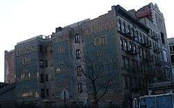 West 147th-149th Streets Historic District |
May 18, 2003 (#03000407) |
Roughly bounded by Eighth Ave., W. 149th St., Seventh Ave., and W. 147th Ave. 40°49′26″N 73°56′22″W |
Harlem |
Former listing
| [3] | Name on the Register | Image | Date listed | Date removed | Location | City or town | Summary |
|---|---|---|---|---|---|---|---|
| 1 | Florence Mills House | 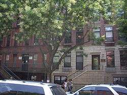 Florence Mills House |
December 8, 1976 (#76001244) | January 9, 2009 | 220 W. 135th St. 40°49′31″N 73°56′09″W |
Harlem | Mistakenly designated National Historic Landmark of building that is blocks away from building where Florence Mills actually lived, which was since torn down. In 2009, the house was delisted from the NRHP and de-designated as NHL. |
See also
| Wikimedia Commons has media related to National Register of Historic Places in Manhattan above 110th Street. |
- County: National Register of Historic Places listings in New York County, New York
- State: National Register of Historic Places listings in New York
- Municipal: List of New York City Designated Landmarks in Manhattan above 110th Street
References
- The latitude and longitude information provided in this table was derived originally from the National Register Information System, which has been found to be fairly accurate for about 99% of listings. Some locations in this table may have been corrected to current GPS standards.
- "National Register of Historic Places: Weekly List Actions". National Park Service, United States Department of the Interior. Retrieved on June 26, 2020.
- Numbers represent an ordering by significant words. Various colorings, defined here, differentiate National Historic Landmarks and historic districts from other NRHP buildings, structures, sites or objects.
- The eight-digit number below each date is the number assigned to each location in the National Register Information System database, which can be viewed by clicking the number.
| Topics |  | |
|---|---|---|
| Lists by county |
| |
| Lists by city | ||
| Other lists | ||
| ||
This article is issued from Wikipedia. The text is licensed under Creative Commons - Attribution - Sharealike. Additional terms may apply for the media files.