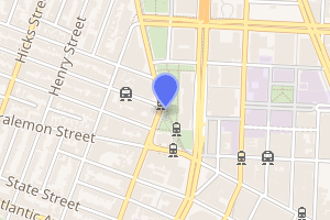
Borough Hall/Court Street station
Borough Hall/Court Street is an underground New York City Subway station complex shared by the BMT Fourth Avenue Line, the IRT Broadway–Seventh Avenue Line and the IRT Eastern Parkway Line. The station is named Borough Hall on the IRT lines and Court Street on the BMT. Located at the intersection of Court, Joralemon and Montague Streets at the border of Downtown Brooklyn and Brooklyn Heights, it is served by the:
- 2, 4 and R trains at all times
- 3 train all times except late nights
- 5 train weekdays until 8:45 PM
- N train during late nights only
- Limited rush hour W trains
Borough Hall/Court Street | |||||||||||||||||
|---|---|---|---|---|---|---|---|---|---|---|---|---|---|---|---|---|---|
 | |||||||||||||||||
| Station statistics | |||||||||||||||||
| Address | Court Street between Joralemon Street & Montague Street Brooklyn, NY 11201 | ||||||||||||||||
| Borough | Brooklyn | ||||||||||||||||
| Locale | Downtown Brooklyn, Brooklyn Heights | ||||||||||||||||
| Coordinates | 40°41′37″N 73°59′25″W | ||||||||||||||||
| Division | A (IRT), B (BMT) | ||||||||||||||||
| Line | BMT Fourth Avenue Line IRT Broadway–Seventh Avenue Line IRT Eastern Parkway Line | ||||||||||||||||
| Services | 2 3 4 5 N R W | ||||||||||||||||
| Transit connections | |||||||||||||||||
| Levels | 3 | ||||||||||||||||
| Other information | |||||||||||||||||
| Opened | July 1, 1948[1] | ||||||||||||||||
| Station code | 620[2] | ||||||||||||||||
| Accessible | |||||||||||||||||
| Wireless service | |||||||||||||||||
| Traffic | |||||||||||||||||
| Passengers (2019) | 10,135,722[4] | ||||||||||||||||
| Rank | 28 out of 424[4] | ||||||||||||||||
| |||||||||||||||||
| |||||||||||||||||
| |||||||||||||||||


Station layout
| G | Street level | Exit/entrance |
| M | Mezzanine | Fare control, station agent |
| B2 | Northbound local | ← ← |
| Side platform | ||
| Side platform | ||
| Northbound express | ← ← | |
| Southbound express | | |
| Side platform | ||
| B3 | Southbound local | |
| Side platform | ||
| B4 | Northbound | ← ← ← |
| Island platform | ||
| Southbound | | |
IRT Broadway–Seventh Avenue Line platforms
Borough Hall | |||||||||||||
|---|---|---|---|---|---|---|---|---|---|---|---|---|---|
 Manhattan-bound 3 train arriving | |||||||||||||
| Station statistics | |||||||||||||
| Division | A (IRT) | ||||||||||||
| Line | IRT Broadway–Seventh Avenue Line | ||||||||||||
| Services | 2 3 | ||||||||||||
| Structure | Underground | ||||||||||||
| Levels | 2 | ||||||||||||
| Platforms | 2 side platforms (1 on each level) | ||||||||||||
| Tracks | 2 (1 on each level) | ||||||||||||
| Other information | |||||||||||||
| Opened | April 15, 1919 | ||||||||||||
| Station code | 335[2] | ||||||||||||
| Accessible | |||||||||||||
| Wireless service | |||||||||||||
| Opposite-direction transfer available | Yes | ||||||||||||
| Station succession | |||||||||||||
| Next north | Clark Street: 2 | ||||||||||||
| Next | Fulton Street: 2 | ||||||||||||
| Next south | Hoyt Street: 2 | ||||||||||||
| Next | Atlantic Avenue–Barclays Center: 2 | ||||||||||||
| |||||||||||||
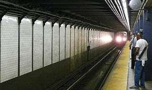
Borough Hall on the IRT Broadway–Seventh Avenue Line has two levels. Each level has one track with a side platform on the south side. Manhattan-bound trains use the upper level while southbound trains use the lower one.[5]
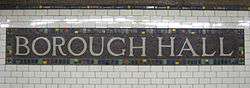
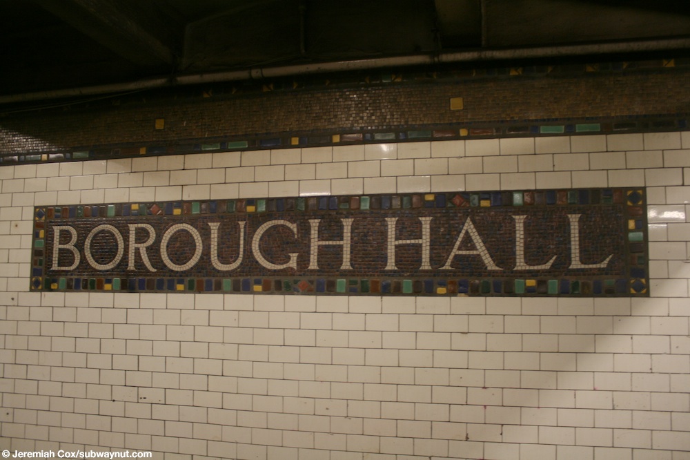
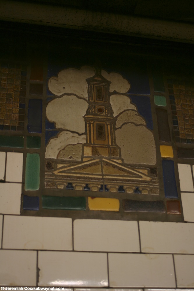
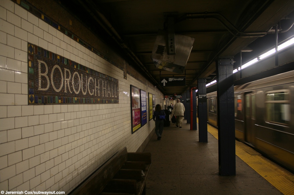
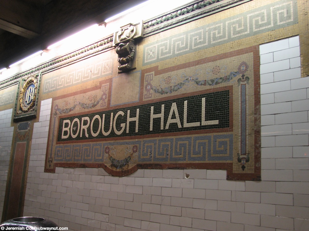
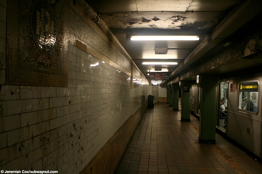
Both platforms have their original IRT trim line and name tablets reading "BOROUGH HALL" in a serif lettering style.[6] Tablets showing images of Borough Hall are located at regular intervals on the trim line.[7] Dark blue I-beam columns line both platforms at regular intervals with alternating ones having the standard black station name plate in white lettering.[8]
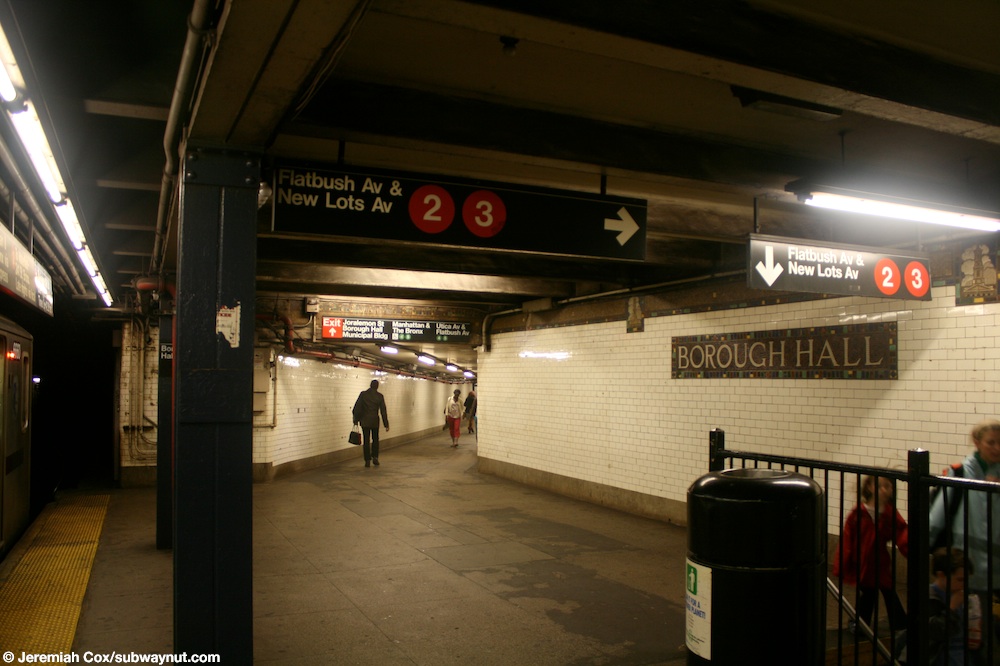
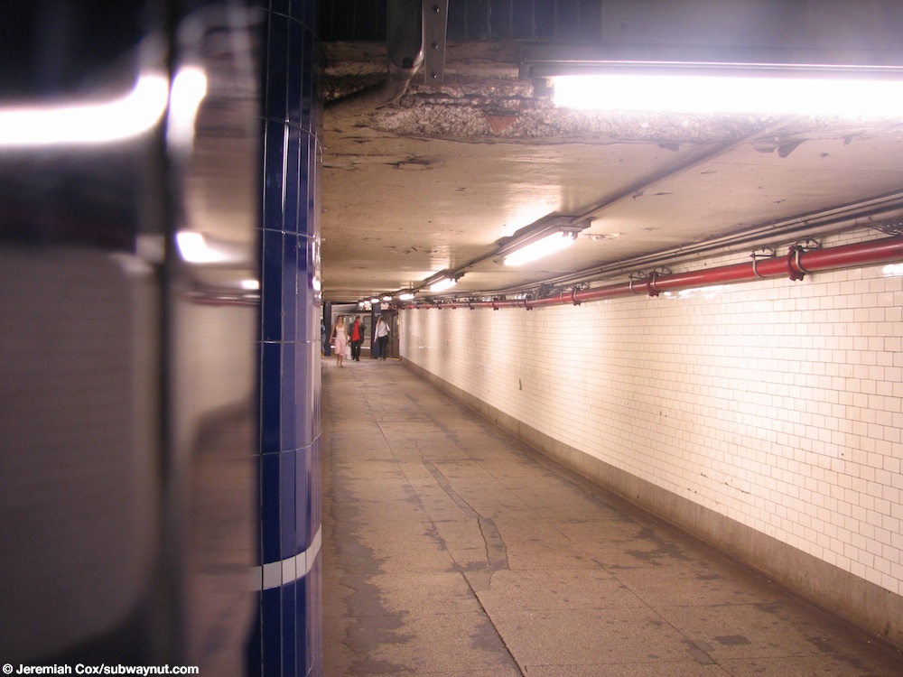
At the eastern (railroad south) end of the platforms, a staircase from the lower level goes up to the upper level, where a passageway connects to the Manhattan-bound platform of the IRT Eastern Parkway Line section of the complex.[9] Also, the southbound track crosses under the tracks of the Eastern Parkway Line, and both tracks become the local tracks for the line.[5]
History
The station opened on April 15, 1919 when the branch of the IRT Broadway–Seventh Avenue Line to Wall Street was extended to Atlantic Avenue in Brooklyn. Through service between the Brooklyn Line and the Broadway–Seventh Avenue Line was inaugurated with this extension.[10]
In 1976, with funding from the Exxon Corporation, this station, as well as three others citywide, received new "artfully humorous graffiti" murals and artwork.[11] Local designer Samuel Lebowitz received $5,000 to "improve the level of lighting in an exciting and light hearted way." Some "multicolored animated neon signs" were placed underneath transparent plastic screens; such signs included "an abstract eye that winks every five seconds" and another that looked to be "blow[ing] smoke rings."[11]
Exits
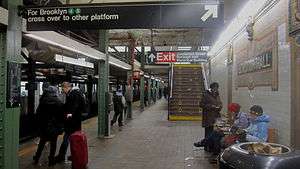
The fare control for this section of the station complex is at the west (railroad north) end of the platforms. A staircase from the lower level goes up to the upper level before another staircase goes up to the mezzanine. The lower level also has an up-only escalator that bypasses the upper level, leading directly to the mezzanine. A single elevator stopping at all three levels makes this part of the complex ADA-accessible. The mezzanine has a passageway leading to the BMT platform and two public restrooms inside fare control. Outside the turnstile bank that provides entrance/exit from the station, there is a token booth, two staircases going up to the southeast corner of Court and Montague Streets, and a staircase and elevator going up to Columbus Park, the entrance plaza of Borough Hall, on the east side of Court Street.[12]
IRT Eastern Parkway Line platforms
Borough Hall | |||||||||||
|---|---|---|---|---|---|---|---|---|---|---|---|
 | |||||||||||
| Station statistics | |||||||||||
| Division | A (IRT) | ||||||||||
| Line | IRT Eastern Parkway Line | ||||||||||
| Services | 4 5 | ||||||||||
| Structure | Underground | ||||||||||
| Platforms | 2 side platforms | ||||||||||
| Tracks | 2 | ||||||||||
| Other information | |||||||||||
| Opened | January 9, 1908 | ||||||||||
| Station code | 415[2] | ||||||||||
| Accessible | |||||||||||
| Wireless service | |||||||||||
| Opposite-direction transfer available | Yes | ||||||||||
| Station succession | |||||||||||
| Next north | Bowling Green: 4 | ||||||||||
| Next | Bowling Green: 4 | ||||||||||
| Next south | Nevins Street: 4 | ||||||||||
| Next | station not accessible southbound Next accessible station southbound: Atlantic Avenue–Barclays Center: 4 | ||||||||||
| |||||||||||
Borough Hall Subway Station (IRT) | |||||||||||
New York City Landmark No. 1096 | |||||||||||
| MPS | New York City Subway System MPS | ||||||||||
| NRHP reference No. | 04001022[13] | ||||||||||
| NYCL No. | 1096 | ||||||||||
| Significant dates | |||||||||||
| Added to NRHP | September 17, 2004 | ||||||||||
| Designated NYCL | November 24, 1981[14] | ||||||||||
Borough Hall on the IRT Eastern Parkway Line has two tracks and two side platforms.[5]
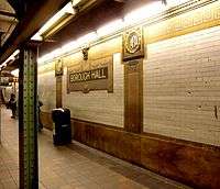
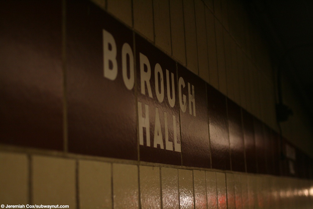
Both platforms have their original terra-cotta wall reliefs and name tablets reading "BOROUGH HALL" in sans serif lettering. "BH" tablets are located along the reliefs at regular intervals.[15] At the extreme east (railroad south) end of the platforms, where they were extended in the 1950s to accommodate the current standard "A" Division train length, there is a brown trim line on beige tiles with "BOROUGH HALL" in white sans serif lettering.[16] Narrow I-beam columns painted in dark green line both platforms at regular intervals.[17]
The northbound platform has a passageway leading to the northbound platform of the IRT Broadway–Seventh Avenue Line section of the complex at the east (railroad south) end. As a result, only this platform is ADA-accessible.[18][19] Southbound accessibility was proposed in February 2019 as part of the MTA's "Fast Forward" program.[20]
Railroad south (compass east) of this station, the two tracks become the express tracks of the IRT Eastern Parkway Line and the two tracks of the IRT Broadway–Seventh Avenue Line become the local tracks. As a result, Manhattan-bound trains on that line can be seen from the eastern end of the platforms as they turn away into their own tunnel.[5]
History
This was the first underground subway station in Brooklyn, opened on January 9, 1908, as the terminal for the extension of the IRT Lexington Avenue Line from Lower Manhattan.[21][22] It provided easy access to the BRT elevated Fulton Street Line and Myrtle Avenue Line, although a separate fare had to be paid.
The platforms were extended to the east in 1911 and in 1964, allowing the station to accommodate 10-car trains.[23]
The Borough Hall IRT Eastern Parkway Line station has been listed on the National Register of Historic Places since September 17, 2004.[24]
In June 2018, part of the Borough Hall ceiling collapsed, injuring a bystander.[25] The collapse necessitated expensive emergency repairs that would set the MTA back $8.3 million. A report found that the staff sent to inspect the station verified the defect existed in 2017, but underestimated its severity due to a lack of expertise in terracotta ceilings, nor was the issue escalated to engineers who were familiar with terracotta. The ceiling was over 100 years old, and the station has an unusual and old-fashioned design. The MTA report suggested that special care be taken in the inspection of the 13 stations of the NYC subway system that have terracotta ceilings due to the different properties when compared to concrete or steel.[25]
Exits
The main fare control area is at the center of the platforms and tracks. Two overpasses connect the two platforms with two staircases to each of them. On the Manhattan-bound side, the overpasses have full height turnstiles leading to an unstaffed mezzanine and two staircases going up to the northeast corner of Court and Joralemon Streets. On the southbound side, the overpasses have small turnstile banks leading to a mezzanine that has a token booth and two staircases going up to the southeast corner of Court and Joralemon Streets. The banisters on these staircases are made of concrete since they are outside the Brooklyn Municipal Building. The mezzanine has a large set of doors leading into the building (this entrance was closed in February 1996 due to security concerns), a plaque commemorating the subway's arrival in Brooklyn, and a now defunct bank teller window. An overpass between the two platforms connects the two mezzanine areas.[12]
This section of the station complex has an unstaffed fare control area at the extreme north (geographical west) end. A single staircase from each platform goes up to a crossover, where a turnstile bank and two exit-only turnstiles provide entrance/exit from the station. Outside fare control, two staircases go up to either western corners of Livingston and Court Streets.[12]
Image gallery
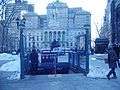 Station entrance at Columbus Park with view of Brooklyn Borough Hall, before the M train was rerouted.
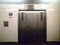
 The street elevator only connects with the IRT Broadway–Seventh Avenue Line and the northbound platform of the IRT Eastern Parkway Line.
 Another view of the elevator from the side
_15_-_IRT.jpg) Entrance in front of Brooklyn Borough Hall
Entrance in front of Brooklyn Borough Hall_03_-_IRT_Lex_Mezzanine%2C_Municipal_Building.jpg) Former entrance to the Brooklyn Municipal Building
Former entrance to the Brooklyn Municipal Building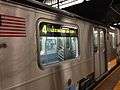 An R142A
BMT Fourth Avenue Line platform
Court Street | |||||||||||||
|---|---|---|---|---|---|---|---|---|---|---|---|---|---|
.jpg) Platform | |||||||||||||
| Station statistics | |||||||||||||
| Division | B (BMT) | ||||||||||||
| Line | BMT Fourth Avenue Line | ||||||||||||
| Services | N R W | ||||||||||||
| Structure | Underground | ||||||||||||
| Platforms | 1 island platform | ||||||||||||
| Tracks | 2 | ||||||||||||
| Other information | |||||||||||||
| Opened | August 1, 1920 | ||||||||||||
| Station code | 024[2] | ||||||||||||
| Accessible | |||||||||||||
| Wireless service | |||||||||||||
| Opposite-direction transfer available | Yes | ||||||||||||
| Station succession | |||||||||||||
| Next north | Broad Street (Nassau Street): no regular service Whitehall Street–South Ferry (Broadway): N | ||||||||||||
| Next south | Jay Street–MetroTech: N | ||||||||||||
| |||||||||||||
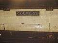
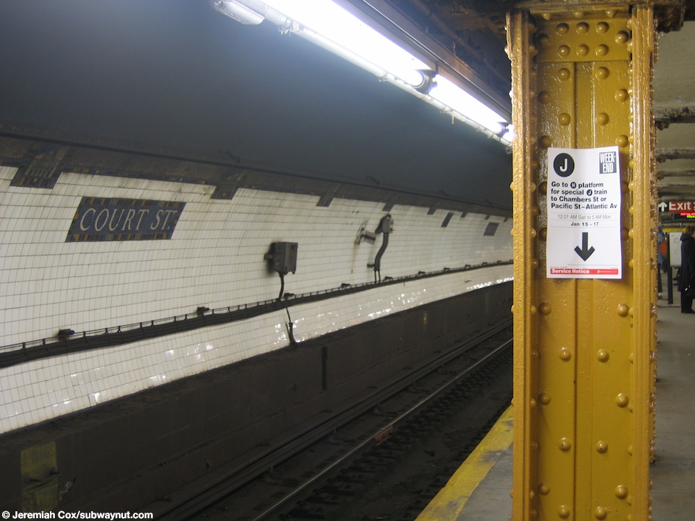
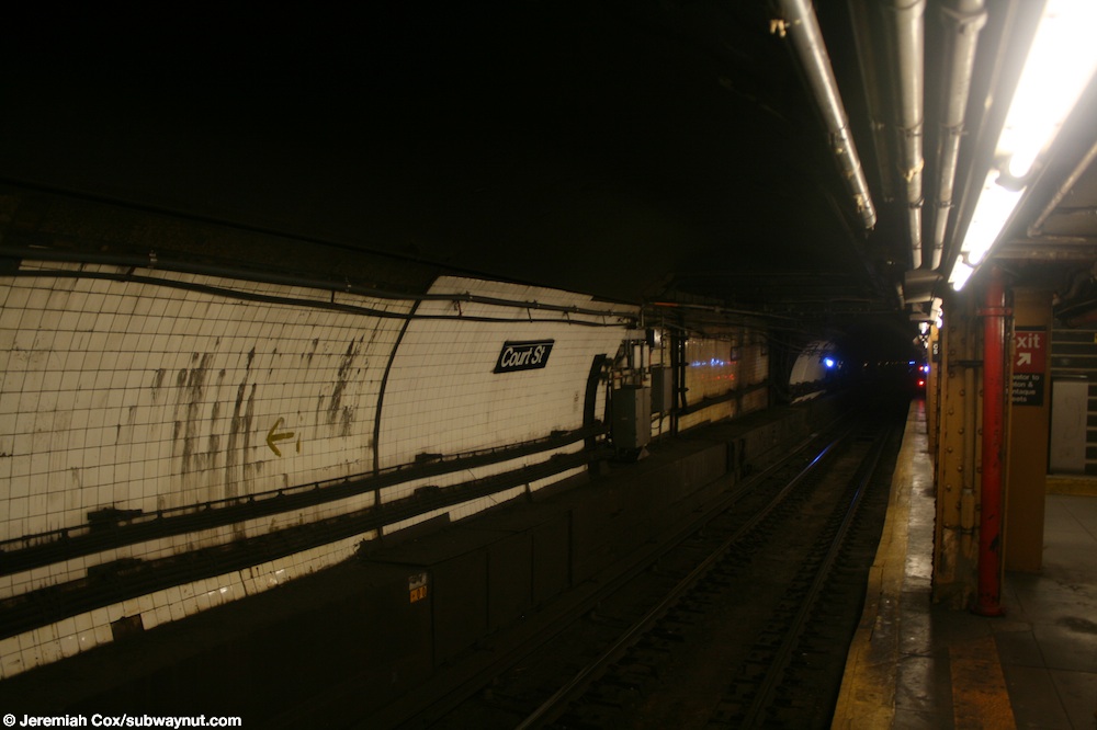
Court Street on the BMT Fourth Avenue Line is a local station with two tracks and an island platform.[5] Since the tunnel descends to go underneath the East River, it was constructed with a deep-bore tunnel, making both track walls curved.[26] The walls also still have their original Dual Contracts mosaic tablets and trim line. The name tablets have "COURT ST." in serif lettering, and tablets showing scenes of Borough Hall are located along the trim line at regular intervals.[27] The western end (railroad north) of the walls are plain white.[28]
Yellow I-beam columns line both sides of the island platform at regular intervals with alternating ones having the standard black station name plate in white lettering.[29] Some of these show the name "Carnegie", from Carnegie Steel (predecessor of United States Steel).
This portion of the complex is not ADA-accessible as there are no elevators from the platform going to fare control. The elevator from the street to fare control is only for the services at the IRT stations.
To the west of the station, the line goes through the Montague Street Tunnel under the East River to connect to the BMT Broadway Line and the BMT Nassau Street Line. Currently, all trains use the former connection. The latter connection has been unused since the rerouting of the M train in June 2010.[5]
History
Service running from the BMT Broadway Line through to the BMT Fourth Avenue Line via the Montague Tunnel began on August 1, 1920, along with the opening of the Court Street station.[30][31]
On weekdays between August 2, 2013 and September 15, 2014,[32][33] this station served as the northern terminal of the Brooklyn half of the divided R. Service ran in two sections: one section between Forest Hills and Whitehall Street–South Ferry, and the other between Court Street-Borough Hall and Bay Ridge–95th Street. This change was necessary to repair damage on the Montague Street Tunnel resulting from Hurricane Sandy.[34][35][36]
Exits
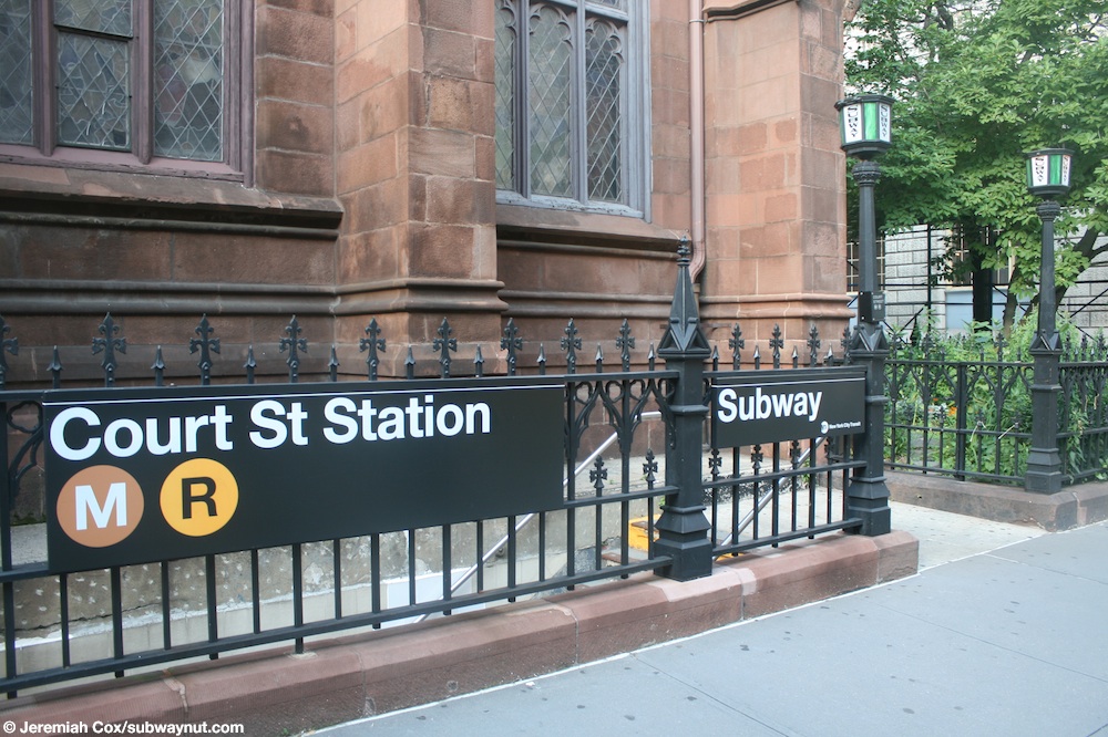
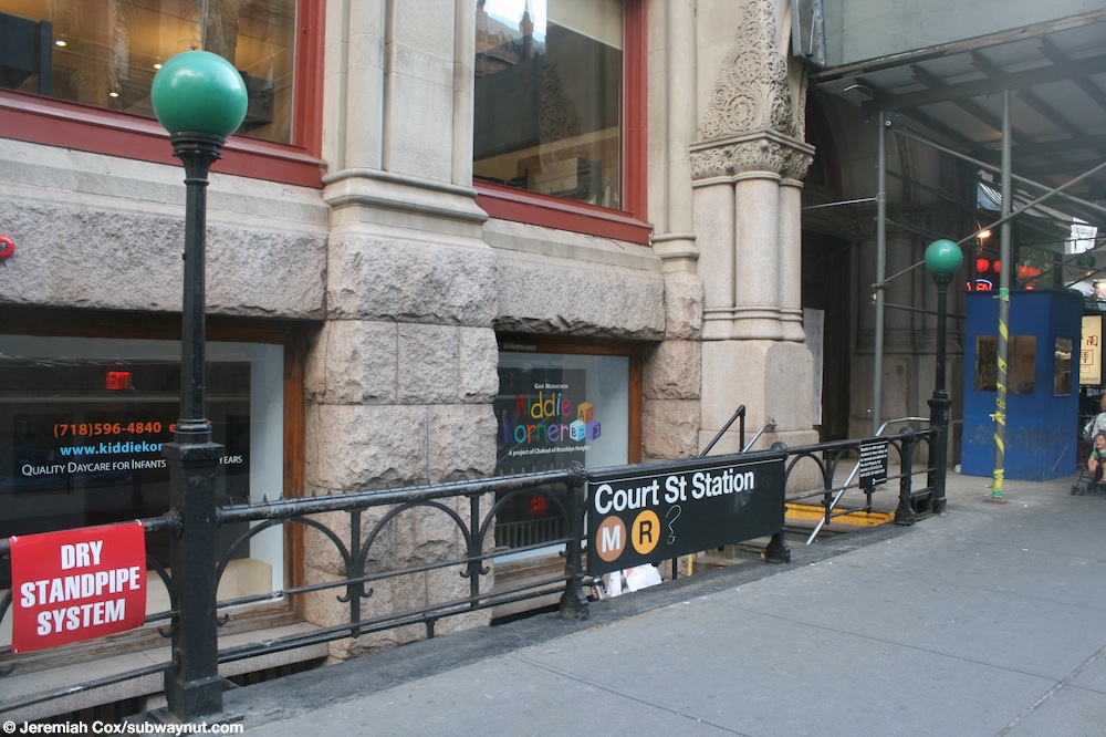
At the east (railroad south) end of the platform, two staircases go up a landing, where two staircases and two escalators go up to a passageway that leads to the fare control area of the IRT Broadway–Seventh Avenue Line. At the west (railroad north) of the platform, a single staircase goes up to a landing where two elevators and an emergency staircase that is commonly opened for public use go up to a mezzanine. The elevator banks here have two pairs of doors to each elevator car. The mezzanine has a part-time turnstile bank and customer assistance booth (full height turnstiles provide entrance/exit from the station at all times) and two staircases going up to either western corners of Montague and Clinton Streets. The northwest staircase has an antique "SUBWAY" white and green globe sign since it is in the front yard of St. Ann's and Holy Trinity Church (the mezzanine has a mosaic sign with the church's name on it).[37] However, the southwest staircase is next to the basement entrance of a Kiddie Korner daycare.[12][38]
Image gallery
 Mosaics on the track wall
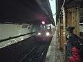 An
An
 An elevator to the Clinton Street mezzanine
Surface connections
In 1916, a single-track counterclockwise trolley loop was built around Borough Hall with both ends at Joralemon Street and access from westbound Fulton Street to the loop and from the loop to southbound Court Street. Passengers on lines that used the loop, Court Street, or Fulton Street could transfer to the entrance of this station complex bounded by those two streets and the loop, north of Borough Hall. The lines that used this loop included:[39]
- Flatbush–Prospect Park Line to Prospect Park
- Flatbush–Seventh Avenue Line to Greenwood Cemetery and the Ninth Avenue Depot
- Hicks Street Line to Erie Basin
- Rogers Avenue Line to Flatbush
- St. Johns Place Line to Ocean Hill
- Third Avenue Line to Fort Hamilton
- 16th Avenue Line to New Utrecht
There were other lines that passed Borough Hall and thus served the station. On Court Street, such lines included:
- Court Street Line to Gowanus
- Flatbush Avenue Line to Bergen Beach
- Greenpoint Line to Greenpoint (also on Joralemon Street)
- Montague Street Line to Wall Street Ferry
- Union Street Line to Greenwood Cemetery, Ninth Avenue Depot, and Coney Island
On Fulton Street:
- DeKalb Avenue Line to Ridgewood
- Fulton Street Line to Cypress Hills
- Greene and Gates Avenues Line to Ridgewood
- Myrtle Avenue Line to Ridgewood
- Putnam Avenue Line to Ridgewood
On Joralemon Street:
- Crosstown Line to Erie Basin and Long Island City
- Erie Basin Line to Erie Basin
On April 7, 1930, the Brooklyn–Manhattan Transit Corporation eliminated the loop to relieve congestion.[40][41] Several lines were moved to a loop on Washington Street north of Tillary Street or a clockwise loop on Livingston Street, Court Street, Joralemon Street, Fulton Street, and Boerum Place.
References
- The New York Times, Transfer Points Under Higher Fare, June 30, 1948, page 19
- "Station Developers' Information". Metropolitan Transportation Authority. Retrieved June 13, 2017.
- "NYC Subway Wireless – Active Stations". Transit Wireless Wifi. Retrieved November 13, 2019.
- "Facts and Figures: Annual Subway Ridership 2014–2019". Metropolitan Transportation Authority. 2020. Retrieved May 26, 2020.
- Dougherty, Peter (2006) [2002]. Tracks of the New York City Subway 2006 (3rd ed.). Dougherty. OCLC 49777633 – via Google Books.
- Cox, Jeremiah (June 18, 2009). "A Borough Hall name tablet, it has a fairly colorful border". subwaynut.com. Retrieved August 6, 2017.
- Cox, Jeremiah (June 28, 2008). "A close-up of an intricate Vickers dual-contracts era representation of a Brooklyn Building that is the trimline for the platform trim line at Borough Hall". subwaynut.com. Retrieved August 6, 2017.
- Cox, Jeremiah (June 18, 2009). "Looking down the Manhattan-bound platform at Borough Hall, by a name tablet". subwaynut.com. Retrieved August 6, 2017.
- Cox, Jeremiah (June 18, 2009). "The back of the Manhattan-bound platform at Borough Hall, the passageway to the East Side 4,5 Line is visible up-ahead, one of the two staircases down to the Flatbush & New Lots 2,3 platform is down below". subwaynut.com. Retrieved August 6, 2017.
- "Open Clark Street Line — New Route Doubles Subway Service Between the Two Boroughs" (PDF). The New York Times. April 16, 1919. p. 18. Retrieved November 6, 2016.
- Burks, Edward C. (November 18, 1976). "A Subway Elongatomus? Why, It's Preposterous!". The New York Times. Retrieved September 21, 2016.
- "MTA Neighborhood Maps: Downtown Brooklyn and Borough Hall" (PDF). mta.info. Metropolitan Transportation Authority. 2015. Retrieved August 2, 2015.
- "NPS Focus". National Register of Historic Places. National Park Service. Retrieved December 12, 2011.
- "Interborough Rapid Transit System, Underground Interior" (PDF). New York City Landmarks Preservation Commission. November 24, 1981. Retrieved November 19, 2019.
- Cox, Jeremiah (May 12, 2007). "A mosaic Borough Hall name tablet, there is a decorative terra-cotta wall reliefs above it". subwaynut.com. Retrieved August 6, 2017.
- Cox, Jeremiah (June 9, 2008). "Painted on Borough Hall text in the 1950s tiled portion of the extreme eastern (southern) end of the station at Borough Hall". subwaynut.com. Retrieved August 6, 2017.
- Cox, Jeremiah (June 18, 2009). "Another view down the Manhattan-bound side platform at Borough Hall with its green columns and a Woodlawn-bound R142 4 train stopped in the station". subwaynut.com. Retrieved August 6, 2017.
- Cox, Jeremiah (May 12, 2007). "Looking down the passageway between the Manhattan-bound 2,3 and 4,5 platforms at Borough Hall". subwaynut.com. Retrieved August 6, 2017.
- "Accessibility". web.mta.info. Metropolitan Transportation Authority. Retrieved August 6, 2017.
- mtainfo (February 6, 2019). NYCT Public Event - Discussion About the Next Accessible Subway Stations - 02/06/2019 (video) – via YouTube.
- "SUBWAY TO BROOKLYN OPENED FOR TRAFFIC; First Regular Passenger Train Went Under the East River Early This Morning. NOT A HITCH IN THE SERVICE Gov. Hughes and Brooklyn Officials to Join in a Formal Celebration of Event To-day. SUBWAY TO BROOKLYN OPENED TO TRAFFIC" (PDF). The New York Times. January 9, 1908. Retrieved September 1, 2016.
- "Brooklyn Joyful Over Its Tunnel". The New York Times. January 10, 1908. Retrieved March 6, 2010.
- Brennan, Joseph (January 1996). "www.nycsubway.org: Brooklyn IRT Map - Contract 2 Construction". www.nycsubway.org. Retrieved August 6, 2017.
- "Borough Hall Subway Station (IRT)". npgallery.nps.gov. Retrieved August 6, 2017.
- MTA Inspector General: Brooklyn Borough Hall Ceiling Collapse Could Have Been Avoided
- Cox, Jeremiah (January 15, 2005). "Looking out along one of the tracks at Court Street, at a name tablet on the track walls, there is also a sign on a platform column saying that special J trains stop at this platform that are replacing 4 train service between Brooklyn Bridge and Brooklyn". subwaynut.com. Retrieved August 6, 2017.
- Cox, Jeremiah (July 6, 2009). "The tiling of the platform walls at Court Street are extremely decorative and colorful, with rainbow colored borders around the name tablets and trim-lines". subwaynut.com. Retrieved August 6, 2017.
- Cox, Jeremiah (July 6, 2009). "Approaching the northern (western) end of the platform at Court Street, the walls become single white tiles with simple station name signs". subwaynut.com. Retrieved August 6, 2017.
- Cox, Jeremiah (April 2, 2006). "Looking down the single island platform at Court Street towards a staircase up to the small lower-mezzanine landing that leads up to the escalators and the IRT transfer". subwaynut.com. Retrieved August 6, 2017.
- "Two River Tunnels Opened 90 Years Ago". The Bulletin. New York Division, Electric Railroaders' Association. 53 (8). August 2010. Retrieved August 26, 2016 – via Issuu.
- District, New York (State) Public Service Commission First (January 1, 1921). Annual Report for the Year Ended ... The Commission.
- McGeehan, Patrick (September 12, 2014). "Subway Tunnel to Open, Storm Repairs Finished". The New York Times. Retrieved September 13, 2014.
- Newman, Andy; Goodman, J. David (September 15, 2014). "The R Roars Back". The New York Times. Retrieved October 30, 2016.
- "R Montague Tunnel Closure Map" (PDF). mta.info. Metropolitan Transportation Authority. June 2013. Archived from the original on June 16, 2013. Retrieved October 30, 2016.CS1 maint: BOT: original-url status unknown (link)
- "mta.info - R Service affected by 14 month closure of Montague Under River Tube". mta.info. Metropolitan Transportation Authority. July 2013. Archived from the original on June 9, 2013. Retrieved October 30, 2016.CS1 maint: BOT: original-url status unknown (link)
- Flegenheimer, Matt (August 4, 2013). "On R Train, Unwelcome Reminder of Storm's Impact". The New York Times. ISSN 0362-4331. Retrieved July 26, 2017.
- Cox, Jeremiah (July 6, 2009). "One of the entrance staircases to Court Street, it is extremely unusual, in front of St. Ann's and the Holy Trinity Church". subwaynut.com. Retrieved August 6, 2017.
- Cox, Jeremiah (July 6, 2009). "Another unusual entrance staircase to the Clinton Street exit at Court Street". subwaynut.com. Retrieved August 6, 2017.
- Brooklyn Daily Eagle, Brooklyn Daily Eagle Almanac, 1916
- The New York Times, Reroute Cars to Aid Brooklyn Traffic, April 1, 1930, page 14
- The New York Times, Brooklyn Accepts New Traffic Rules, April 8, 1930, page 24
Further reading
- Lee Stokey. Subway Ceramics: A History and Iconography. 1994. ISBN 978-0-9635486-1-0.
External links
| Wikimedia Commons has media related to Court Street – Borough Hall (New York City Subway). |
NYC Subway.org:
- nycsubway.org – Brooklyn IRT: Borough Hall (West Side Branch)
- nycsubway.org – Brooklyn IRT: Borough Hall (East Side Branch)
- nycsubway.org – BMT Broadway Subway: Court Street
- nycsubway.org – Brooklyn IRT Contract 2 map: Map 1 (includes current and former track configurations, and provisions for future connections)
Google Maps Street View:
- Court Street/Cadman Plaza West and Montague Street entrance to the Broadway–Seventh Avenue Line
- Entrance and elevator in Columbus Park
- Clinton Street and Montague Street entrance to Fourth Avenue Line
- Joralemon Street and Court Street entrance to Eastern Parkway Line
- IRT Eastern Parkway Line platforms
- IRT Broadway - Seventh Avenue Line platforms
- BMT platform
| Broadway– Seventh Ave. Line |
| ||||
|---|---|---|---|---|---|
| Eastern Pkwy. Line |
| ||||
| Fourth Ave. Line |
| ||||
| |||||
| Topics |  | |
|---|---|---|
| Lists by county |
| |
| Lists by city | ||
| Other lists | ||
| ||