National Register of Historic Places listings in Staten Island
List of the National Register of Historic Places listings in Richmond County, New York.
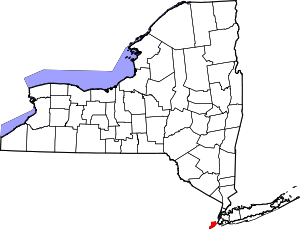
Location of Richmond County in New York
This is intended to be a complete list of properties and districts listed on the National Register of Historic Places on Staten Island, or in other words in Richmond County, New York, United States. The locations of National Register properties and districts (at least for all showing latitude and longitude coordinates below) may be seen in a map by clicking on "Map of all coordinates".[1]
- This National Park Service list is complete through NPS recent listings posted June 19, 2020.[2]
| Albany (Albany) – Allegany – Bronx – Broome – Cattaraugus – Cayuga – Chautauqua – Chemung – Chenango – Clinton – Columbia – Cortland – Delaware – Dutchess (Poughkeepsie, Rhinebeck) – Erie (Buffalo) – Essex – Franklin – Fulton – Genesee – Greene – Hamilton – Herkimer – Jefferson – Kings – Lewis – Livingston – Madison – Monroe (Rochester) – Montgomery – Nassau – New York (Below 14th Street, 14th to 59th Streets, 59th to 110th Streets, Above 110th Street, Islands) – Niagara – Oneida – Onondaga – Ontario – Orange – Orleans – Oswego – Otsego – Putnam – Queens – Rensselaer – Richmond – Rockland – St. Lawrence – Saratoga – Schenectady – Schoharie – Schuyler – Seneca – Steuben – Suffolk – Sullivan – Tioga – Tompkins – Ulster – Warren – Washington – Wayne – Westchester (Northern, Southern, New Rochelle, Peekskill, Yonkers) – Wyoming – Yates |
Current listings
| [3] | Name on the Register | Image | Date listed[4] | Location | City or town | Description |
|---|---|---|---|---|---|---|
| 1 | Elizabeth Alice Austen House – Clear Comfort | 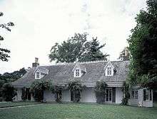 Elizabeth Alice Austen House – Clear Comfort |
July 28, 1970 (#70000925) |
2 Hylan Boulevard 40°36′54″N 74°03′49″W |
Rosebank | |
| 2 | Battery Weed | 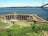 Battery Weed |
January 20, 1972 (#72000908) |
Fort Wadsworth Reservation 40°36′19″N 74°03′17″W |
Fort Wadsworth | |
| 3 | Billiou-Stillwell-Perine House | 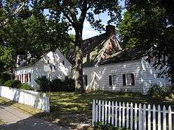 Billiou-Stillwell-Perine House |
January 1, 1976 (#76001269) |
1476 Richmond Rd. 40°35′34″N 74°06′03″W |
Dongan Hills | |
| 4 | Building at One Pendleton Place | October 20, 2014 (#14000874) |
1 Pendleton Place 40°38′29″N 74°05′32″W |
New Brighton | 1860 village is rare surviving High Victorian Picturesque structure in New York City | |
| 5 | Boardman–Mitchell House |  Boardman–Mitchell House |
January 4, 2012 (#11001004) |
710 Bay St. 40°37′29″N 74°04′29″W |
Stapleton | |
| 6 | Brighton Heights Reformed Church | 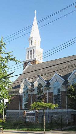 Brighton Heights Reformed Church |
June 3, 1982 (#82003399) |
320 St. Mark 40°38′29″N 74°04′43″W |
Brighton Heights | |
| 7 | Calvary Presbyterian Church | 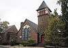 Calvary Presbyterian Church |
November 21, 2002 (#02001356) |
909 Castleton Ave. 40°38′06″N 74°06′47″W |
West New Brighton | |
| 8 | Christ Church New Brighton (Episcopal) |  Christ Church New Brighton (Episcopal) |
May 27, 2004 (#04000544) |
76 Franklin Ave. 40°38′36″N 74°05′36″W |
New Brighton | |
| 9 | Church of St. Andrew (Episcopal) | 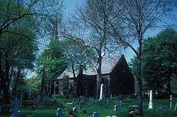 Church of St. Andrew (Episcopal) |
October 6, 2000 (#82005078) |
Arthur Kill and Old Mill Rds. 40°34′22″N 74°08′51″W |
Richmondtown | |
| 10 | Conference House | 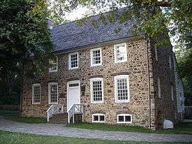 Conference House |
October 15, 1966 (#66000566) |
Hylan Boulevard 40°30′10″N 74°15′14″W |
Tottenville | |
| 11 | Edgewater Village Hall and Tappen Park | 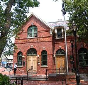 Edgewater Village Hall and Tappen Park |
May 19, 1980 (#80002756) |
Bounded by Wright, Water, Bay, and Canal Sts. 40°37′36″N 74°04′40″W |
Stapleton | |
| 12 | Dr. Samuel MacKenzie Elliott House | 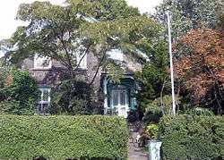 Dr. Samuel MacKenzie Elliott House |
March 28, 1980 (#80002757) |
69 Delafield Pl. 40°38′38″N 74°06′37″W |
West New Brighton | |
| 13 | FIREFIGHTER |  FIREFIGHTER |
June 30, 1989 (#89001447) |
Docked at Saint George 40°37′47″N 74°04′21″W |
North Shore | |
| 14 | Fort Tompkins Quadrangle | 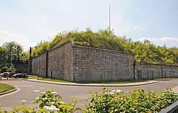 Fort Tompkins Quadrangle |
July 30, 1974 (#74001300) |
Building 137, Fort Wadsworth 40°36′00″N 74°03′40″W |
Fort Wadsworth | |
| 15 | Gardiner-Tyler House | 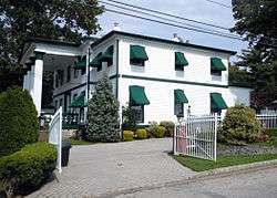 Gardiner-Tyler House |
November 23, 1984 (#84000294) |
27 Tyler St. 40°37′24″N 74°06′48″W |
West New Brighton | |
| 16 | Garibaldi Memorial | 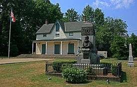 Garibaldi Memorial |
April 17, 1980 (#80002758) |
420 Tompkins Ave. 40°36′54″N 74°04′27″W |
Rosebank | |
| 17 | Hamilton Park Community Houses | 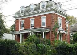 Hamilton Park Community Houses |
September 26, 1983 (#83003437) |
105 Franklin Ave., 66 Harvard Ave., and 32 Park Pl. 40°38′30″N 74°05′27″W |
New Brighton | |
| 18 | House at 5910 Amboy Road | 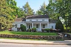 House at 5910 Amboy Road |
December 16, 1982 (#82001263) |
5910 Amboy Rd. 40°31′32″N 74°12′17″W |
Prince's Bay | |
| 19 | Peter Houseman House | 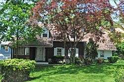 Peter Houseman House |
October 29, 1982 (#82001261) |
308 St. John Ave. 40°36′57″N 74°08′12″W |
Westerleigh | |
| 20 | Houses at 364 and 390 Van Duzer Street |  Houses at 364 and 390 Van Duzer Street |
November 14, 1982 (#82001262) |
364 and 390 Van Duzer St. 40°37′45″N 74°04′47″W |
Stapleton | |
| 21 | Immanuel Union Church |  Immanuel Union Church |
July 27, 2018 (#100002742) |
693 Jewett Ave 40°37′13″N 74°07′52″W |
Westerleigh | Church complex built as centerpiece of Prohibition Park in late 19th and early 20th centuries spurred residential development in the neighborhood. |
| 22 | Jacques Marchais Center of Tibetan Art | 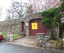 Jacques Marchais Center of Tibetan Art |
May 29, 2009 (#09000379) |
338 Lighthouse Ave. 40°34′35″N 74°08′19″W |
Egbertville | |
| 23 | Kreischer House | 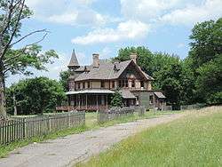 Kreischer House |
October 29, 1982 (#82001199) |
4500 Arthur Kill Rd. 40°31′57″N 74°14′18″W |
Charleston | Built about 1885. |
| 24 | Kreuzer-Pelton House | 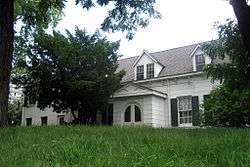 Kreuzer-Pelton House |
January 29, 1973 (#73001261) |
1262 Richmond Ter. 40°38′37″N 74°06′43″W |
West New Brighton | |
| 25 | LaTourette House |  LaTourette House |
March 5, 1982 (#82003400) |
Richmond Hill 40°34′34″N 74°08′50″W |
New Springville | 1836 brick Federal-style building now used as clubhouse for city-owned golf course |
| 26 | McFarlane-Bredt House |  McFarlane-Bredt House |
September 8, 1983 (#83001784) |
30 Hylan Boulevard 40°36′51″N 74°03′51″W |
Rosebank | |
| 27 | Miller Army Air Field Historic District | Miller Army Air Field Historic District |
April 11, 1980 (#80000362) |
New Dorp Lane 40°33′51″N 74°05′44″W |
New Dorp Beach | |
| 28 | Moore-McMillen House | 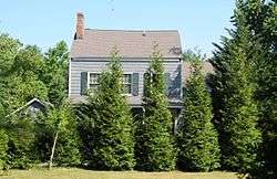 Moore-McMillen House |
April 23, 1980 (#80002760) |
3531 Richmond Rd. 40°34′21″N 74°08′21″W |
Egbertville | |
| 29 | Neville House | 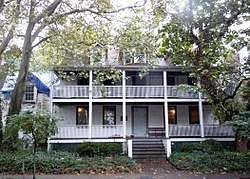 Neville House |
July 28, 1977 (#77000979) |
806 Richmond Terrace 40°38′40″N 74°05′57″W |
New Brighton | |
| 30 | New Brighton Village Hall | December 15, 1978 (#78001904) |
66 Lafayette Ave. 40°38′35″N 74°05′46″W |
New Brighton | ||
| 31 | New Dorp Light | 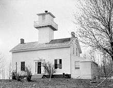 New Dorp Light |
August 28, 1973 (#73001260) |
Altamont Ave., Staten Island 40°34′51″N 74°07′13″W |
New Dorp | |
| 32 | Office Building and U.S. Light-House Depot Complex | 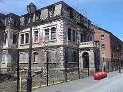 Office Building and U.S. Light-House Depot Complex |
September 15, 1983 (#83001785) |
1 Bay St. 40°38′28″N 74°04′30″W |
St. George | |
| 33 | Old Orchard Shoal Light Station | 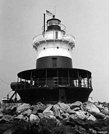 Old Orchard Shoal Light Station |
September 20, 2006 (#06000864) |
In Lower New York Bay, 3.5 miles south of New Dorp Beach 40°30′44″N 74°05′56″W |
Lower New York Bay | |
| 34 | Our Lady of Mount Carmel Grotto | 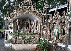 Our Lady of Mount Carmel Grotto |
November 2, 2000 (#00001276) |
36 Amity St. 40°36′44″N 74°04′31″W |
Rosebank | |
| 35 | Poillon-Seguine-Britton House | February 2, 1984 (#84002942) |
360 Great Kills Rd. 40°32′44″N 74°08′25″W |
Great Kills | ||
| 36 | Reformed Church on Staten Island | 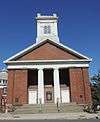 Reformed Church on Staten Island |
January 20, 2005 (#04001533) |
54 Port Richmond Ave. 40°38′23″N 74°07′58″W |
Port Richmond | |
| 37 | Richmond Terrace Cemeteries |  Richmond Terrace Cemeteries |
March 22, 2016 (#16000112) |
1562 Richmond Terrace and 25 Van St. 40°38′22″N 74°07′16″W |
West New Brighton | Three contiguous cemeteries established between 1802 and 1866 contain graves of many early residents of the Factoryville and West New Brighton neighborhoods |
| 38 | Sailors' Snug Harbor National Register District | 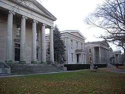 Sailors' Snug Harbor National Register District |
March 16, 1972 (#72000909) |
Richmond Ter. 40°38′33″N 74°06′10″W |
Livingston | |
| 39 | Sandy Ground Historic Archeological District | September 23, 1982 (#82003398) |
Address Restricted |
Sandy Ground | ||
| 40 | Scott-Edwards House |  Scott-Edwards House |
February 11, 1983 (#83001786) |
752 Delafiel Ave. 40°37′43″N 74°07′26″W |
West New Brighton | |
| 41 | Seaview Hospital | .jpg) Seaview Hospital |
September 7, 2005 (#05000992) |
460 Brielle Ave. 40°35′30″N 74°07′58″W |
Willowbrook | |
| 42 | Seguine House | 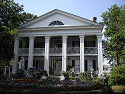 Seguine House |
May 6, 1980 (#80002761) |
440 Seguine Ave. 40°31′00″N 74°11′52″W |
Lemon Creek | |
| 43 | Silver Lake Cemetery | 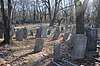 Silver Lake Cemetery |
February 21, 2017 (#100000660) |
926 Victory Blvd. 40°37′20″N 74°05′47″W |
Silver Lake | |
| 44 | St. Alban's Episcopal Church |  St. Alban's Episcopal Church |
October 29, 1982 (#82001264) |
76 St. Alban's Place 40°32′37″N 74°09′40″W |
Eltingville | |
| 45 | St. Paul's Memorial Church and Rectory |  St. Paul's Memorial Church and Rectory |
November 21, 1980 (#80002762) |
225 St. Pauls Ave. 40°37′55″N 74°04′46″W |
Stapleton | |
| 46 | STANDARD OIL COMPANY NO. 16 (harbor tug) | 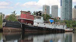 STANDARD OIL COMPANY NO. 16 (harbor tug) |
November 29, 2001 (#01001321) |
3001 Richmond Terrace 40°38′18″N 74°09′35″W |
Mariners Harbor | |
| 47 | Staten Island Borough Hall and Richmond County Courthouse |  Staten Island Borough Hall and Richmond County Courthouse |
October 6, 1983 (#83004150) |
Richmond Terr. 40°38′33″N 74°04′35″W |
St. George | |
| 48 | Staten Island Light | 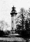 Staten Island Light |
November 30, 2005 (#05001340) |
Southern side of Edinboro Rd., between 402 and 426 Rds. 40°34′34″N 74°08′29″W |
Lighthouse Hill | |
| 49 | Louis A. and Laura Stirn House | 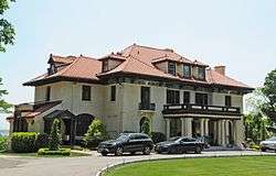 Louis A. and Laura Stirn House |
November 12, 2010 (#10000899) |
79 Howard Ave. 40°37′43″N 74°05′18″W |
Grymes Hill | |
| 50 | Sylvan Grove Cemetery | 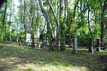 Sylvan Grove Cemetery |
August 24, 2015 (#15000540) |
Victory Boulevard at Glen St. 40°35′28″N 74°11′31″W |
Travis–Chelsea | Established 1795, many people important in developing Staten Island are buried here. |
| 51 | Temple Emanu-El | 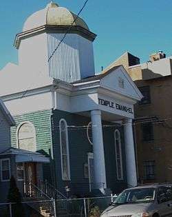 Temple Emanu-El |
August 2, 2007 (#07000778) |
984 Post Ave. 40°37′56″N 74°08′03″W |
Port Richmond | |
| 52 | Voorlezer's House | 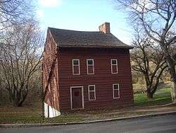 Voorlezer's House |
October 15, 1966 (#66000565) |
Arthur Kill Rd., opposite Center St. 40°34′18″N 74°08′52″W |
Richmondtown | |
| 53 | Caleb T. Ward Mansion | 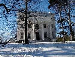 Caleb T. Ward Mansion |
July 26, 1982 (#82003401) |
141 Nixon Ave. 40°38′03″N 74°04′53″W |
Ward Hill | |
| 54 | Ward's Point Conservation Area |  Ward's Point Conservation Area |
September 29, 1982 (#82003402) |
Address Restricted |
Tottenville | |
| 55 | Wards Point Archeological Site |  Wards Point Archeological Site |
April 19, 1993 (#93000609) |
Address Restricted |
Tottenville | |
| 56 | West Bank Light Station | _Light.JPG) West Bank Light Station |
January 9, 2007 (#06001230) |
In lower New York Bay, 3.3 miles east of New Dorp Beach 40°32′17″N 74°02′35″W |
New Dorp Beach | |
| 57 | Woodrow Methodist Church | 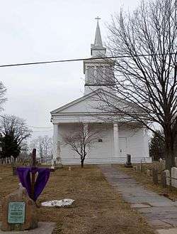 Woodrow Methodist Church |
October 29, 1982 (#82001265) |
1109 Woodrow Rd. 40°32′35″N 74°12′04″W |
Woodrow |
See also
| Wikimedia Commons has media related to National Register of Historic Places in Richmond County, New York. |
- Statewide: National Register of Historic Places listings in New York
- Citywide: Manhattan, Queens, Brooklyn, Bronx
- List of New York City Designated Landmarks in Staten Island
References
- The latitude and longitude information provided in this table was derived originally from the National Register Information System, which has been found to be fairly accurate for about 99% of listings. Some locations in this table may have been corrected to current GPS standards.
- "National Register of Historic Places: Weekly List Actions". National Park Service, United States Department of the Interior. Retrieved on June 19, 2020.
- Numbers represent an ordering by significant words. Various colorings, defined here, differentiate National Historic Landmarks and historic districts from other NRHP buildings, structures, sites or objects.
- The eight-digit number below each date is the number assigned to each location in the National Register Information System database, which can be viewed by clicking the number.
| Topics |  | |
|---|---|---|
| Lists by county |
| |
| Lists by city | ||
| Other lists | ||
| ||
This article is issued from Wikipedia. The text is licensed under Creative Commons - Attribution - Sharealike. Additional terms may apply for the media files.