National Register of Historic Places listings in Jefferson County, New York
List of the National Register of Historic Places listings in Jefferson County, New York
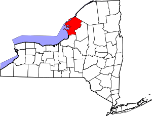
Location of Jefferson County in New York
This is intended to be a complete list of properties and districts listed on the National Register of Historic Places in Jefferson County, New York. The locations of National Register properties and districts (at least for all showing latitude and longitude coordinates below) may be seen in a map by clicking on "Map of all coordinates".[1]
- This National Park Service list is complete through NPS recent listings posted June 26, 2020.[2]
| Albany (Albany) – Allegany – Bronx – Broome – Cattaraugus – Cayuga – Chautauqua – Chemung – Chenango – Clinton – Columbia – Cortland – Delaware – Dutchess (Poughkeepsie, Rhinebeck) – Erie (Buffalo) – Essex – Franklin – Fulton – Genesee – Greene – Hamilton – Herkimer – Jefferson – Kings – Lewis – Livingston – Madison – Monroe (Rochester) – Montgomery – Nassau – New York (Below 14th Street, 14th to 59th Streets, 59th to 110th Streets, Above 110th Street, Islands) – Niagara – Oneida – Onondaga – Ontario – Orange – Orleans – Oswego – Otsego – Putnam – Queens – Rensselaer – Richmond – Rockland – St. Lawrence – Saratoga – Schenectady – Schoharie – Schuyler – Seneca – Steuben – Suffolk – Sullivan – Tioga – Tompkins – Ulster – Warren – Washington – Wayne – Westchester (Northern, Southern, New Rochelle, Peekskill, Yonkers) – Wyoming – Yates |
Listings county-wide
| [3] | Name on the Register | Image | Date listed[4] | Location | City or town | Description |
|---|---|---|---|---|---|---|
| 1 | Abingdon and New Abingdon Apartments | November 9, 2018 (#100003114) |
327 Holcomb & 270-272 Mullin Sts. Coordinates missing |
Watertown | First purpose-built apartment buildings in city, dating to 1908–10 | |
| 2 | Adams Commercial Historic District | 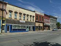 Adams Commercial Historic District |
September 29, 2006 (#06000882) |
Main and North Main Sts. and portions of East and West Church Sts. 43°48′32″N 76°01′28″W |
Adams | |
| 3 | Levi Anthony Building | September 27, 1985 (#85002451) |
Broadway 44°07′47″N 76°19′47″W |
Cape Vincent | part of the Cape Vincent Town and Village Multiple Resource Area (MRA) | |
| 4 | William Archer House | 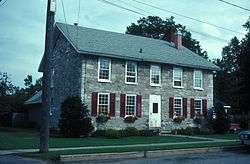 William Archer House |
November 19, 1980 (#80002623) |
112 Washington St. 44°00′11″N 75°58′56″W |
Brownville | part of the Stone Houses of Brownville Thematic Resource (TR) |
| 5 | Aubertine Building | 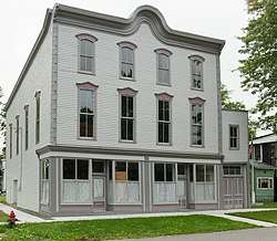 Aubertine Building |
September 27, 1985 (#85002452) |
Broadway 44°07′45″N 76°19′55″W |
Cape Vincent | part of the Cape Vincent Town and Village MRA |
| 6 | Cyrus Bates House |  Cyrus Bates House |
July 14, 2004 (#04000710) |
7185 NY 3 43°49′28″N 76°12′08″W |
Henderson | |
| 7 | Bedford Creek Bridge | Bedford Creek Bridge |
October 18, 1989 (#89001617) |
Campbell's Point Rd. over Bedford Creek 43°54′32″N 76°07′12″W |
Hounsfield | part of the Hounsfield MRA |
| 8 | Dr. Abner Benton House | 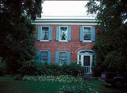 Dr. Abner Benton House |
August 23, 1984 (#84002405) |
Main St. 44°17′20″N 75°37′36″W |
Oxbow | |
| 9 | George C. Boldt Yacht House |  George C. Boldt Yacht House |
April 26, 1978 (#78001853) |
Northwest of Alexandria Bay on Wellesley Island 44°20′47″N 75°55′37″W |
Alexandria Bay | G. W. & W. D. Hewitt, architects. |
| 10 | John Borland House | 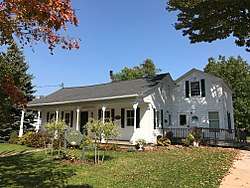 John Borland House |
September 27, 1985 (#85002453) |
Market St. 44°07′36″N 76°20′12″W |
Cape Vincent | part of the Cape Vincent Town and Village MRA |
| 11 | Broadway Historic District | September 27, 1985 (#85002455) |
St. Lawrence River, W. edge of Village of Cape Vincent, on Broadway & Tibbetts Point 44°07′26″N 76°20′44″W |
Cape Vincent | part of the Cape Vincent Town and Village MRA | |
| 12 | Gen. Jacob Brown Mansion | 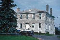 Gen. Jacob Brown Mansion |
November 19, 1980 (#80002624) |
Brown Blvd. 44°00′19″N 75°59′00″W |
Brownville | part of the Stone Houses of Brownville TR |
| 13 | Brownville Hotel | November 19, 1980 (#80002625) |
Brown Blvd. and W. Main St. 44°00′10″N 75°59′02″W |
Brownville | part of the Stone Houses of Brownville TR | |
| 14 | James Buckley House | 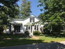 James Buckley House |
September 27, 1985 (#85002454) |
Joseph St. 44°07′37″N 76°20′10″W |
Cape Vincent | part of the Cape Vincent Town and Village MRA |
| 15 | E. K. Burnham House |  E. K. Burnham House |
September 27, 1985 (#85002456) |
565 Broadway 44°07′45″N 76°20′00″W |
Cape Vincent | part of the Cape Vincent Town and Village MRA |
| 16 | Buttermilk Flat Schoolhouse No. 22 | June 28, 1996 (#96000671) |
South side of Buttermilk Flat Rd., east of junction with Carter St. Rd., 44°10′23″N 75°56′57″W |
Orleans | part of the Orleans Multiple Property Submission (MPS) | |
| 17 | Elisha Camp House | 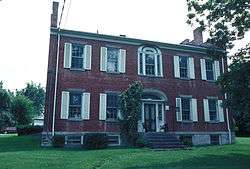 Elisha Camp House |
April 23, 1973 (#73001196) |
310 General Smith Dr. 43°56′55″N 76°07′05″W |
Sackets Harbor | |
| 18 | Carter Street Schoolhouse No. 21 | June 28, 1996 (#96000665) |
Junction of Vaadi and Dog Hill Rds., southwest corner 44°07′11″N 75°57′12″W |
Orleans | part of the Orleans MPS | |
| 19 | Cedar Grove Cemetery | September 6, 1990 (#90001324) |
Washington St. 44°03′51″N 76°08′02″W |
Chaumont | part of the Lyme MRA | |
| 20 | Central Garage | 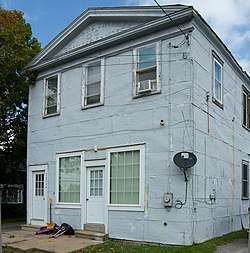 Central Garage |
October 18, 1996 (#96001172) |
North side of Clayton St., west of junction with Main St., Hamlet of La Fargeville 44°11′41″N 75°58′00″W |
Orleans | part of the Orleans MPS |
| 21 | Chaumont Grange Hall and Dairymen's League Building | September 6, 1990 (#90001337) |
Main St. 44°03′55″N 76°07′44″W |
Chaumont | part of the Lyme MRA | |
| 22 | Chaumont Historic District | September 6, 1990 (#90001336) |
Along Main St., roughly between Washington and Church Sts. 44°04′04″N 76°08′00″W |
Chaumont | part of the Lyme MRA | |
| 23 | Chaumont House | September 6, 1990 (#90001341) |
Main St. 44°04′08″N 76°08′19″W |
Chaumont | part of the Lyme MRA | |
| 24 | Chaumont Railroad Station | September 6, 1990 (#90001332) |
Main St. 44°04′02″N 76°07′45″W |
Chaumont | part of the Lyme MRA | |
| 25 | Xavier Chevalier House | September 27, 1985 (#85002457) |
Gosier Rd. 44°09′29″N 76°14′27″W |
Cape Vincent | part of the Cape Vincent Town and Village MRA | |
| 26 | Church of Saint Lawrence | 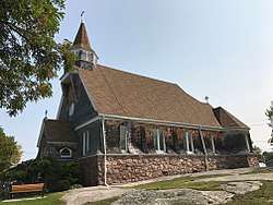 Church of Saint Lawrence |
May 16, 1997 (#97000442) |
Fuller St., junction with Sisson St. 44°20′11″N 75°55′17″W |
Alexandria Bay | part of the Historic Churches of the Episcopal Diocese of Central New York MPS |
| 27 | Clayton Historic District | Clayton Historic District |
September 12, 1985 (#85002368) |
203-215 & 200-326 James St., 500-544 & 507-537 Riverside Dr. • Boundary increase (listed May 9, 1997, refnum 97000424): 335, 403, 409, 413, 419, and 435 Riverside Dr. 44°14′31″N 76°05′22″W |
Clayton | |
| 28 | Nicholas Cocaigne House | September 27, 1985 (#85002458) |
Favret Rd. 44°06′58″N 76°18′45″W |
Cape Vincent | part of the Cape Vincent Town and Village MRA | |
| 29 | Conklin Farm | October 18, 1989 (#89001624) |
Evans Rd. 43°59′02″N 75°59′29″W |
Hounsfield | part of the Hounsfield MRA | |
| 30 | Cornwall Brothers' Store | 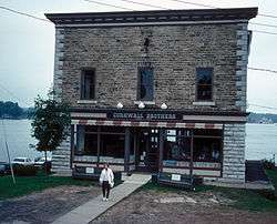 Cornwall Brothers' Store |
May 2, 1975 (#75001191) |
2 Howell Pl. 44°20′17″N 75°55′11″W |
Alexandria Bay | |
| 31 | Densmore Methodist Church of the Thousand Islands | May 19, 1988 (#88000591) |
Rt. 100 at Densmore Bay 44°19′19″N 75°57′15″W |
Alexandria | ||
| 32 | Dexter Universalist Church |  Dexter Universalist Church |
September 19, 2003 (#03000249) |
Brown and Kirby Sts. 44°00′29″N 76°02′41″W |
Dexter | |
| 33 | Remy Dezengremel House | September 27, 1985 (#85002459) |
Rosiere Rd. 44°06′21″N 76°15′39″W |
Cape Vincent | part of the Cape Vincent Town and Village MRA | |
| 34 | District School No. 19 | October 18, 1989 (#89001618) |
Co. Rd. 69 43°55′29″N 76°01′53″W |
Hounsfield | part of the Hounsfield MRA | |
| 35 | District School No. 20 | October 18, 1989 (#89001619) |
NY 3, south of Co. Rd. 75 43°55′34″N 76°06′32″W |
Hounsfield | part of the Hounsfield MRA | |
| 36 | District School No. 3 | September 6, 1990 (#90001326) |
Junction of NY 3 and County Rd. 57, Putnam Corners 44°04′09″N 76°14′18″W |
Lyme | part of the Lyme MRA | |
| 37 | Joseph Docteur House | September 27, 1985 (#85002460) |
Rosiere Rd. 44°07′06″N 76°13′52″W |
Cape Vincent | part of the Cape Vincent Town and Village MRA | |
| 38 | Duvillard Mill | 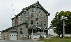 Duvillard Mill |
September 27, 1985 (#85002461) |
Broadway 44°07′49″N 76°19′54″W |
Cape Vincent | part of the Cape Vincent Town and Village MRA |
| 39 | Reuter Dyer House | September 27, 1985 (#85002462) |
Rosiere Rd. 44°06′12″N 76°17′11″W |
Cape Vincent | part of the Cape Vincent Town and Village MRA | |
| 40 | East Charity Shoal Light | 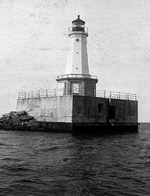 East Charity Shoal Light |
March 27, 2008 (#08000231) |
Northeast Lake Ontario at US-Canada boundary 9.5 miles (15.3 km) southwest of Cape Vincent 44°02′19″N 76°28′54″W |
Cape Vincent | part of the Light Stations of the United States MPS |
| 41 | East Hounsfield Christian Church | October 18, 1989 (#89001621) |
NY 3 43°58′08″N 75°59′33″W |
Hounsfield | part of the Hounsfield MRA | |
| 42 | Emerson Place | April 18, 2003 (#03000241) |
20-30 Emerson Place 43°58′24″N 75°53′59″W |
Watertown | ||
| 43 | Evans-Gaige-Dillenback House | September 6, 1990 (#90001340) |
Evans Rd. 44°04′09″N 76°08′13″W |
Lyme | part of the Lyme MRA | |
| 44 | Fairview Manor | Fairview Manor |
August 30, 2007 (#07000866) |
38289 NY 12-E 44°13′22″N 76°07′18″W |
Clayton | |
| 45 | First Baptist Church and Cook Memorial Building | 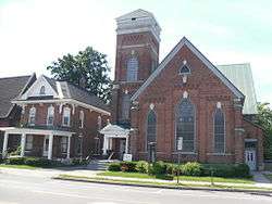 First Baptist Church and Cook Memorial Building |
February 9, 2005 (#05000016) |
511 State St. 43°58′55″N 75°36′29″W |
Carthage | |
| 46 | First Presbyterian Society of Cape Vincent | 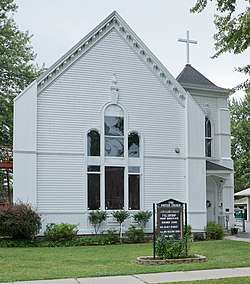 First Presbyterian Society of Cape Vincent |
February 5, 2013 (#12001258) |
260 E. Broadway 44°07′36″N 76°20′23″W |
Cape Vincent | from Cape Vincent Town and Village MRA |
| 47 | Roswell P. Flower Memorial Library | 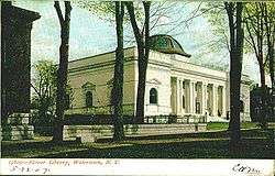 Roswell P. Flower Memorial Library |
January 10, 1980 (#80002628) |
229 Washington St. 43°58′23″N 75°54′39″W |
Watertown | |
| 48 | Charles Ford House | December 20, 1996 (#96001472) |
West side of Ford St., south of junction with Co. Rd. 181, Hamlet of La Fargeville 44°11′36″N 75°58′17″W |
Orleans | part of the Orleans MPS | |
| 49 | Fort Haldimand Site |  Fort Haldimand Site |
December 15, 1978 (#78001854) |
Address Restricted |
Cape Vincent | |
| 50 | Jean Philippe Galband du Fort House | September 27, 1985 (#85002463) |
James St. 44°07′34″N 76°20′01″W |
Cape Vincent | part of the Cape Vincent Town and Village MRA | |
| 51 | Galloo Island Light | 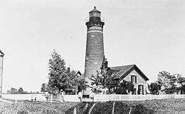 Galloo Island Light |
August 4, 1983 (#83001682) |
Galloo Island 43°53′18″N 76°26′40″W |
Sackets Harbor | part of the U.S. Coast Guard Lighthouses and Light Stations on the Great Lakes TR |
| 52 | George Brothers Building | 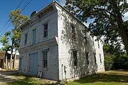 George Brothers Building |
September 6, 1990 (#90001334) |
Mill St. 44°03′56″N 76°07′47″W |
Chaumont | part of the Lyme MRA |
| 53 | George House | September 6, 1990 (#90001338) |
Washington St. 44°03′57″N 76°08′05″W |
Chaumont | part of the Lyme MRA | |
| 54 | Getman Farmhouse | September 6, 1990 (#90001322) |
S. Shore Rd. 43°58′31″N 76°16′25″W |
Lyme | part of the Lyme MRA | |
| 55 | Glen Building | September 27, 1985 (#85002465) |
Broadway 44°07′42″N 76°20′03″W |
Cape Vincent | part of the Cape Vincent Town and Village MRA | |
| 56 | Grenadier Island Schoolhouse | _Schoolhouse.jpg) Grenadier Island Schoolhouse |
November 21, 2012 (#12000955) |
Grenadier Island Rd. 3 44°02′53″N 76°21′15″W |
Grenadier Island vicinity | |
| 57 | Grindstone Island Upper Schoolhouse | August 14, 2012 (#12000509) |
41591 Cross Island Rd. 44°16′12″N 76°07′45″W |
Clayton vicinity | ||
| 58 | Dr. Samuel Guthrie House |  Dr. Samuel Guthrie House |
October 18, 1989 (#89001616) |
Co. Rd. 75/Military Rd. 43°57′05″N 76°05′36″W |
Hounsfield | part of the Hounsfield MRA |
| 59 | Holland Library | 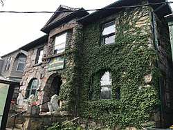 Holland Library |
November 15, 2002 (#02001330) |
7 Market St. 44°20′11″N 75°55′06″W |
Alexandria Bay | |
| 60 | Elijah Horr House | June 28, 1996 (#96000666) |
East side of NY 180, north of junction with Woodard Rd., Hamlet of Stone Mills 44°06′49″N 75°58′28″W |
Orleans | part of the Orleans MPS | |
| 61 | Hiram Hubbard House | September 9, 2009 (#09000699) |
34237 NY 126 43°57′41″N 75°41′11″W |
Champion | ||
| 62 | Ingleside | April 16, 1980 (#80002622) |
West of Alexandria Bay on Cherry Island 44°19′58″N 75°55′40″W |
Alexandria Bay | ||
| 63 | Irwin Brothers Store | September 15, 1983 (#83001681) |
NY 180 44°06′46″N 75°58′34″W |
Stone Mills | ||
| 64 | Jefferson County Courthouse Complex | .jpg) Jefferson County Courthouse Complex |
June 7, 1974 (#74001248) |
SE corner of Arsenal and Sherman Sts. 43°58′31″N 75°54′51″W |
Watertown | |
| 65 | Johnson House | September 27, 1985 (#85002466) |
Tibbetts Point Rd. 44°06′22″N 76°21′17″W |
Cape Vincent | part of the Cape Vincent Town and Village MRA | |
| 66 | Capt. Simon Johnston House | _-_Clayton_NY.jpg) Capt. Simon Johnston House |
June 17, 1982 (#82003358) |
507 Riverside Dr. 44°14′31″N 76°05′18″W |
Clayton | |
| 67 | KESTREL (steam yacht) | August 12, 1977 (#77000873) |
George C. Boldt Yacht House, Saint Lawrence River 44°20′47″N 75°55′37″W |
Alexandria Bay | Moored at West New York, New Jersey when listed | |
| 68 | La Farge Land Office | 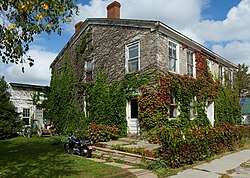 La Farge Land Office |
June 28, 1996 (#96000668) |
Junction of Main and Mill Sts., southwest corner, Hamlet of La Fargeville 44°11′35″N 75°58′03″W |
Orleans | part of the Orleans MPS |
| 69 | La Farge Retainer Houses | La Farge Retainer Houses |
August 21, 1997 (#97000941) |
Main St., south of junction of Main St. and Ford Rd. 44°11′28″N 75°58′04″W |
Orleans | part of the Orleans MPS |
| 70 | La Fargeville United Methodist Church | 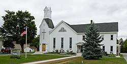 La Fargeville United Methodist Church |
June 28, 1996 (#96000670) |
West side of Main St., south of junction with Co. Rt. 181, Hamlet of La Fargeville 44°11′27″N 75°58′08″W |
Orleans | part of the Orleans MPS |
| 71 | Lance Farm | September 6, 1990 (#90001323) |
S. Shore Rd. 43°58′52″N 76°15′28″W |
Lyme | part of the Lyme MRA | |
| 72 | LeRay Hotel | October 29, 1982 (#82001175) |
Main and Noble Sts. 44°05′16″N 75°48′28″W |
Evans Mills | ||
| 73 | LeRay Mansion | 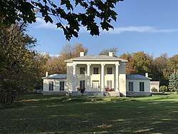 LeRay Mansion |
July 11, 1974 (#74001245) |
Northeast of Black River on Fort Drum Military Reservation 44°03′00″N 75°45′48″W |
Black River | |
| 74 | Vincent LeRay House | 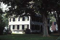 Vincent LeRay House |
November 15, 1973 (#73001195) |
Broadway (NY 12E) 44°07′31″N 76°20′34″W |
Cape Vincent | part of the Cape Vincent Town and Village MRA |
| 75 | LeRaysville Archeological District | LeRaysville Archeological District |
November 2, 1995 (#95000069) |
Address Restricted |
Le Ray | |
| 76 | Lewis House | September 27, 1985 (#85002467) |
Market St. 44°07′45″N 76°20′18″W |
Cape Vincent | part of the Cape Vincent Town and Village MRA | |
| 77 | Longue Vue Island |  Longue Vue Island |
November 4, 1982 (#82001176) |
St. Lawrence River 44°18′14″N 75°56′25″W |
Alexandria Bay | |
| 78 | John Losee House | February 14, 2014 (#14000004) |
17100 Cty. Rd. 155 43°55′01″N 75°55′47″W |
Watertown | ||
| 79 | Madison Barracks | 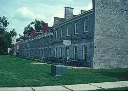 Madison Barracks |
November 21, 1974 (#74001246) |
Military Rd. 43°57′10″N 76°06′35″W |
Sackets Harbor | |
| 80 | Methodist Episcopal Church | 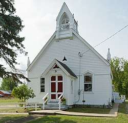 Methodist Episcopal Church |
June 28, 1996 (#96000663) |
South side of NY 180, west of junction with Gore Rd., Hamlet of Omar 44°15′43″N 75°58′35″W |
Orleans | part of the Orleans MPS |
| 81 | Methodist-Protestant Church at Fisher's Landing | 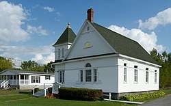 Methodist-Protestant Church at Fisher's Landing |
June 28, 1996 (#96000667) |
Reed Point Rd., near junction with Co. Rd. 195, Hamlet of Fisher's Landing 44°16′34″N 76°00′33″W |
Orleans | part of the Orleans MPS |
| 82 | A. Newton Farm | May 5, 1997 (#97000356) |
NY 180, junction with Co. Rd. 13, Hamlet of Omar 44°15′45″N 75°58′44″W |
Orleans | part of the Orleans MPS | |
| 83 | Norton–Burnham House | 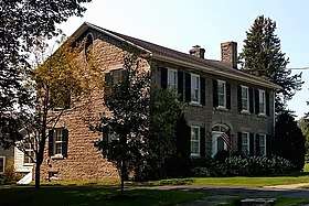 Norton–Burnham House |
February 23, 2016 (#16000034) |
8748 NY 178 43°50′45″N 76°11′22″W |
Henderson | 1818 stone house built by early settler was birthplace of City Beautiful movement founder Daniel Burnham |
| 84 | Paddock Arcade | 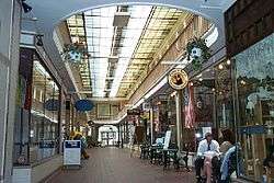 Paddock Arcade |
June 15, 1976 (#76001224) |
Public Square between Arsenal and Stone Sts. 43°58′28″N 75°54′41″W |
Watertown | |
| 85 | Paddock Mansion | 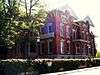 Paddock Mansion |
December 11, 1979 (#79001587) |
228 Washington St. 43°58′23″N 75°54′43″W |
Watertown | |
| 86 | Captain Louis Peugnet House | September 27, 1985 (#85002469) |
Tibbetts Point Rd. 44°07′02″N 76°21′13″W |
Cape Vincent | part of the Cape Vincent Town and Village MRA | |
| 87 | Pierrepont Manor Complex | September 15, 1977 (#77000943) |
North of Mannsville on Ellisburg St. 43°44′04″N 76°03′42″W |
Mannsville | ||
| 88 | Point Salubrious Historic District | September 6, 1990 (#90001339) |
Point Salubrious Rd. 44°02′34″N 76°09′20″W |
Lyme | part of the Lyme MRA | |
| 89 | Public Square Historic District | .jpg) Public Square Historic District |
September 7, 1984 March 22, 2016 (#84002409)16000110 |
J.B. Wise & Park Pls., Arcade & Stone Sts., 43°58′28″N 75°54′37″W |
Watertown | |
| 90 | Ressequie Farm | October 18, 1989 (#89001622) |
Parker Rd. 43°56′05″N 76°02′31″W |
Hounsfield | part of the Hounsfield MRA | |
| 91 | George Reynolds House | September 27, 1985 (#85002470) |
River Rd. 44°09′50″N 76°15′38″W |
Cape Vincent | part of the Cape Vincent Town and Village MRA | |
| 92 | George T. Robinson House | April 17, 2017 (#100000893) |
15082 Bluff Island 44°16′09″N 76°04′13″W |
Clayton | 1901 Shingle Style Thousand Island summer house on island in St. Lawrence built by Pittsburgh steel executive for family | |
| 93 | Rock Island Light Station | 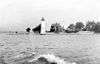 Rock Island Light Station |
November 14, 1978 (#78001855) |
North of Fishers Landing on Rock Island 44°16′50″N 76°01′03″W |
Fishers Landing | |
| 94 | Rogers Brothers Farmstead | May 11, 1998 (#98000392) |
Dablon Point Rd. 44°04′52″N 76°20′59″W |
Cape Vincent | part of the Cape Vincent Town and Village MRA | |
| 95 | John N. Rottiers Farm | September 30, 1996 (#96001022) |
East side of NY 180, approximately 2 miles (3.2 km) south of the Hamlet of Lafargeville 44°09′54″N 75°58′29″W |
Orleans | part of the Orleans MPS | |
| 96 | The Row | September 6, 1990 (#90001329) |
Main St. at Shaver Creek, Three Mile Bay 44°04′49″N 76°12′18″W |
Lyme | part of the Lyme MRA | |
| 97 | Roxy Hotel |  Roxy Hotel |
September 27, 1985 (#85002472) |
310 Broadway 44°07′39″N 76°20′16″W |
Cape Vincent | part of the Cape Vincent Town and Village MRA |
| 98 | Cornelius Sacket House | 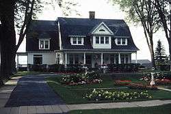 Cornelius Sacket House |
September 27, 1985 (#85002473) |
571 Broadway 44°07′46″N 76°19′58″W |
Cape Vincent | part of the Cape Vincent Town and Village MRA |
| 99 | General Sacket House |  General Sacket House |
September 27, 1985 (#85002464) |
4407 James St. 44°07′18″N 76°19′52″W |
Cape Vincent | part of the Cape Vincent Town and Village MRA |
| 100 | Sackets Harbor Battlefield | 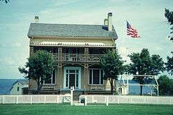 Sackets Harbor Battlefield |
December 31, 1974 (#74001247) |
Coastline and area from Sackets Harbor SW to and including Horse Island 43°56′43″N 76°07′59″W |
Sackets Harbor | |
| 101 | Sackets Harbor Village Historic District | 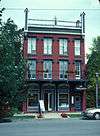 Sackets Harbor Village Historic District |
September 15, 1983 (#83001683) |
Main, Washington, Pike, Edmund, Hill, Hamilton, Broad, and Ambrose Sts. 43°56′44″N 76°07′10″W |
Sackets Harbor | |
| 102 | St. John's Episcopal Church | 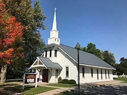 St. John's Episcopal Church |
September 27, 1985 (#85002476) |
Market St. 44°07′30″N 76°20′08″W |
Cape Vincent | part of the Cape Vincent Town and Village MRA |
| 103 | St. Paul's Church | August 30, 1996 (#96000960) |
210 Washington St. 44°00′18″N 75°58′53″W |
Brownville | Historic Churches of the Episcopal Diocese of Central New York MPS | |
| 104 | St. Paul's Episcopal | June 28, 1996 (#96000669) |
East side of Main St., south of the junction with Co. Rd. 181, Hamlet of La Fargeville 44°11′26″N 75°58′05″W |
Orleans | part of the Orleans MPS | |
| 105 | Saint Paul's Episcopal Church | 052613_014.JPG) Saint Paul's Episcopal Church |
May 23, 1997 (#97000413) |
308-314 Clay St. 43°58′19″N 75°54′28″W |
Watertown | Historic Churches of the Episcopal Diocese of Central New York MPS |
| 106 | St. Vincent of Paul Catholic Church | 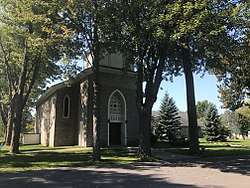 St. Vincent of Paul Catholic Church |
September 27, 1985 (#85002477) |
Kanady St. 44°07′28″N 76°20′24″W |
Cape Vincent | part of the Cape Vincent Town and Village MRA |
| 107 | Shore Farm | October 18, 1989 (#89001623) |
Military Rd., east of Mill Creek 43°57′27″N 76°06′14″W |
Hounsfield | part of the Hounsfield MRA | |
| 108 | Stephen Simmons House | October 18, 1989 (#89001615) |
Camps Mills Rd., west of Old Slat Points Rd. 43°56′07″N 76°04′28″W |
Hounsfield | part of the Hounsfield MRA | |
| 109 | Smith-Ripley House | 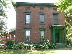 Smith-Ripley House |
February 13, 2008 (#08000021) |
29 E. Church St. 43°48′40″N 76°01′16″W |
Adams | |
| 110 | Star Grange No. 9 | October 18, 1989 (#89001626) |
Sulphur Springs Rd. between Jericho and Spencer Rds. 43°55′38″N 76°01′40″W |
Hounsfield | part of the Hounsfield MRA | |
| 111 | Otis Starkey House | .jpg) Otis Starkey House |
September 27, 1985 (#85002478) |
Point St. 44°07′36″N 76°20′06″W |
Cape Vincent | part of the Cape Vincent Town and Village MRA |
| 112 | State Street Historic District | 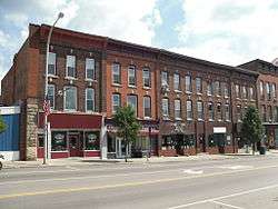 State Street Historic District |
September 22, 1983 (#83001684) |
249-401 State St., 246-274 State St. and 106-108 Mechanic St. 43°58′40″N 75°36′36″W |
Carthage | |
| 113 | Sterlingville Archeological District | Sterlingville Archeological District |
November 2, 1995 (#95000070) |
Address Restricted |
Philadelphia | |
| 114 | Stevenson-Frink Farm | October 18, 1989 (#89001625) |
Salt Point Rd. 44°00′10″N 76°03′56″W |
Hounsfield | part of the Hounsfield MRA | |
| 115 | Stone Mills Union Church | December 12, 1976 (#76001223) |
NY 180 near junction with Carter St. 44°06′52″N 75°58′27″W |
Stone Mills | ||
| 116 | Storrs' Harbor Naval Shipyard Site | Storrs' Harbor Naval Shipyard Site |
February 7, 2012 (#11001091) |
Address restricted |
Hounsfield vicinity | |
| 117 | Old Stone Shop | September 6, 1990 (#90001328) |
Main St., Three Mile Bay 44°04′56″N 76°11′50″W |
Lyme | part of the Lyme MRA | |
| 118 | Byron J. Strough House | January 2, 1997 (#96001549) |
South side of Clayton St., west of junction with NY 411, Hamlet of La Fargeville 44°11′41″N 75°58′10″W |
Orleans | part of the Orleans MPS | |
| 119 | Sulphur Springs Cemetery | October 18, 1989 (#89001620) |
Co. Rd. 62, southwest of Spencer Rd. 43°55′27″N 76°01′54″W |
Hounsfield | part of the Hounsfield MRA | |
| 120 | Swarthout Site-A04507.000038 | Swarthout Site-A04507.000038 |
January 24, 2002 (#01001504) |
Address Restricted |
Clayton | |
| 121 | Taft House | September 6, 1990 (#90001297) |
Main St., Three Mile Bay 44°04′50″N 76°12′11″W |
Lyme | part of the Lyme MRA | |
| 122 | Talcott Falls Site | Talcott Falls Site |
June 5, 1974 (#74001244) |
Address Restricted |
Adams | |
| 123 | Taylor Boathouse | September 6, 1990 (#90001330) |
Bay View Dr., Three Mile Bay 44°04′46″N 76°12′02″W |
Lyme | part of the Lyme MRA | |
| 124 | Taylor Flats | August 28, 2018 (#100002834) |
550 Coffeen St. 43°58′51″N 75°55′15″W |
Watertown | 1907 apartment building was one of the first upstate to be built for workers with middle-class aspirations. | |
| 125 | Emma Flower Taylor Mansion | 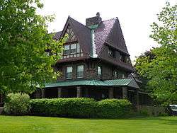 Emma Flower Taylor Mansion |
October 10, 2002 (#02001114) |
241 Clinton St. 43°58′20″N 75°55′04″W |
Watertown | |
| 126 | Thomas Memorial AME Zion Church | 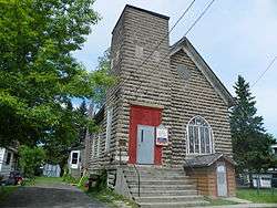 Thomas Memorial AME Zion Church |
March 6, 2002 (#02000144) |
715 Morrison St. 43°59′07″N 75°54′55″W |
Watertown | |
| 127 | Thousand Island Grange Hall | June 28, 1996 (#96000664) |
East side of Gore Rd., north of junction with NY 180, Hamlet of Omar 44°15′40″N 75°58′20″W |
Orleans | part of the Orleans MPS | |
| 128 | Thousand Island Park Historic District | 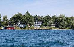 Thousand Island Park Historic District |
November 14, 1982 (#82001177) |
S tip of Wellesley Island 44°17′18″N 76°01′33″W |
Orleans | |
| 129 | Three Mile Bay Historic District | September 6, 1990 (#90001327) |
Junction of Church and Depot Sts., Three Mile Bay 44°04′56″N 76°11′53″W |
Lyme | part of the Lyme MRA | |
| 130 | Tibbetts Point Light | 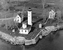 Tibbetts Point Light |
July 19, 1984 (#84002412) |
Tibbetts Point 44°06′02″N 76°22′13″W |
Cape Vincent | |
| 131 | Tracy Farm | February 14, 1997 (#97000066) |
East side of Wilder Rd., south of junction with Overbluff Rd. 44°09′09″N 75°59′56″W |
Orleans | part of the Orleans MPS | |
| 132 | Trinity Episcopal Church and Parish House | 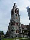 Trinity Episcopal Church and Parish House |
June 30, 2000 (#00000747) |
227 Sherman St. 43°58′24″N 75°54′55″W |
Watertown | part of the Historic Churches of the Episcopal Diocese of Central New York MPS |
| 133 | Union Hall | September 6, 1990 (#90001333) |
S. Shore Rd. 44°00′21″N 76°13′08″W |
Lyme | part of the Lyme MRA | |
| 134 | Union Hotel |  Union Hotel |
June 19, 1972 (#72000849) |
Main and Ray Sts. 43°56′55″N 76°07′24″W |
Sackets Harbor | |
| 135 | Union Meeting House | September 27, 1985 (#85002479) |
Millens Bay Rd. 44°10′19″N 76°14′32″W |
Cape Vincent | part of the Cape Vincent Town and Village MRA | |
| 136 | United Methodist Church | September 6, 1990 (#90001325) |
S. Shore Rd. 44°00′24″N 76°13′08″W |
Lyme | part of the Lyme MRA | |
| 137 | US Post Office-Carthage | November 17, 1988 (#88002470) |
521 State St. 43°58′49″N 75°36′27″W |
Carthage | part of the US Post Offices in New York State, 1858-1943, TR | |
| 138 | Claude Vautrin House | September 27, 1985 (#85002480) |
Mason Rd. 44°08′39″N 76°13′43″W |
Cape Vincent | part of the Cape Vincent Town and Village MRA | |
| 139 | Village of Antwerp Historic District | April 19, 2001 (#01000389) |
Roughly Main, Depot, Maple, VanBuren, Mechanic, Fulton, Academy and Washington Sts., Lexington, Hoyt & Madison Aves. 44°11′53″N 75°36′33″W |
Antwerp | ||
| 140 | Vogt House | November 19, 1980 (#80002626) |
110 Main St. 44°00′08″N 75°58′52″W |
Brownville | part of the Stone Houses of Brownville TR | |
| 141 | Arthur Walrath House | November 19, 1980 (#80002627) |
114 Corner Pike 44°00′11″N 75°58′55″W |
Brownville | part of the Stone Houses of Brownville TR | |
| 142 | Watertown Masonic Temple | 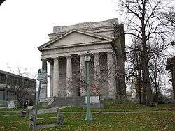 Watertown Masonic Temple |
January 23, 1980 (#80002629) |
240 Washington St. 43°58′23″N 75°54′42″W |
Watertown | |
| 143 | Menzo Wheeler House | September 6, 1990 (#90001335) |
Main and Depot Sts. 44°04′52″N 76°11′53″W |
Chaumont | part of the Lyme MRA | |
| 144 | Wilcox Farmhouse | September 6, 1990 (#90001331) |
Carrying Place Rd. 44°03′33″N 76°15′25″W |
Three Mile Bay | part of the Lyme MRA | |
| 145 | Warren Wilson House | September 27, 1985 (#85002482) |
Favret Rd. 44°07′49″N 76°16′27″W |
Cape Vincent | part of the Cape Vincent Town and Village MRA | |
| 146 | Amos Wood House | January 4, 2012 (#11001000) |
7751 County Road 120 43°44′28″N 76°10′51″W |
North Landing vicinity; Ellisburg | ||
| 147 | Wood's Grist Mill |  Wood's Grist Mill |
November 2, 1995 (#95000072) |
Address Restricted |
Wilna |
See also
| Wikimedia Commons has media related to National Register of Historic Places in Jefferson County, New York. |
References
- The latitude and longitude information provided in this table was derived originally from the National Register Information System, which has been found to be fairly accurate for about 99% of listings. Some locations in this table may have been corrected to current GPS standards.
- "National Register of Historic Places: Weekly List Actions". National Park Service, United States Department of the Interior. Retrieved on June 26, 2020.
- Numbers represent an ordering by significant words. Various colorings, defined here, differentiate National Historic Landmarks and historic districts from other NRHP buildings, structures, sites or objects.
- The eight-digit number below each date is the number assigned to each location in the National Register Information System database, which can be viewed by clicking the number.
| Topics |  | |
|---|---|---|
| Lists by county |
| |
| Lists by city | ||
| Other lists | ||
| ||
This article is issued from Wikipedia. The text is licensed under Creative Commons - Attribution - Sharealike. Additional terms may apply for the media files.