Noxapater, Mississippi
| Noxapater, Mississippi | |
|---|---|
| Town | |
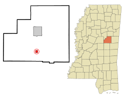 Location of Noxapater, Mississippi | |
 Noxapater, Mississippi Location in the United States | |
| Coordinates: 32°59′32″N 89°3′50″W / 32.99222°N 89.06389°WCoordinates: 32°59′32″N 89°3′50″W / 32.99222°N 89.06389°W | |
| Country | United States |
| State | Mississippi |
| County | Winston |
| Area | |
| • Total | 1.0 sq mi (2.6 km2) |
| • Land | 1.0 sq mi (2.6 km2) |
| • Water | 0.0 sq mi (0.0 km2) |
| Elevation | 548 ft (167 m) |
| Population (2010) | |
| • Total | 472 |
| • Estimate (2016)[1] | 443 |
| • Density | 470/sq mi (180/km2) |
| Time zone | UTC-6 (Central (CST)) |
| • Summer (DST) | UTC-5 (CDT) |
| ZIP code | 39346 |
| Area code(s) | 662 |
| FIPS code | 28-52880 |
| GNIS feature ID | 0674982 |
Noxapater is a town in Winston County, Mississippi. The population was 419 at the 2000 census.
History
A post office was established in 1846, and the town was incorporated in 1906.
Noxapater was a stop on the Mobile, Jackson and Kansas City Railroad, built in 1890.[2]
Geography
Noxapater is located at 32°59′32″N 89°3′50″W / 32.99222°N 89.06389°W (32.992208, -89.063796).[3]
According to the United States Census Bureau, the town has a total area of 1.0 square mile (2.6 km2), all land.
Demographics
| Historical population | |||
|---|---|---|---|
| Census | Pop. | %± | |
| 1910 | 311 | — | |
| 1920 | 515 | 65.6% | |
| 1930 | 526 | 2.1% | |
| 1940 | 569 | 8.2% | |
| 1950 | 615 | 8.1% | |
| 1960 | 549 | −10.7% | |
| 1970 | 554 | 0.9% | |
| 1980 | 516 | −6.9% | |
| 1990 | 441 | −14.5% | |
| 2000 | 419 | −5.0% | |
| 2010 | 472 | 12.6% | |
| Est. 2016 | 443 | [1] | −6.1% |
| U.S. Decennial Census[4] | |||
At the 2000 census,[5] there were 419 people, 171 households and 121 families residing in the town. The population density was 417.2 per square mile (161.8/km²). There were 191 housing units at an average density of 190.2 per square mile (73.7/km²). The racial makeup of the town was 64.44% White and 35.56% African American.
There were 171 households, of which 30.4% had children under the age of 18 living with them, 48.0% were married couples living together, 18.7% had a female householder with no husband present, and 29.2% were non-families. 27.5% of all households were made up of individuals and 17.5% had someone living alone who was 65 years of age or older. The average household size was 2.45 and the average family size was 2.96.
Age distribution was 24.6% under the age of 18, 7.4% from 18 to 24, 24.1% from 25 to 44, 25.1% from 45 to 64, and 18.9% who were 65 years of age or older. The median age was 41 years. For every 100 females, there were 80.6 males. For every 100 females age 18 and over, there were 71.7 males.
The median household income was $27,917, and the median family income was $28,750. Males had a median income of $25,500 versus $18,500 for females. The per capita income for the town was $13,658. About 16.9% of families and 18.4% of the population were below the poverty line, including 25.7% of those under age 18 and 9.5% of those age 65 or over.
Education
The Town of Noxapater is served by the Louisville Municipal School District. Its school is Noxapater Attendance Center.
Notable people
- F. Mason Sones, pioneer in cardiac catheterization.[6]
References
- 1 2 "Population and Housing Unit Estimates". Retrieved June 9, 2017.
- ↑ Howe, Tony. "Noxapater, Mississippi". Mississippi Rails. Retrieved March 2014. Check date values in:
|accessdate=(help) - ↑ "US Gazetteer files: 2010, 2000, and 1990". United States Census Bureau. 2011-02-12. Retrieved 2011-04-23.
- ↑ "Census of Population and Housing". Census.gov. Retrieved June 4, 2015.
- ↑ "American FactFinder". United States Census Bureau. Retrieved 2008-01-31.
- ↑ Sheldon, William C. (2008). Pathfinders of the Heart: The History of Cardiology at the Cleveland Clinic. Xlibris.
External links
Municipalities and communities of Winston County, Mississippi, United States | ||
|---|---|---|
| Cities | 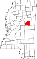 | |
| Towns | ||
| Unincorporated communities | ||
| Ghost towns | ||
| Indian reservation | ||
| Footnotes | ‡This populated place also has portions in an adjacent county or counties | |