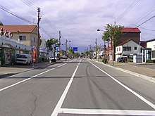
Main street in Toyokoro
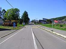
A residential area
Toyokoro (豊頃町, Toyokoro-chō) is a town in Tokachi Subprefecture, Hokkaido, Japan.
As of September 2016, the town has an estimated population of 3,262 and a density of 6.1 persons per km². The total area is 536.52 square kilometres (207.15 sq mi).
The town is separated into two main areas, Toyokoro and Moiwa. These areas are separated by the Tokachi River. Two bridges, Toyokoro Ohashi Bridge and Moiwa Bridge, connect the two. The Toyokoro area has the town's railway station (which is unstaffed), an elementary school, the town's only junior high school, a gas station and the town's only major convenience store (Seicomart) and a few residential streets. The Moiwa area is the major area of the town, which has the Town Hall, the town convention center, the bank, two small supermarkets, a post office, an elementary school and the majority of the residential area. It is also where Moiwa Mountain is, which has a park golf course, camping facilities, and even a very small airport.
The town is famous for the Harunire Tree, which is two elm trees that are fused together to look like one. The tree has a very pleasing shape and was used in a car commercial.